Academic Profile
Statistics
Similar Authors
Papers on arXiv
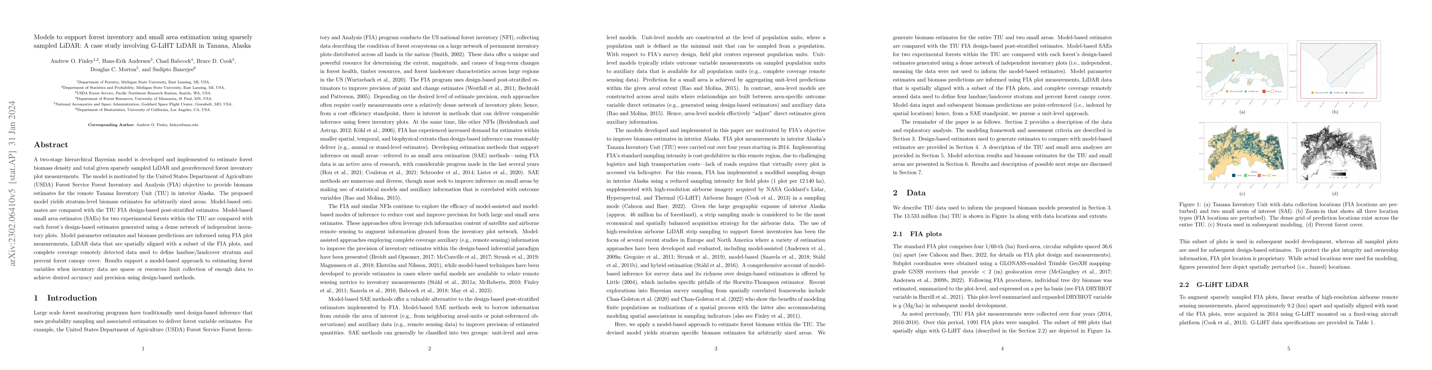
A two-stage hierarchical Bayesian model is developed and implemented to estimate forest biomass density and total given sparsely sampled LiDAR and georeferenced forest inventory plot measurements. T...
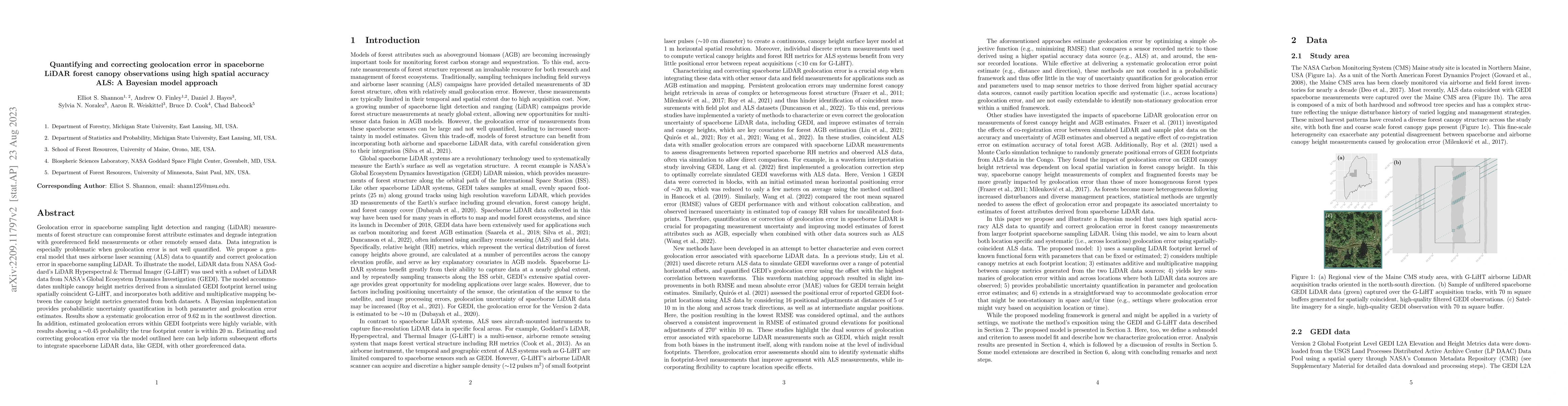
Geolocation error in spaceborne sampling light detection and ranging (LiDAR) measurements of forest structure can compromise forest attribute estimates and degrade integration with georeferenced fie...
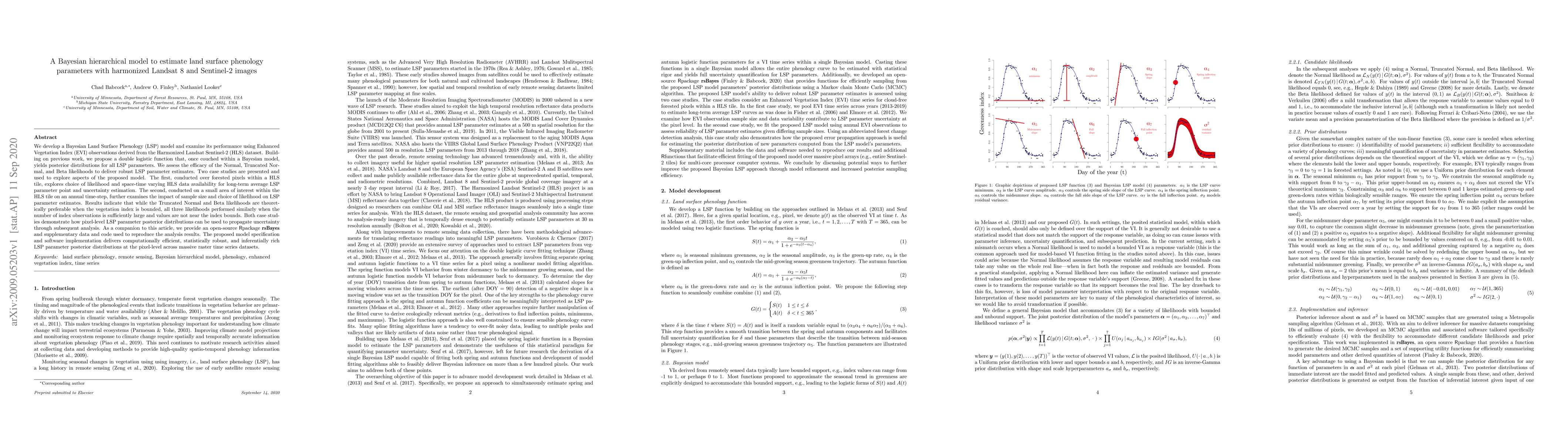
We develop a Bayesian Land Surface Phenology (LSP) model and examine its performance using Enhanced Vegetation Index (EVI) observations derived from the Harmonized Landsat Sentinel-2 (HLS) dataset. ...