Christophe Fatras

4 papers on arXiv

Statistics

arXiv Papers 4

Papers on arXiv

Thumbnail for Assimilation of SAR-derived Flood Observations for Improving Fluvial
  Flood Forecast

Assimilation of SAR-derived Flood Observations for Improving Fluvial Flood Forecast

As the severity and occurrence of flood events tend to intensify with climate change, the need for flood forecasting capability increases. In this regard, the Flood Detection, Alert and rapid Mappin...

Thumbnail for Improvement of Flood Extent Representation with Remote Sensing Data and
  Data Assimilation

Improvement of Flood Extent Representation with Remote Sensing Data and Data Assimilation

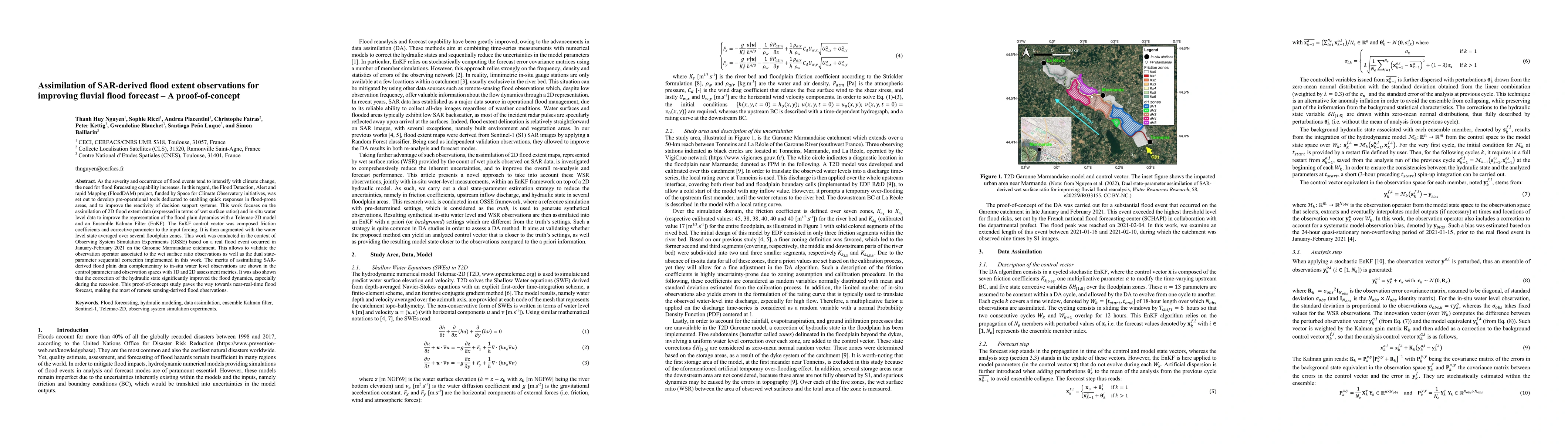
Flood simulation and forecast capability have been greatly improved thanks to advances in data assimilation. Such an approach combines in-situ gauge measurements with numerical hydrodynamic models t...

Thumbnail for Validation and Improvement of Data Assimilation for Flood Hydrodynamic
  Modelling Using SAR Imagery Data

Validation and Improvement of Data Assimilation for Flood Hydrodynamic Modelling Using SAR Imagery Data

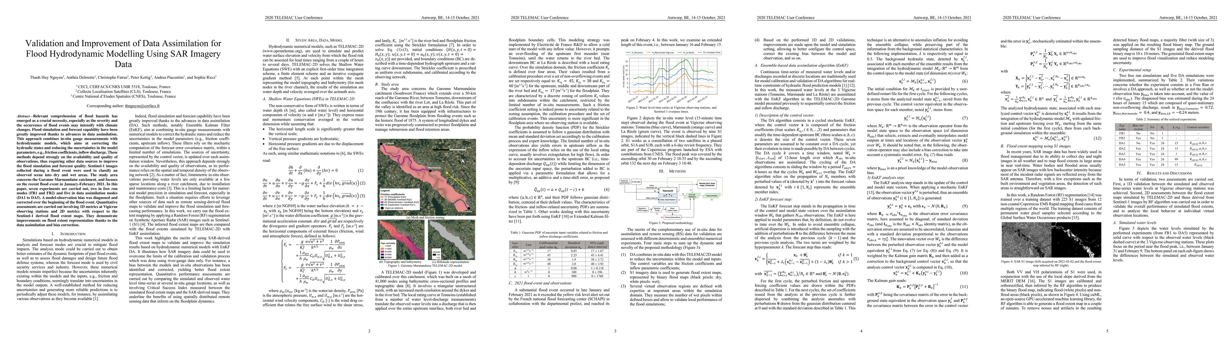
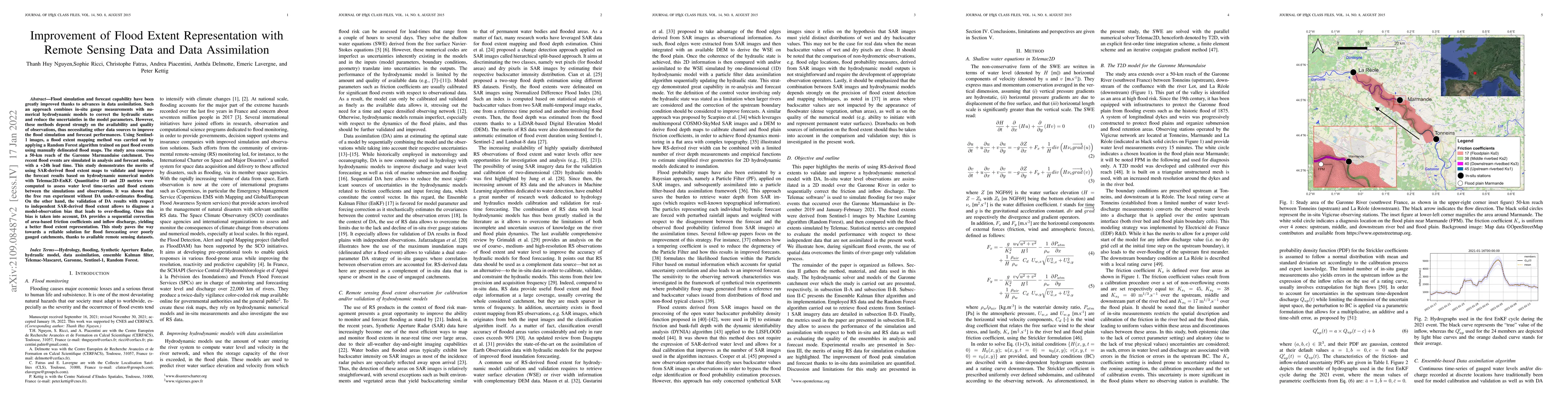
Relevant comprehension of flood hazards has emerged as a crucial necessity, especially as the severity and the occurrence of flood events intensify with climate changes. Flood simulation and forecas...

Thumbnail for Assimilation of SWOT Altimetry Data for Riverine Flood Reanalysis: From
  Synthetic to Real Data

Assimilation of SWOT Altimetry Data for Riverine Flood Reanalysis: From Synthetic to Real Data

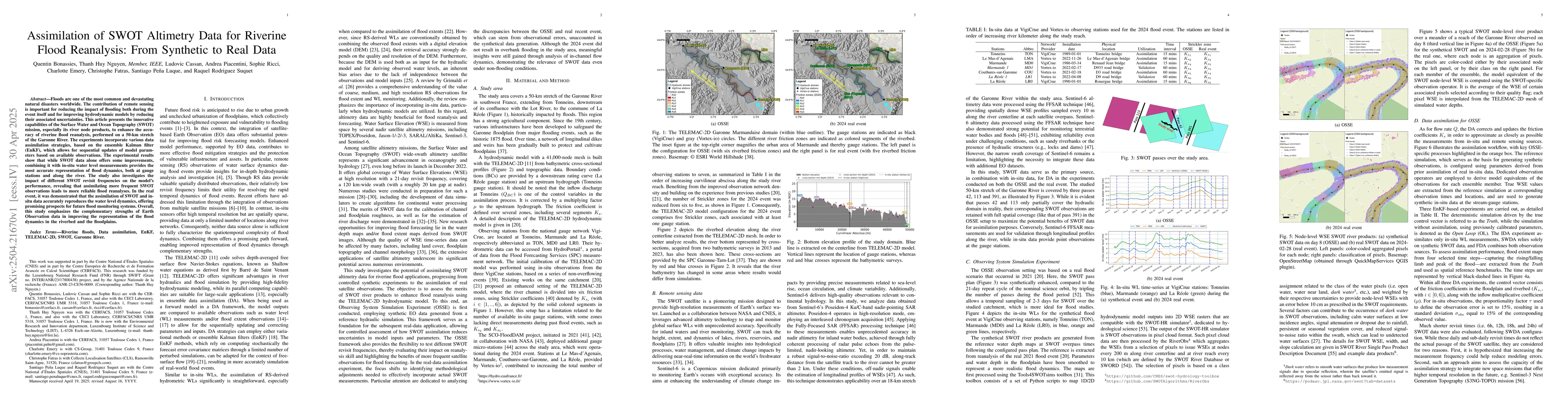
Floods are one of the most common and devastating natural disasters worldwide. The contribution of remote sensing is important for reducing the impact of flooding both during the event itself and for ...

This website uses cookies to ensure you get the best experience. Learn more