Academic Profile
Statistics
Similar Authors
Papers on arXiv
The convergence of artificial intelligence (AI) and Earth observation (EO) technologies has brought geoscience and remote sensing into an era of unparalleled capabilities. AI's transformative impact...
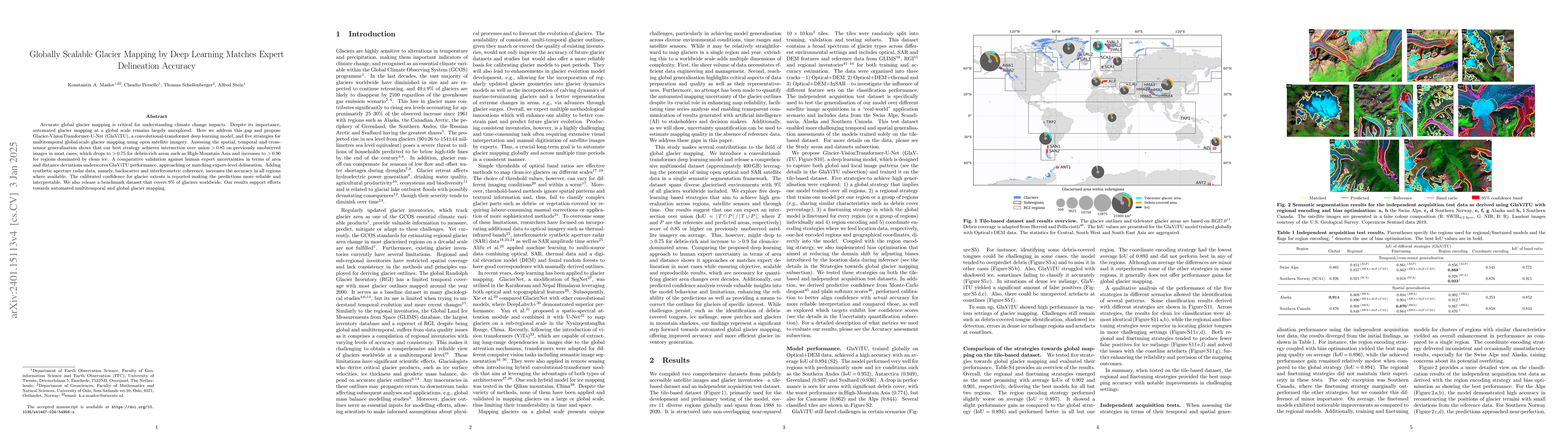
Accurate global glacier mapping is critical for understanding climate change impacts. Despite its importance, automated glacier mapping at a global scale remains largely unexplored. Here we address ...
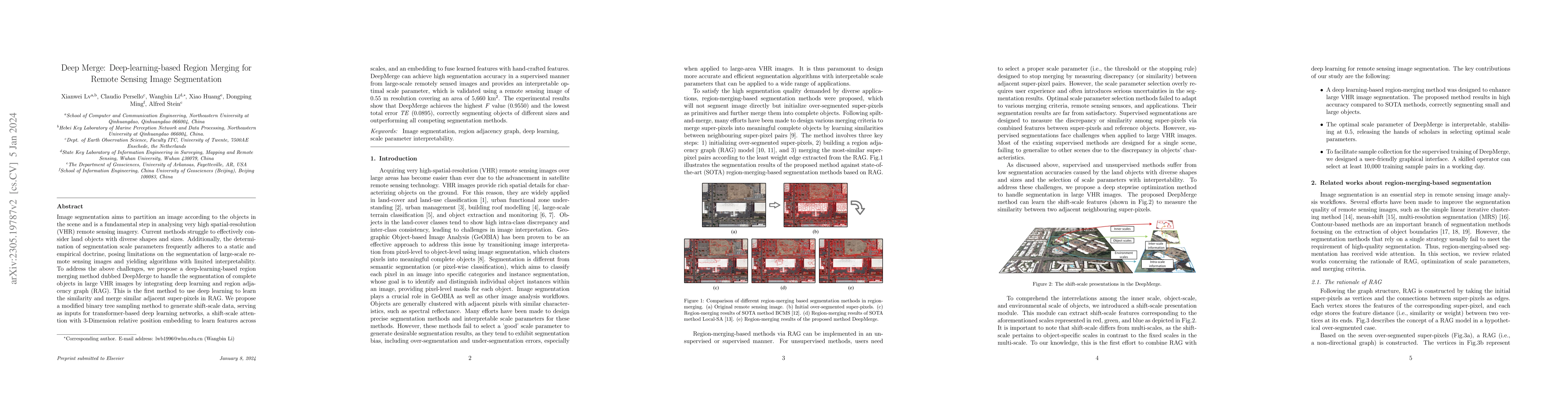
Image segmentation aims to partition an image according to the objects in the scene and is a fundamental step in analysing very high spatial-resolution (VHR) remote sensing imagery. Current methods ...
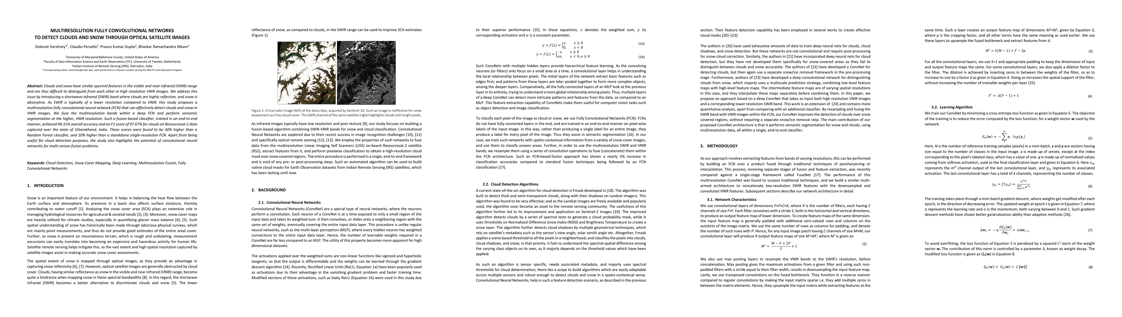
Clouds and snow have similar spectral features in the visible and near-infrared (VNIR) range and are thus difficult to distinguish from each other in high resolution VNIR images. We address this iss...
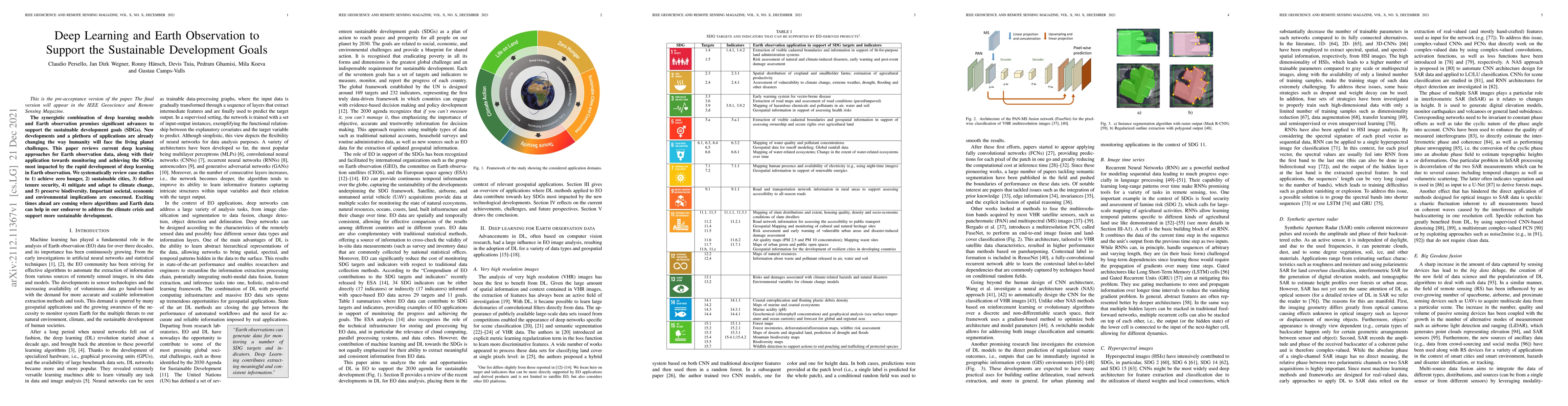
The synergistic combination of deep learning models and Earth observation promises significant advances to support the sustainable development goals (SDGs). New developments and a plethora of applic...
The success of supervised classification of remotely sensed images acquired over large geographical areas or at short time intervals strongly depends on the representativity of the samples used to t...
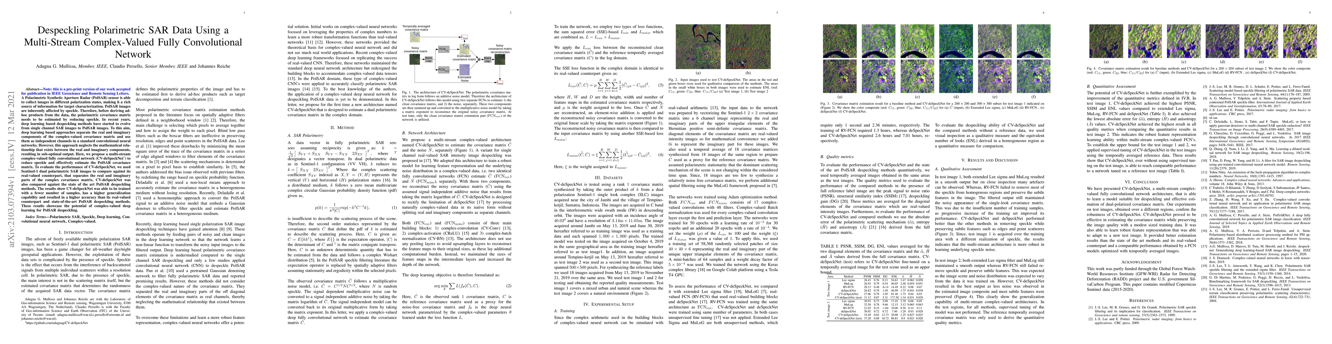
A Polarimetric Synthetic Aperture Radar (PolSAR) sensor is able to collect images in different polarization states, making it a rich source of information for target characterization. PolSAR images ...
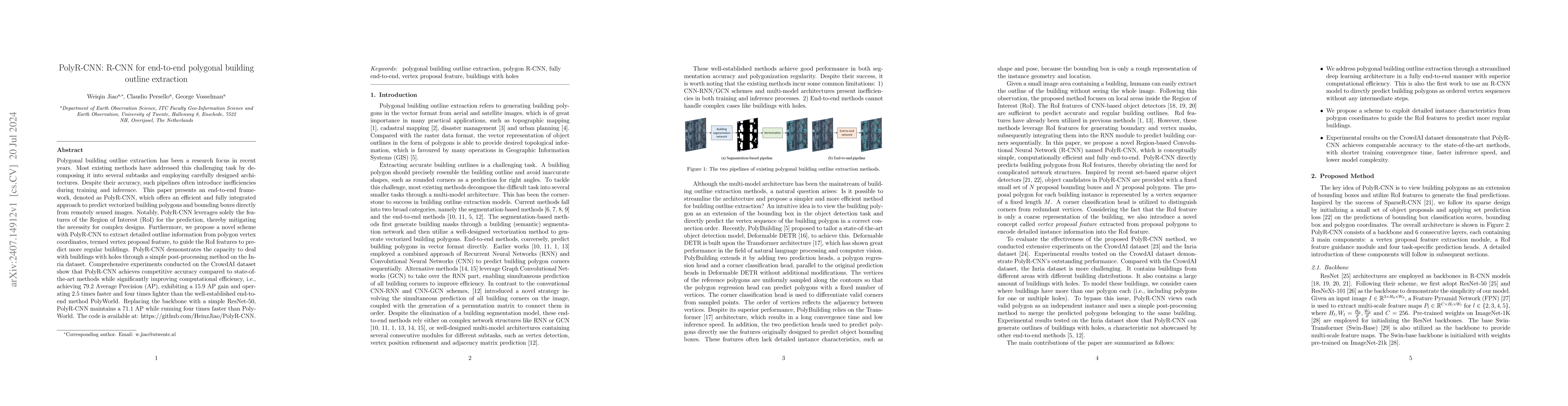
Polygonal building outline extraction has been a research focus in recent years. Most existing methods have addressed this challenging task by decomposing it into several subtasks and employing carefu...
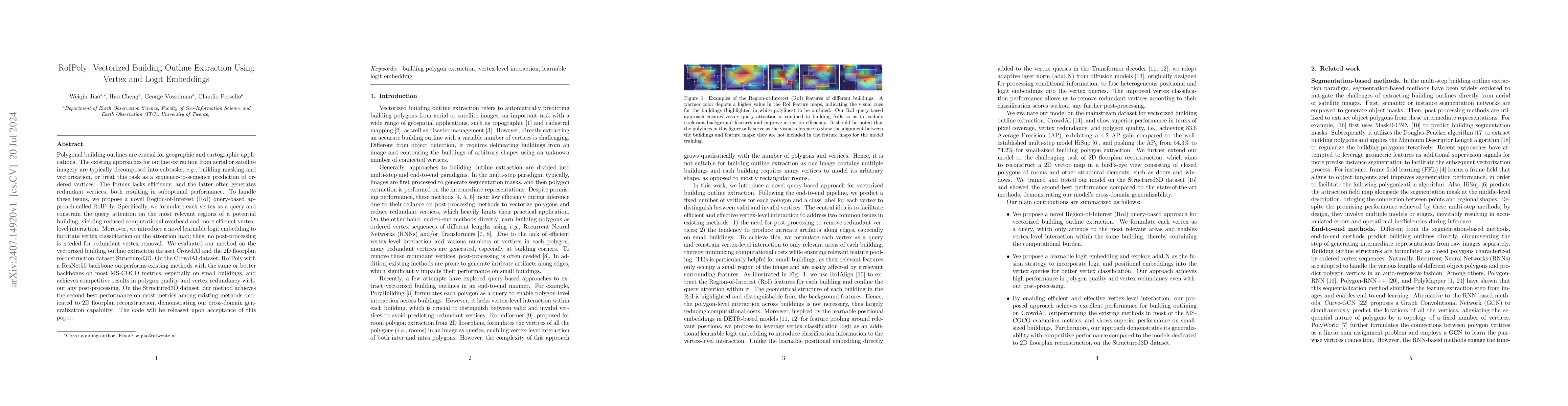
Polygonal building outlines are crucial for geographic and cartographic applications. The existing approaches for outline extraction from aerial or satellite imagery are typically decomposed into subt...
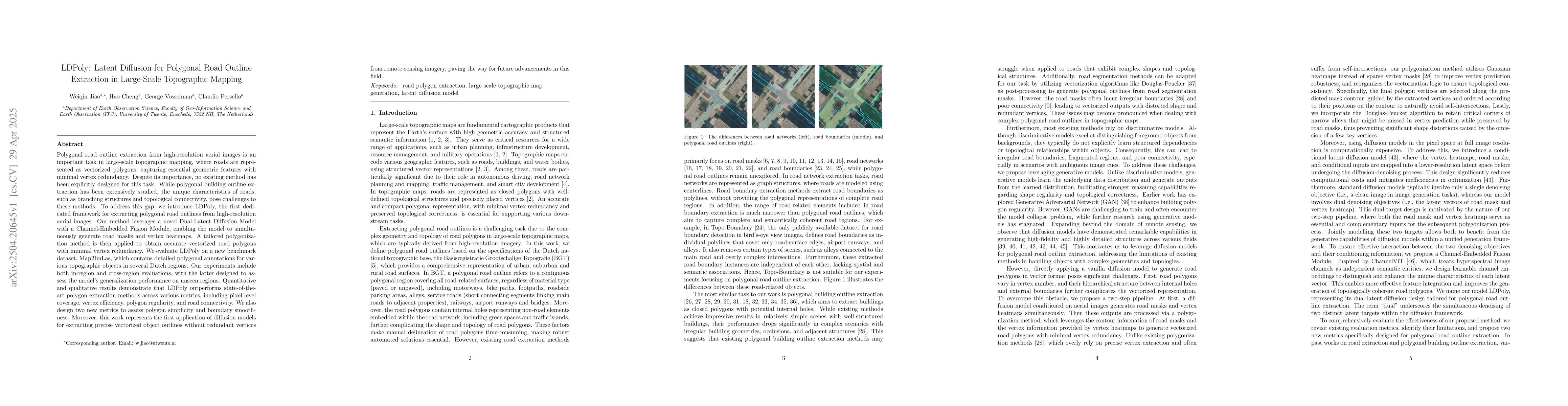
Polygonal road outline extraction from high-resolution aerial images is an important task in large-scale topographic mapping, where roads are represented as vectorized polygons, capturing essential ge...
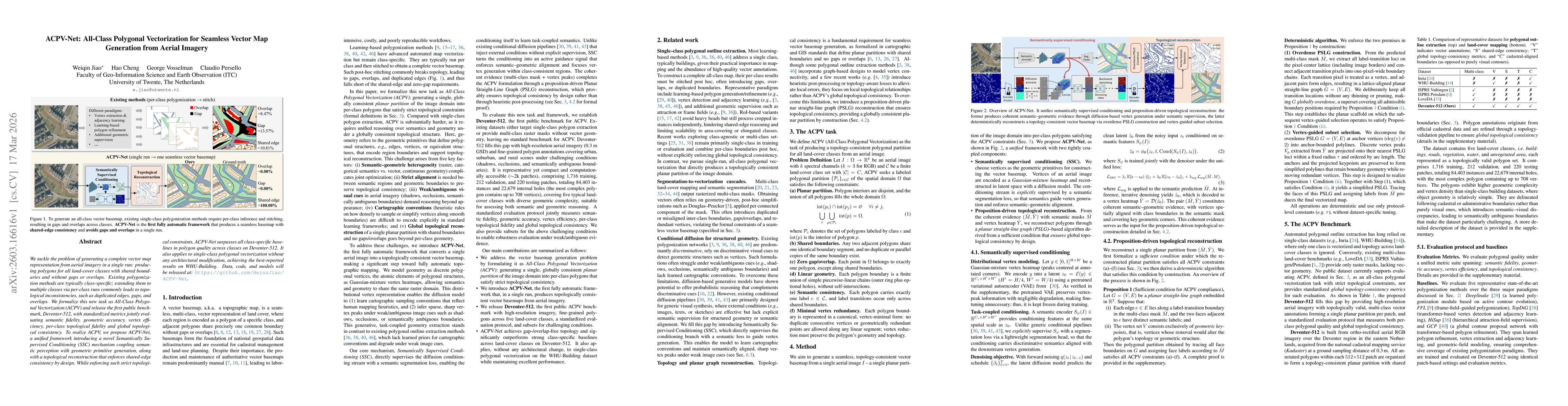
We tackle the problem of generating a complete vector map representation from aerial imagery in a single run: producing polygons for all land-cover classes with shared boundaries and without gaps or o...