Polygonal road outline extraction from high-resolution aerial images is an
important task in large-scale topographic mapping, where roads are represented
as vectorized polygons, capturing essential geometric features with minimal
vertex redundancy. Despite its importance, no existing method has been
explicitly designed for this task. While polygonal building outline extraction
has been extensively studied, the unique characteristics of roads, such as
branching structures and topological connectivity, pose challenges to these
methods. To address this gap, we introduce LDPoly, the first dedicated
framework for extracting polygonal road outlines from high-resolution aerial
images. Our method leverages a novel Dual-Latent Diffusion Model with a
Channel-Embedded Fusion Module, enabling the model to simultaneously generate
road masks and vertex heatmaps. A tailored polygonization method is then
applied to obtain accurate vectorized road polygons with minimal vertex
redundancy. We evaluate LDPoly on a new benchmark dataset, Map2ImLas, which
contains detailed polygonal annotations for various topographic objects in
several Dutch regions. Our experiments include both in-region and cross-region
evaluations, with the latter designed to assess the model's generalization
performance on unseen regions. Quantitative and qualitative results demonstrate
that LDPoly outperforms state-of-the-art polygon extraction methods across
various metrics, including pixel-level coverage, vertex efficiency, polygon
regularity, and road connectivity. We also design two new metrics to assess
polygon simplicity and boundary smoothness. Moreover, this work represents the
first application of diffusion models for extracting precise vectorized object
outlines without redundant vertices from remote-sensing imagery, paving the way
for future advancements in this field.
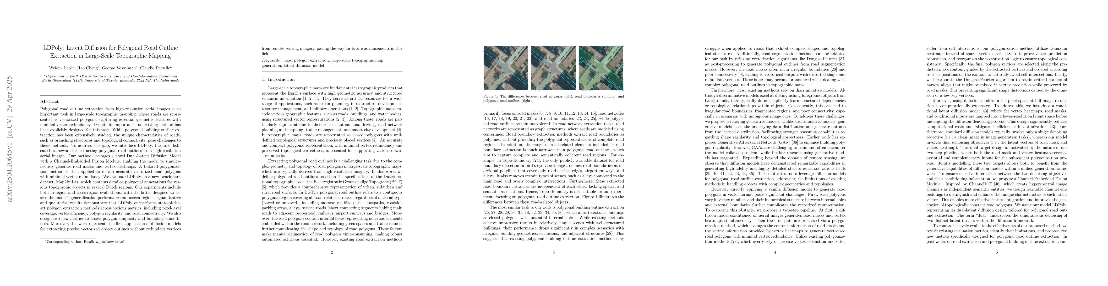
Discussion 0