Academic Profile
Statistics
Similar Authors
Papers on arXiv
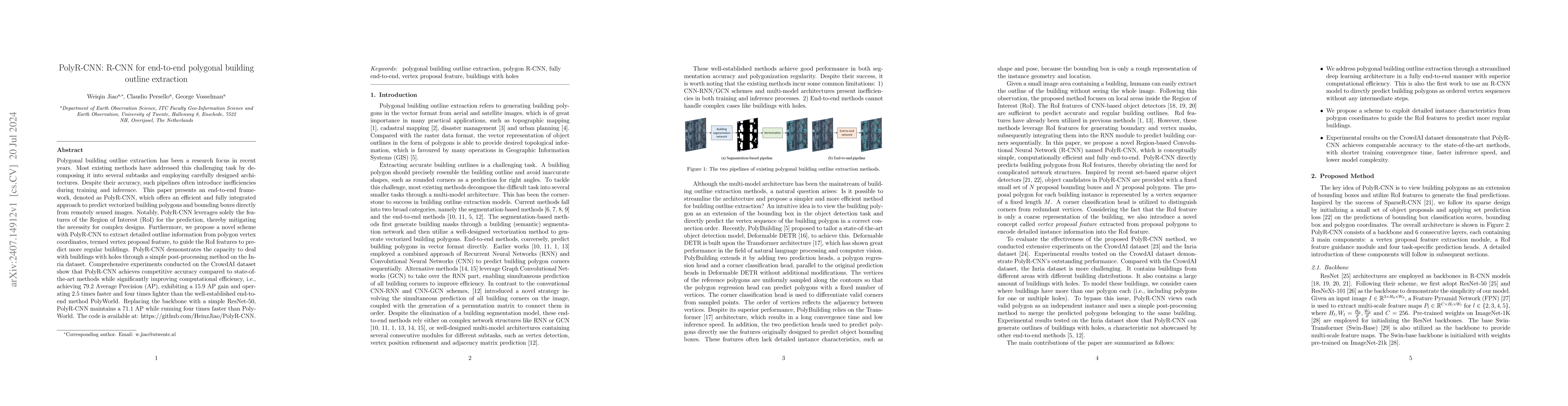
Polygonal building outline extraction has been a research focus in recent years. Most existing methods have addressed this challenging task by decomposing it into several subtasks and employing carefu...
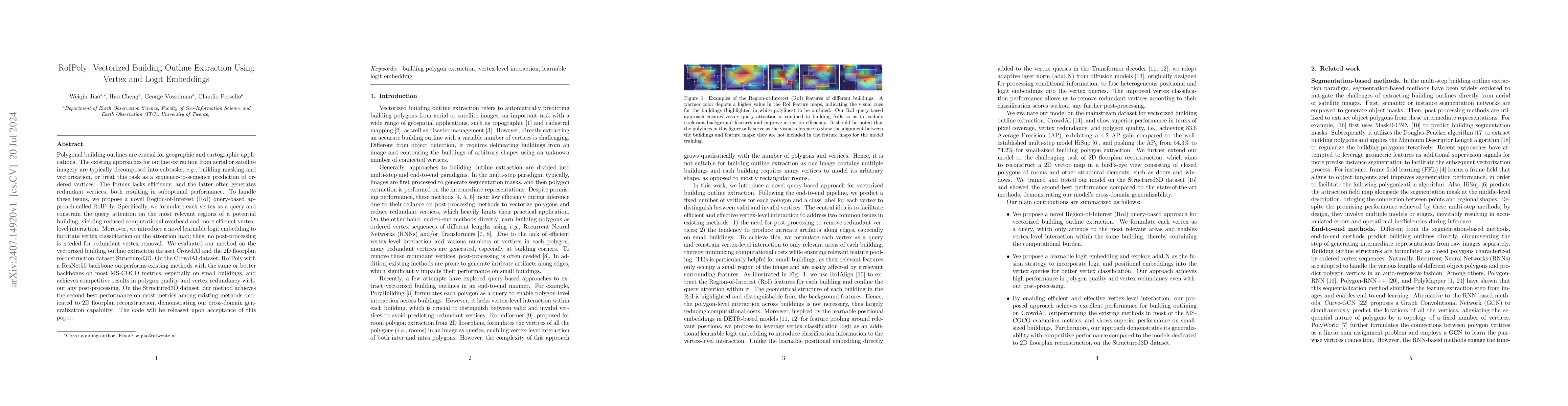
Polygonal building outlines are crucial for geographic and cartographic applications. The existing approaches for outline extraction from aerial or satellite imagery are typically decomposed into subt...
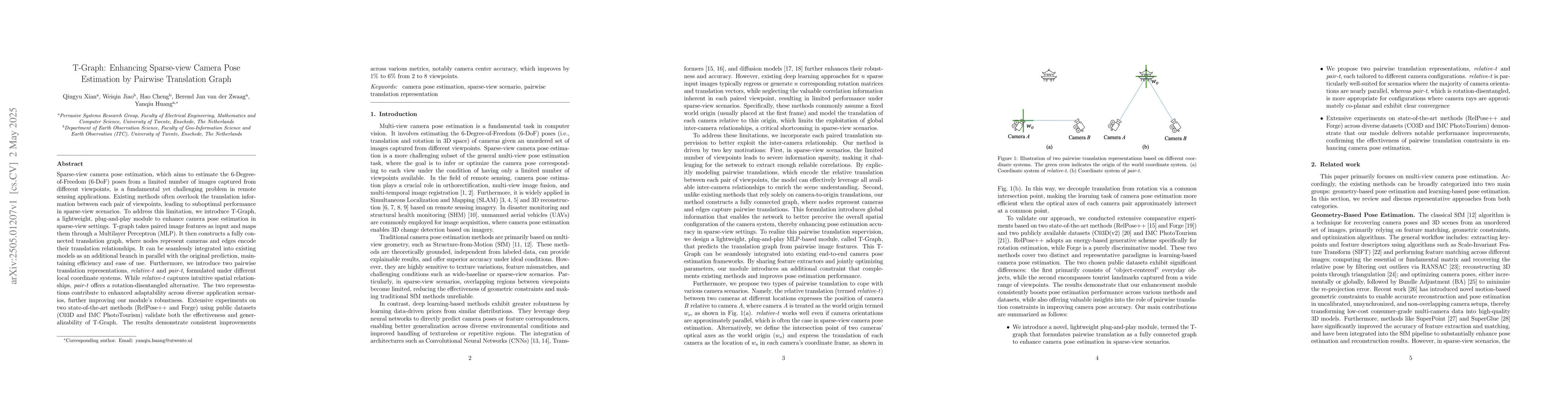
Sparse-view camera pose estimation, which aims to estimate the 6-Degree-of-Freedom (6-DoF) poses from a limited number of images captured from different viewpoints, is a fundamental yet challenging pr...
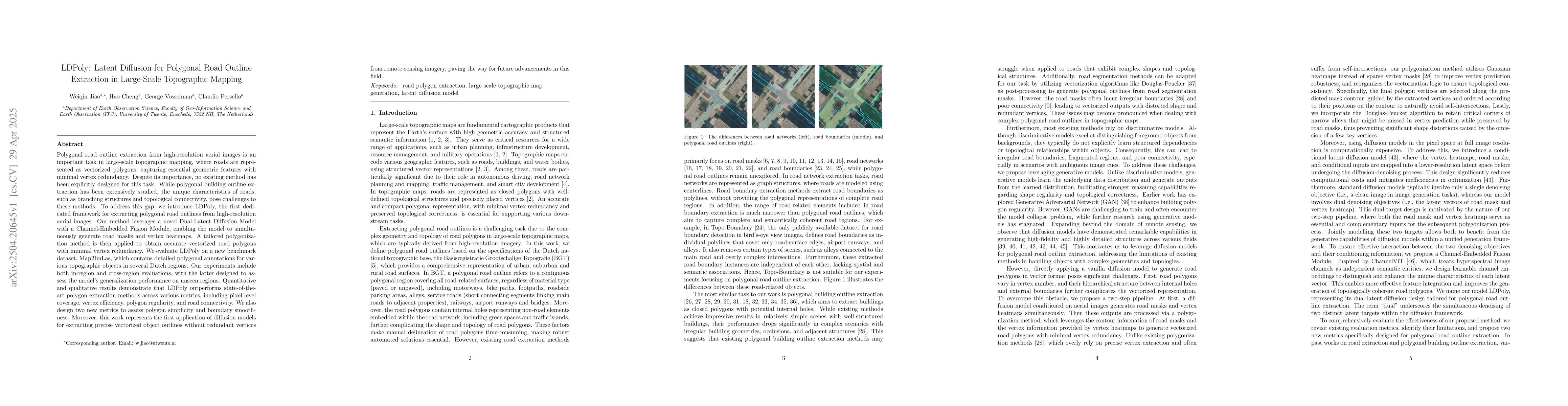
Polygonal road outline extraction from high-resolution aerial images is an important task in large-scale topographic mapping, where roads are represented as vectorized polygons, capturing essential ge...
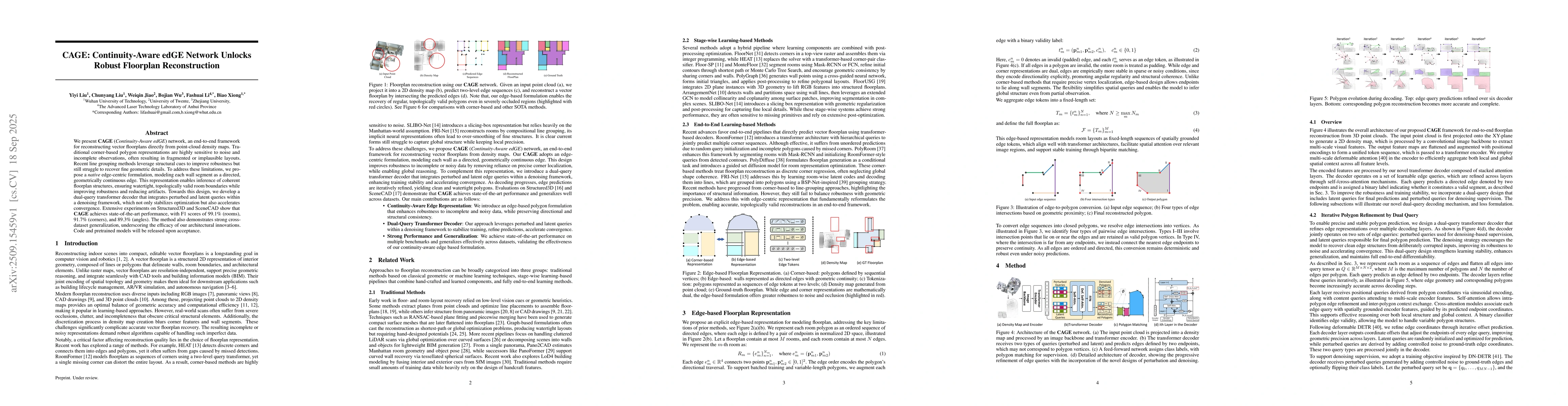
We present \textbf{CAGE} (\textit{Continuity-Aware edGE}) network, a \textcolor{red}{robust} framework for reconstructing vector floorplans directly from point-cloud density maps. Traditional corner-b...
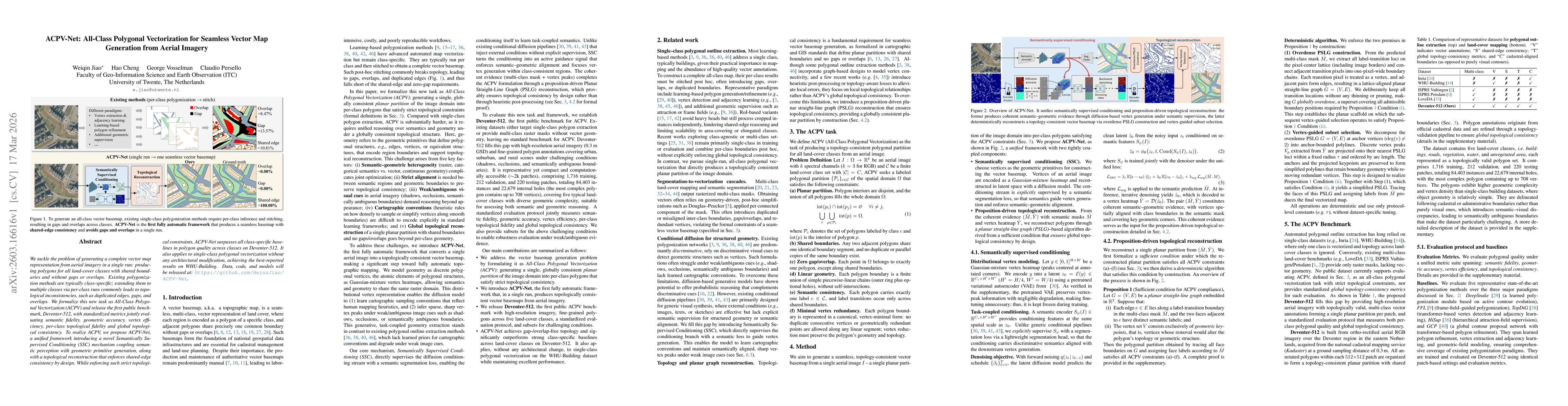
We tackle the problem of generating a complete vector map representation from aerial imagery in a single run: producing polygons for all land-cover classes with shared boundaries and without gaps or o...