Academic Profile
Statistics
Similar Authors
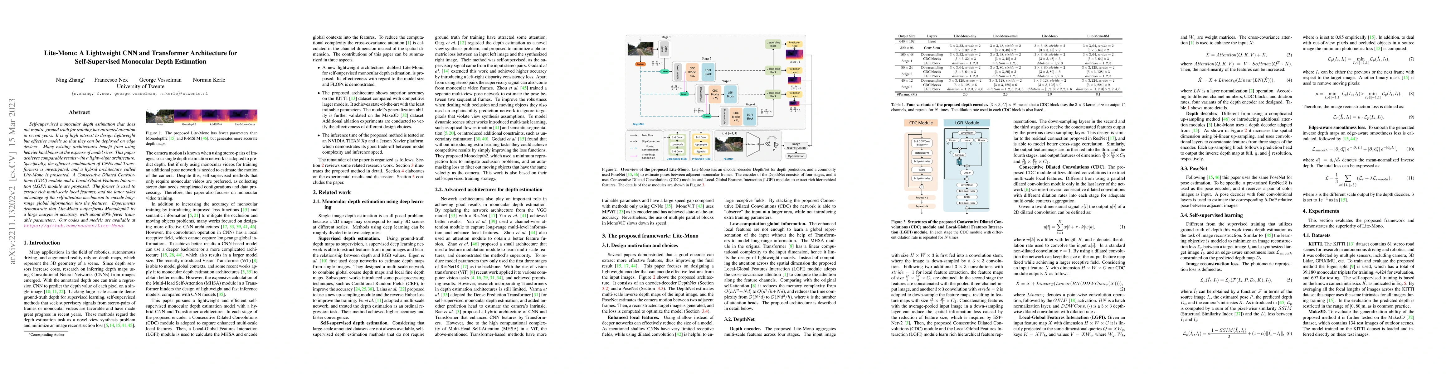
Papers on arXiv
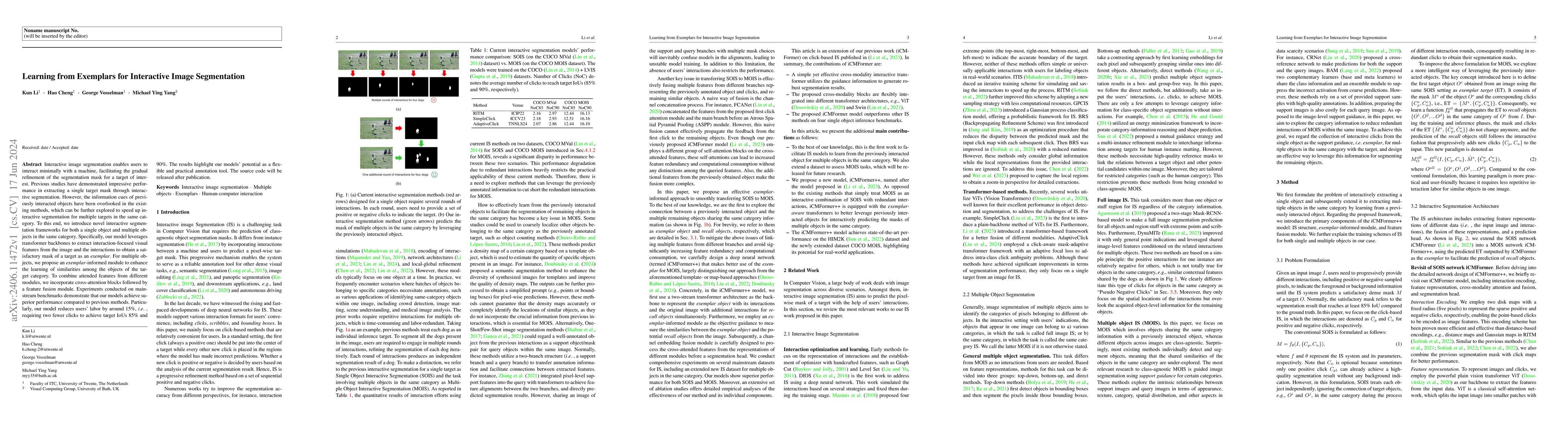
Interactive image segmentation enables users to interact minimally with a machine, facilitating the gradual refinement of the segmentation mask for a target of interest. Previous studies have demonstr...
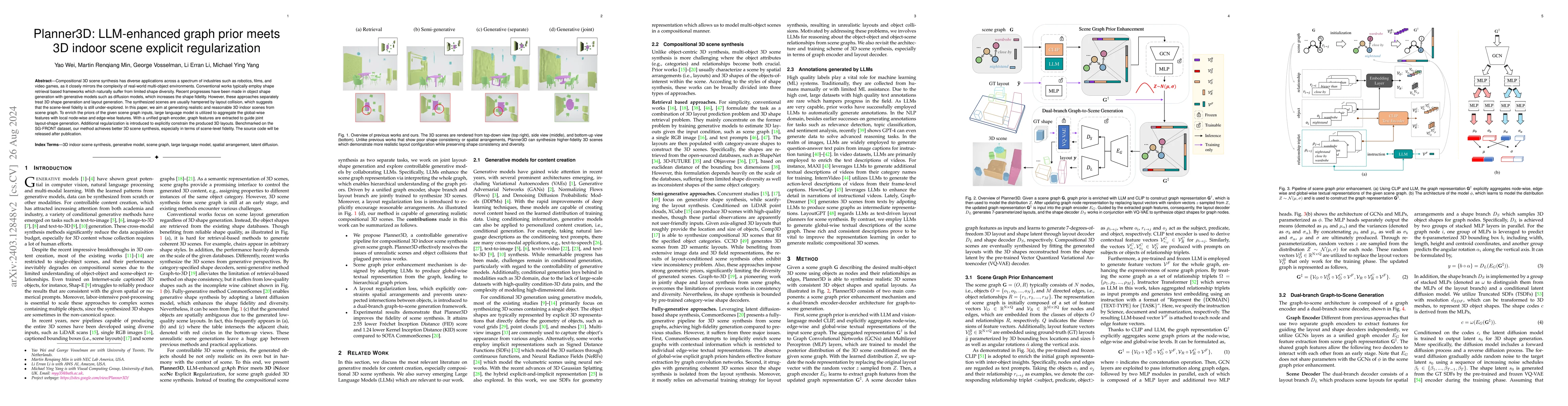
Compositional 3D scene synthesis has diverse applications across a spectrum of industries such as robotics, films, and video games, as it closely mirrors the complexity of real-world multi-object en...
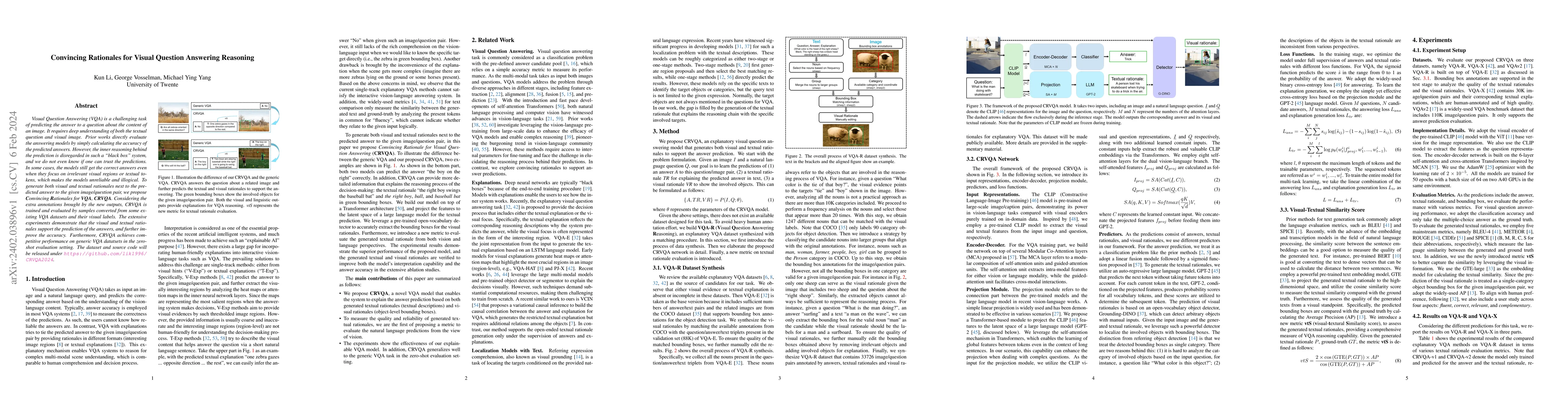
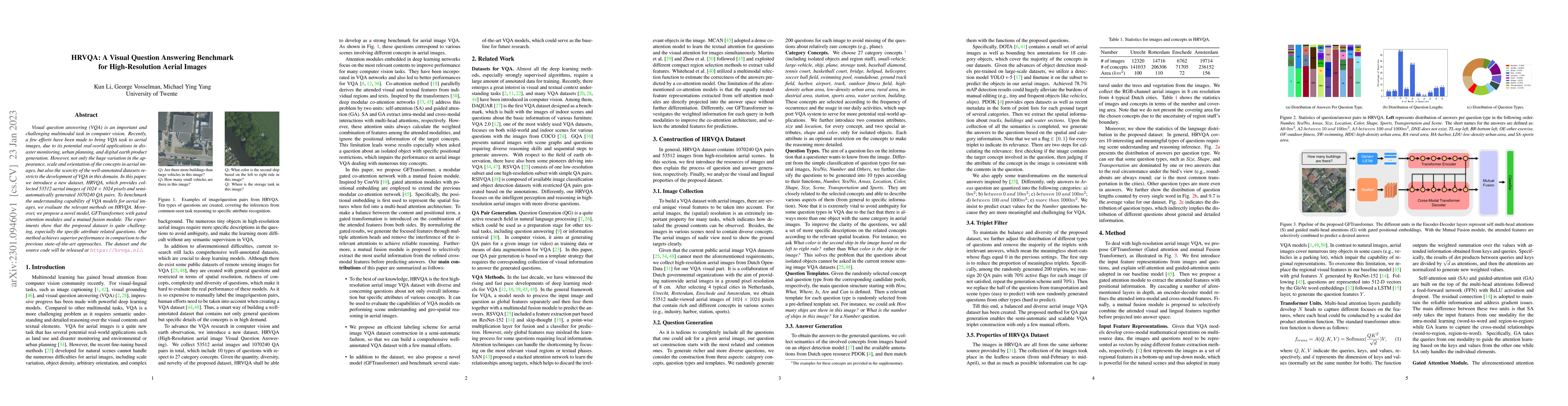
Visual Question Answering (VQA) is a challenging task of predicting the answer to a question about the content of an image. It requires deep understanding of both the textual question and visual ima...
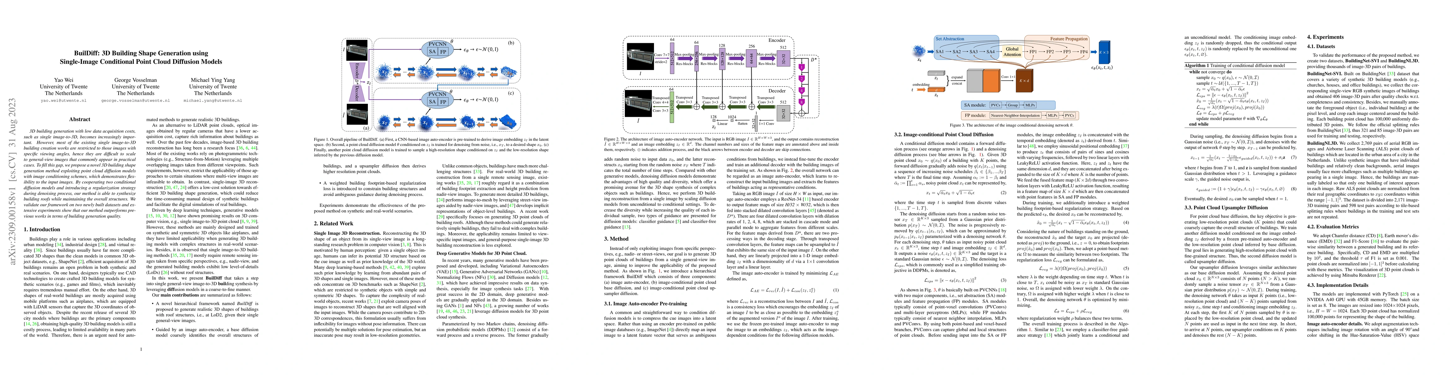
3D building generation with low data acquisition costs, such as single image-to-3D, becomes increasingly important. However, most of the existing single image-to-3D building creation works are restr...
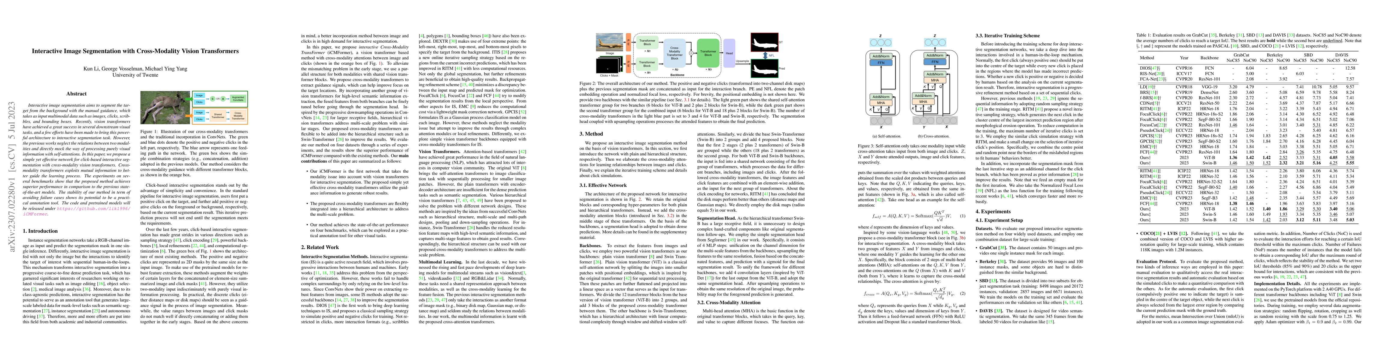
Interactive image segmentation aims to segment the target from the background with the manual guidance, which takes as input multimodal data such as images, clicks, scribbles, and bounding boxes. Re...
Autonomous navigation of drones using computer vision has achieved promising performance. Nano-sized drones based on edge computing platforms are lightweight, flexible, and cheap, thus suitable for ...
Visual question answering (VQA) is an important and challenging multimodal task in computer vision. Recently, a few efforts have been made to bring VQA task to aerial images, due to its potential re...
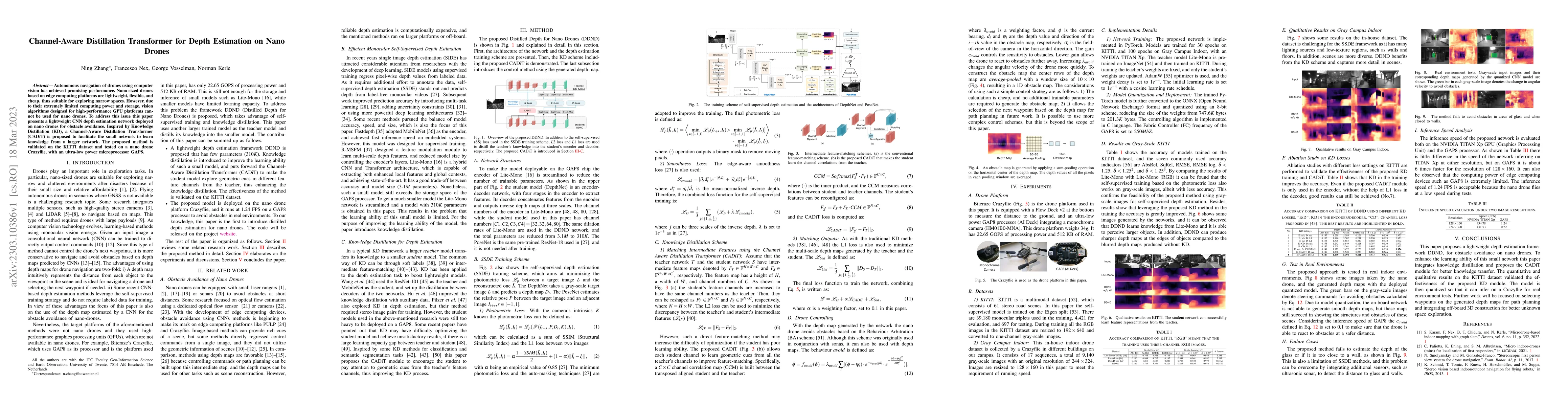
Self-supervised monocular depth estimation that does not require ground truth for training has attracted attention in recent years. It is of high interest to design lightweight but effective models ...
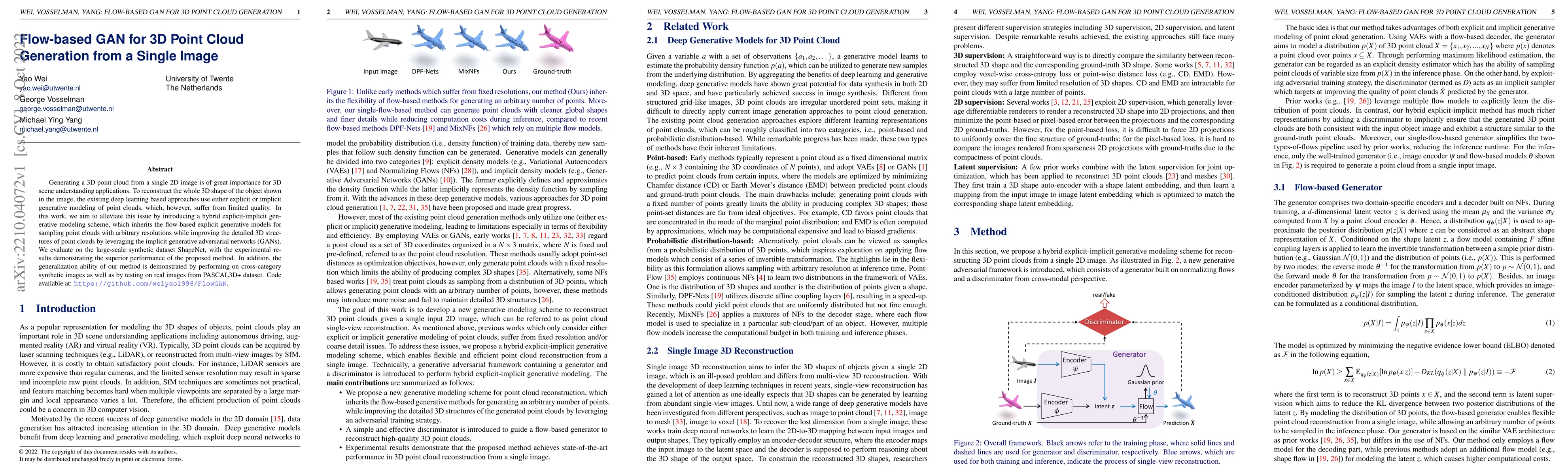
Generating a 3D point cloud from a single 2D image is of great importance for 3D scene understanding applications. To reconstruct the whole 3D shape of the object shown in the image, the existing de...
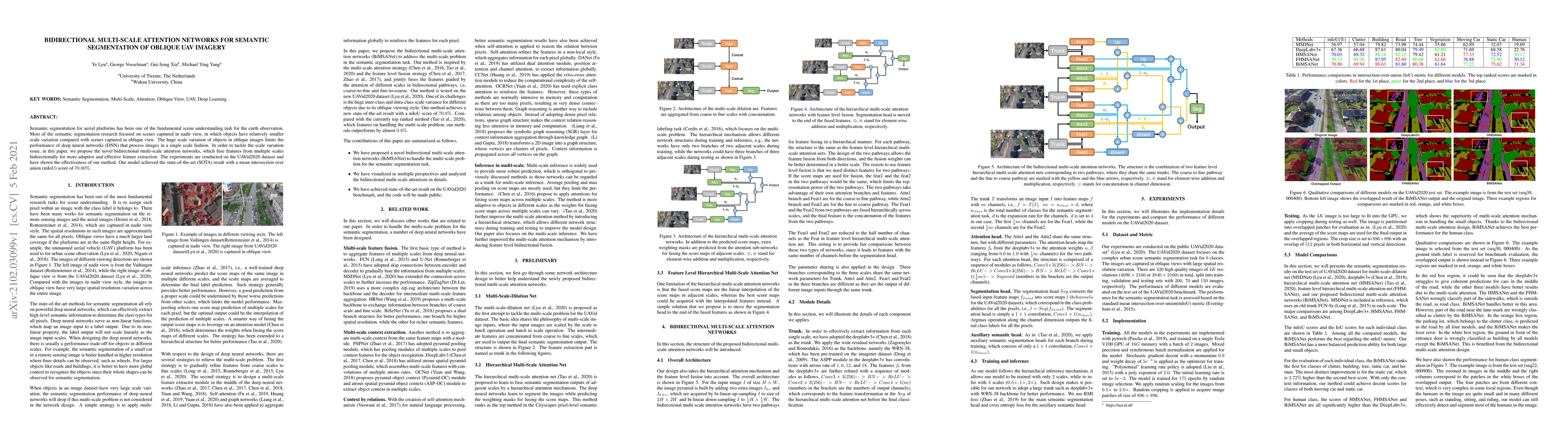
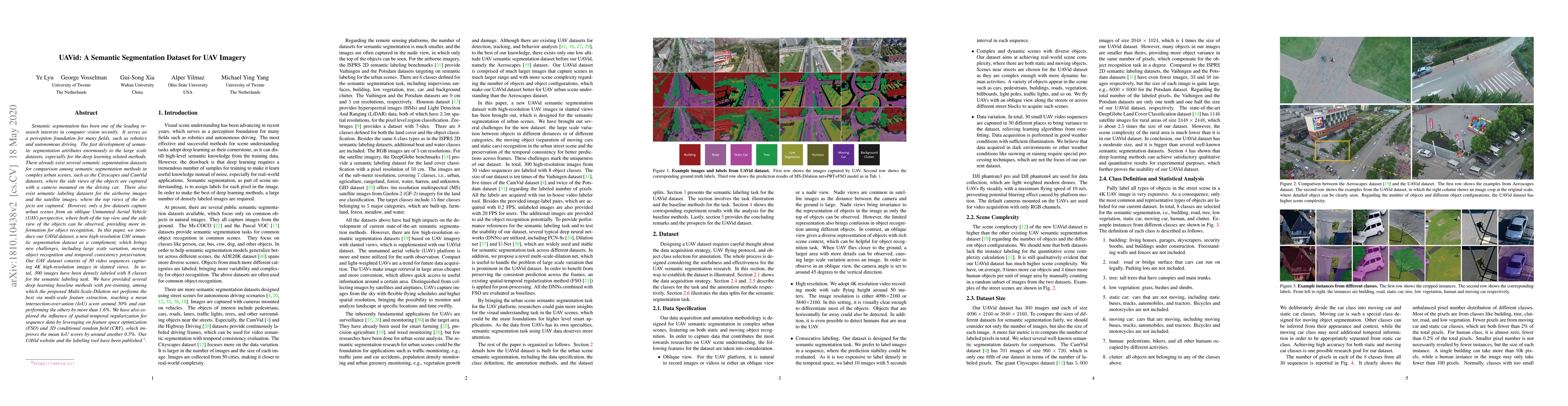
Semantic segmentation for aerial platforms has been one of the fundamental scene understanding task for the earth observation. Most of the semantic segmentation research focused on scenes captured i...
Interpretation of Airborne Laser Scanning (ALS) point clouds is a critical procedure for producing various geo-information products like 3D city models, digital terrain models and land use maps. In ...
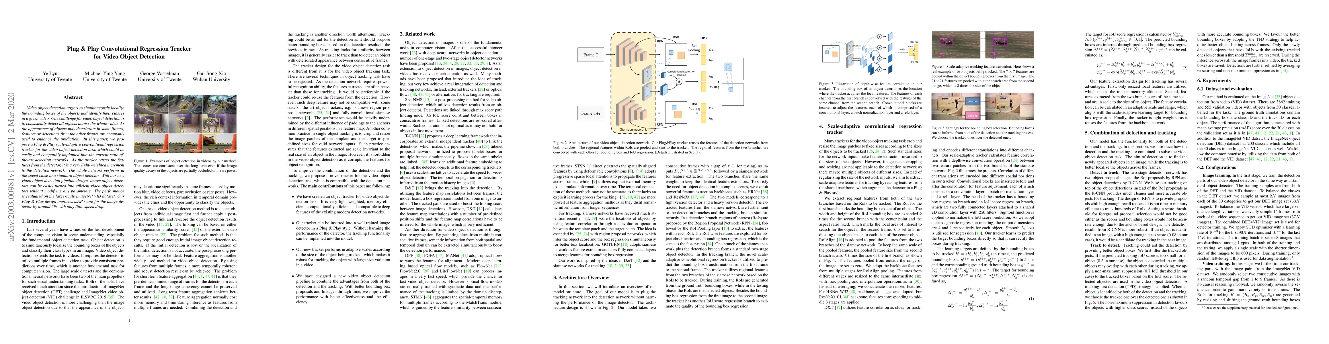
Video object detection targets to simultaneously localize the bounding boxes of the objects and identify their classes in a given video. One challenge for video object detection is to consistently d...
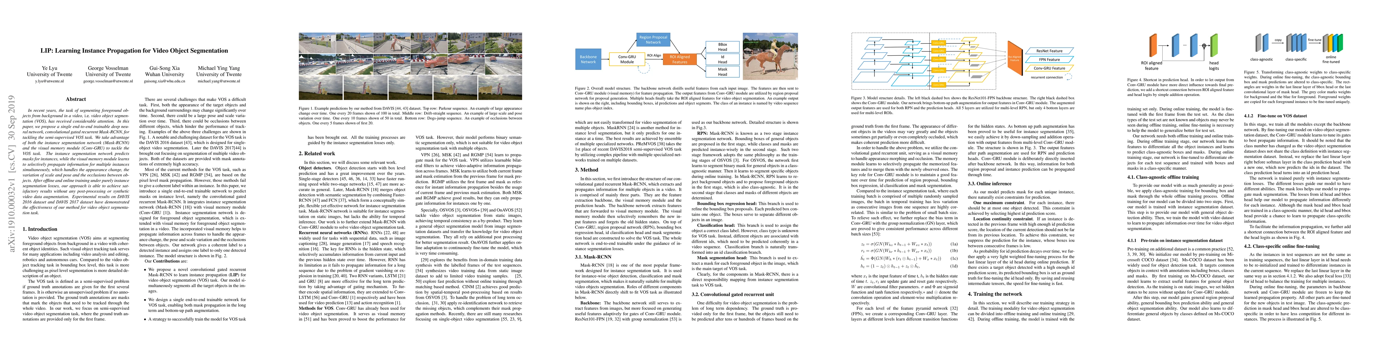
In recent years, the task of segmenting foreground objects from background in a video, i.e. video object segmentation (VOS), has received considerable attention. In this paper, we propose a single e...
Semantic segmentation has been one of the leading research interests in computer vision recently. It serves as a perception foundation for many fields, such as robotics and autonomous driving. The f...
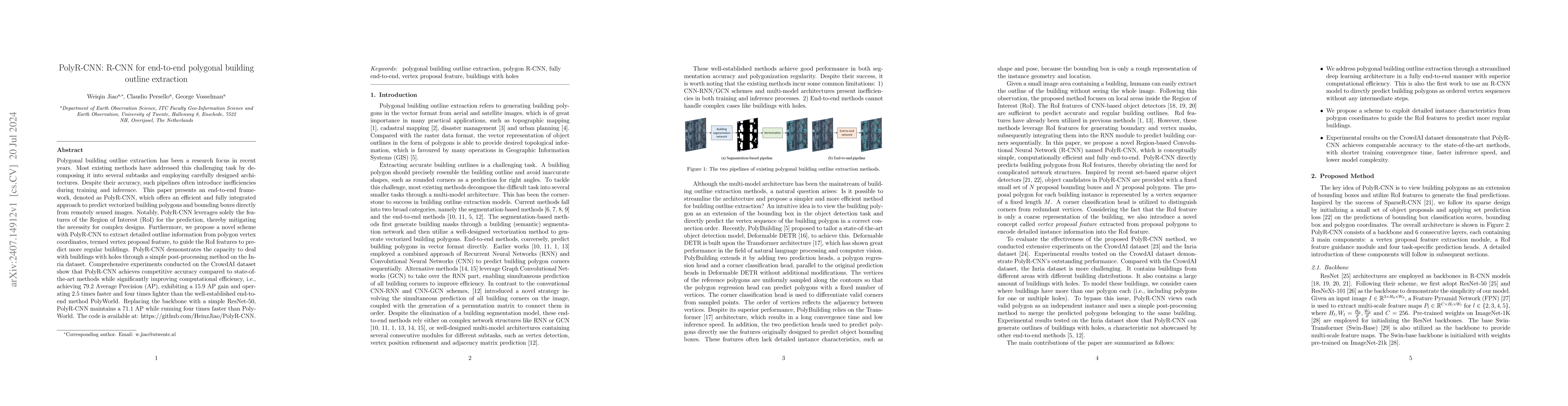
Polygonal building outline extraction has been a research focus in recent years. Most existing methods have addressed this challenging task by decomposing it into several subtasks and employing carefu...
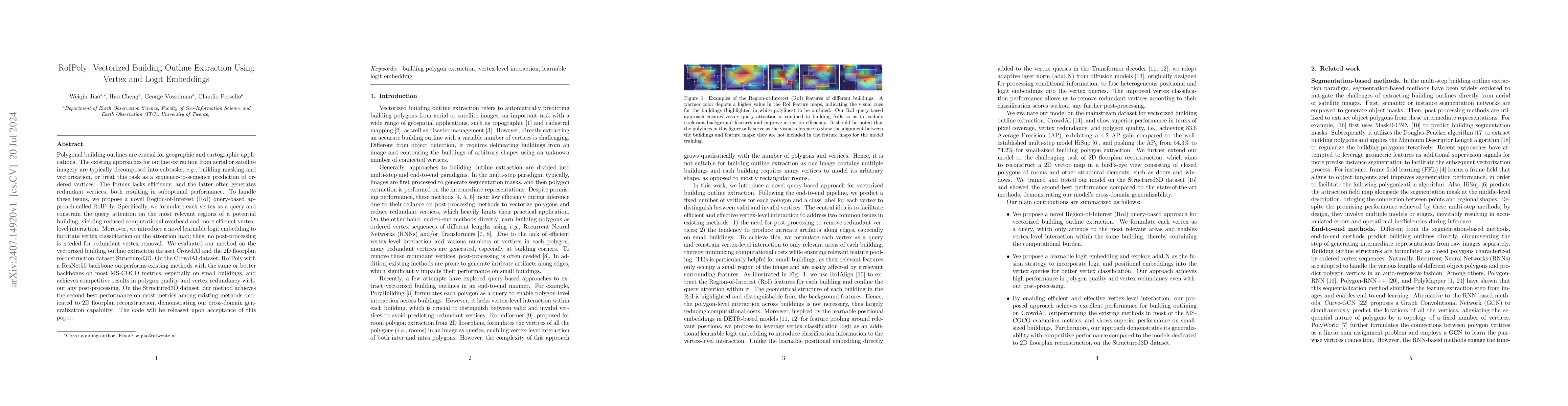
Polygonal building outlines are crucial for geographic and cartographic applications. The existing approaches for outline extraction from aerial or satellite imagery are typically decomposed into subt...
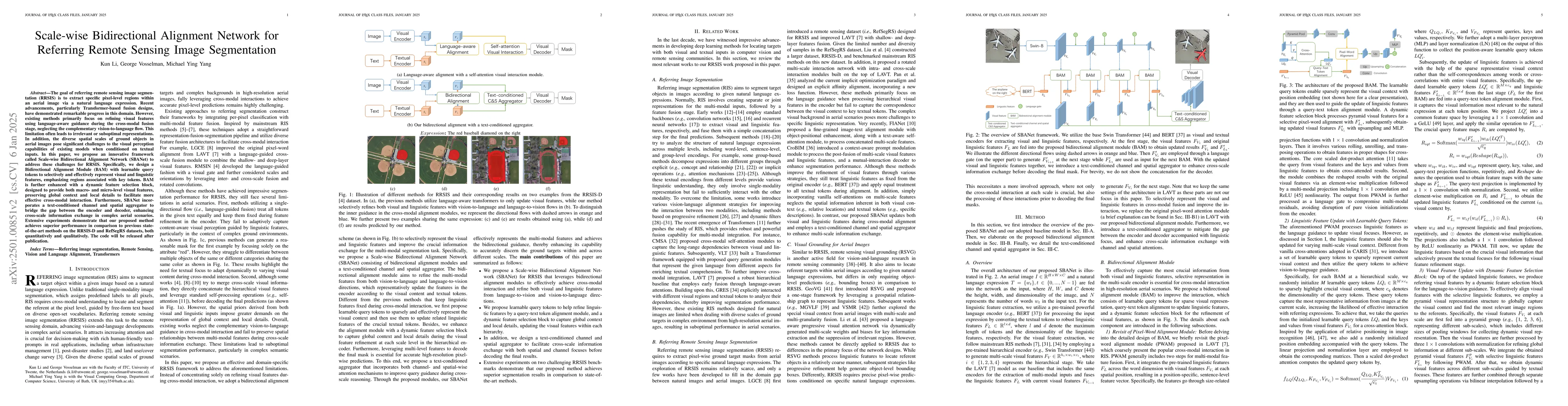
The goal of referring remote sensing image segmentation (RRSIS) is to extract specific pixel-level regions within an aerial image via a natural language expression. Recent advancements, particularly T...
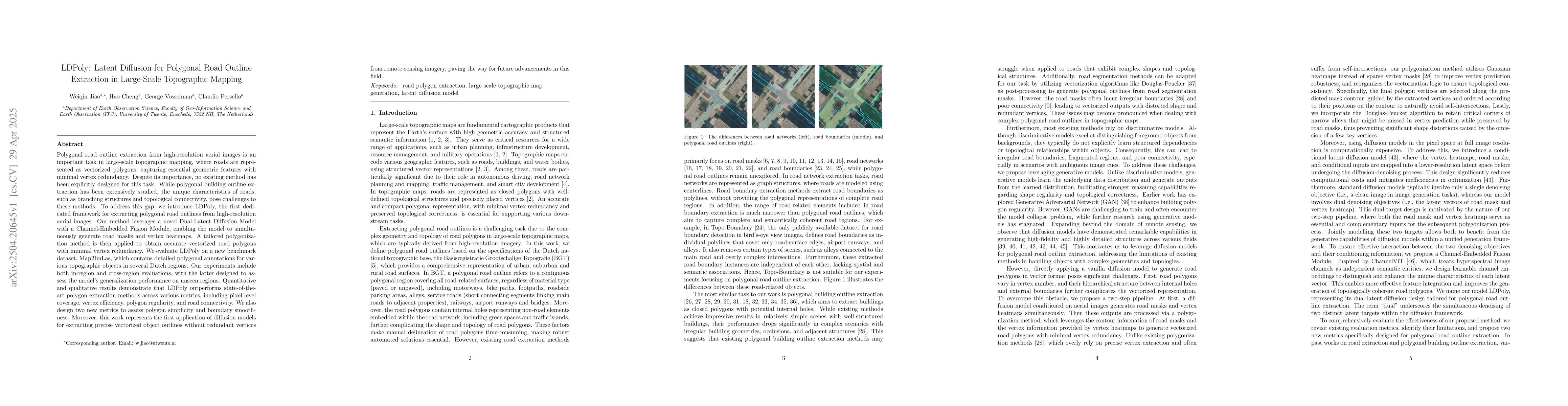
Polygonal road outline extraction from high-resolution aerial images is an important task in large-scale topographic mapping, where roads are represented as vectorized polygons, capturing essential ge...
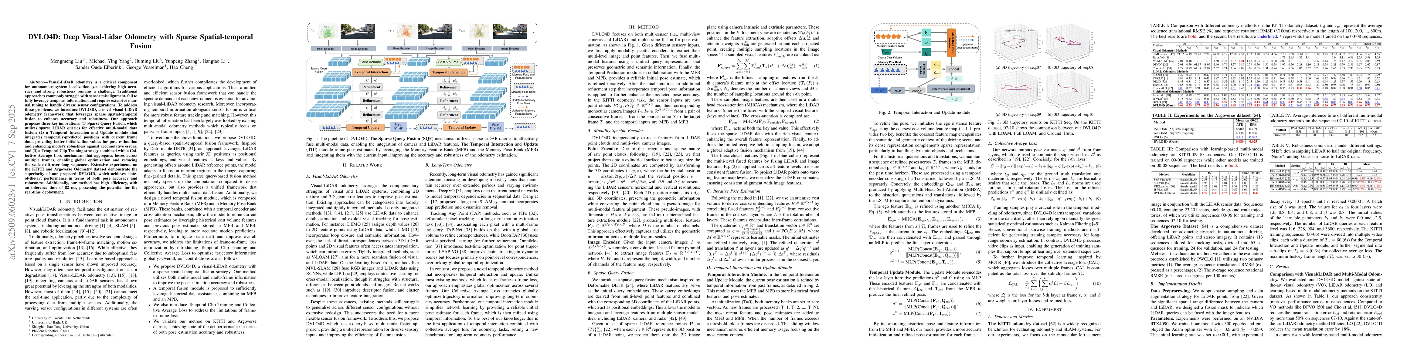
Visual-LiDAR odometry is a critical component for autonomous system localization, yet achieving high accuracy and strong robustness remains a challenge. Traditional approaches commonly struggle with s...
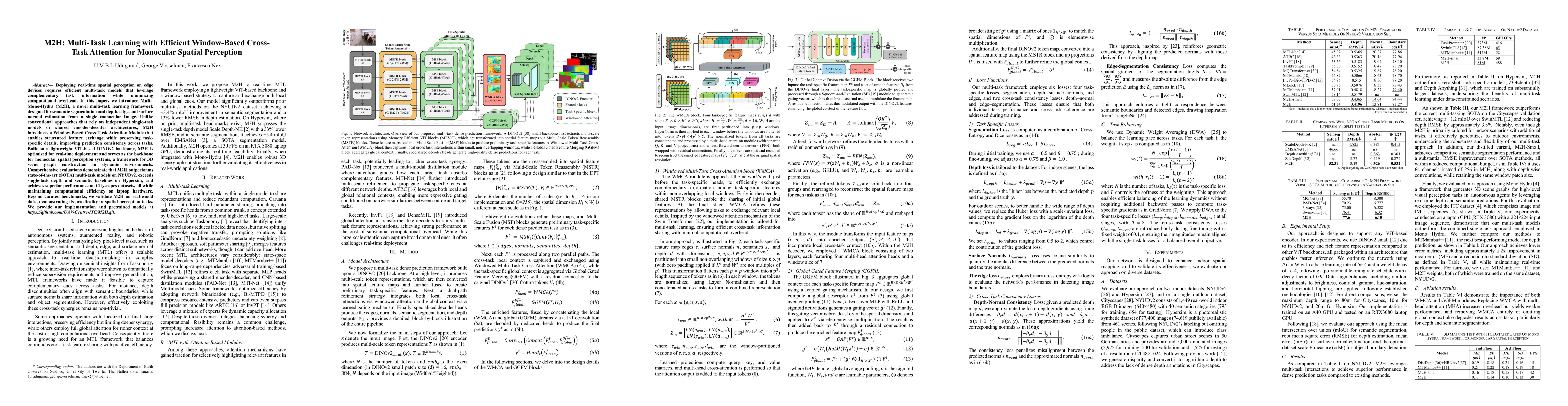
Deploying real-time spatial perception on edge devices requires efficient multi-task models that leverage complementary task information while minimizing computational overhead. This paper introduces ...
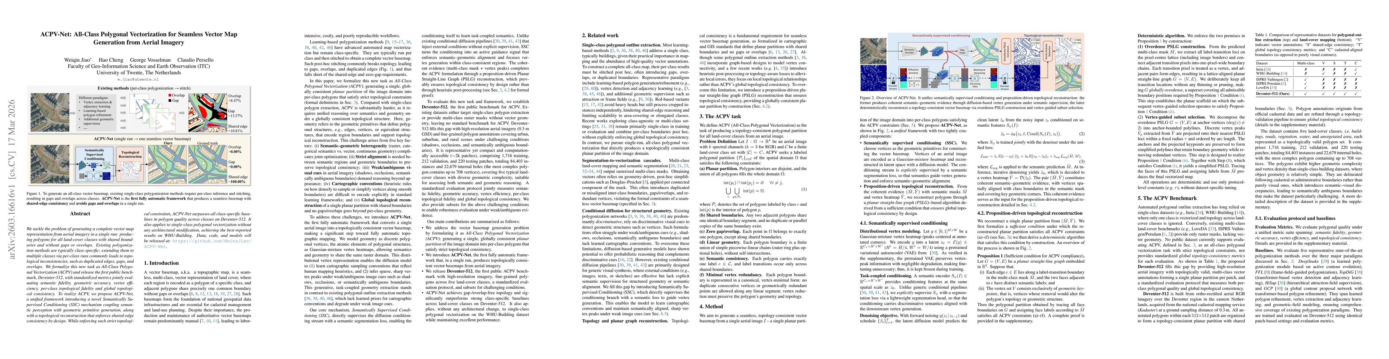
We tackle the problem of generating a complete vector map representation from aerial imagery in a single run: producing polygons for all land-cover classes with shared boundaries and without gaps or o...
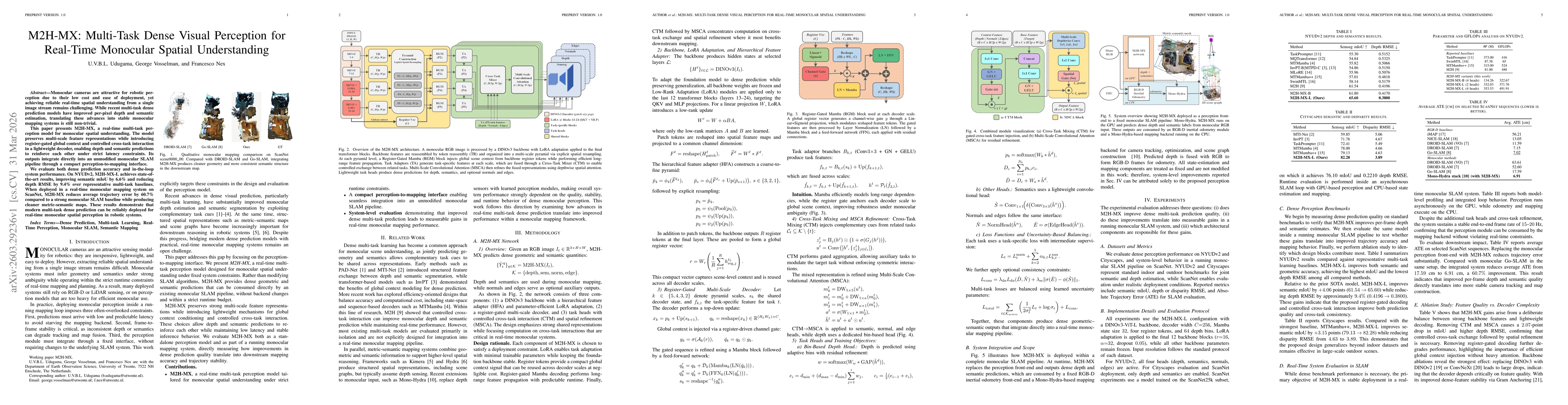
Monocular cameras are attractive for robotic perception due to their low cost and ease of deployment, yet achieving reliable real-time spatial understanding from a single image stream remains challeng...
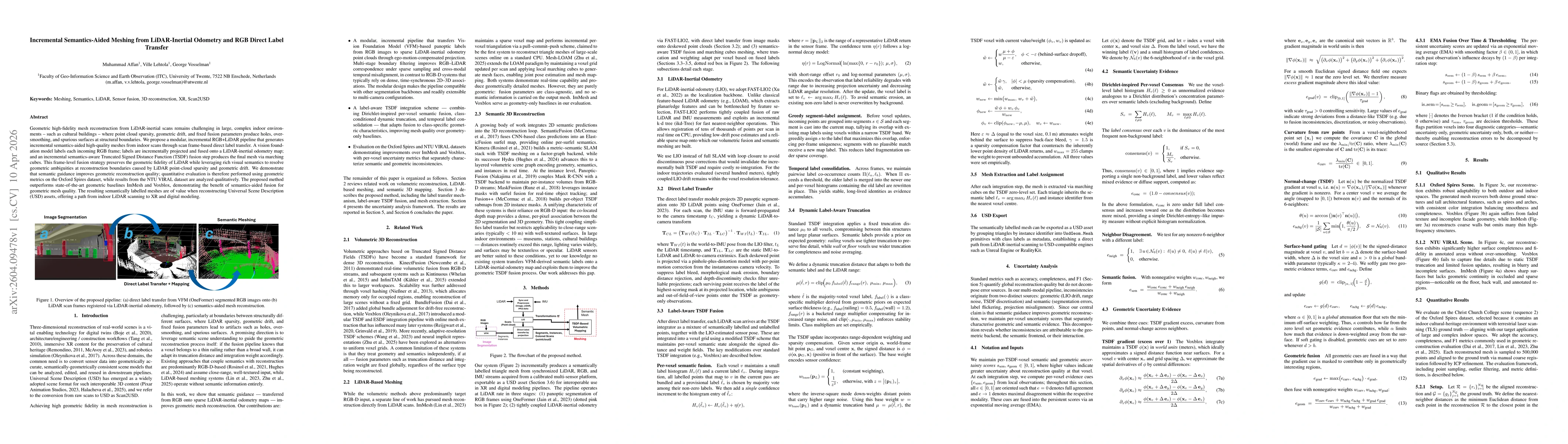
Geometric high-fidelity mesh reconstruction from LiDAR-inertial scans remains challenging in large, complex indoor environments -- such as cultural buildings -- where point cloud sparsity, geometric d...
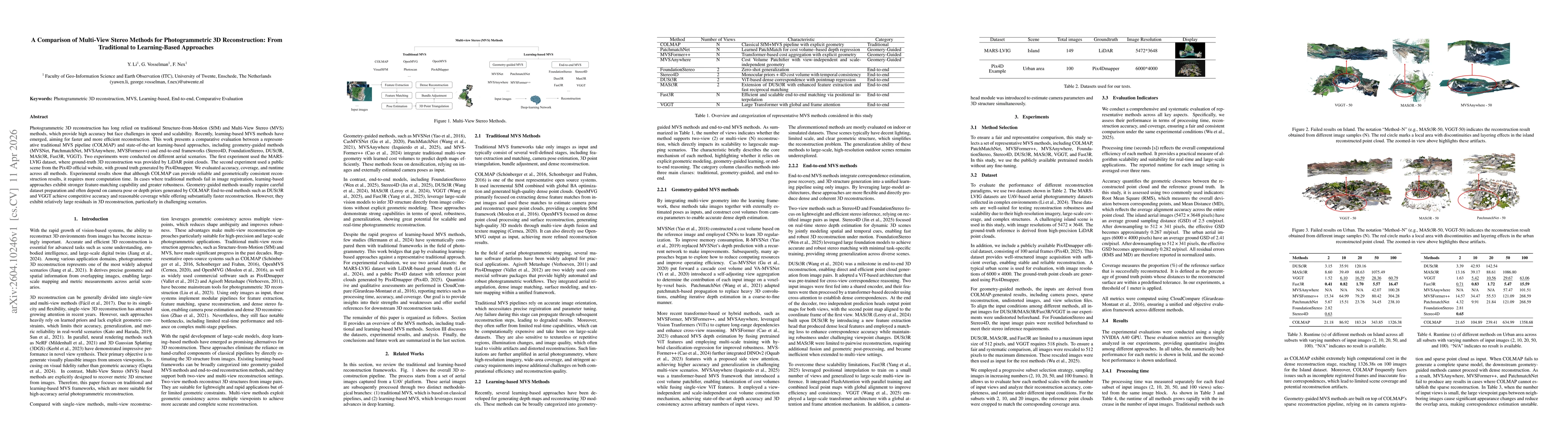
Photogrammetric 3D reconstruction has long relied on traditional Structure-from-Motion (SfM) and Multi-View Stereo (MVS) methods, which provide high accuracy but face challenges in speed and scalabili...
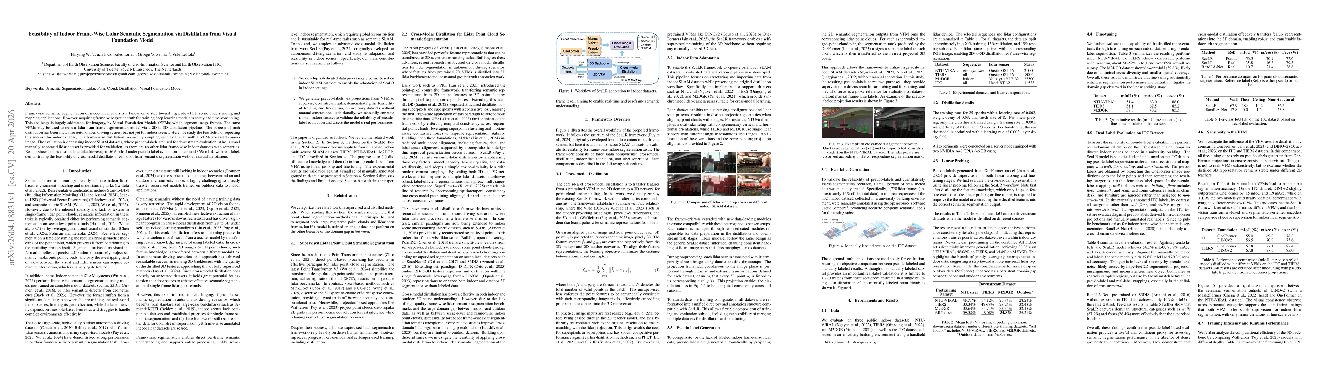
Frame-wise semantic segmentation of indoor lidar scans is a fundamental step toward higher-level 3D scene understanding and mapping applications. However, acquiring frame-wise ground truth for trainin...
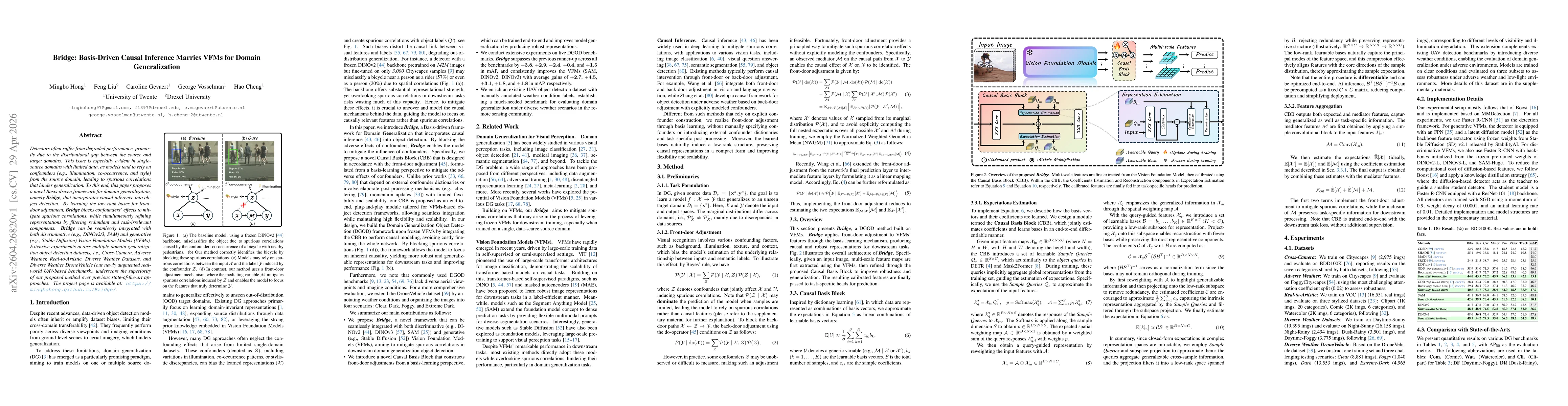
Detectors often suffer from degraded performance, primarily due to the distributional gap between the source and target domains. This issue is especially evident in single-source domains with limited ...
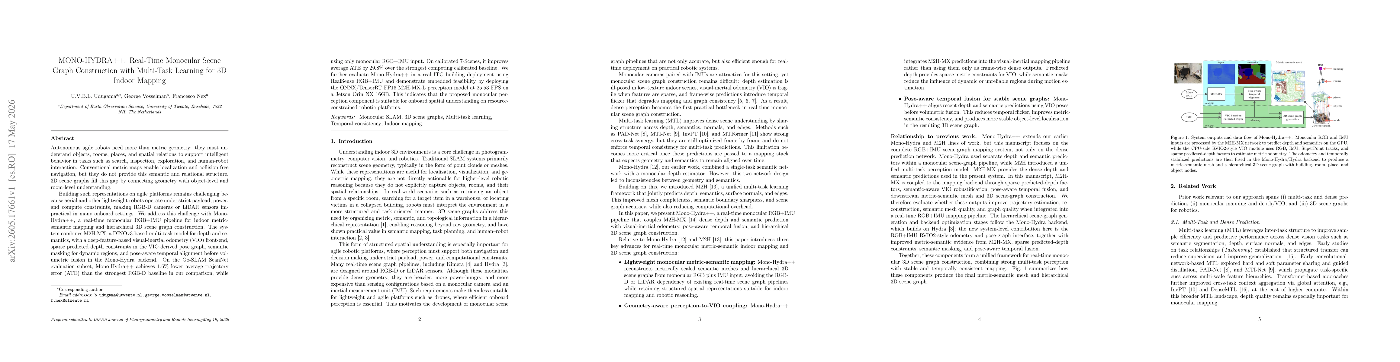
Autonomous agile robots need more than metric geometry: they must understand objects, rooms, places, and spatial relations for search, inspection, exploration, and human robot interaction. Conventiona...