Academic Profile
Statistics
Similar Authors
Papers on arXiv
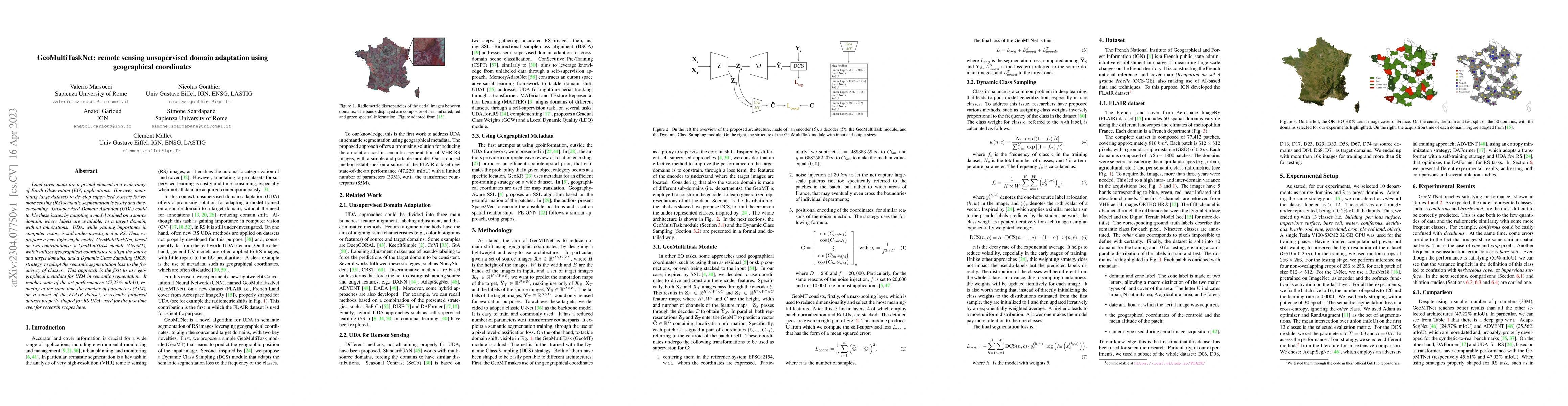
Land cover maps are a pivotal element in a wide range of Earth Observation (EO) applications. However, annotating large datasets to develop supervised systems for remote sensing (RS) semantic segmen...
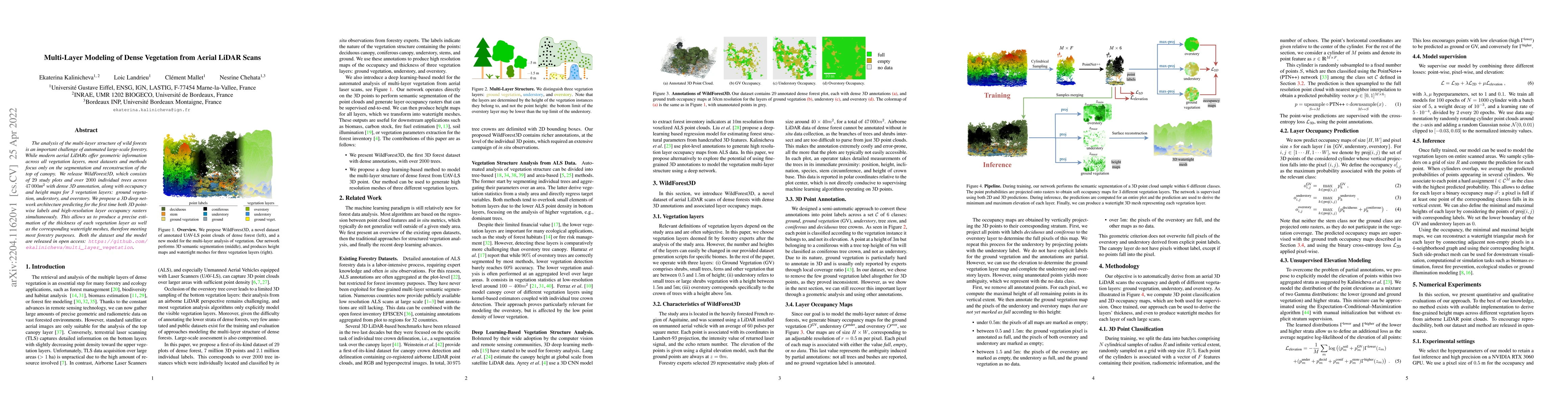
The analysis of the multi-layer structure of wild forests is an important challenge of automated large-scale forestry. While modern aerial LiDARs offer geometric information across all vegetation la...
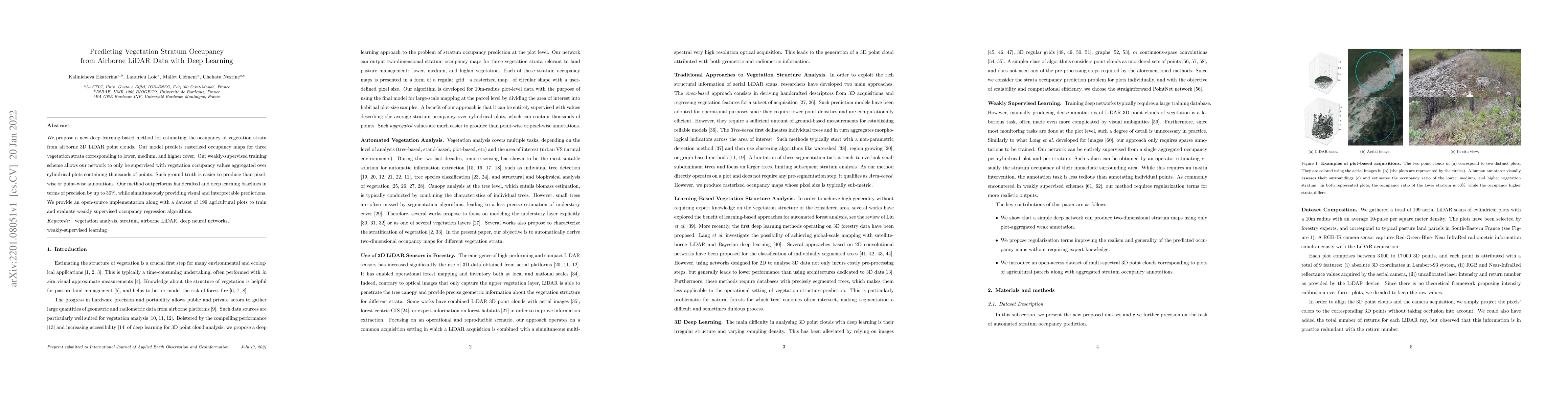
We propose a new deep learning-based method for estimating the occupancy of vegetation strata from airborne 3D LiDAR point clouds. Our model predicts rasterized occupancy maps for three vegetation s...
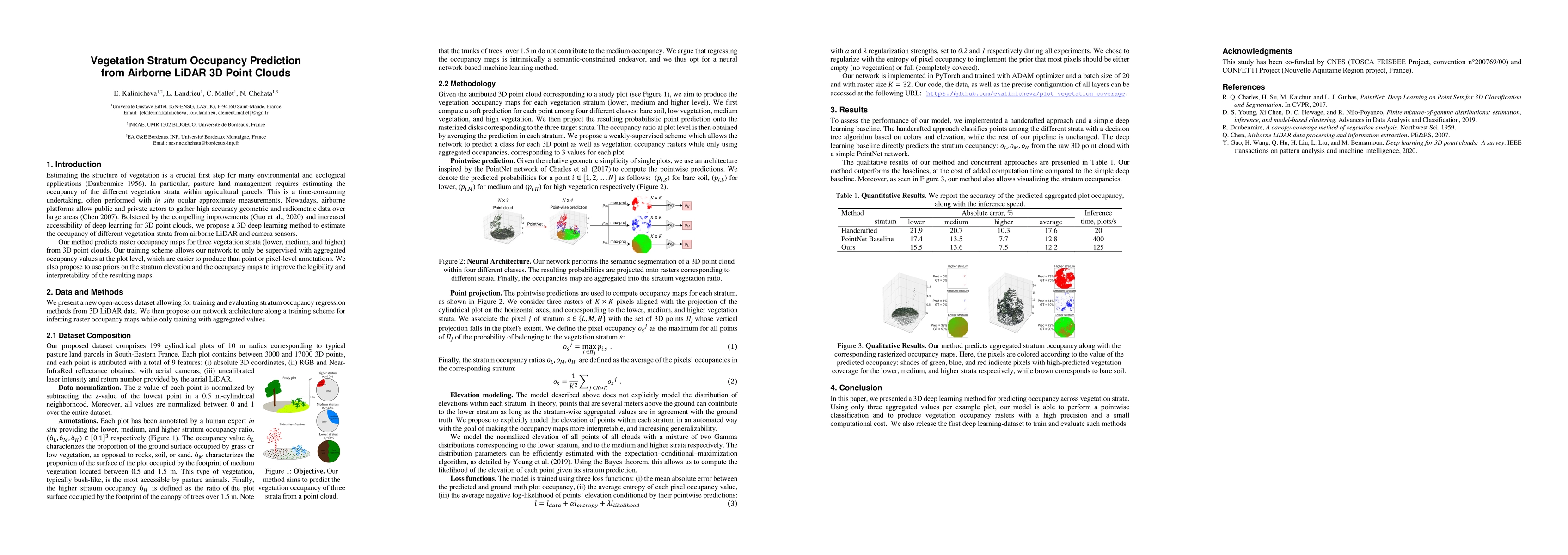
We propose a new deep learning-based method for estimating the occupancy of vegetation strata from 3D point clouds captured from an aerial platform. Our model predicts rasterized occupancy maps for ...
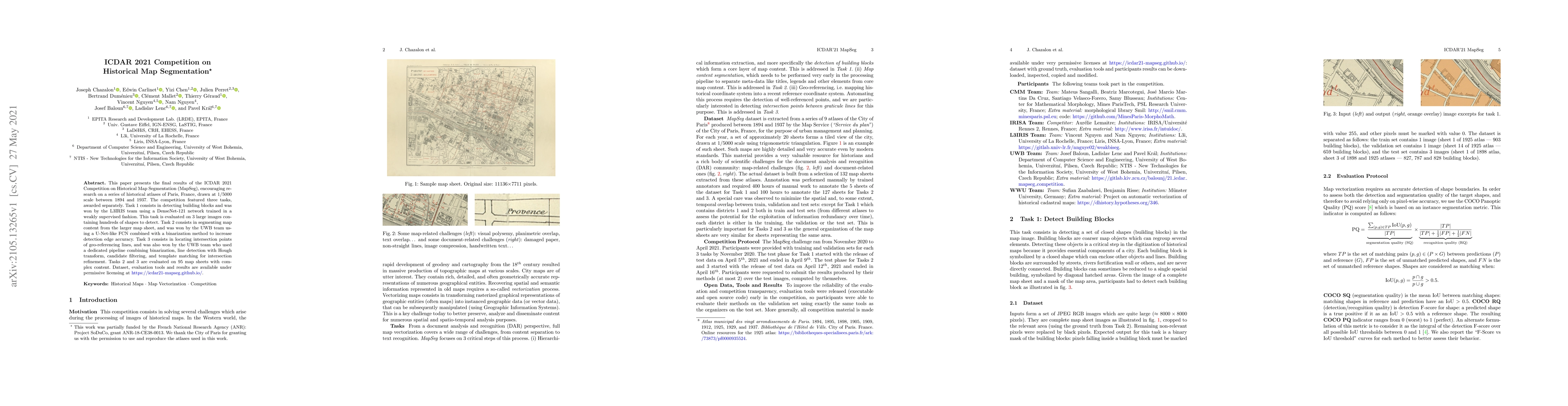
This paper presents the final results of the ICDAR 2021 Competition on Historical Map Segmentation (MapSeg), encouraging research on a series of historical atlases of Paris, France, drawn at 1/5000 ...
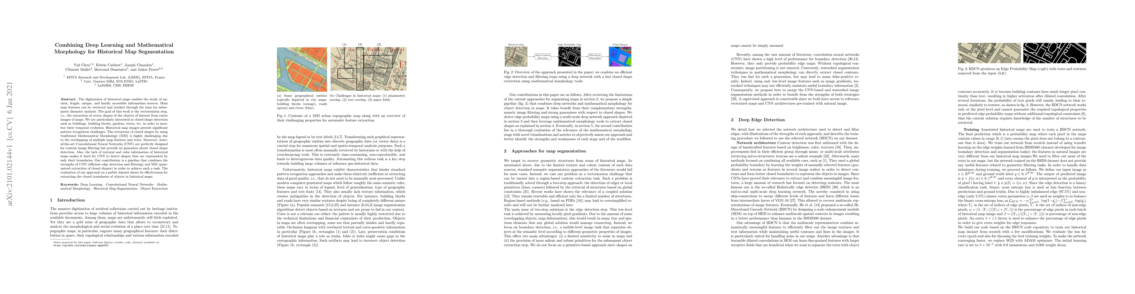
The digitization of historical maps enables the study of ancient, fragile, unique, and hardly accessible information sources. Main map features can be retrieved and tracked through the time for subs...
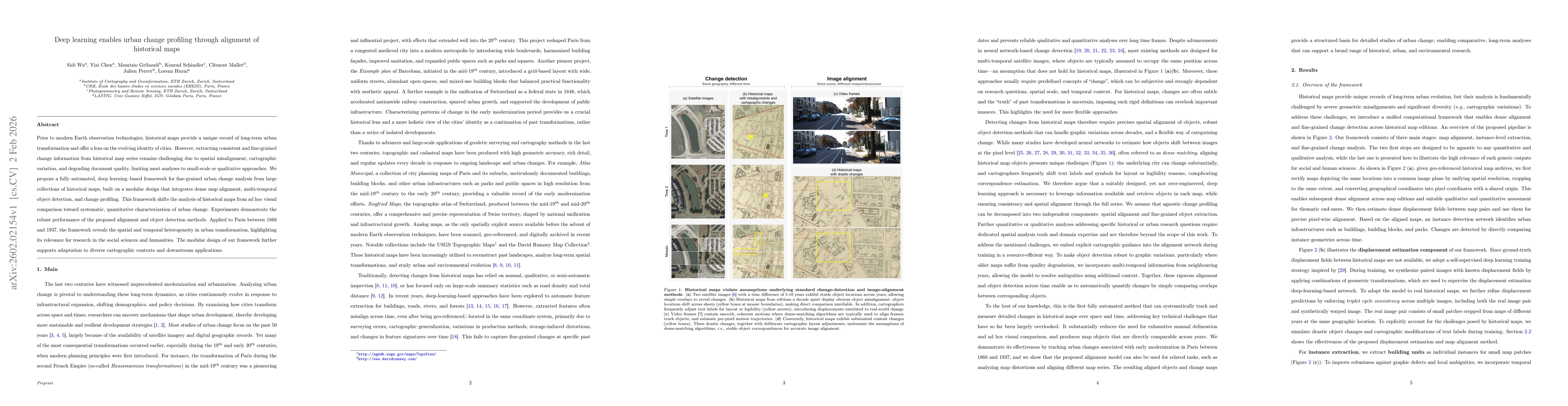
Prior to modern Earth observation technologies, historical maps provide a unique record of long-term urban transformation and offer a lens on the evolving identity of cities. However, extracting consi...

We face a unprecedented amount of geospatial data, describing directly or indirectly the Earth Surface at multiple spatial, temporal, and semantic scales, and stemming from numerous contributors, from...
Forest attributes are essential for national-scale resource monitoring. Airborne LiDAR metrics are among the auxiliary variables most strongly correlated with forest attributes used in National Forest...