Academic Profile
Statistics
Similar Authors
Papers on arXiv
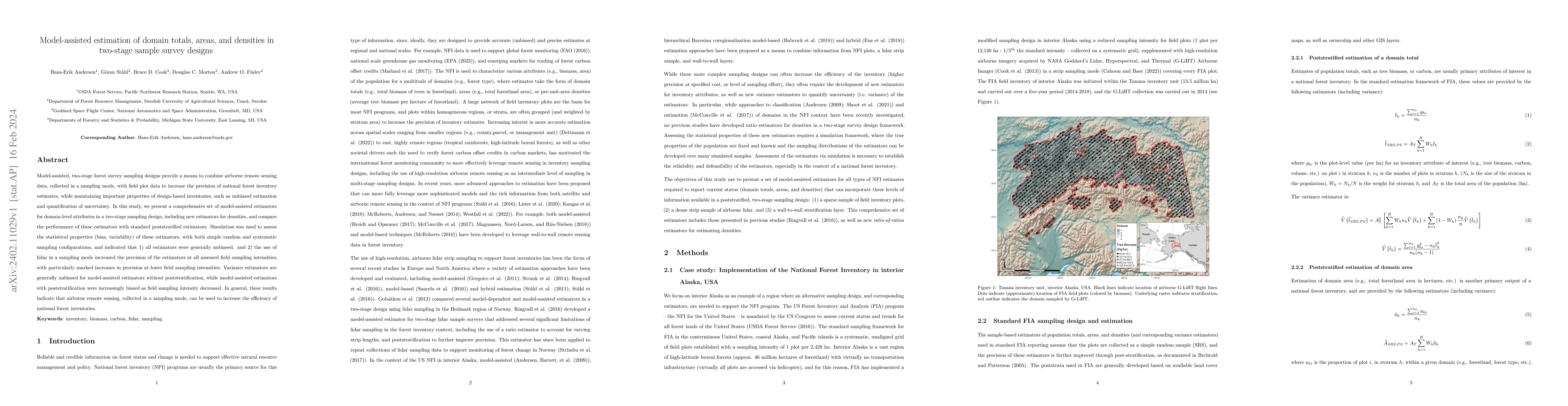
Model-assisted, two-stage forest survey sampling designs provide a means to combine airborne remote sensing data, collected in a sampling mode, with field plot data to increase the precision of nati...
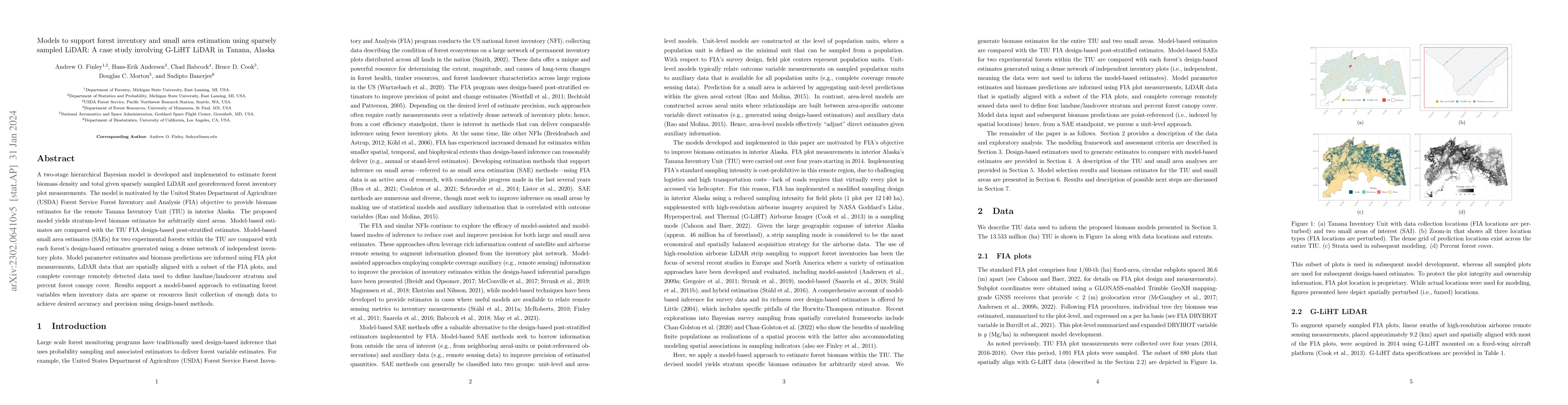
A two-stage hierarchical Bayesian model is developed and implemented to estimate forest biomass density and total given sparsely sampled LiDAR and georeferenced forest inventory plot measurements. T...
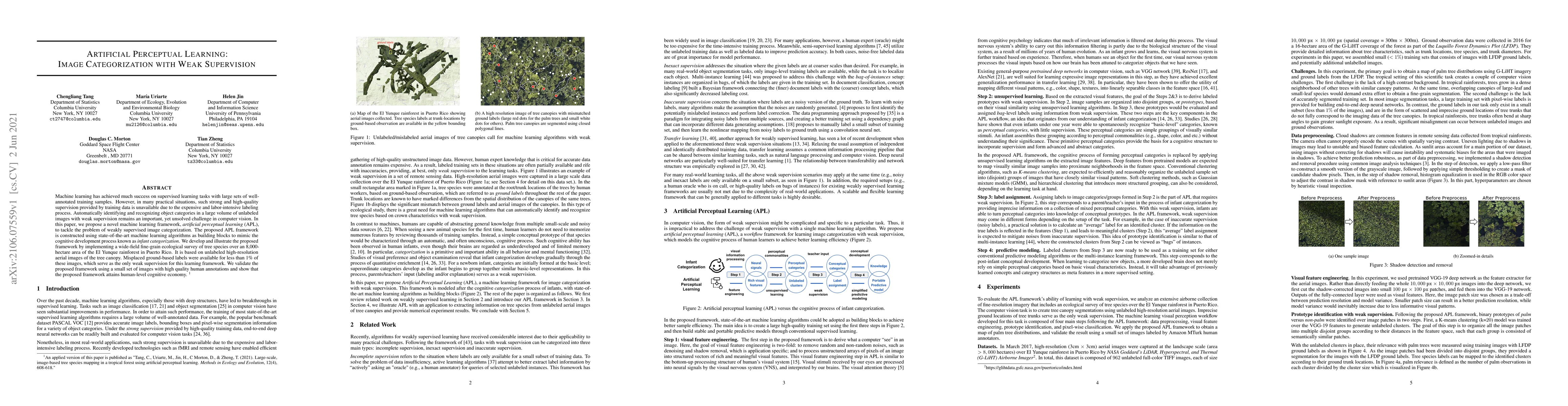
Machine learning has achieved much success on supervised learning tasks with large sets of well-annotated training samples. However, in many practical situations, such strong and high-quality superv...