Academic Profile
Statistics
Similar Authors
Papers on arXiv
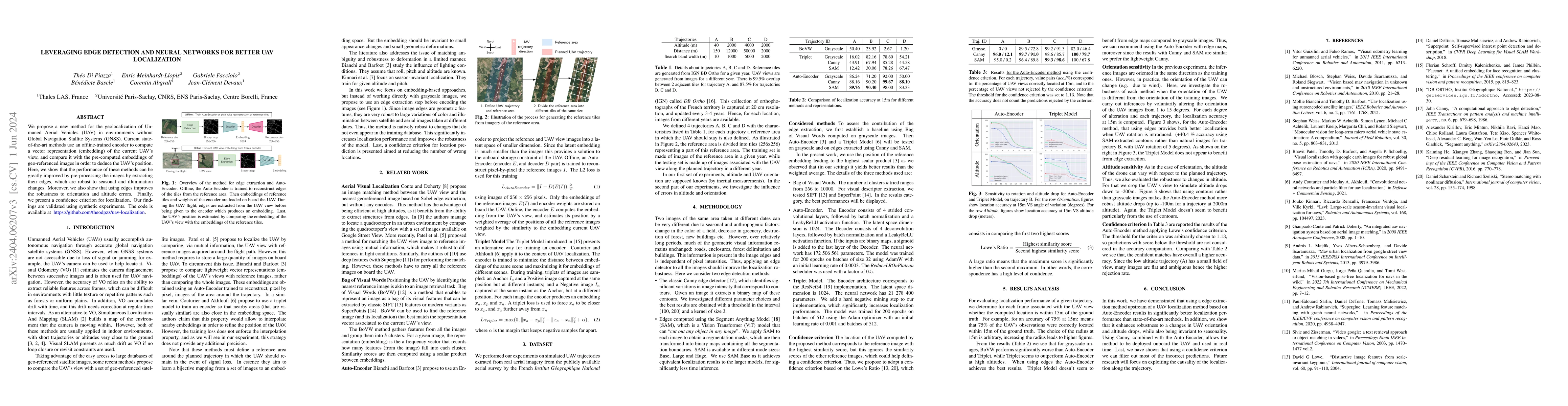
We propose a novel method for geolocalizing Unmanned Aerial Vehicles (UAVs) in environments lacking Global Navigation Satellite Systems (GNSS). Current state-of-the-art techniques employ an offline-...
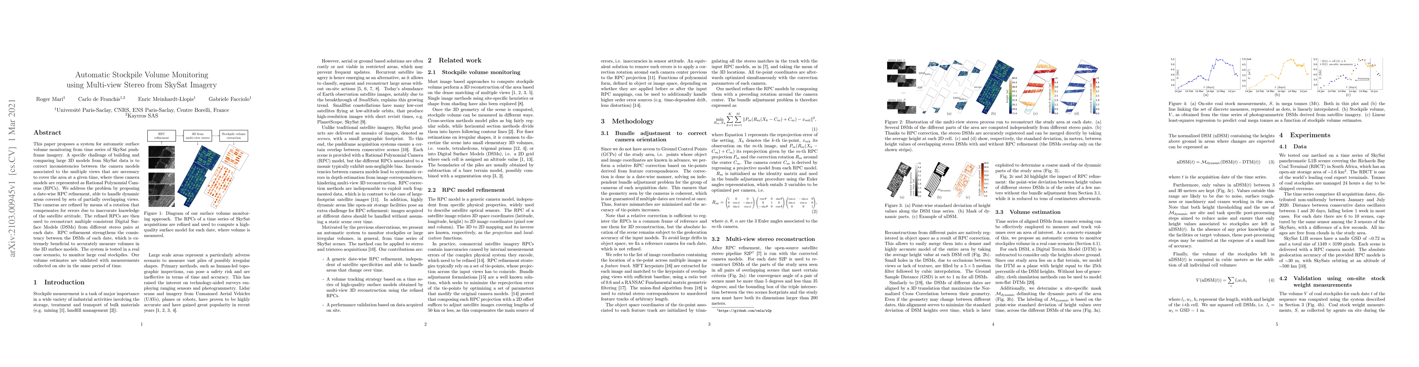
This paper proposes a system for automatic surface volume monitoring from time series of SkySat pushframe imagery. A specific challenge of building and comparing large 3D models from SkySat data is ...
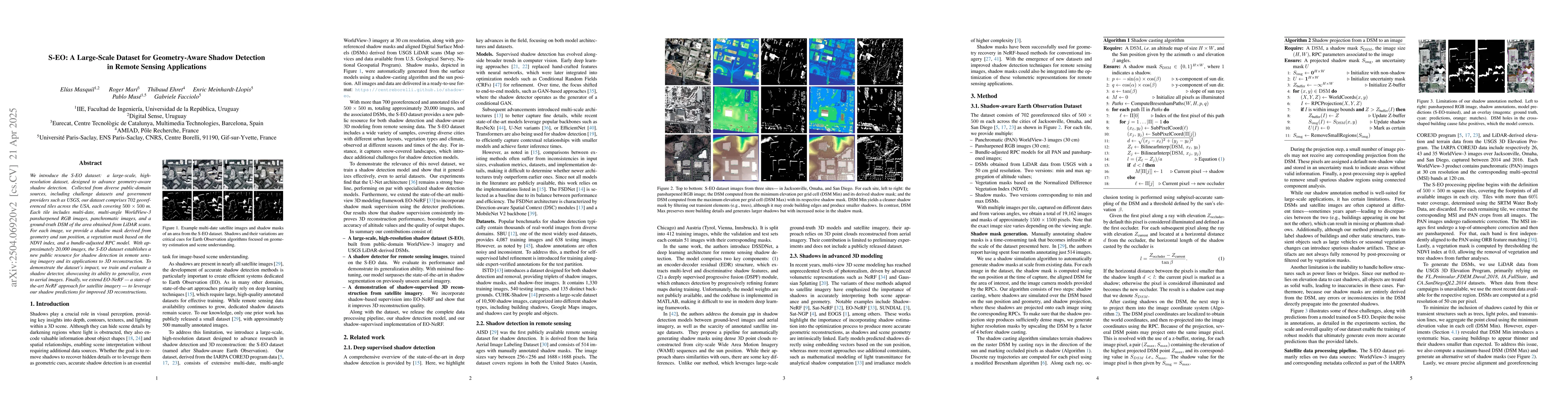
We introduce the S-EO dataset: a large-scale, high-resolution dataset, designed to advance geometry-aware shadow detection. Collected from diverse public-domain sources, including challenge datasets a...
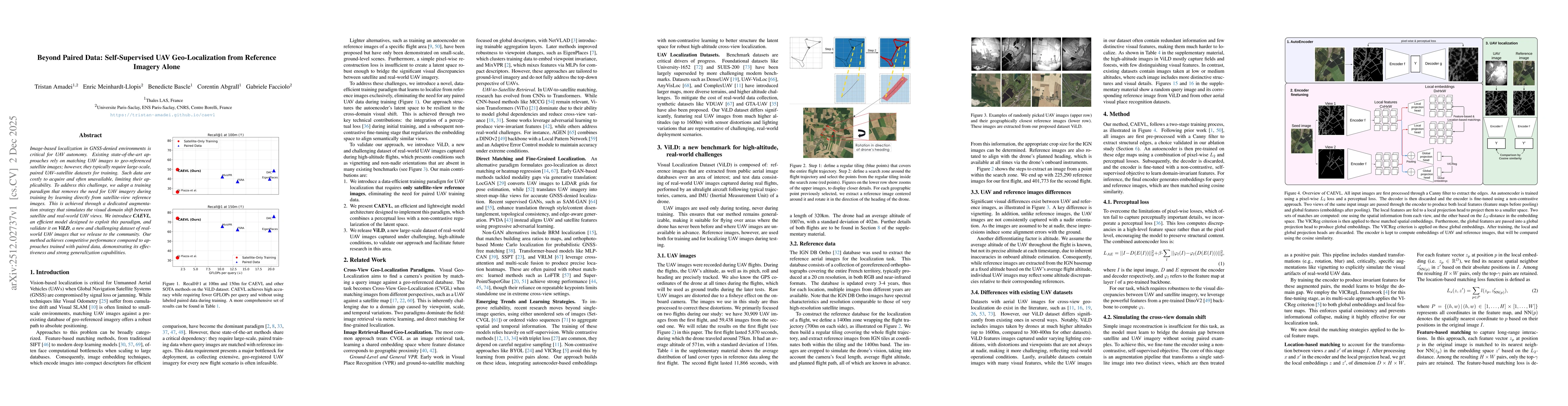
Image-based localization in GNSS-denied environments is critical for UAV autonomy. Existing state-of-the-art approaches rely on matching UAV images to geo-referenced satellite images; however, they ty...
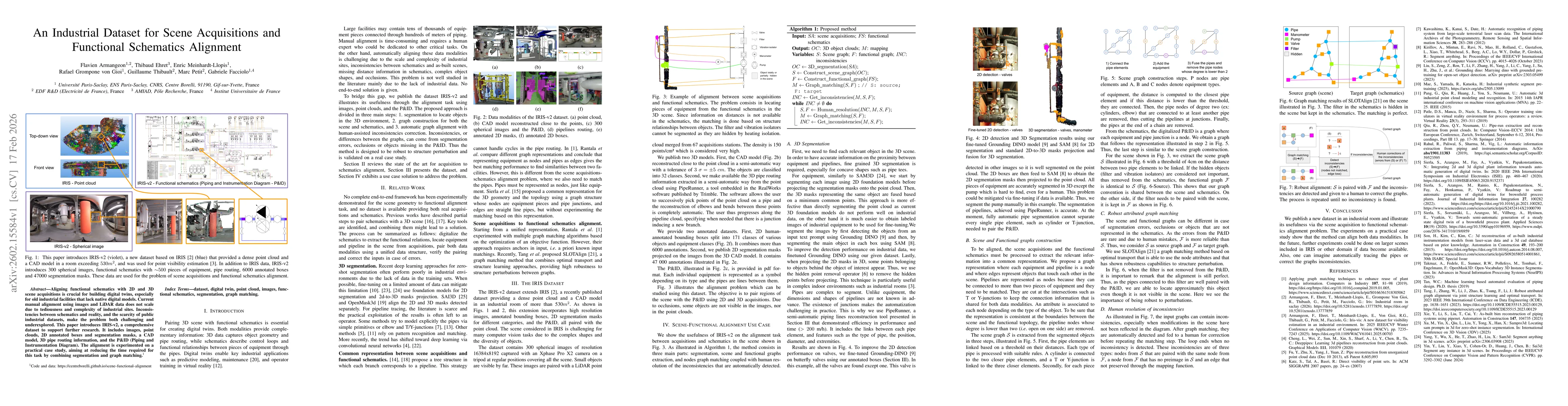
Aligning functional schematics with 2D and 3D scene acquisitions is crucial for building digital twins, especially for old industrial facilities that lack native digital models. Current manual alignme...
A fundamental open question in self-supervised learning (SSL) is the explicit characterization of the optimal geometry of the learned representations. Recently, LeJEPA identified isotropic Gaussian em...
In Self-Supervised Learning (SSL), preventing representation collapse by explicitly enforcing a uniform distribution on the unit hypersphere has proven to be effective. However, current frameworks typ...