Academic Profile
Statistics
Similar Authors
Papers on arXiv
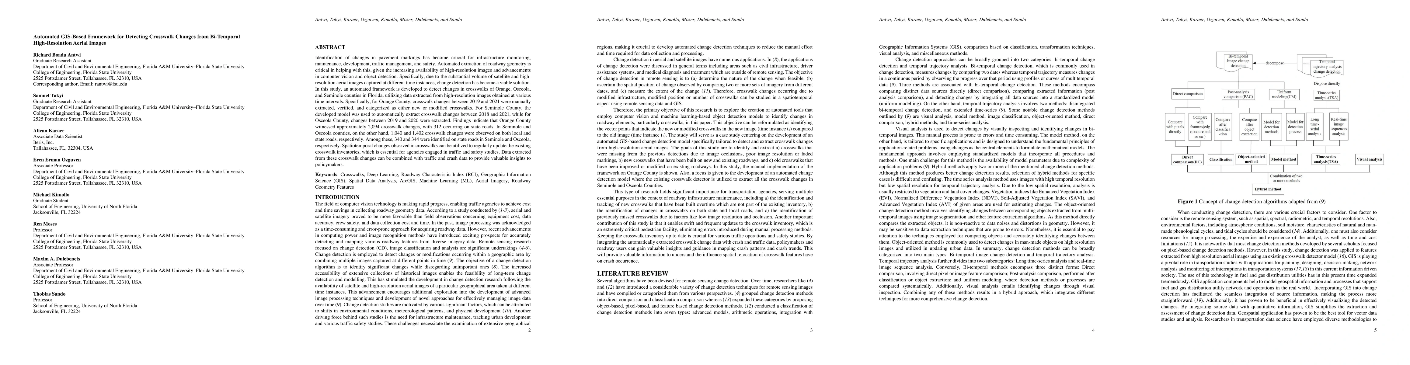
Identification of changes in pavement markings has become crucial for infrastructure monitoring, maintenance, development, traffic management, and safety. Automated extraction of roadway geometry is...
Efficient and current roadway geometry data collection is critical to transportation agencies in road planning, maintenance, design, and rehabilitation. Data collection methods are divided into land...
Rapid advancements in autonomous vehicles (AVs) are poised to revolutionize transportation and communities, including disaster evacuations, particularly through the deployment of Shared Autonomous Veh...
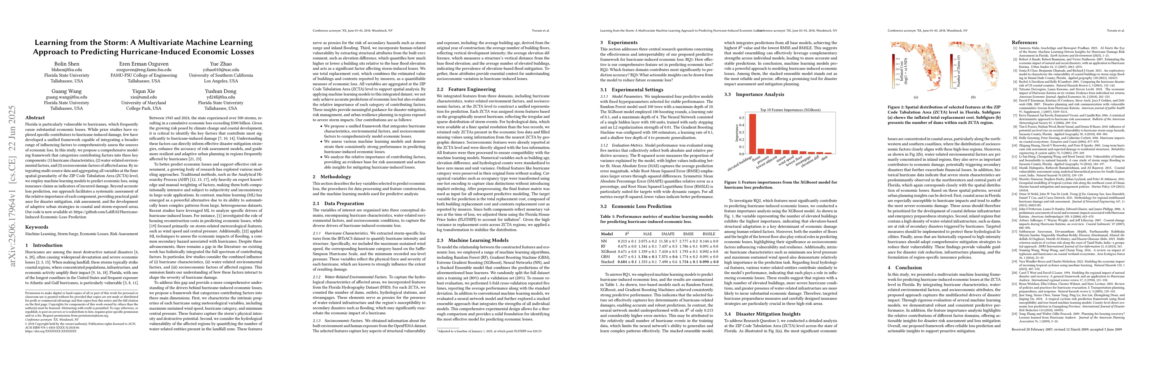
Florida is particularly vulnerable to hurricanes, which frequently cause substantial economic losses. While prior studies have explored specific contributors to hurricane-induced damage, few have deve...
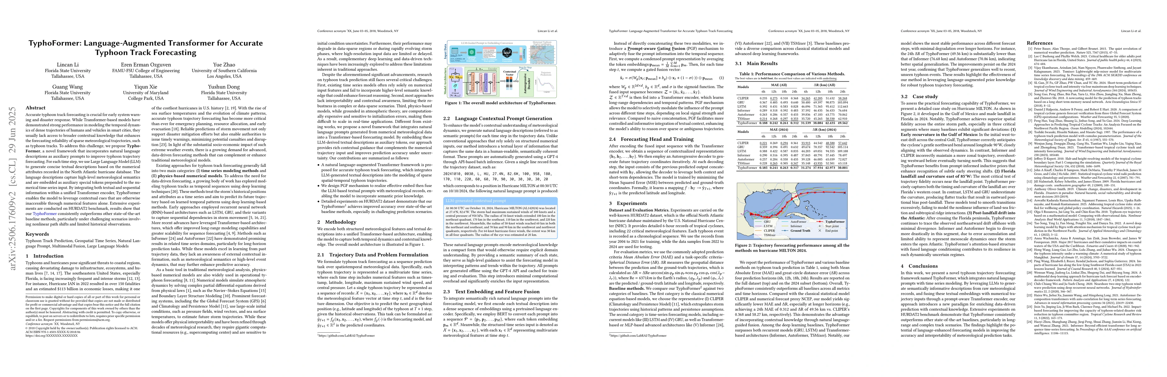
Accurate typhoon track forecasting is crucial for early system warning and disaster response. While Transformer-based models have demonstrated strong performance in modeling the temporal dynamics of d...
Surveying is a core component of civil engineering education, requiring students to engage in hands-on spatial measurement, instrumentation handling, and field-based decision-making. However, traditio...
Proactive safety systems that anticipate and mitigate traffic risks before incidents occur are increasingly recognized as essential for improving work zone safety. Unlike traditional reactive methods,...
Proactive safety systems aim to mitigate risks by anticipating potential conflicts between vehicles and enabling early intervention to prevent work zone-related crashes. This study presents an infrast...
Rural roadways often expose Commercial Motor Vehicle (CMV) drivers to hazardous conditions, such as heavy fog, rain, snow, black ice, and flash floods, many of which remain unreported in real time. Th...
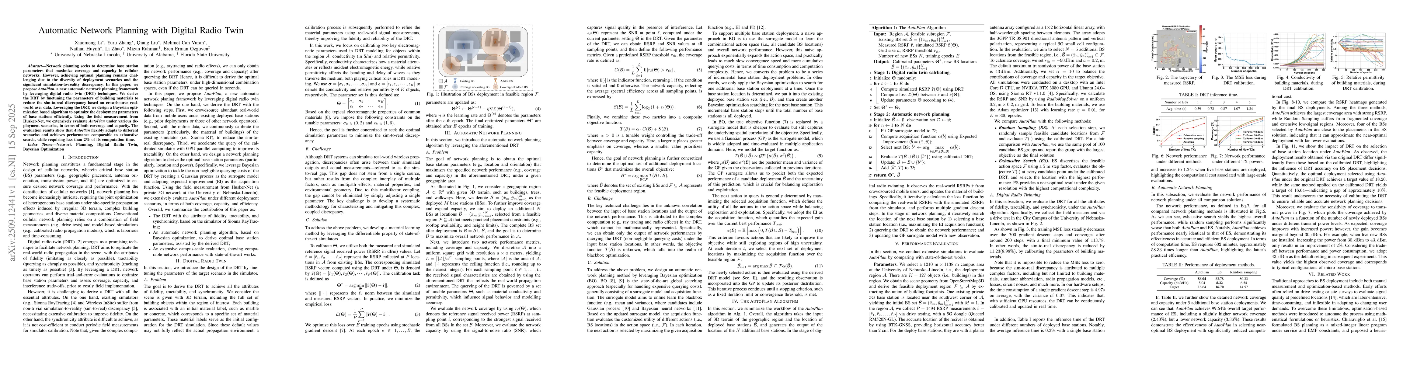
Network planning seeks to determine base station parameters that maximize coverage and capacity in cellular networks. However, achieving optimal planning remains challenging due to the diversity of de...
Infrastructure-based sensing and real-time trajectory generation show promise for improving safety in high-risk roadway segments such as work zones, yet practical deployments are hindered by perspecti...