Academic Profile
Statistics
Similar Authors
Papers on arXiv
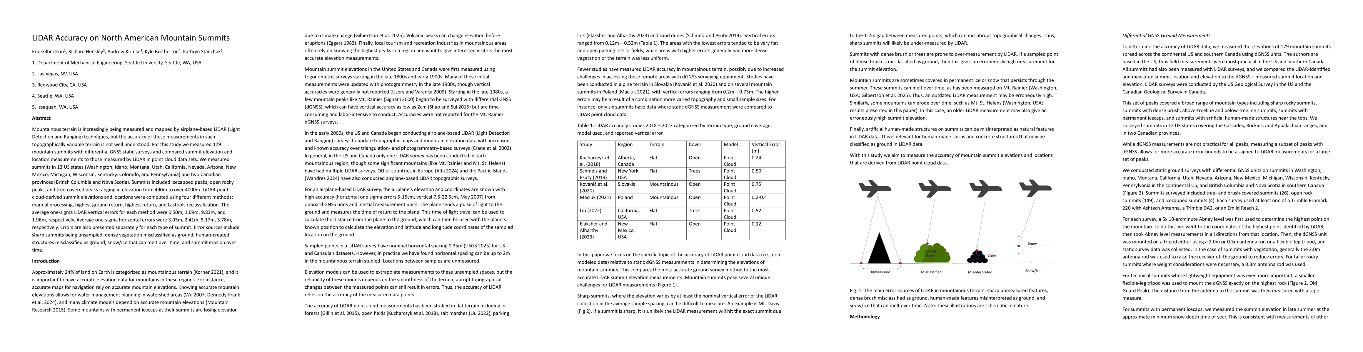
Mountainous terrain is increasingly being measured and mapped by airplane-based LiDAR (Light Detection and Ranging) techniques, but the accuracy of these measurements in such topographically variable ...
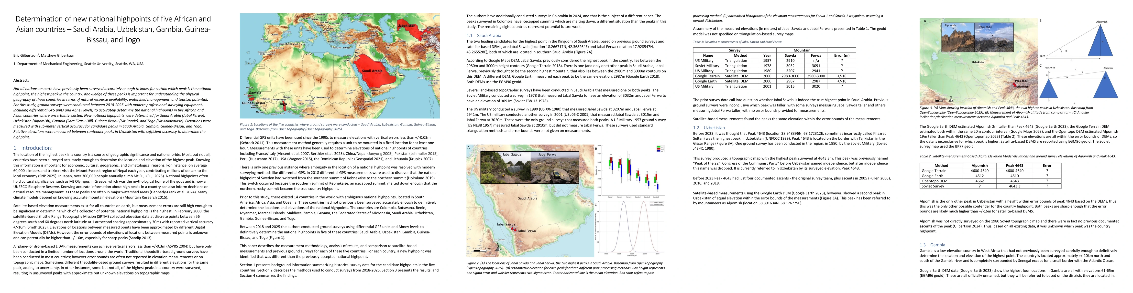
Not all nations on earth have previously been surveyed accurately enough to know for certain which peak is the national highpoint, the highest peak in the country. Knowledge of these peaks is importan...
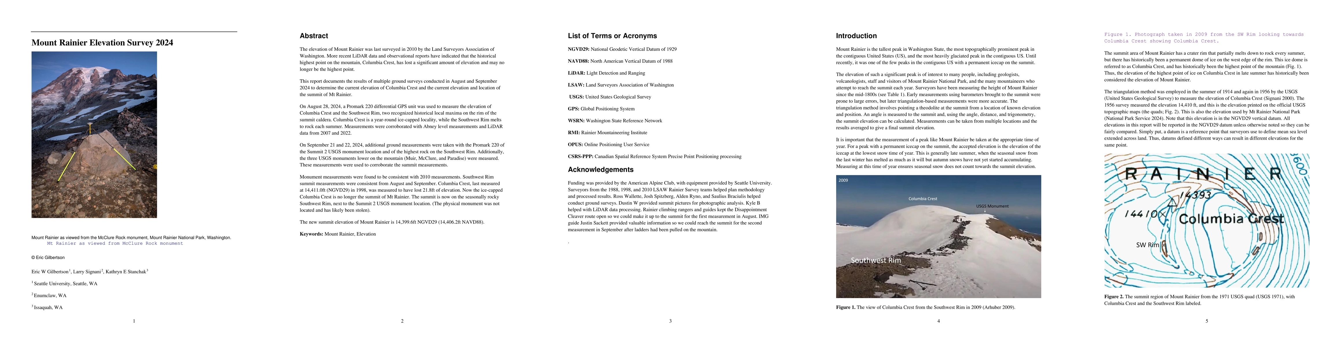
The elevation of Mount Rainier was last surveyed in 2010 by the Land Surveyors Association of Washington. More recent LiDAR data and observational reports have indicated that the historical highest po...
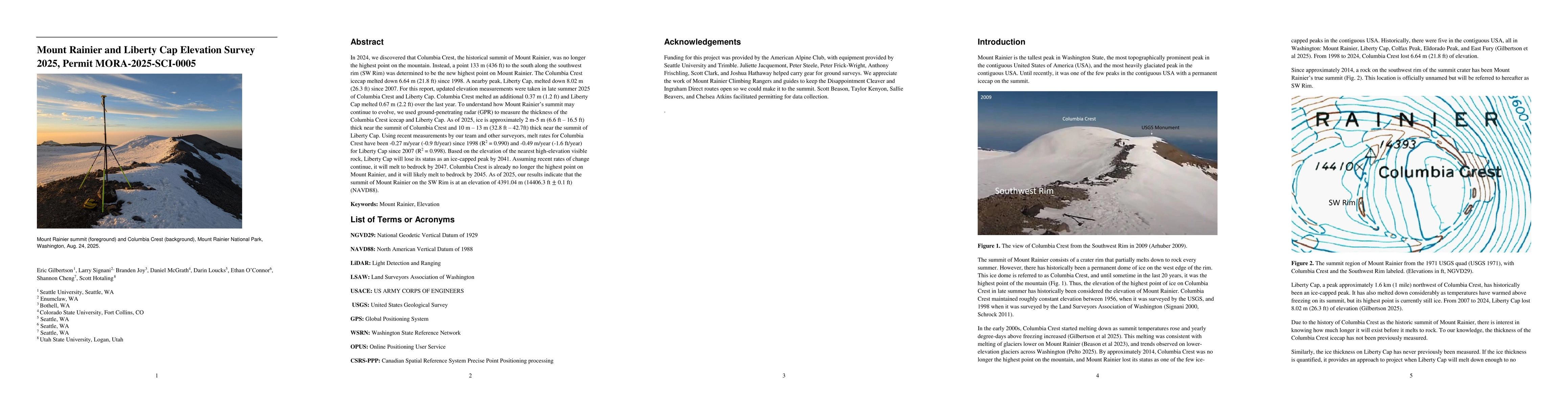
In 2024, we discovered that Columbia Crest, the historical summit of Mount Rainier, was no longer the highest point on the mountain. Instead, a point 133 m (436 ft) to the south along the southwest ri...
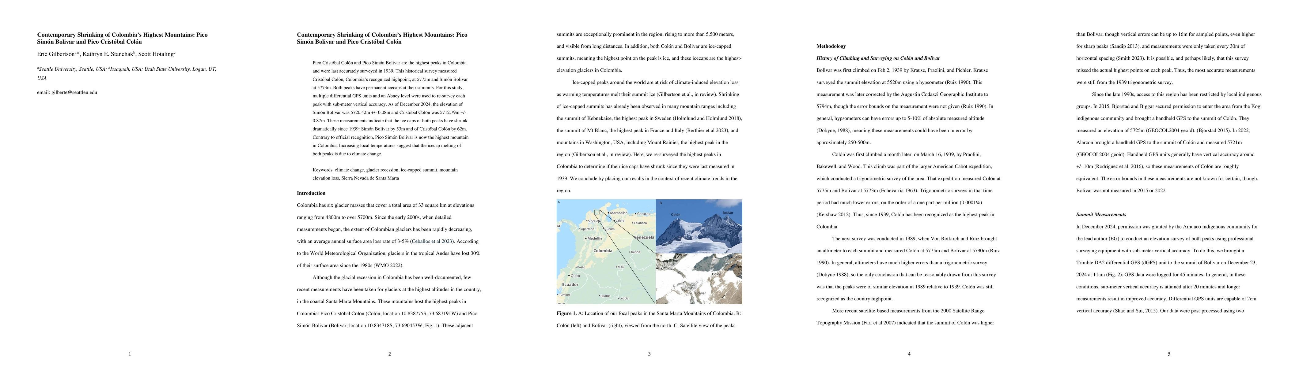
Pico Cristobal Colon and Pico Simon Bolivar are the highest peaks in Colombia and were last accurately surveyed in 1939. This historical survey measured Cristobal Colon, Colombia's recognized highpoin...