Publication
Metrics
Paper Preview
Abstract
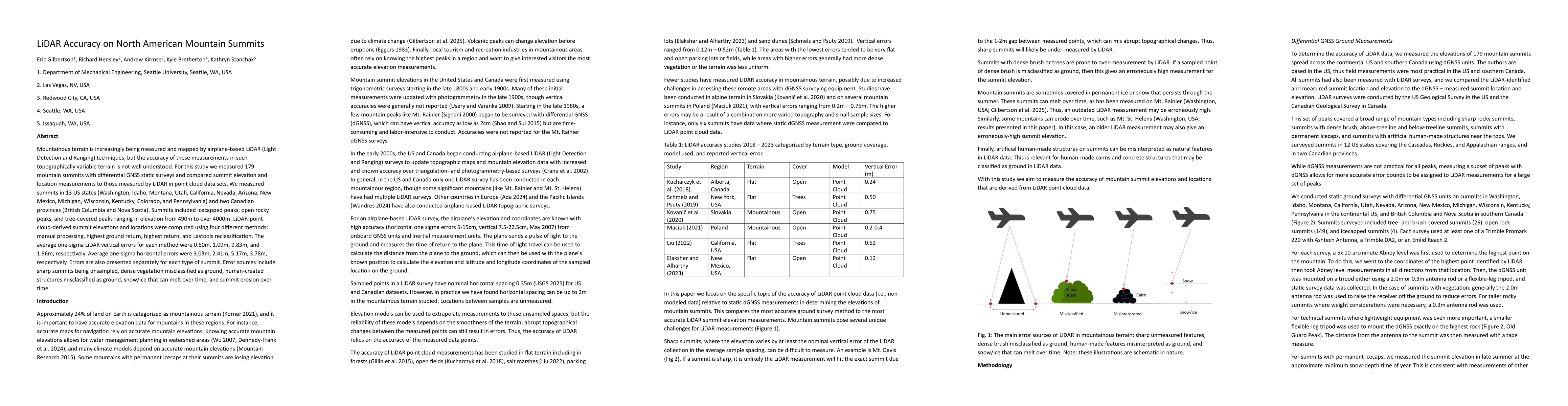
Mountainous terrain is increasingly being measured and mapped by airplane-based LiDAR (Light Detection and Ranging) techniques, but the accuracy of these measurements in such topographically variable terrain is not well understood. For this study we measured 179 mountain summits with differential GNSS static surveys and compared summit elevation and location measurements to those measured by LiDAR in point cloud data sets. We measured summits in 13 US states (Washington, Idaho, Montana, Utah, California, Nevada, Arizona, New Mexico, Michigan, Wisconsin, Kentucky, Colorado, and Pennsylvania) and two Canadian provinces (British Columbia and Nova Scotia). Summits included icecapped peaks, open rocky peaks, and tree-covered peaks ranging in elevation from 490m to over 4000m. LiDAR-point-cloud-derived summit elevations and locations were computed using four different methods: manual processing, highest ground return, highest return, and Lastools reclassification. The average one-sigma LiDAR vertical errors for each method were 0.50m, 1.09m, 9.83m, and 1.96m, respectively. Average one-sigma horizontal errors were 3.03m, 2.41m, 5.17m, 3.78m, respectively. Errors are also presented separately for each type of summit. Error sources include sharp summits being unsampled, dense vegetation misclassified as ground, human-created structures misclassified as ground, snow/ice that can melt over time, and summit erosion over time.
AI Key Findings
Get AI-generated insights about this paper's methodology, results, significance, and more — seven facets brought into focus.
Discussion 0