Academic Profile
Statistics
Similar Authors
Papers on arXiv
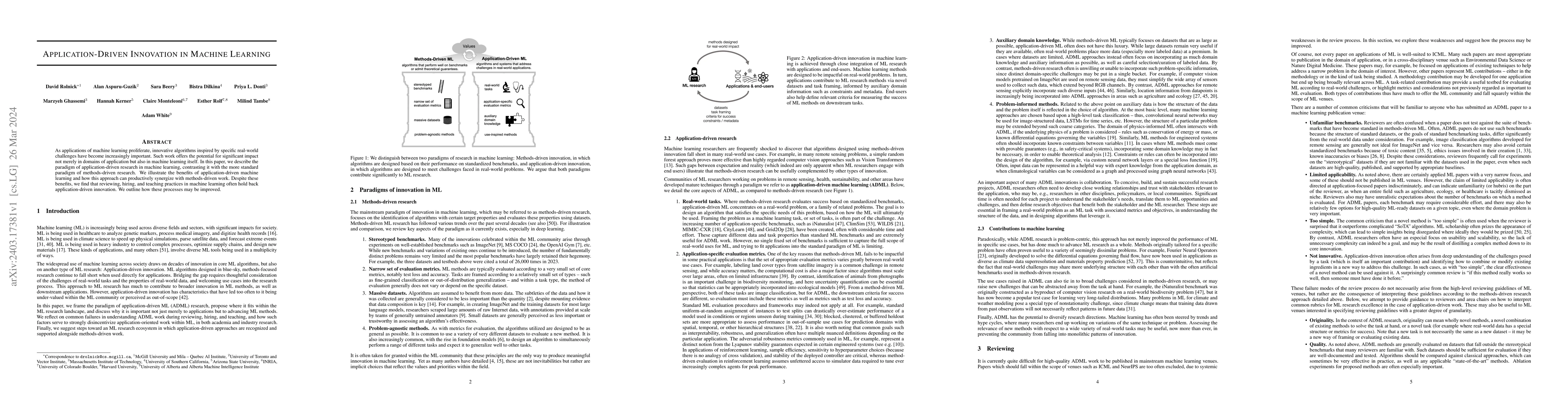
As applications of machine learning proliferate, innovative algorithms inspired by specific real-world challenges have become increasingly important. Such work offers the potential for significant i...
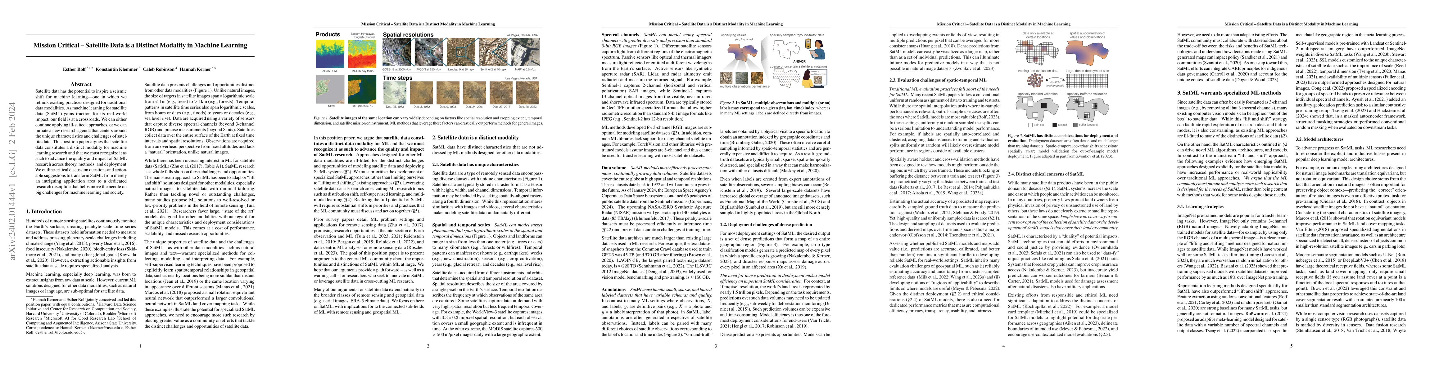
Satellite data has the potential to inspire a seismic shift for machine learning -- one in which we rethink existing practices designed for traditional data modalities. As machine learning for satel...
Geographic information is essential for modeling tasks in fields ranging from ecology to epidemiology. However, extracting relevant location characteristics for a given task can be challenging, ofte...
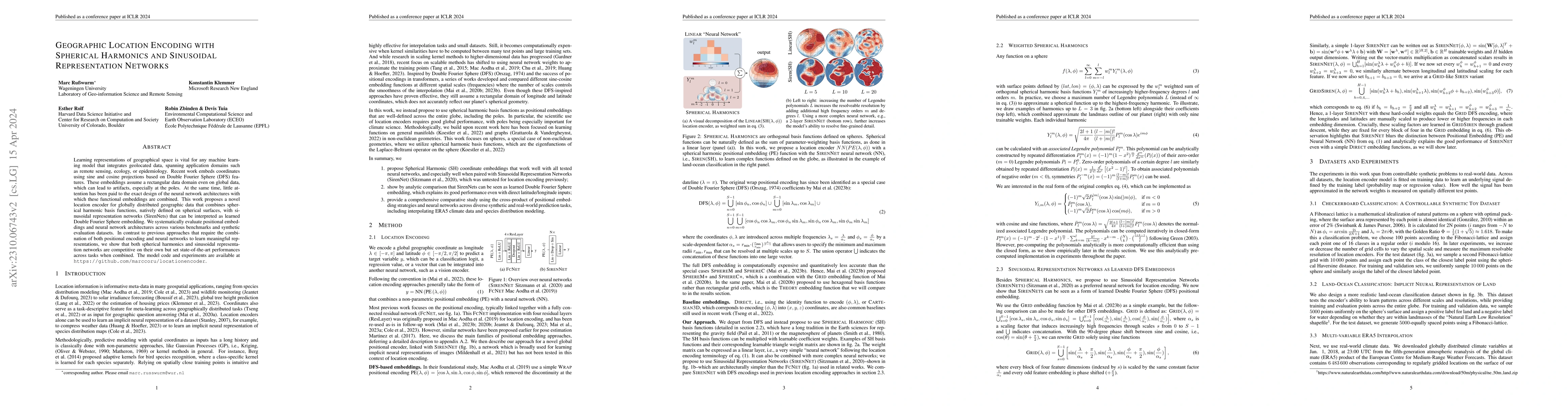
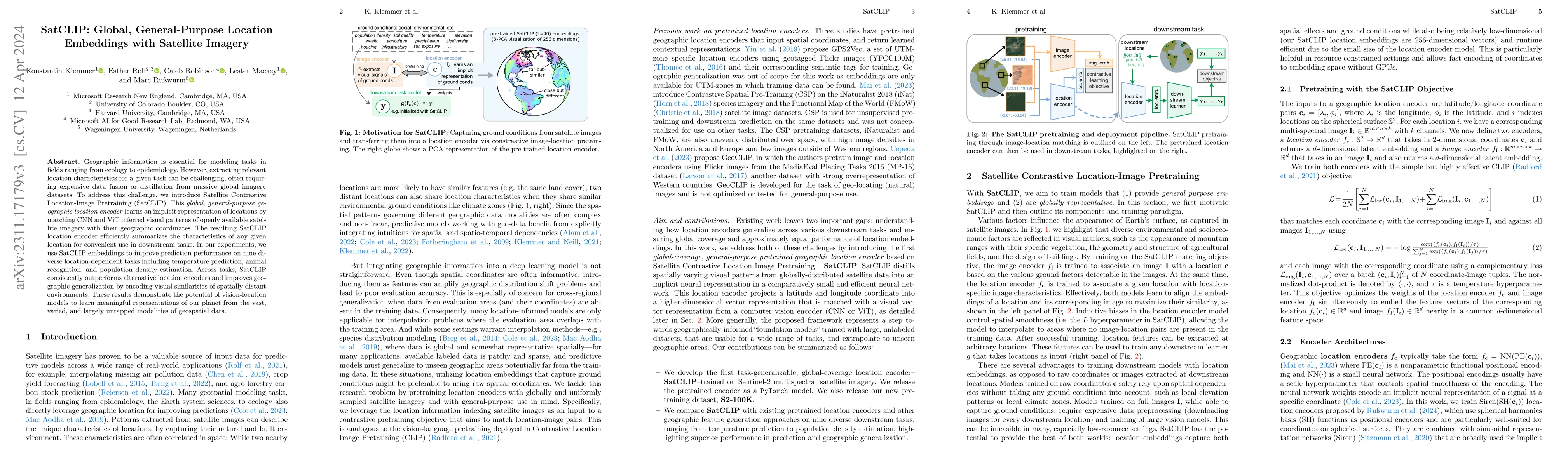
Learning representations of geographical space is vital for any machine learning model that integrates geolocated data, spanning application domains such as remote sensing, ecology, or epidemiology....
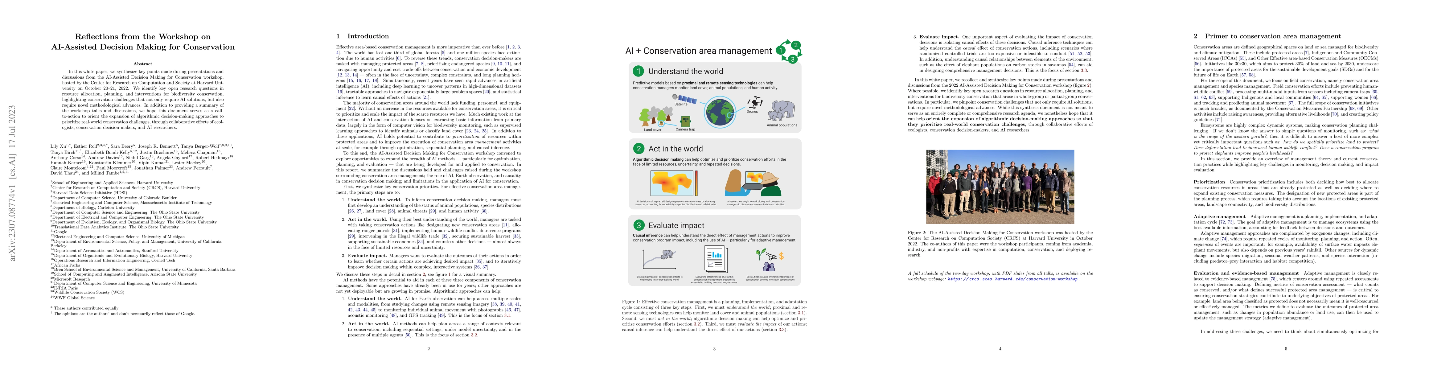
In this white paper, we synthesize key points made during presentations and discussions from the AI-Assisted Decision Making for Conservation workshop, hosted by the Center for Research on Computati...
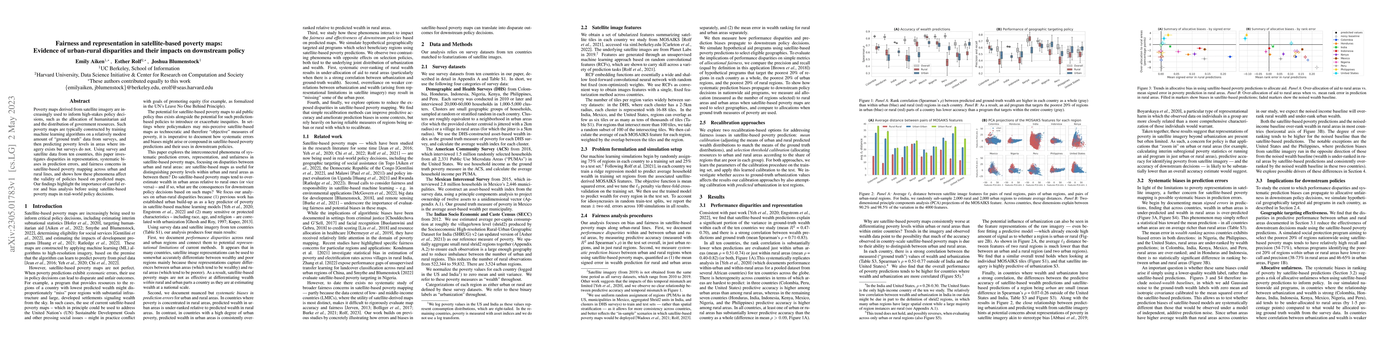
Poverty maps derived from satellite imagery are increasingly used to inform high-stakes policy decisions, such as the allocation of humanitarian aid and the distribution of government resources. Suc...
As geospatial machine learning models and maps derived from their predictions are increasingly used for downstream analyses in science and policy, it is imperative to evaluate their accuracy and app...
Machine learning-based estimates of poverty and wealth are increasingly being used to guide the targeting of humanitarian aid and the allocation of social assistance. However, the ground truth label...
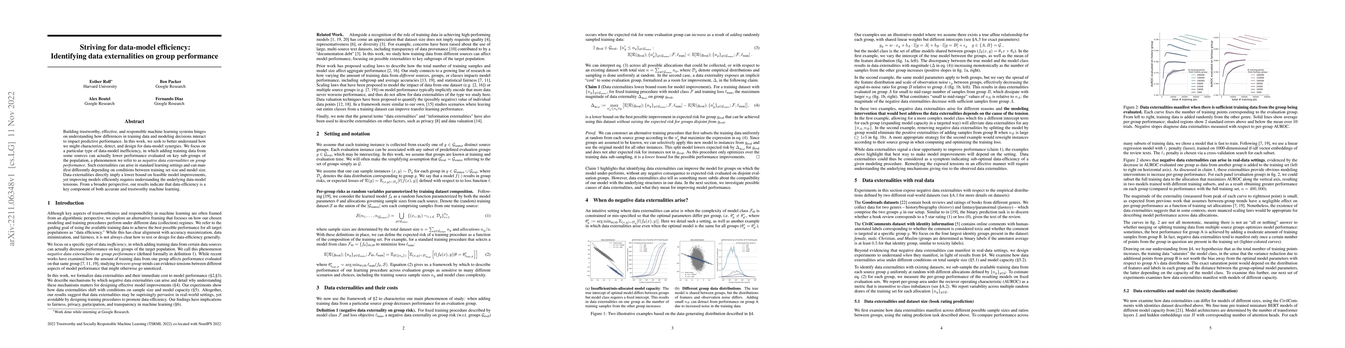
Building trustworthy, effective, and responsible machine learning systems hinges on understanding how differences in training data and modeling decisions interact to impact predictive performance. I...
We propose a method for jointly inferring labels across a collection of data samples, where each sample consists of an observation and a prior belief about the label. By implicitly assuming the exis...
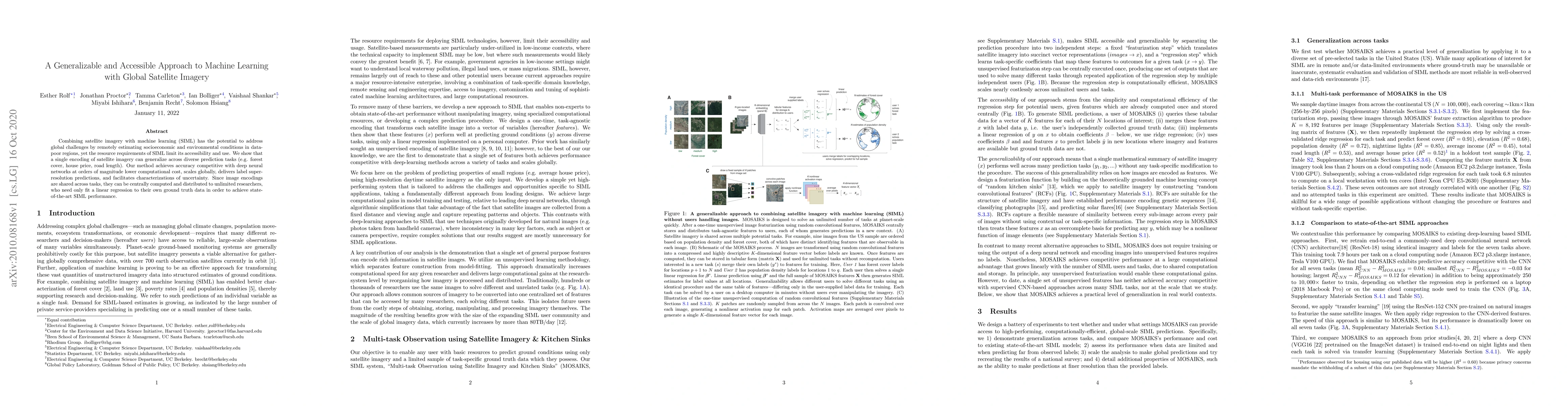
Combining satellite imagery with machine learning (SIML) has the potential to address global challenges by remotely estimating socioeconomic and environmental conditions in data-poor regions, yet th...
Observational data are often accompanied by natural structural indices, such as time stamps or geographic locations, which are meaningful to prediction tasks but are often discarded. We leverage sem...
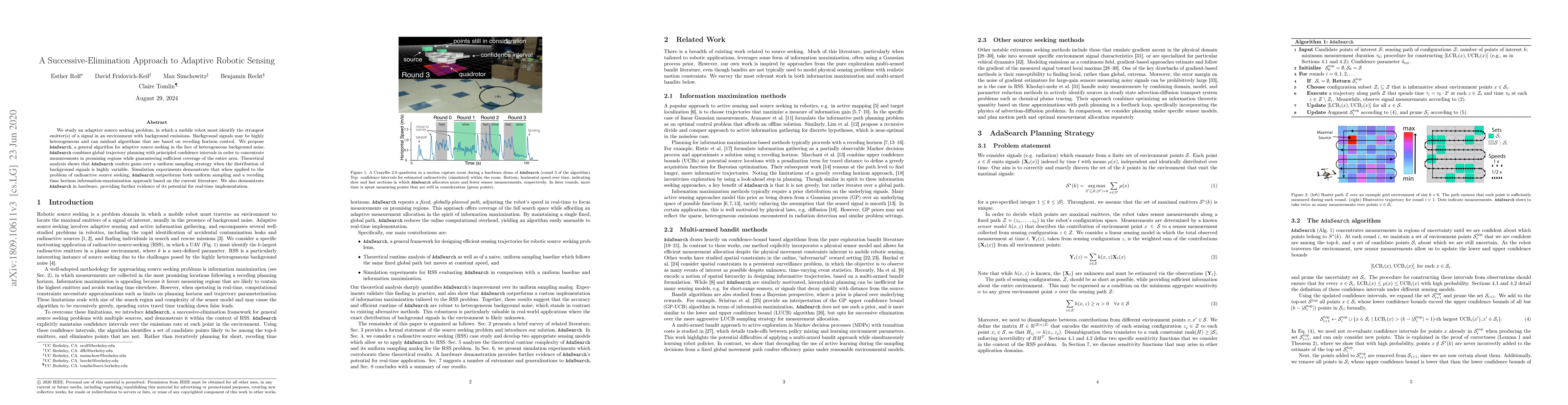
We study an adaptive source seeking problem, in which a mobile robot must identify the strongest emitter(s) of a signal in an environment with background emissions. Background signals may be highly ...
Stochastic multi-agent multi-armed bandits typically assume that the rewards from each arm follow a fixed distribution, regardless of which agent pulls the arm. However, in many real-world settings, r...
While advances in machine learning with satellite imagery (SatML) are facilitating environmental monitoring at a global scale, developing SatML models that are accurate and useful for local regions re...
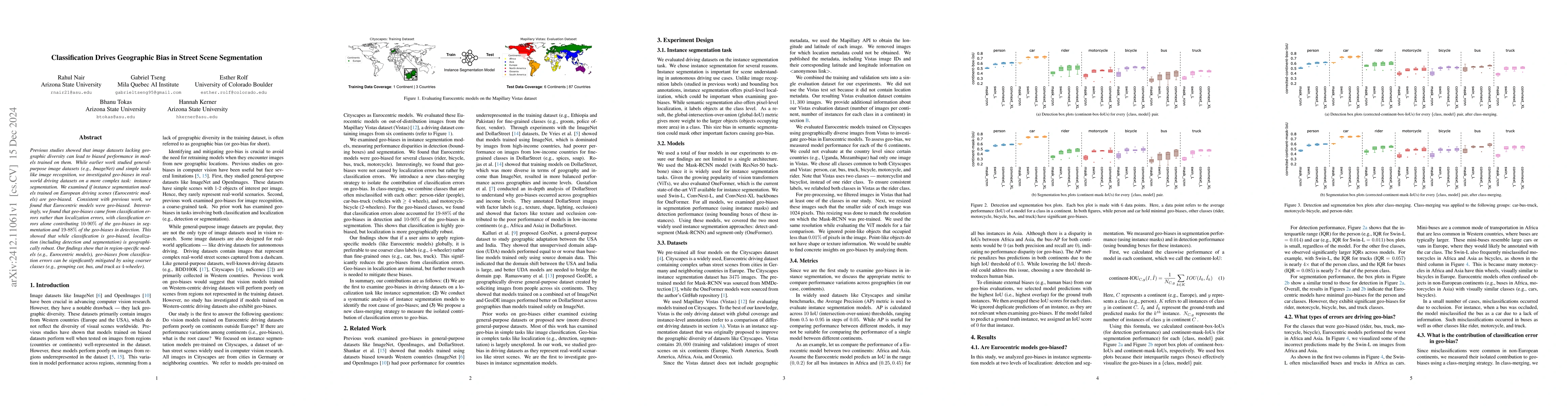
Previous studies showed that image datasets lacking geographic diversity can lead to biased performance in models trained on them. While earlier work studied general-purpose image datasets (e.g., Imag...
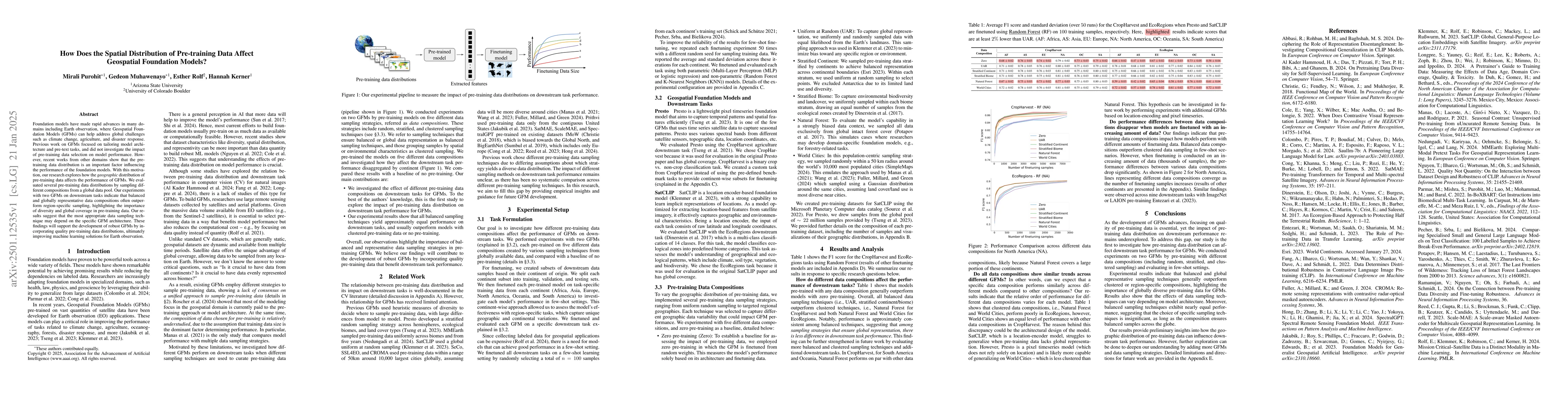
Foundation models have made rapid advances in many domains including Earth observation, where Geospatial Foundation Models (GFMs) can help address global challenges such as climate change, agriculture...
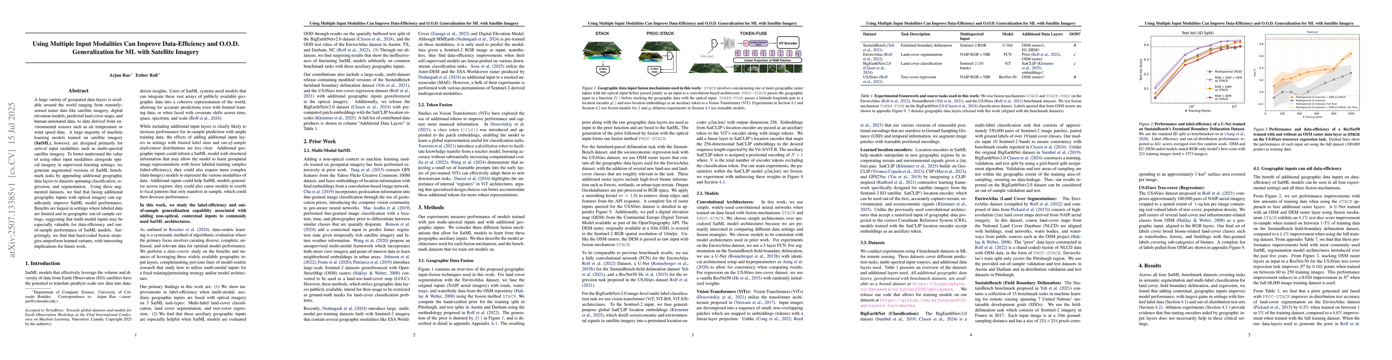
A large variety of geospatial data layers is available around the world ranging from remotely-sensed raster data like satellite imagery, digital elevation models, predicted land cover maps, and human-...
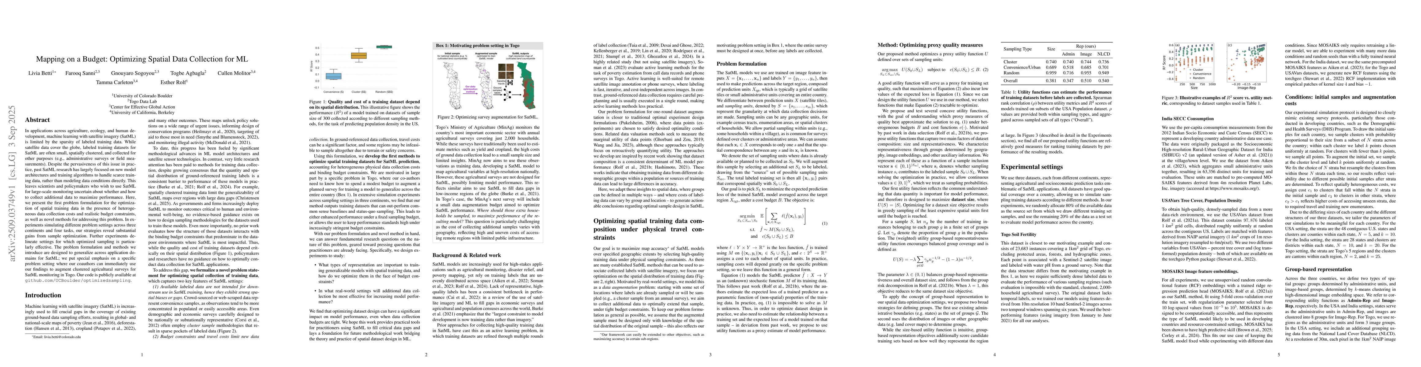
In applications across agriculture, ecology, and human development, machine learning with satellite imagery (SatML) is limited by the sparsity of labeled training data. While satellite data cover the ...
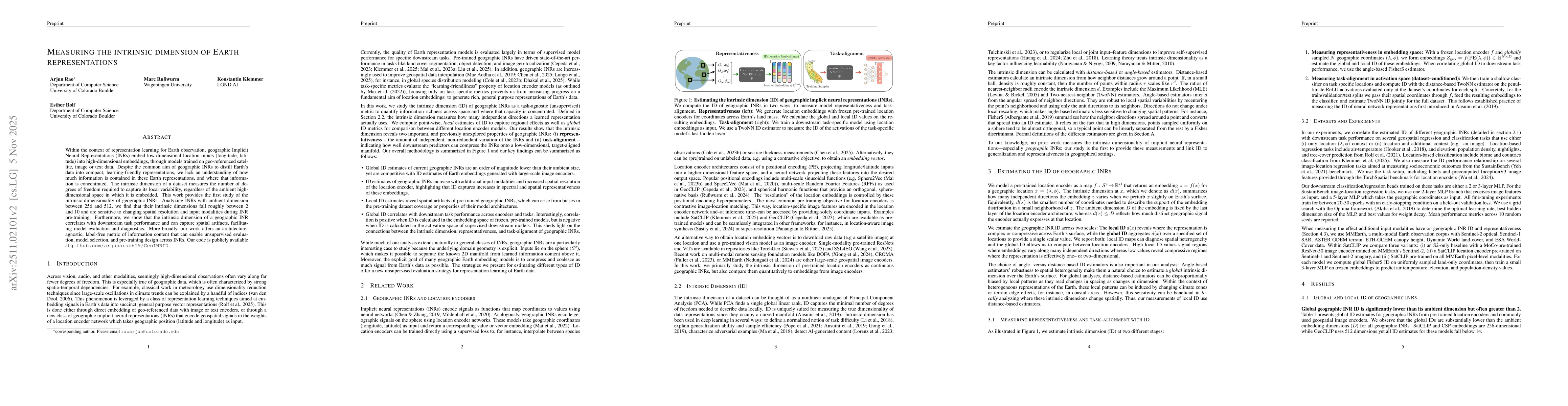
Within the context of representation learning for Earth observation, geographic Implicit Neural Representations (INRs) embed low-dimensional location inputs (longitude, latitude) into high-dimensional...
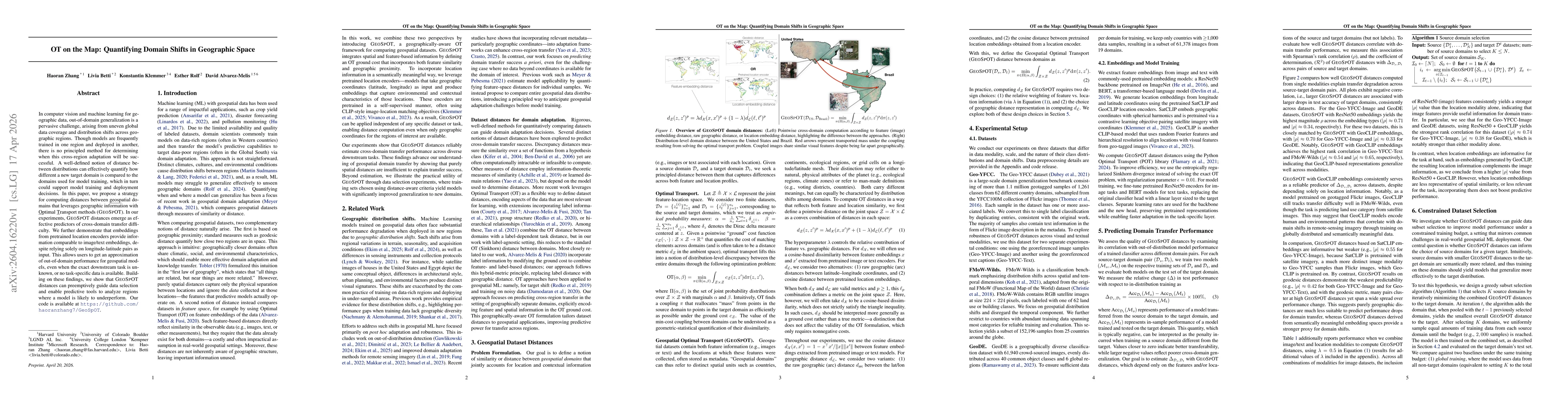
In computer vision and machine learning for geographic data, out-of-domain generalization is a pervasive challenge, arising from uneven global data coverage and distribution shifts across geographic r...
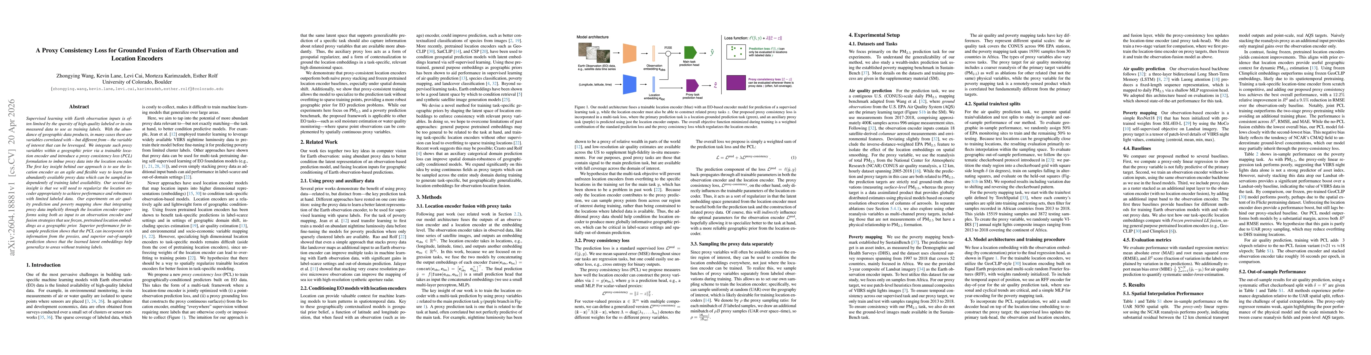
Supervised learning with Earth observation inputs is often limited by the sparsity of high-quality labeled or in-situ measured data to use as training labels. With the abundance of geographic data pro...
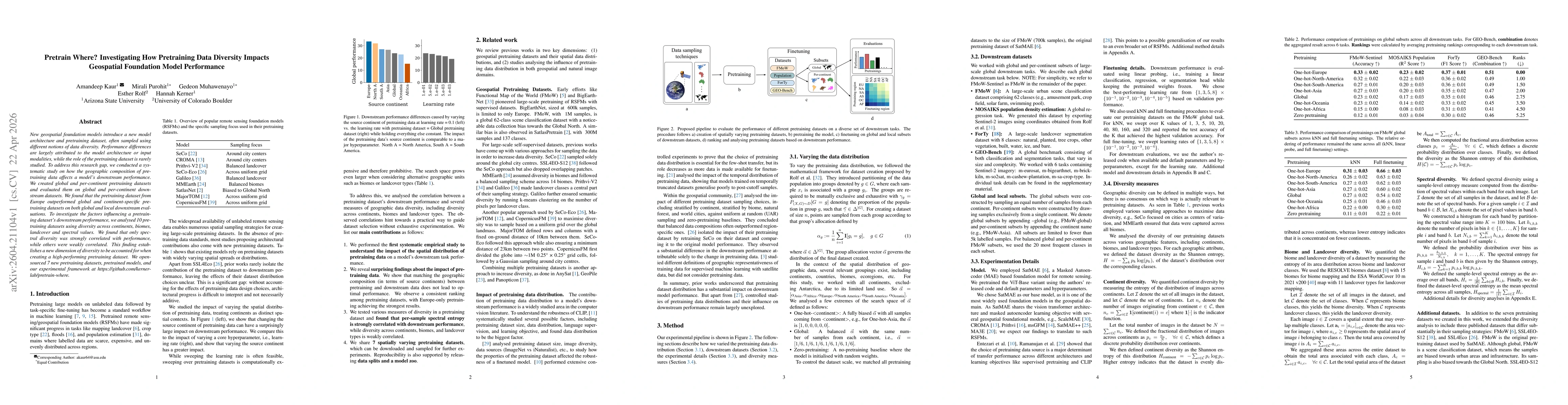
New geospatial foundation models introduce a new model architecture and pretraining dataset, often sampled using different notions of data diversity. Performance differences are largely attributed to ...
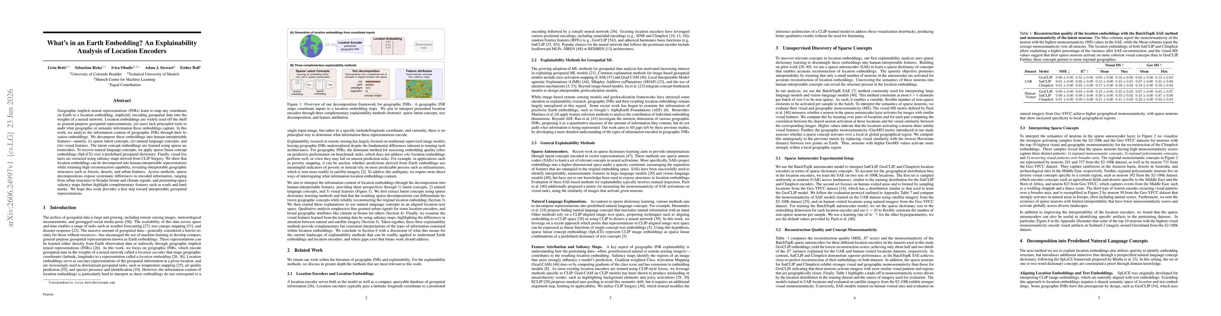
Geographic implicit neural representations (INRs) learn to map any coordinate on Earth to a location embedding, implicitly encoding geospatial data into the weights of a neural network. Location embed...