Academic Profile
Statistics
Similar Authors
Papers on arXiv
While human mobility plays a crucial role in determining air pollution exposures and health risks, research to-date has assessed risks based solely on residential location. Here we leveraged a datab...
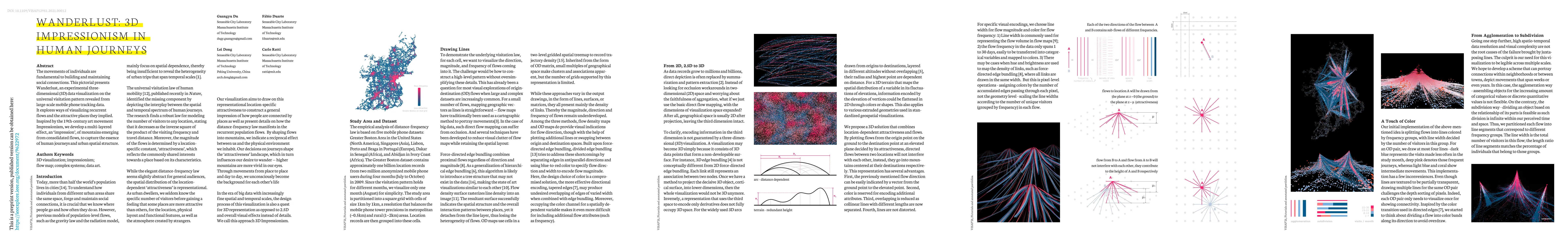
The movements of individuals are fundamental to building and maintaining social connections. This pictorial presents Wanderlust, an experimental three-dimensional data visualization on the universal...
One billion people live in informal settlements worldwide. The complex and multilayered spaces that characterize this unplanned form of urbanization pose a challenge to traditional approaches to map...
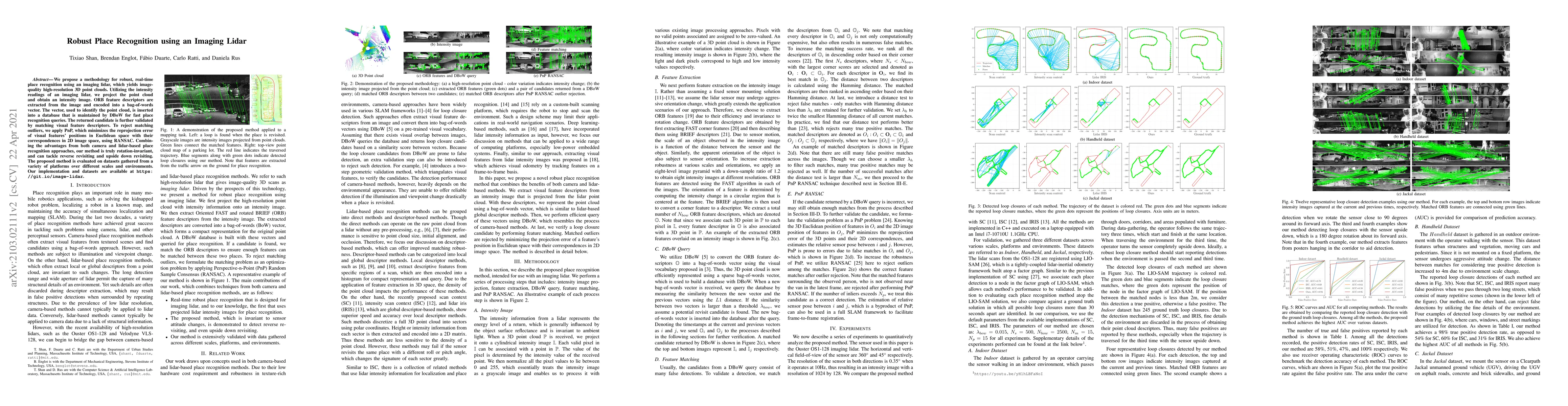
We propose a methodology for robust, real-time place recognition using an imaging lidar, which yields image-quality high-resolution 3D point clouds. Utilizing the intensity readings of an imaging li...
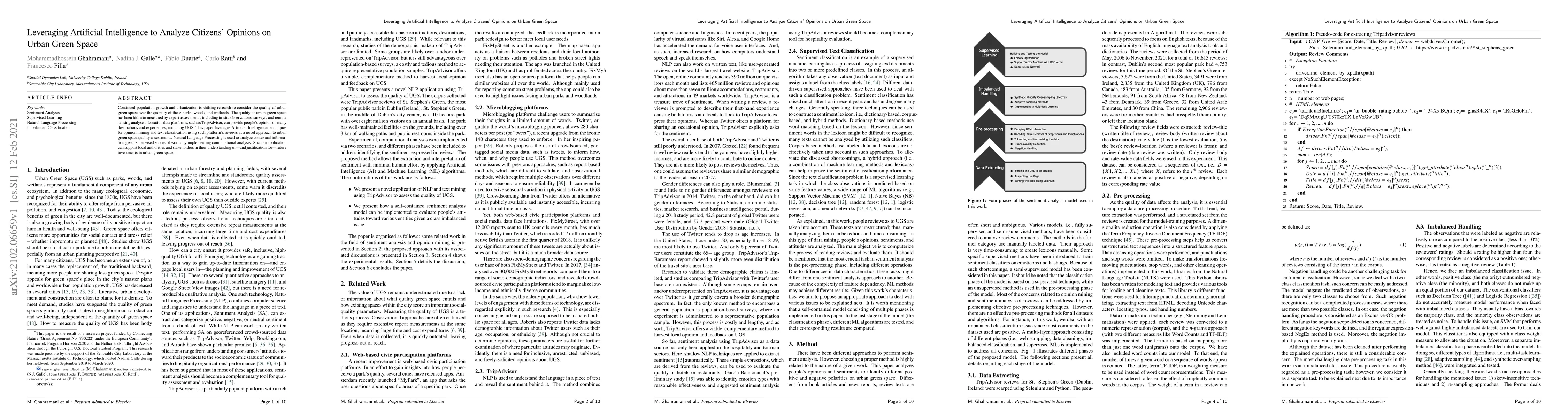
Continued population growth and urbanization is shifting research to consider the quality of urban green space over the quantity of these parks, woods, and wetlands. The quality of urban green space...
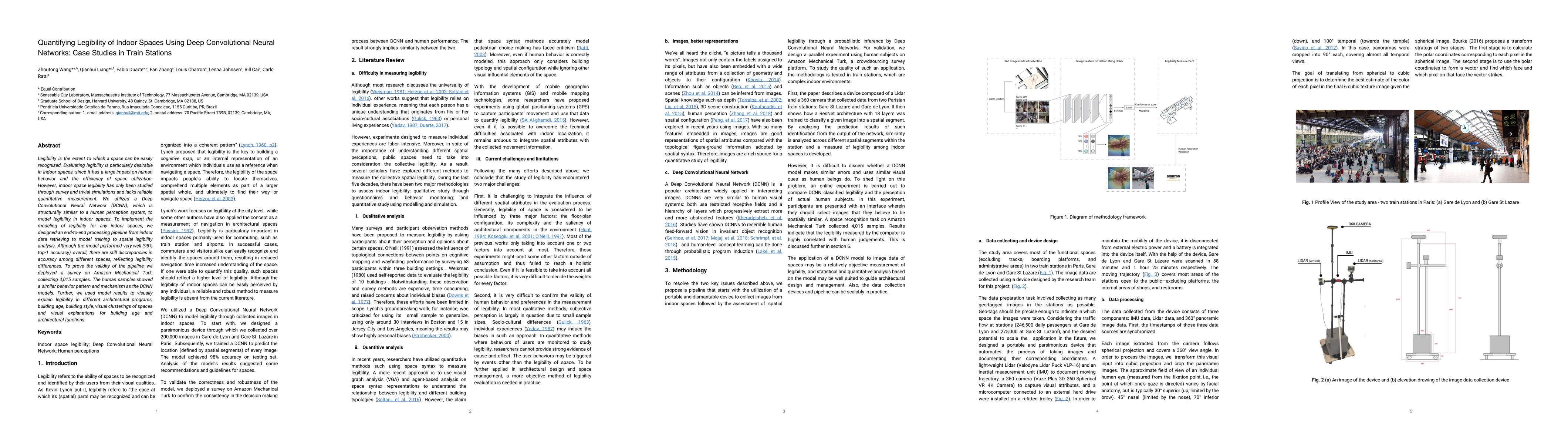
Legibility is the extent to which a space can be easily recognized. Evaluating legibility is particularly desirable in indoor spaces, since it has a large impact on human behavior and the efficiency...
Shared micro-mobility such as e-scooters has gained significant popularity in many cities. However, existing methods for detecting community structures in mobility networks often overlook potential ov...
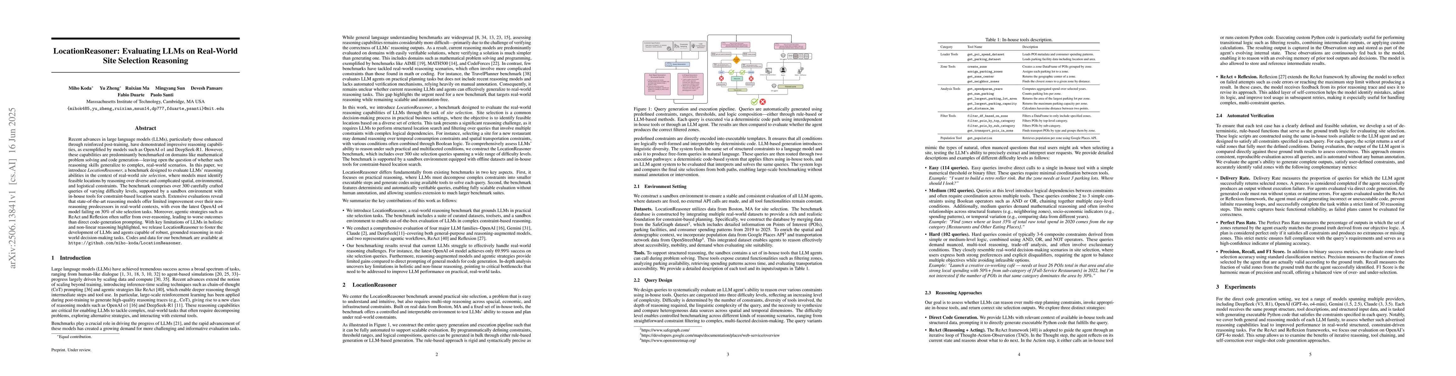
Recent advances in large language models (LLMs), particularly those enhanced through reinforced post-training, have demonstrated impressive reasoning capabilities, as exemplified by models such as Ope...
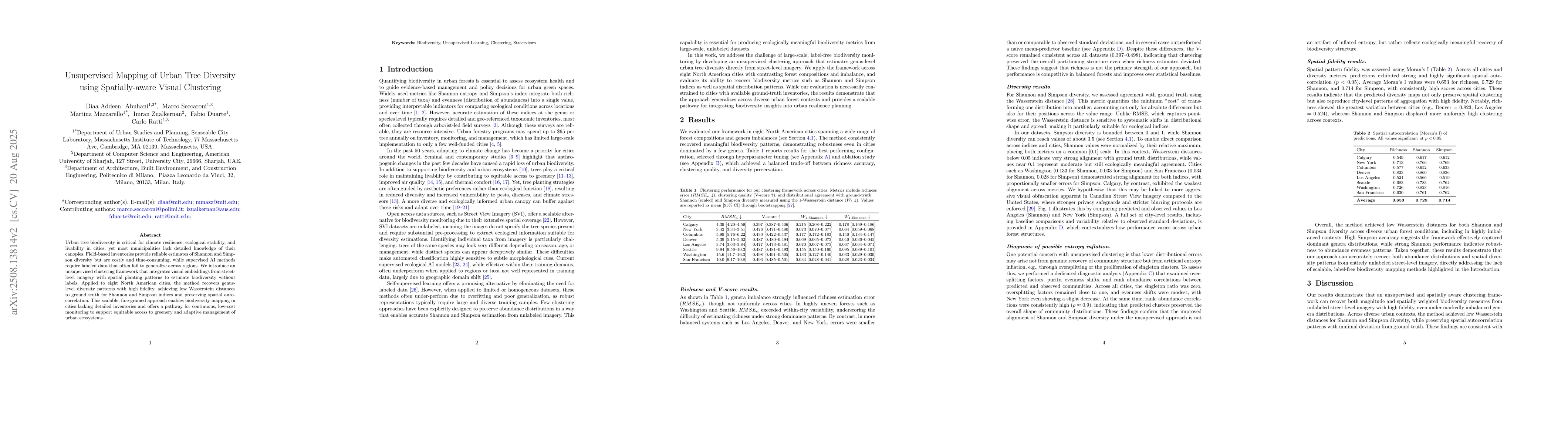
Urban tree biodiversity is critical for climate resilience, ecological stability, and livability in cities, yet most municipalities lack detailed knowledge of their canopies. Field-based inventories p...
The way residents perceive safety plays an important role in how they use public spaces. Studies have combined large-scale street view images and advanced computer vision techniques to measure the per...
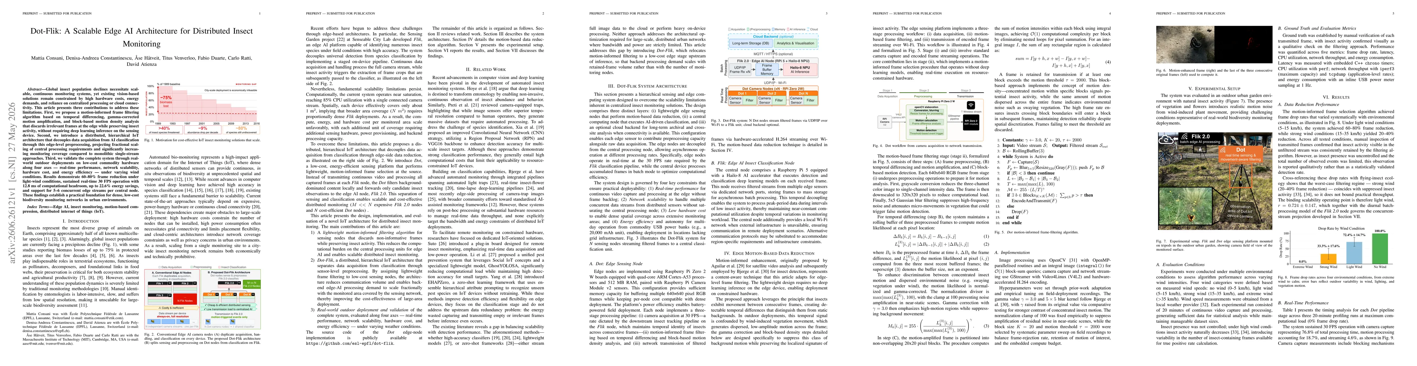
Global insect population declines necessitate scalable, continuous monitoring systems, yet existing vision-based solutions remain constrained by high hardware costs, energy demands, and reliance on ce...