Academic Profile
Statistics
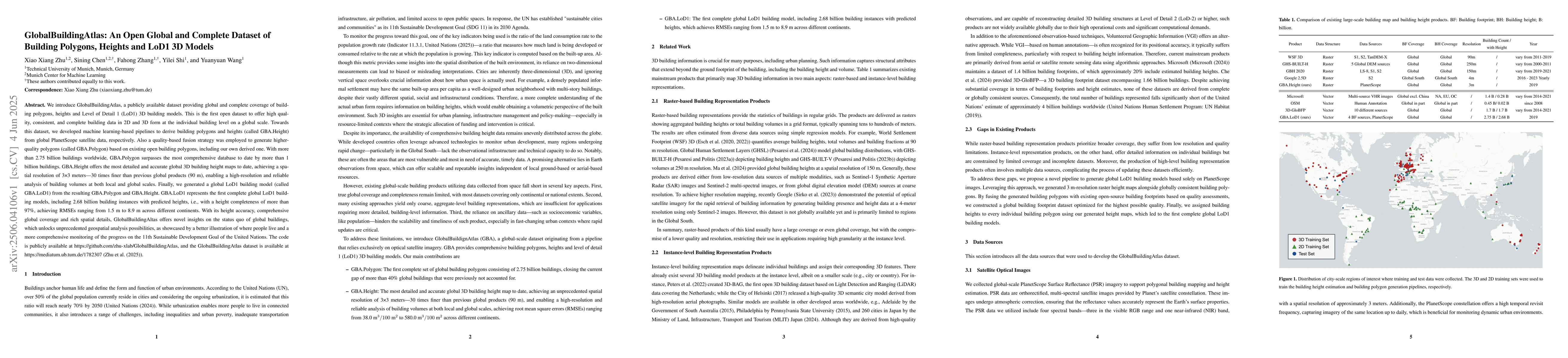
Similar Authors
Papers on arXiv
The development of foundation models has revolutionized our ability to interpret the Earth's surface using satellite observational data. Traditional models have been siloed, tailored to specific sen...
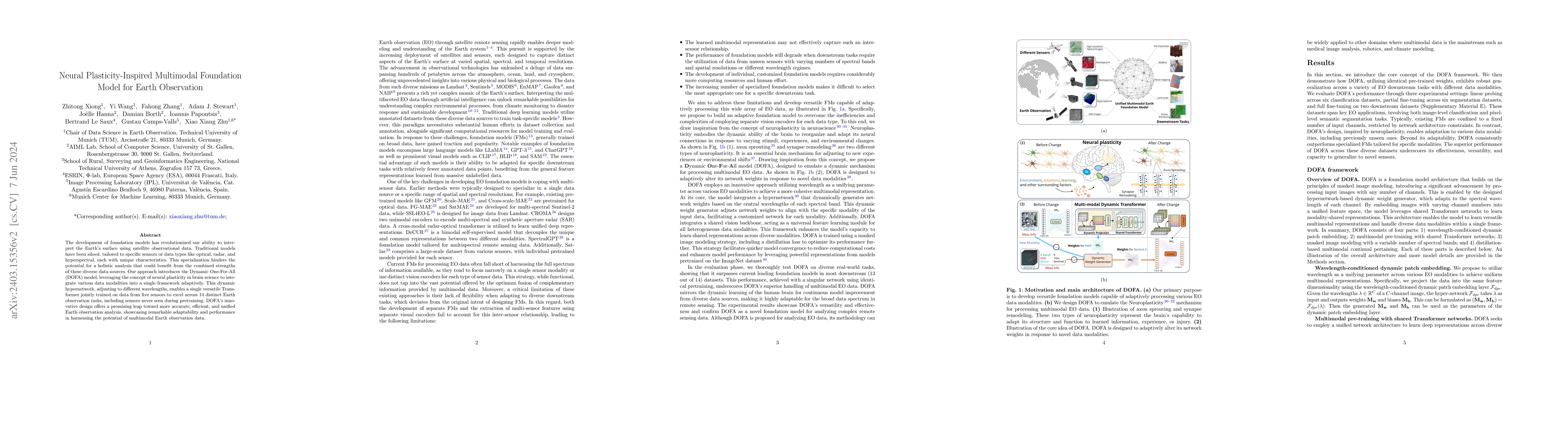
Foundation models characterized by extensive parameters and trained on large-scale datasets have demonstrated remarkable efficacy across various downstream tasks for remote sensing data. Current rem...
Domain shift caused by, e.g., different geographical regions or acquisition conditions is a common issue in machine learning for global scale satellite image processing. A promising method to addres...
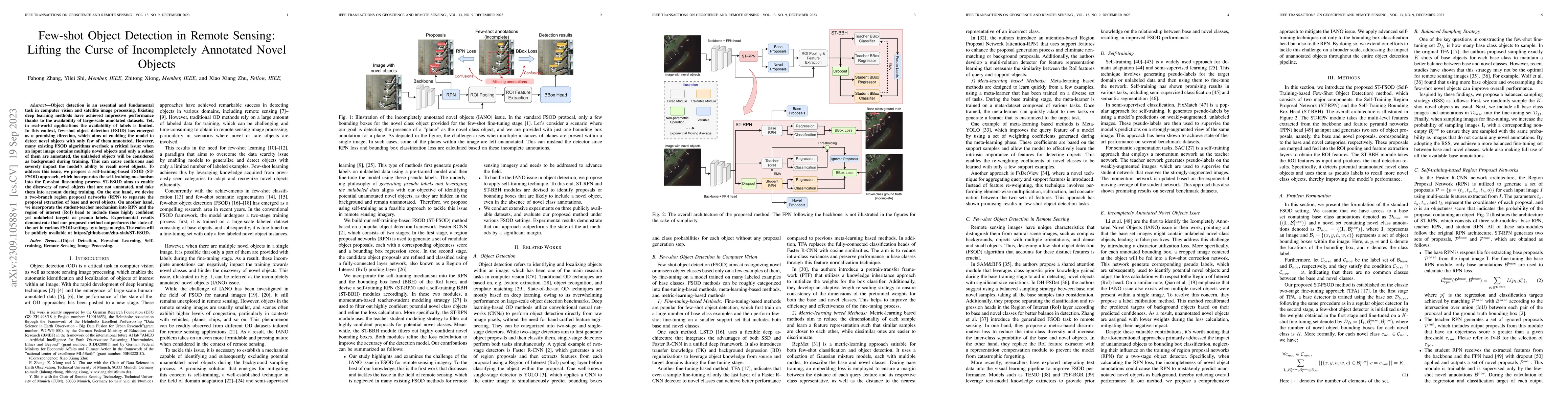
Object detection is an essential and fundamental task in computer vision and satellite image processing. Existing deep learning methods have achieved impressive performance thanks to the availabilit...
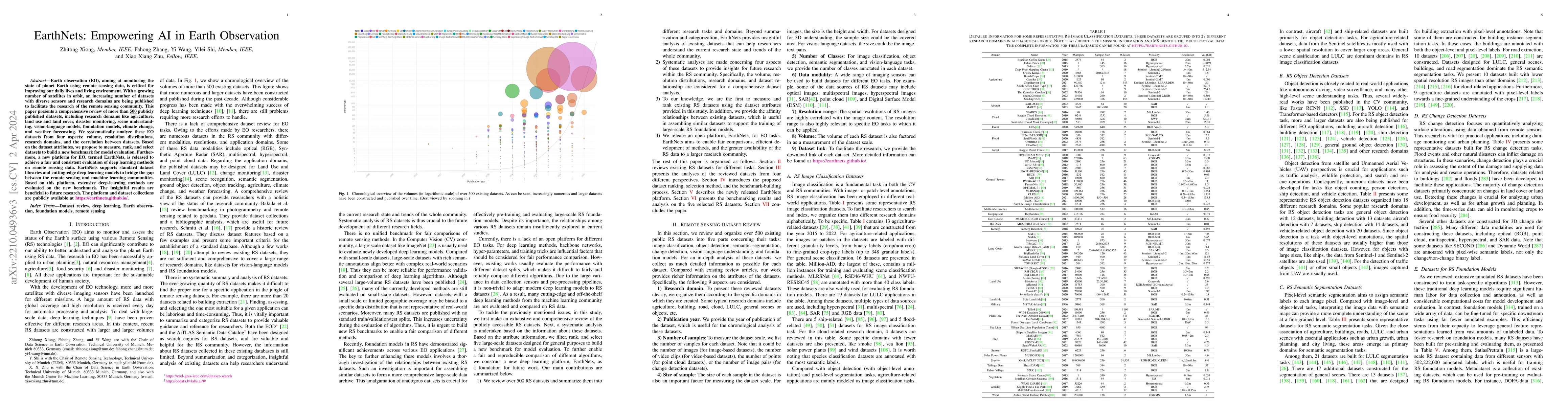
Earth observation (EO), aiming at monitoring the state of planet Earth using remote sensing data, is critical for improving our daily lives and living environment. With a growing number of satellite...
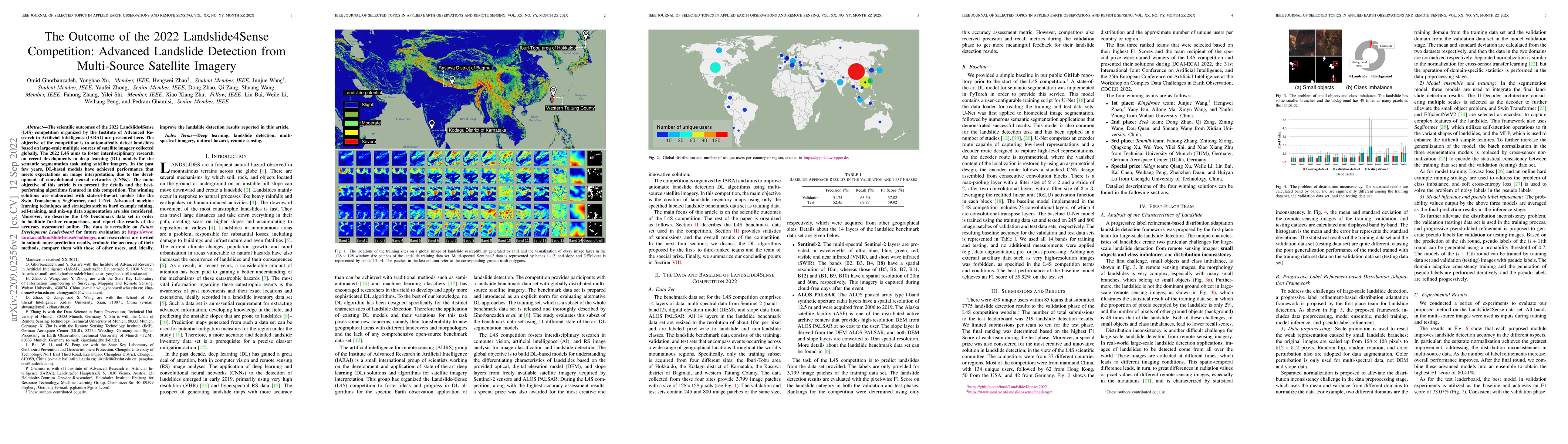
The scientific outcomes of the 2022 Landslide4Sense (L4S) competition organized by the Institute of Advanced Research in Artificial Intelligence (IARAI) are presented here. The objective of the comp...
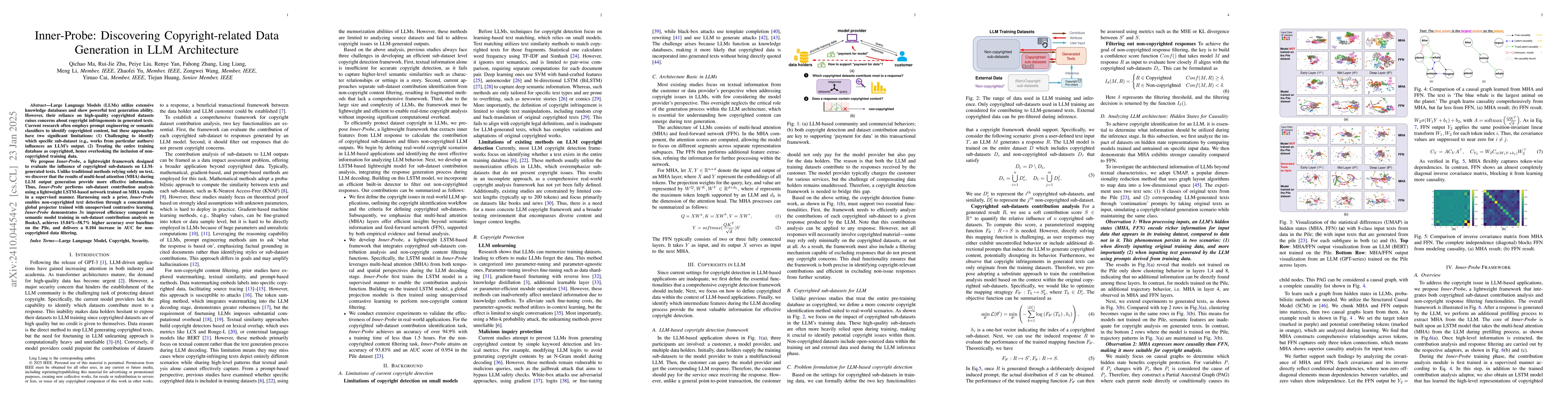
Large Language Models (LLMs) have become pervasive due to their knowledge absorption and text-generation capabilities. Concurrently, the copyright issue for pretraining datasets has been a pressing co...
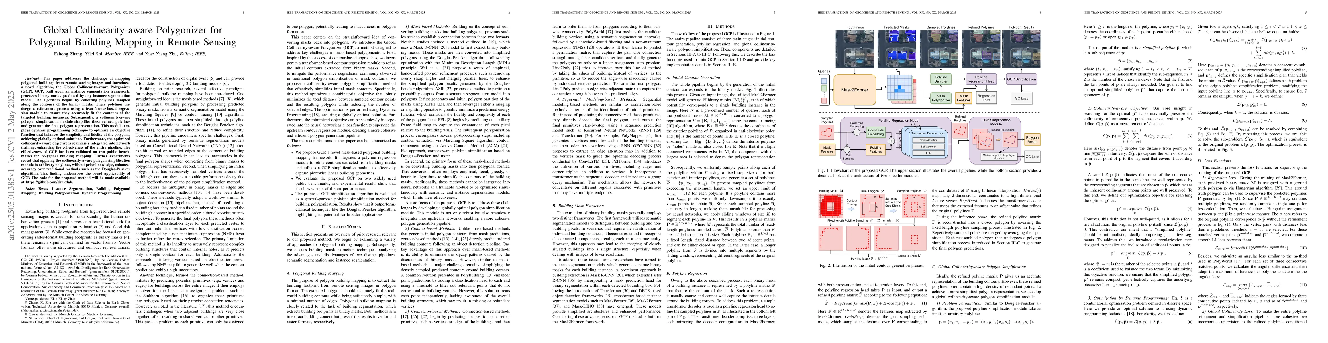
This paper addresses the challenge of mapping polygonal buildings from remote sensing images and introduces a novel algorithm, the Global Collinearity-aware Polygonizer (GCP). GCP, built upon an insta...
We introduce GlobalBuildingAtlas, a publicly available dataset providing global and complete coverage of building polygons, heights and Level of Detail 1 (LoD1) 3D building models. This is the first o...