Academic Profile
Statistics
Similar Authors
Papers on arXiv
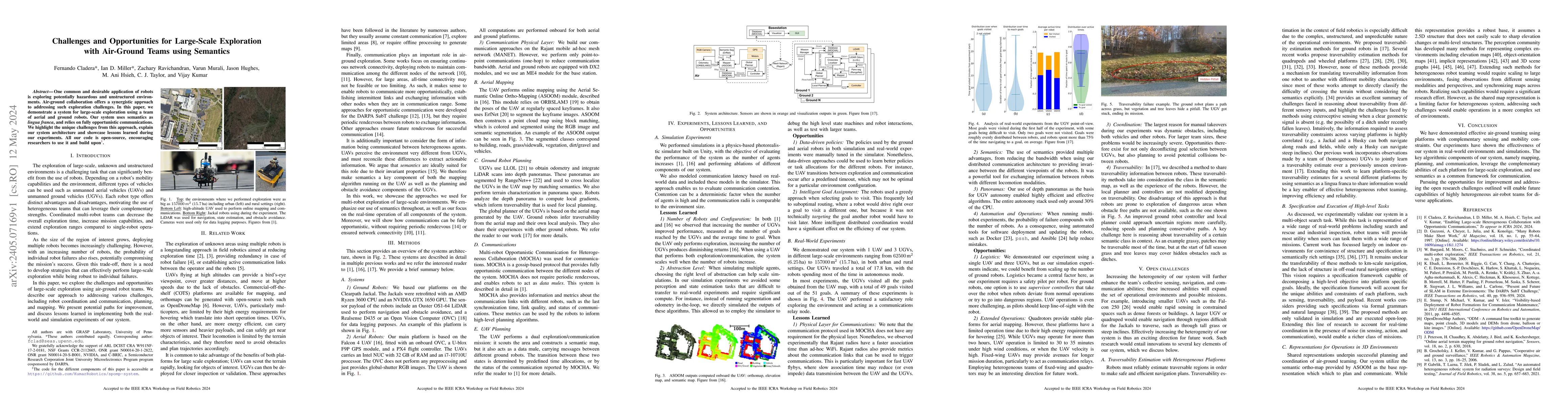
One common and desirable application of robots is exploring potentially hazardous and unstructured environments. Air-ground collaboration offers a synergistic approach to addressing such exploration...
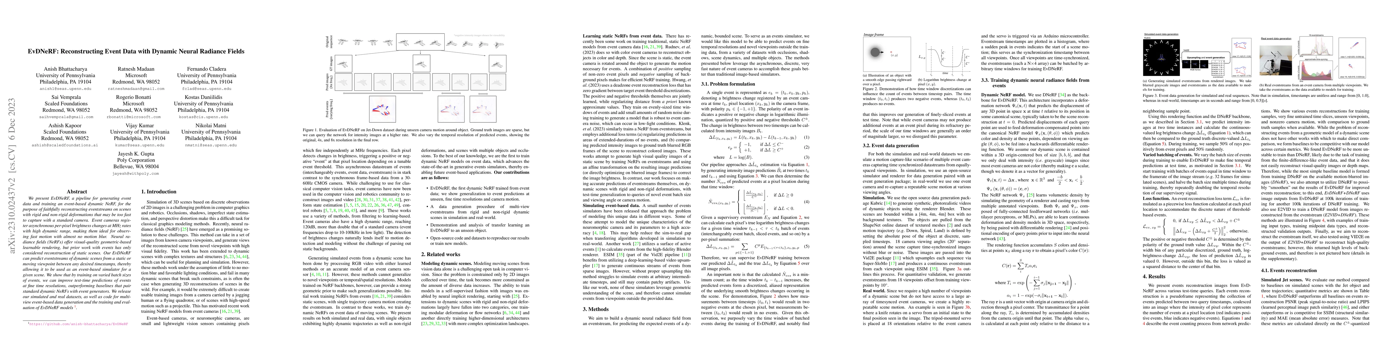
We present EvDNeRF, a pipeline for generating event data and training an event-based dynamic NeRF, for the purpose of faithfully reconstructing eventstreams on scenes with rigid and non-rigid deform...
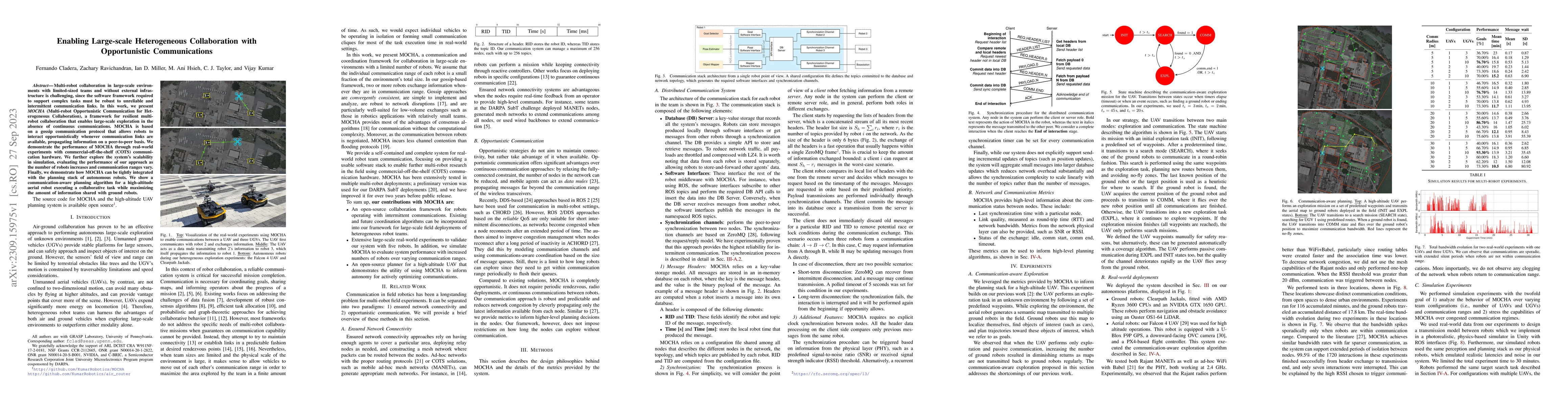
Multi-robot collaboration in large-scale environments with limited-sized teams and without external infrastructure is challenging, since the software framework required to support complex tasks must...
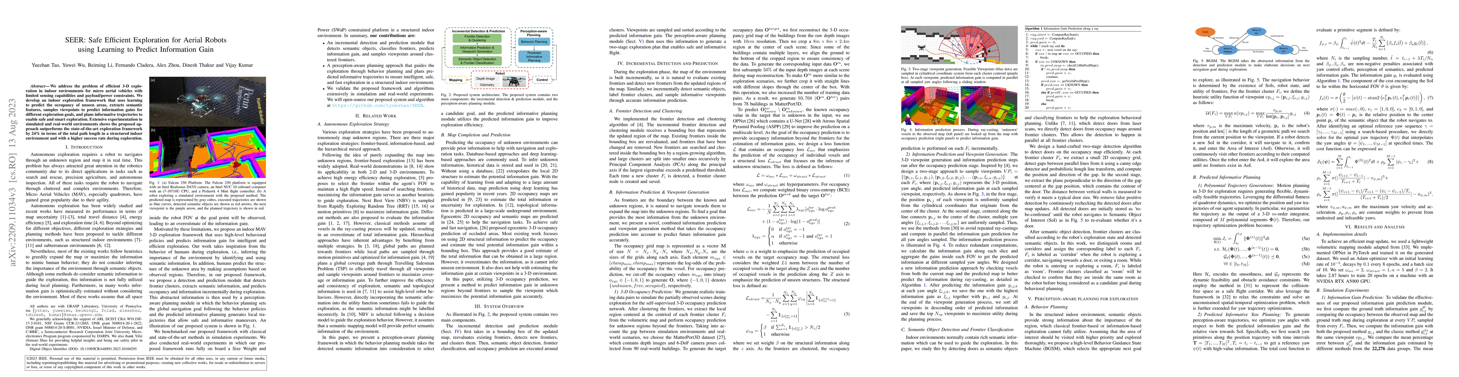
We address the problem of efficient 3-D exploration in indoor environments for micro aerial vehicles with limited sensing capabilities and payload/power constraints. We develop an indoor exploration...
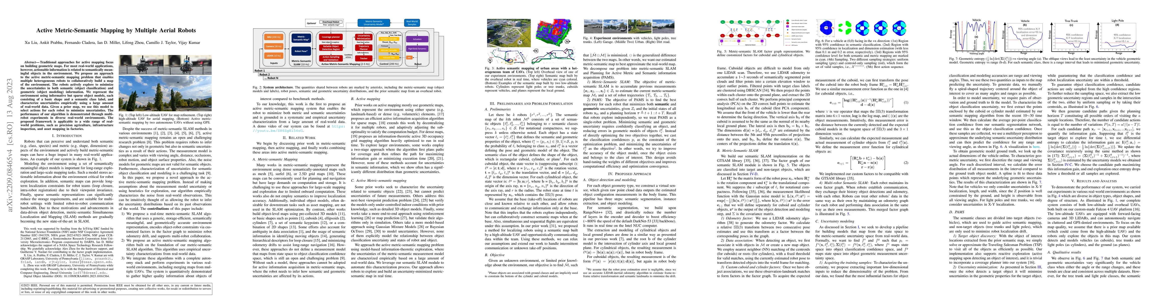
Traditional approaches for active mapping focus on building geometric maps. For most real-world applications, however, actionable information is related to semantically meaningful objects in the env...
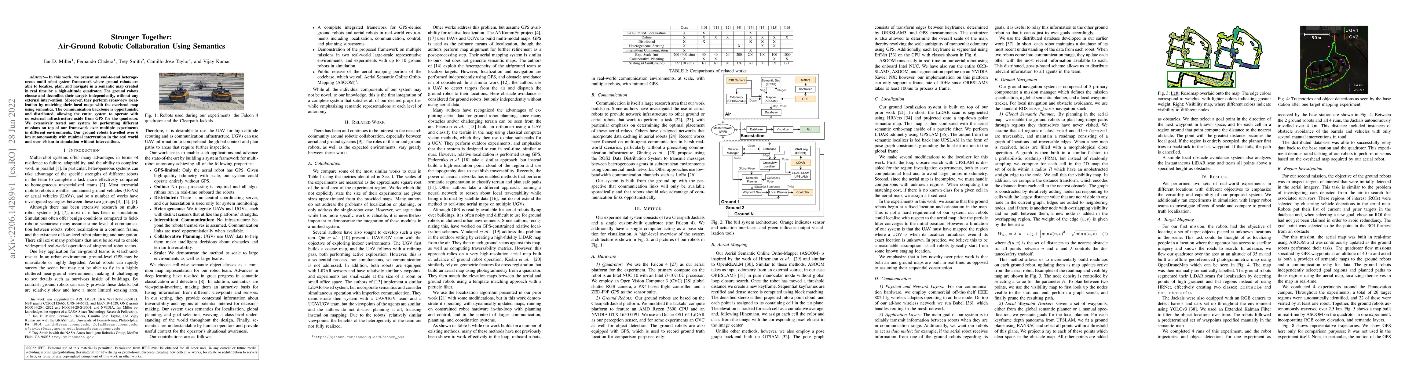
In this work, we present an end-to-end heterogeneous multi-robot system framework where ground robots are able to localize, plan, and navigate in a semantic map created in real time by a high-altitu...
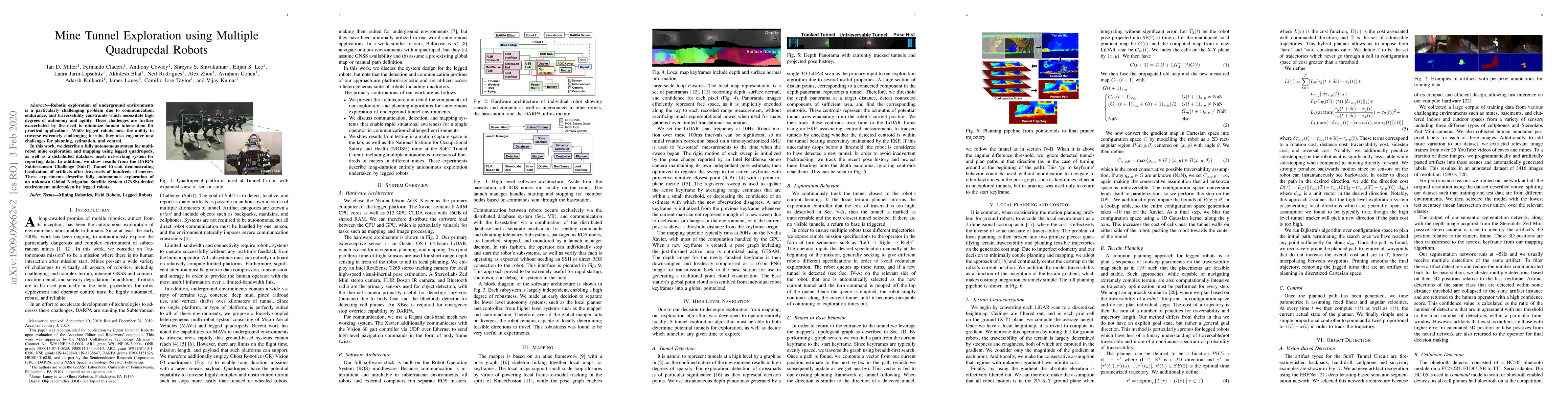
Robotic exploration of underground environments is a particularly challenging problem due to communication, endurance, and traversability constraints which necessitate high degrees of autonomy and a...
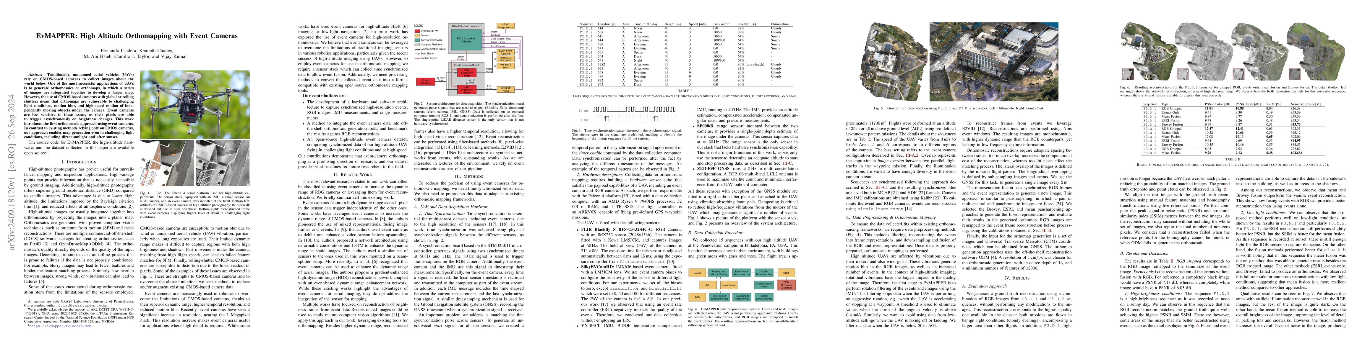
Traditionally, unmanned aerial vehicles (UAVs) rely on CMOS-based cameras to collect images about the world below. One of the most successful applications of UAVs is to generate orthomosaics or orthom...
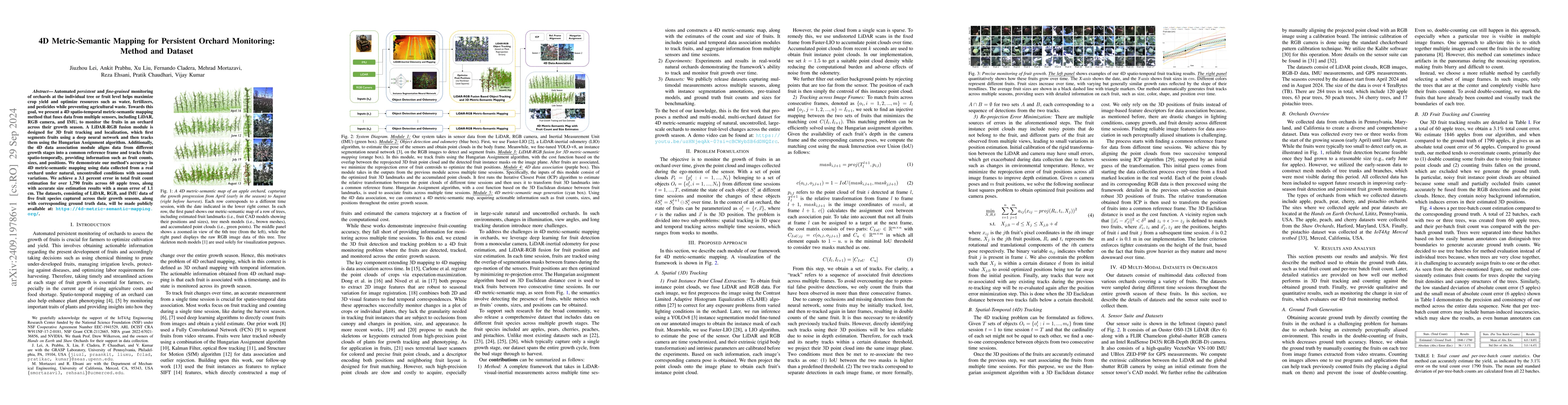
Automated persistent and fine-grained monitoring of orchards at the individual tree or fruit level helps maximize crop yield and optimize resources such as water, fertilizers, and pesticides while pre...
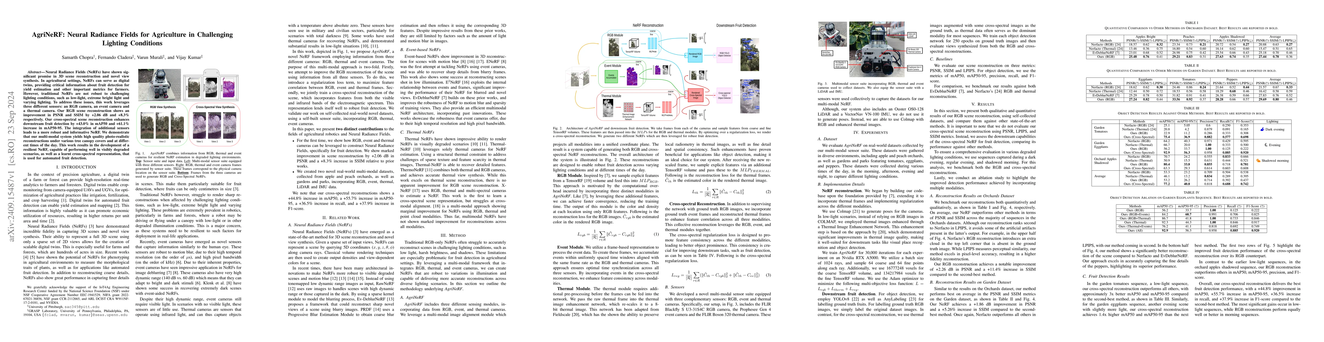
Neural Radiance Fields (NeRFs) have shown significant promise in 3D scene reconstruction and novel view synthesis. In agricultural settings, NeRFs can serve as digital twins, providing critical inform...
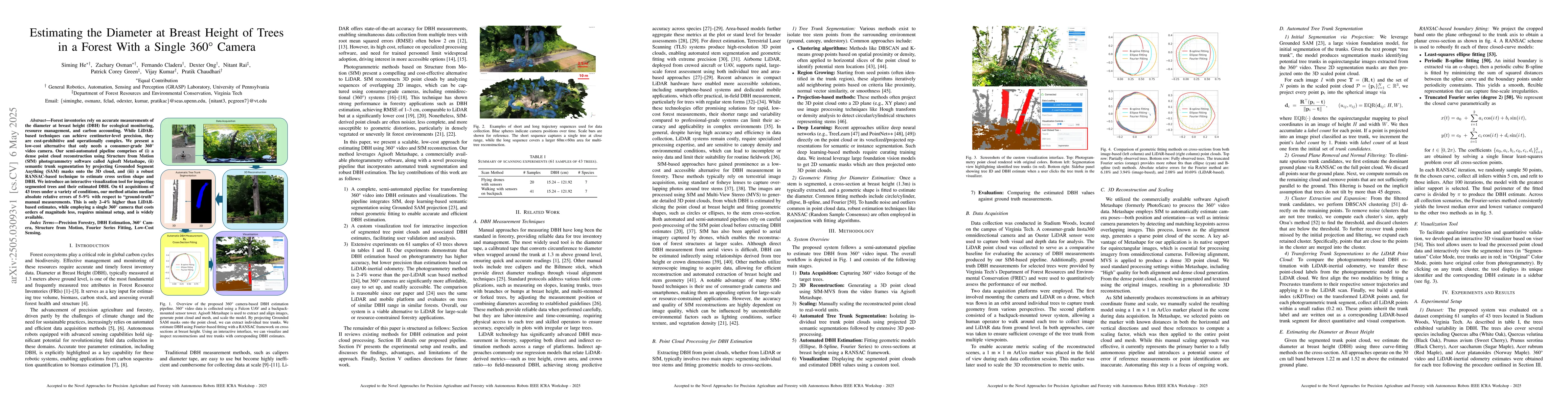
Forest inventories rely on accurate measurements of the diameter at breast height (DBH) for ecological monitoring, resource management, and carbon accounting. While LiDAR-based techniques can achieve ...
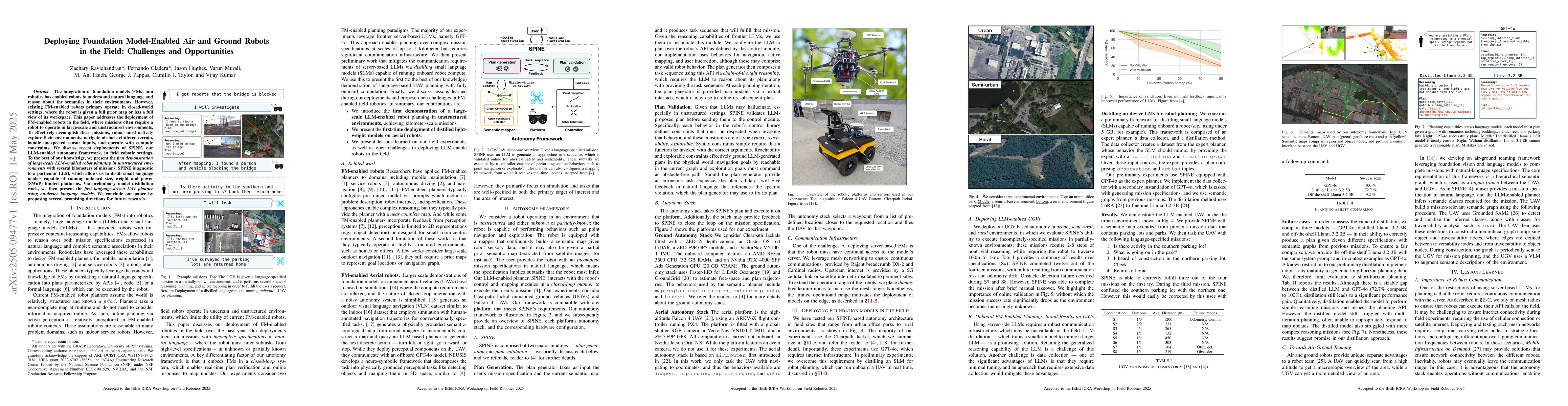
The integration of foundation models (FMs) into robotics has enabled robots to understand natural language and reason about the semantics in their environments. However, existing FM-enabled robots pri...
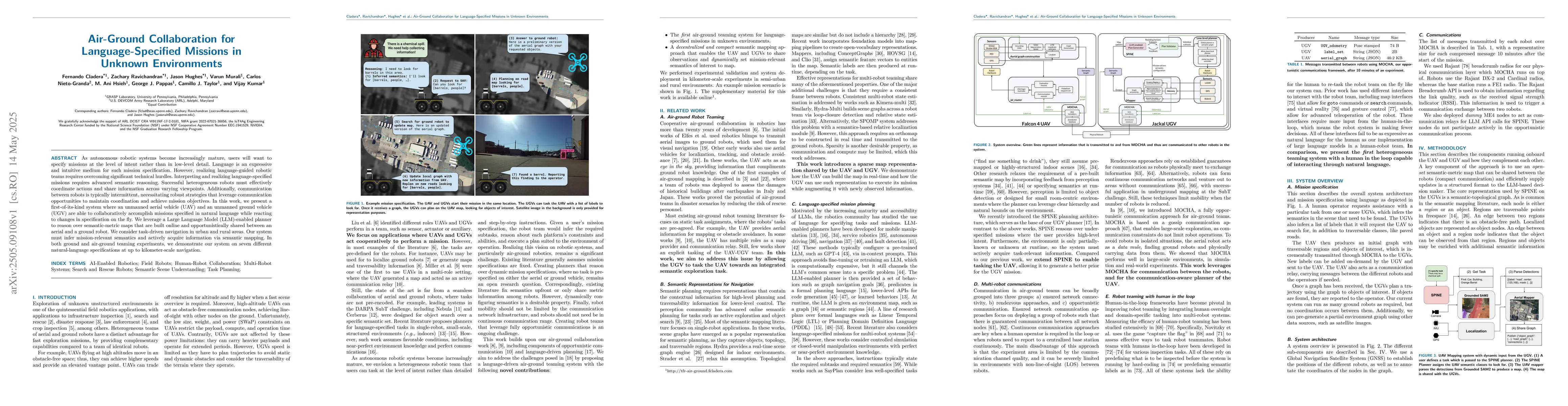
As autonomous robotic systems become increasingly mature, users will want to specify missions at the level of intent rather than in low-level detail. Language is an expressive and intuitive medium for...
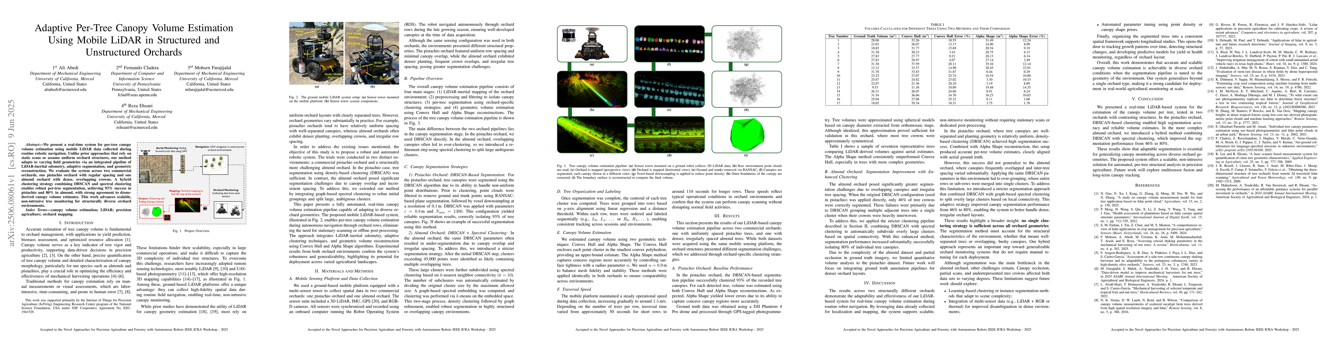
We present a real-time system for per-tree canopy volume estimation using mobile LiDAR data collected during routine robotic navigation. Unlike prior approaches that rely on static scans or assume uni...
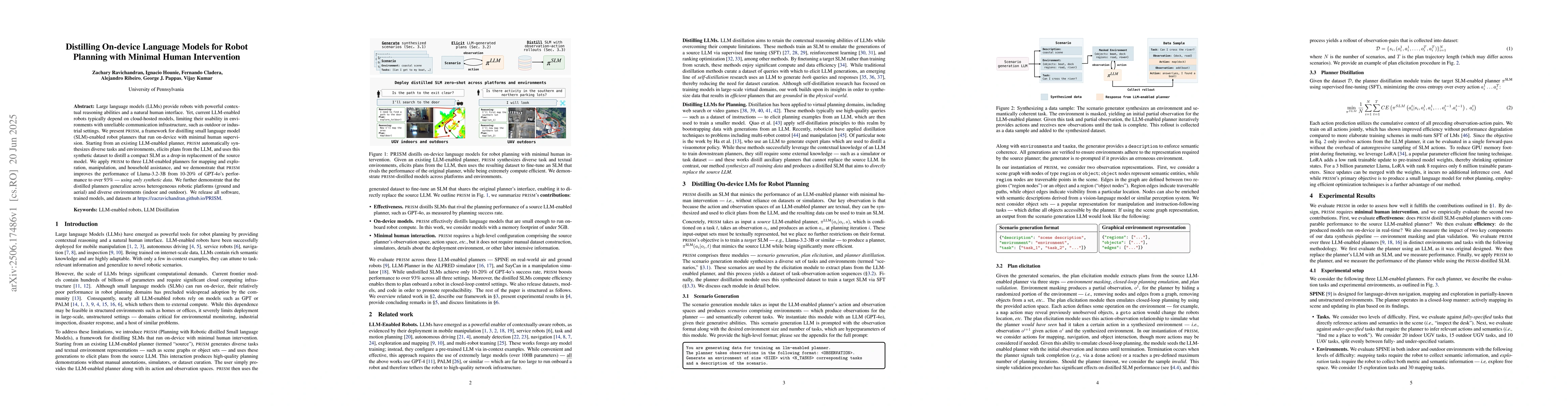
Large language models (LLMs) provide robots with powerful contextual reasoning abilities and a natural human interface. Yet, current LLM-enabled robots typically depend on cloud-hosted models, limitin...
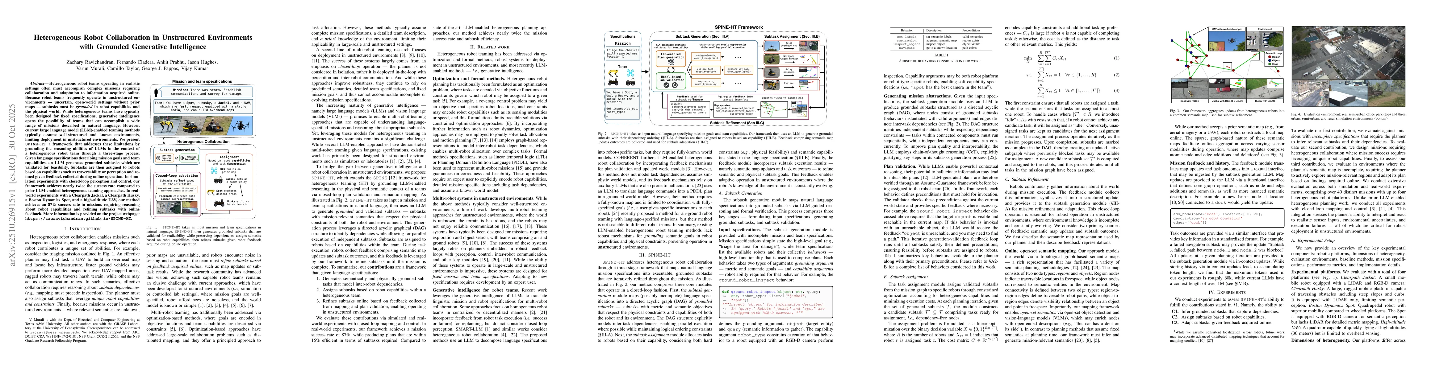
Heterogeneous robot teams operating in realistic settings often must accomplish complex missions requiring collaboration and adaptation to information acquired online. Because robot teams frequently o...
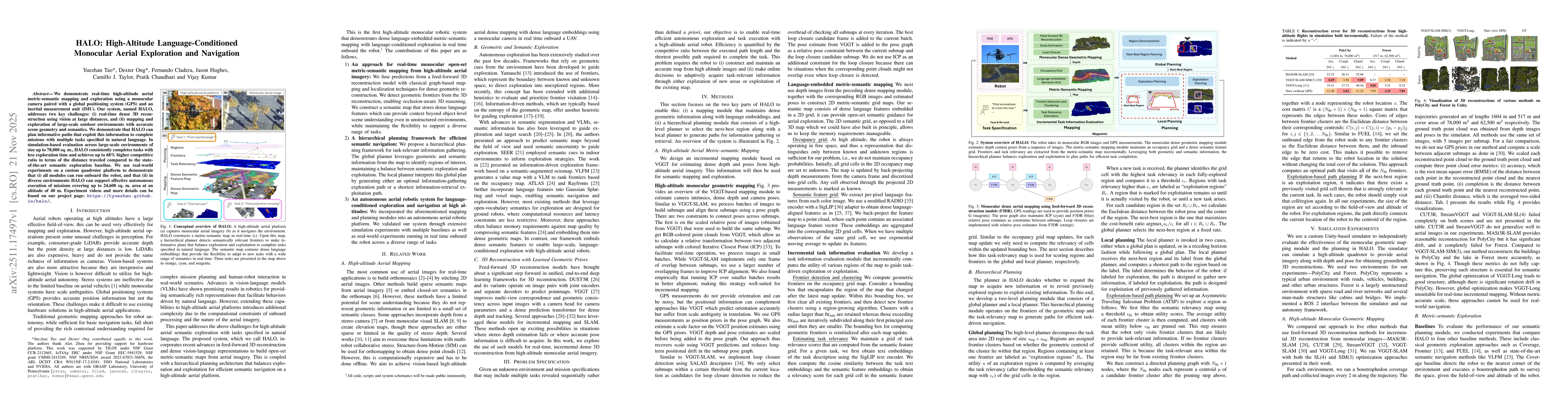
We demonstrate real-time high-altitude aerial metric-semantic mapping and exploration using a monocular camera paired with a global positioning system (GPS) and an inertial measurement unit (IMU). Our...
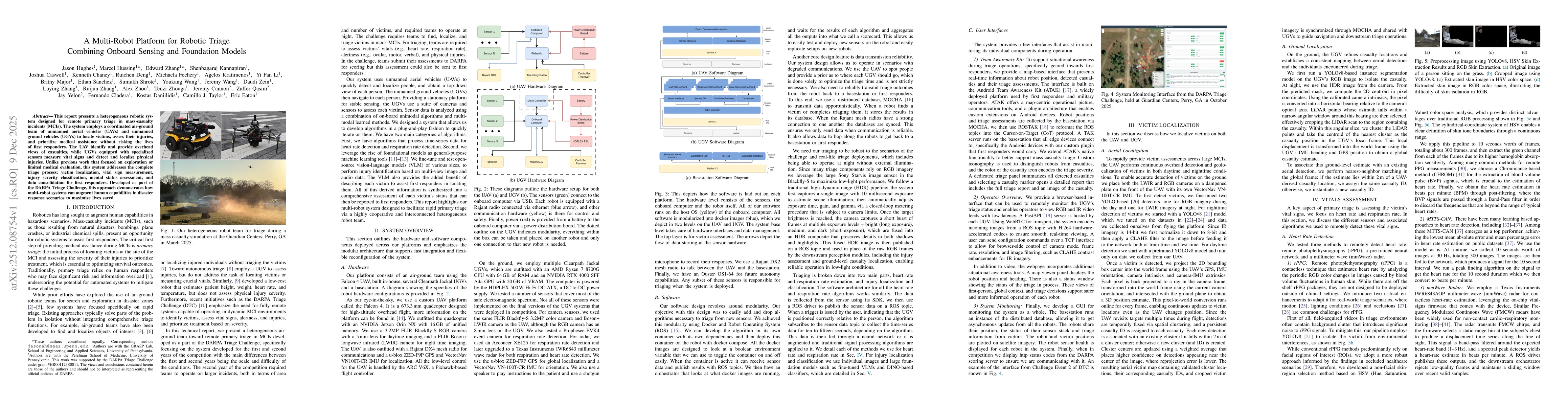
This report presents a heterogeneous robotic system designed for remote primary triage in mass-casualty incidents (MCIs). The system employs a coordinated air-ground team of unmanned aerial vehicles (...
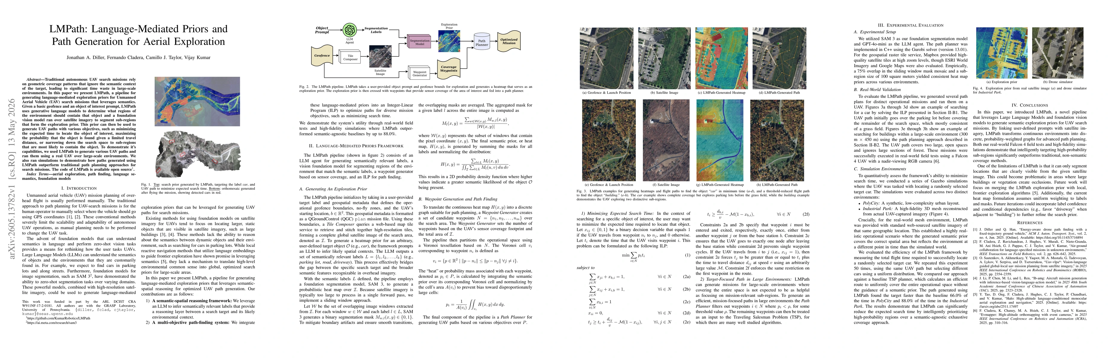
Traditional autonomous UAV search missions rely on geometric coverage patterns that ignore the semantic context of the target, leading to significant time waste in large-scale environments. In this pa...
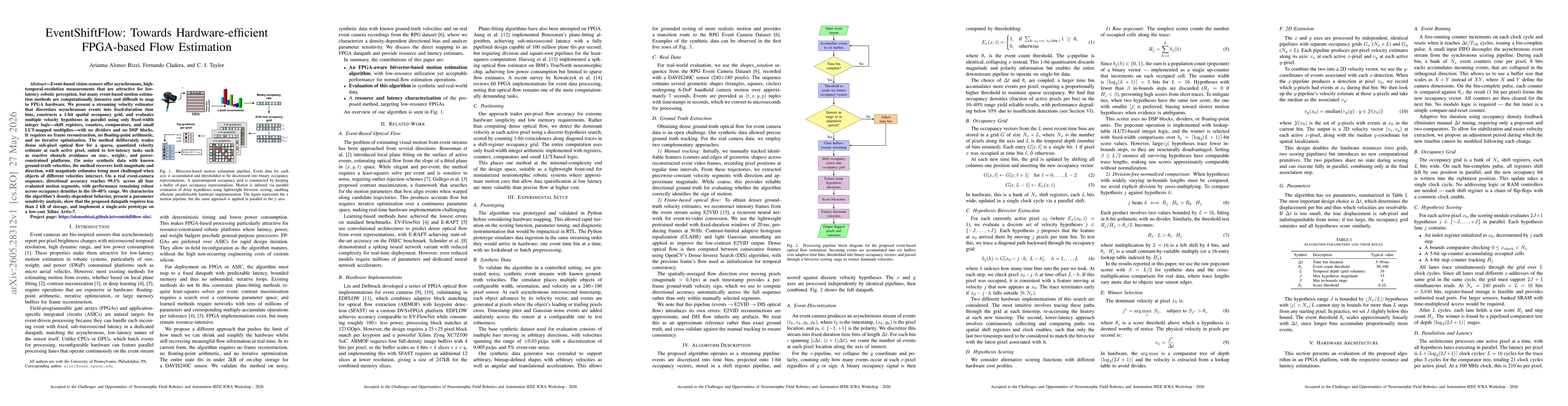
Event-based vision sensors offer asynchronous, high-temporal-resolution measurements that are attractive for low-latency robotic perception, but many event-based motion estimation methods are computat...
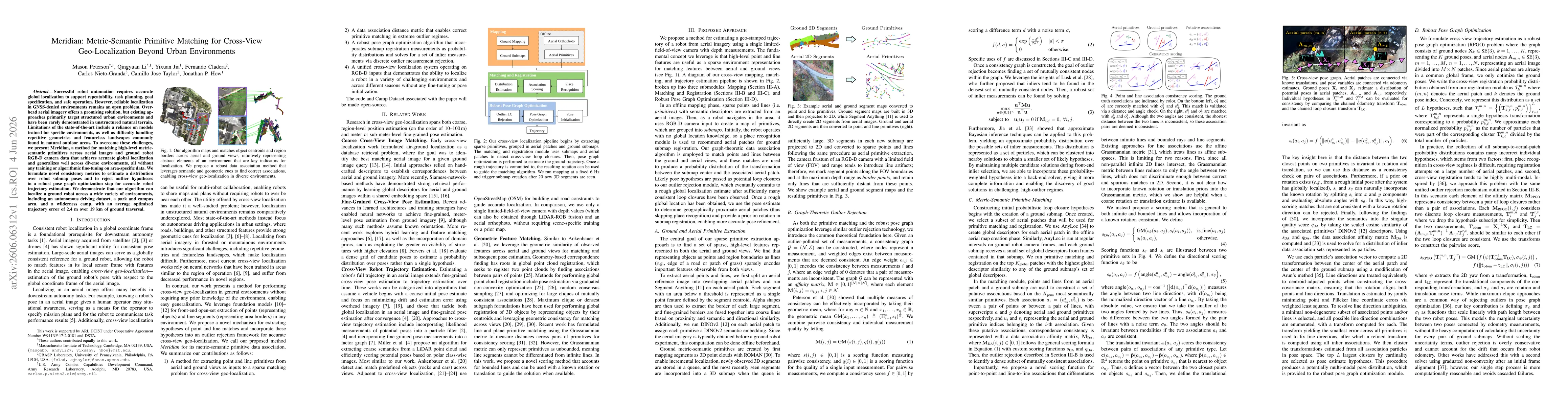
Successful robot automation requires accurate global localization to support repeatability, task planning, goal specification, and safe operation. However, reliable localization in GNSS-denied environ...