ArxivLens
F
Researcher

Florian Fervers

6 papers on arXiv

6 arXiv Papers
2 Total Publications
Profile

Academic Profile

Name F. Fervers
Total Papers 2
Scholar Profile View on Semantic Scholar
Metrics

Statistics

6 arXiv Papers
2 Total Publications
Publications

Papers on arXiv

Thumbnail for C-BEV: Contrastive Bird's Eye View Training for Cross-View Image
  Retrieval and 3-DoF Pose Estimation
arXiv
C-BEV: Contrastive Bird's Eye View Training for Cross-View Image Retrieval and 3-DoF Pose Estimation

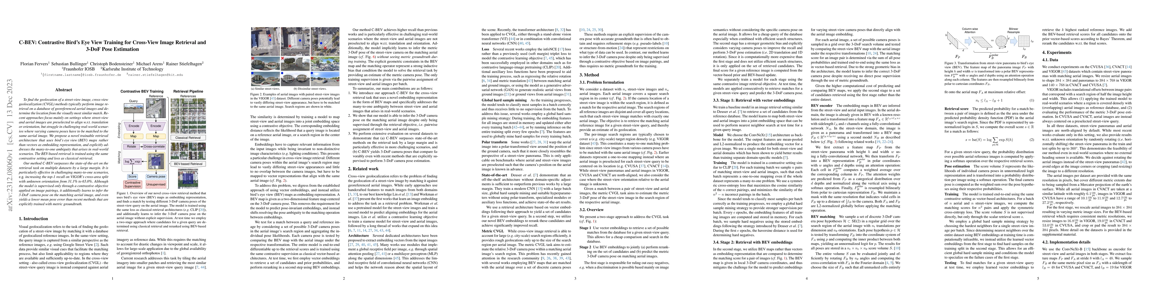
To find the geolocation of a street-view image, cross-view geolocalization (CVGL) methods typically perform image retrieval on a database of georeferenced aerial images and determine the location fr...

Thumbnail for Geo-Tiles for Semantic Segmentation of Earth Observation Imagery
arXiv
Geo-Tiles for Semantic Segmentation of Earth Observation Imagery

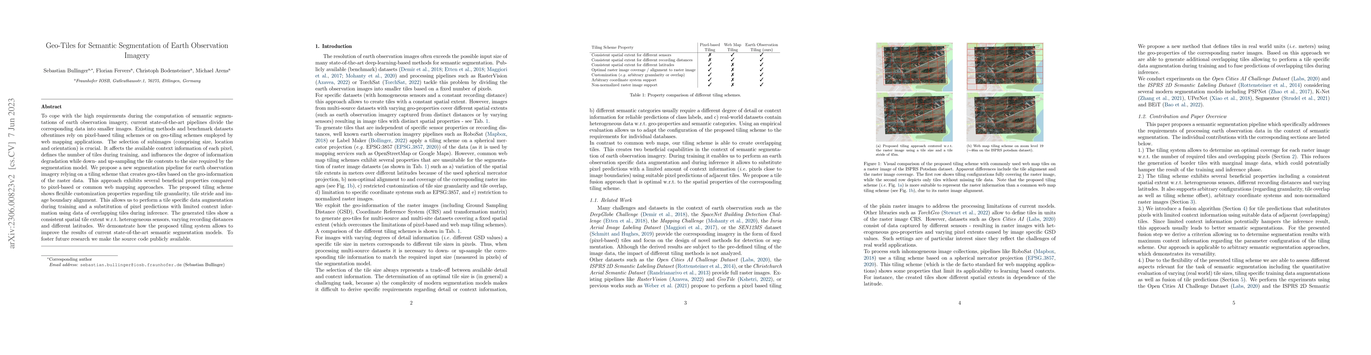
To cope with the high requirements during the computation of semantic segmentations of earth observation imagery, current state-of-the-art pipelines divide the corresponding data into smaller images...

Thumbnail for Uncertainty-aware Vision-based Metric Cross-view Geolocalization
arXiv
Uncertainty-aware Vision-based Metric Cross-view Geolocalization

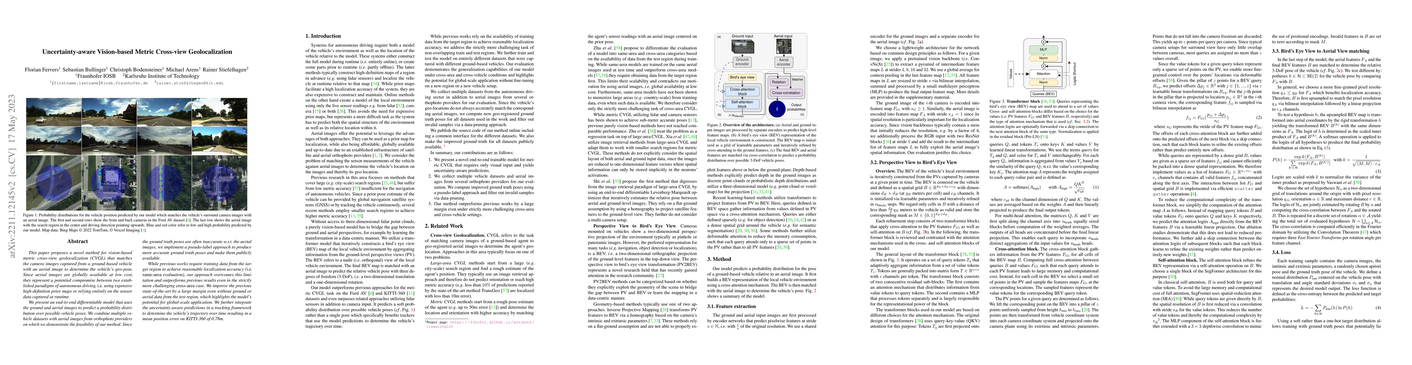
This paper proposes a novel method for vision-based metric cross-view geolocalization (CVGL) that matches the camera images captured from a ground-based vehicle with an aerial image to determine the...

Thumbnail for Continuous Self-Localization on Aerial Images Using Visual and Lidar
  Sensors
arXiv
Continuous Self-Localization on Aerial Images Using Visual and Lidar Sensors

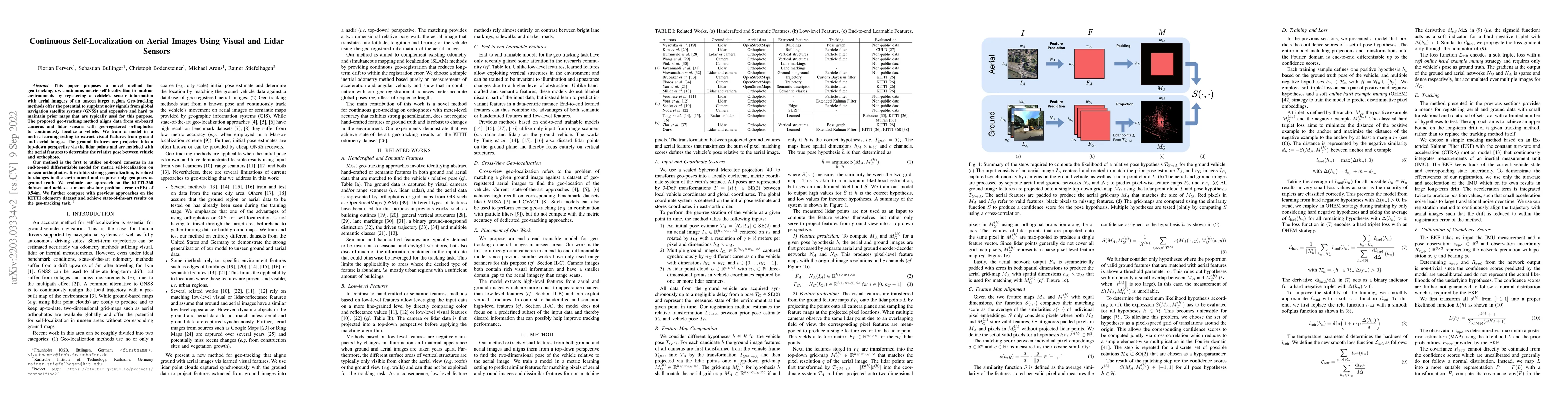
This paper proposes a novel method for geo-tracking, i.e. continuous metric self-localization in outdoor environments by registering a vehicle's sensor information with aerial imagery of an unseen t...

Thumbnail for Improving Semantic Image Segmentation via Label Fusion in Semantically
  Textured Meshes
arXiv
Improving Semantic Image Segmentation via Label Fusion in Semantically Textured Meshes

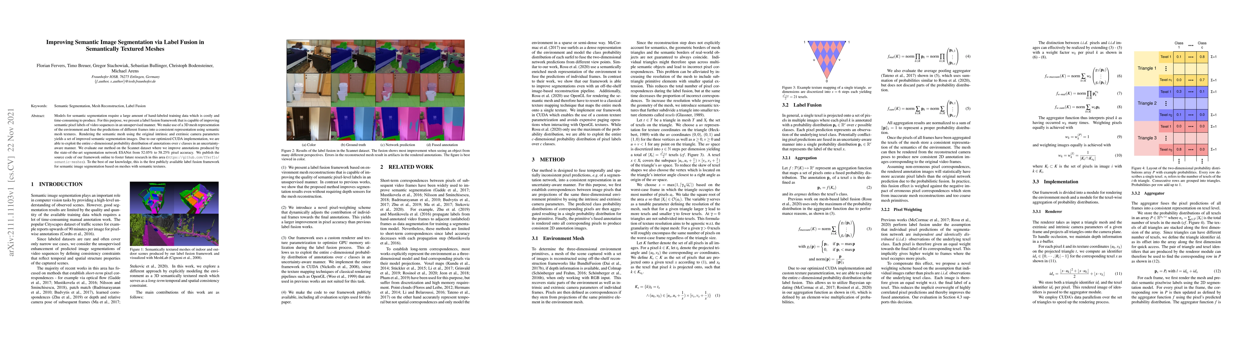
Models for semantic segmentation require a large amount of hand-labeled training data which is costly and time-consuming to produce. For this purpose, we present a label fusion framework that is cap...

Thumbnail for Statewide Visual Geolocalization in the Wild
arXiv
Statewide Visual Geolocalization in the Wild

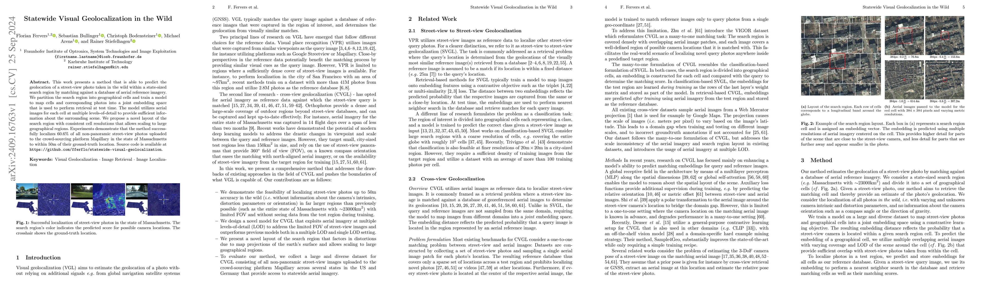
This work presents a method that is able to predict the geolocation of a street-view photo taken in the wild within a state-sized search region by matching against a database of aerial reference image...

This website uses cookies to ensure you get the best experience. Learn more