Academic Profile
Statistics
Similar Authors
Papers on arXiv
Satellite-based remote sensing has revolutionised the way we address global challenges in a rapidly evolving world. Huge quantities of Earth Observation (EO) data are generated by satellite sensors ...
Self-supervised learning (SSL) models have recently demonstrated remarkable performance across various tasks, including image segmentation. This study delves into the emergent characteristics of the...
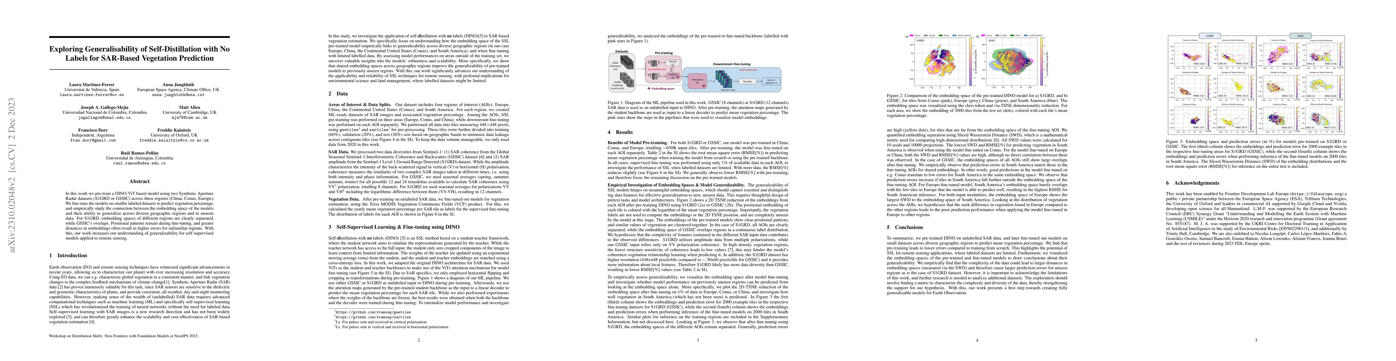
In this work we pre-train a DINO-ViT based model using two Synthetic Aperture Radar datasets (S1GRD or GSSIC) across three regions (China, Conus, Europe). We fine-tune the models on smaller labeled ...
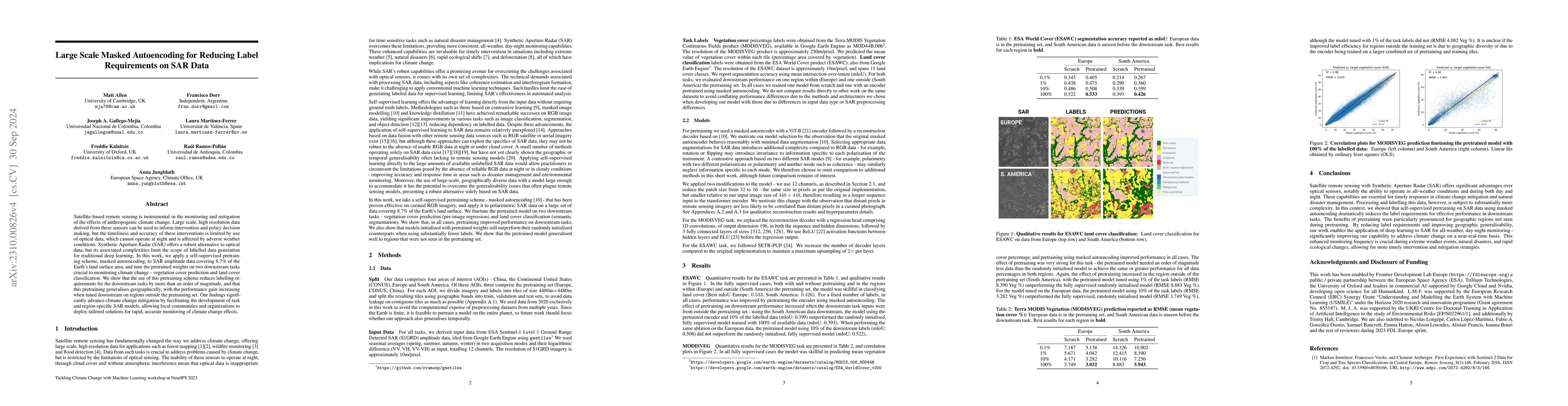
Satellite-based remote sensing is instrumental in the monitoring and mitigation of the effects of anthropogenic climate change. Large scale, high resolution data derived from these sensors can be us...
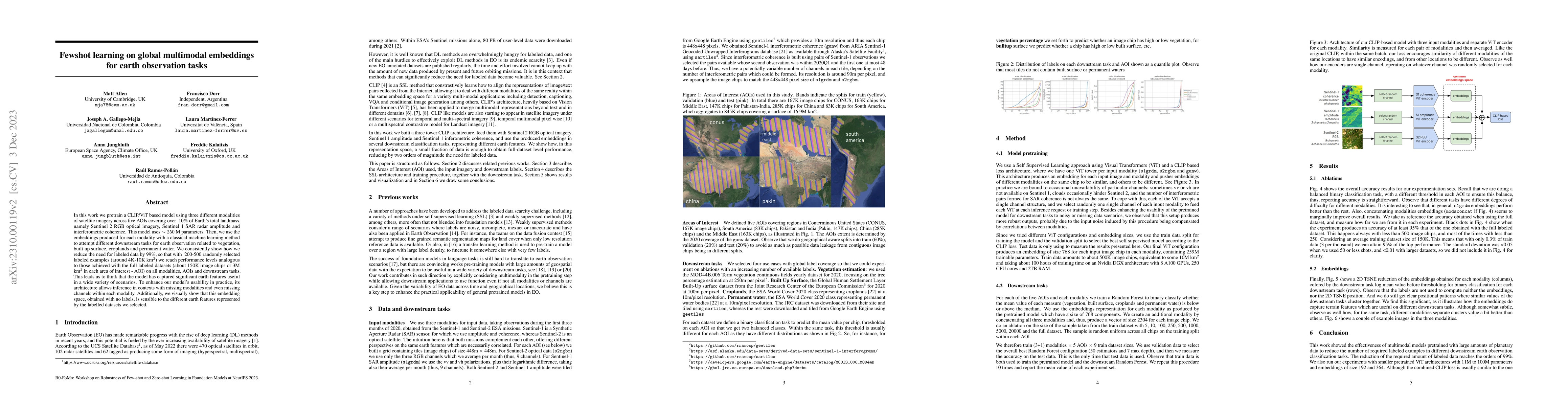
In this work we pretrain a CLIP/ViT based model using three different modalities of satellite imagery across five AOIs covering over ~10\% of Earth's total landmass, namely Sentinel 2 RGB optical im...
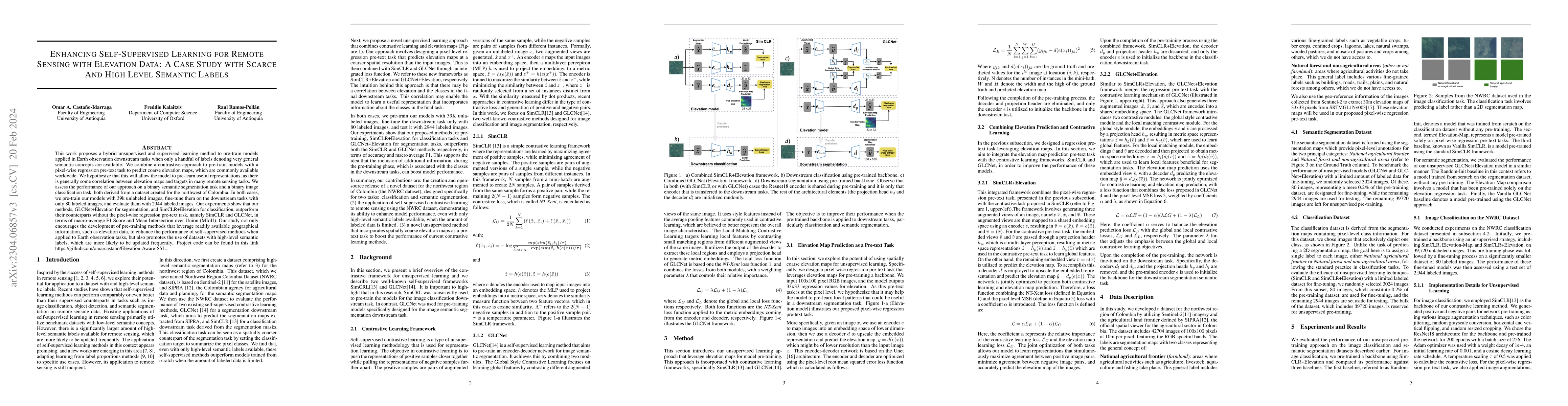
This work proposes a hybrid unsupervised and supervised learning method to pre-train models applied in Earth observation downstream tasks when only a handful of labels denoting very general semantic...
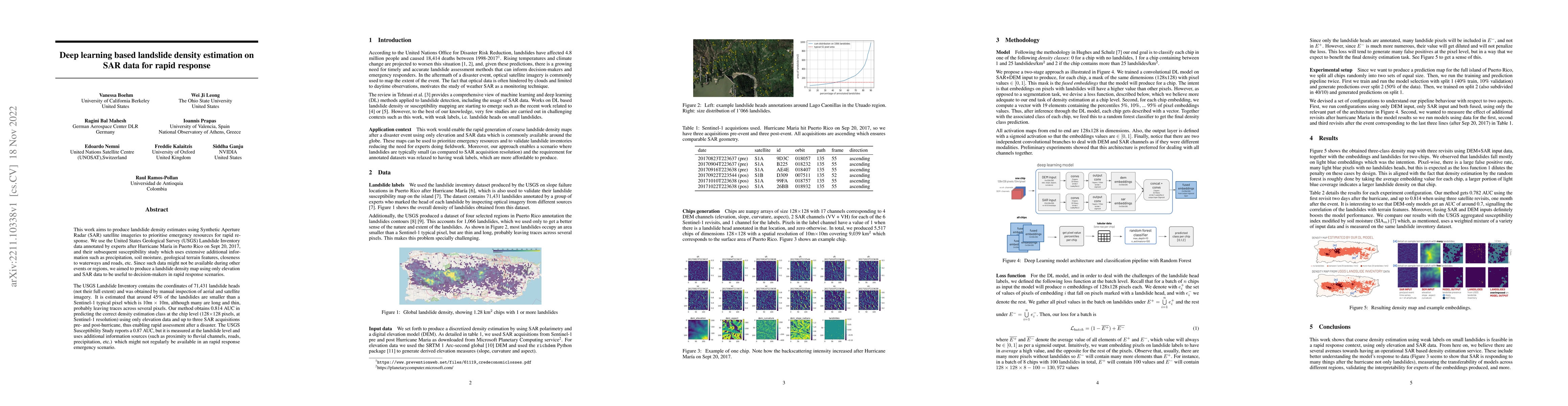
This work aims to produce landslide density estimates using Synthetic Aperture Radar (SAR) satellite imageries to prioritise emergency resources for rapid response. We use the United States Geologic...
Rapid assessment after a natural disaster is key for prioritizing emergency resources. In the case of landslides, rapid assessment involves determining the extent of the area affected and measuring ...
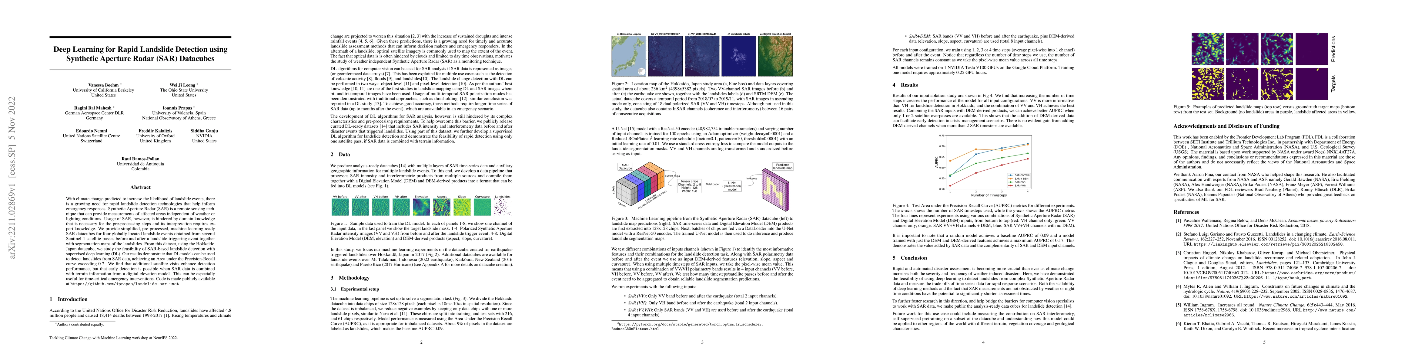
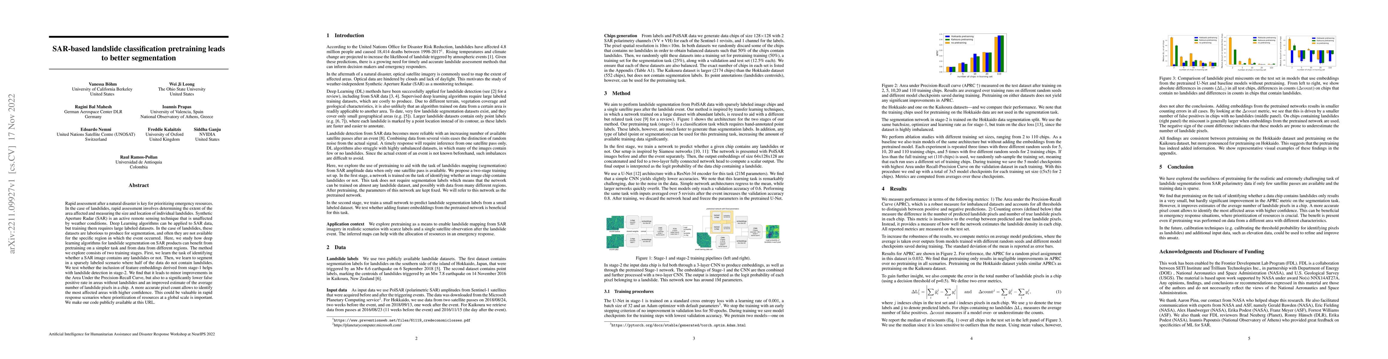
With climate change predicted to increase the likelihood of landslide events, there is a growing need for rapid landslide detection technologies that help inform emergency responses. Synthetic Apert...
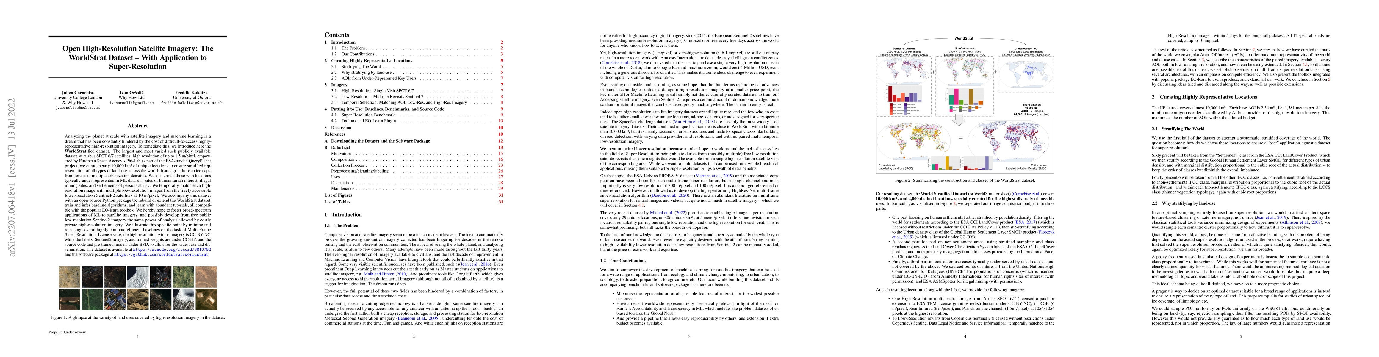
Analyzing the planet at scale with satellite imagery and machine learning is a dream that has been constantly hindered by the cost of difficult-to-access highly-representative high-resolution imager...
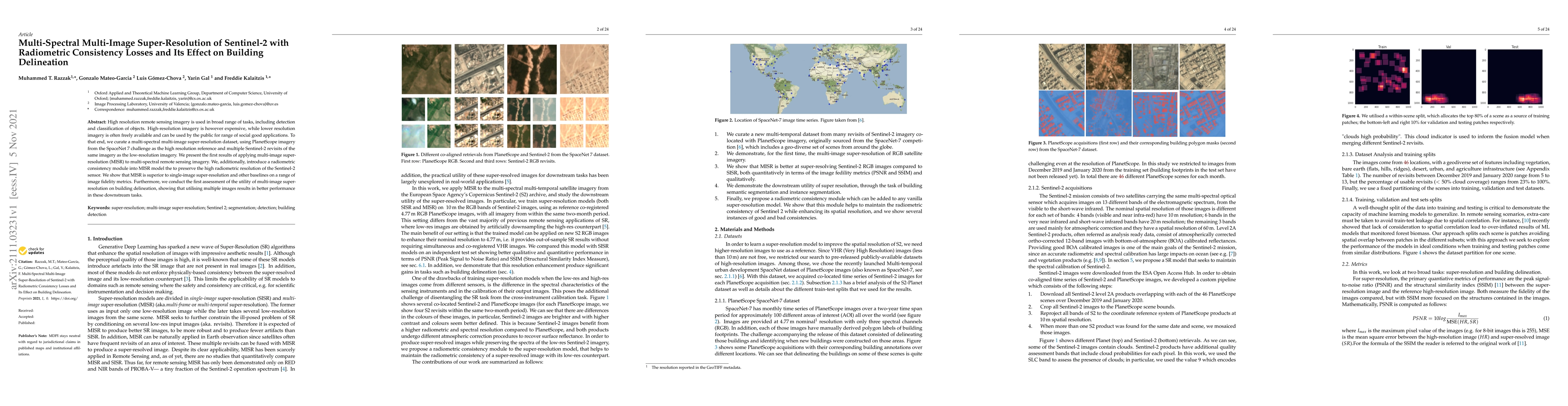
High resolution remote sensing imagery is used in broad range of tasks, including detection and classification of objects. High-resolution imagery is however expensive, while lower resolution imager...
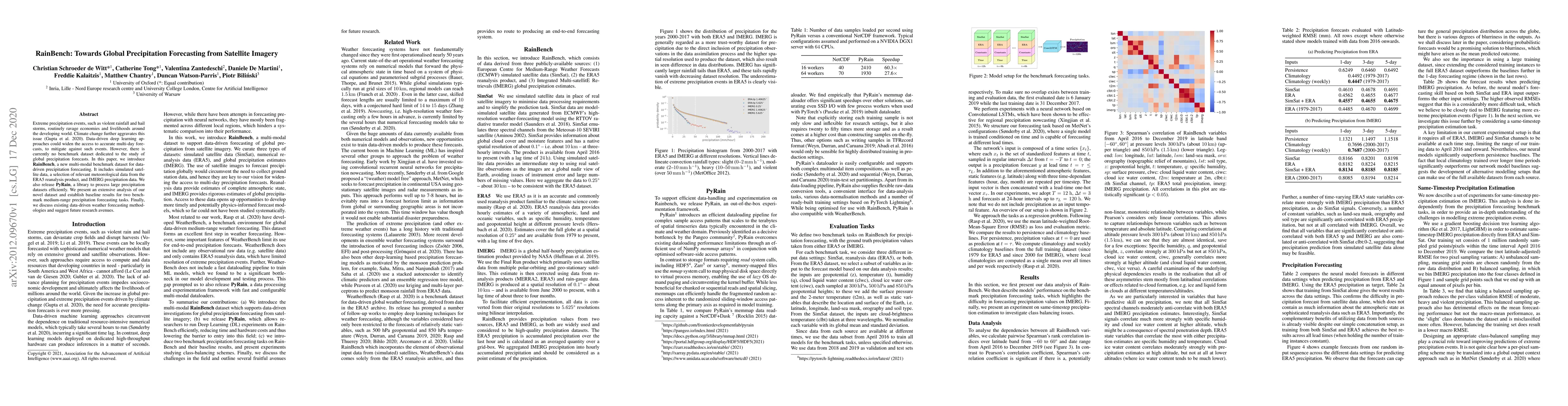
Extreme precipitation events, such as violent rainfall and hail storms, routinely ravage economies and livelihoods around the developing world. Climate change further aggravates this issue. Data-dri...
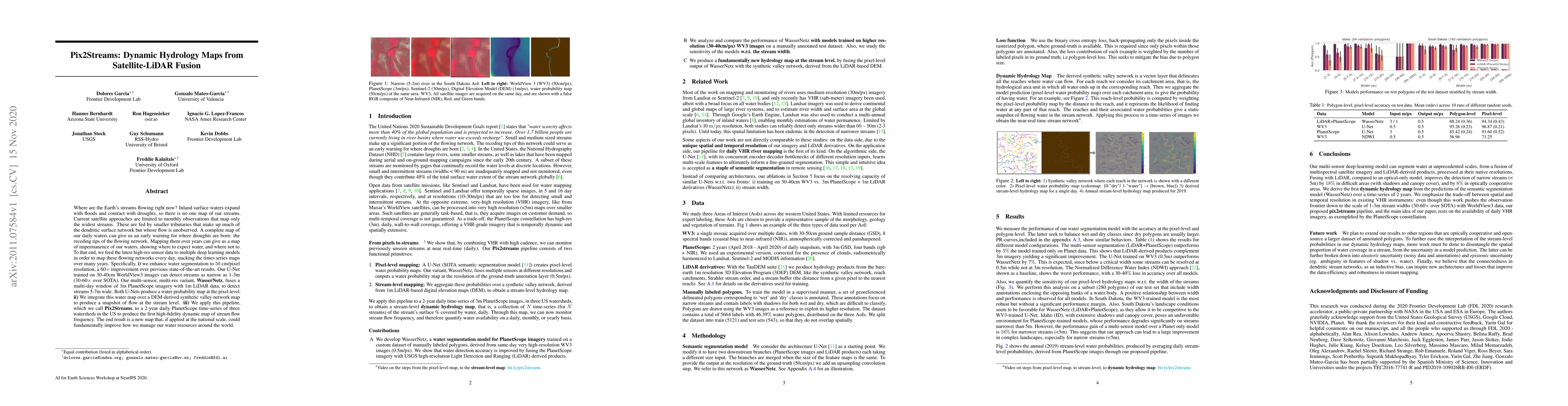
Where are the Earth's streams flowing right now? Inland surface waters expand with floods and contract with droughts, so there is no one map of our streams. Current satellite approaches are limited ...
Cattle farming is responsible for 8.8\% of greenhouse gas emissions worldwide. In addition to the methane emitted due to their digestive process, the growing need for grazing areas is an important d...
This study investigates the efficacy of Low-Rank Adaptation (LoRA) in fine-tuning Earth Observation (EO) foundation models for flood segmentation. We hypothesize that LoRA, a parameter-efficient techn...
We take the perspective in which we want to design a downstream task (such as estimating vegetation coverage) on a certain area of interest (AOI) with a limited labeling budget. By leveraging an exist...
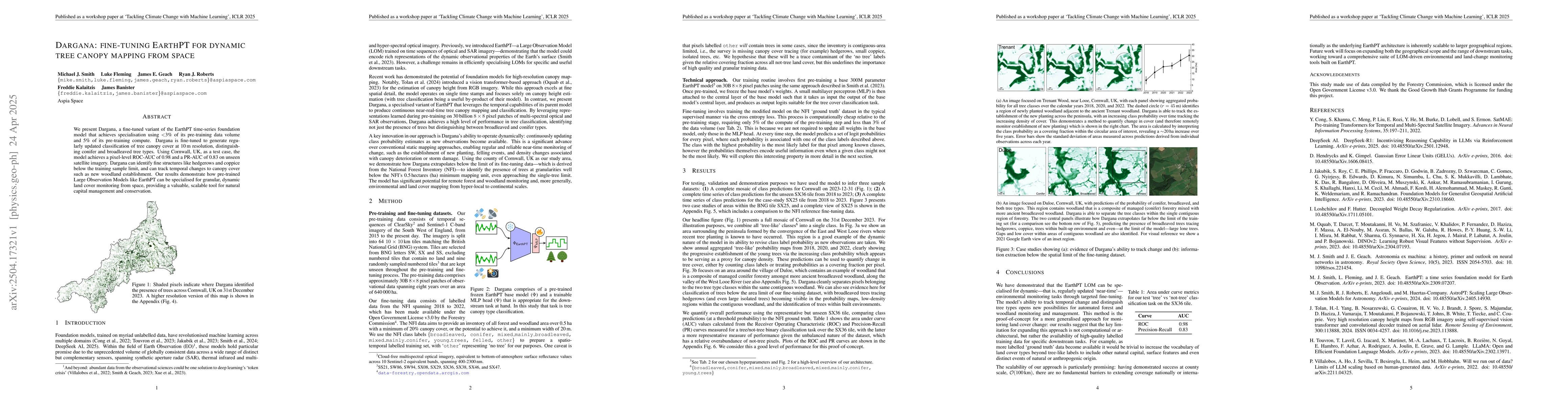
We present Dargana, a fine-tuned variant of the EarthPT time-series foundation model that achieves specialisation using <3% of its pre-training data volume and 5% of its pre-training compute. Dargana ...
Air pollution is the world's largest environmental risk factor for human disease and premature death, resulting in more than 6 million permature deaths in 2019. Currently, there is still a challenge t...
Air pollution is a global hazard, and as of 2023, 94\% of the world's population is exposed to unsafe pollution levels. Surface Ozone (O3), an important pollutant, and the drivers of its trends are di...