Academic Profile
Statistics
Similar Authors
Papers on arXiv
We construct flexible spatio-temporal models through stochastic partial differential equations (SPDEs) where both diffusion and advection can be spatially varying. Computations are done through a Ga...
Anonymizing the GPS locations of observations can bias a spatial model's parameter estimates and attenuate spatial predictions when improperly accounted for, and is relevant in applications from pub...
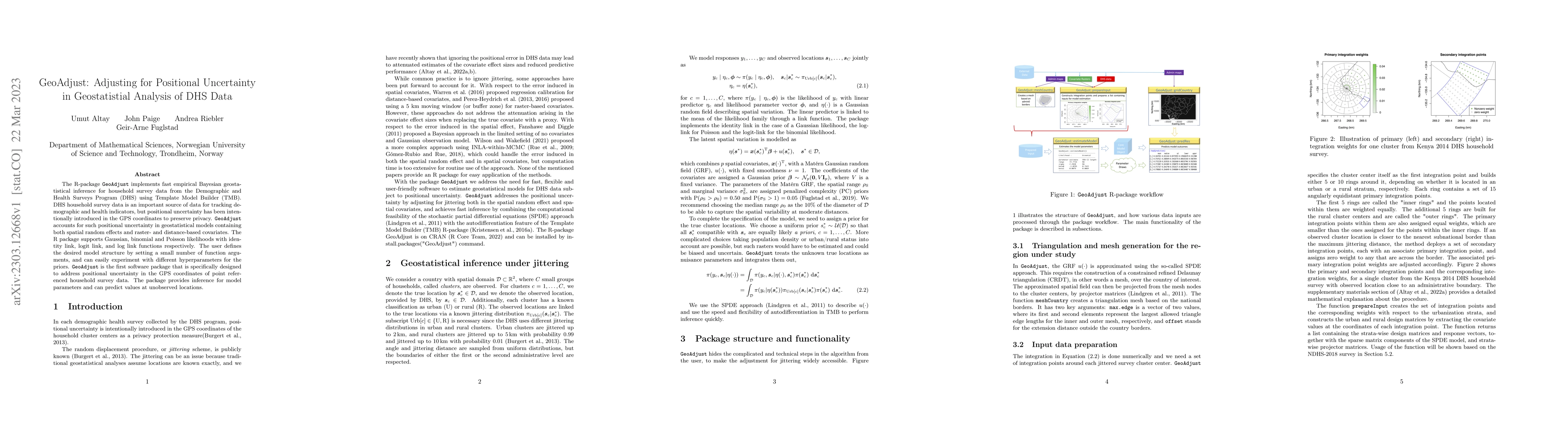
The R-package GeoAdjust https://github.com/umut-altay/GeoAdjust-package implements fast empirical Bayesian geostatistical inference for household survey data from the Demographic and Health Surveys ...
Obtaining high-resolution maps of precipitation data can provide key insights to stakeholders to assess a sustainable access to water resources at urban scale. Mapping a nonstationary, sparse proces...
Isotropic covariance structures can be unreasonable for phenomena in three-dimensional spaces such as the ocean. In the ocean, the variability of the response may vary with depth, and ocean currents...
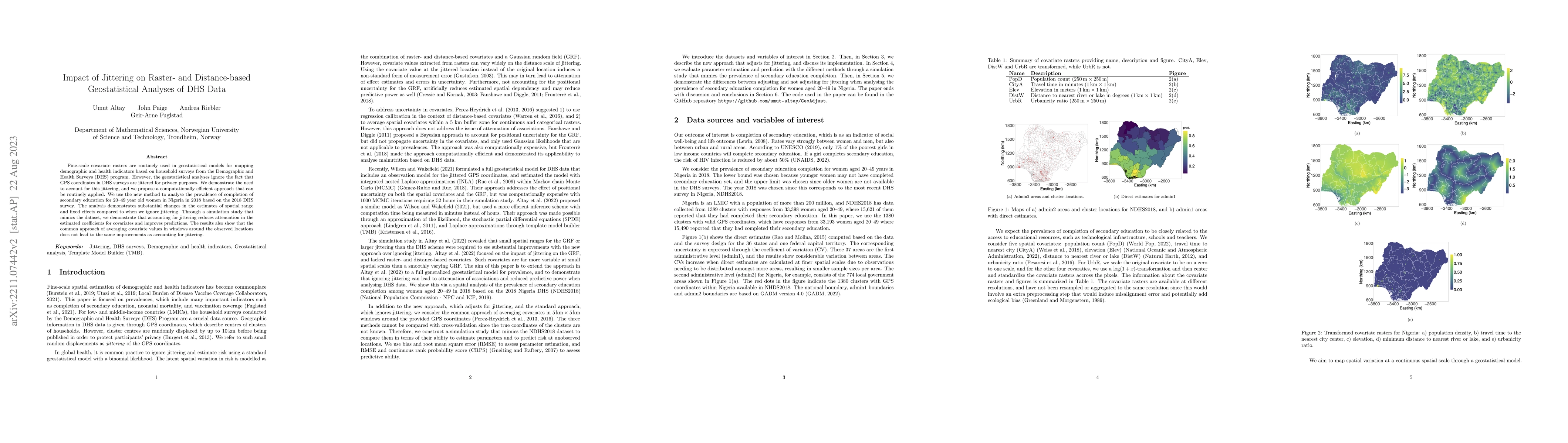
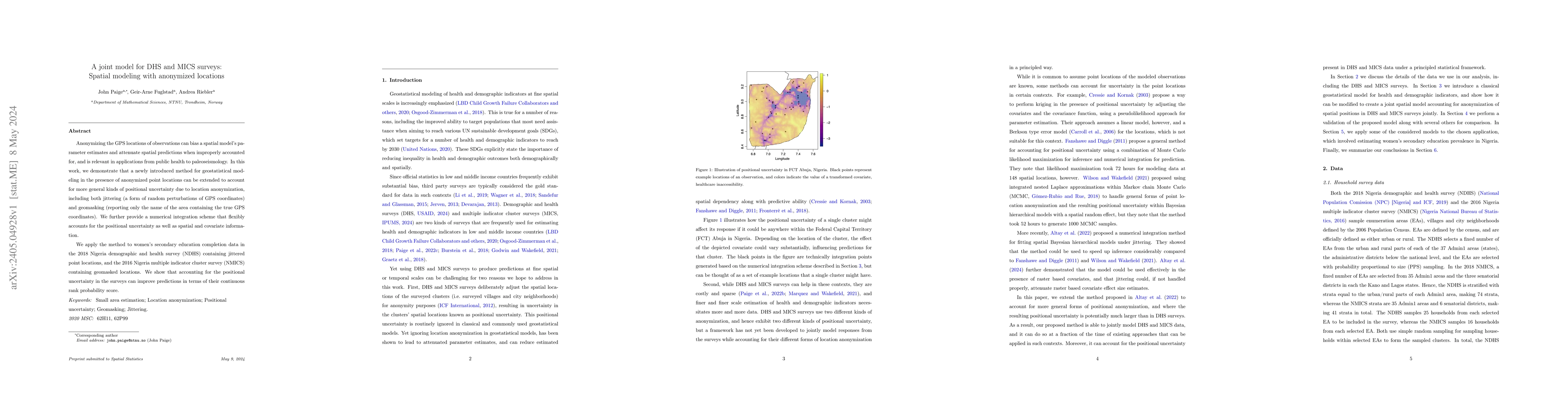
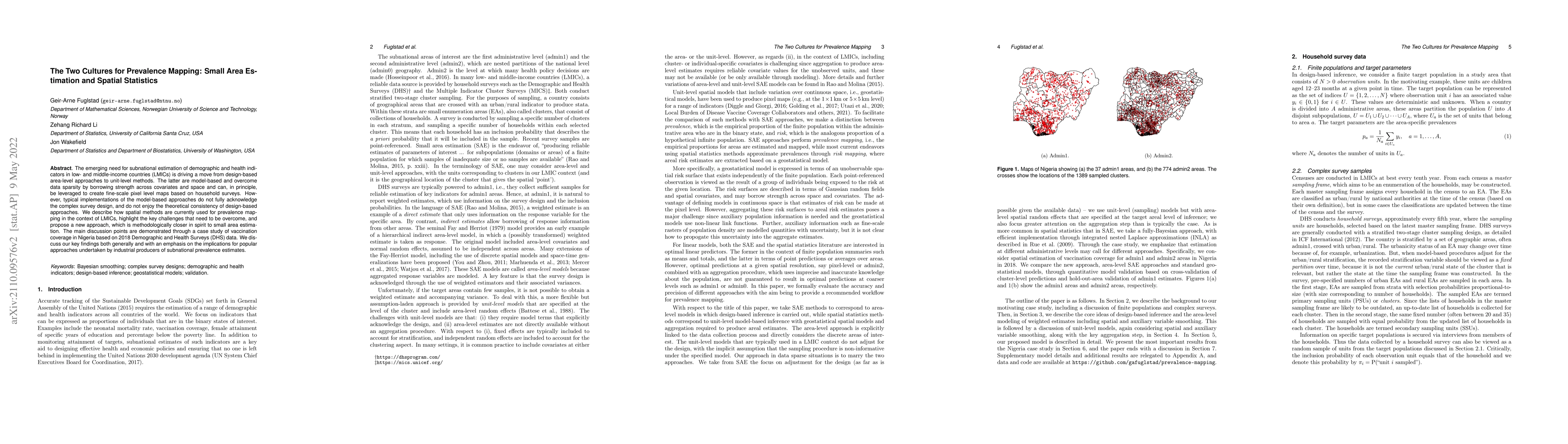
Fine-scale covariate rasters are routinely used in geostatistical models for mapping demographic and health indicators based on household surveys from the Demographic and Health Surveys (DHS) progra...
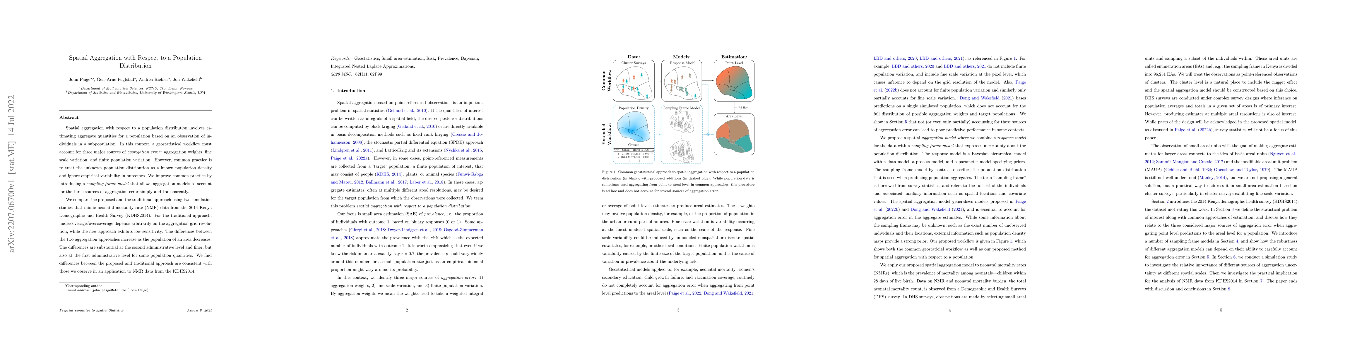
Spatial aggregation with respect to a population distribution involves estimating aggregate quantities for a population based on an observation of individuals in a subpopulation. In this context, a ...
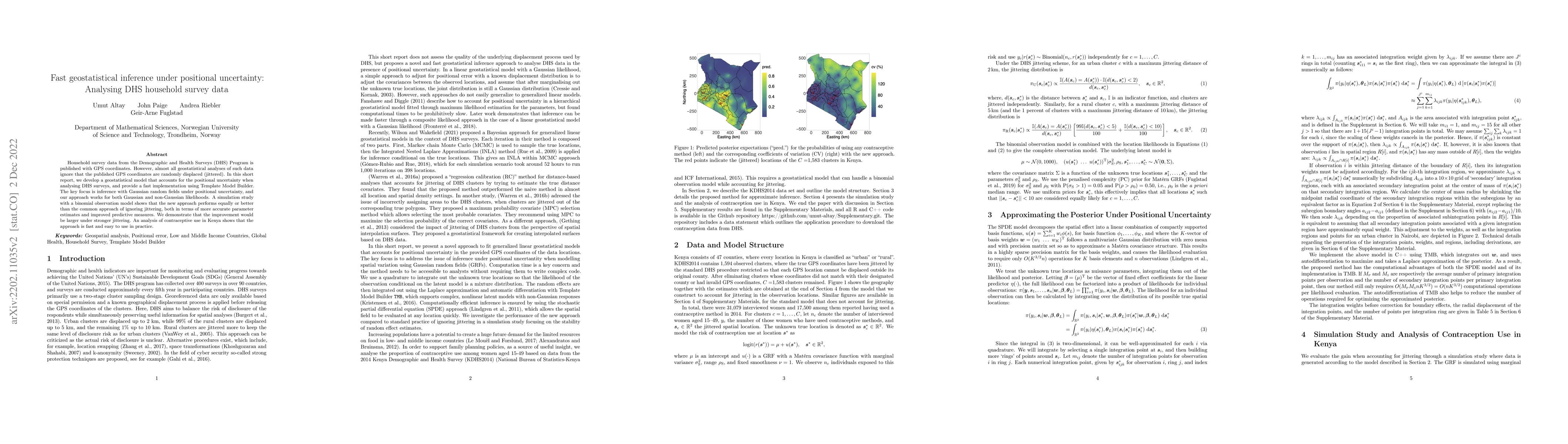
Household survey data from the Demographic and Health Surveys (DHS) Program is published with GPS coordinates. However, almost all geostatistical analyses of such data ignore that the published GPS ...
The emerging need for subnational estimation of demographic and health indicators in low- and middle-income countries (LMICs) is driving a move from design-based area-level approaches to unit-level ...
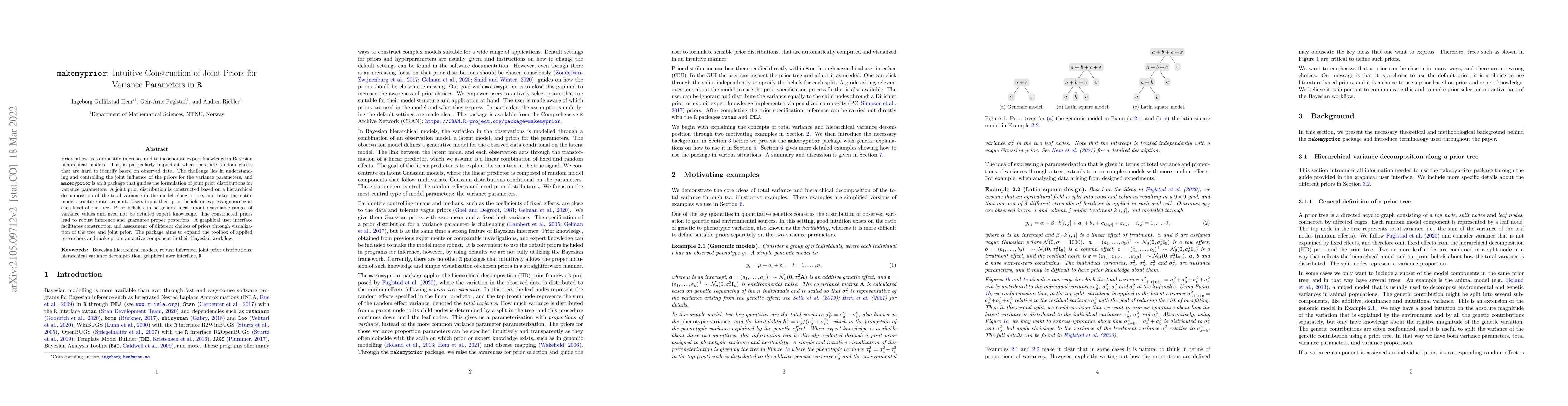
Priors allow us to robustify inference and to incorporate expert knowledge in Bayesian hierarchical models. This is particularly important when there are random effects that are hard to identify bas...
Current implementations of multiresolution methods are limited in terms of possible types of responses and approaches to inference. We provide a multiresolution approach for spatial analysis of non-...
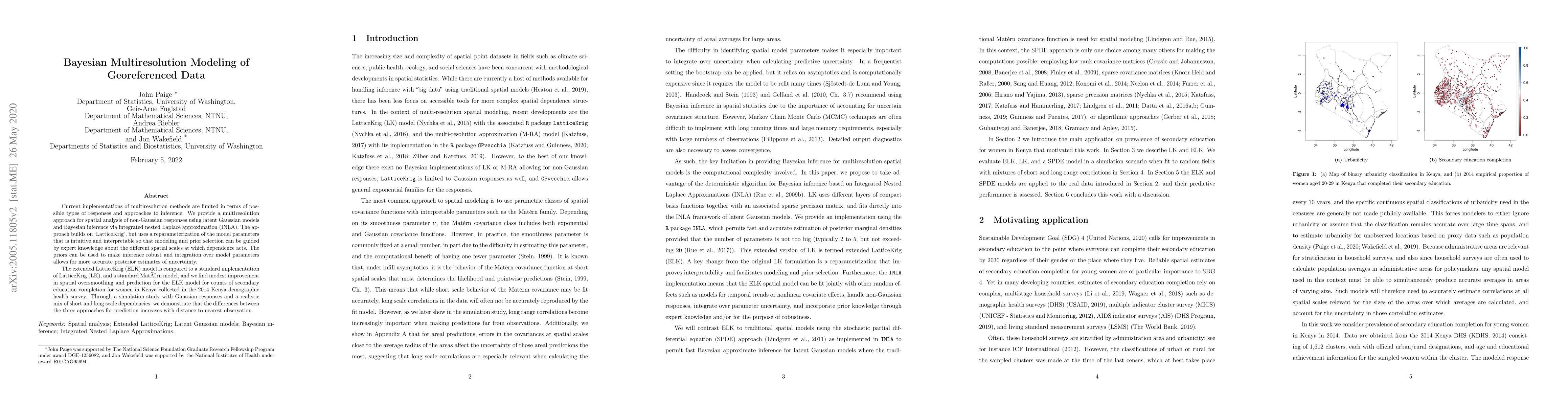
The need for rigorous and timely health and demographic summaries has provided the impetus for an explosion in geographic studies, with a common approach being the production of pixel-level maps, pa...
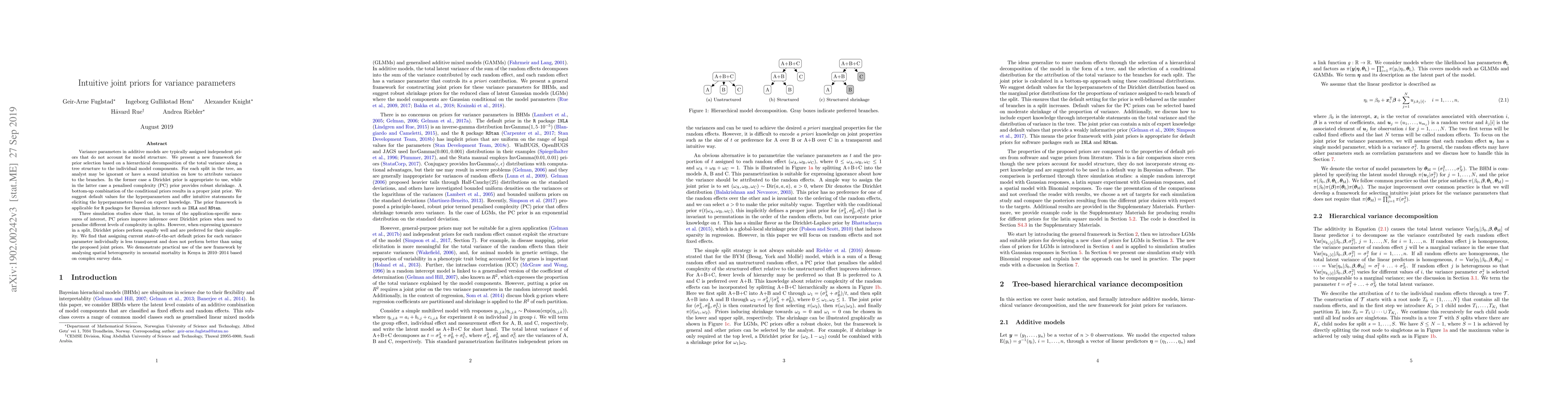
Variance parameters in additive models are typically assigned independent priors that do not account for model structure. We present a new framework for prior selection based on a hierarchical decom...
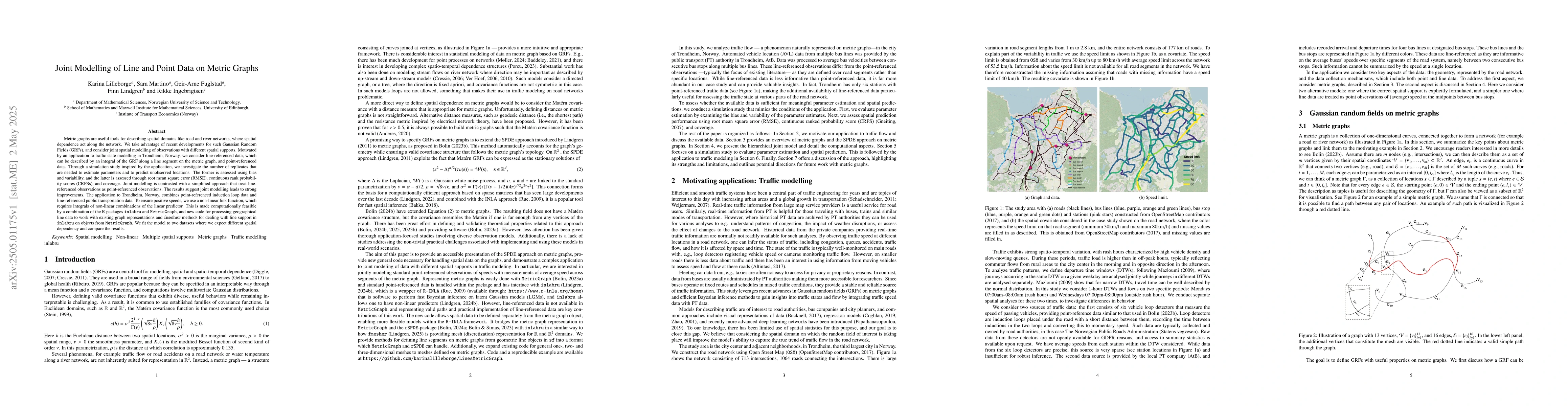
Metric graphs are useful tools for describing spatial domains like road and river networks, where spatial dependence act along the network. We take advantage of recent developments for such Gaussian R...
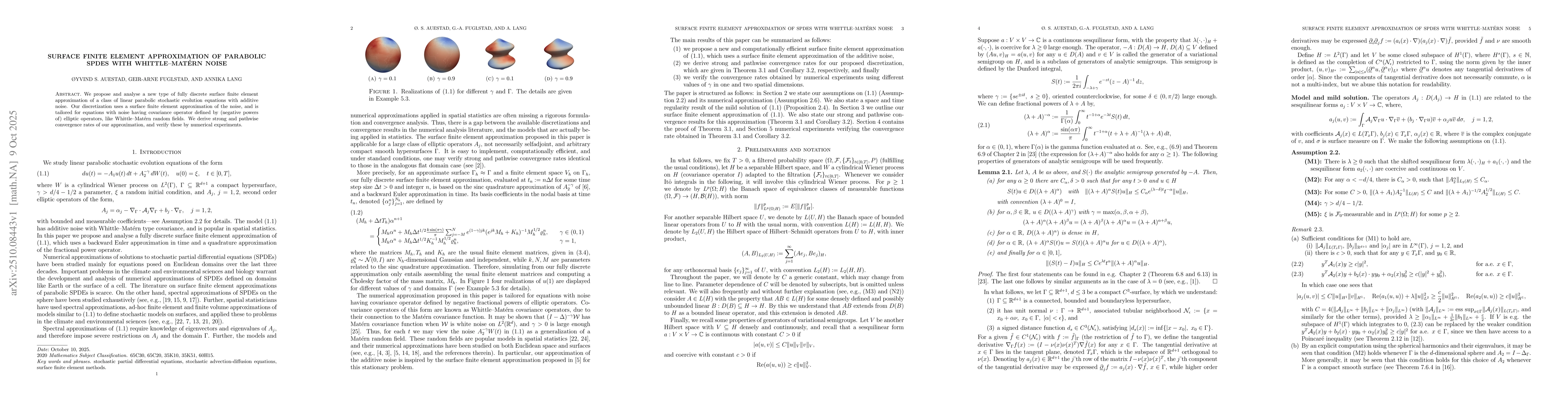
We propose and analyse a new type of fully discrete surface finite element approximation of a class of linear parabolic stochastic evolution equations with additive noise. Our discretization uses a su...
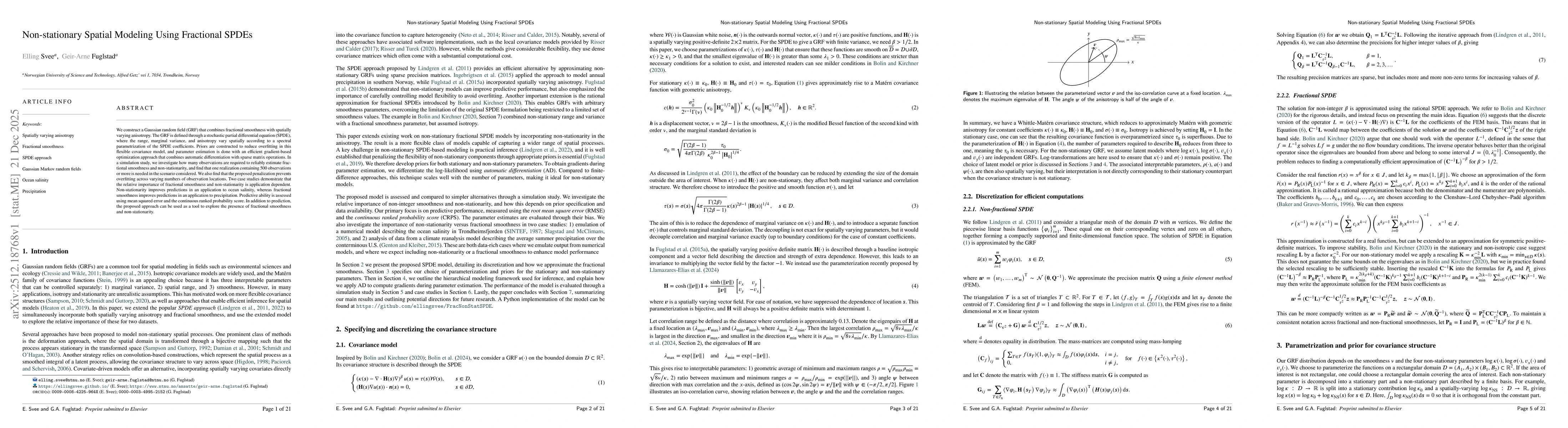
We construct a Gaussian random field (GRF) that combines fractional smoothness with spatially varying anisotropy. The GRF is defined through a stochastic partial differential equation (SPDE), where th...
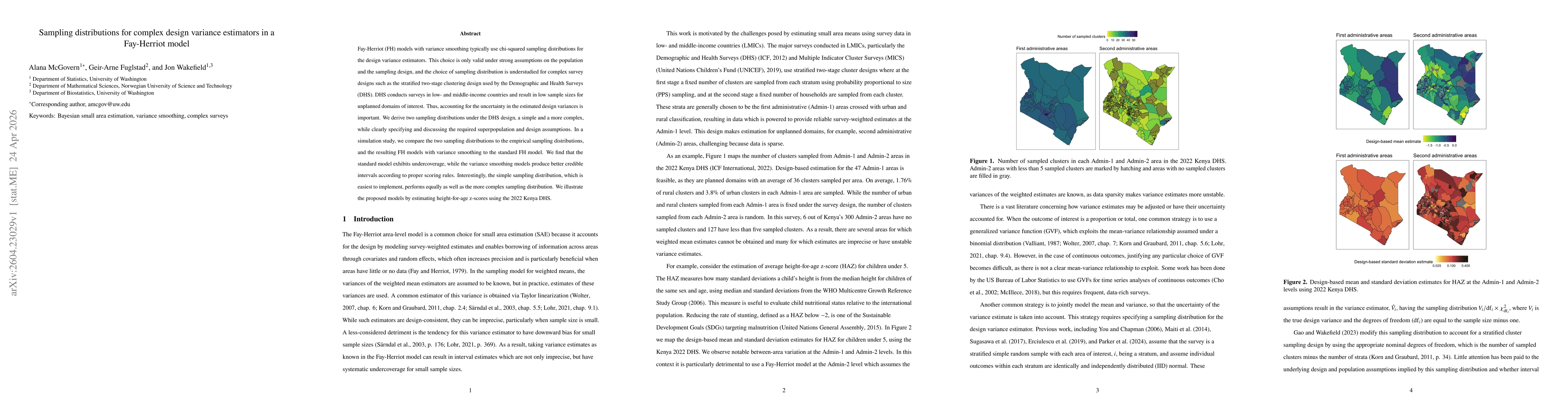
Fay-Herriot (FH) models with variance smoothing typically use chi-squared sampling distributions for the design variance estimators. This choice is only valid under strong assumptions on the populatio...
The Matérn covariance model is ubiquitous in spatial modelling, but there is no default choice for spatio-temporal modelling. In this paper, we consider the recently proposed ``diffusion-based'' exten...