Academic Profile
Statistics
Similar Authors
Papers on arXiv
Global Navigation Satellite Systems (GNSS)-based positioning plays a crucial role in various applications, including navigation, transportation, logistics, mapping, and emergency services. Tradition...
Robots often use feature-based image tracking to identify their position in their surrounding environment; however, feature-based image tracking is prone to errors in low-textured and poorly lit env...
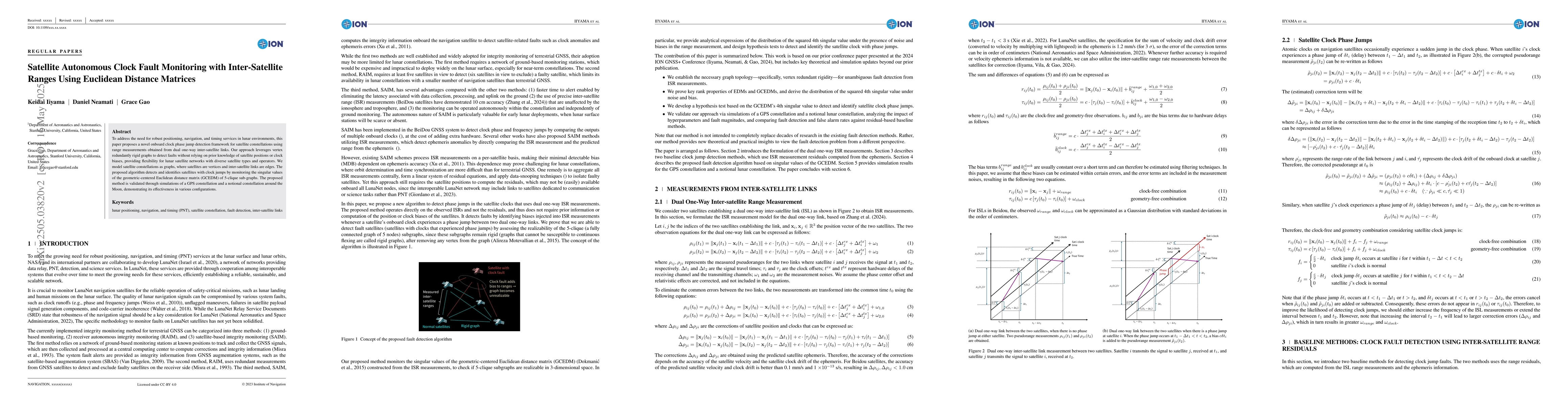
To address the need for robust positioning, navigation, and timing services in lunar and Martian environments, this paper proposes a novel fault detection framework for satellite constellations usin...
This work introduces Neural Elevations Models (NEMos), which adapt Neural Radiance Fields to a 2.5D continuous and differentiable terrain model. In contrast to traditional terrain representations su...
Optimizing the correlation properties of spreading codes is critical for minimizing inter-channel interference in satellite navigation systems. By improving the codes' correlation sidelobes, we can ...
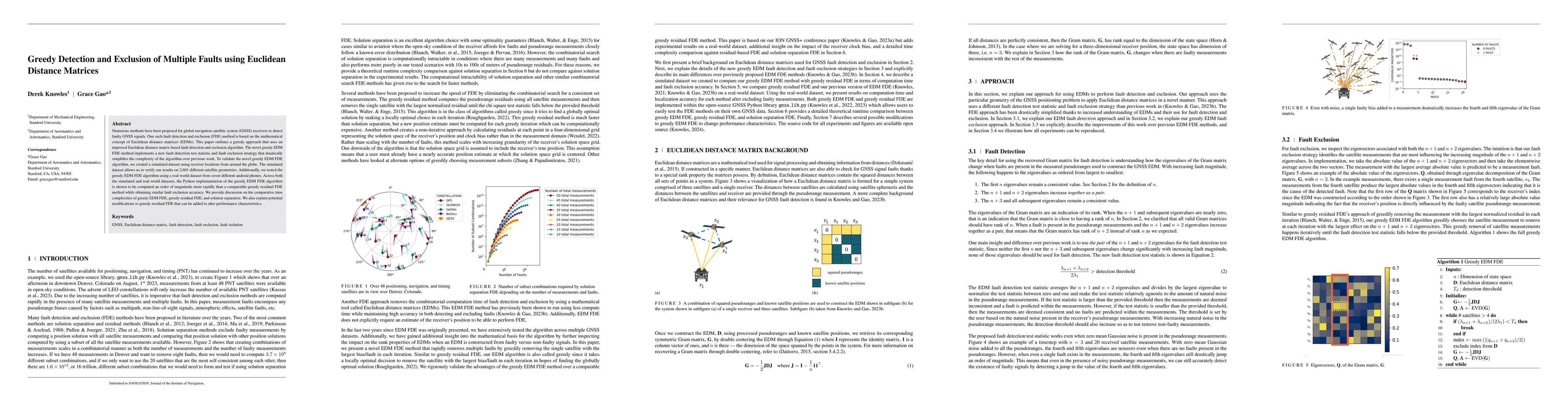
Numerous methods have been proposed for global navigation satellite system (GNSS) receivers to detect faulty GNSS signals. One such fault detection and exclusion (FDE) method is based on the mathema...
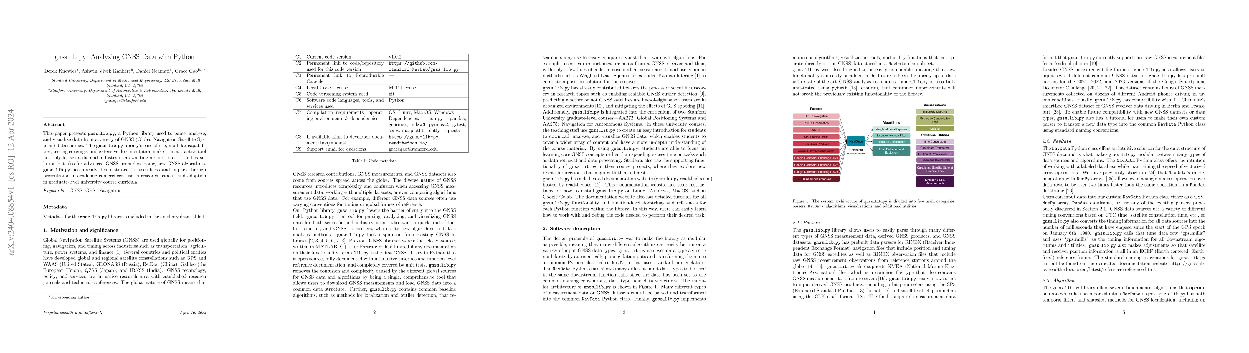
This paper presents gnss_lib_py, a Python library used to parse, analyze, and visualize data from a variety of GNSS (Global Navigation Satellite Systems) data sources. The gnss_lib_py library's ease...
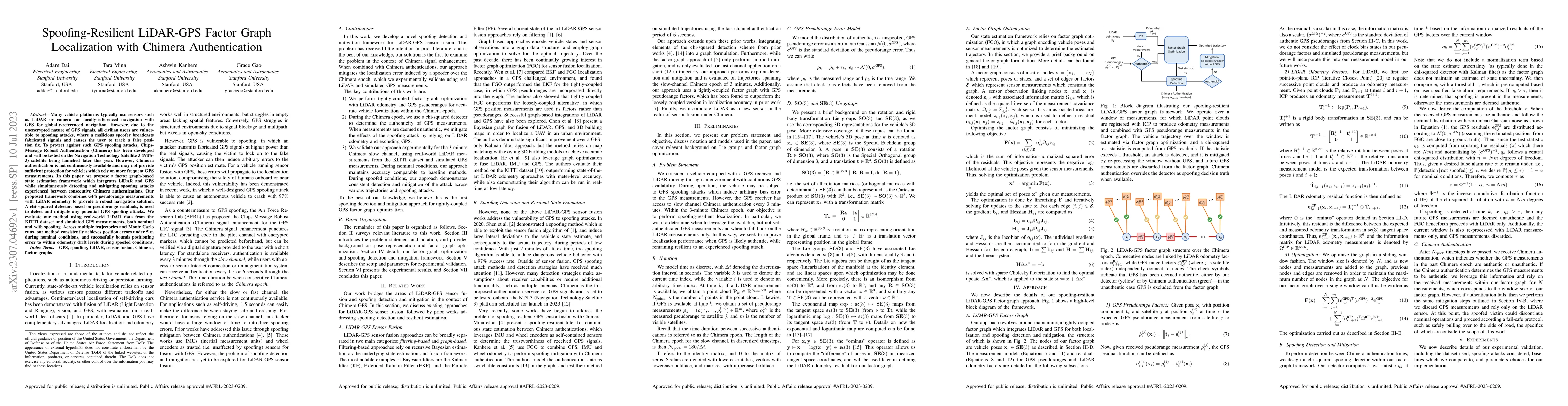
Many vehicle platforms typically use sensors such as LiDAR or camera for locally-referenced navigation with GPS for globally-referenced navigation. However, due to the unencrypted nature of GPS sign...
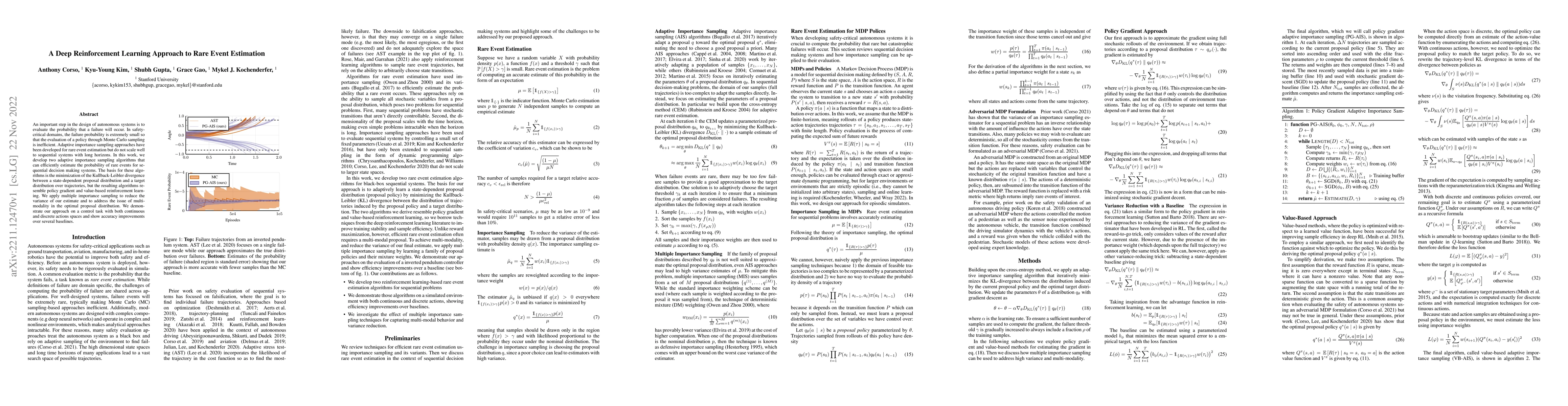
An important step in the design of autonomous systems is to evaluate the probability that a failure will occur. In safety-critical domains, the failure probability is extremely small so that the eva...
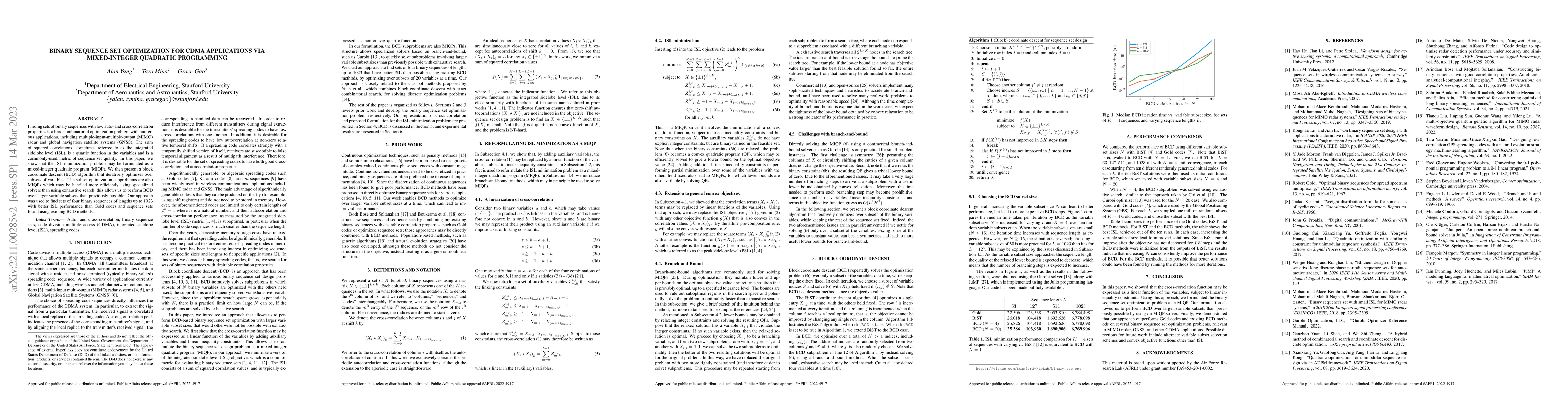
Finding sets of binary sequences with low auto- and cross-correlation properties is a hard combinatorial optimization problem with numerous applications, including multiple-input-multiple-output (MI...
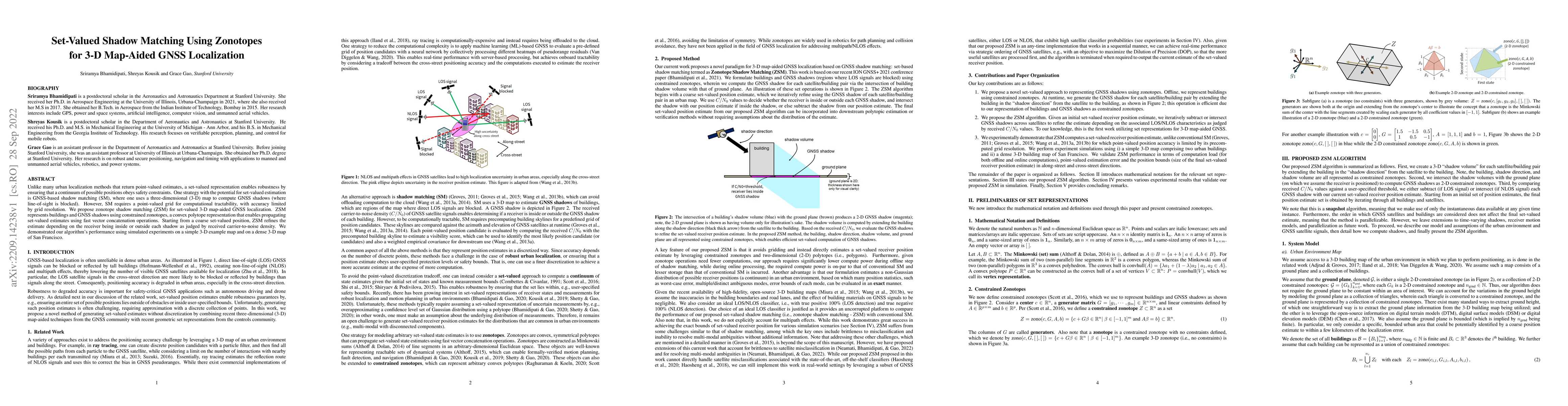
Unlike many urban localization methods that return point-valued estimates, a set-valued representation enables robustness by ensuring that a continuum of possible positions obeys safety constraints....
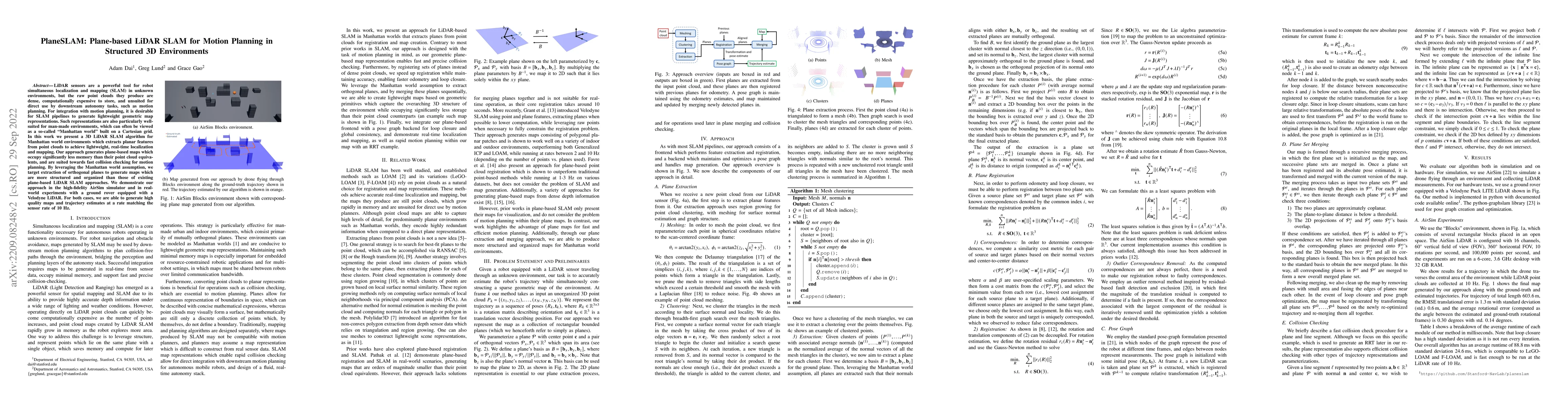
LiDAR sensors are a powerful tool for robot simultaneous localization and mapping (SLAM) in unknown environments, but the raw point clouds they produce are dense, computationally expensive to store,...
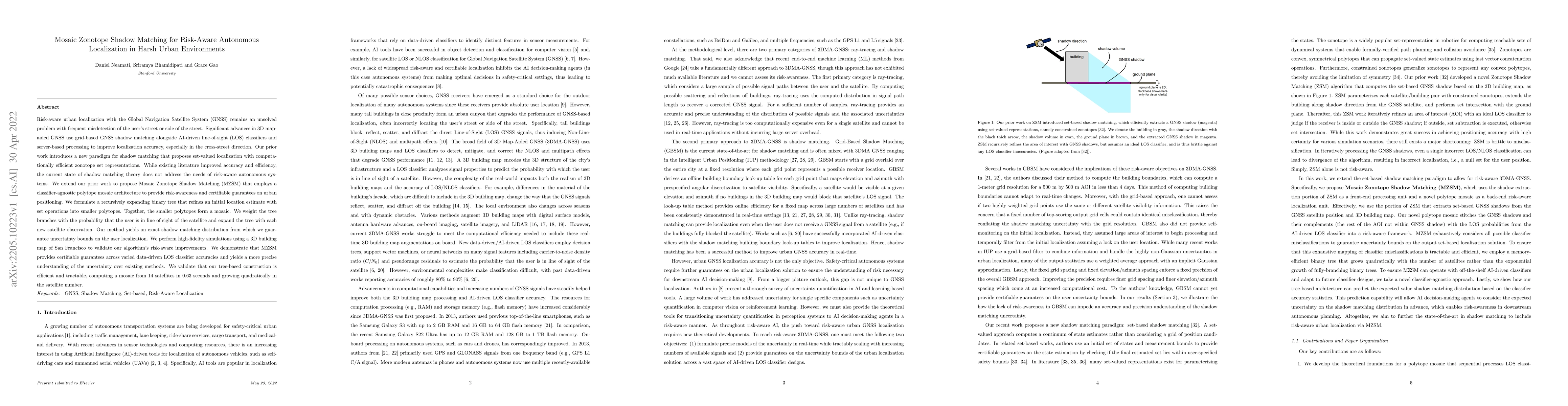
Risk-aware urban localization with the Global Navigation Satellite System (GNSS) remains an unsolved problem with frequent misdetection of the user's street or side of the street. Significant advanc...
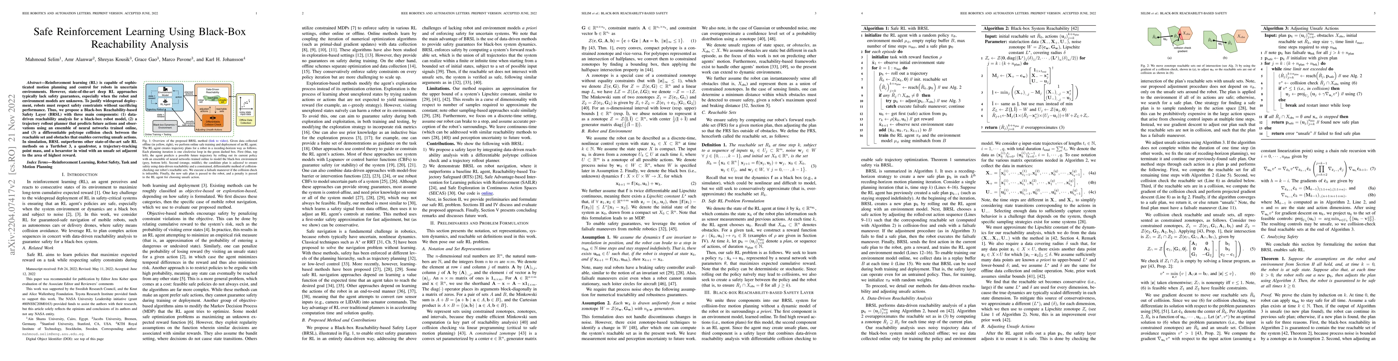
Reinforcement learning (RL) is capable of sophisticated motion planning and control for robots in uncertain environments. However, state-of-the-art deep RL approaches typically lack safety guarantee...
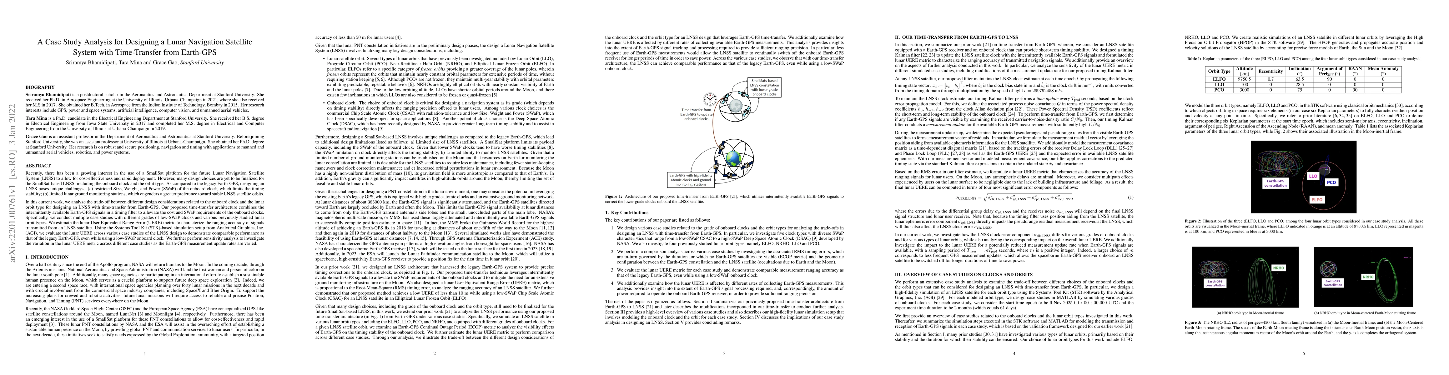
Recently, there has been a growing interest in the use of a SmallSat platform for the future Lunar Navigation Satellite System (LNSS) to allow for cost-effectiveness and rapid deployment. However, m...
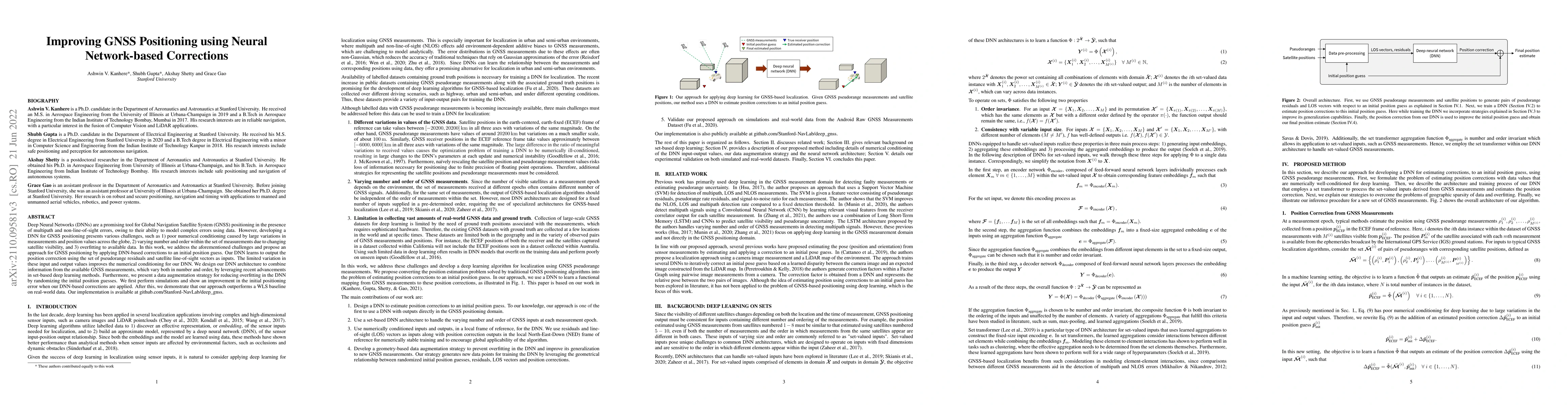
Deep Neural Networks (DNNs) are a promising tool for Global Navigation Satellite System (GNSS) positioning in the presence of multipath and non-line-of-sight errors, owing to their ability to model ...
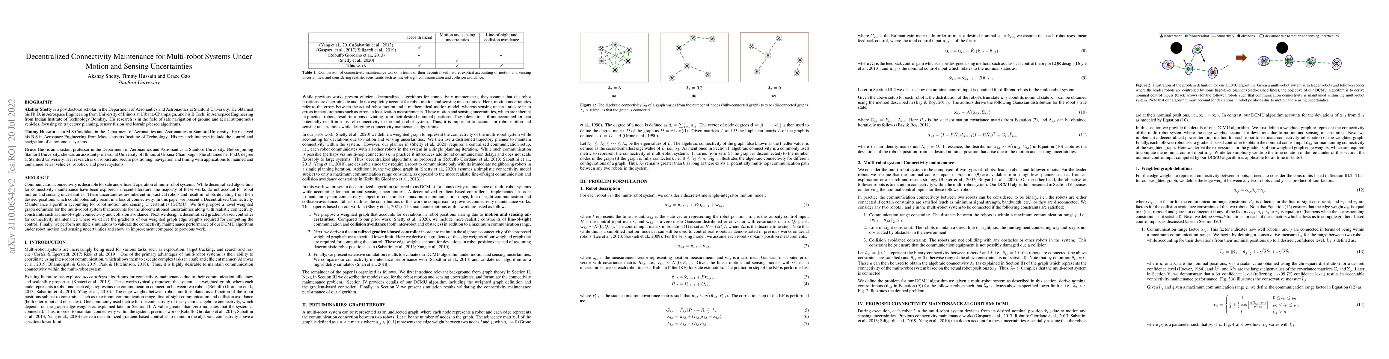
Communication connectivity is desirable for safe and efficient operation of multi-robot systems. While decentralized algorithms for connectivity maintenance have been explored in recent literature, ...
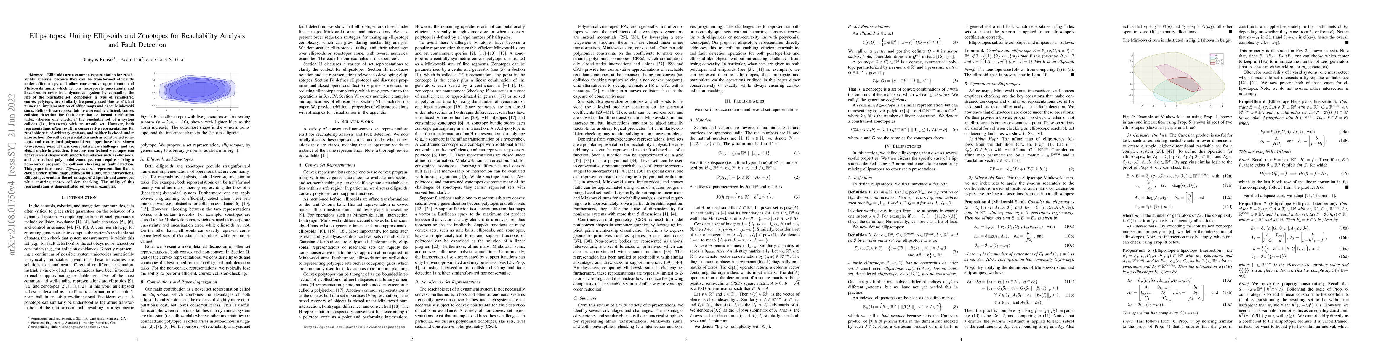
Ellipsoids are a common representation for reachability analysis, because they can be transformed efficiently under affine maps, and allow conservative approximation of Minkowski sums, which let one...
We propose a bit-flip descent method for optimizing binary spreading codes with large family sizes and long lengths, addressing the challenges of large-scale code design in GNSS and emerging PNT appli...
To address the need for robust positioning, navigation, and timing services in lunar environments, this paper proposes a novel onboard clock phase jump detection framework for satellite constellations...
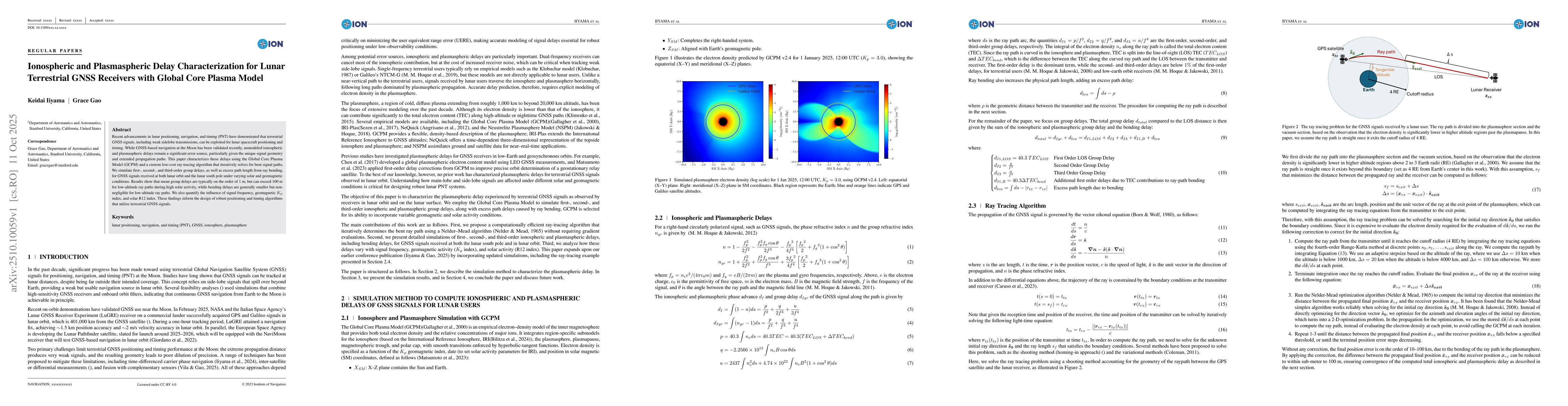
Recent advancements in lunar positioning, navigation, and timing (PNT) have demonstrated that terrestrial GNSS signals, including weak sidelobe transmissions, can be exploited for lunar spacecraft pos...

The establishment of a sustainable human presence on the Moon demands robust positioning, navigation, and timing (PNT) services capable of supporting both surface and orbital operations. This paper pr...

This paper presents almanac and ephemeris message representation for lunar navigation satellites supporting the Lunar Augmented Navigation System (LANS). The proposed method combines osculating orbita...
This paper presents a terrestrial GNSS-based orbit and clock estimation framework for lunar navigation satellites. To enable high-precision estimation under the low-observability conditions encountere...
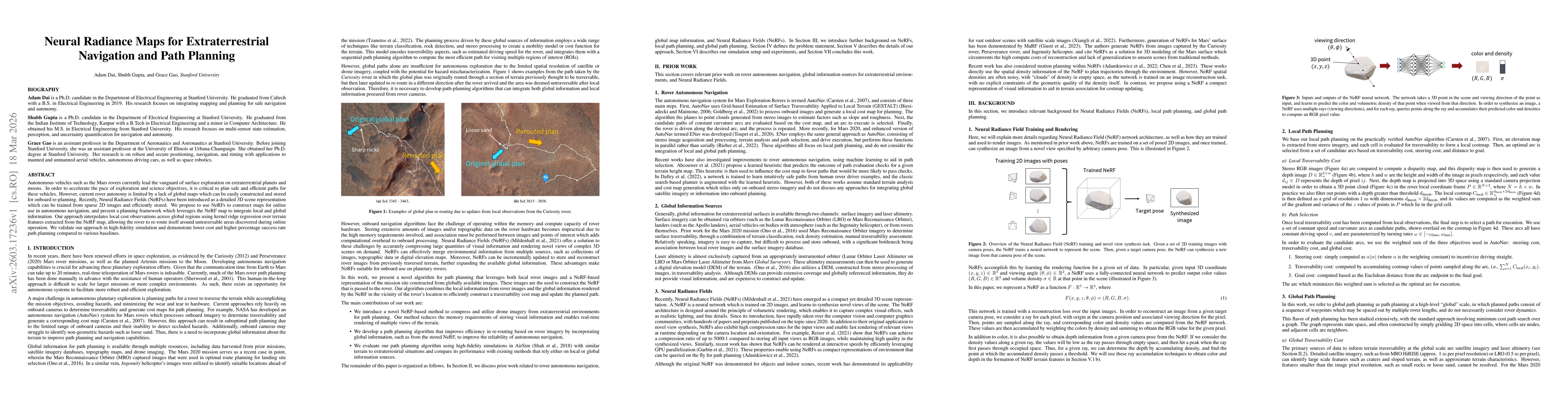
Autonomous vehicles such as the Mars rovers currently lead the vanguard of surface exploration on extraterrestrial planets and moons. In order to accelerate the pace of exploration and science objecti...
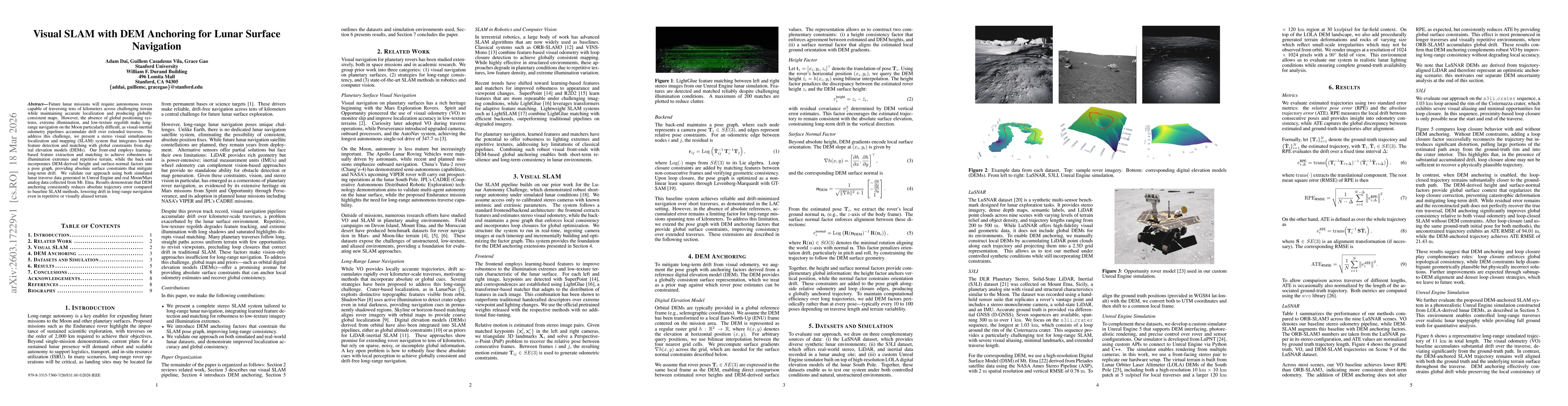
Future lunar missions will require autonomous rovers capable of traversing tens of kilometers across challenging terrain while maintaining accurate localization and producing globally consistent maps....
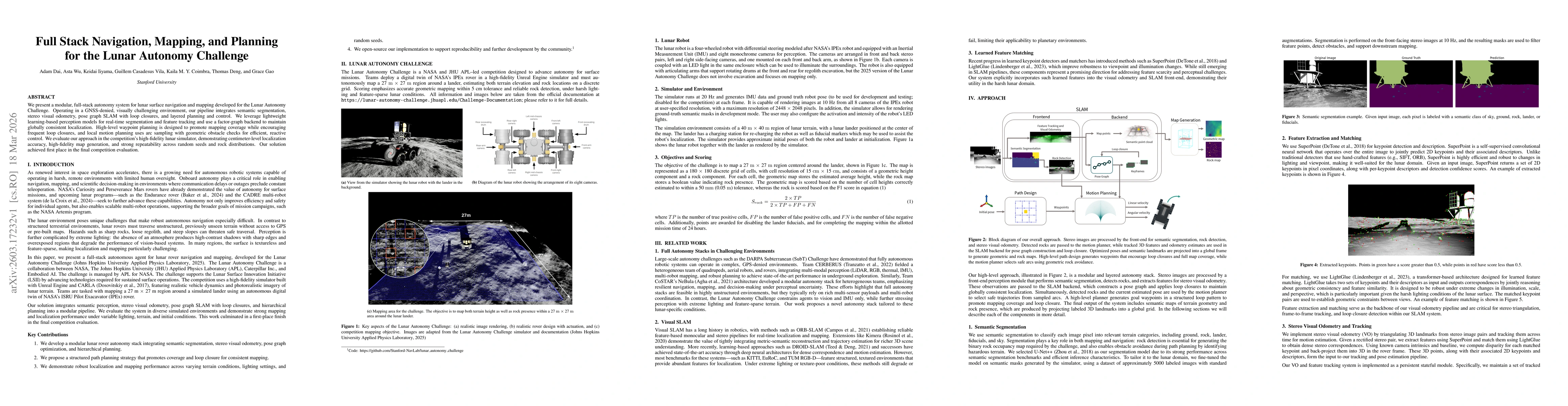
We present a modular, full-stack autonomy system for lunar surface navigation and mapping developed for the Lunar Autonomy Challenge. Operating in a GNSS-denied, visually challenging environment, our ...
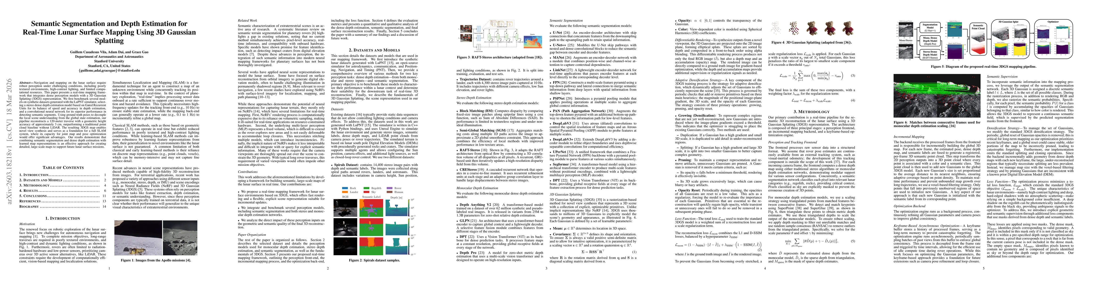
Navigation and mapping on the lunar surface require robust perception under challenging conditions, including poorly textured environments, high-contrast lighting, and limited computational resources....
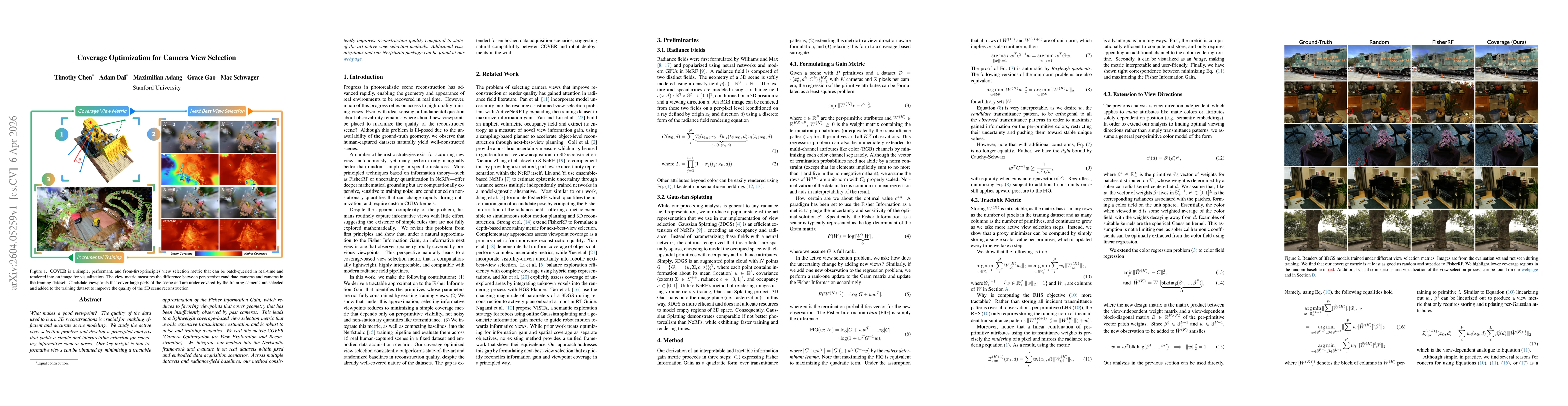
What makes a good viewpoint? The quality of the data used to learn 3D reconstructions is crucial for enabling efficient and accurate scene modeling. We study the active view selection problem and deve...