Publication
Metrics
AI Quick Summary
This paper introduces gnss_lib_py, a Python library designed for parsing, analyzing, and visualizing GNSS data, offering ease of use, modularity, and extensive documentation, with proven utility in academic research and teaching.
Paper Preview
Abstract
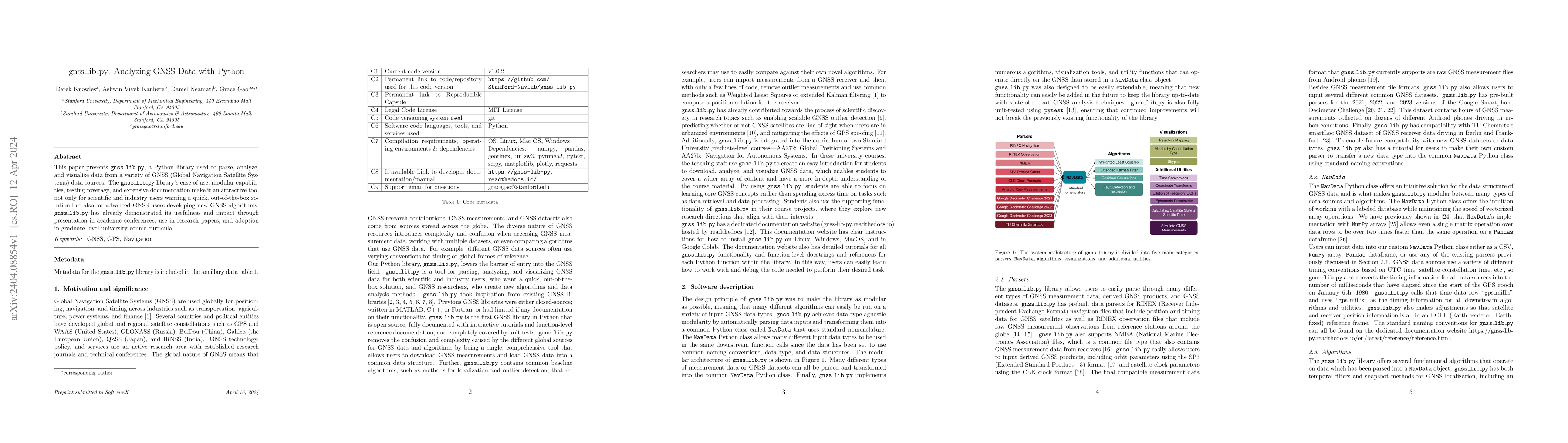
This paper presents gnss_lib_py, a Python library used to parse, analyze, and visualize data from a variety of GNSS (Global Navigation Satellite Systems) data sources. The gnss_lib_py library's ease of use, modular capabilities, testing coverage, and extensive documentation make it an attractive tool not only for scientific and industry users wanting a quick, out-of-the-box solution but also for advanced GNSS users developing new GNSS algorithms. gnss_lib_py has already demonstrated its usefulness and impact through presentation in academic conferences, use in research papers, and adoption in graduate-level university course curricula.
AI Key Findings
Get AI-generated insights about this paper's methodology, results, significance, and more — seven facets brought into focus.
Impact
Paper Details
Authors
PDF Preview
Key Terms
Citation Network
Current paper (gray), citations (green), references (blue)
Display is limited for performance on very large graphs.
Discussion 0