Academic Profile
Statistics
Similar Authors
Papers on arXiv
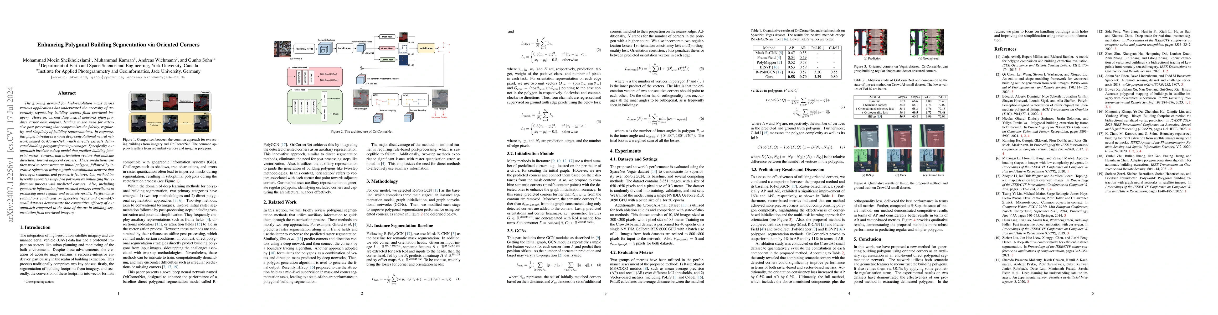
The growing demand for high-resolution maps across various applications has underscored the necessity of accurately segmenting building vectors from overhead imagery. However, current deep neural netw...
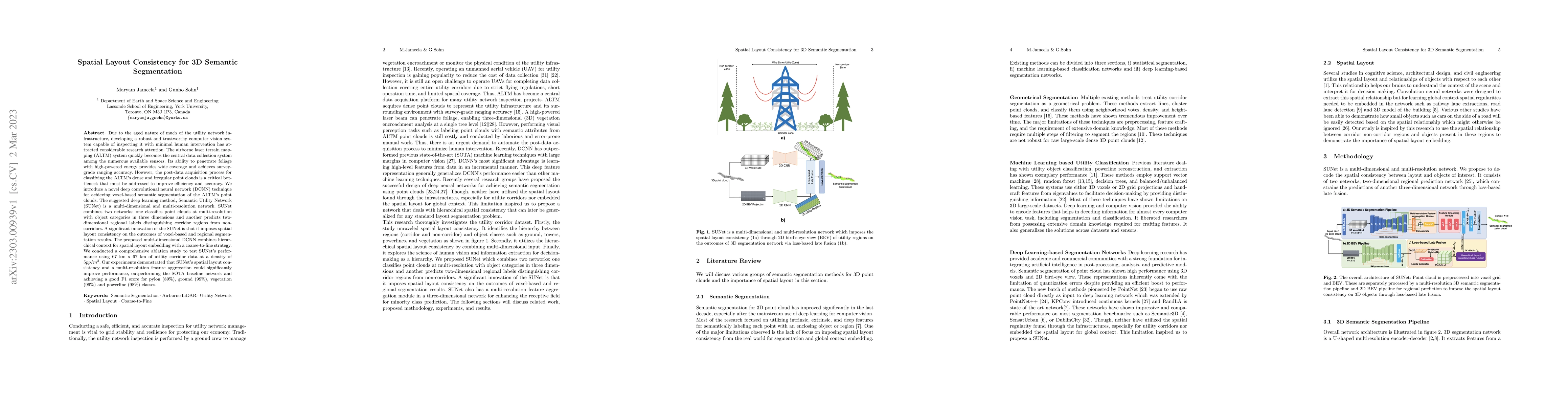
Due to the aged nature of much of the utility network infrastructure, developing a robust and trustworthy computer vision system capable of inspecting it with minimal human intervention has attracte...
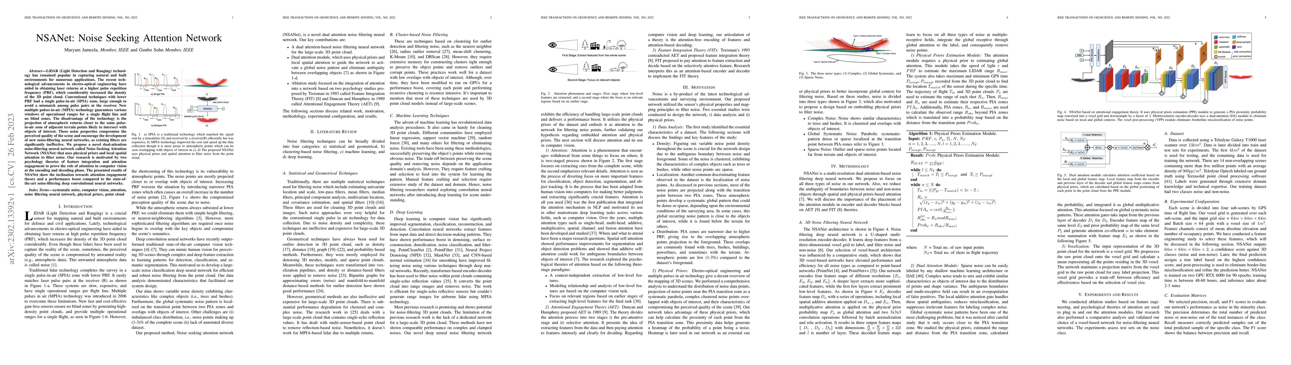
LiDAR (Light Detection and Ranging) technology has remained popular in capturing natural and built environments for numerous applications. The recent technological advancements in electro-optical en...
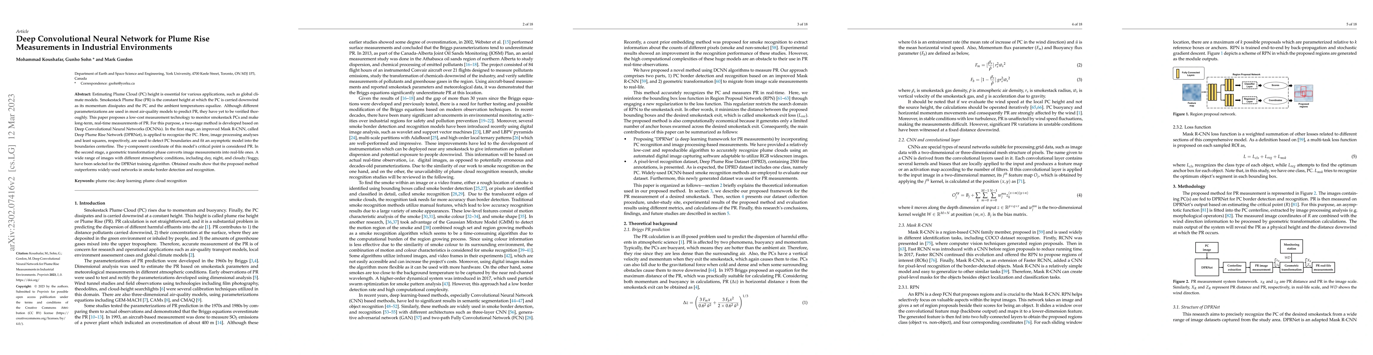
Estimating Plume Cloud (PC) height is essential for various applications, such as global climate models. Smokestack Plume Rise (PR) is the constant height at which the PC is carried downwind as its ...
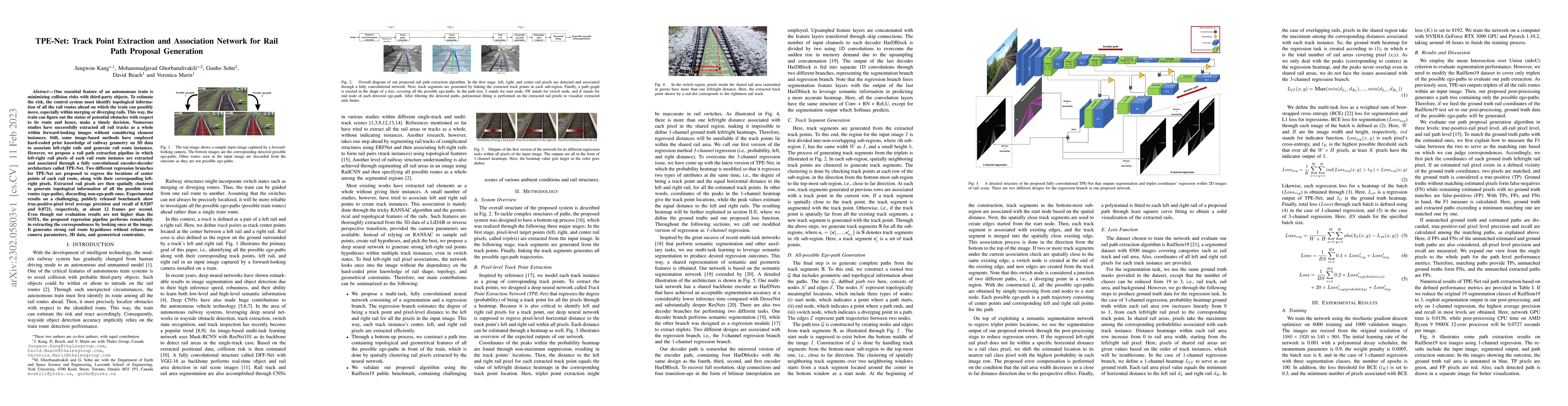
One essential feature of an autonomous train is minimizing collision risks with third-party objects. To estimate the risk, the control system must identify topological information of all the rail ro...
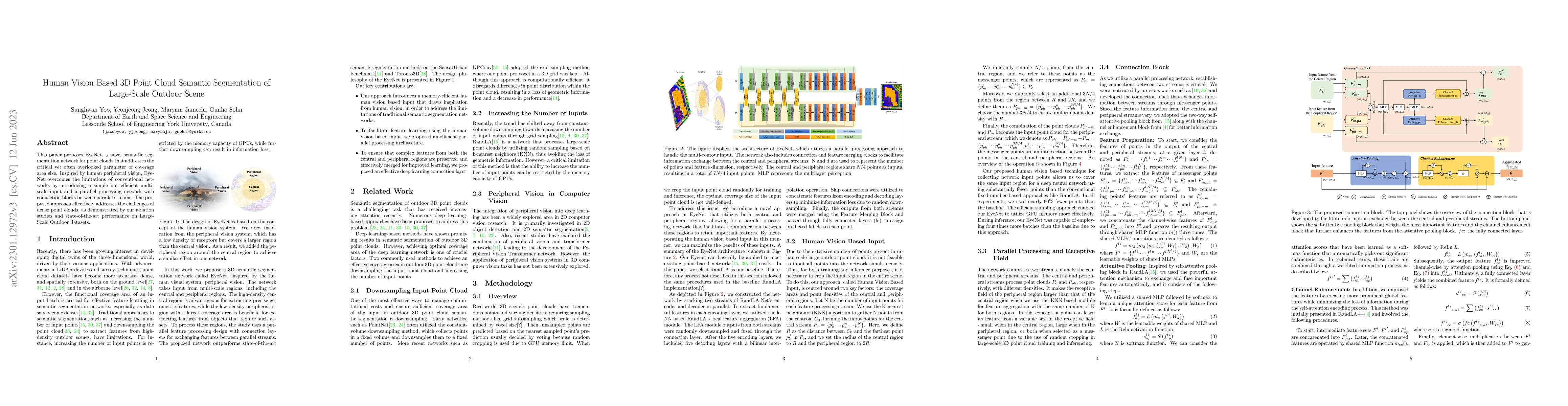
This paper proposes EyeNet, a novel semantic segmentation network for point clouds that addresses the critical yet often overlooked parameter of coverage area size. Inspired by human peripheral visi...
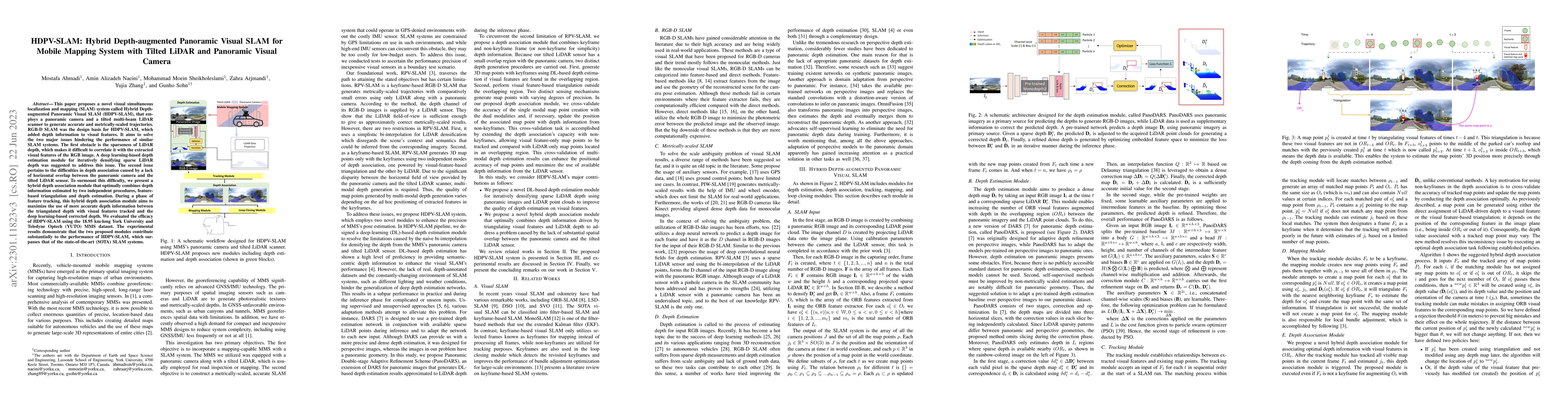
This paper proposes a novel visual simultaneous localization and mapping (SLAM) system called Hybrid Depth-augmented Panoramic Visual SLAM (HDPV-SLAM), that employs a panoramic camera and a tilted m...
In recent years, an ever-increasing number of remote satellites are orbiting the Earth which streams vast amount of visual data to support a wide range of civil, public and military applications. On...
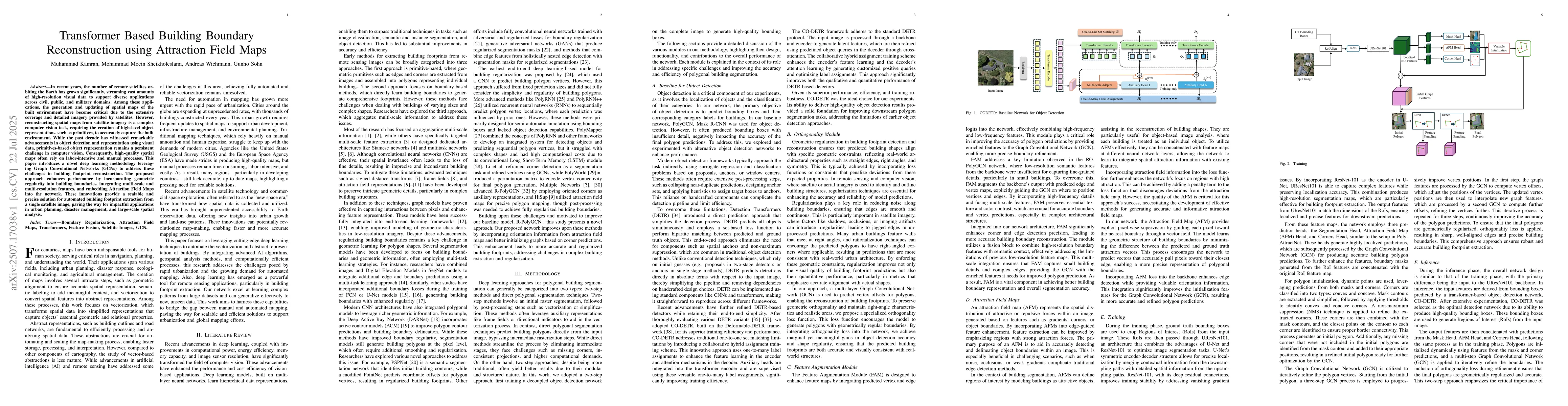
In recent years, the number of remote satellites orbiting the Earth has grown significantly, streaming vast amounts of high-resolution visual data to support diverse applications across civil, public,...
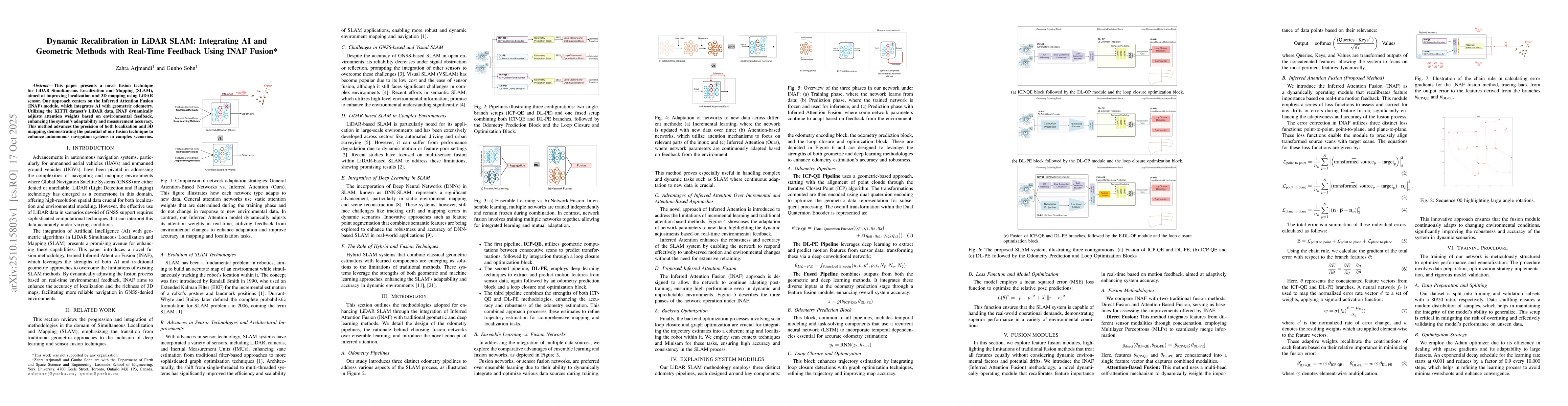
This paper presents a novel fusion technique for LiDAR Simultaneous Localization and Mapping (SLAM), aimed at improving localization and 3D mapping using LiDAR sensor. Our approach centers on the Infe...