Academic Profile
Statistics
Similar Authors
Papers on arXiv
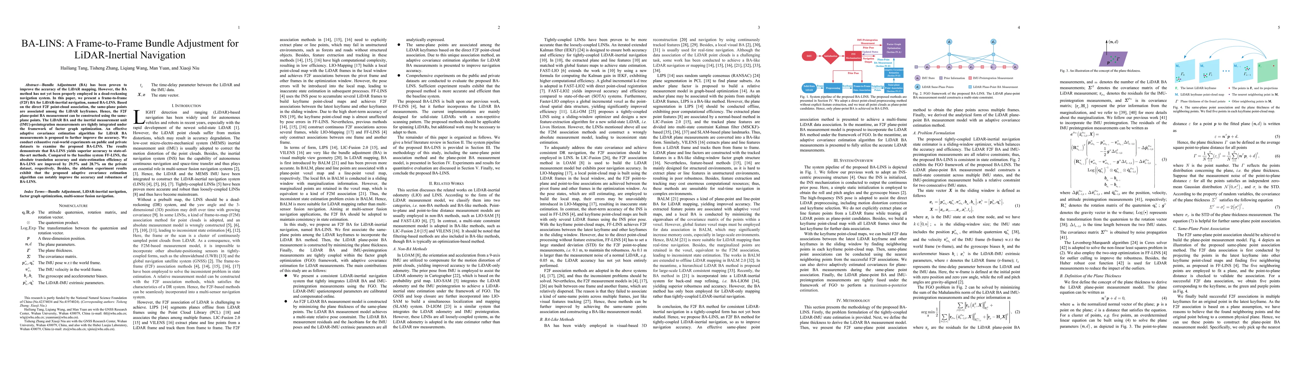
Bundle Adjustment (BA) has been proven to improve the accuracy of the LiDAR mapping. However, the BA method has not yet been properly employed in a dead-reckoning navigation system. In this paper, w...
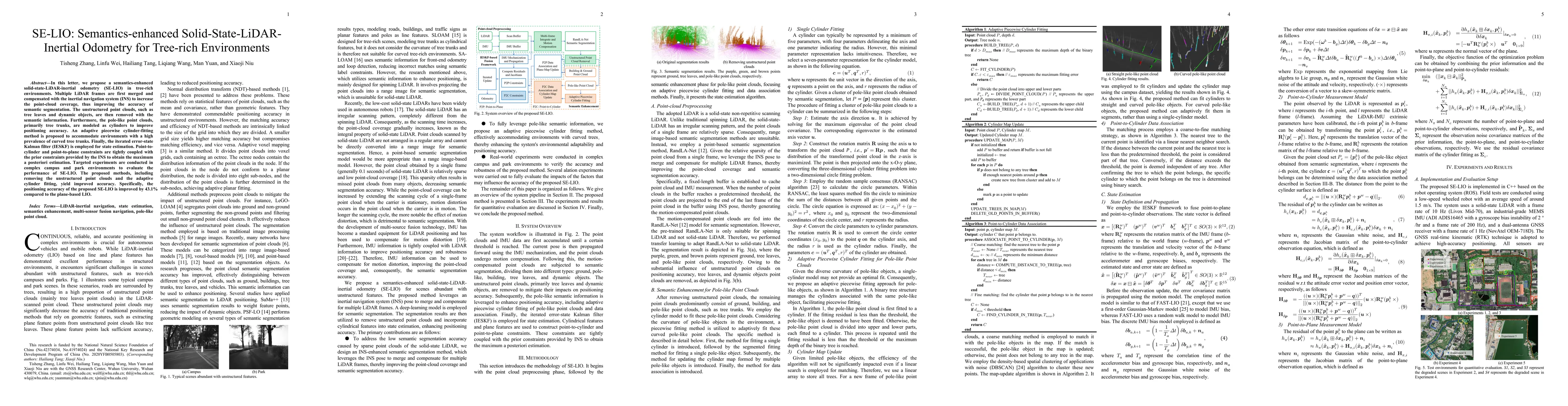
In this letter, we propose a semantics-enhanced solid-state-LiDAR-inertial odometry (SE-LIO) in tree-rich environments. Multiple LiDAR frames are first merged and compensated with the inertial navig...
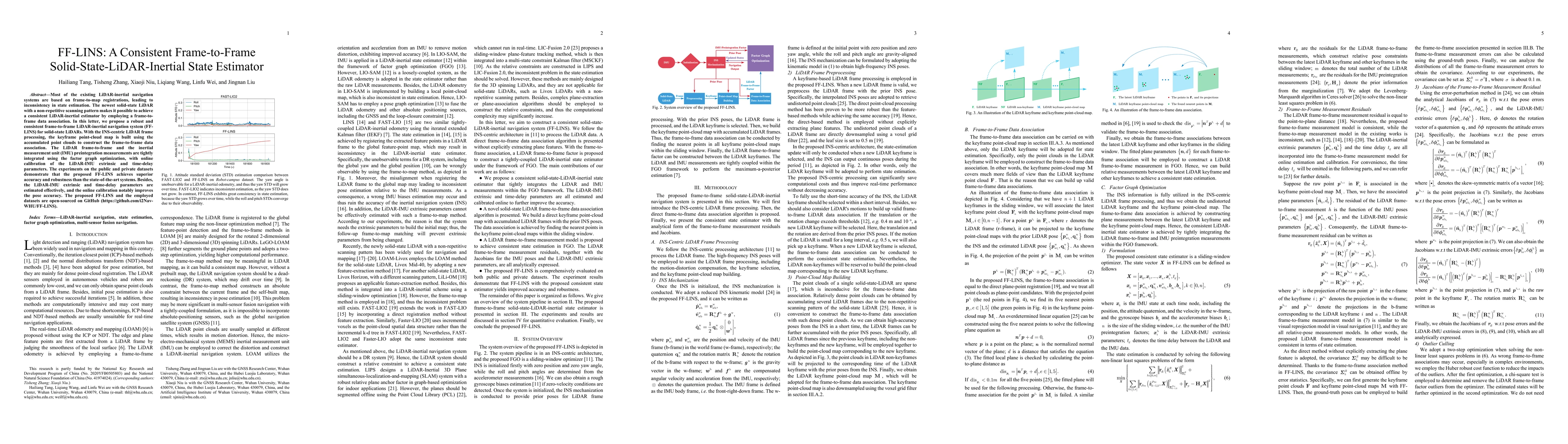
Most of the existing LiDAR-inertial navigation systems are based on frame-to-map registrations, leading to inconsistency in state estimation. The newest solid-state LiDAR with a non-repetitive scann...
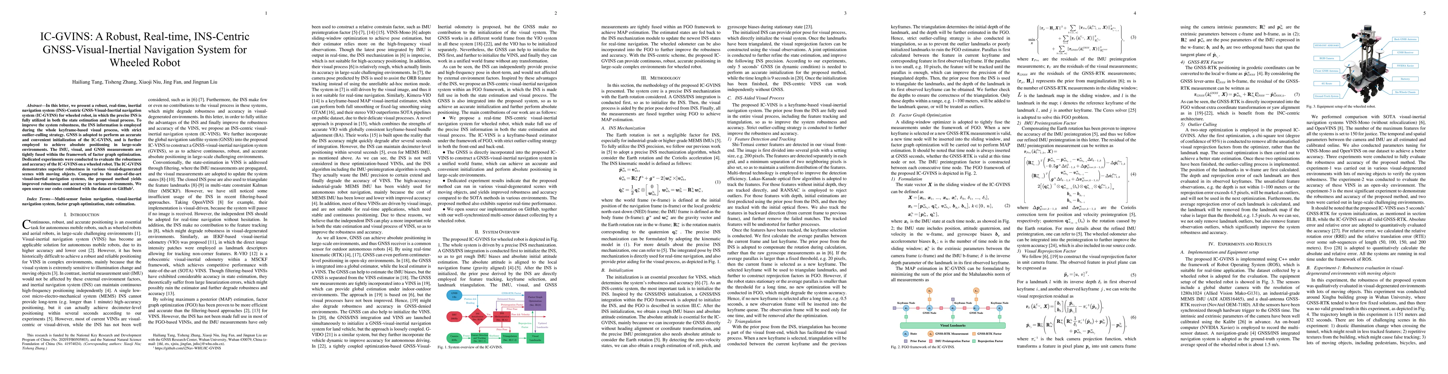
In this letter, we present a robust, real-time, inertial navigation system (INS)-Centric GNSS-Visual-Inertial navigation system (IC-GVINS) for wheeled robot, in which the precise INS is fully utiliz...
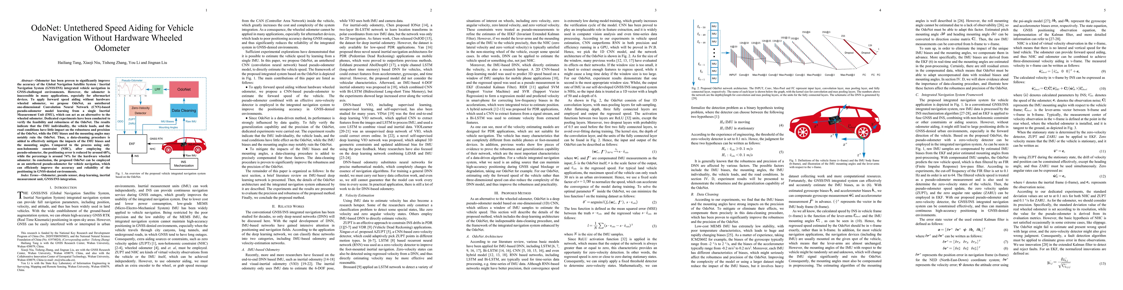
Odometer has been proven to significantly improve the accuracy of the Global Navigation Satellite System / Inertial Navigation System (GNSS/INS) integrated vehicle navigation in GNSS-challenged envi...
Inertial measurement unit (IMU) preintegration is widely used in factor graph optimization (FGO); e.g., in visual-inertial navigation system and global navigation satellite system/inertial navigatio...
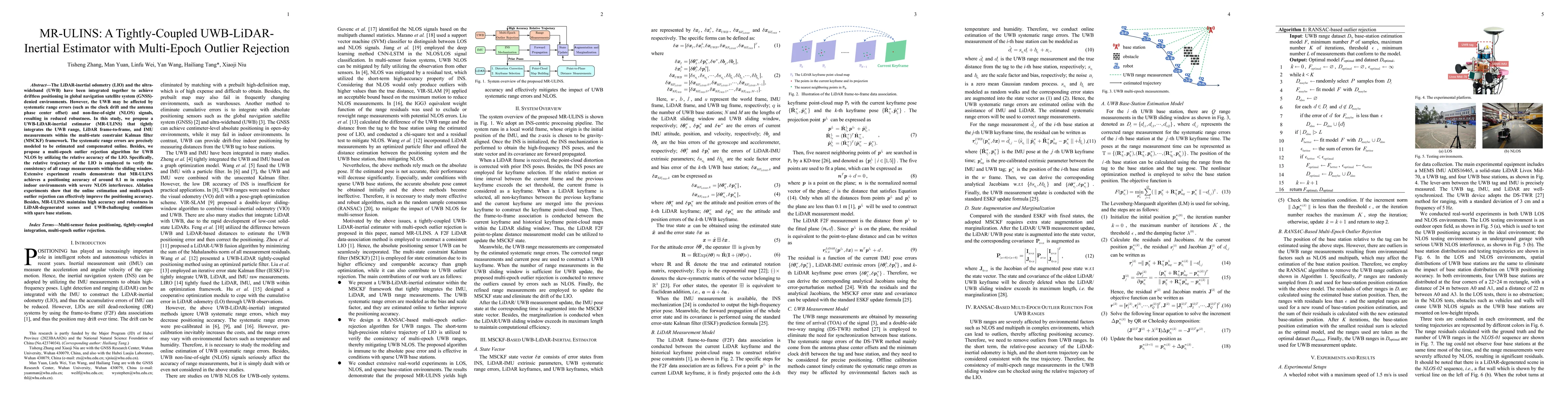
The LiDAR-inertial odometry (LIO) and the ultra-wideband (UWB) have been integrated together to achieve driftless positioning in global navigation satellite system (GNSS)-denied environments. However,...
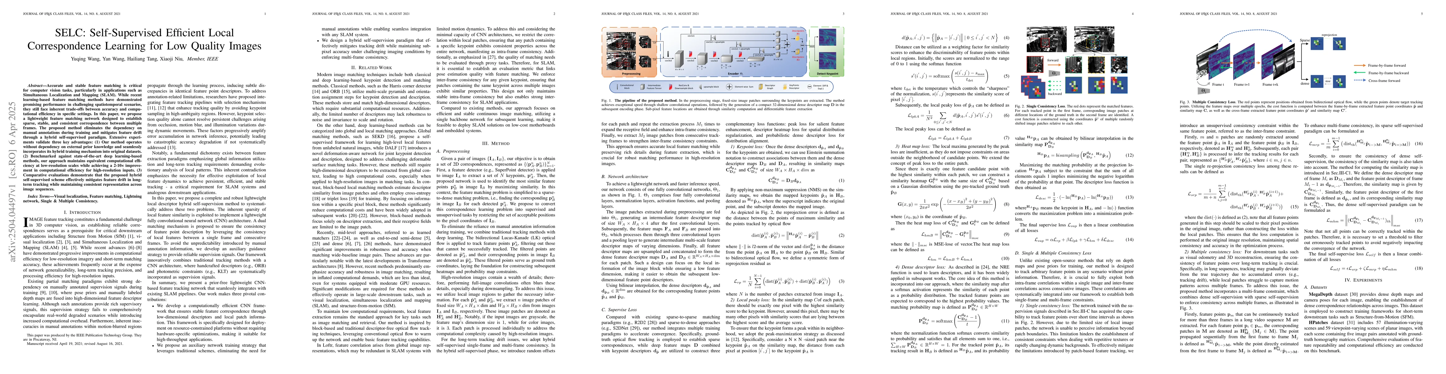
Accurate and stable feature matching is critical for computer vision tasks, particularly in applications such as Simultaneous Localization and Mapping (SLAM). While recent learning-based feature match...
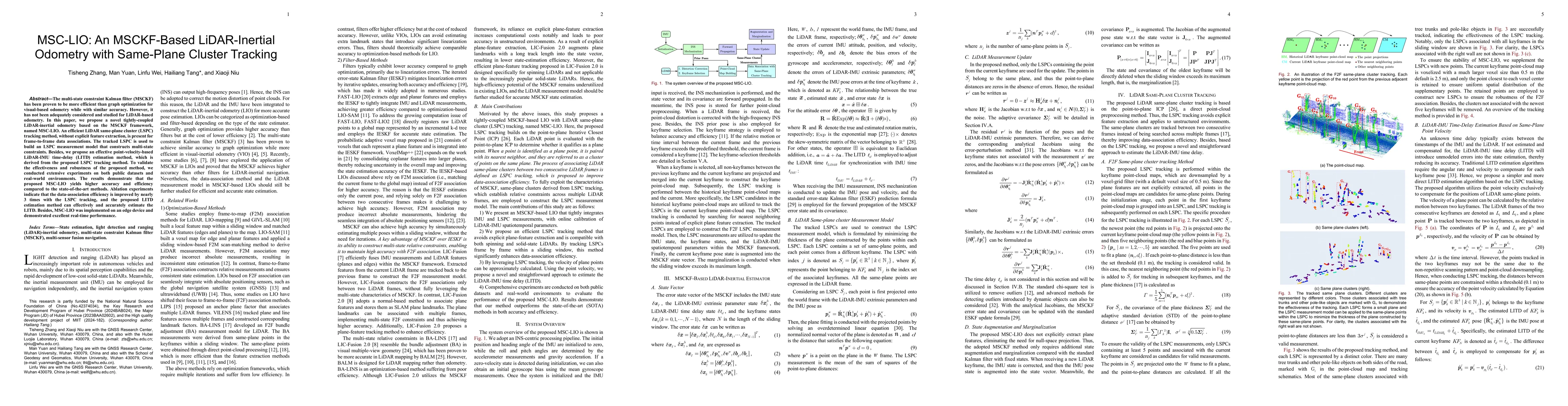
The multi-state constraint Kalman filter (MSCKF) has been proven to be more efficient than graph optimization for visual-based odometry while with similar accuracy. However, it has not been adequately...
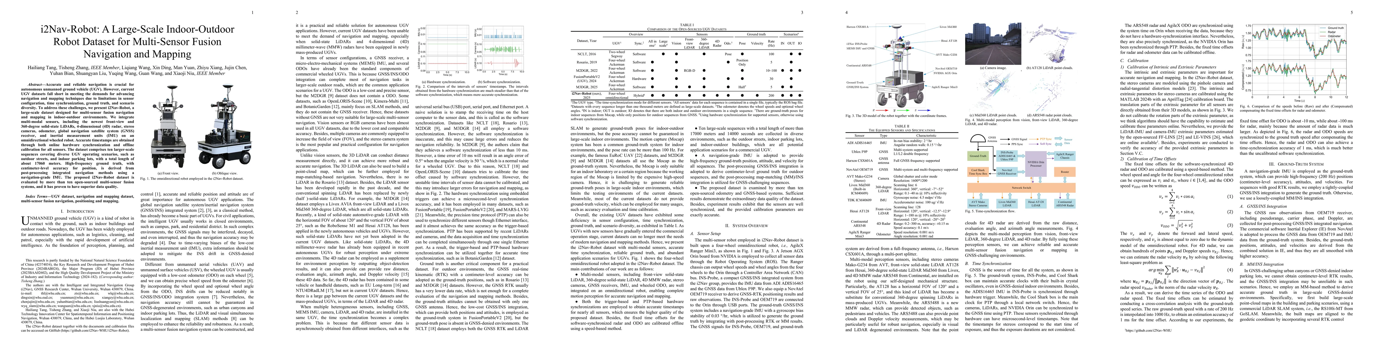
Accurate and reliable navigation is crucial for autonomous unmanned ground vehicle (UGV). However, current UGV datasets fall short in meeting the demands for advancing navigation and mapping technique...
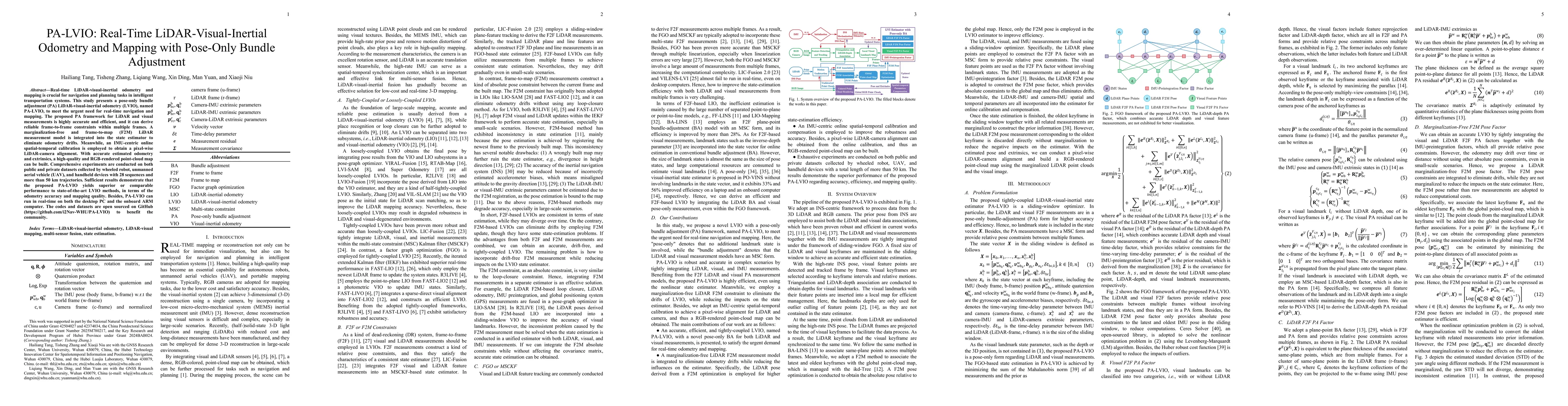
Real-time LiDAR-visual-inertial odometry and mapping is crucial for navigation and planning tasks in intelligent transportation systems. This study presents a pose-only bundle adjustment (PA) LiDAR-vi...
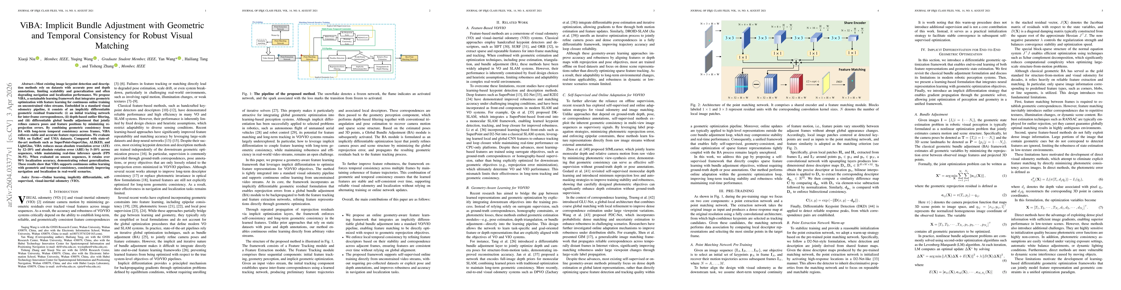
Most existing image keypoint detection and description methods rely on datasets with accurate pose and depth annotations, limiting scalability and generalization, and often degrading navigation and lo...