Academic Profile
Statistics
Similar Authors
Papers on arXiv
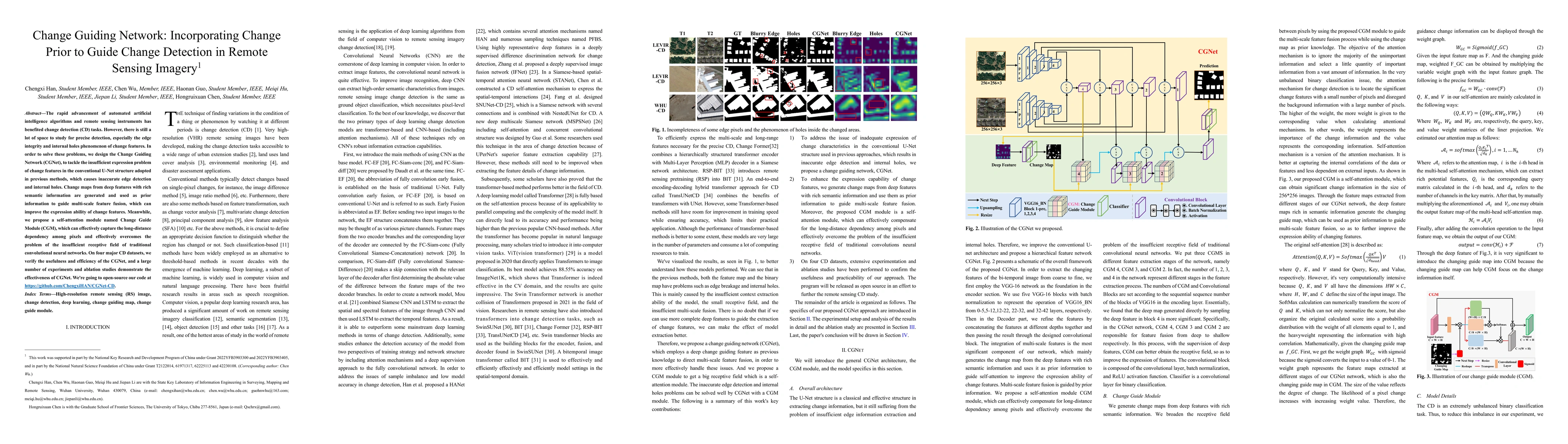
The rapid advancement of automated artificial intelligence algorithms and remote sensing instruments has benefited change detection (CD) tasks. However, there is still a lot of space to study for pr...
Benefiting from the developments in deep learning technology, deep-learning-based algorithms employing automatic feature extraction have achieved remarkable performance on the change detection (CD) ...
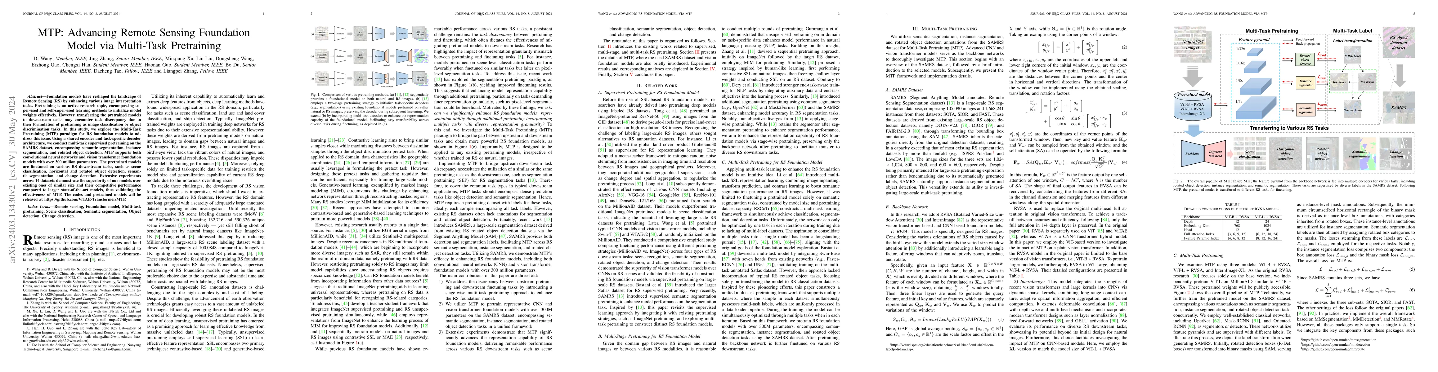
Foundation models have reshaped the landscape of Remote Sensing (RS) by enhancing various image interpretation tasks. Pretraining is an active research topic, encompassing supervised and self-superv...
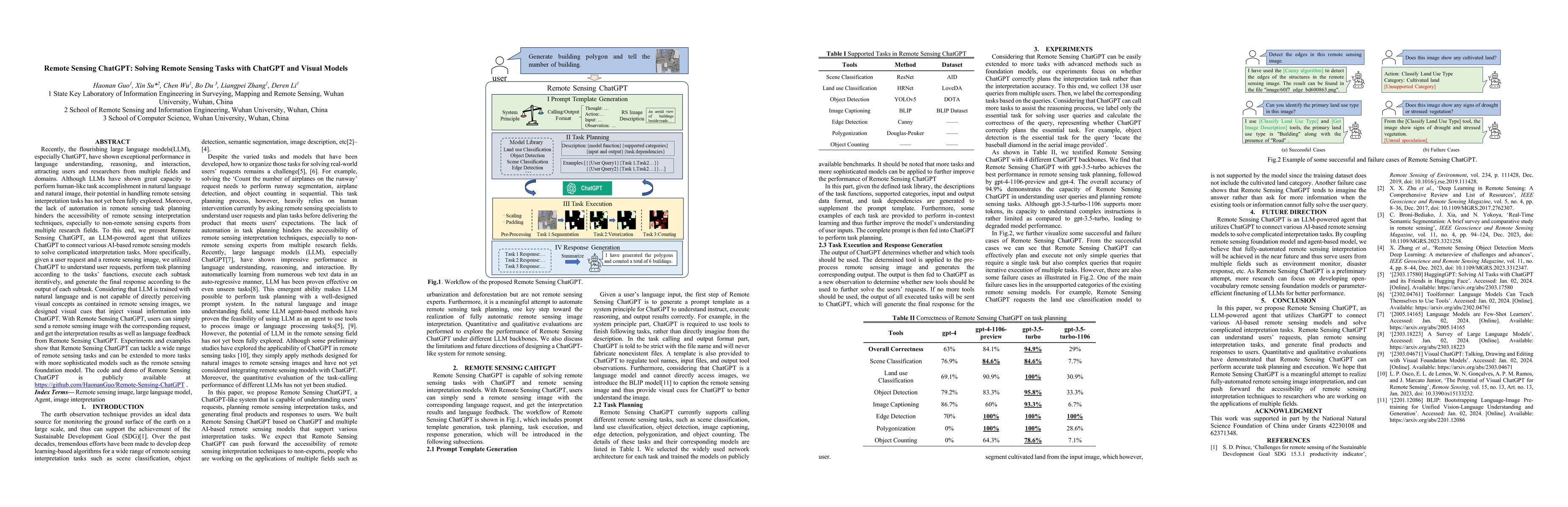
Recently, the flourishing large language models(LLM), especially ChatGPT, have shown exceptional performance in language understanding, reasoning, and interaction, attracting users and researchers f...
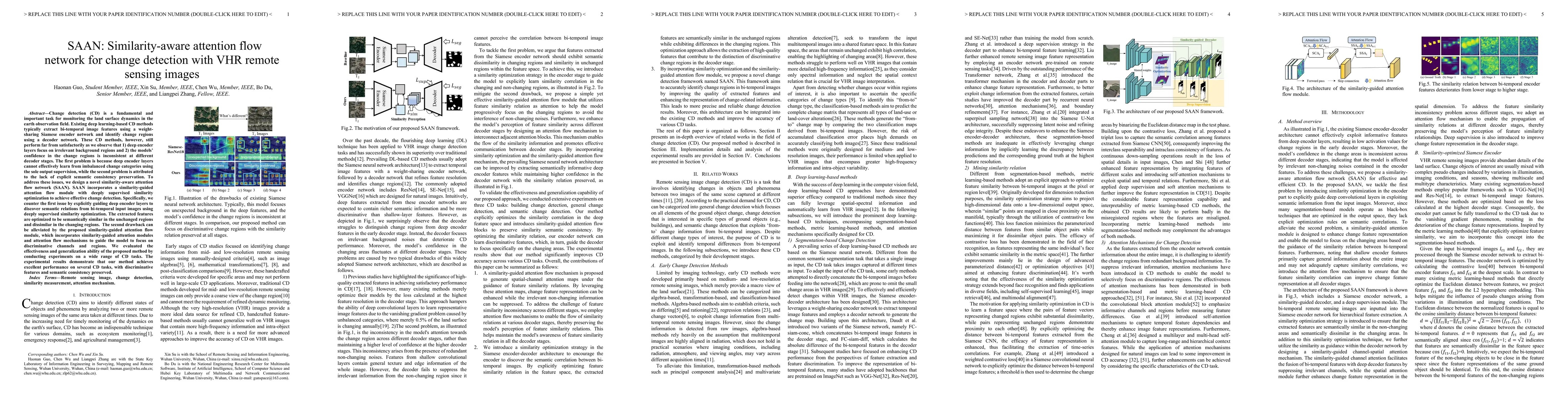
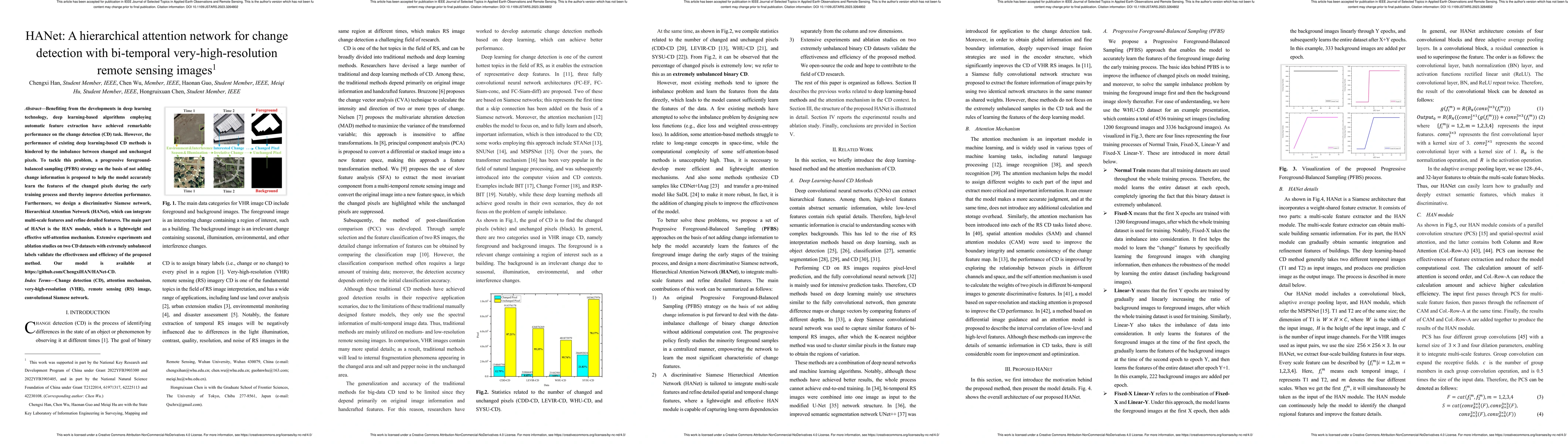
Change detection (CD) is a fundamental and important task for monitoring the land surface dynamics in the earth observation field. Existing deep learning-based CD methods typically extract bi-tempor...
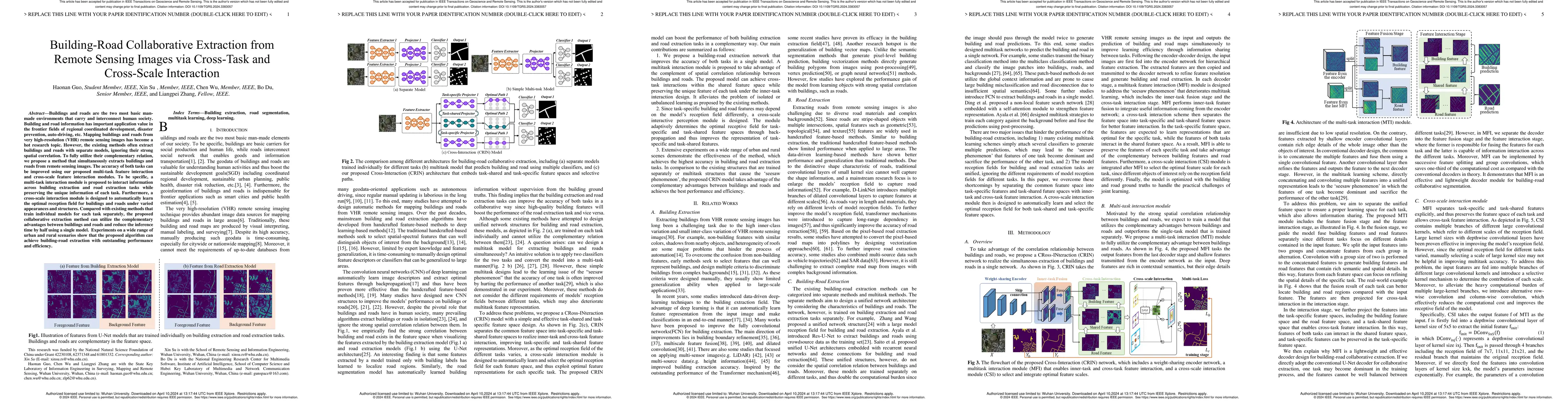
Buildings are the basic carrier of social production and human life; roads are the links that interconnect social networks. Building and road information has important application value in the front...
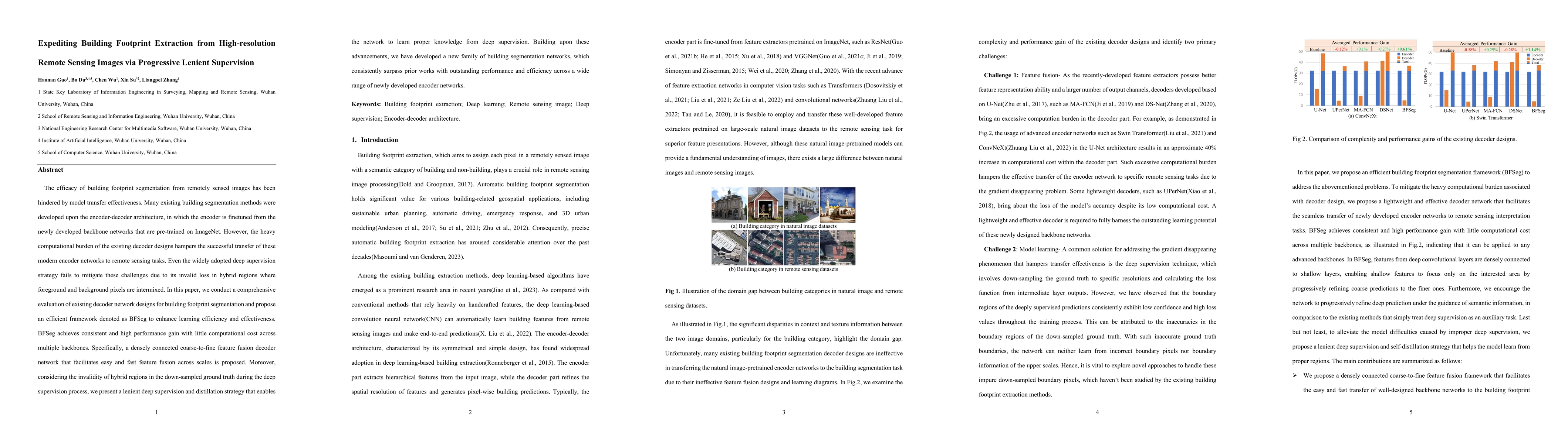
The efficacy of building footprint segmentation from remotely sensed images has been hindered by model transfer effectiveness. Many existing building segmentation methods were developed upon the enc...
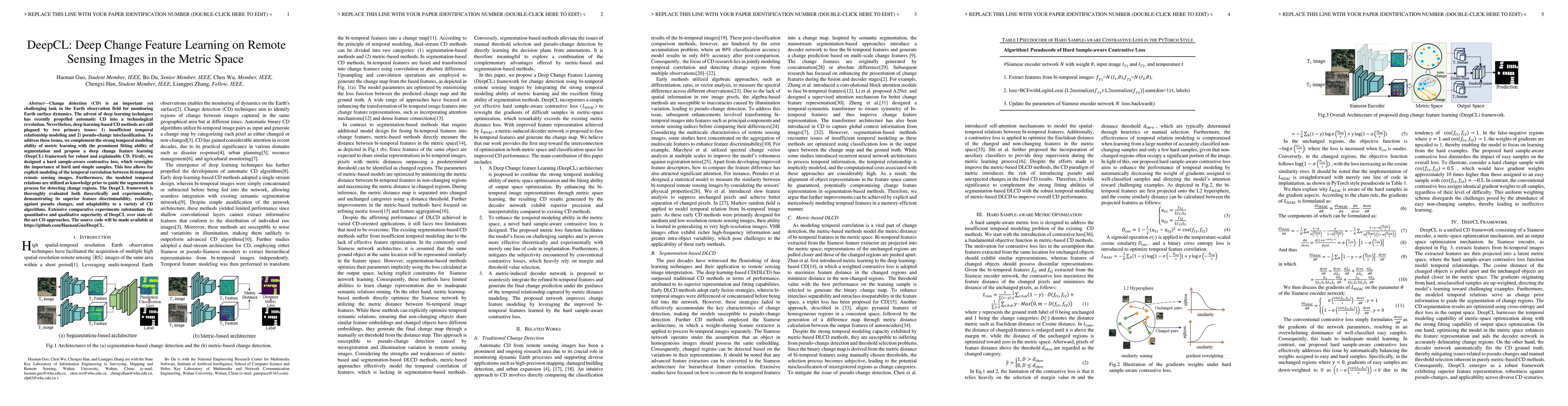
Change detection (CD) is an important yet challenging task in the Earth observation field for monitoring Earth surface dynamics. The advent of deep learning techniques has recently propelled automat...
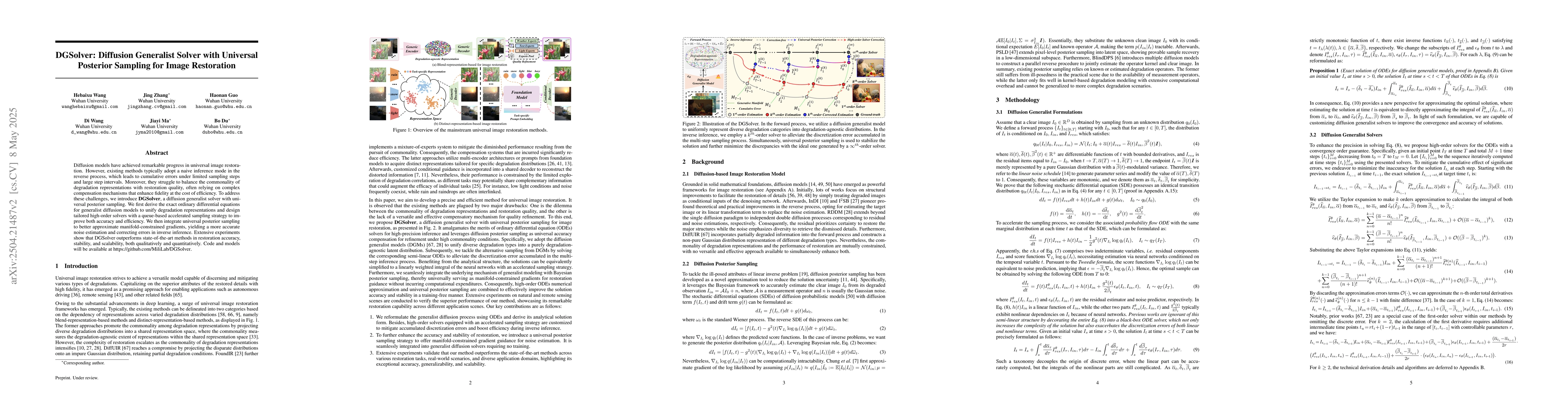
Diffusion models have achieved remarkable progress in universal image restoration. While existing methods speed up inference by reducing sampling steps, substantial step intervals often introduce cumu...
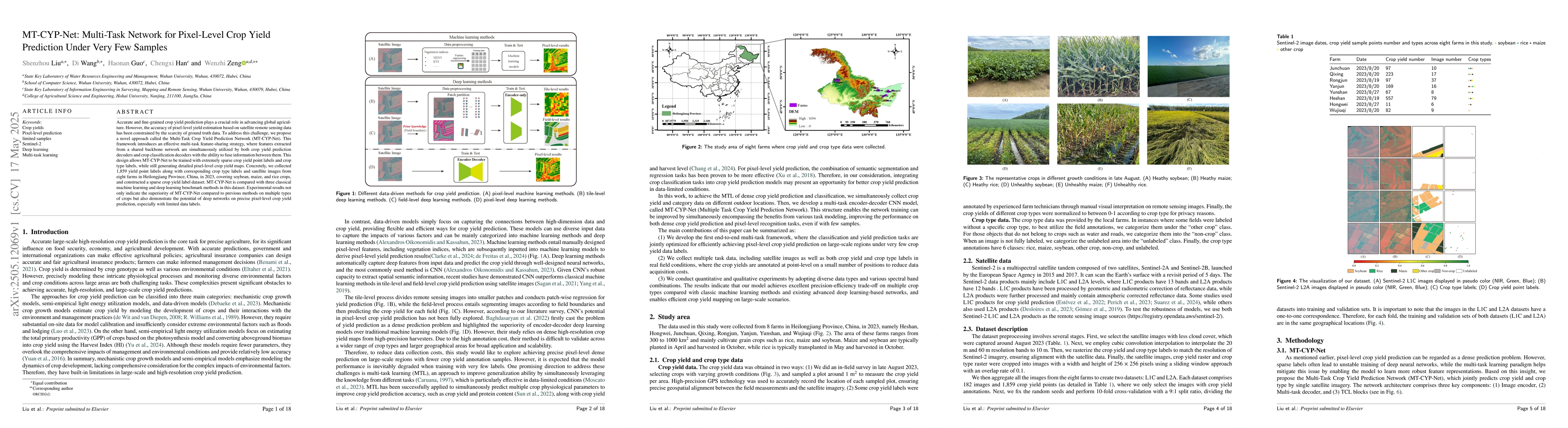
Accurate and fine-grained crop yield prediction plays a crucial role in advancing global agriculture. However, the accuracy of pixel-level yield estimation based on satellite remote sensing data has b...
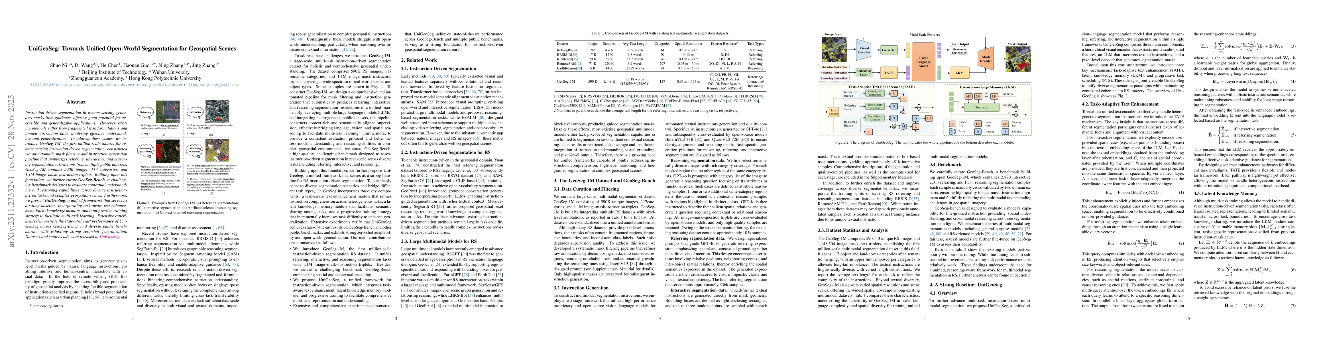
Instruction-driven segmentation in remote sensing generates masks from guidance, offering great potential for accessible and generalizable applications. However, existing methods suffer from fragmente...
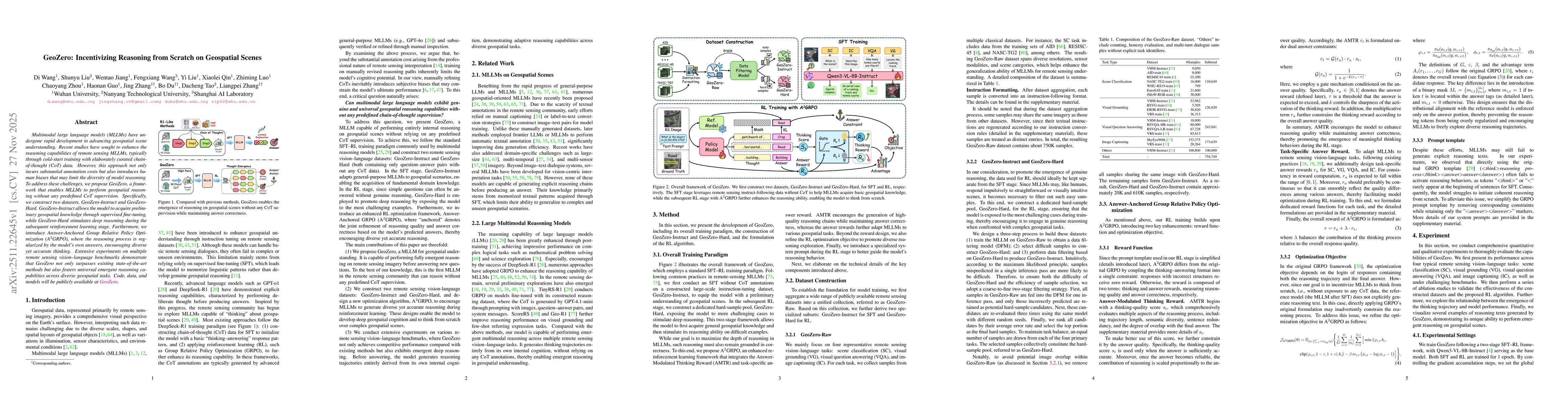
Multimodal large language models (MLLMs) have undergone rapid development in advancing geospatial scene understanding. Recent studies have sought to enhance the reasoning capabilities of remote sensin...
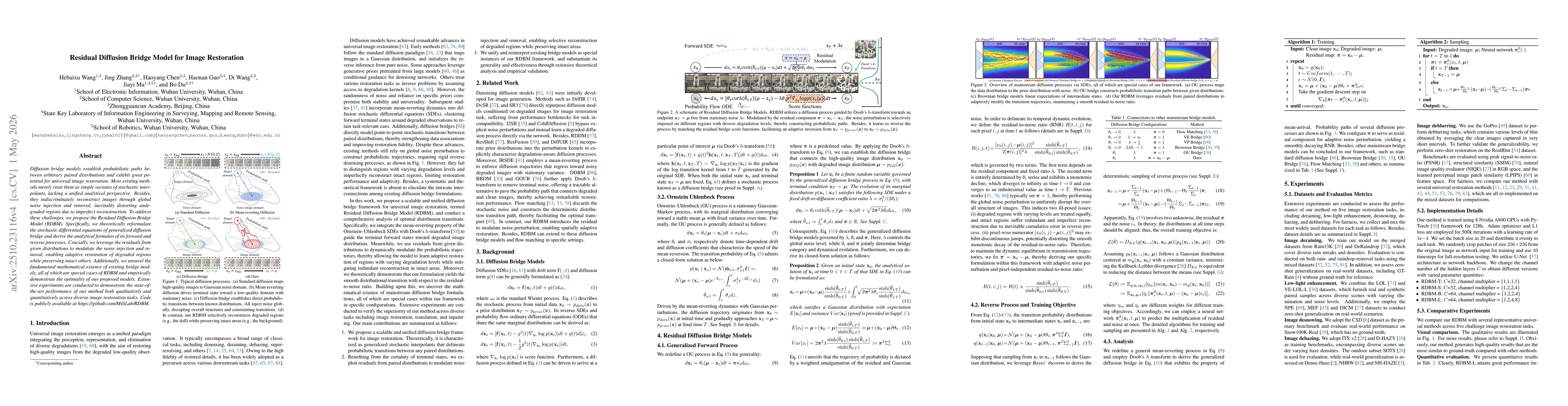
Diffusion bridge models establish probabilistic paths between arbitrary paired distributions and exhibit great potential for universal image restoration. Most existing methods merely treat them as sim...
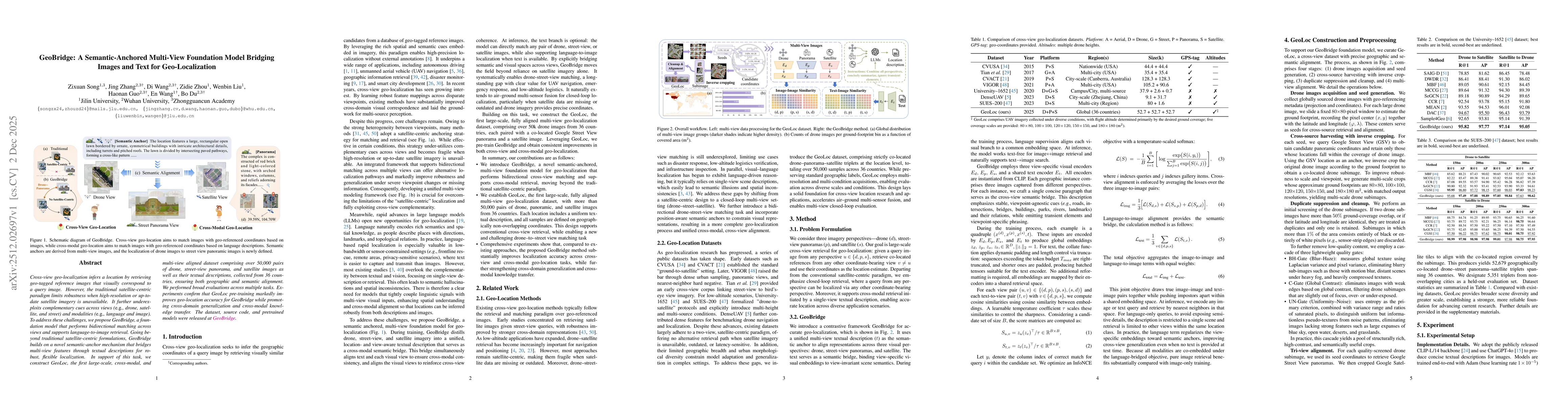
Cross-view geo-localization infers a location by retrieving geo-tagged reference images that visually correspond to a query image. However, the traditional satellite-centric paradigm limits robustness...

Synthetic Aperture Radar (SAR) imagery plays a critical role in all-weather, day-and-night remote sensing applications. However, existing SAR-oriented deep learning is constrained by data scarcity, wh...
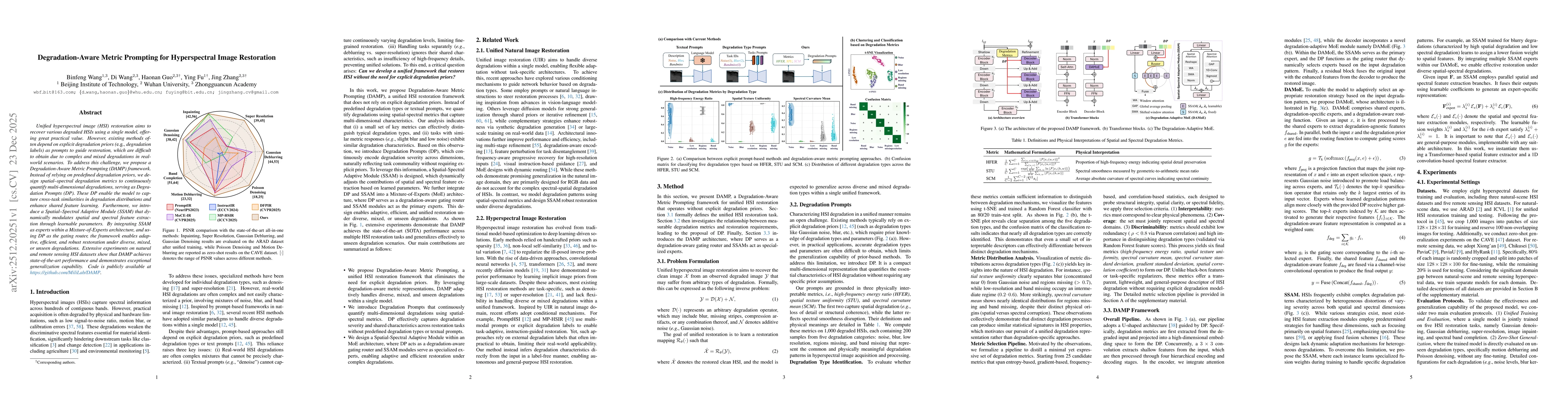
Unified hyperspectral image (HSI) restoration aims to recover various degraded HSIs using a single model, offering great practical value. However, existing methods often depend on explicit degradation...
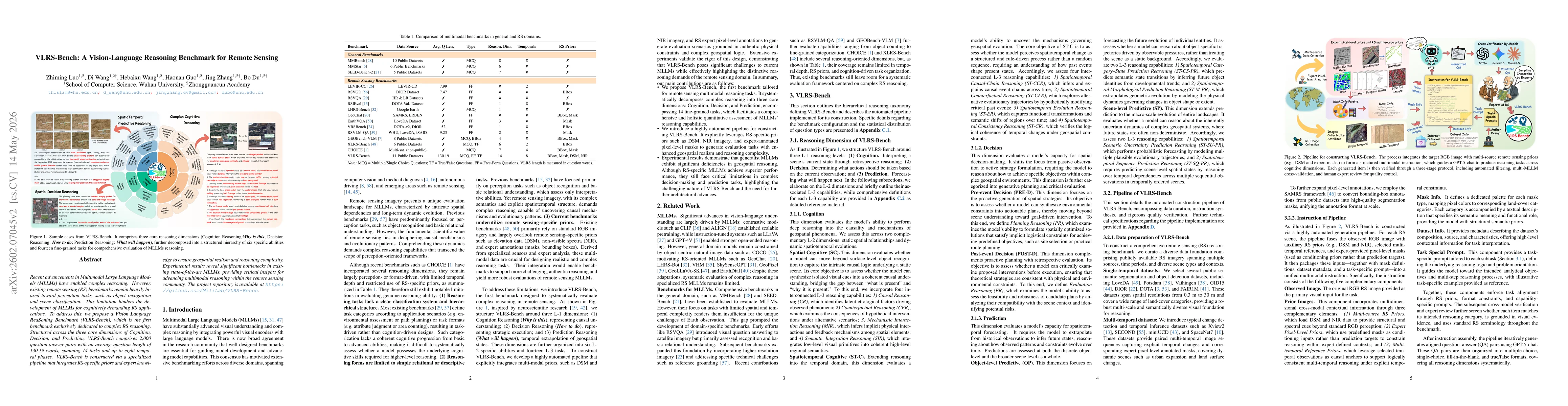
Recent advancements in Multimodal Large Language Models (MLLMs) have enabled complex reasoning. However, existing remote sensing (RS) benchmarks remain heavily biased toward perception tasks, such as ...
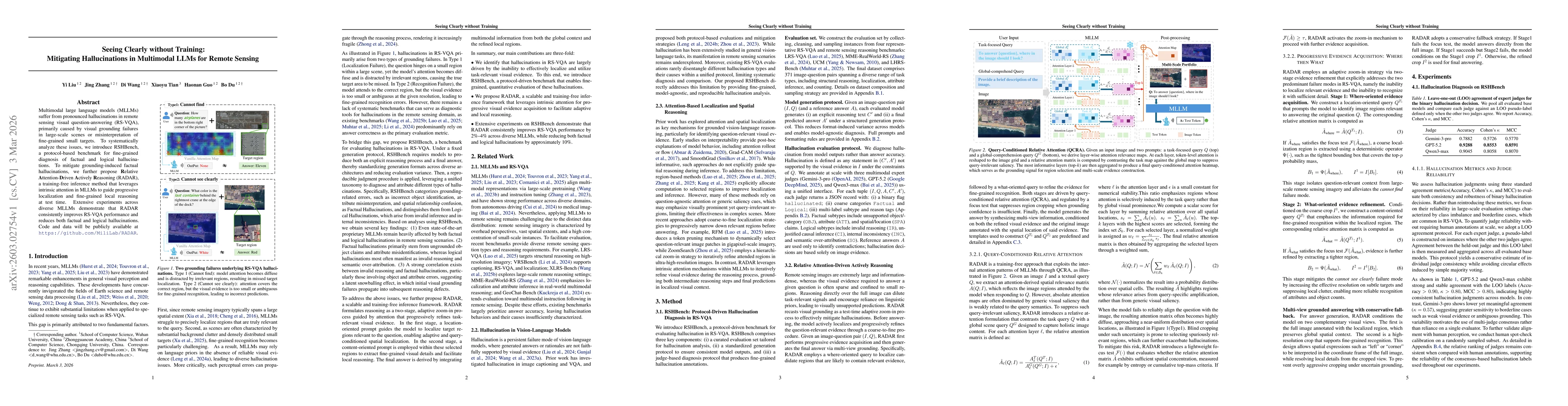
Multimodal large language models (MLLMs) suffer from pronounced hallucinations in remote sensing visual question-answering (RS-VQA), primarily caused by visual grounding failures in large-scale scenes...
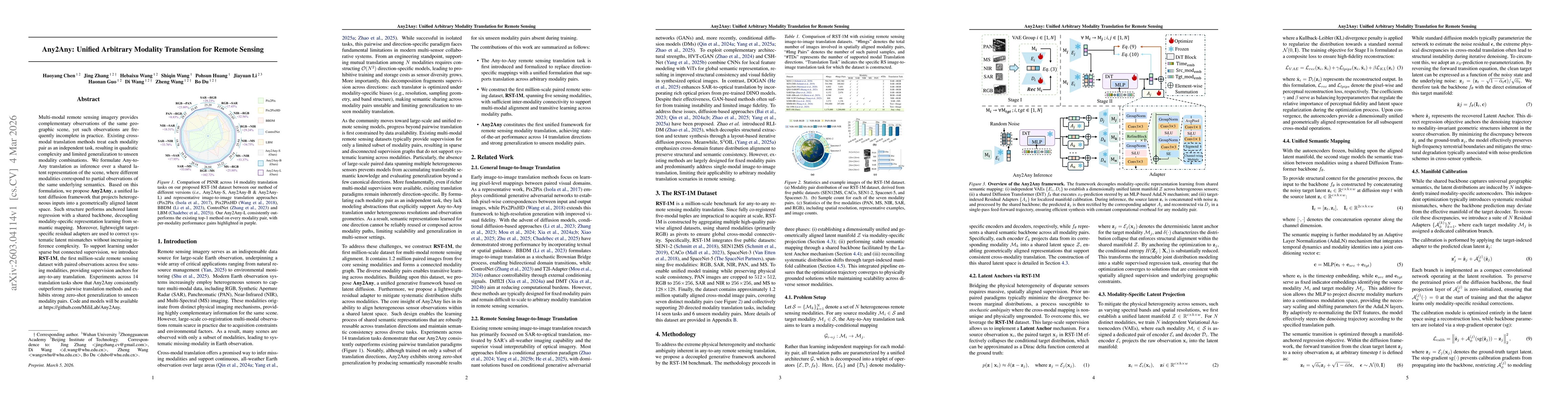
Multi-modal remote sensing imagery provides complementary observations of the same geographic scene, yet such observations are frequently incomplete in practice. Existing cross-modal translation metho...
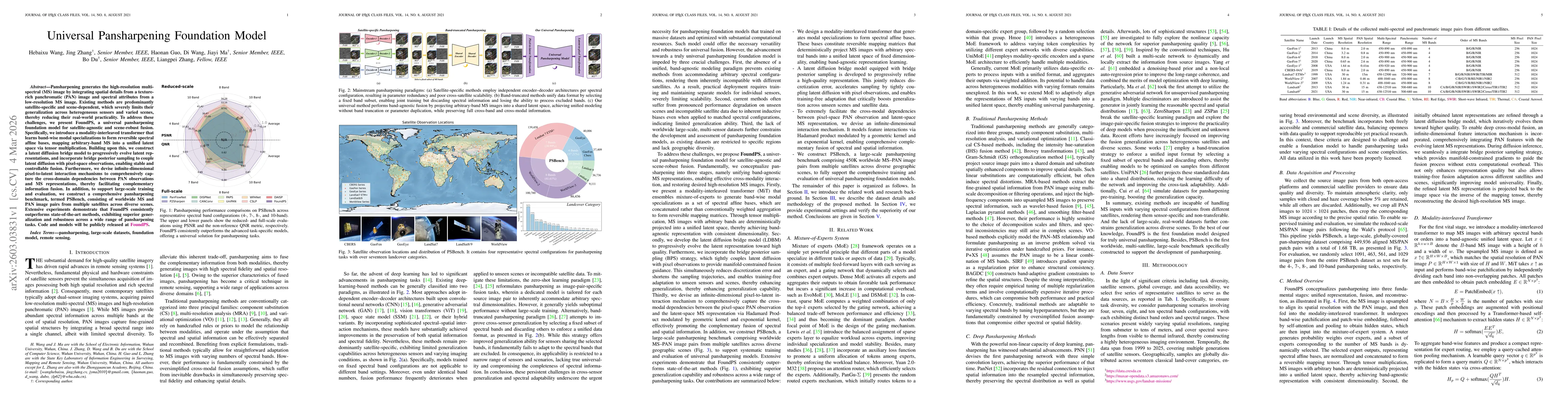
Pansharpening generates the high-resolution multi-spectral (MS) image by integrating spatial details from a texture-rich panchromatic (PAN) image and spectral attributes from a low-resolution MS image...
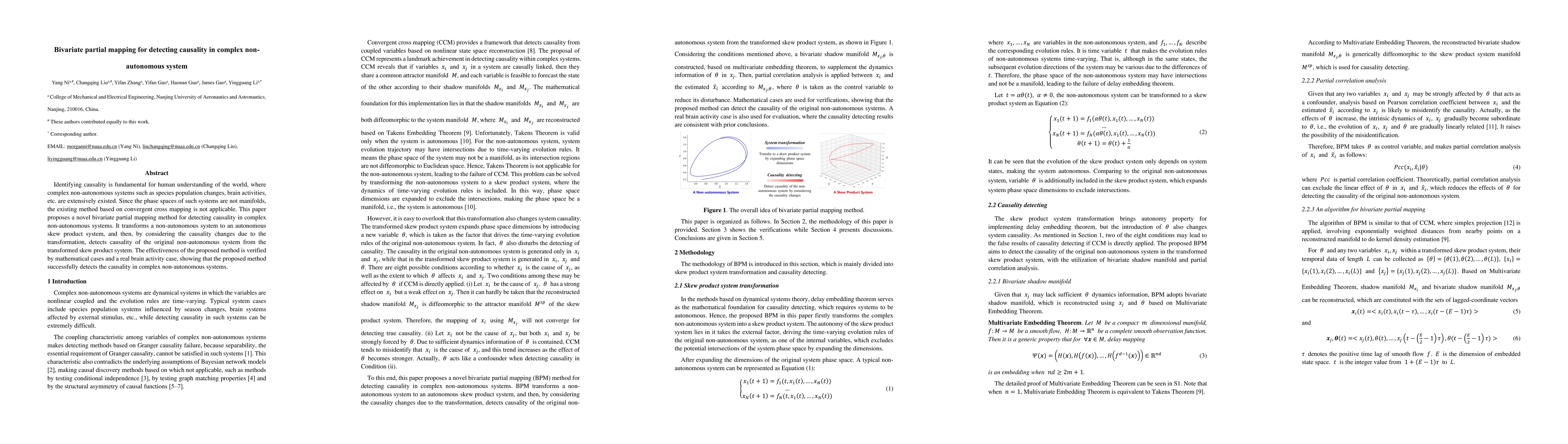
Identifying causality is fundamental for human understanding of the world, where complex non-autonomous systems such as species population changes, brain activities, etc. are extensively existed. Sinc...
Vision-Language Models (VLMs) increasingly operate on ultra-high-resolution (UHR) Earth observation imagery, yet they remain vulnerable to a severe scale mismatch between large-scale scene context and...
Hyperspectral foundation models learn transferable spectral-spatial representations from large-scale unlabeled data. They provide an effective paradigm for adapting to downstream hyperspectral image (...