Academic Profile
Statistics
Similar Authors
Papers on arXiv
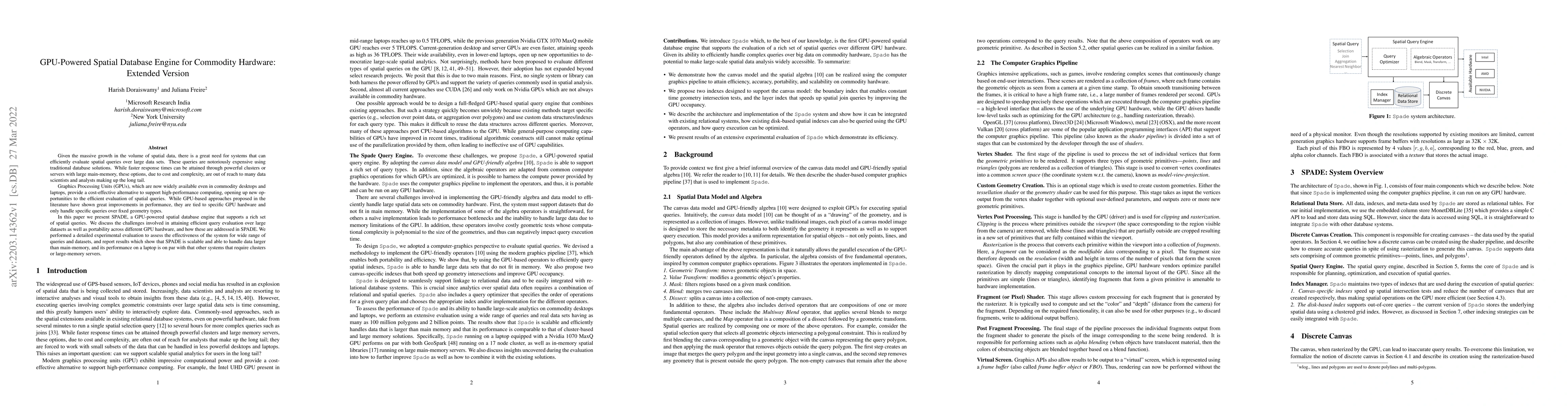
Given the massive growth in the volume of spatial data, there is a great need for systems that can efficiently evaluate spatial queries over large data sets. These queries are notoriously expensive ...
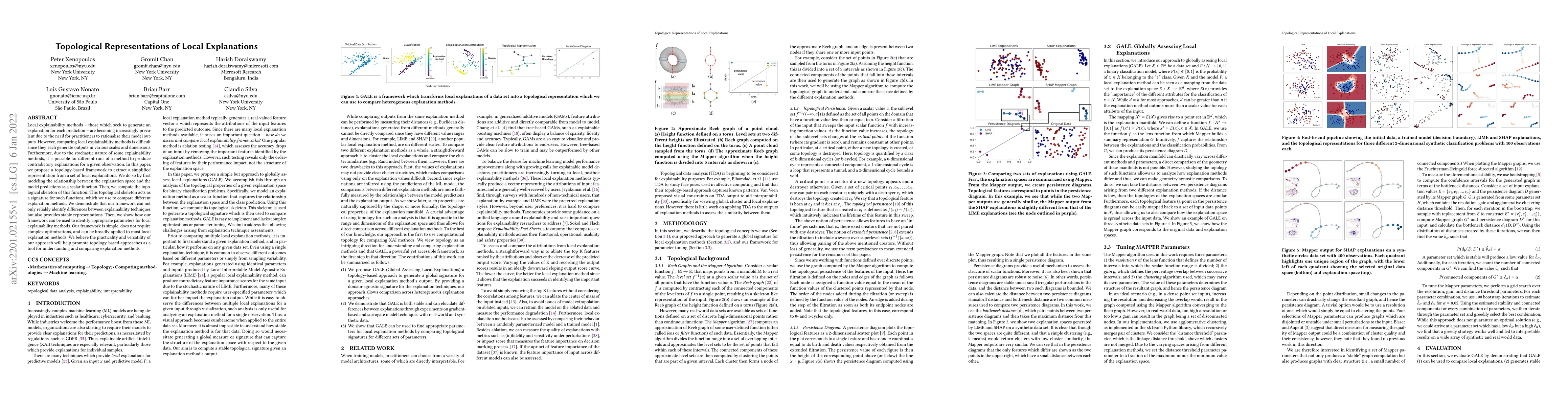
Local explainability methods -- those which seek to generate an explanation for each prediction -- are becoming increasingly prevalent due to the need for practitioners to rationalize their model ou...
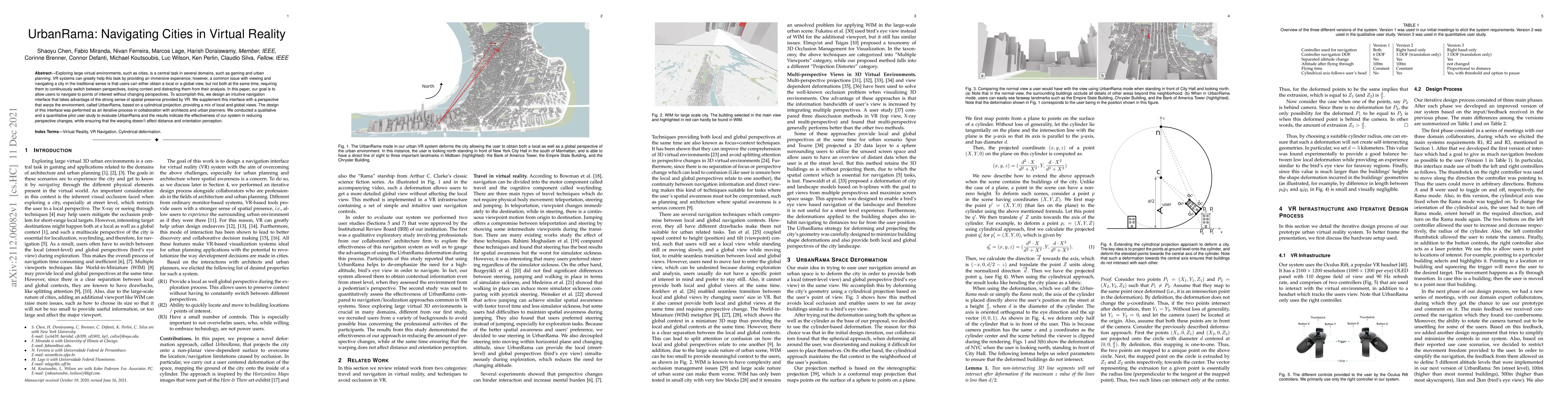
Exploring large virtual environments, such as cities, is a central task in several domains, such as gaming and urban planning. VR systems can greatly help this task by providing an immersive experie...
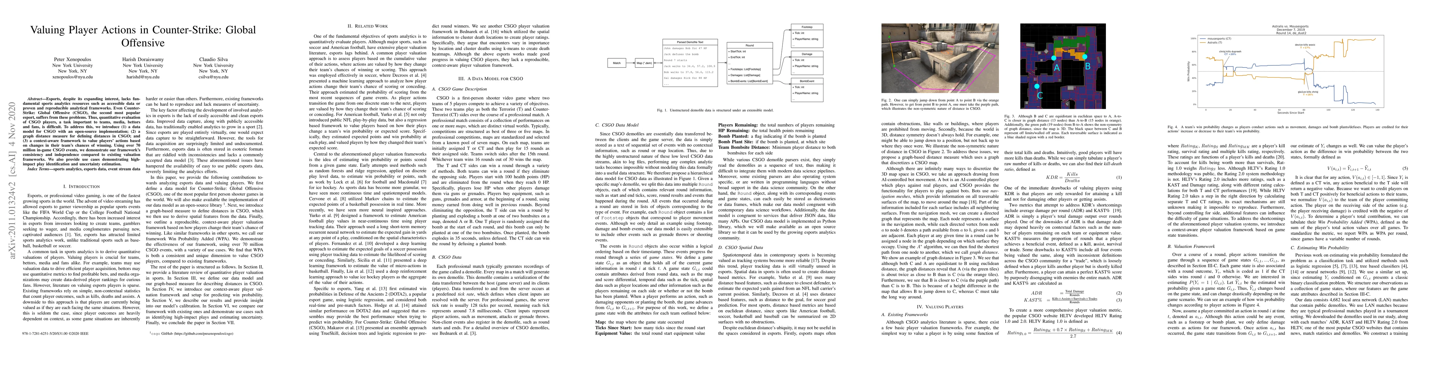
Esports, despite its expanding interest, lacks fundamental sports analytics resources such as accessible data or proven and reproducible analytical frameworks. Even Counter-Strike: Global Offensive ...
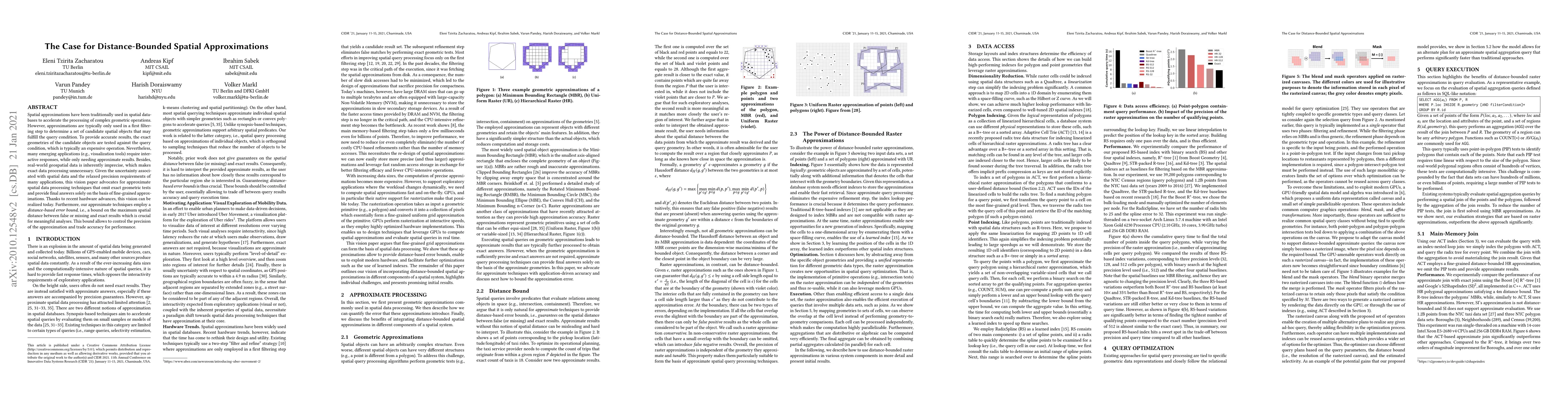
Spatial approximations have been traditionally used in spatial databases to accelerate the processing of complex geometric operations. However, approximations are typically only used in a first filt...
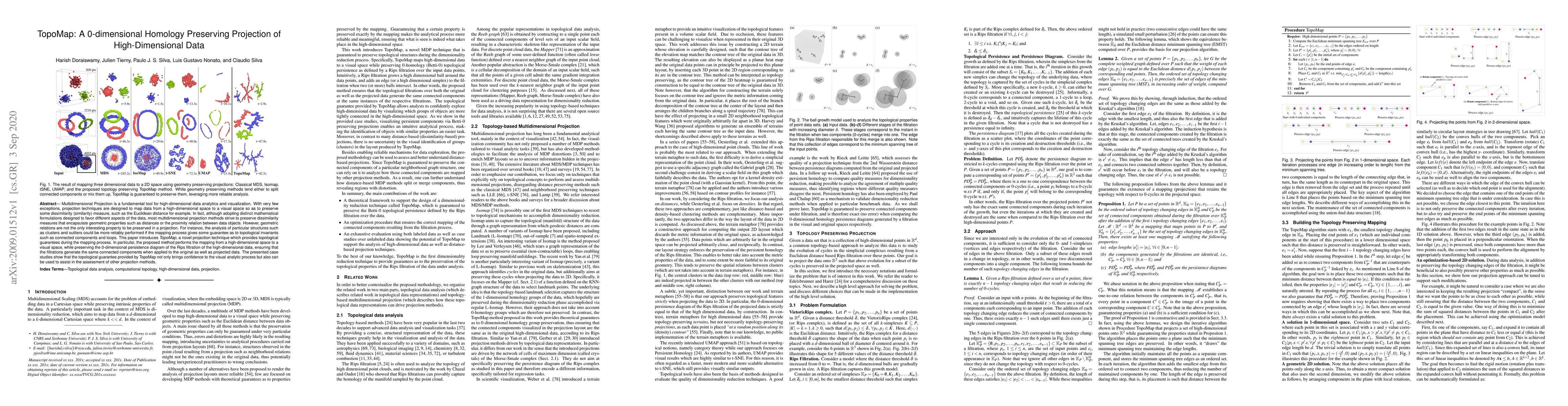
Multidimensional Projection is a fundamental tool for high-dimensional data analytics and visualization. With very few exceptions, projection techniques are designed to map data from a high-dimensio...
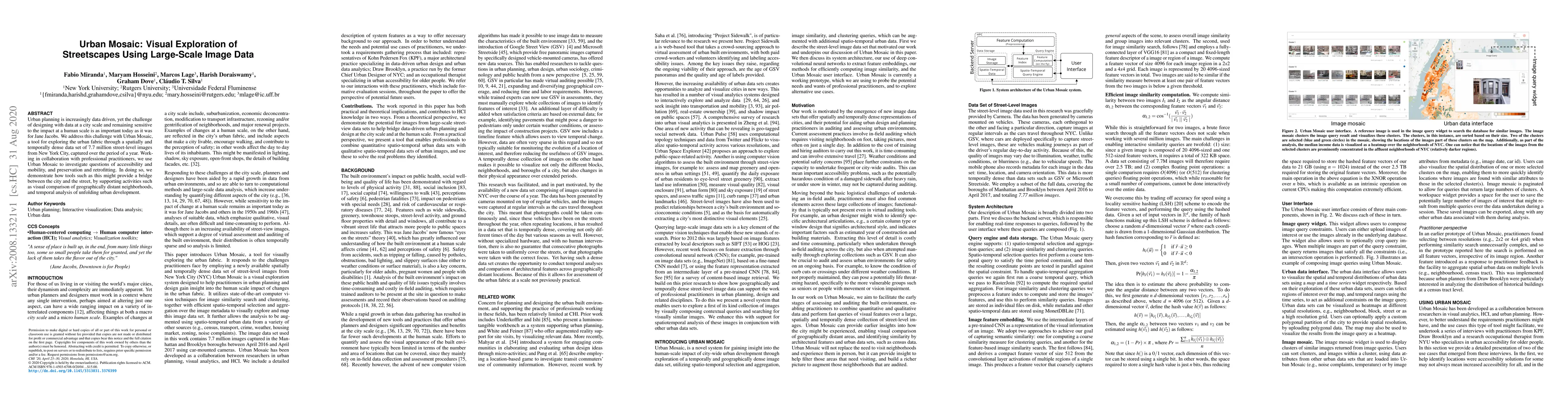
Urban planning is increasingly data driven, yet the challenge of designing with data at a city scale and remaining sensitive to the impact at a human scale is as important today as it was for Jane J...
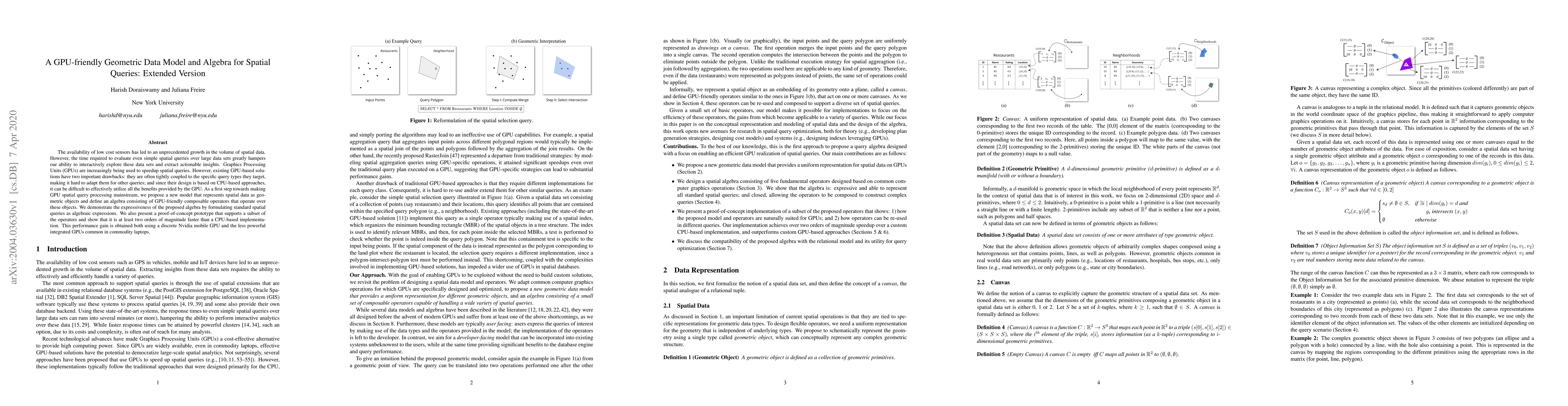
The availability of low cost sensors has led to an unprecedented growth in the volume of spatial data. However, the time required to evaluate even simple spatial queries over large data sets greatly...
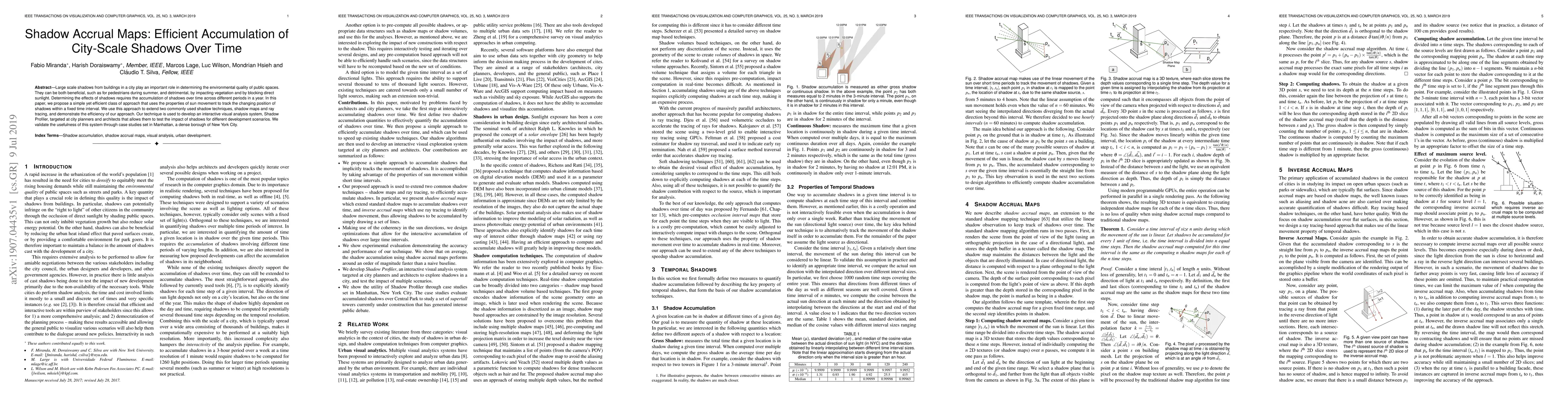
Large scale shadows from buildings in a city play an important role in determining the environmental quality of public spaces. They can be both beneficial, such as for pedestrians during summer, and...
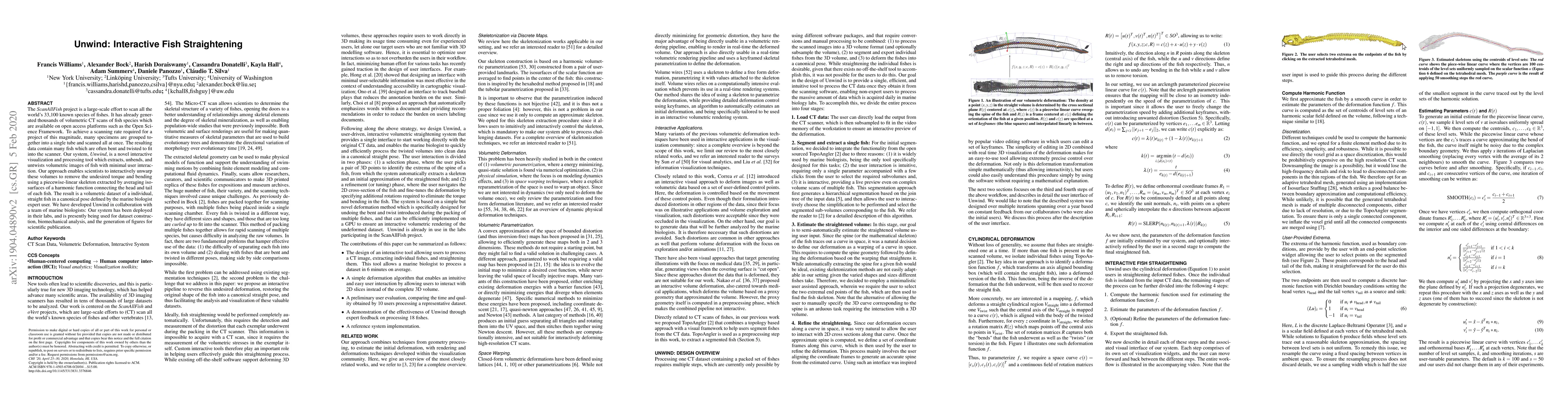
The ScanAllFish project is a large-scale effort to scan all the world's 33,100 known species of fishes. It has already generated thousands of volumetric CT scans of fish species which are available ...
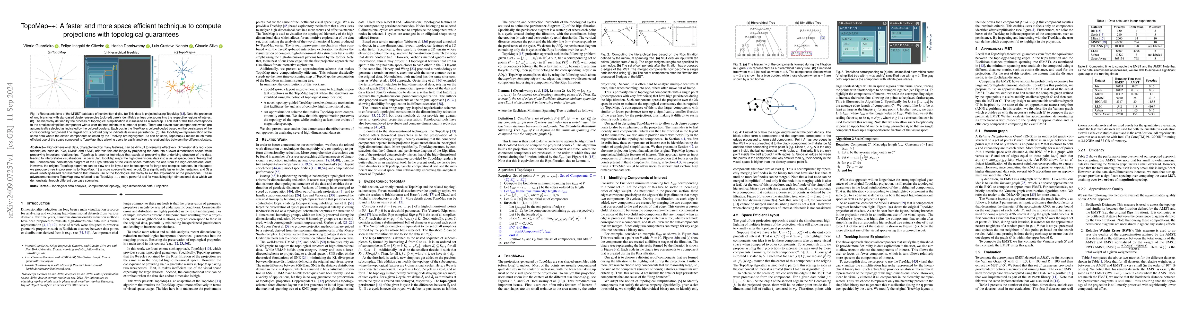
High-dimensional data, characterized by many features, can be difficult to visualize effectively. Dimensionality reduction techniques, such as PCA, UMAP, and t-SNE, address this challenge by projectin...
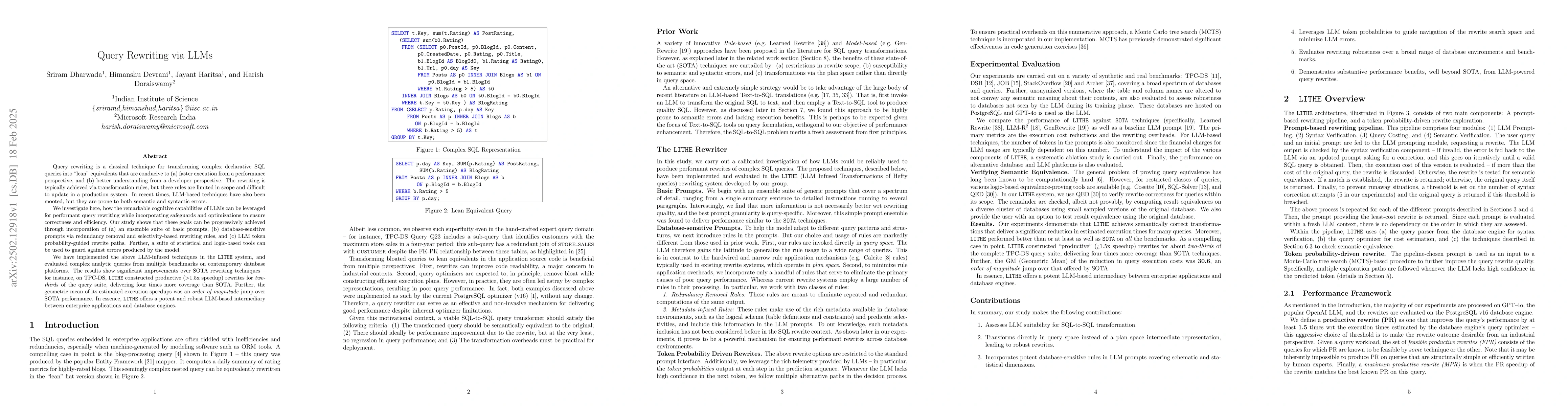
Query rewriting is a classical technique for transforming complex declarative SQL queries into ``lean'' equivalents that are conducive to (a) faster execution from a performance perspective, and (b) b...