Academic Profile
Statistics
Similar Authors
Papers on arXiv
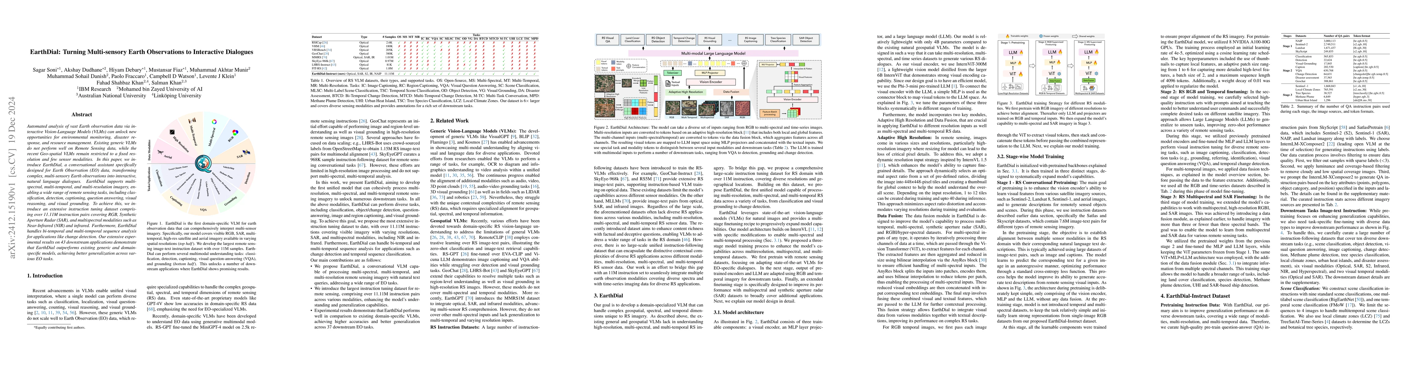
Automated analysis of vast Earth observation data via interactive Vision-Language Models (VLMs) can unlock new opportunities for environmental monitoring, disaster response, and resource management. E...
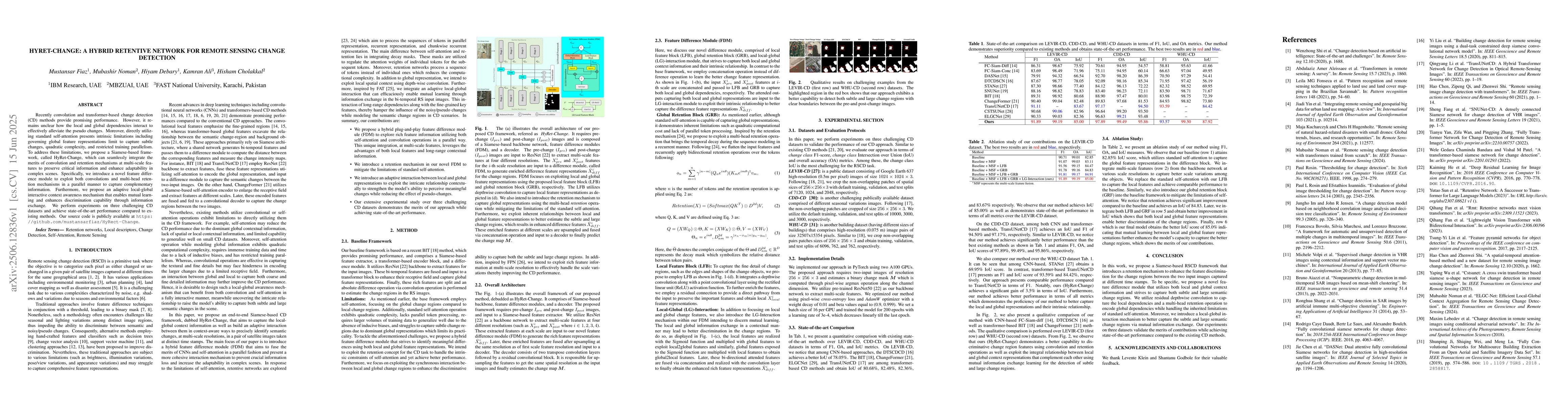
Recently convolution and transformer-based change detection (CD) methods provide promising performance. However, it remains unclear how the local and global dependencies interact to effectively allevi...
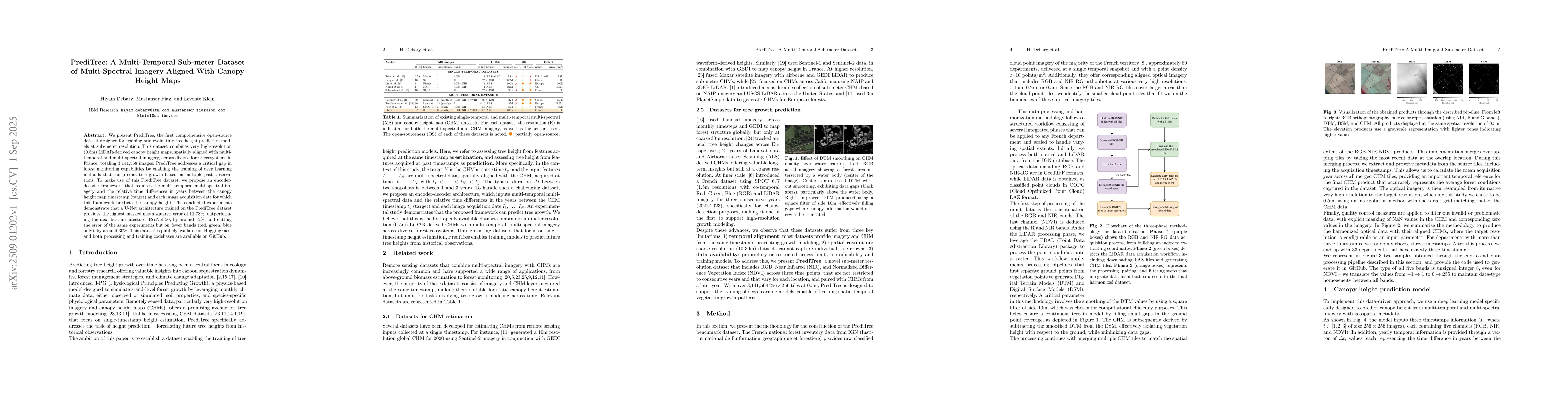
We present PrediTree, the first comprehensive open-source dataset designed for training and evaluating tree height prediction models at sub-meter resolution. This dataset combines very high-resolution...
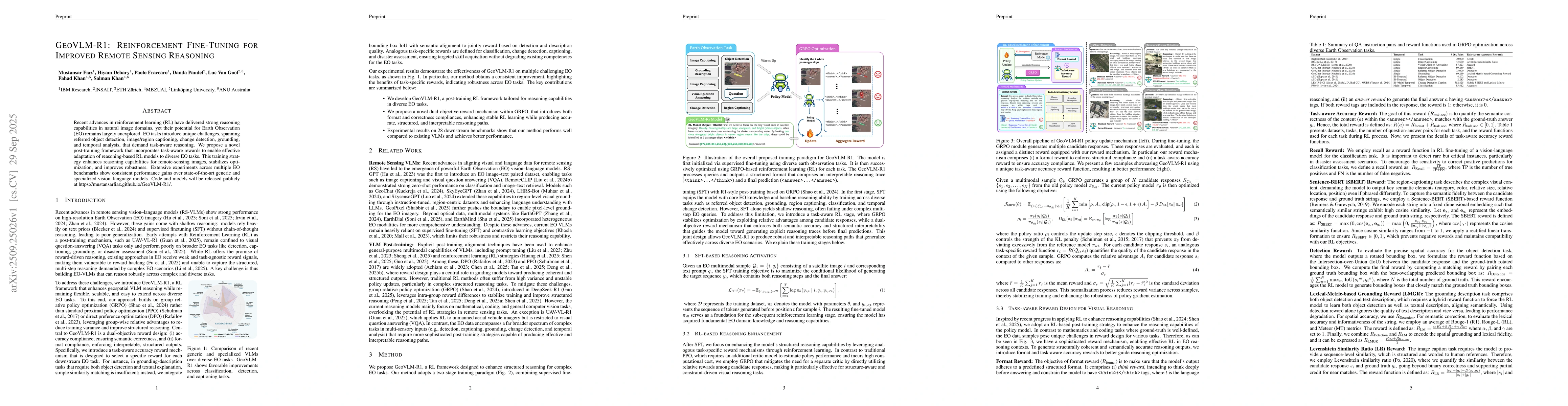
Recent advances in reinforcement learning (RL) have delivered strong reasoning capabilities in natural image domains, yet their potential for Earth Observation (EO) remains largely unexplored. EO task...
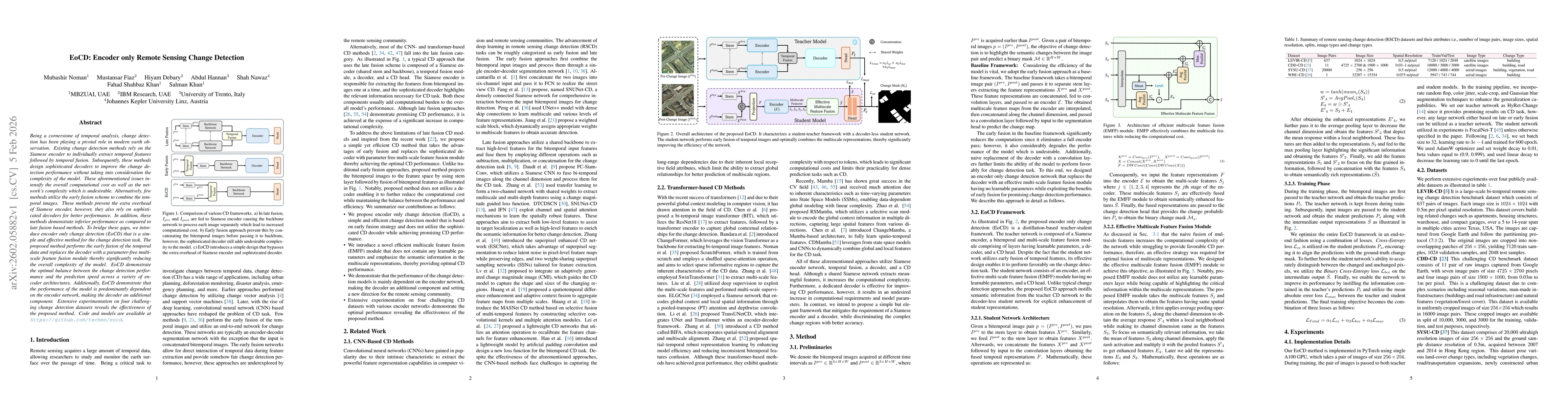
Being a cornerstone of temporal analysis, change detection has been playing a pivotal role in modern earth observation. Existing change detection methods rely on the Siamese encoder to individually ex...
Recent progress in multimodal reasoning has enabled agents that can interpret imagery, connect it with language, and perform structured analytical tasks. Extending such capabilities to the remote sens...
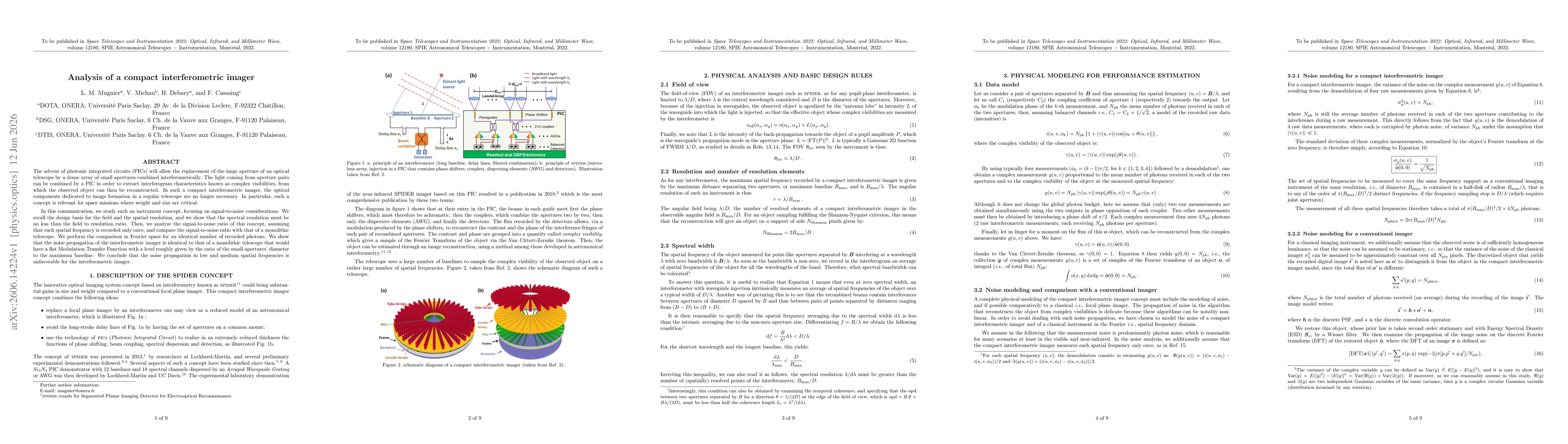
The advent of photonic integrated circuits (PICs) will allow the replacement of the large aperture of an optical telescope by a dense array of small apertures combined interferometically. The light co...