01
MethodologyHow they did it
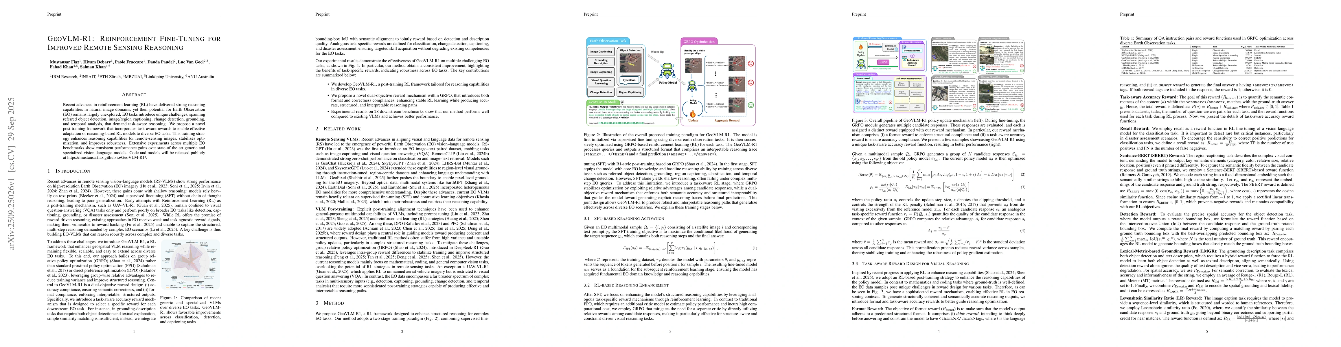
The research employs a task-oriented structured reasoning framework for remote sensing imagery, combining supervised fine-tuning with reinforcement learning (GRPO) to enhance reasoning capabilities. It utilizes a task-aware accuracy reward function and formative reward to minimize policy variance and improve structured, semantically consistent reasoning paths.
Discussion 0