Academic Profile
Statistics
Similar Authors
Papers on arXiv
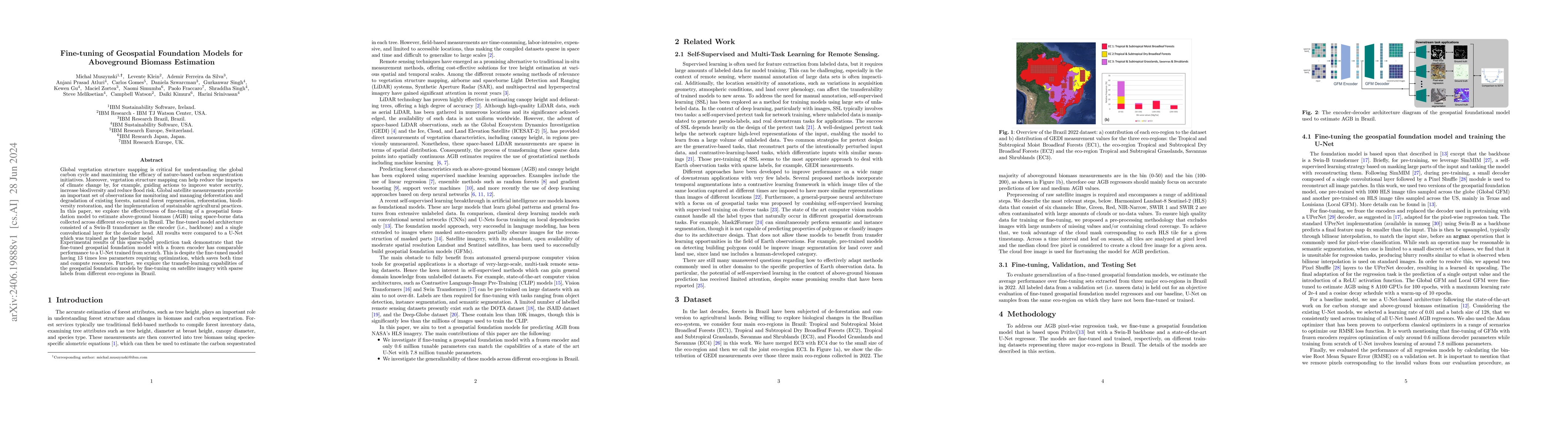
Global vegetation structure mapping is critical for understanding the global carbon cycle and maximizing the efficacy of nature-based carbon sequestration initiatives. Moreover, vegetation structure m...
Geospatial observations combined with computational models have become key to understanding the physical systems of our environment and enable the design of best practices to reduce societal harm. C...
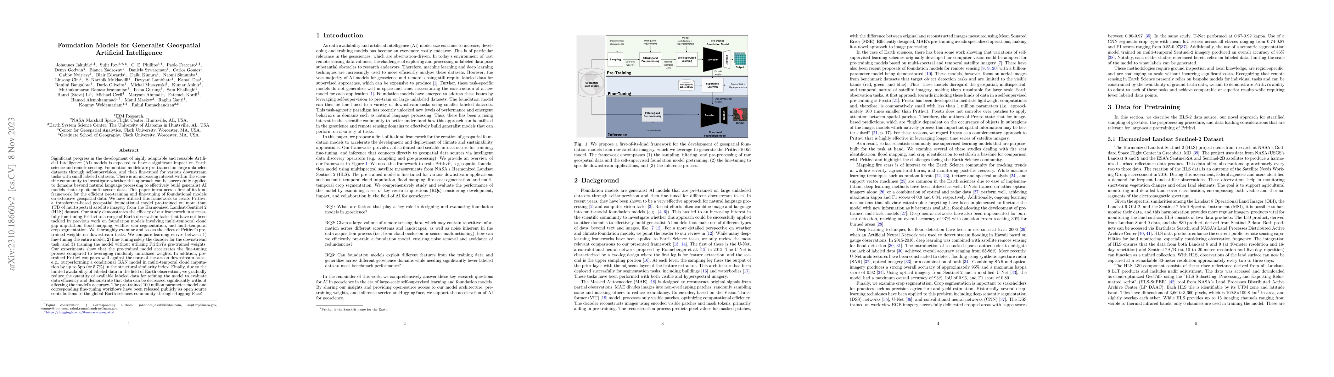
Significant progress in the development of highly adaptable and reusable Artificial Intelligence (AI) models is expected to have a significant impact on Earth science and remote sensing. Foundation ...
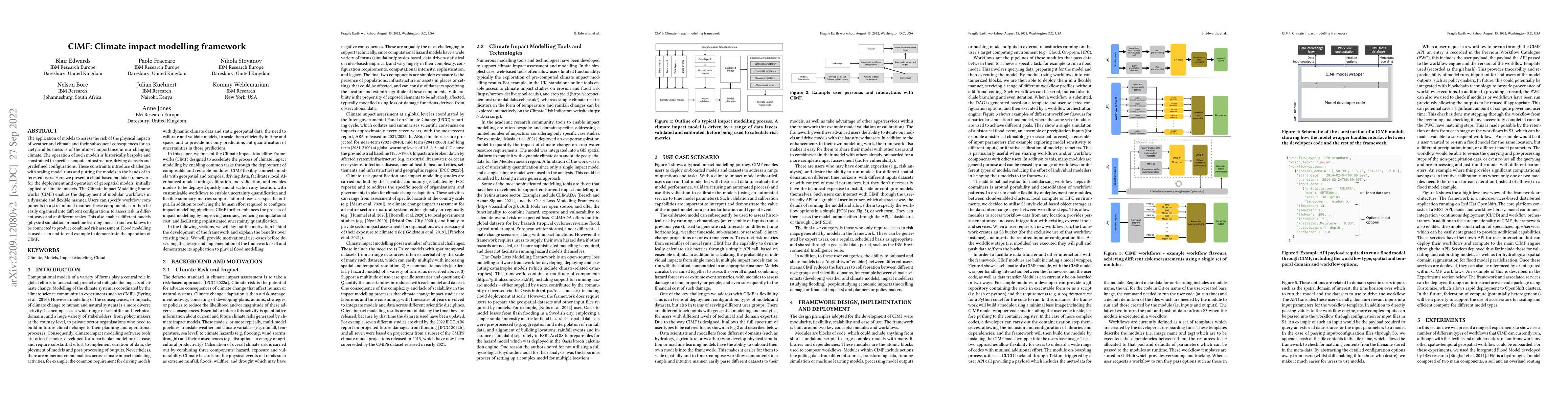
The application of models to assess the risk of the physical impacts of weather and climate and their subsequent consequences for society and business is of the utmost importance in our changing cli...
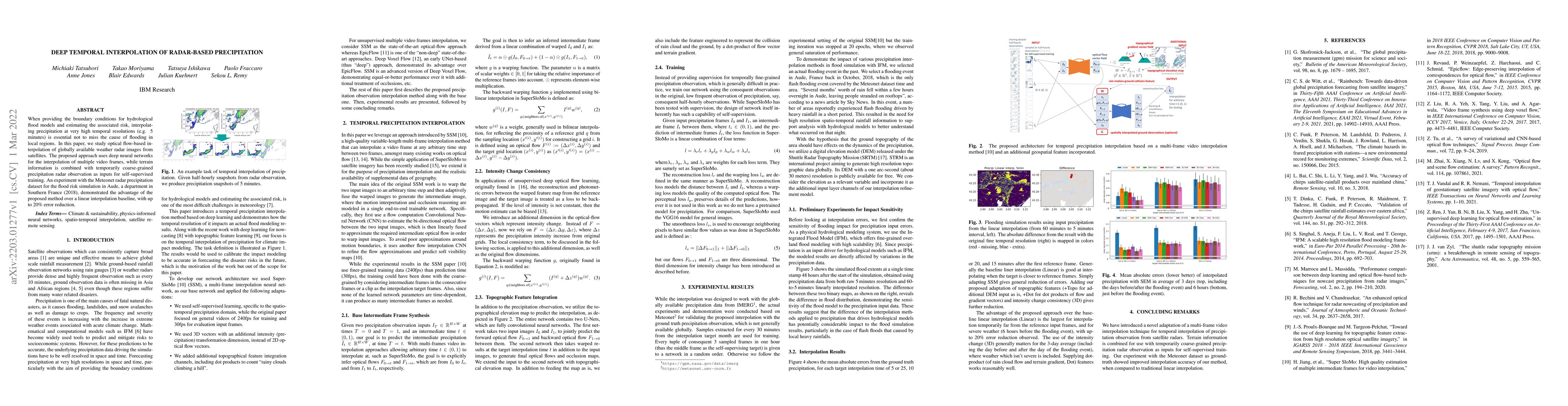
When providing the boundary conditions for hydrological flood models and estimating the associated risk, interpolating precipitation at very high temporal resolutions (e.g. 5 minutes) is essential n...
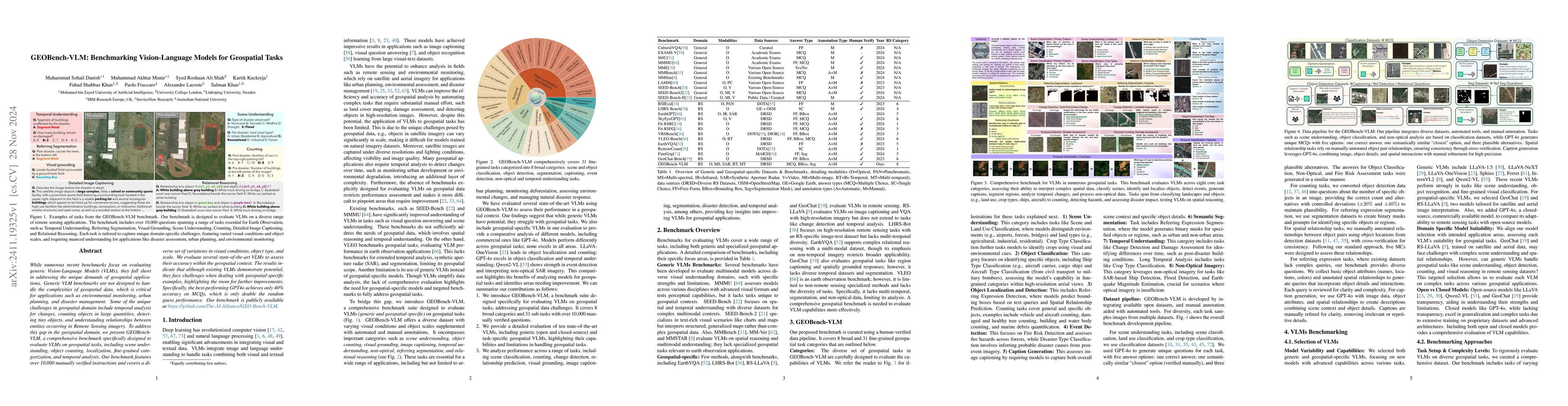
While numerous recent benchmarks focus on evaluating generic Vision-Language Models (VLMs), they fall short in addressing the unique demands of geospatial applications. Generic VLM benchmarks are not ...
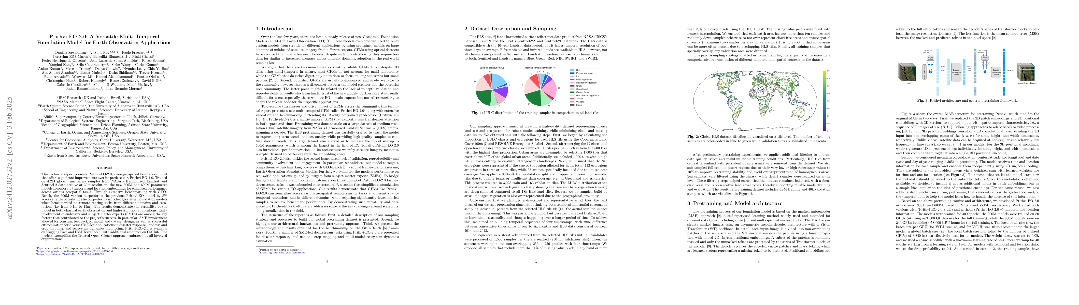
This technical report presents Prithvi-EO-2.0, a new geospatial foundation model that offers significant improvements over its predecessor, Prithvi-EO-1.0. Trained on 4.2M global time series samples f...
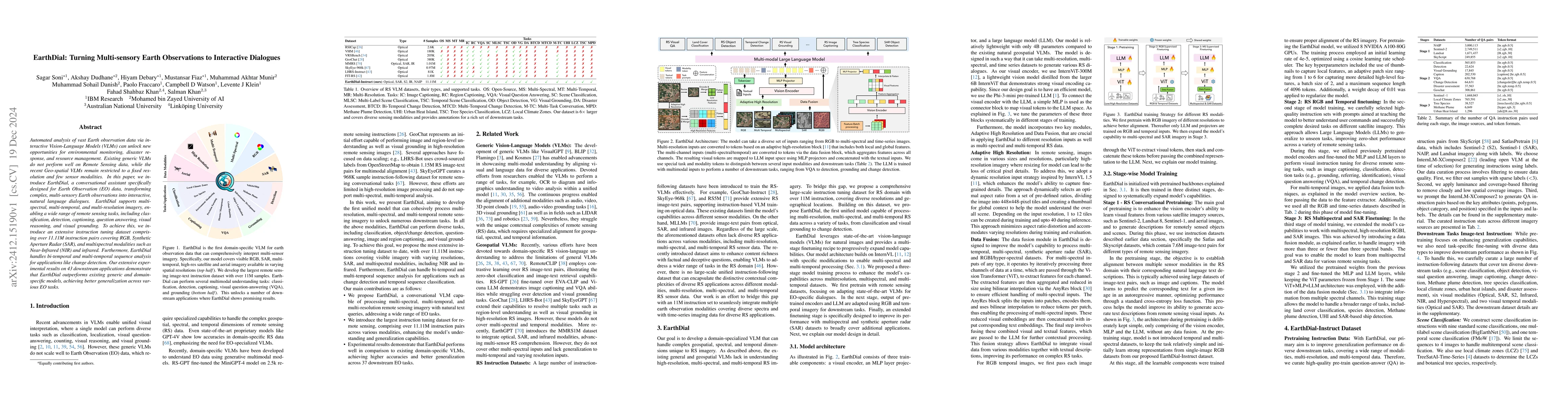
Automated analysis of vast Earth observation data via interactive Vision-Language Models (VLMs) can unlock new opportunities for environmental monitoring, disaster response, and resource management. E...
Hyperspectral imaging provides detailed spectral information, offering significant potential for monitoring greenhouse gases like CH4 and NO2. However, its application is constrained by limited spatia...
Over the past decades, there has been an explosion in the amount of available Earth Observation (EO) data. The unprecedented coverage of the Earth's surface and atmosphere by satellite imagery has res...
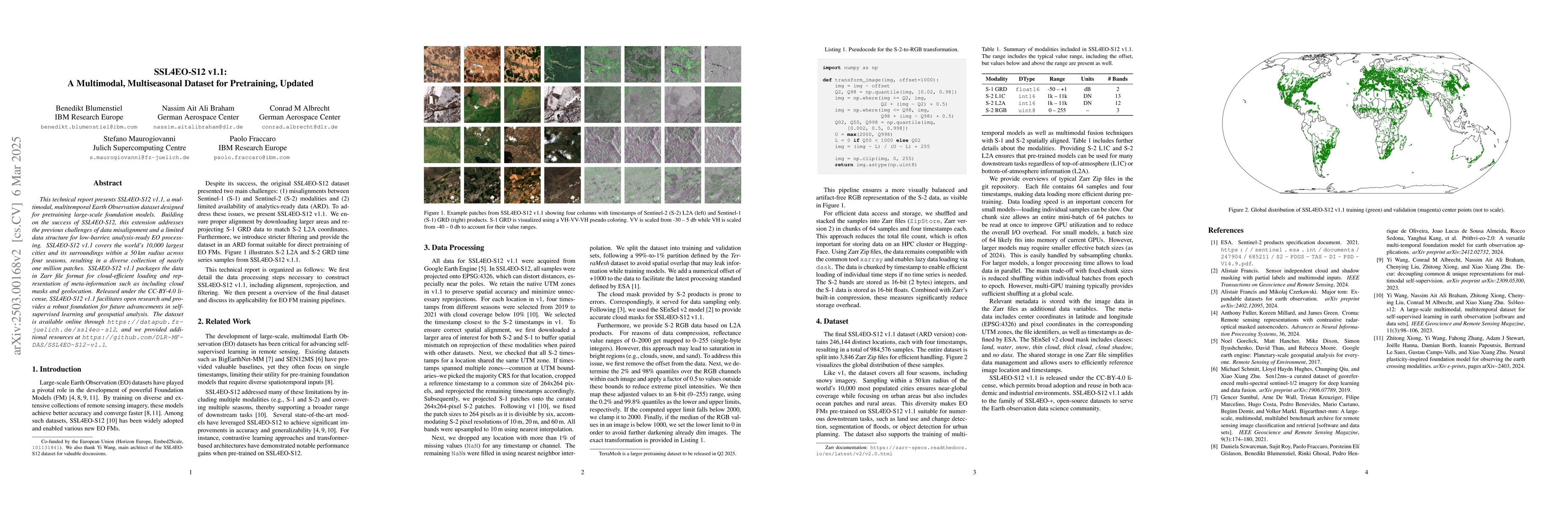
This technical report presents SSL4EO-S12 v1.1, a multimodal, multitemporal Earth Observation dataset designed for pretraining large-scale foundation models. Building on the success of SSL4EO-S12 v1.0...
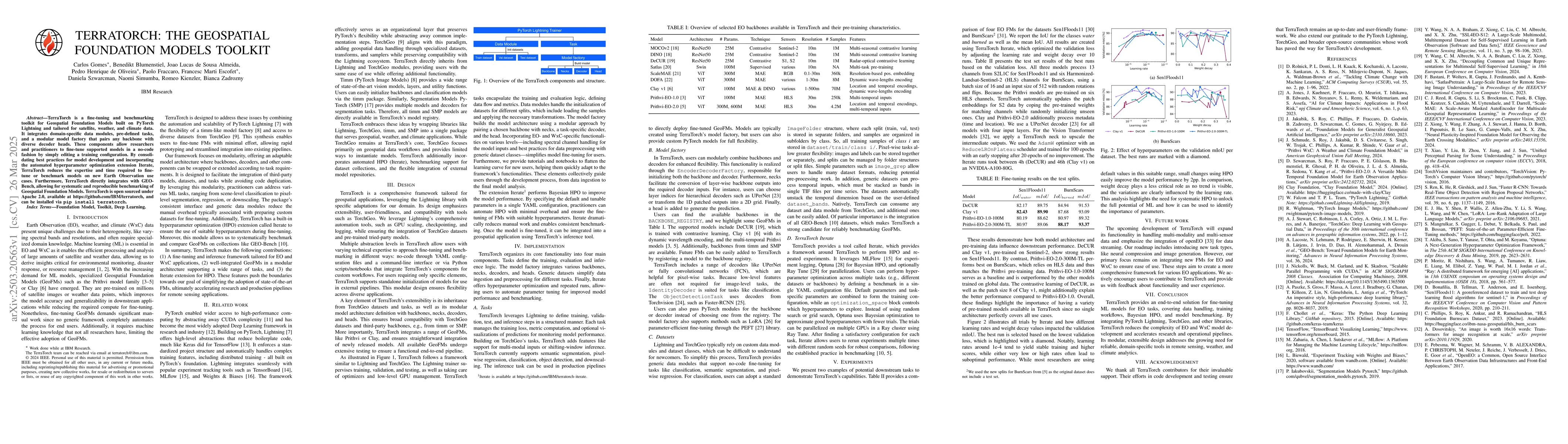
TerraTorch is a fine-tuning and benchmarking toolkit for Geospatial Foundation Models built on PyTorch Lightning and tailored for satellite, weather, and climate data. It integrates domain-specific da...
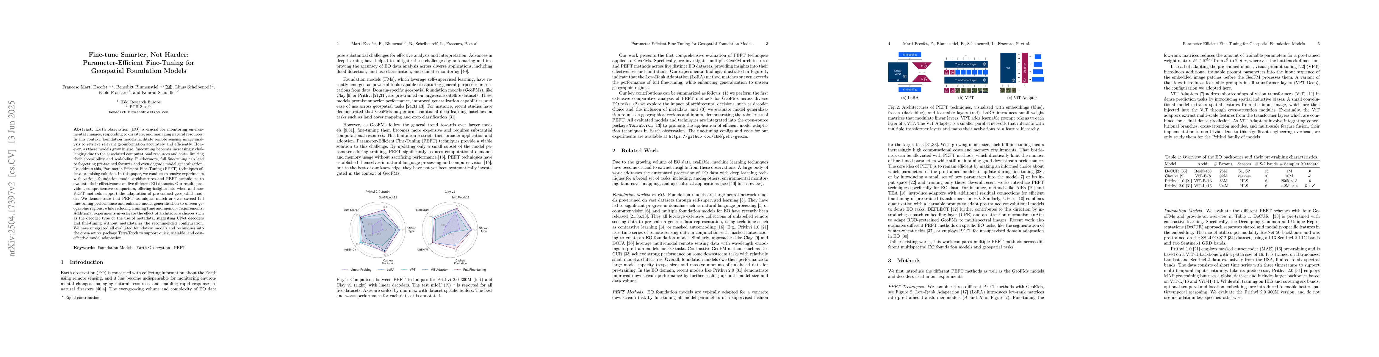
Earth observation (EO) is crucial for monitoring environmental changes, responding to disasters, and managing natural resources. In this context, foundation models facilitate remote sensing image anal...
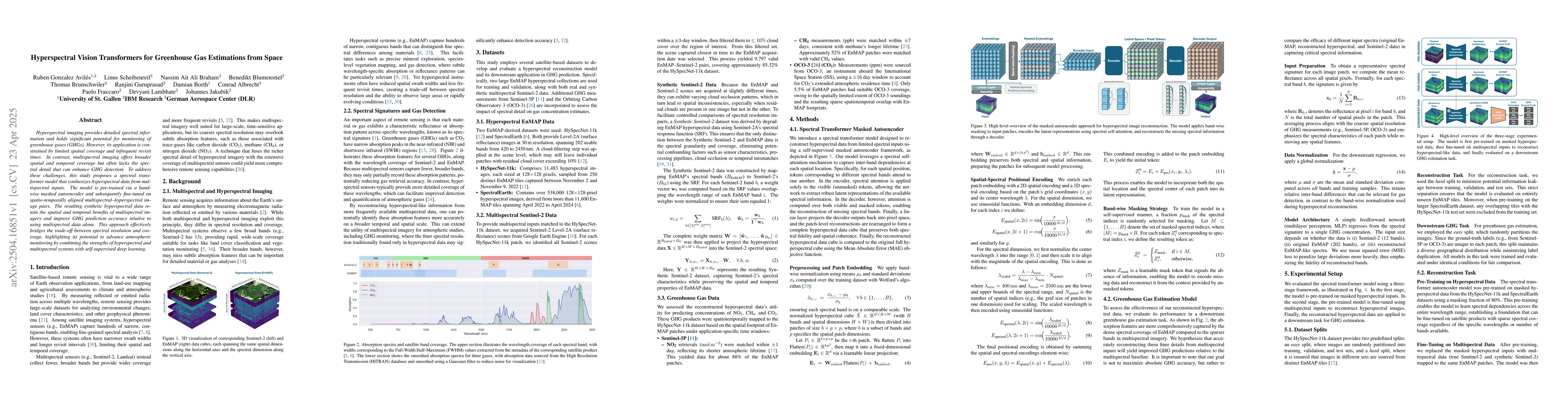
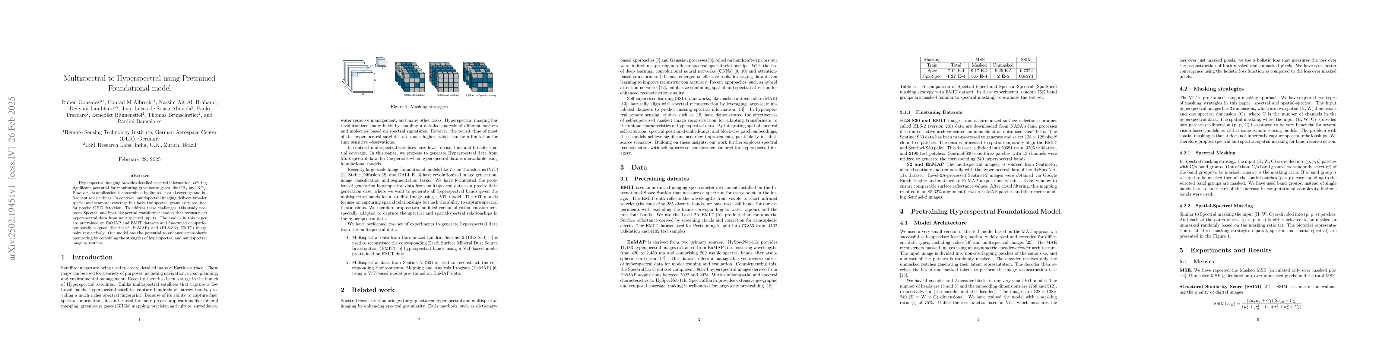
Hyperspectral imaging provides detailed spectral information and holds significant potential for monitoring of greenhouse gases (GHGs). However, its application is constrained by limited spatial cover...
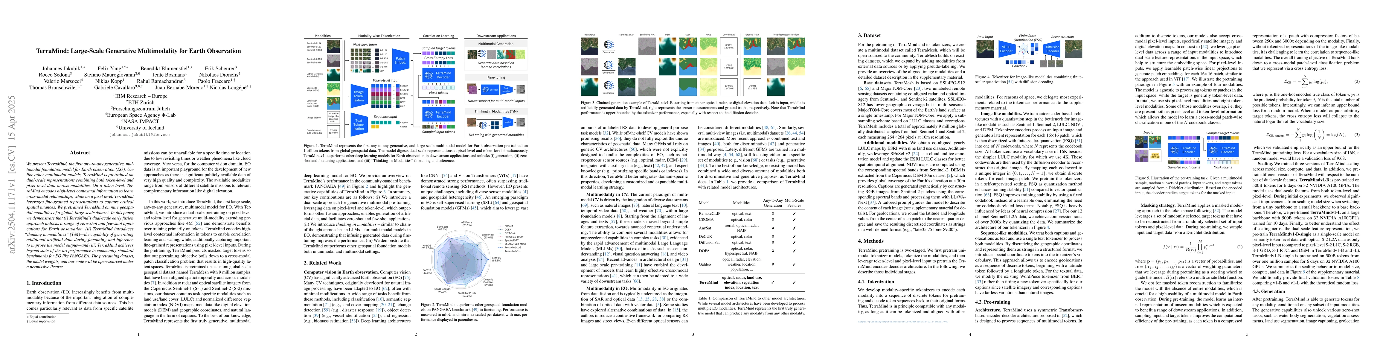
We present TerraMind, the first any-to-any generative, multimodal foundation model for Earth observation (EO). Unlike other multimodal models, TerraMind is pretrained on dual-scale representations com...
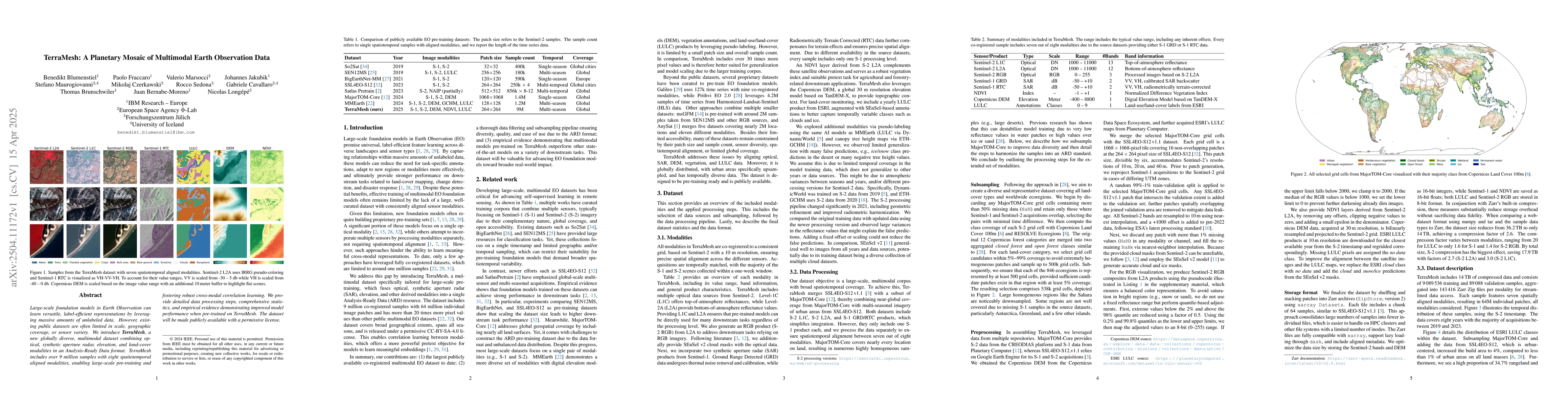
Large-scale foundation models in Earth Observation can learn versatile, label-efficient representations by leveraging massive amounts of unlabeled data. However, existing public datasets are often lim...
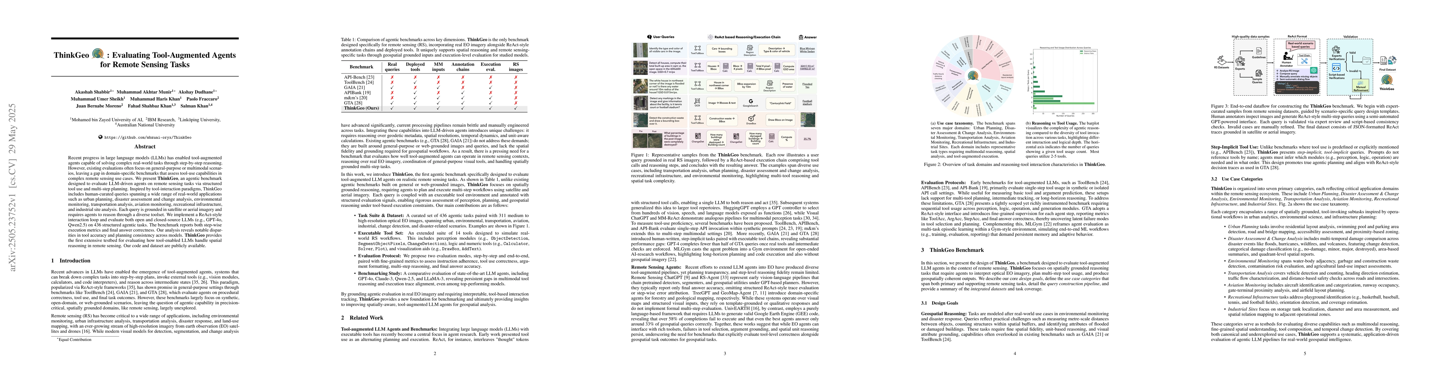
Recent progress in large language models (LLMs) has enabled tool-augmented agents capable of solving complex real-world tasks through step-by-step reasoning. However, existing evaluations often focus ...
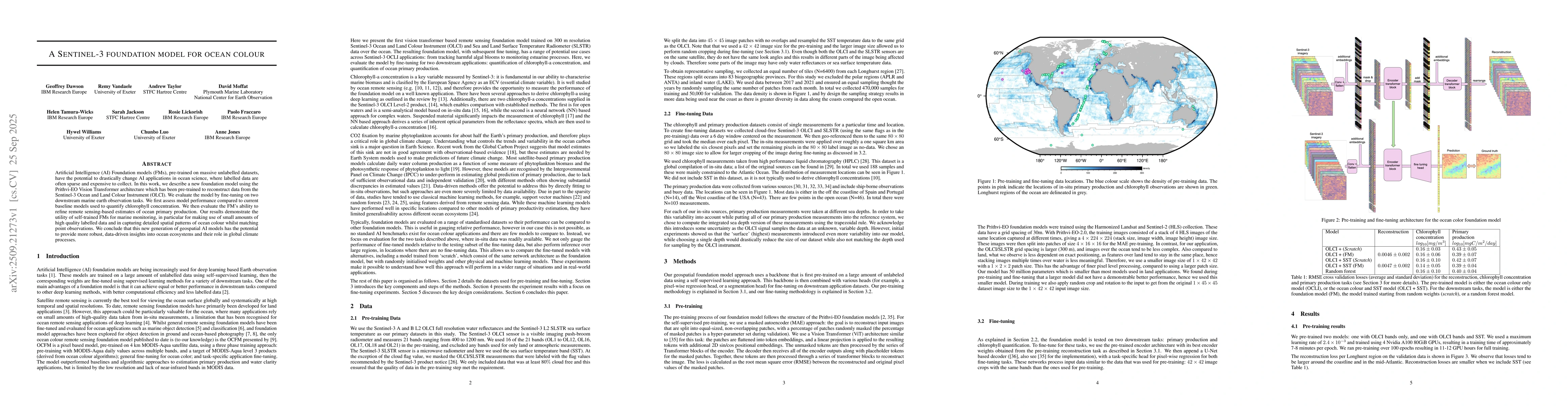
Artificial Intelligence (AI) Foundation models (FMs), pre-trained on massive unlabelled datasets, have the potential to drastically change AI applications in ocean science, where labelled data are oft...
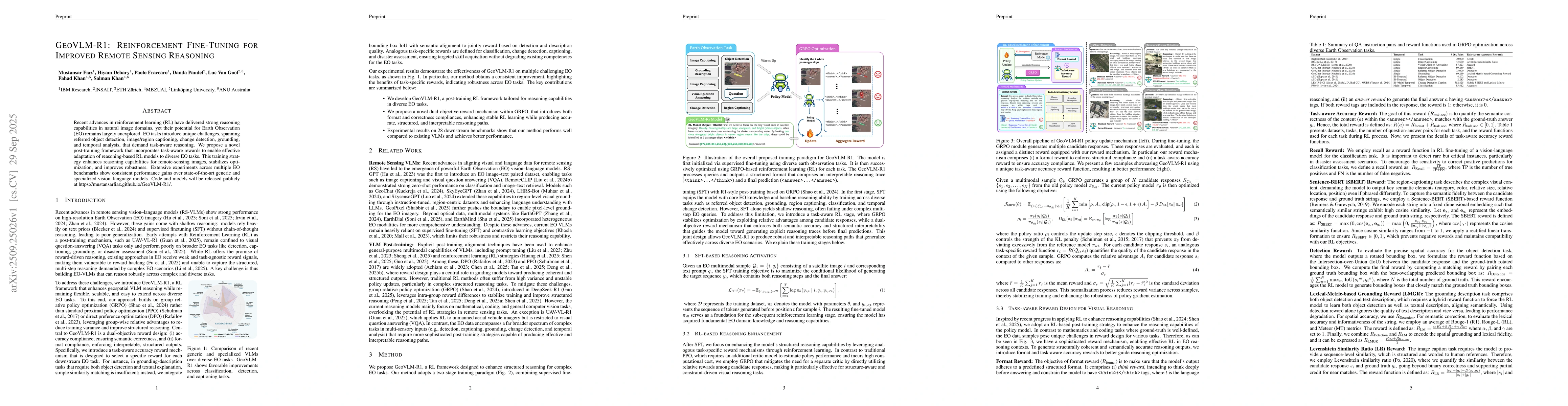
Recent advances in reinforcement learning (RL) have delivered strong reasoning capabilities in natural image domains, yet their potential for Earth Observation (EO) remains largely unexplored. EO task...
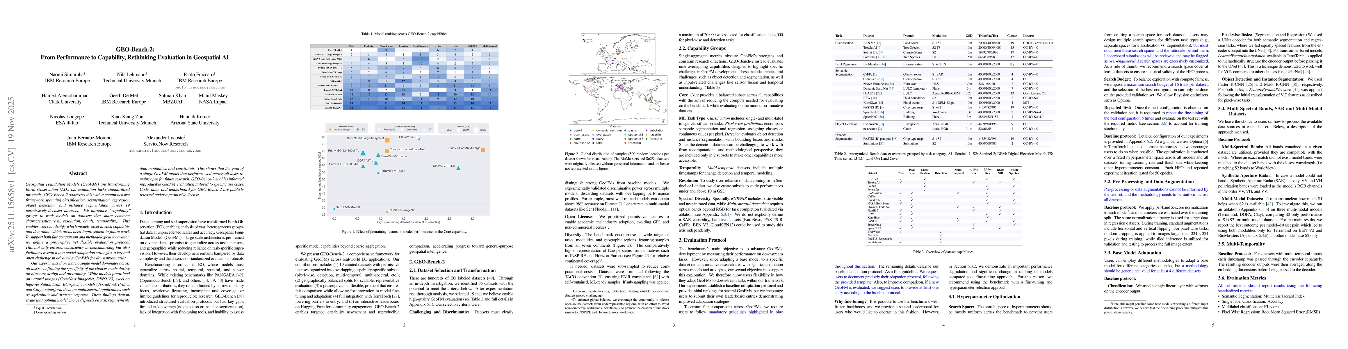
Geospatial Foundation Models (GeoFMs) are transforming Earth Observation (EO), but evaluation lacks standardized protocols. GEO-Bench-2 addresses this with a comprehensive framework spanning classific...
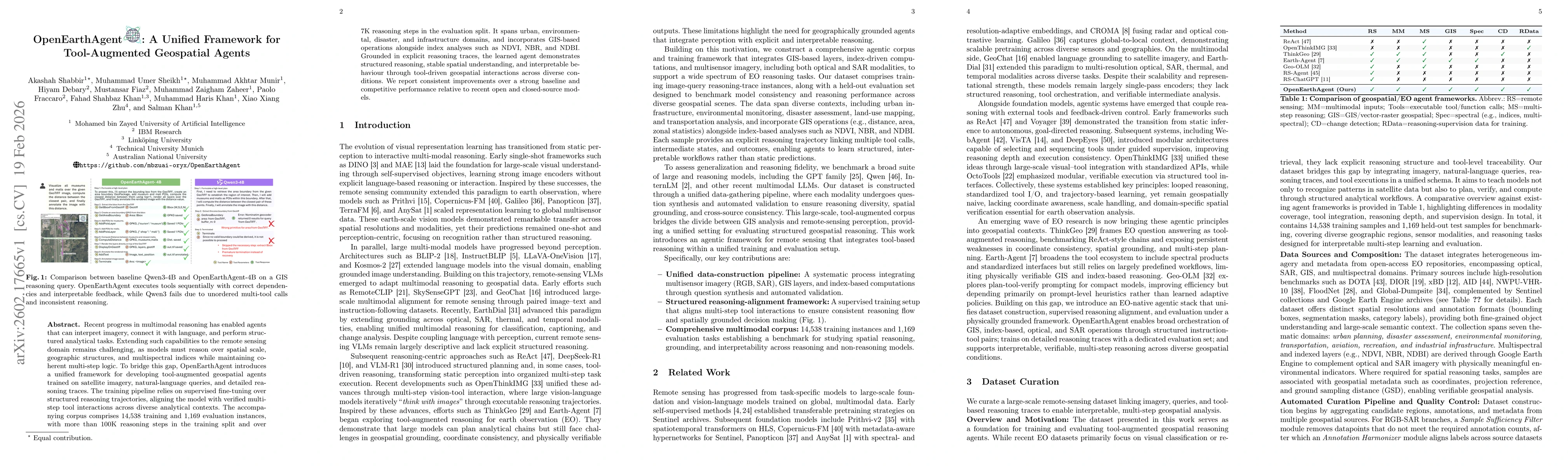
Recent progress in multimodal reasoning has enabled agents that can interpret imagery, connect it with language, and perform structured analytical tasks. Extending such capabilities to the remote sens...
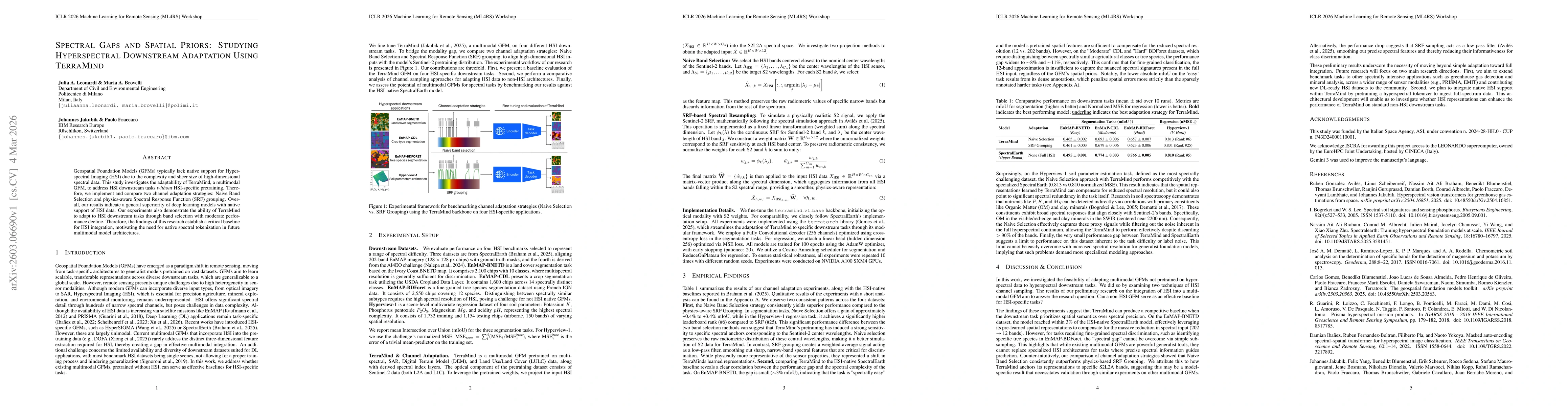
Geospatial Foundation Models (GFMs) typically lack native support for Hyperspectral Imaging (HSI) due to the complexity and sheer size of high-dimensional spectral data. This study investigates the ad...