ArxivLens
H
Researcher

Hong Wei

5 papers on arXiv

5 arXiv Papers
2 Total Publications
Profile

Academic Profile

Name W. Hong
Total Papers 2
Scholar Profile View on Semantic Scholar
Metrics

Statistics

5 arXiv Papers
2 Total Publications
Publications

Papers on arXiv

Thumbnail for Semi-supervised segmentation of land cover images using nonlinear
  canonical correlation analysis with multiple features and t-SNE
arXiv
Semi-supervised segmentation of land cover images using nonlinear canonical correlation analysis with multiple features and t-SNE

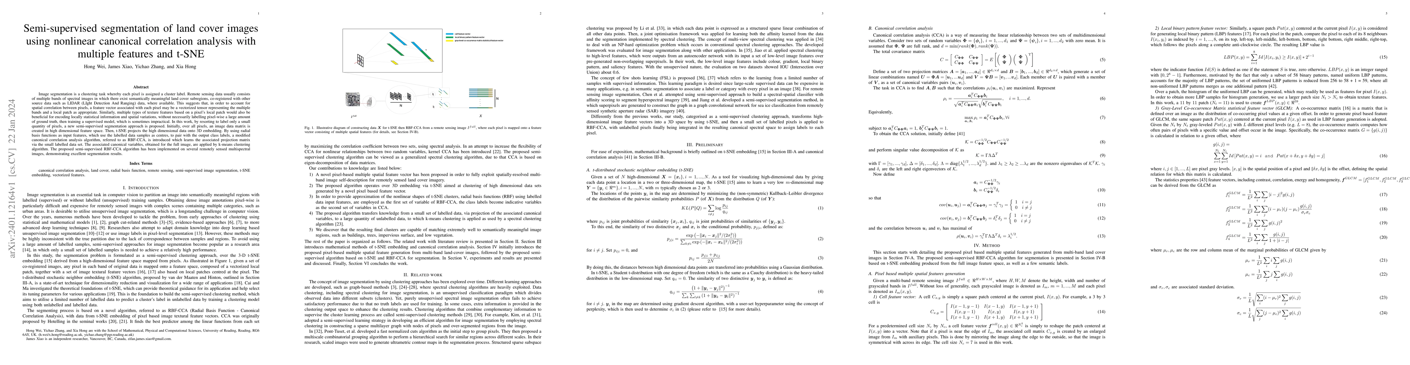
Image segmentation is a clustering task whereby each pixel is assigned a cluster label. Remote sensing data usually consists of multiple bands of spectral images in which there exist semantically me...

Thumbnail for Evaluating Large Language Models in Ophthalmology
arXiv
Evaluating Large Language Models in Ophthalmology

Purpose: The performance of three different large language models (LLMS) (GPT-3.5, GPT-4, and PaLM2) in answering ophthalmology professional questions was evaluated and compared with that of three d...

Thumbnail for Evaluating multiple large language models in pediatric ophthalmology
arXiv
Evaluating multiple large language models in pediatric ophthalmology

IMPORTANCE The response effectiveness of different large language models (LLMs) and various individuals, including medical students, graduate students, and practicing physicians, in pediatric ophtha...

Thumbnail for A Data Quality Assessment Framework for AI-enabled Wireless
  Communication
arXiv
A Data Quality Assessment Framework for AI-enabled Wireless Communication

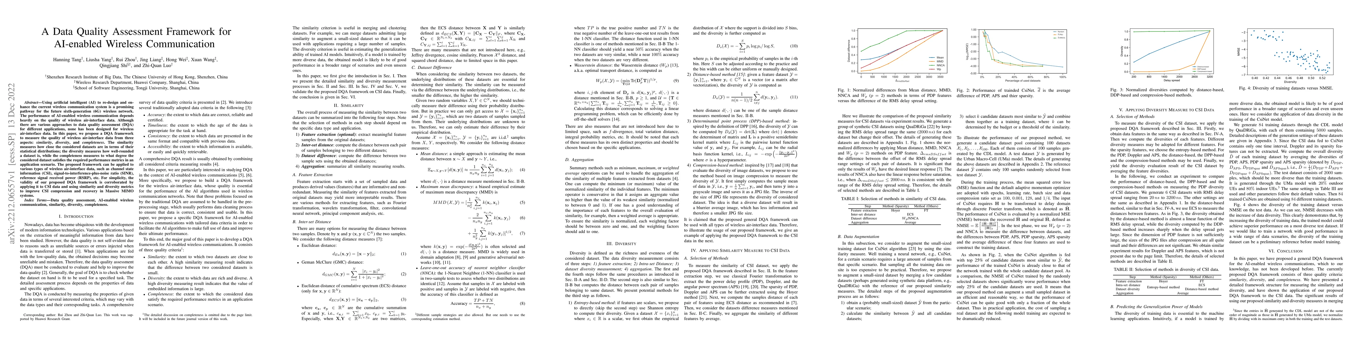
Using artificial intelligent (AI) to re-design and enhance the current wireless communication system is a promising pathway for the future sixth-generation (6G) wireless network. The performance of ...

Thumbnail for CoronaViz: Visualizing Multilayer Spatiotemporal COVID-19 Data with
  Animated Geocircles
arXiv
CoronaViz: Visualizing Multilayer Spatiotemporal COVID-19 Data with Animated Geocircles

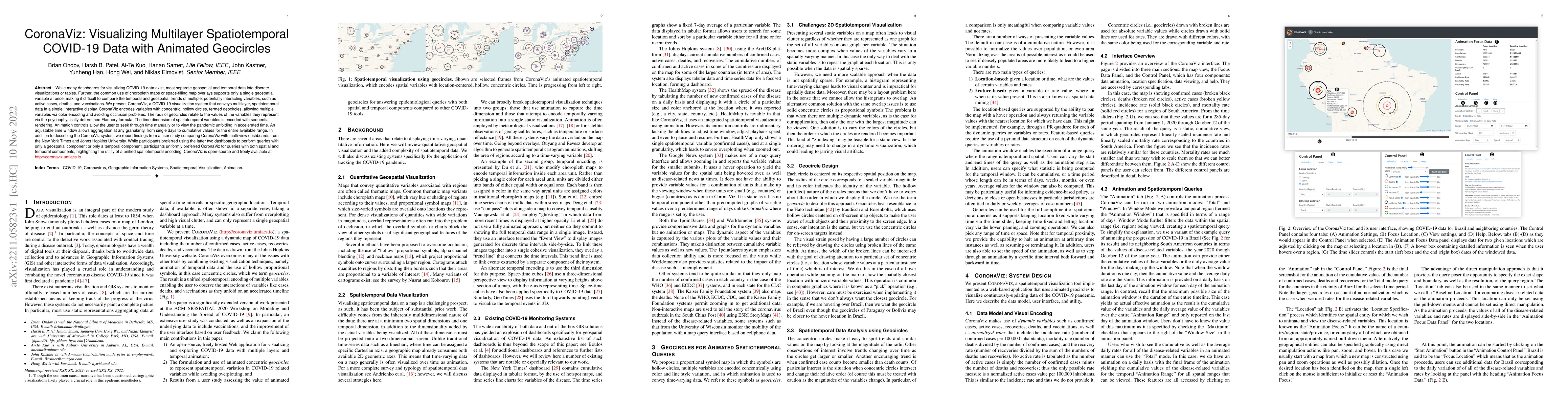
While many dashboards for visualizing COVID-19 data exist, most separate geospatial and temporal data into discrete visualizations or tables. Further, the common use of choropleth maps or space-fill...

This website uses cookies to ensure you get the best experience. Learn more