Academic Profile
Statistics
Similar Authors
Papers on arXiv
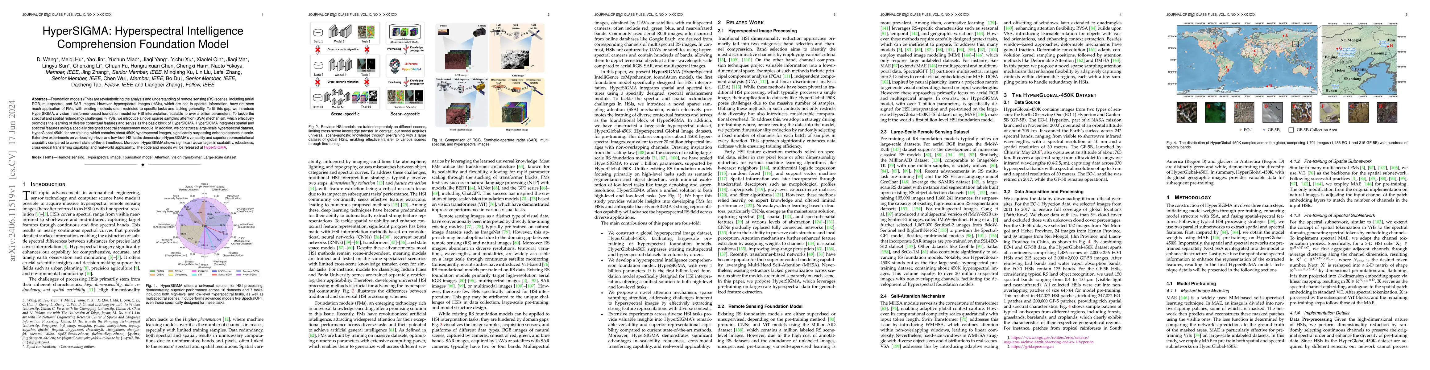
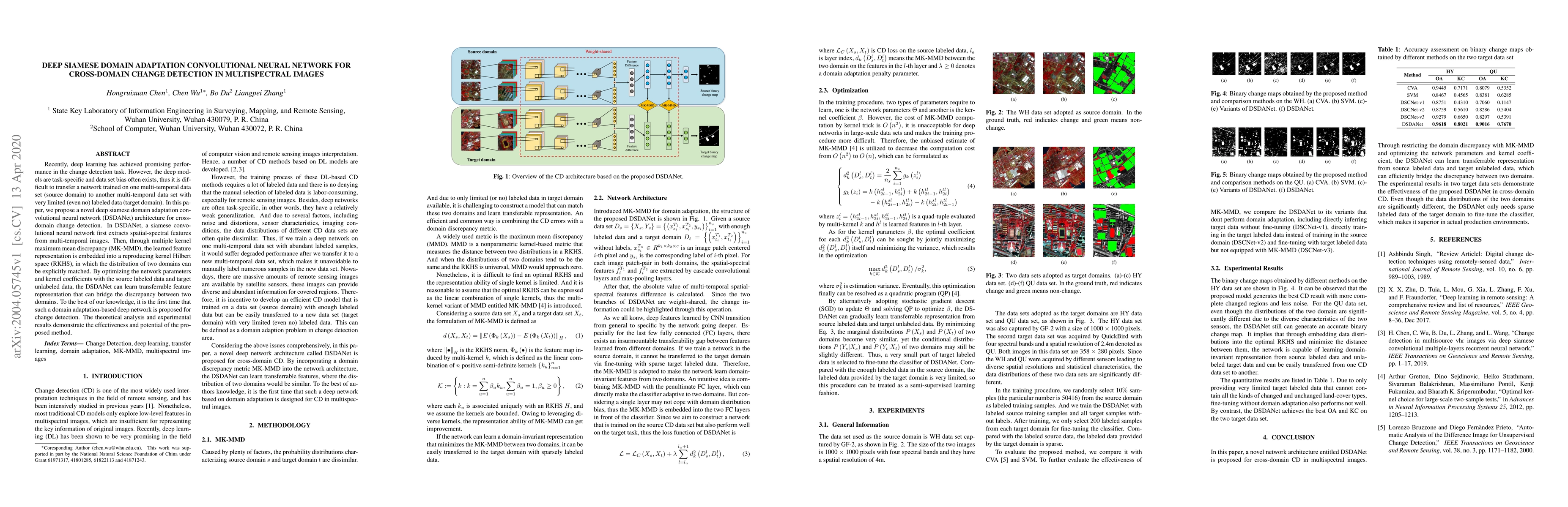
Foundation models (FMs) are revolutionizing the analysis and understanding of remote sensing (RS) scenes, including aerial RGB, multispectral, and SAR images. However, hyperspectral images (HSIs), whi...
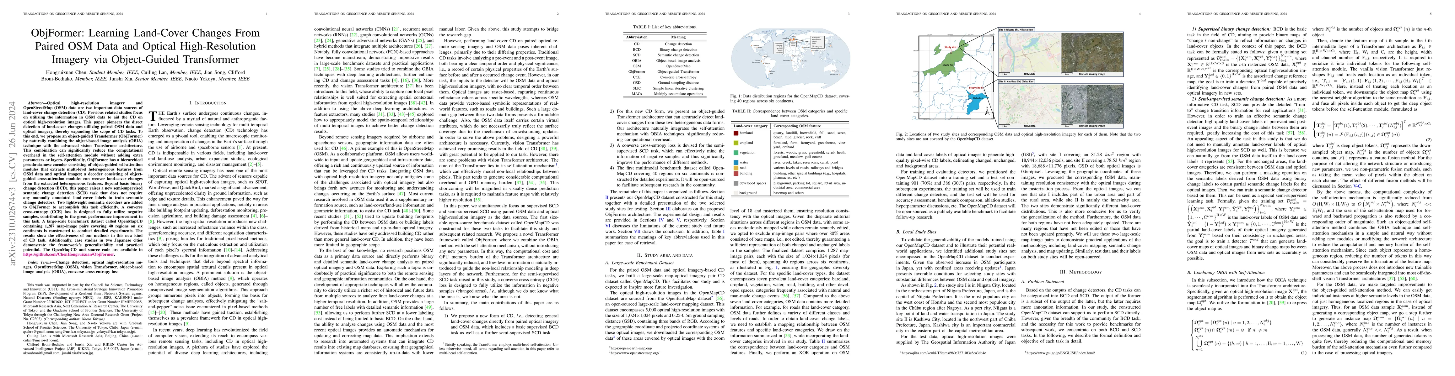
Optical high-resolution imagery and OSM data are two important data sources of change detection (CD). Previous related studies focus on utilizing the information in OSM data to aid the CD on optical h...
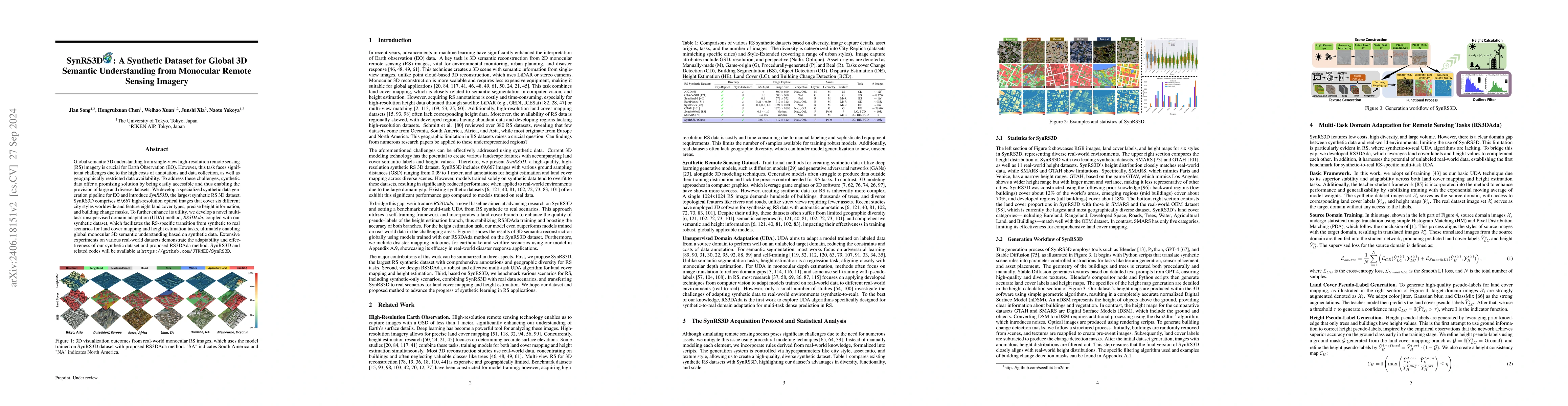
Global semantic 3D understanding from single-view high-resolution remote sensing (RS) imagery is crucial for Earth Observation (EO). However, this task faces significant challenges due to the high cos...
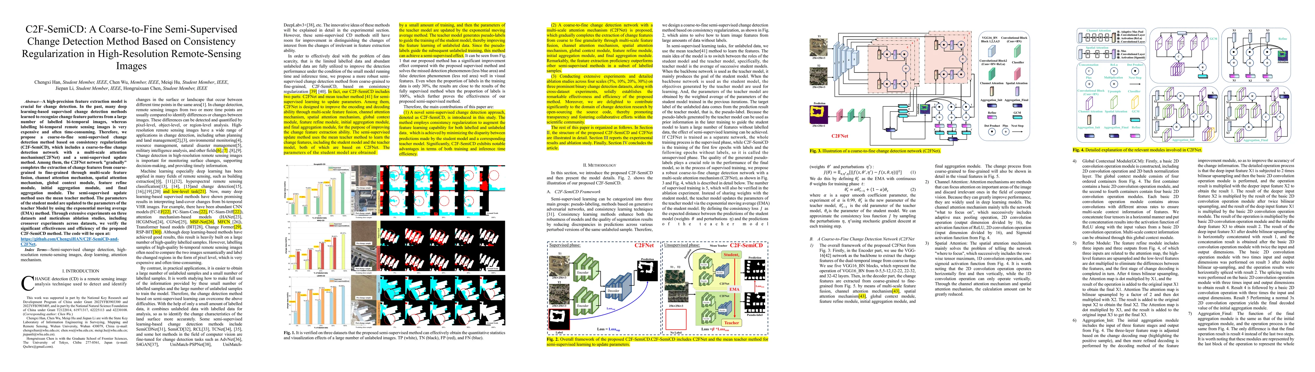
A high-precision feature extraction model is crucial for change detection (CD). In the past, many deep learning-based supervised CD methods learned to recognize change feature patterns from a large ...
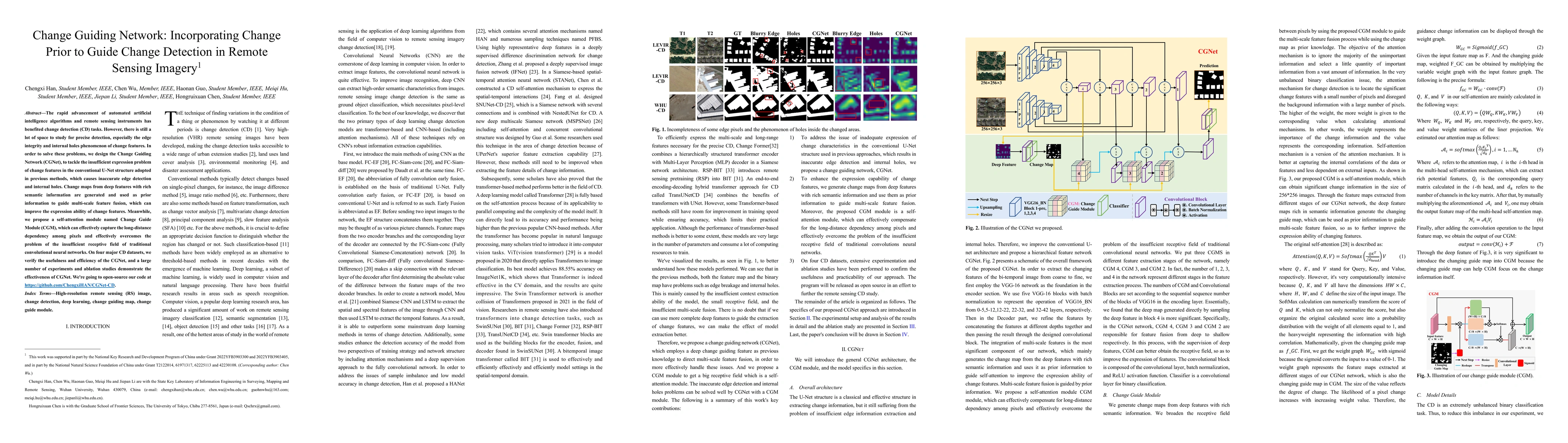
The rapid advancement of automated artificial intelligence algorithms and remote sensing instruments has benefited change detection (CD) tasks. However, there is still a lot of space to study for pr...
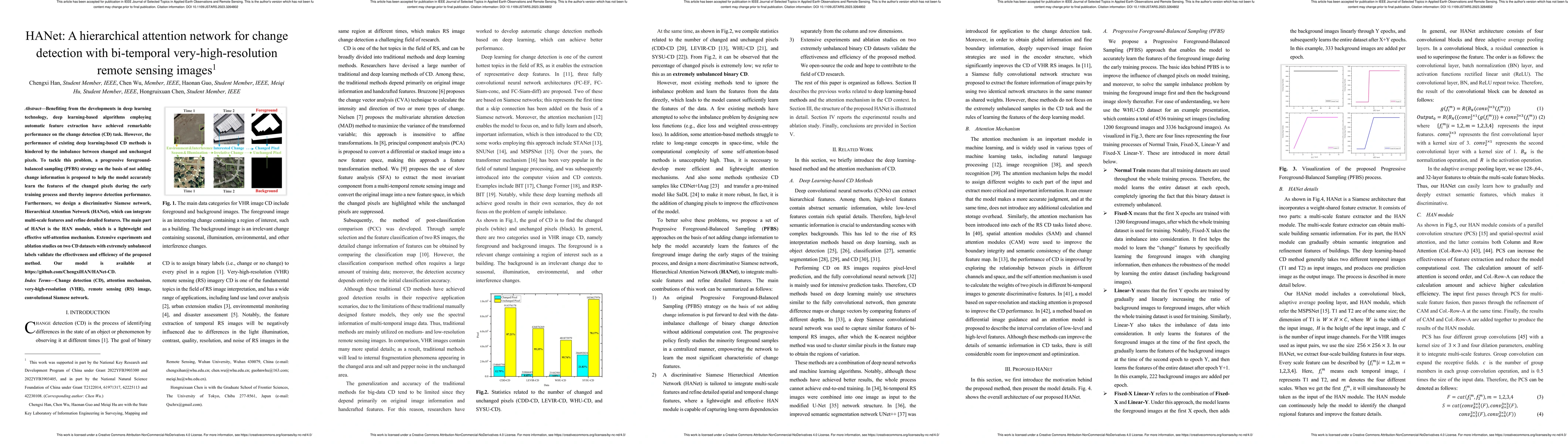
Benefiting from the developments in deep learning technology, deep-learning-based algorithms employing automatic feature extraction have achieved remarkable performance on the change detection (CD) ...
Since coral reef ecosystems face threats from human activities and climate change, coral conservation programs are implemented worldwide. Monitoring coral health provides references for guiding cons...
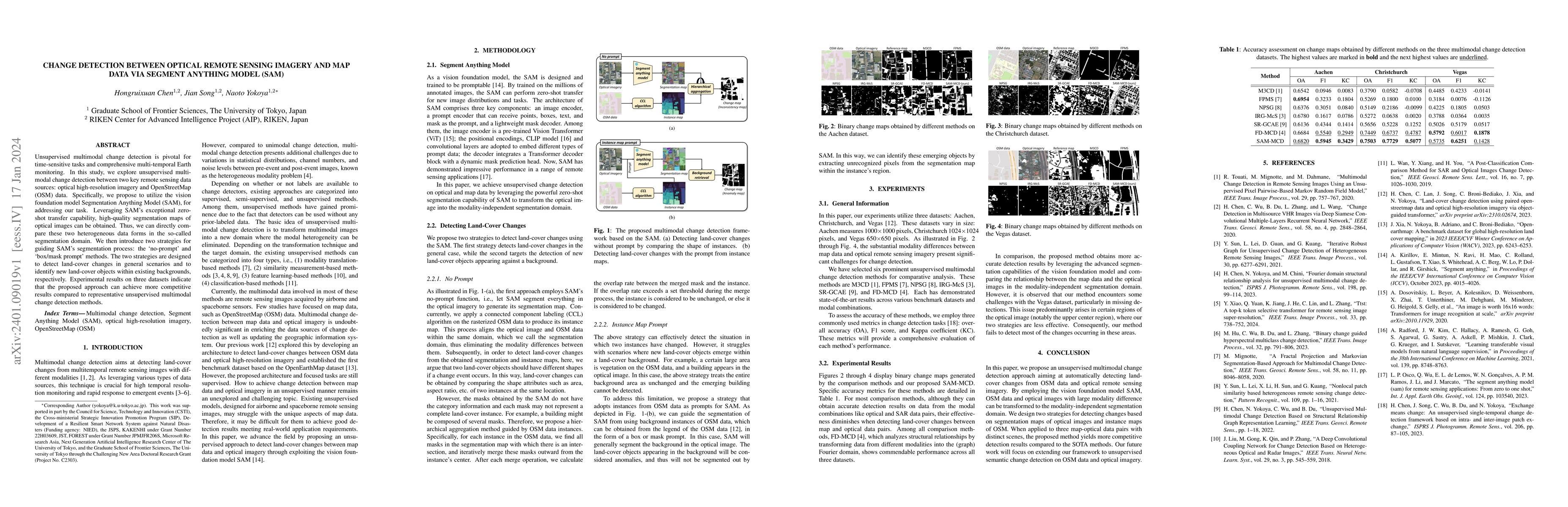
Unsupervised multimodal change detection is pivotal for time-sensitive tasks and comprehensive multi-temporal Earth monitoring. In this study, we explore unsupervised multimodal change detection bet...
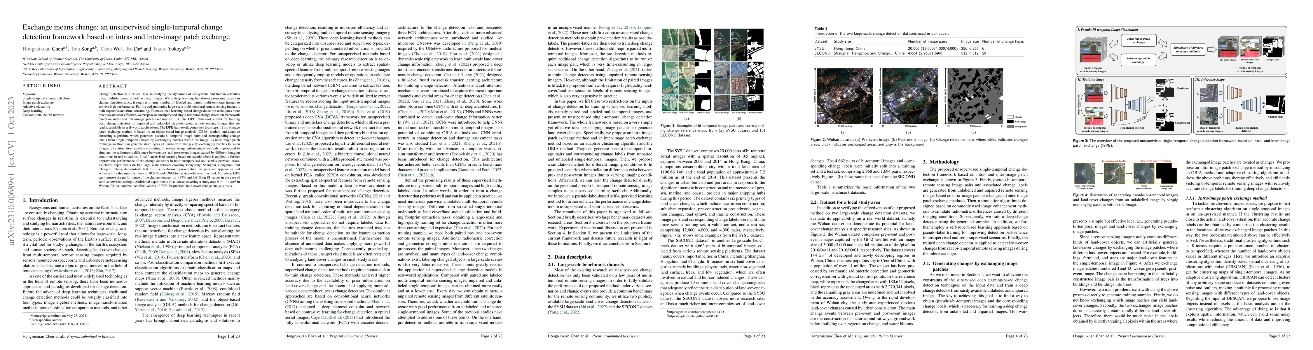
Change detection (CD) is a critical task in studying the dynamics of ecosystems and human activities using multi-temporal remote sensing images. While deep learning has shown promising results in CD...
Synthetic datasets, recognized for their cost effectiveness, play a pivotal role in advancing computer vision tasks and techniques. However, when it comes to remote sensing image processing, the cre...
Unsupervised multimodal change detection is a practical and challenging topic that can play an important role in time-sensitive emergency applications. To address the challenge that multimodal remot...
Accurate and fine-grained information about the extent of damage to buildings is essential for humanitarian relief and disaster response. However, as the most commonly used architecture in remote se...
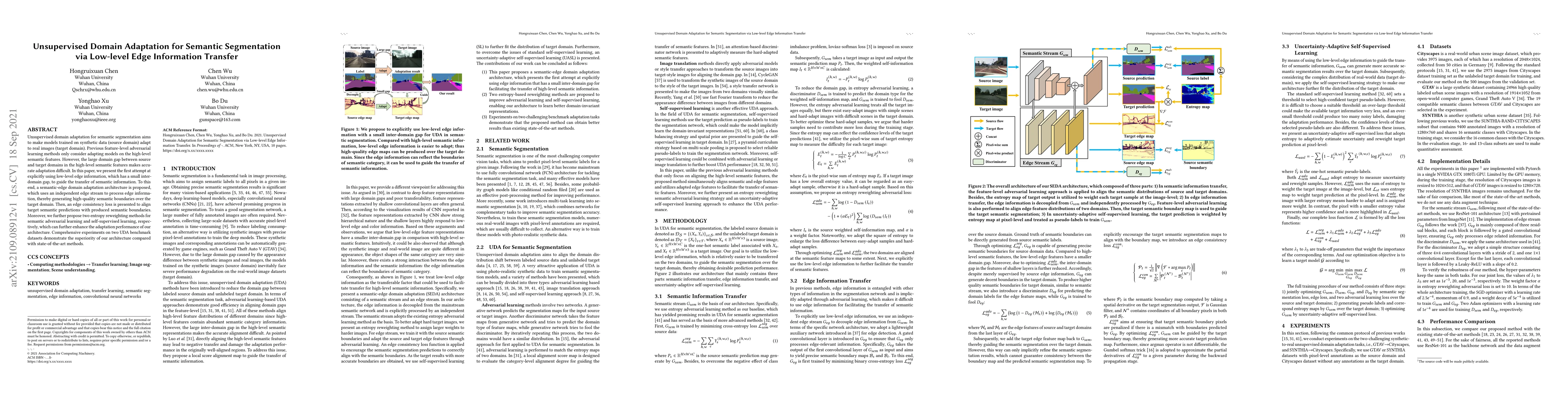
Unsupervised domain adaptation for semantic segmentation aims to make models trained on synthetic data (source domain) adapt to real images (target domain). Previous feature-level adversarial learni...
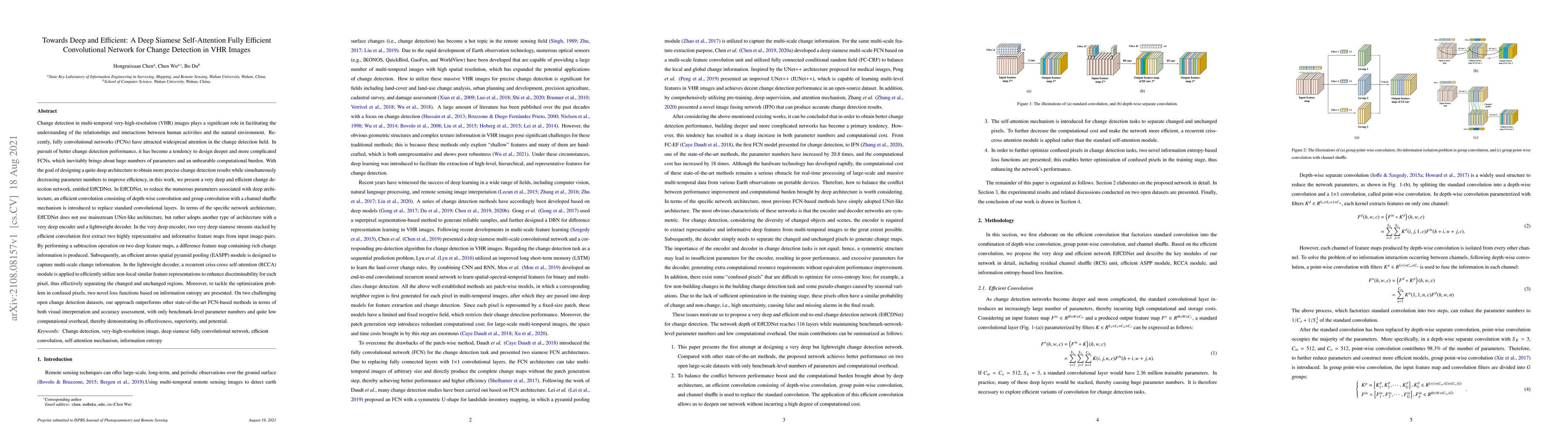
Recently, FCNs have attracted widespread attention in the CD field. In pursuit of better CD performance, it has become a tendency to design deeper and more complicated FCNs, which inevitably brings ...
Change detection (CD) is one of the most vital applications in remote sensing. Recently, deep learning has achieved promising performance in the CD task. However, the deep models are task-specific a...
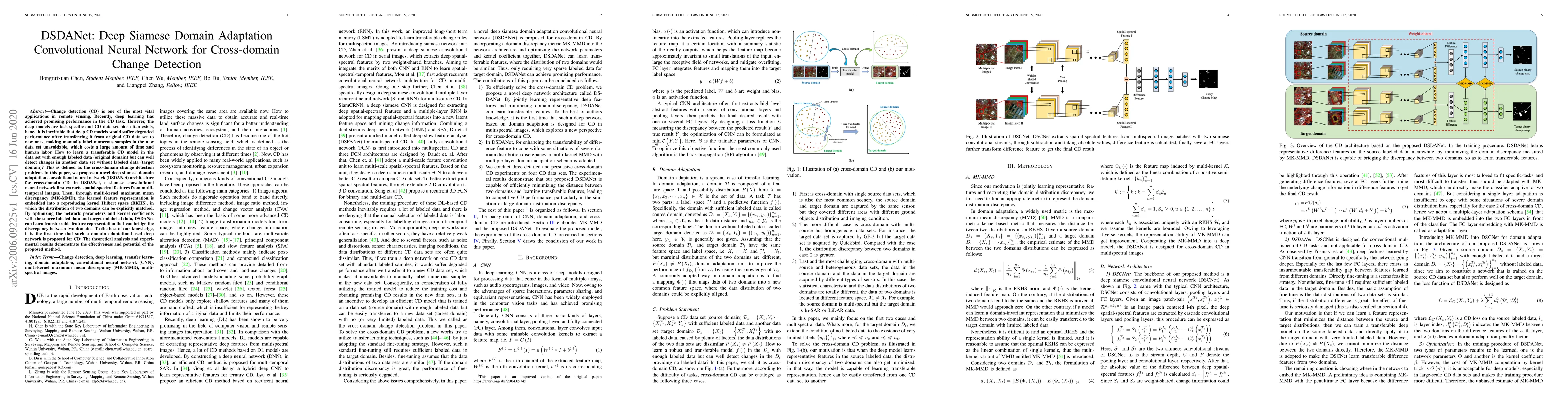
Recently, deep learning has achieved promising performance in the change detection task. However, the deep models are task-specific and data set bias often exists, thus it is difficult to transfer a...
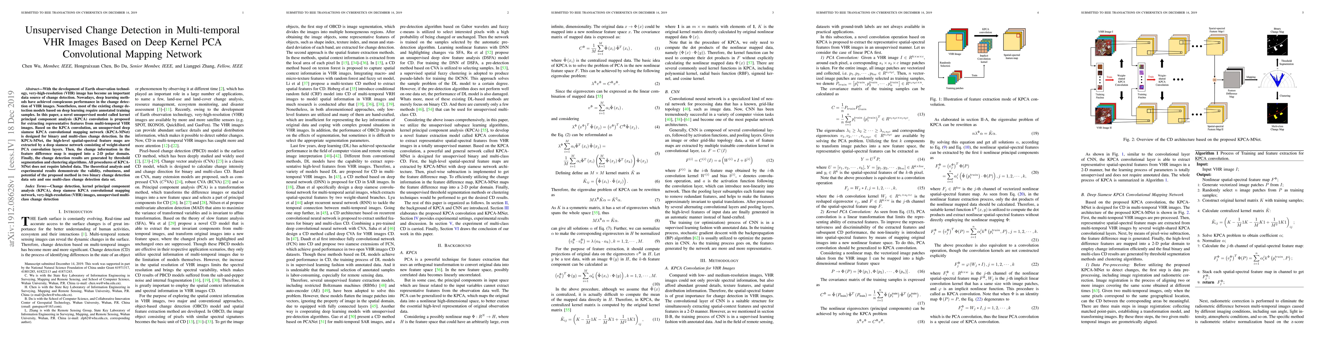
With the development of Earth observation technology, very-high-resolution (VHR) image has become an important data source of change detection. Nowadays, deep learning methods have achieved conspicu...
Learning with limited labelled data is a challenging problem in various applications, including remote sensing. Few-shot semantic segmentation is one approach that can encourage deep learning models t...
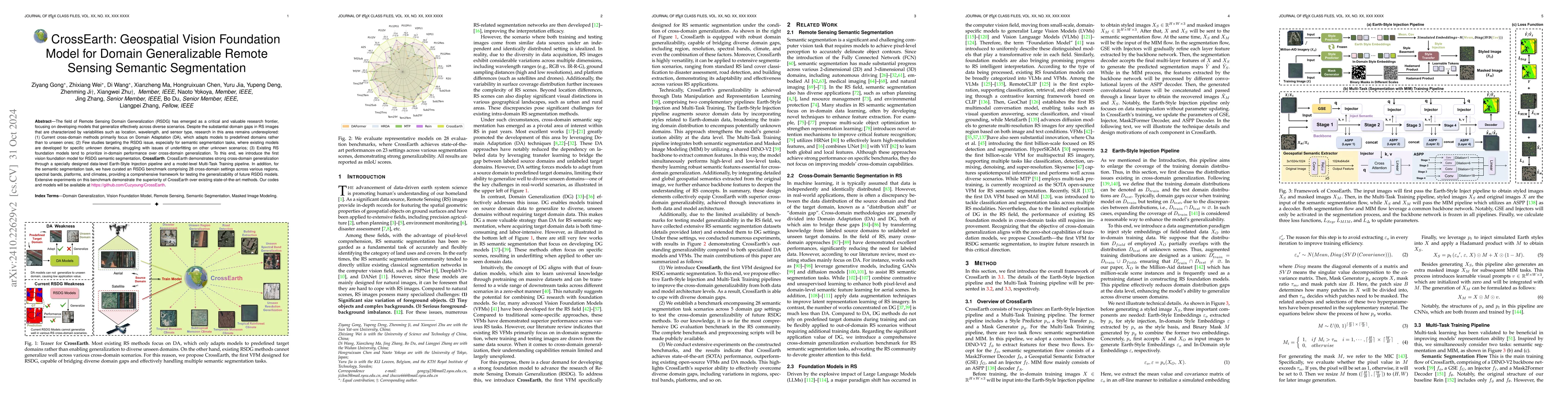
The field of Remote Sensing Domain Generalization (RSDG) has emerged as a critical and valuable research frontier, focusing on developing models that generalize effectively across diverse scenarios. D...
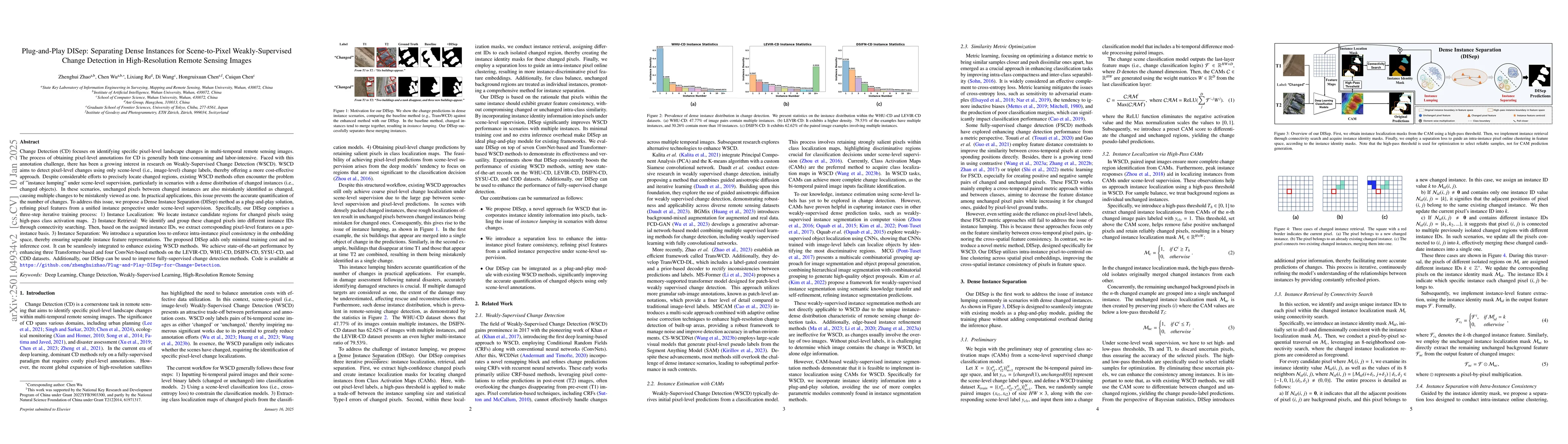
Existing Weakly-Supervised Change Detection (WSCD) methods often encounter the problem of "instance lumping" under scene-level supervision, particularly in scenarios with a dense distribution of chang...
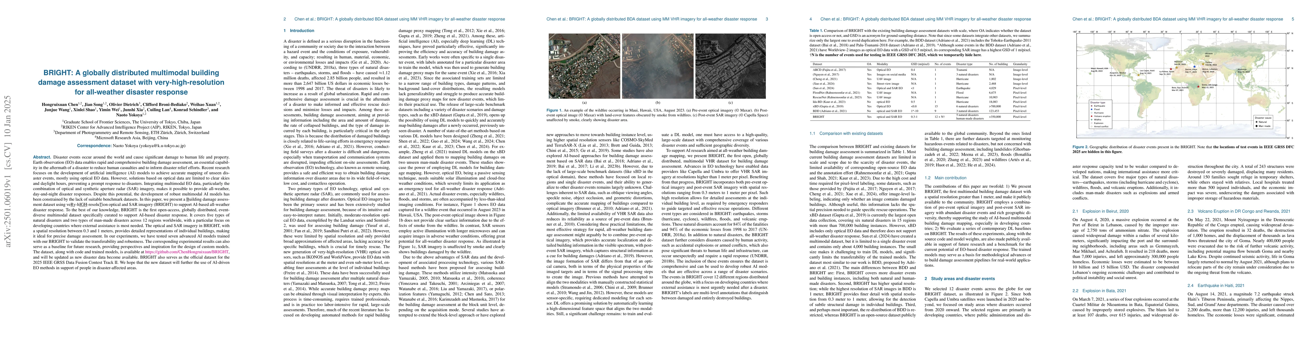
Disaster events occur around the world and cause significant damage to human life and property. Earth observation (EO) data enables rapid and comprehensive building damage assessment (BDA), an essenti...
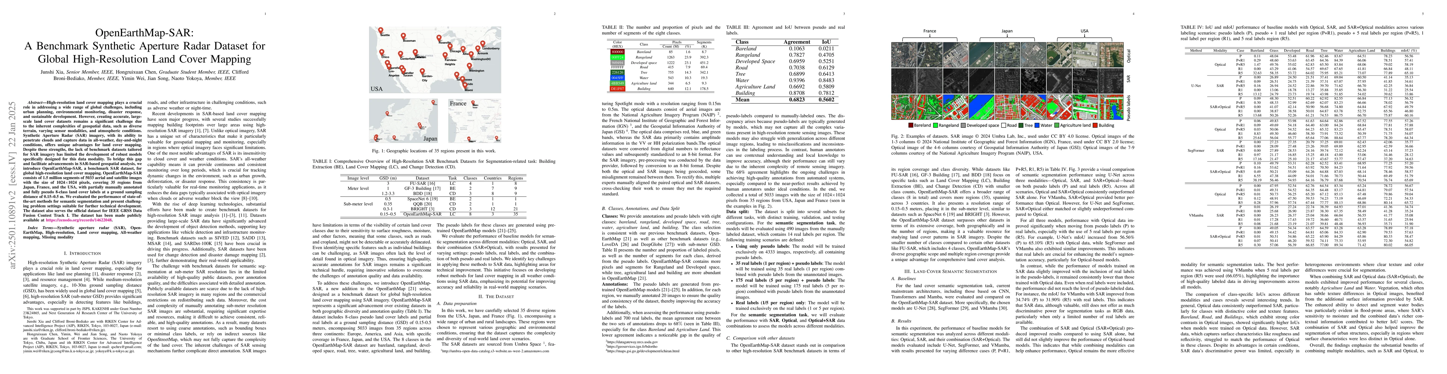
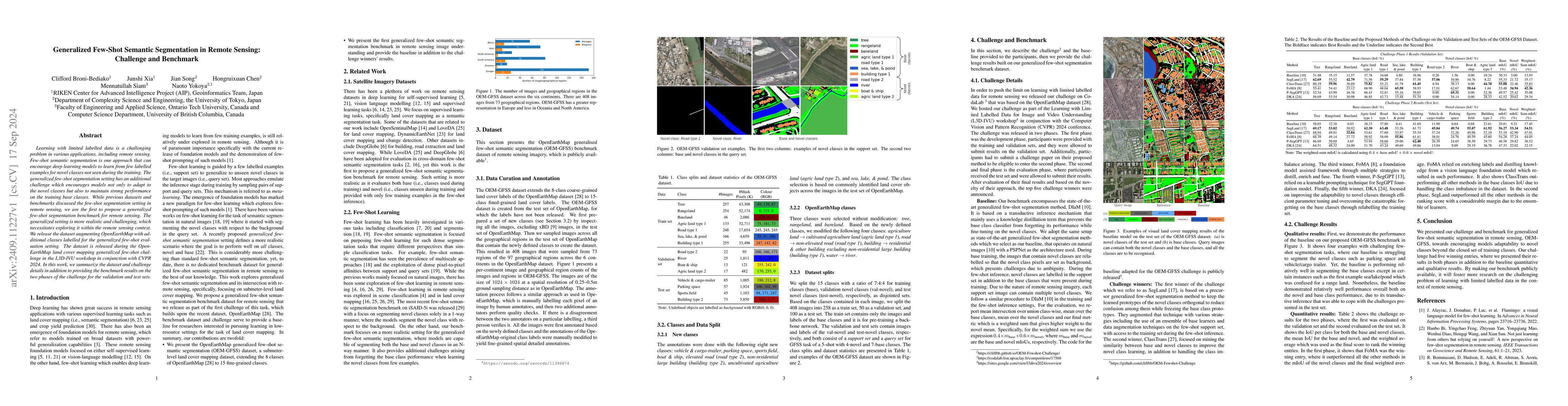
High-resolution land cover mapping plays a crucial role in addressing a wide range of global challenges, including urban planning, environmental monitoring, disaster response, and sustainable developm...
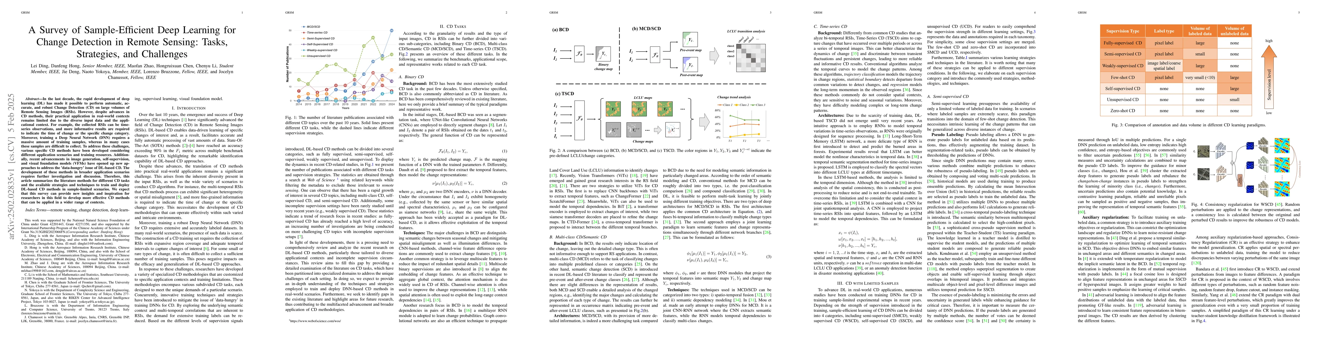
In the last decade, the rapid development of deep learning (DL) has made it possible to perform automatic, accurate, and robust Change Detection (CD) on large volumes of Remote Sensing Images (RSIs). ...
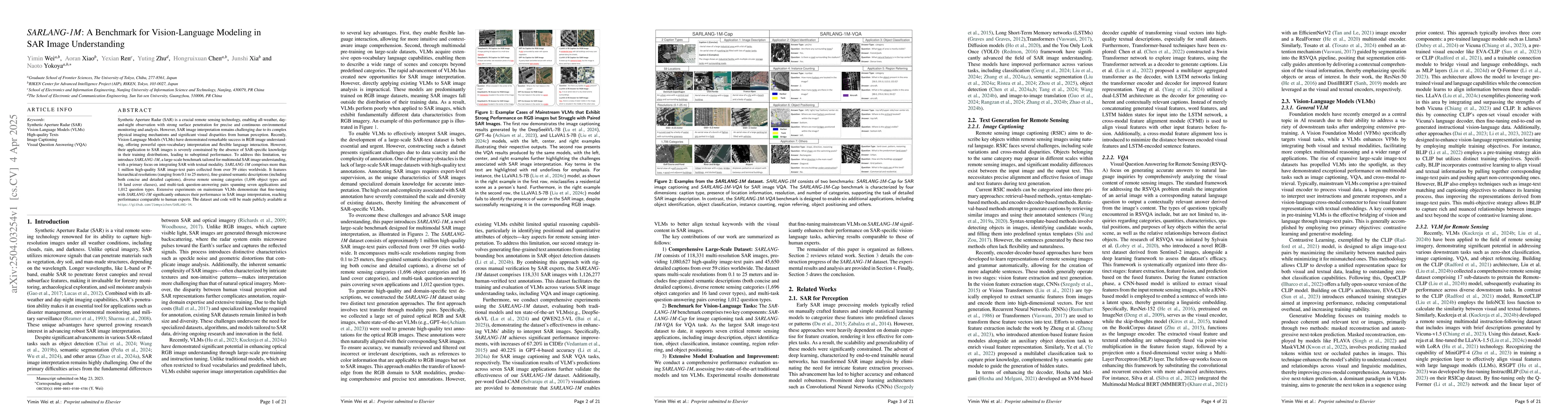
Synthetic Aperture Radar (SAR) is a crucial remote sensing technology, enabling all-weather, day-and-night observation with strong surface penetration for precise and continuous environmental monitori...
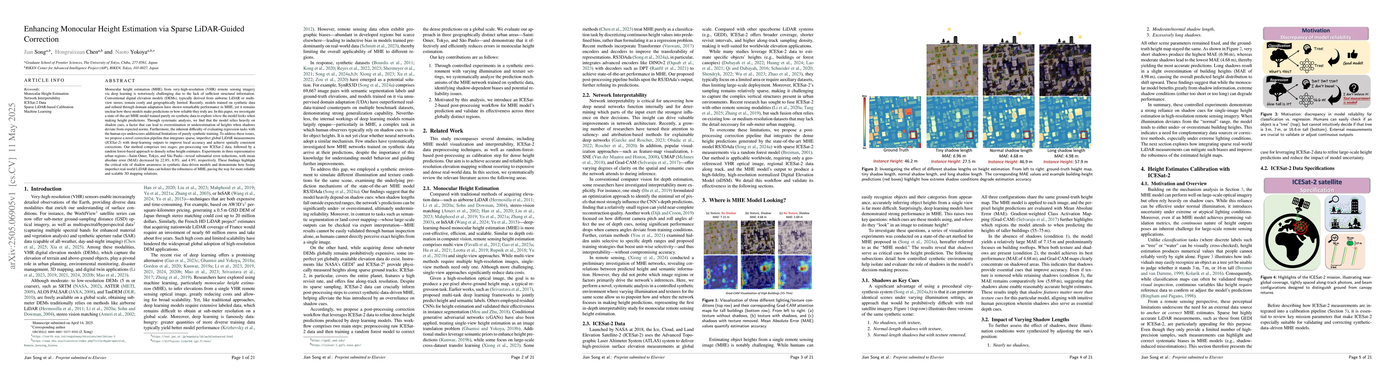
Monocular height estimation (MHE) from very-high-resolution (VHR) remote sensing imagery via deep learning is notoriously challenging due to the lack of sufficient structural information. Conventional...
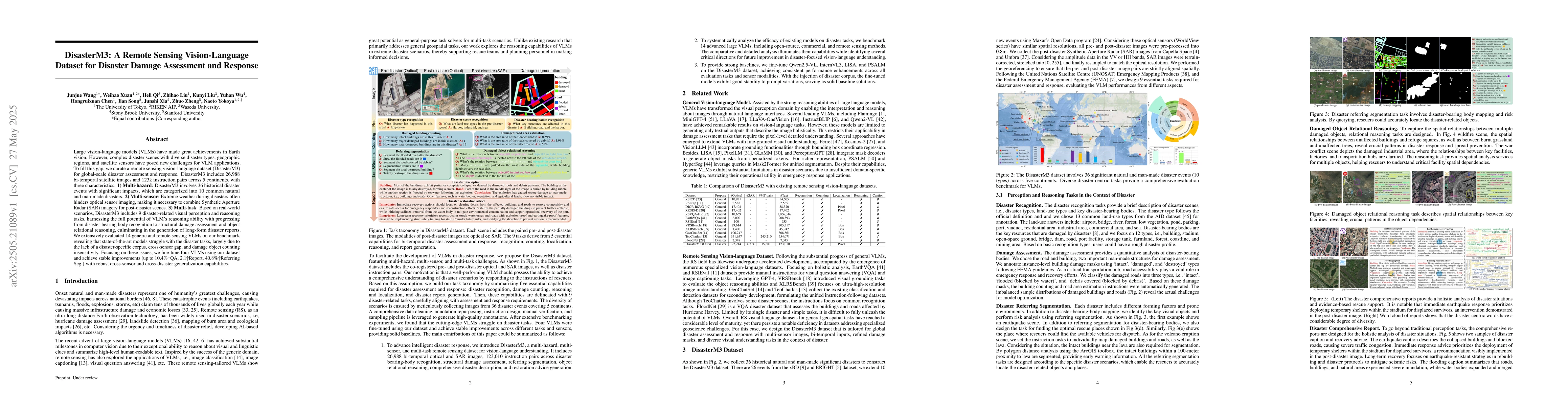
Large vision-language models (VLMs) have made great achievements in Earth vision. However, complex disaster scenes with diverse disaster types, geographic regions, and satellite sensors have posed new...
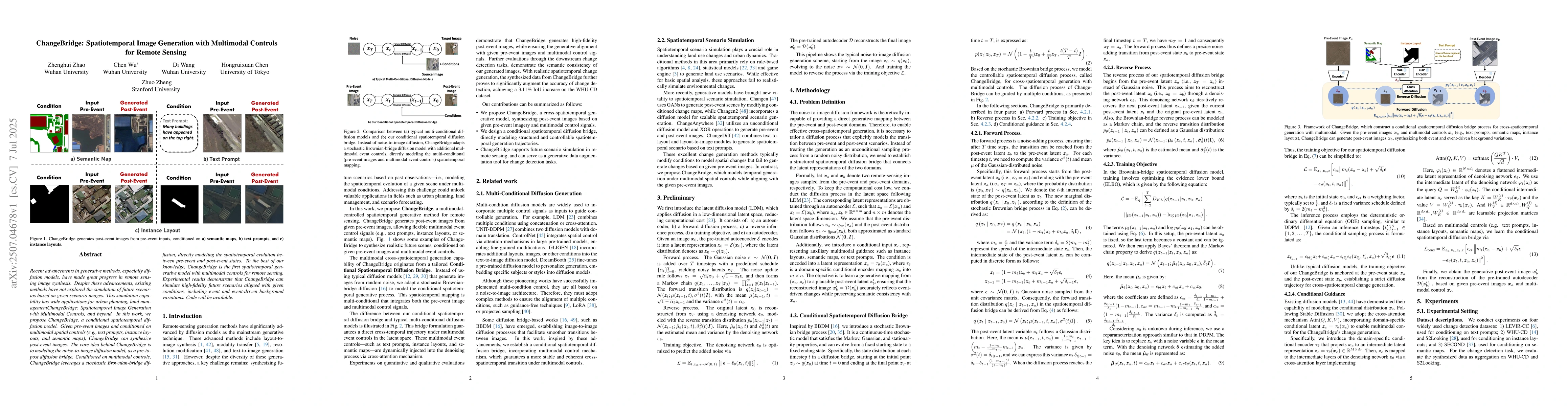
Recent advancements in generative methods, especially diffusion models, have made great progress in remote sensing image synthesis. Despite these advancements, existing methods have not explored the s...
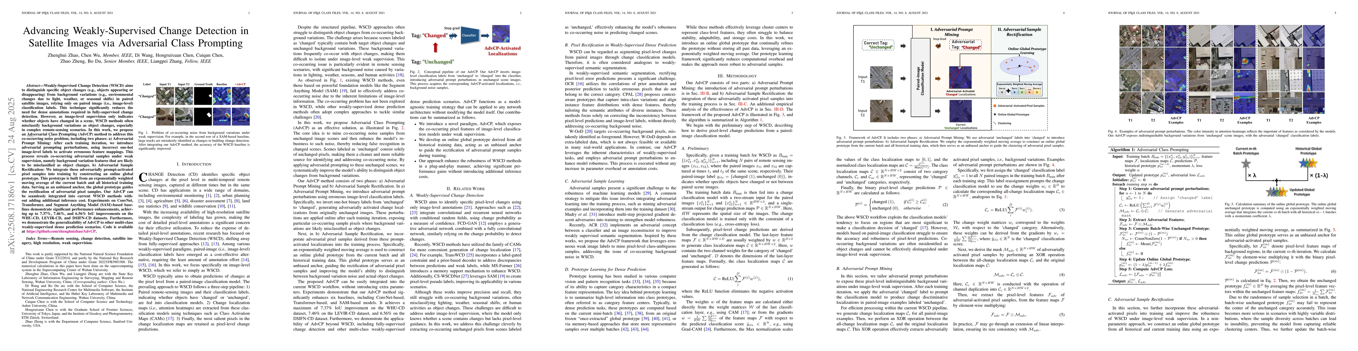
Weakly-Supervised Change Detection (WSCD) aims to distinguish specific object changes (e.g., objects appearing or disappearing) from background variations (e.g., environmental changes due to light, we...
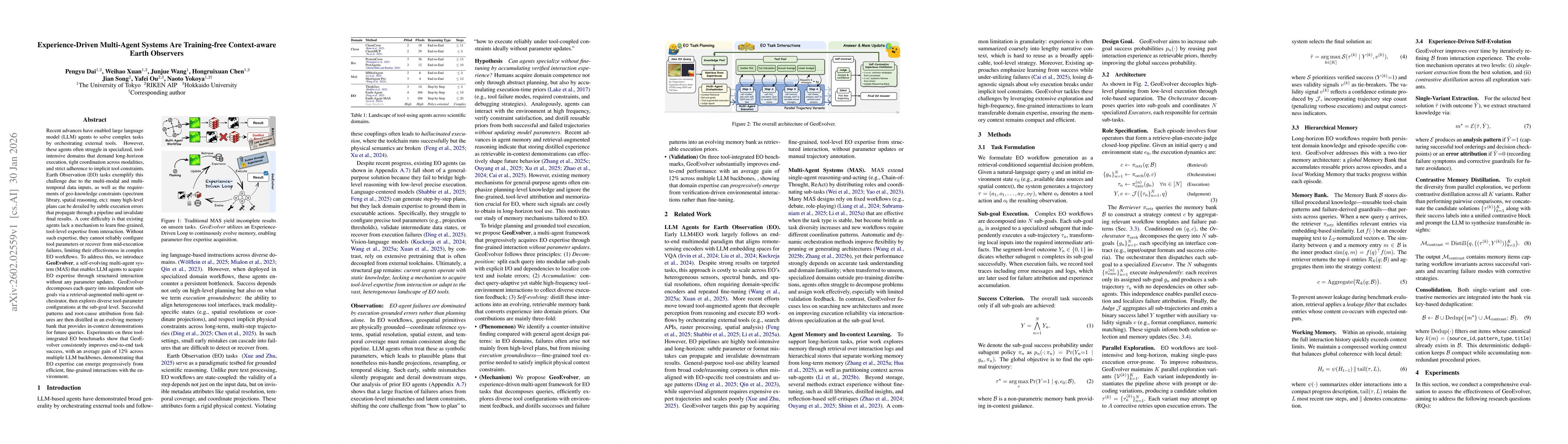
Recent advances have enabled large language model (LLM) agents to solve complex tasks by orchestrating external tools. However, these agents often struggle in specialized, tool-intensive domains that ...
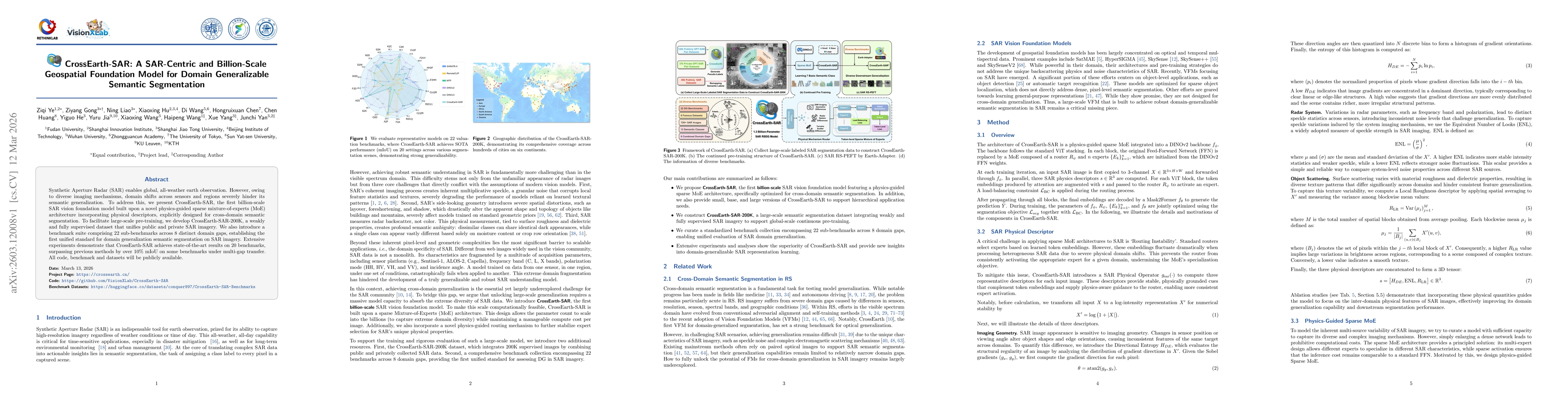
Synthetic Aperture Radar (SAR) enables global, all-weather earth observation. However, owing to diverse imaging mechanisms, domain shifts across sensors and regions severely hinder its semantic genera...
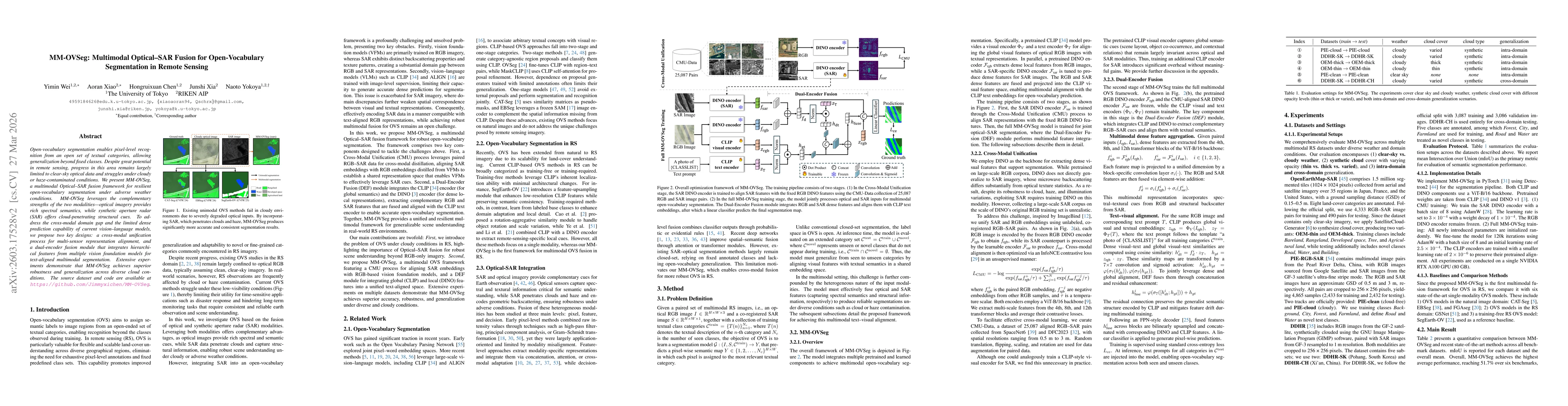
Open-vocabulary segmentation enables pixel-level recognition from an open set of textual categories, allowing generalization beyond fixed classes. Despite great potential in remote sensing, progress i...
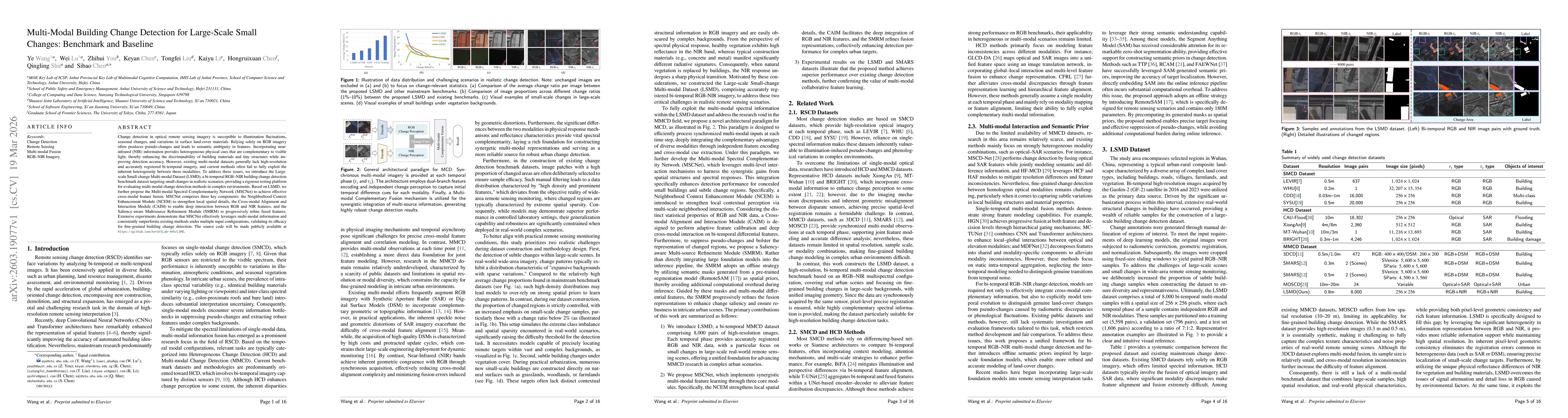
Change detection in optical remote sensing imagery is susceptible to illumination fluctuations, seasonal changes, and variations in surface land-cover materials. Relying solely on RGB imagery often pr...
Recent advances in multimodal large language models (MLLMs) have accelerated progress in domain-oriented AI, yet their development in geoscience and remote sensing (RS) remains constrained by distinct...
Building extraction from optical Remote Sensing (RS) imagery suffers from performance degradation under real-world hazy and low-light conditions. However, existing optical methods and benchmarks focus...

Shadows are a prevalent problem in remote sensing imagery (RSI), degrading visual quality and severely limiting the performance of downstream tasks like object detection and semantic segmentation. Mos...
Rheumatoid arthritis (RA) assessment from hand radiographs requires multi-level analysis and modeling of anatomical structures and fine-grained local pathological changes. However, existing public res...
Operational disaster response goes beyond damage assessment, requiring responders to integrate multi-sensor signals, reason over road networks, populations and key facilities, plan evacuations, and pr...