Academic Profile
Statistics
Similar Authors
Papers on arXiv
High resolution mapping of PM2.5 concentration over Tehran city is challenging because of the complicated behavior of numerous sources of pollution and the insufficient number of ground air quality ...
Crop classification using remote sensing data has emerged as a prominent research area in recent decades. Studies have demonstrated that fusing SAR and optical images can significantly enhance the a...
One of the techniques for estimating the surface particle concentration with a diameter of fewer than 2.5 micrometers (PM2.5) is using aerosol optical depth (AOD) products. Different AOD products ar...
Synergetic use of sensors for soil moisture retrieval is attracting considerable interest due to the different advantages of different sensors. Active, passive, and optic data integration could be a...
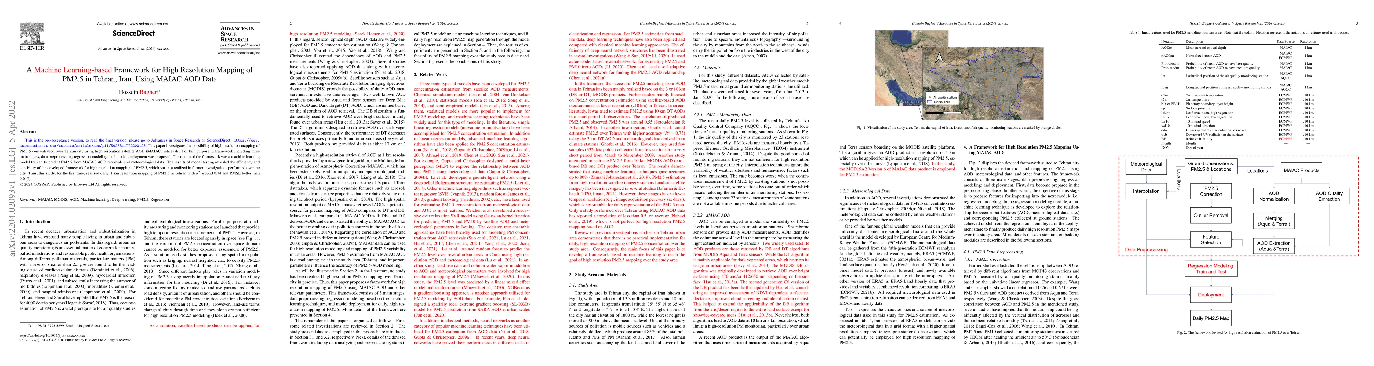
This paper investigates the possibility of high resolution mapping of PM2.5 concentration over Tehran city using high resolution satellite AOD (MAIAC) retrievals. For this purpose, a framework inclu...
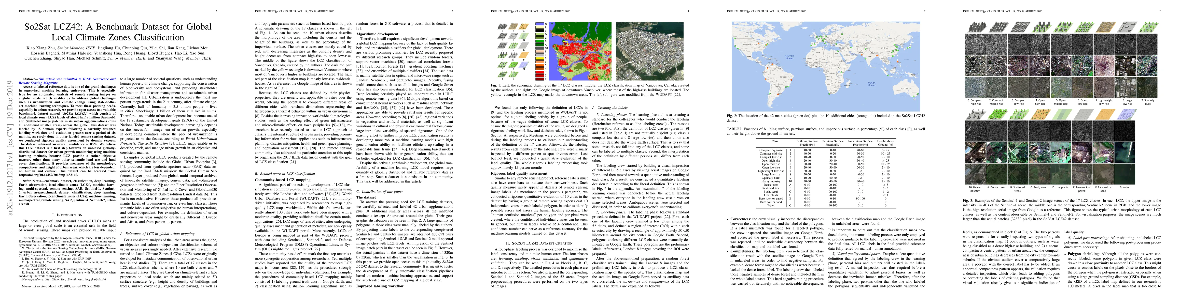
Access to labeled reference data is one of the grand challenges in supervised machine learning endeavors. This is especially true for an automated analysis of remote sensing images on a global scale...
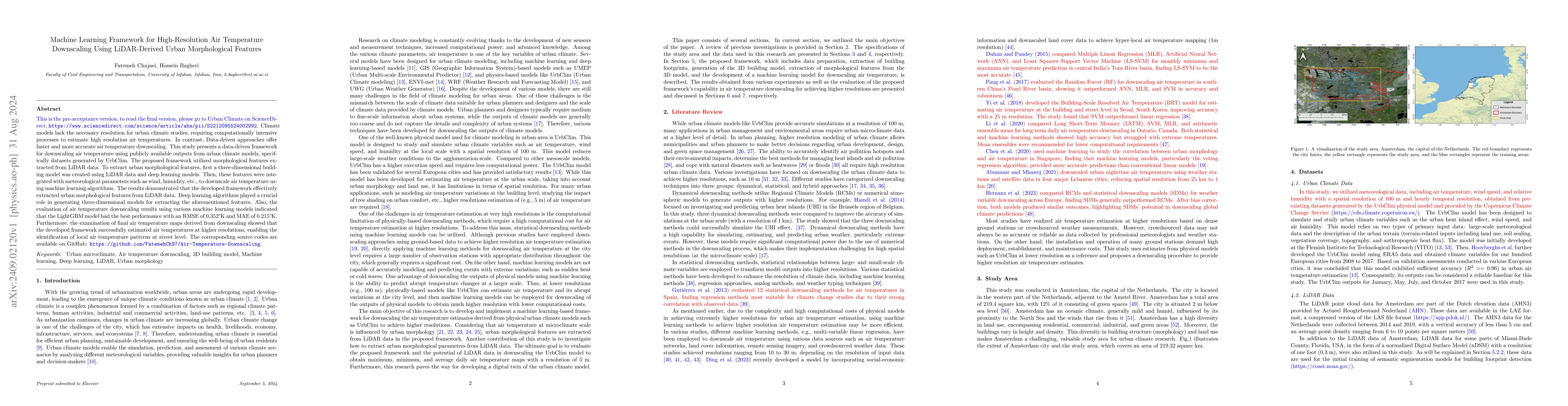
Climate models lack the necessary resolution for urban climate studies, requiring computationally intensive processes to estimate high resolution air temperatures. In contrast, Data-driven approaches ...
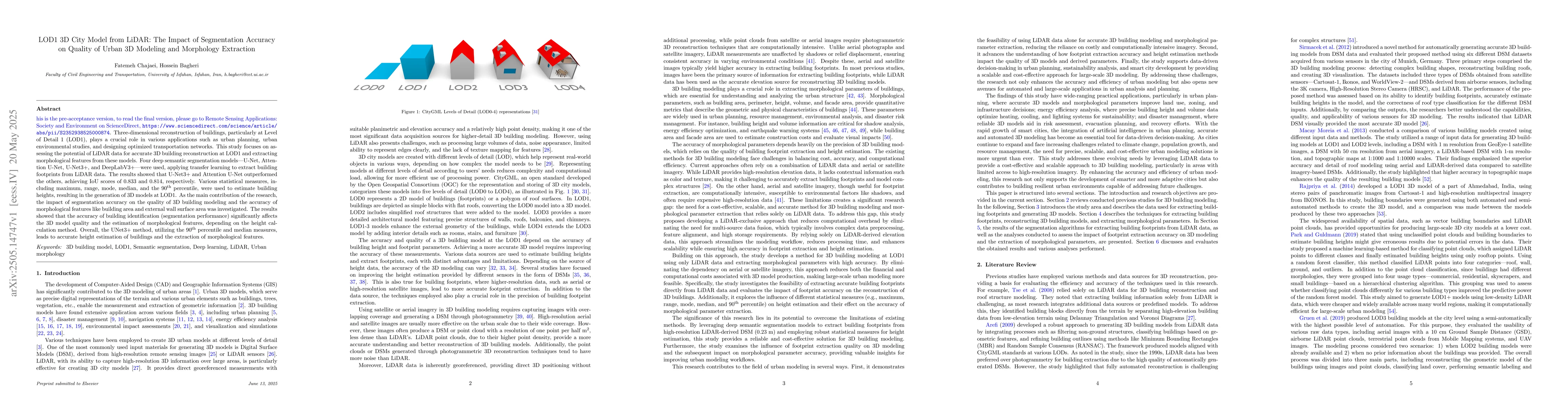
Three-dimensional reconstruction of buildings, particularly at Level of Detail 1 (LOD1), plays a crucial role in various applications such as urban planning, urban environmental studies, and designing...
This paper presents a novel framework for prioritizing urban green space development in Tehran using diverse socio-economic, environmental, and sensitivity indices. The indices were derived from vario...
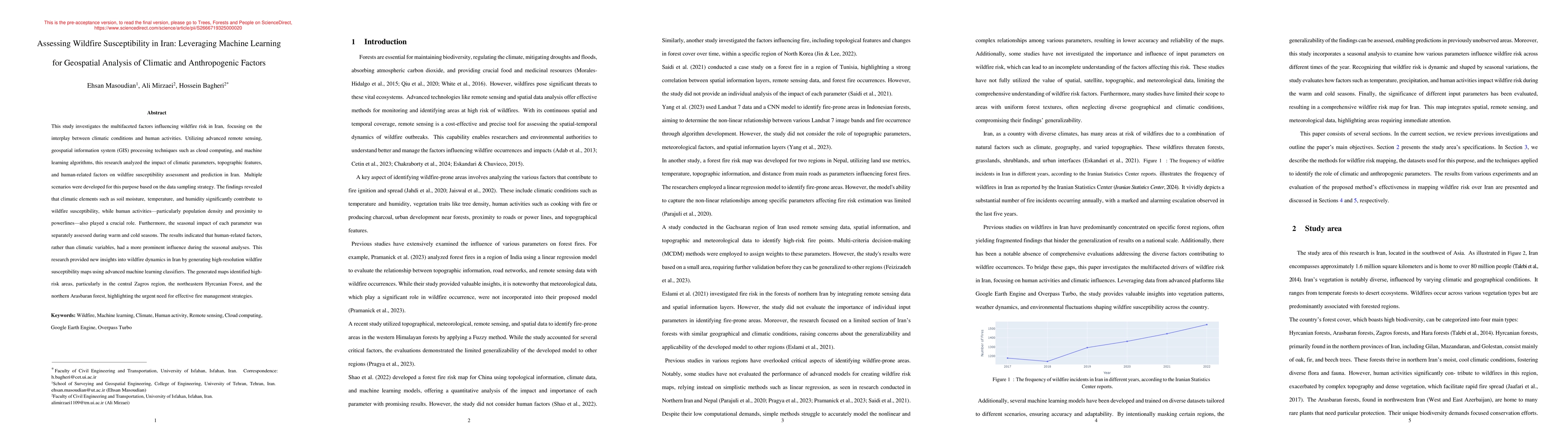
This study investigates the multifaceted factors influencing wildfire risk in Iran, focusing on the interplay between climatic conditions and human activities. Utilizing advanced remote sensing, geosp...