This study investigates the impact of semantic segmentation accuracy on 3D building modeling and morphology extraction from LiDAR data, finding that U-Net3+ outperforms other models in terms of IoU scores and accurate height estimation.
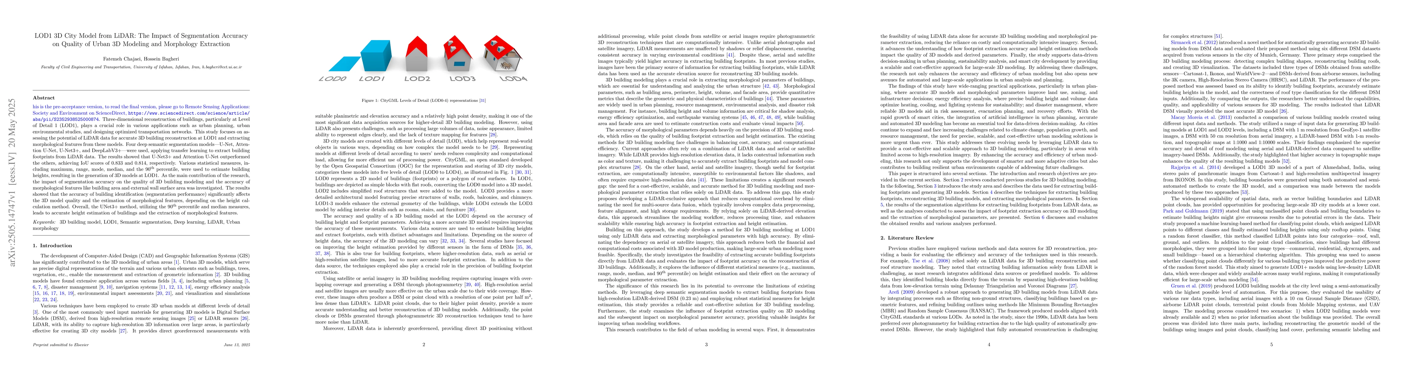
Three-dimensional reconstruction of buildings, particularly at Level of Detail 1 (LOD1), plays a crucial role in various applications such as urban planning, urban environmental studies, and designing optimized transportation networks. This study focuses on assessing the potential of LiDAR data for accurate 3D building reconstruction at LOD1 and extracting morphological features from these models. Four deep semantic segmentation models, U-Net, Attention U-Net, U-Net3+, and DeepLabV3+, were used, applying transfer learning to extract building footprints from LiDAR data. The results showed that U-Net3+ and Attention U-Net outperformed the others, achieving IoU scores of 0.833 and 0.814, respectively. Various statistical measures, including maximum, range, mode, median, and the 90th percentile, were used to estimate building heights, resulting in the generation of 3D models at LOD1. As the main contribution of the research, the impact of segmentation accuracy on the quality of 3D building modeling and the accuracy of morphological features like building area and external wall surface area was investigated. The results showed that the accuracy of building identification (segmentation performance) significantly affects the 3D model quality and the estimation of morphological features, depending on the height calculation method. Overall, the UNet3+ method, utilizing the 90th percentile and median measures, leads to accurate height estimation of buildings and the extraction of morphological features.
Get AI-generated insights about this paper's methodology, results, and significance.
Current paper (gray), citations (green), references (blue)
Xiao Wang, Filip Biljecki, Biao Li et al.
Yong Li, Yu Shang, Jiansheng Chen et al.
No citations found for this paper.
Title | Authors | Year | Actions |
---|---|---|---|
Improving the resolution of solar energy potential maps derived from global DSMs for rooftop solar panel placement using deep learning
|
Maryam Hosseini, Hossein Bagheri
|
2024
|
View Paper |
Machine Learning Framework for High-Resolution Air Temperature Downscaling Using LiDAR-Derived Urban Morphological Features
|
Fatemeh Chajaei, Hossein Bagheri
|
2024
|
View Paper |
Development and Application of an Integrated BIM-GIS System for the Energy Management of Buildings
|
V. Barrile, E. Genovese, Francesco Favasuli
|
2023
|
View Paper |
Elevation Estimation-Driven Building 3-D Reconstruction From Single-View Remote Sensing Imagery
|
Yongqiang Mao, Kaiqiang Chen, Liangjin Zhao, Wei Chen, Deke Tang, Wenjie Liu, Zhirui Wang, Wenhui Diao, Xian Sun, Kun Fu
|
2023
|
View Paper |
Reconstruction of LoD-2 Building Models Guided by Façade Structures from Oblique Photogrammetric Point Cloud
|
Feng Wang, Guoqing Zhou, Han Hu, Yuefeng Wang, B. Fu, Shiming Li, Jiali Xie
|
2023
|
View Paper |
3D building metrics for urban morphology
|
A. Labetski, S. Vitalis, Filip Biljecki, K. Ohori, J. Stoter
|
2022
|
View Paper |
The impact of the building morphology on microclimate and thermal comfort-a case study in Beijing
|
Jiaolong Zhang, Zhen Li, Yaxi Wei, Dan Hu
|
2022
|
View Paper |
Global Building Morphology Indicators
|
Filip Biljecki, Y. S. Chow
|
2022
|
View Paper |
Design morphology complexity and conceptual building project cost forecasting
|
D. Kantianis
|
2022
|
View Paper |
City3D: Large-Scale Building Reconstruction from Airborne LiDAR Point Clouds
|
Jin Huang, J. Stoter, Ravi Peters, Liangliang Nan
|
2022
|
View Paper |
Understanding the effects of 2D/3D urban morphology on land surface temperature based on local climate zones
|
Liang Zhou, Bo Yuan, Fengning Hu, Chunzhu Wei, Xuewei Dang, Dongqi Sun
|
2021
|
View Paper |
A Novel Method Based on Deep Learning, GIS and Geomatics Software for Building a 3D City Model from VHR Satellite Stereo Imagery
|
M. Pepe, D. Costantino, V. Alfio, Gabriele Vozza, Elena Cartellino
|
2021
|
View Paper |
A systematic method to develop three dimensional geometry models of buildings for urban building energy modeling
|
Chao Wang, Shen Wei, Sihong Du, Dian Zhuang, Yanxia Li, Xingzhi Shi, Xing Jin, Xin Zhou
|
2021
|
View Paper |
The effects of 2D and 3D building morphology on urban environments: A multi-scale analysis in the Beijing metropolitan region
|
Q. Cao, Q. Luan, Yupeng Liu, Ren-chao Wang
|
2021
|
View Paper |
Digital Twins for Cities: A State of the Art Review
|
Bernd Ketzler, Vasilis Naserentin, Fabio Latino, Christoforos Zangelidis, L. Thuvander, A. Logg
|
2020
|
View Paper |
USING 3D WEBGIS TO SUPPORT THE DISASTER SIMULATION, MANAGEMENT AND ANALYSIS – EXAMPLES OF TSUNAMI AND FLOOD
|
J-H. Hong, C. Tsai
|
2020
|
View Paper |
Automatic LIDAR building segmentation based on DGCNN and euclidean clustering
|
Ahmad Gamal, A. Wibisono, Satrio Bagus Wicaksono, Muhammad Alvin Abyan, Nur Hamid, H. A. Wisesa, W. Jatmiko, Ronny Ardhianto
|
2020
|
View Paper |
Multi-scale three-dimensional detection of urban buildings using aerial LiDAR data
|
Shisong Cao, Qihao Weng, Mingyi Du, Bing Li, Ruofei Zhong, You Mo
|
2020
|
View Paper |
Urban building energy modeling: State of the art and future prospects
|
F. Johari, G. Peronato, P. Sadeghian, X. Zhao, X. Zhao, J. Widén
|
2020
|
View Paper |
UNet 3+: A Full-Scale Connected UNet for Medical Image Segmentation
|
Huimin Huang, Lanfen Lin, Ruofeng Tong, Hongjie Hu, Qiaowei Zhang, Yutaro Iwamoto, Xianhua Han, Yenwei Chen, Jian Wu
|
2020
|
View Paper |
SEMANTICALLY ENRICHED HIGH RESOLUTION LOD 3 BUILDING MODEL GENERATION
|
A. Gruen, S. Schubiger, R. Qin, G. Schrotter, B. Xiong, J. Li, Xiao Ling, C. Xiao, S. Yao, F. Nuesch
|
2019
|
View Paper |
Optimal Compression of a Polyline While Aligning to Preferred Directions
|
A. Gribov
|
2019
|
View Paper |
THE USE OF 3D BUILDING DATA FOR DISASTER MANAGEMENT: A 3D SDI PERSPECTIVE
|
Umroh Dian Sulistyah, Jung-Hong Hong
|
2019
|
View Paper |
Automatic 3-D Building Model Reconstruction from Very High Resolution Stereo Satellite Imagery
|
T. Partovi, F. Fraundorfer, R. Bahmanyar, Hai Huang, P. Reinartz
|
2019
|
View Paper |
Deep-Learning for Lod1 Building Reconstruction from Airborne Lidar Data
|
T. Teo
|
2019
|
View Paper |
The effect of urban 2D and 3D morphology on air temperature in residential neighborhoods
|
Yunyu Tian, Weiqi Zhou, Yuguo Qian, Zhong Zheng, Jingli Yan
|
2019
|
View Paper |
Creating 3D city models with building footprints and LIDAR point cloud classification: A machine learning approach
|
Yujin Park, J. Guldmann
|
2019
|
View Paper |
Fusion of Multi-Sensor-Derived Heights and OSM-Derived Building Footprints for Urban 3D Reconstruction
|
H. Bagheri, M. Schmitt, Xiaoxiang Zhu
|
2019
|
View Paper |
Accurate Reconstruction of the LoD3 Building Model by Integrating Multi-Source Point Clouds and Oblique Remote Sensing Imagery
|
Xuedong Wen, Hong Xie, Hua Liu, Li Yan
|
2019
|
View Paper |
3D CITY MODELLING OF ISTANBUL BASED ON LIDAR DATA AND PANORAMIC IMAGES – ISSUES AND CHALLENGES
|
G. Buyuksalih, P. Baskaraca, S. Bayburt, I. Buyuksalih, Alias Abdul Rahman
|
2019
|
View Paper |
AUTOMATED BUILDING DETECTION USING RANSAC FROM CLASSIFIED LIDAR POINT CLOUD DATA
|
D. L. Bool, L. C. Mabaquiao, M. Tupas, J. Fabila
|
2018
|
View Paper |
Fusion of Urban TanDEM-X Raw DEMs Using Variational Models
|
H. Bagheri, M. Schmitt, Xiaoxiang Zhu
|
2018
|
View Paper |
A framework for SAR-optical stereogrammetry over urban areas
|
H. Bagheri, Michael Schmitt, Pablo d’Angelo, Xiao Xiang Zhu
|
2018
|
View Paper |
A Novel Focal Tversky Loss Function With Improved Attention U-Net for Lesion Segmentation
|
Nabila Abraham, N. Khan
|
2018
|
View Paper |
Fusion of TanDEM-X and Cartosat-1 elevation data supported by neural network-predicted weight maps
|
H. Bagheri, M. Schmitt, Xiaoxiang Zhu
|
2018
|
View Paper |
Building Footprint Extraction From VHR Remote Sensing Images Combined With Normalized DSMs Using Fused Fully Convolutional Networks
|
K. Bittner, Fathalrahman Adam, S. Cui, Marco Körner, P. Reinartz
|
2018
|
View Paper |
A New Method for the Assessment of Spatial Accuracy and Completeness of OpenStreetMap Building Footprints
|
M. Brovelli, G. Zamboni
|
2018
|
View Paper |
Modeling the potential for PV installation in residential buildings in dense urban areas
|
Adi Vulkan, I. Kloog, M. Dorman, E. Erell
|
2018
|
View Paper |
EXPLORING THE APPLICABILITY OF SEMI-GLOBAL MATCHING FOR SAR-OPTICAL STEREOGRAMMETRY OF URBAN SCENES
|
H. Bagheri, M. Schmitt, P. d’Angelo, Xiaoxiang Zhu
|
2018
|
View Paper |
Optimization of OpenStreetMap Building Footprints Based on Semantic Information of Oblique UAV Images
|
X. Zhuo, F. Fraundorfer, F. Kurz, P. Reinartz
|
2018
|
View Paper |
Attention U-Net: Learning Where to Look for the Pancreas
|
O. Oktay, Jo Schlemper, L. L. Folgoc, M. J. Lee, M. Heinrich, K. Misawa, K. Mori, Steven G. McDonagh, Nils Y. Hammerla, Bernhard Kainz, Ben Glocker, D. Rueckert
|
2018
|
View Paper |
Encoder-Decoder with Atrous Separable Convolution for Semantic Image Segmentation
|
Liang-Chieh Chen, Yukun Zhu, G. Papandreou, Florian Schroff, Hartwig Adam
|
2018
|
View Paper |
Identifying critical building morphological design factors of street-level air pollution dispersion in high-density built environment using mobile monitoring
|
Yuan Shi, Xiaoling Xie, J. Fung, E. Ng
|
2018
|
View Paper |
DiSAN: Directional Self-Attention Network for RNN/CNN-free Language Understanding
|
Tao Shen, Tianyi Zhou, Guodong Long, Jing Jiang, Shirui Pan, Chengqi Zhang
|
2017
|
View Paper |
Development of 3D Building Models Using Multi-Source Data: A Study of High-Density Urban Area in Hong Kong
|
Ke Chen, Fan Xue, Weisheng Lu
|
2017
|
View Paper |
Fusion of TanDEM-X and Cartosat-1 DEMS using TV-norm regularization and ANN-predicted weights
|
H. Bagheri, M. Schmitt, Xiaoxiang Zhu
|
2017
|
View Paper |
Rethinking Atrous Convolution for Semantic Image Segmentation
|
Liang-Chieh Chen, G. Papandreou, Florian Schroff, Hartwig Adam
|
2017
|
View Paper |
UNCERTAINTY ASSESSMENT AND WEIGHT MAP GENERATION FOR EFFICIENT FUSION OF TANDEM-X AND CARTOSAT-1 DEMS
|
H. Bagheri, M. Schmitt, Xiaoxiang Zhu
|
2017
|
View Paper |
Optimizing Intersection-Over-Union in Deep Neural Networks for Image Segmentation
|
Md.Atiqur Rahman, Yang Wang
|
2016
|
View Paper |
An improved LOD specification for 3D building models
|
F. Biljecki, H. Ledoux, J. Stoter
|
2016
|
View Paper |
DeepLab: Semantic Image Segmentation with Deep Convolutional Nets, Atrous Convolution, and Fully Connected CRFs
|
Liang-Chieh Chen, G. Papandreou, Iasonas Kokkinos, K. Murphy, A. Yuille
|
2016
|
View Paper |
The variants of an LOD of a 3D building model and their influence on spatial analyses
|
F. Biljecki, H. Ledoux, J. Stoter, G. Vosselman
|
2016
|
View Paper |
Applications of 3D City Models: State of the Art Review
|
F. Biljecki, J. Stoter, H. Ledoux, S. Zlatanova, A. Çöltekin
|
2015
|
View Paper |
SegNet: A Deep Convolutional Encoder-Decoder Architecture for Image Segmentation
|
Vijay Badrinarayanan, Alex Kendall, R. Cipolla
|
2015
|
View Paper |
The utilization of publicly available map types by non-experts – a choice experiment
|
A. Çöltekin, Ismini-Eleni Lokka, A. Boér
|
2015
|
View Paper |
Metrics for evaluating 3D medical image segmentation: analysis, selection, and tool
|
A. Taha, A. Hanbury
|
2015
|
View Paper |
Generating time series of virtual 3-D city models using a retrospective approach
|
J. Kaňuk, M. Gallay, J. Hofierka
|
2015
|
View Paper |
U-Net: Convolutional Networks for Biomedical Image Segmentation
|
O. Ronneberger, P. Fischer, T. Brox
|
2015
|
View Paper |
Generation of 3D Model for Urban area using Ikonos and Cartosat-1 Satellite Imageries with RS and GIS Techniques
|
N. Rajpriya, A. Vyas, Shashikant Sharma
|
2014
|
View Paper |
CityGML Implementation Specifications for a Countrywide 3D Data Set
|
J. Stoter, G. Vosselman, C. Dahmen, S. O. Elberink, H. Ledoux
|
2014
|
View Paper |
Formalisation of the level of detail in 3D city modelling
|
F. Biljecki, H. Ledoux, J. Stoter, Junqiao Zhao
|
2014
|
View Paper |
The Pascal Visual Object Classes Challenge: A Retrospective
|
M. Everingham, S. Eslami, L. Gool, Christopher K. I. Williams, J. Winn, Andrew Zisserman
|
2014
|
View Paper |
Spatial Pyramid Pooling in Deep Convolutional Networks for Visual Recognition
|
Kaiming He, X. Zhang, Shaoqing Ren, Jian Sun
|
2014
|
View Paper |
Simulation-Based Total Energy Demand Estimation of Buildings using Semantic 3D City Models
|
R. Kaden, T. H. Kolbe
|
2014
|
View Paper |
Measuring Completeness of Building Footprints in OpenStreetMap over Space and Time
|
R. Hecht, Carola Kunze, S. Hahmann
|
2013
|
View Paper |
Towards a 3D Spatial Urban Energy Modelling Approach
|
Jean-Marie Bahu, A. Koch, E. Kremers, Syed Monjur Murshed
|
2013
|
View Paper |
EXPLORING THE ROLE OF GENETIC ALGORITHMS AND ARTIFICIAL NEURAL NETWORKS FOR INTERPOLATION OF ELEVATION IN GEOINFORMATION MODELS
|
H. Bagheri, Seyyed Yousef Sadjadi, S. Sadeghian
|
2013
|
View Paper |
VIRTUAL 3D CITY MODELING: TECHNIQUES AND APPLICATIONS
|
Surendra Singh, K. Jain, V. R. Mandla
|
2013
|
View Paper |
From DSM to 3D building models : a quantitative evaluation
|
J. M. M. Moreia, F. Nex, G. Agugiaro, Fabio Remondino, N. J. Lim
|
2013
|
View Paper |
Interactive model of urban development in residential areas in Skopje
|
O. Marina, E. Masala, S. Pensa, M. Stavrić
|
2012
|
View Paper |
3D Analysis and Investigation of Traffic Noise Impact from Hemmat Highway Located in Tehran on Buildings and Surrounding Areas
|
H. Ranjbar, A. Gharagozlou, Ali Reza Vafaei Nejad
|
2012
|
View Paper |
ACCURACY ASSESSMENT OF BUILDING MODELS CREATED FROM LASER SCANNING DATA
|
A. Borkowski, G. Jóźków
|
2012
|
View Paper |
CityGML – Interoperable semantic 3D city models
|
Derek Lichti
|
2012
|
View Paper |
Morphological Building/Shadow Index for Building Extraction From High-Resolution Imagery Over Urban Areas
|
Xin Huang, Liangpei Zhang
|
2012
|
View Paper |
Performance Evaluation for 3-D City Model Generation of Six Different DSMs From Air- and Spaceborne Sensors
|
B. Sirmaçek, H. Taubenböck, P. Reinartz, M. Ehlers
|
2012
|
View Paper |
ACCURACY OF 3D MODELS DERIVED FROM AERIAL LASER SCANNING AND AERIAL ORTHO-IMAGERY
|
Hongjoo Park, M. Salah, Samsung Lim
|
2011
|
View Paper |
Virtual 3D City Models in Urban Land Management - Technologies and Applications
|
L. Ross
|
2011
|
View Paper |
3D Building Model Reconstruction from Multi-view Aerial Imagery and Lidar Data
|
Liang Cheng, J. Gong, Manchun Li, Yongxue Liu
|
2011
|
View Paper |
A Survey on Transfer Learning
|
Sinno Jialin Pan, Qiang Yang
|
2010
|
View Paper |
From LIDAR Point Clouds to 3D Building Models
|
H. Arefi
|
2009
|
View Paper |
An integrated approach for modelling and global registration of point clouds
|
T. Rabbani, S. Dijkman, F. V. Heuvel, G. Vosselman
|
2007
|
View Paper |
3D Navigation for 3D-GIS - Initial Requirements
|
I. A. Musliman, A. Abdul-Rahman, V. Coors
|
2006
|
View Paper |
Automatic Construction of Building Footprints From Airborne LIDAR Data
|
Keqi Zhang, Jianhua Yan, Shu‐Ching Chen
|
2006
|
View Paper |
Interaction in virtual world views-linking 3D GIS with VR
|
E. Verbree, G. V. Maren, Rick Germs, F. Jansen, M. Kraak
|
1999
|
View Paper |
Scene Adaptive Building Individual Segmentation Based on Large-Scale Airborne LiDAR Point Clouds
|
Wangshan Yang, Yongjun Zhang, Xinyi Liu, Boyong Gao
|
2024
|
View Paper |
Building Precision: Efficient Encoder–Decoder Networks for Remote Sensing Based on Aerial RGB and LiDAR Data
|
Muhammad Sulaiman, Erik Finnesand, Mina Farmanbar, A. Belbachir, Chunming Rong
|
2024
|
View Paper |
Probabilistic graphical fusion of LiDAR, GPS, and 3D building maps for urban UAV navigation
|
Derek Chen, G. Gao
|
2019
|
View Paper |
Southeast Florida
|
2018
|
||
Applications of 3D City Models for a Better Understanding of the Built Environment
|
B. Willenborg, M. Sindram, T. H. Kolbe
|
2018
|
View Paper |
Does a Finer Level of Detail of a 3D City Model Bring an Improvement for Estimating Shadows
|
F. Biljecki, H. Ledoux, J. Stoter
|
2017
|
View Paper |
Application of 3D virtual city models in urban analyses of tall buildings : today practice and future challenges
|
K. Czyńska, P. Rubinowicz, A. Zwoliński
|
2014
|
View Paper |
Knowledge-based optimisation of 3D city models for car navigation devices
|
2012
|
||
ESTIMATION OF THE ENERGETIC REHABILITATION STATE OF BUILDINGS FOR THE CITY OF BERLIN USING A 3D CITY MODEL REPRESENTED IN CITYGML
|
Daniel Carrión, Alexandra Lorenz, T. H. Kolbe
|
2010
|
View Paper |
Detail
|
Geoffrey I. Webb, Johannes Fürnkranz, G. Hinton, Claude Sammut, Joerg Sander, Michail Vlachos, Yee Whye Teh, Ying Yang, Dunja Mladeni, Janez Brank, Marko Grobelnik, Ying Zhao, G. Karypis, Susan Craw, Martin L. Puterman, Jonathan Patrick
|
2010
|
View Paper |
LEVELS OF DETAIL IN 3 D BUILDING RECONSTRUCTION FROM LIDAR DATA
|
H. Arefi, J. Engels, M. Hahn, H. Mayer
|
2008
|
View Paper |
3D City Modelling from LIDAR Data
|
R. Tse, C. Gold, D. Kidner
|
2008
|
View Paper |
A GIS-Based approach for 3D noise modelling using 3D city models
|
V. Kurakula, A. Skidmore, H. D. Kluijver, J. Stoter, K. Dąbrowska-Zielińska, M. Kuffer
|
2007
|
View Paper |
SMOTE: Synthetic Minority Over-sampling Technique
|
N. Chawla, K. Bowyer, L. Hall, W. Kegelmeyer
|
2002
|
View Paper |
quality description
|
Showing first page preview. Click "Open Full PDF" to view the complete paper.
Your comment contains inappropriate language and has been rejected.
Are you sure you want to remove this tag? This action cannot be undone.
Someone just favorited a paper!
Comments (0)