Academic Profile
Statistics
Similar Authors
Papers on arXiv
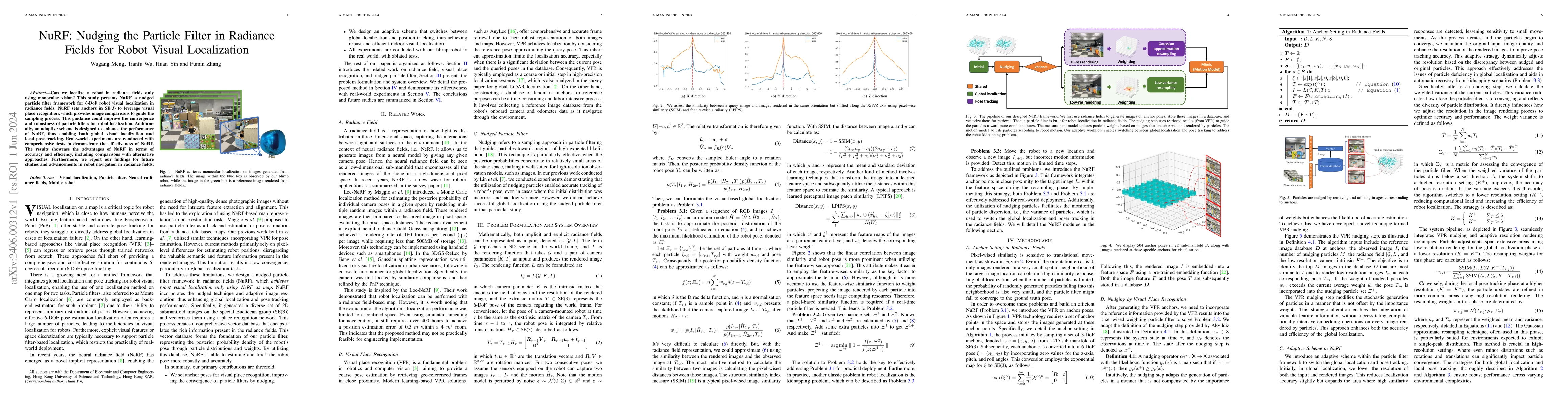
Can we localize a robot in radiance fields only using monocular vision? This study presents NuRF, a nudged particle filter framework for 6-DoF robot visual localization in radiance fields. NuRF sets...
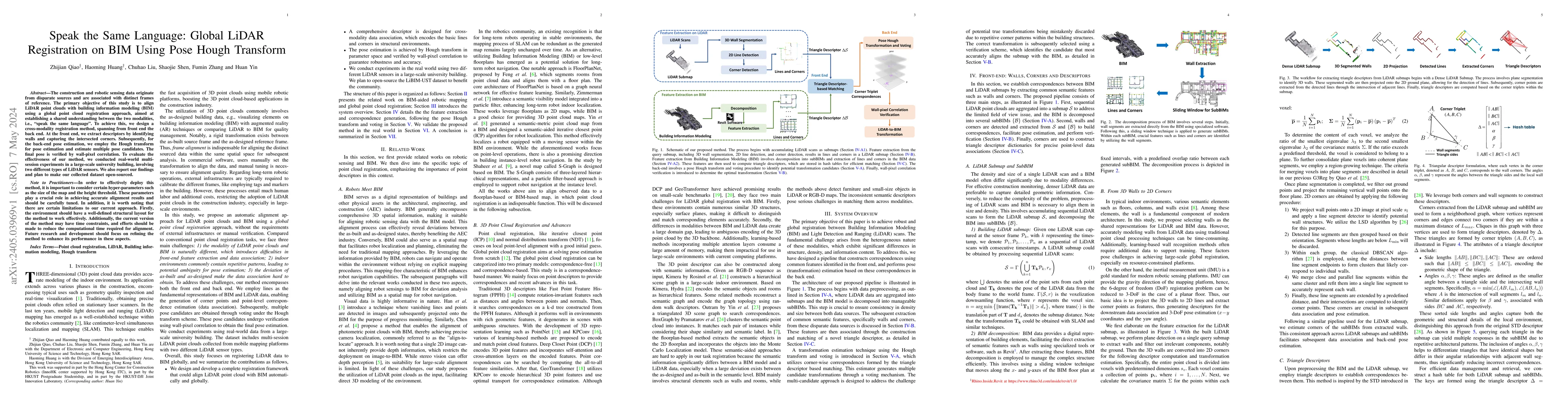
The construction and robotic sensing data originate from disparate sources and are associated with distinct frames of reference. The primary objective of this study is to align LiDAR point clouds wi...
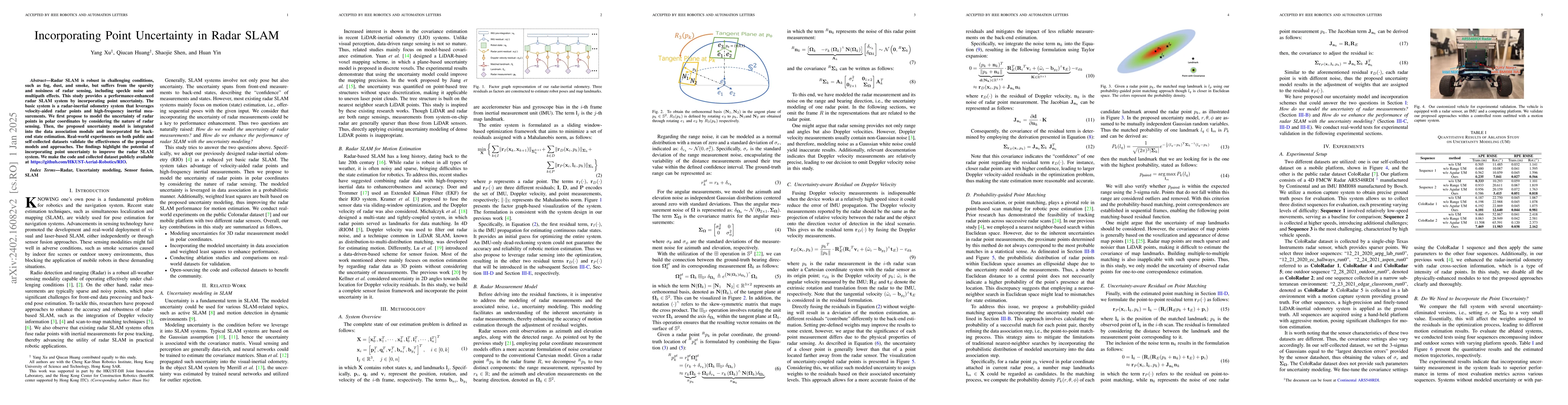
While visual and laser-based simultaneous localization and mapping (SLAM) techniques have gained significant attention, radar SLAM remains a robust option for challenging conditions. This paper aims...
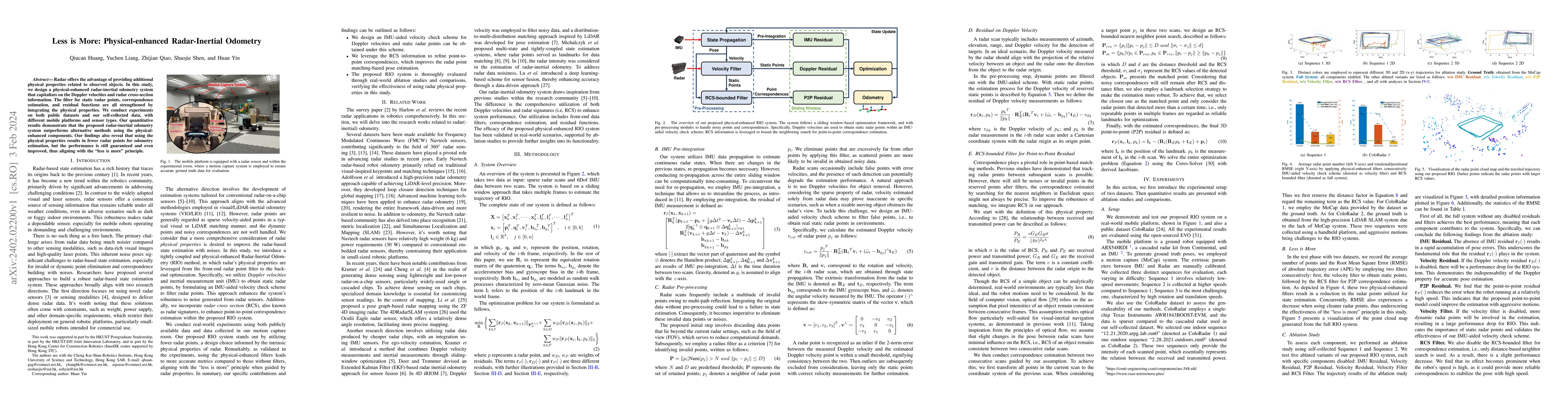
Radar offers the advantage of providing additional physical properties related to observed objects. In this study, we design a physical-enhanced radar-inertial odometry system that capitalizes on th...
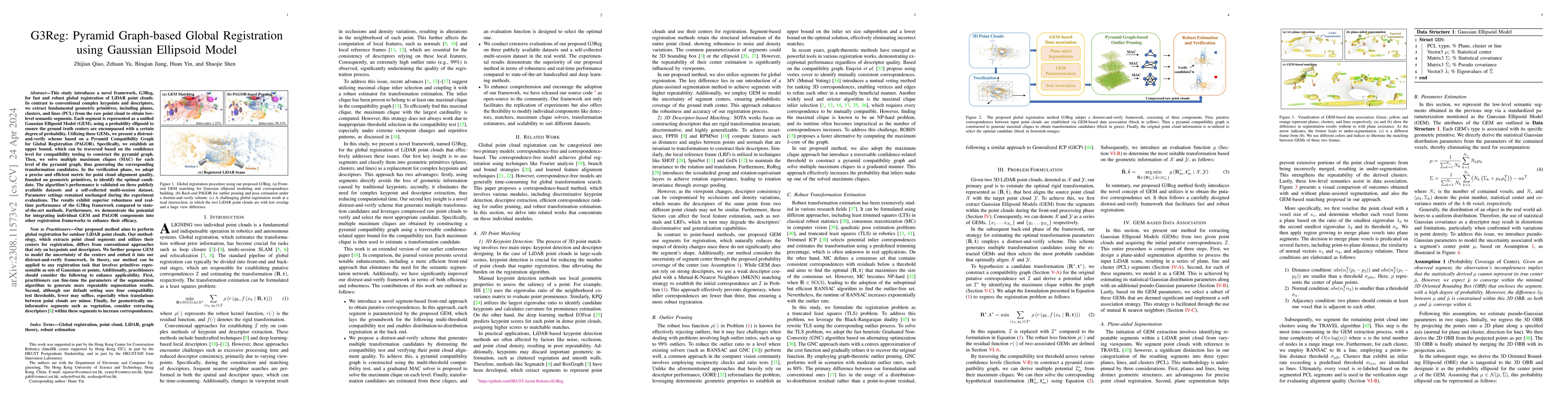
This study introduces a novel framework, G3Reg, for fast and robust global registration of LiDAR point clouds. In contrast to conventional complex keypoints and descriptors, we extract fundamental g...
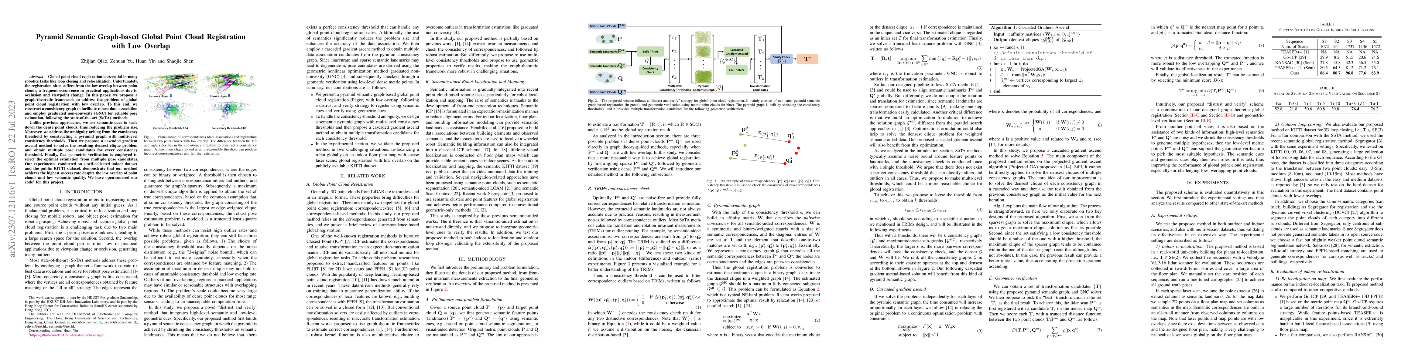
Global point cloud registration is essential in many robotics tasks like loop closing and relocalization. Unfortunately, the registration often suffers from the low overlap between point clouds, a f...
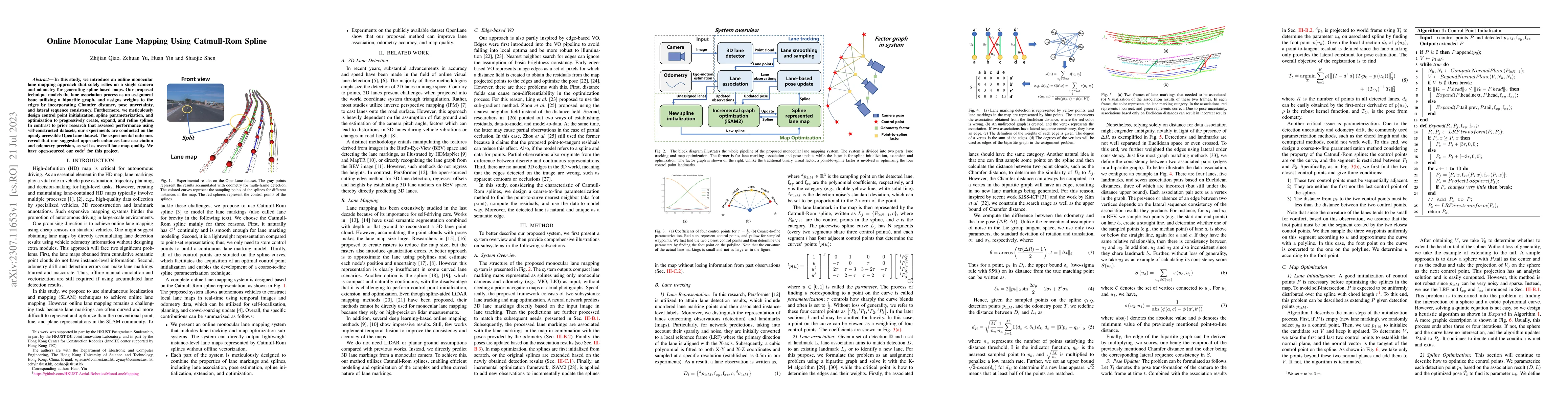
In this study, we introduce an online monocular lane mapping approach that solely relies on a single camera and odometry for generating spline-based maps. Our proposed technique models the lane asso...
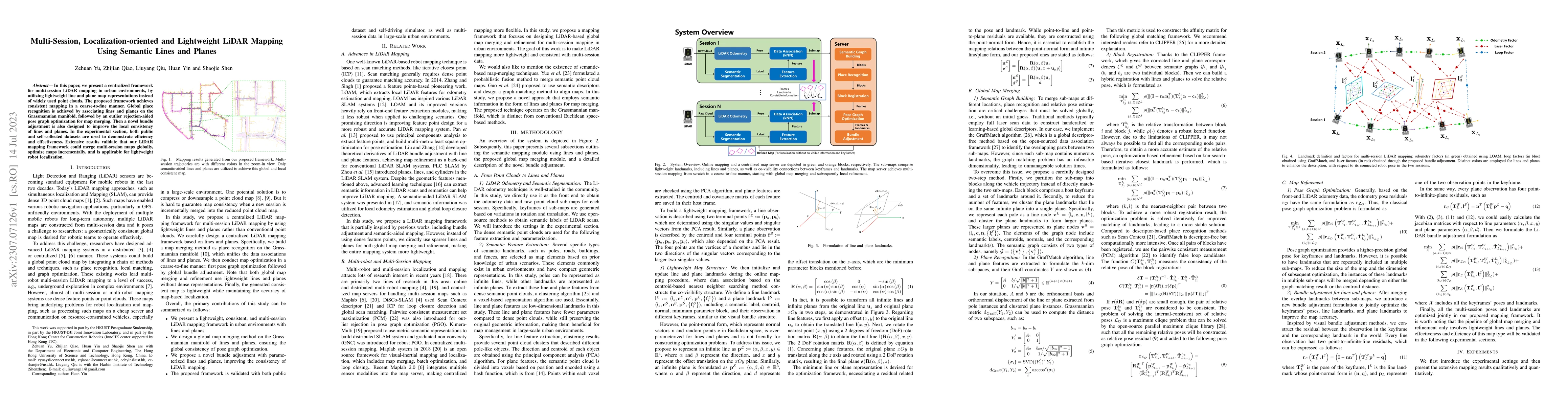
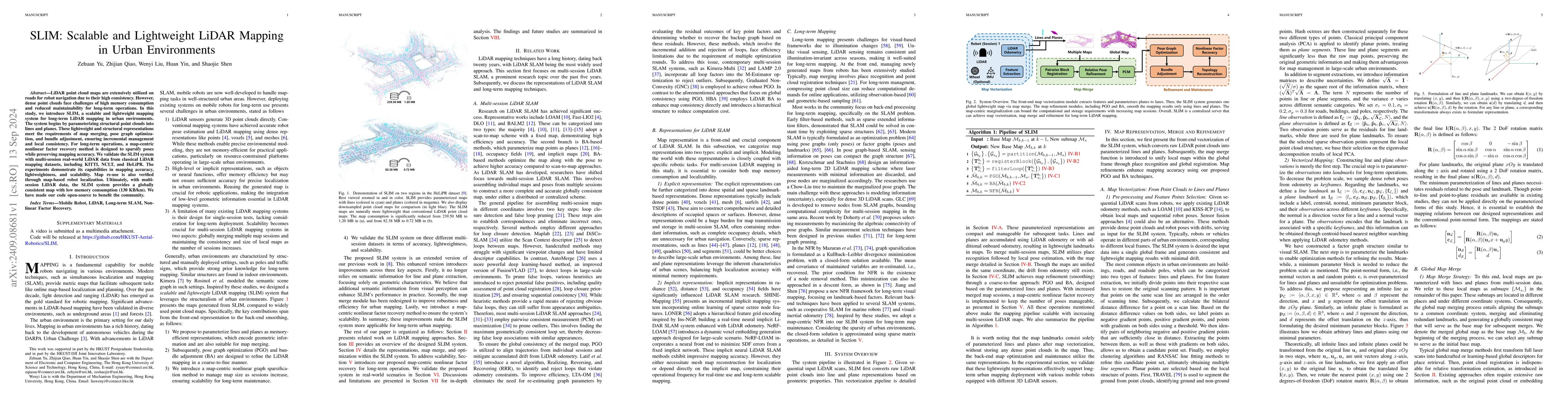
In this paper, we present a centralized framework for multi-session LiDAR mapping in urban environments, by utilizing lightweight line and plane map representations instead of widely used point clou...
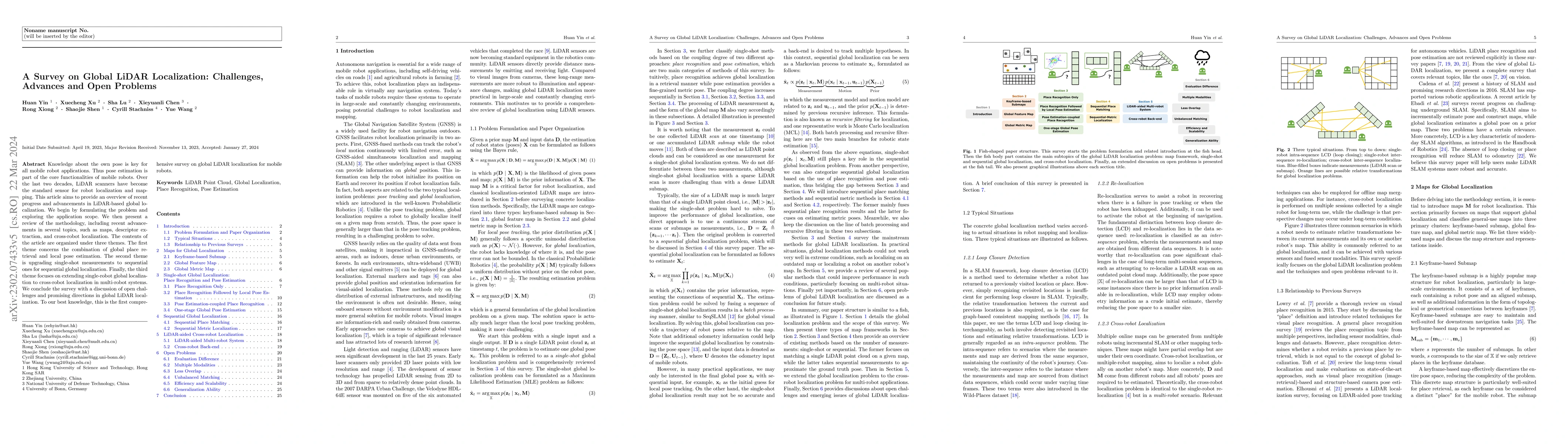
Knowledge about the own pose is key for all mobile robot applications. Thus pose estimation is part of the core functionalities of mobile robots. Over the last two decades, LiDAR scanners have becom...
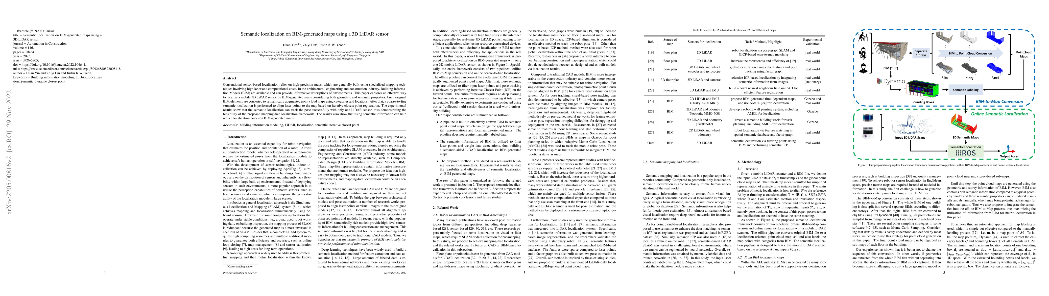
Conventional sensor-based localization relies on high-precision maps, which are generally built using specialized mapping techniques involving high labor and computational costs. In the architectura...
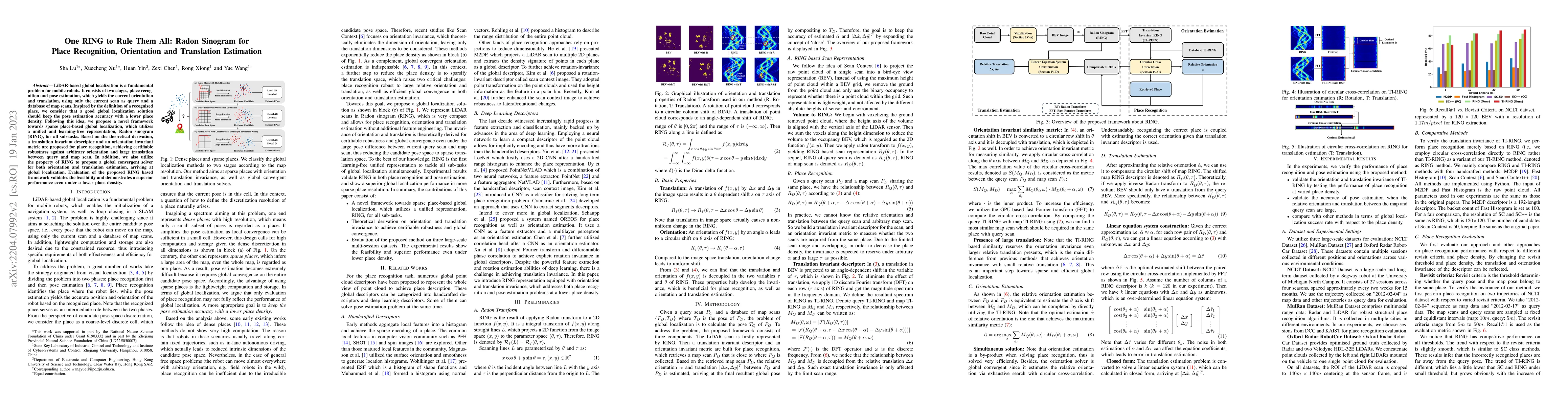
LiDAR-based global localization is a fundamental problem for mobile robots. It consists of two stages, place recognition and pose estimation, which yields the current orientation and translation, us...
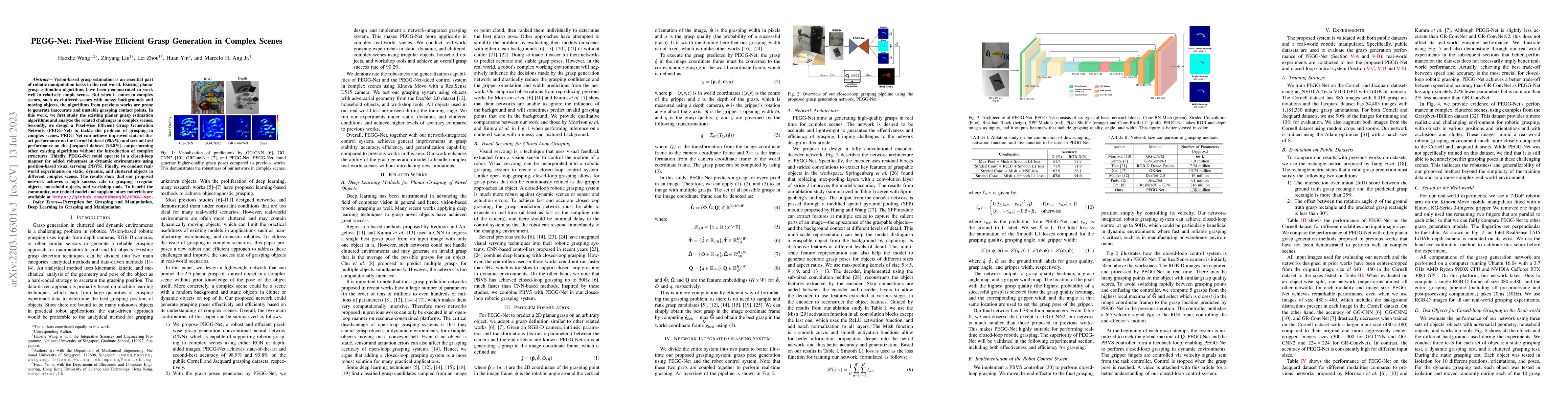
Vision-based grasp estimation is an essential part of robotic manipulation tasks in the real world. Existing planar grasp estimation algorithms have been demonstrated to work well in relatively simp...
Intra-day economic dispatch of an integrated microgrid is a fundamental requirement to integrate distributed generators. The dynamic energy flows in cogeneration units present challenges to the ener...
We present a heterogeneous localization framework for solving radar global localization and pose tracking on pre-built lidar maps. To bridge the gap of sensing modalities, deep neural networks are c...
In-flight objects capture is extremely challenging. The robot is required to complete trajectory prediction, interception position calculation and motion planning in sequence within tens of millisec...
Place recognition is critical for both offline mapping and online localization. However, current single-sensor based place recognition still remains challenging in adverse conditions. In this paper,...
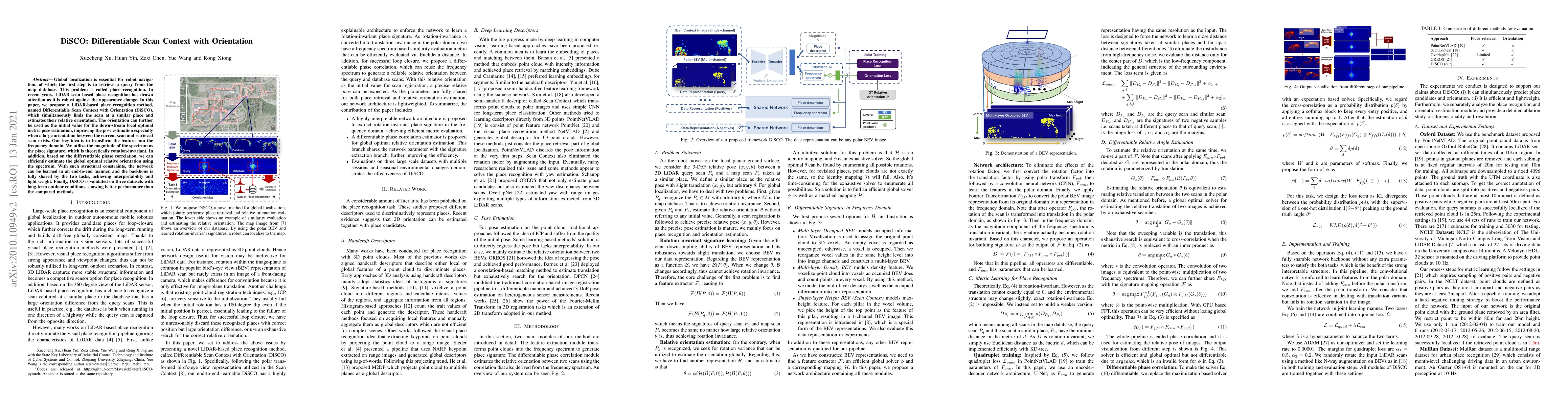
Global localization is essential for robot navigation, of which the first step is to retrieve a query from the map database. This problem is called place recognition. In recent years, LiDAR scan bas...
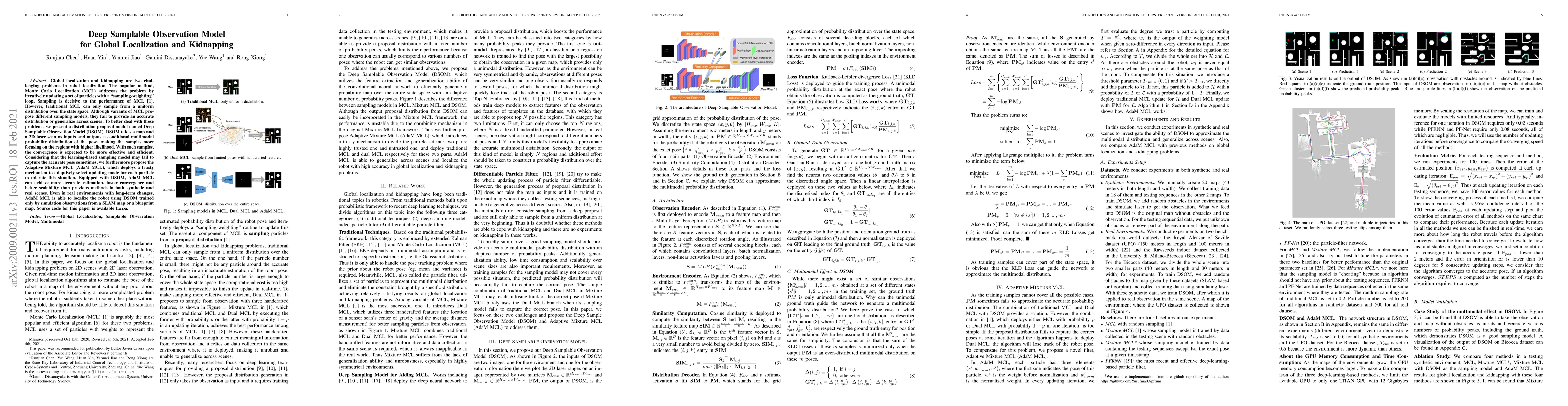
Global localization and kidnapping are two challenging problems in robot localization. The popular method, Monte Carlo Localization (MCL) addresses the problem by iteratively updating a set of parti...
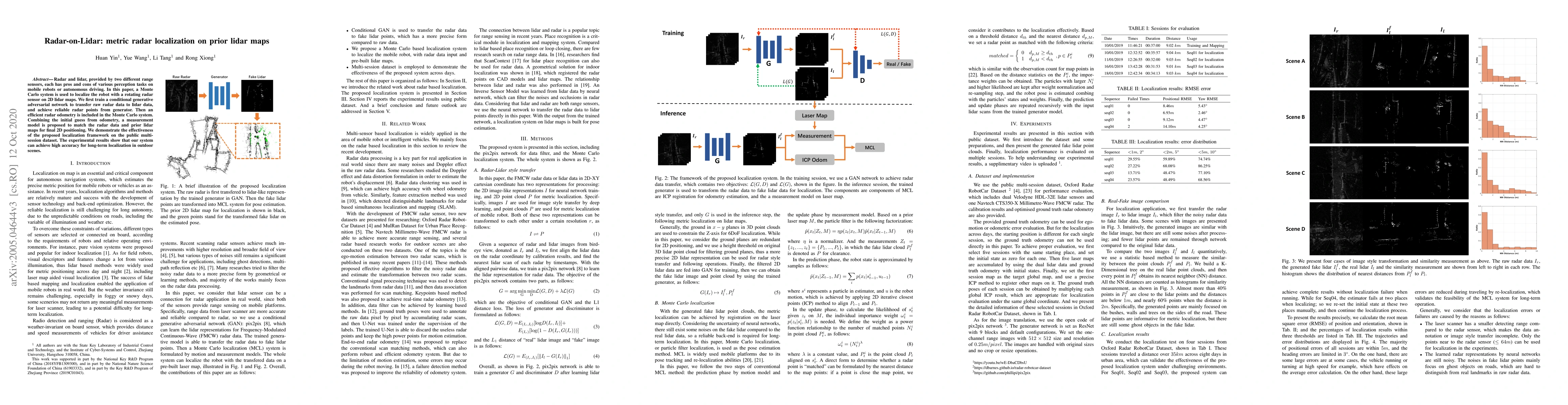
Radar and lidar, provided by two different range sensors, each has pros and cons of various perception tasks on mobile robots or autonomous driving. In this paper, a Monte Carlo system is used to lo...
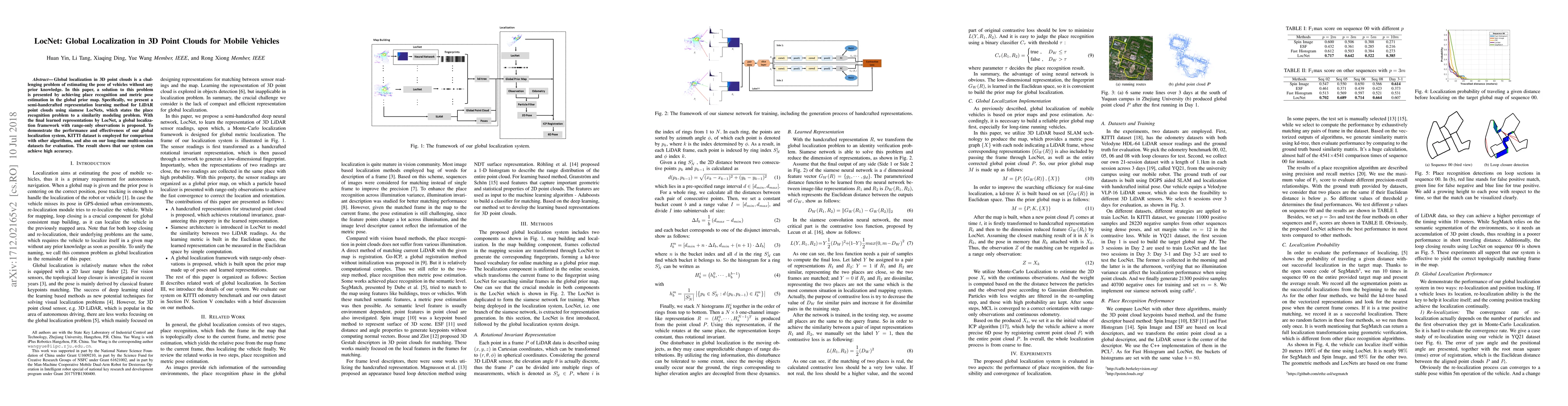
Global localization in 3D point clouds is a challenging problem of estimating the pose of vehicles without any prior knowledge. In this paper, a solution to this problem is presented by achieving pl...
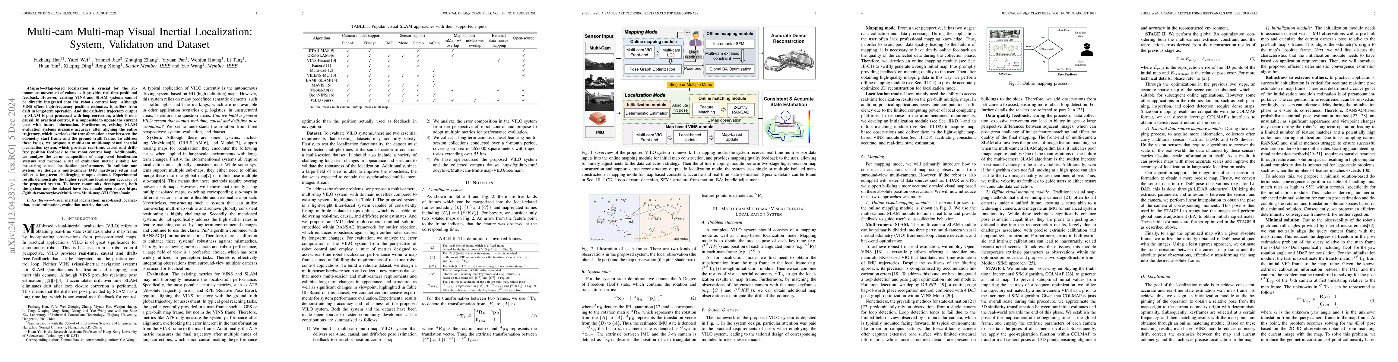
Map-based localization is crucial for the autonomous movement of robots as it provides real-time positional feedback. However, existing VINS and SLAM systems cannot be directly integrated into the rob...
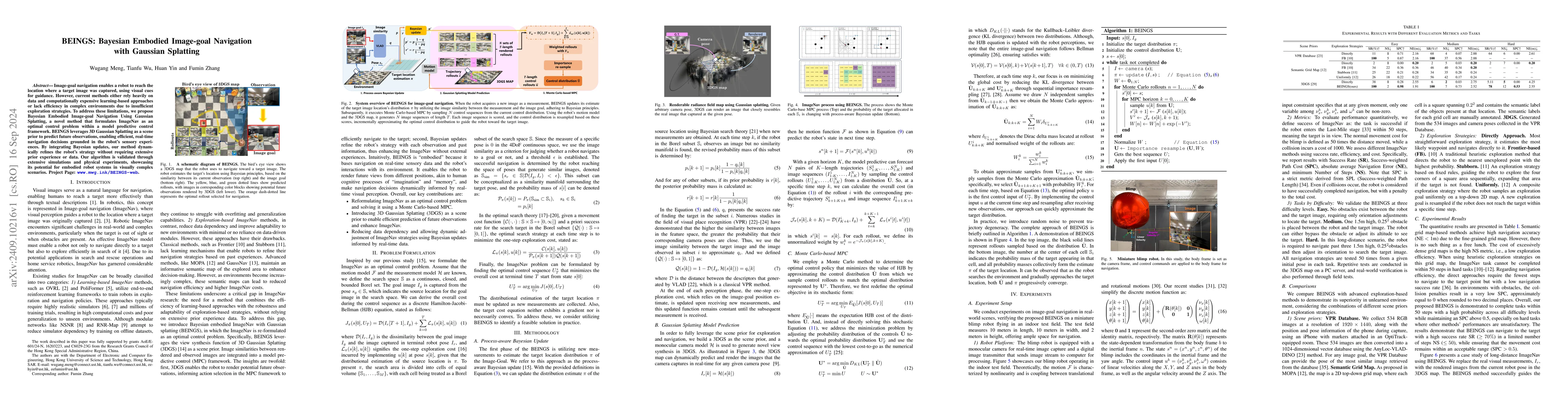
Image-goal navigation enables a robot to reach the location where a target image was captured, using visual cues for guidance. However, current methods either rely heavily on data and computationally ...
LiDAR point cloud maps are extensively utilized on roads for robot navigation due to their high consistency. However, dense point clouds face challenges of high memory consumption and reduced maintain...
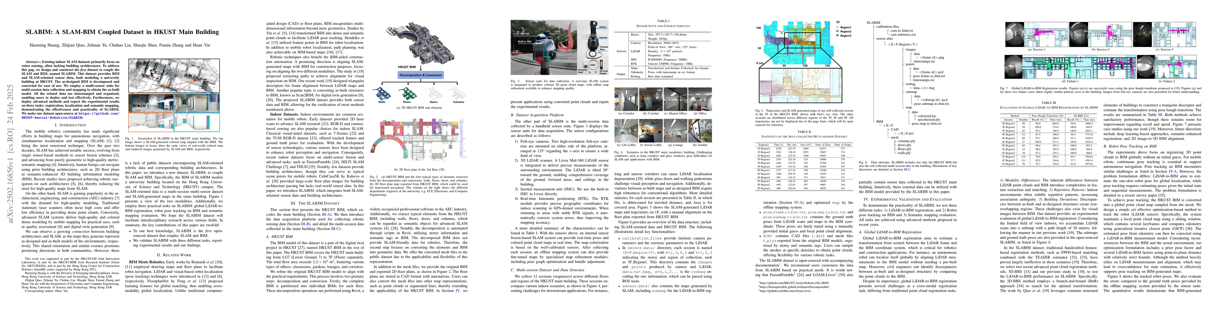
Existing indoor SLAM datasets primarily focus on robot sensing, often lacking building architectures. To address this gap, we design and construct the first dataset to couple the SLAM and BIM, named S...
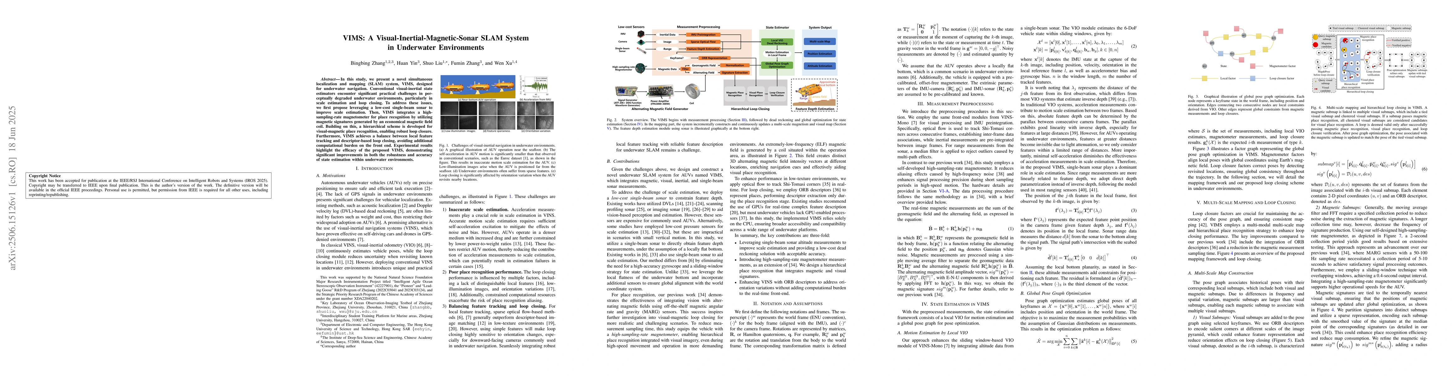
In this study, we present a novel simultaneous localization and mapping (SLAM) system, VIMS, designed for underwater navigation. Conventional visual-inertial state estimators encounter significant pra...
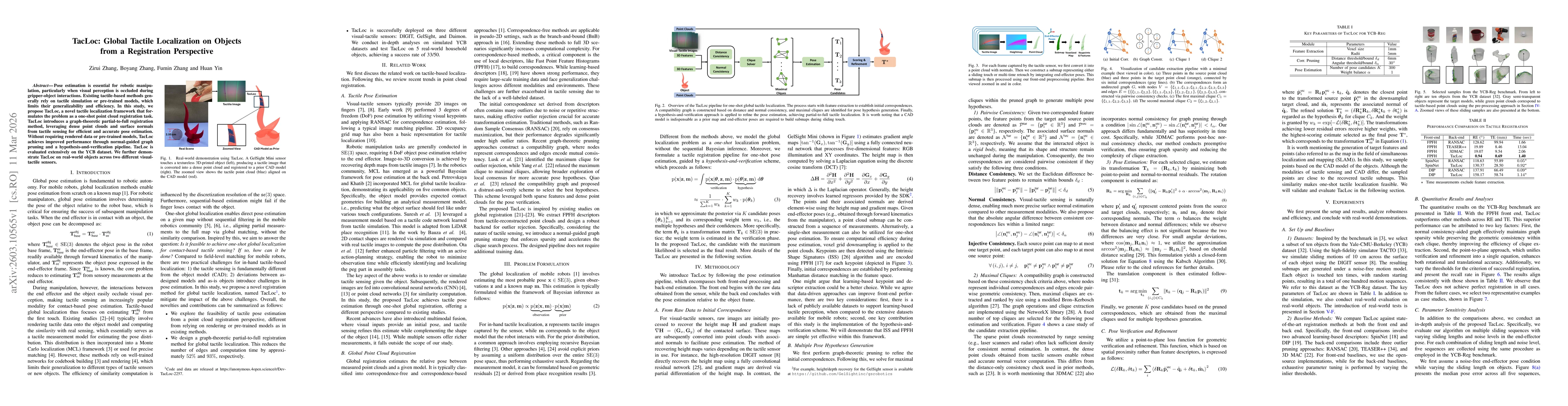
Pose estimation is essential for robotic manipulation, particularly when visual perception is occluded during gripper-object interactions. Existing tactile-based methods generally rely on tactile simu...
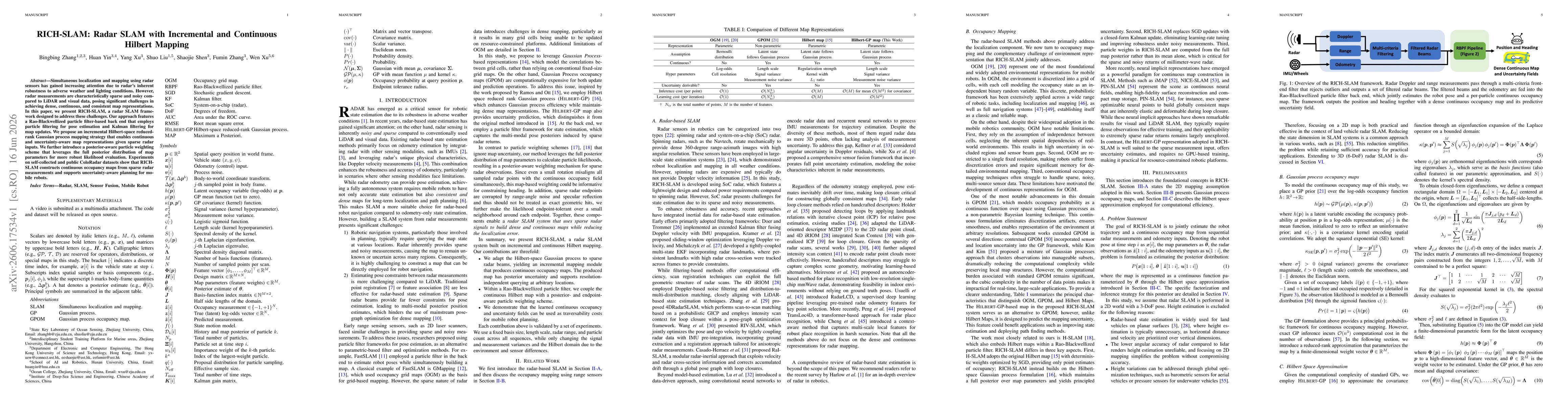
Simultaneous localization and mapping using radar sensors has gained increasing attention due to radar's inherent robustness to adverse weather and lighting conditions. However, radar measurements are...