Publication
Metrics
AI Quick Summary
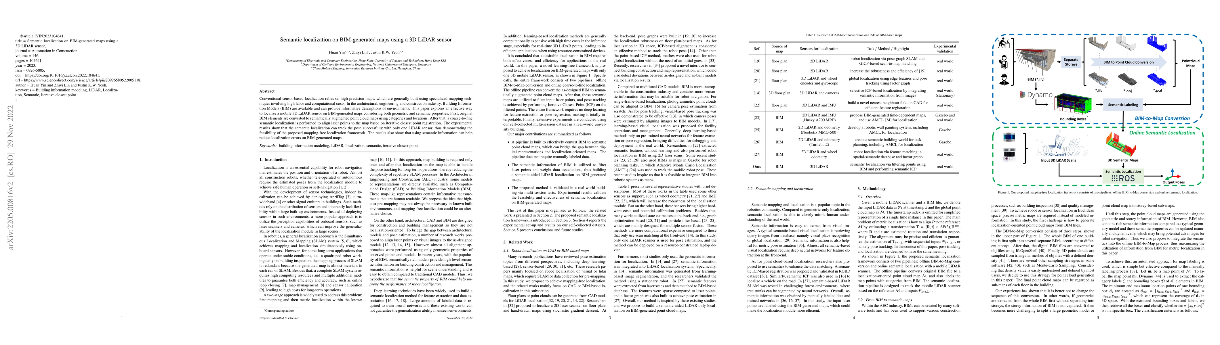
This paper proposes a mapping-free localization framework for a 3D LiDAR sensor using Building Information Models (BIM) that incorporates both geometric and semantic properties. The method converts BIM elements into semantically augmented point cloud maps and performs coarse-to-fine localization, achieving successful pose tracking and reducing errors.
Paper Preview
Abstract
Conventional sensor-based localization relies on high-precision maps, which are generally built using specialized mapping techniques involving high labor and computational costs. In the architectural, engineering and construction industry, Building Information Models (BIM) are available and can provide informative descriptions of environments. This paper explores an effective way to localize a mobile 3D LiDAR sensor on BIM-generated maps considering both geometric and semantic properties. First, original BIM elements are converted to semantically augmented point cloud maps using categories and locations. After that, a coarse-to-fine semantic localization is performed to align laser points to the map based on iterative closest point registration. The experimental results show that the semantic localization can track the pose successfully with only one LiDAR sensor, thus demonstrating the feasibility of the proposed mapping-free localization framework. The results also show that using semantic information can help reduce localization errors on BIM-generated maps.
AI Key Findings
Get AI-generated insights about this paper's methodology, results, significance, and more — seven facets brought into focus.
Impact
Paper Details
Authors
PDF Preview
Key Terms
Citation Network
Current paper (gray), citations (green), references (blue)
Display is limited for performance on very large graphs.
Discussion 0