Academic Profile
Statistics
Similar Authors
Papers on arXiv
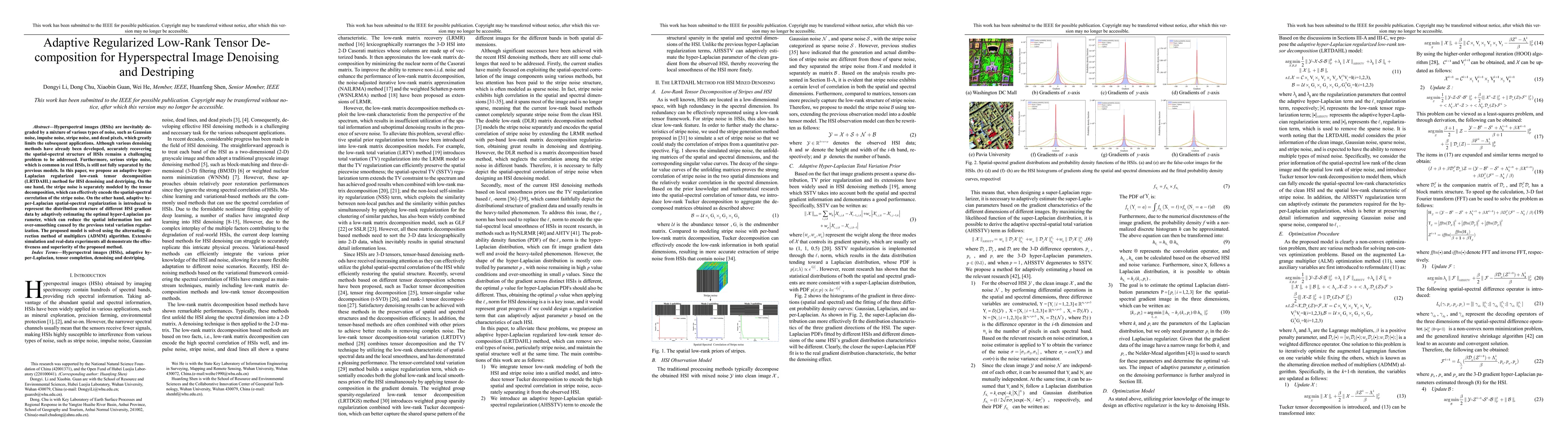
Hyperspectral images (HSIs) are inevitably degraded by a mixture of various types of noise, such as Gaussian noise, impulse noise, stripe noise, and dead pixels, which greatly limits the subsequent ...
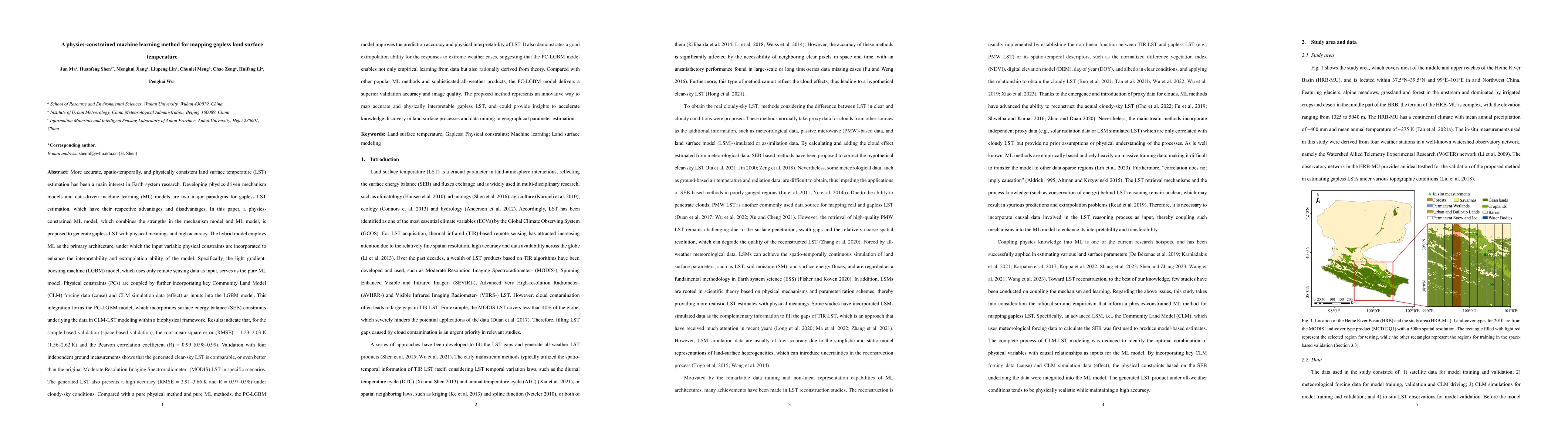
More accurate, spatio-temporally, and physically consistent LST estimation has been a main interest in Earth system research. Developing physics-driven mechanism models and data-driven machine learn...
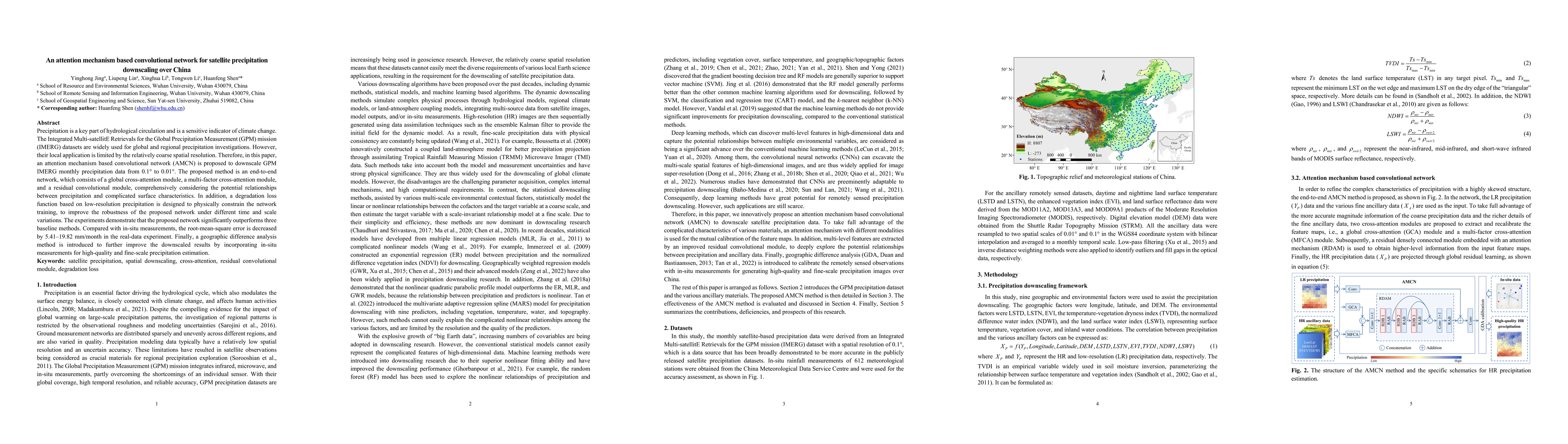
Precipitation is a key part of hydrological circulation and is a sensitive indicator of climate change. The Integrated Multi-satellitE Retrievals for the Global Precipitation Measurement (GPM) missi...
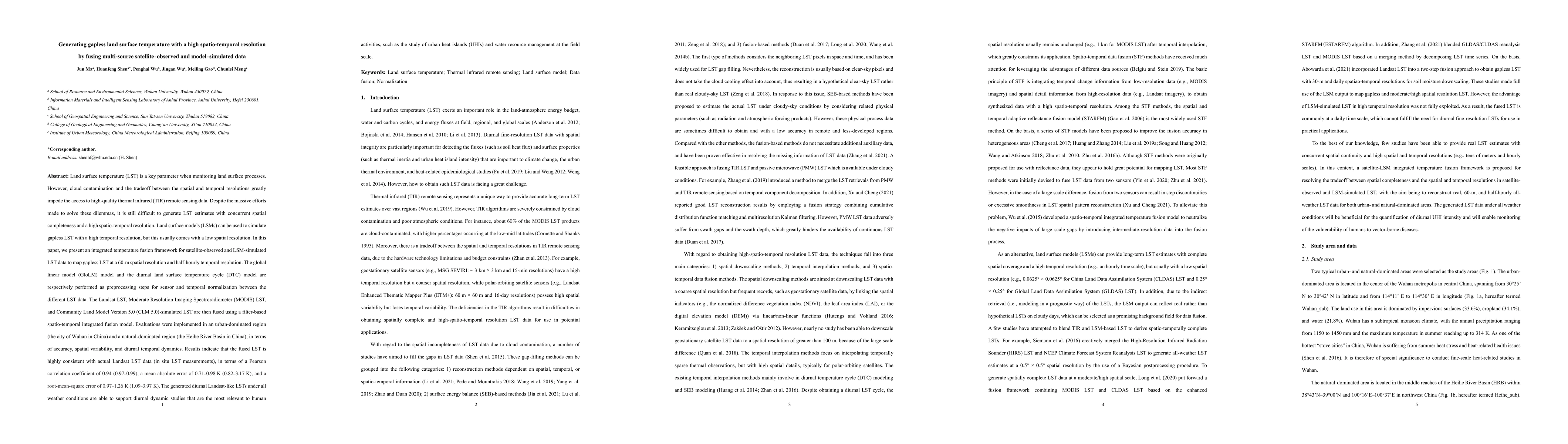
Land surface temperature (LST) is a key parameter when monitoring land surface processes. However, cloud contamination and the tradeoff between the spatial and temporal resolutions greatly impede th...
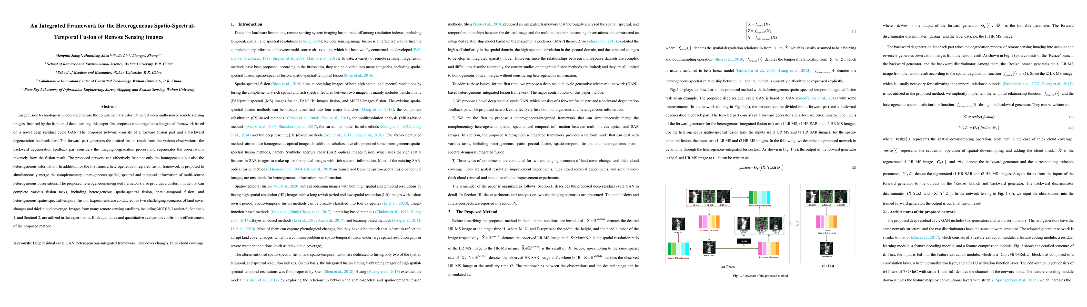
Image fusion technology is widely used to fuse the complementary information between multi-source remote sensing images. Inspired by the frontier of deep learning, this paper first proposes a hetero...
In the fields of image restoration and image fusion, model-driven methods and data-driven methods are the two representative frameworks. However, both approaches have their respective advantages and...
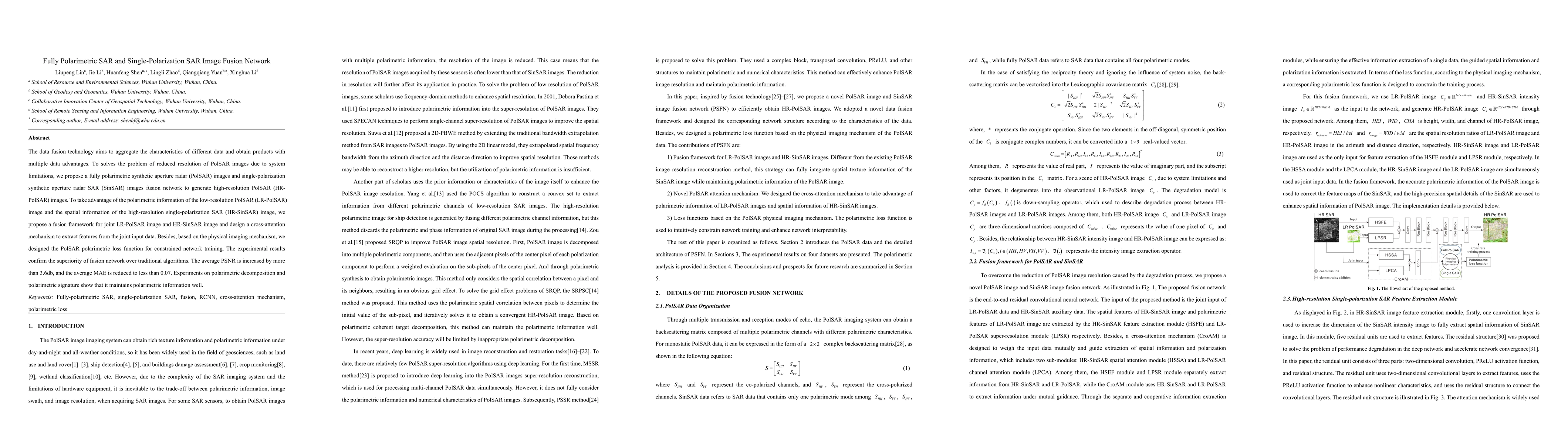
The data fusion technology aims to aggregate the characteristics of different data and obtain products with multiple data advantages. To solves the problem of reduced resolution of PolSAR images due...
A TL-LUE model modified with a radiation scalar (RTL-LUE) is developed in this paper. The same maximum LUE is used for both sunlit and shaded leaves, and the difference in LUE between sunlit and sha...
The applications of Normalized Difference Vegetation Index (NDVI) time-series data are inevitably hampered by cloud-induced gaps and noise. Although numerous reconstruction methods have been develop...
Air temperature (Ta) is an essential climatological component that controls and influences various earth surface processes. In this study, we make the first attempt to employ deep learning for Ta ma...
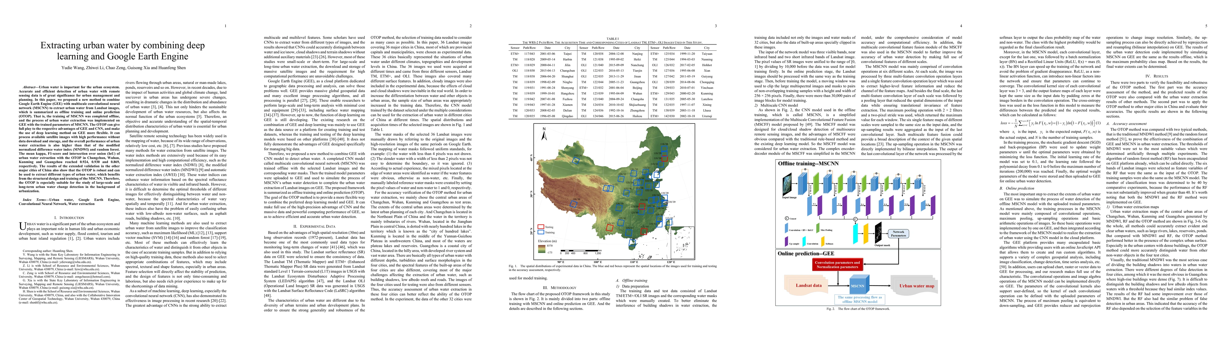
Urban water is important for the urban ecosystem. Accurate and efficient detection of urban water with remote sensing data is of great significance for urban management and planning. In this paper, ...
Remotely sensed, spatially continuous and high spatiotemporal resolution (hereafter referred to as high resolution) land surface temperature (LST) is a key parameter for studying the thermal environ...
Satellite-based retrieval has become a popular PM2.5 monitoring method currently. To improve the retrieval performance, multiple variables are usually introduced as auxiliary variable in addition to...
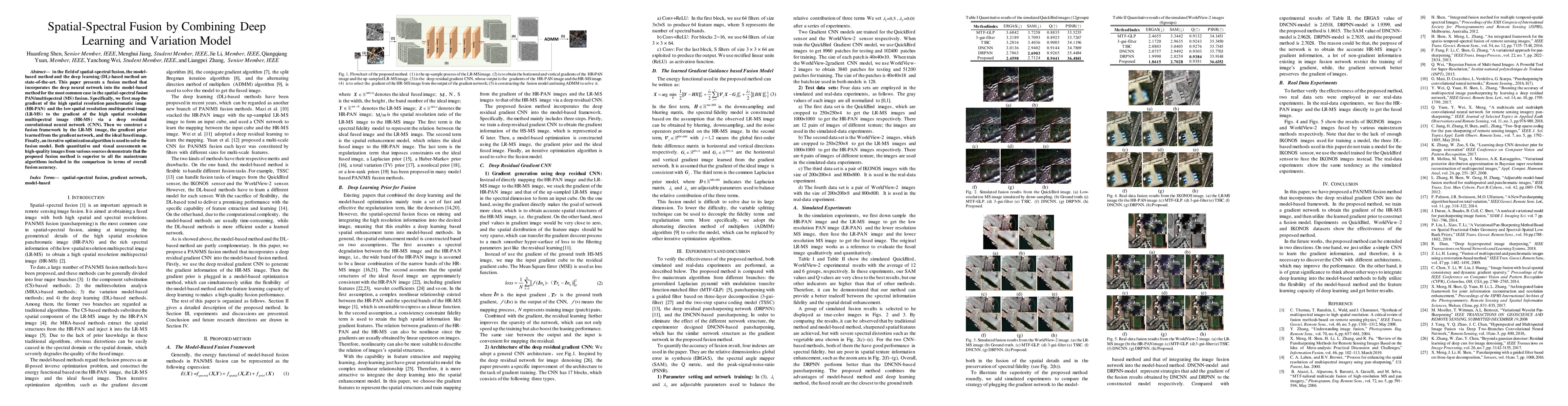
In the field of spatial-spectral fusion, the model-based method and the deep learning (DL)-based method are state-of-the-art. This paper presents a fusion method that incorporates the deep neural ne...
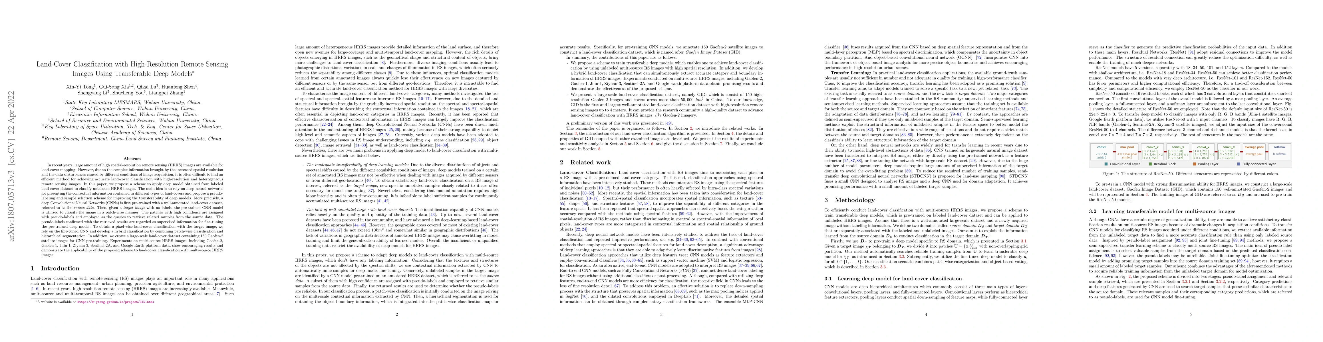
In recent years, large amount of high spatial-resolution remote sensing (HRRS) images are available for land-cover mapping. However, due to the complex information brought by the increased spatial r...
Data quantity and quality are both critical for information extraction and analyzation in remote sensing. However, the current remote sensing datasets often fail to meet these two requirements, for wh...
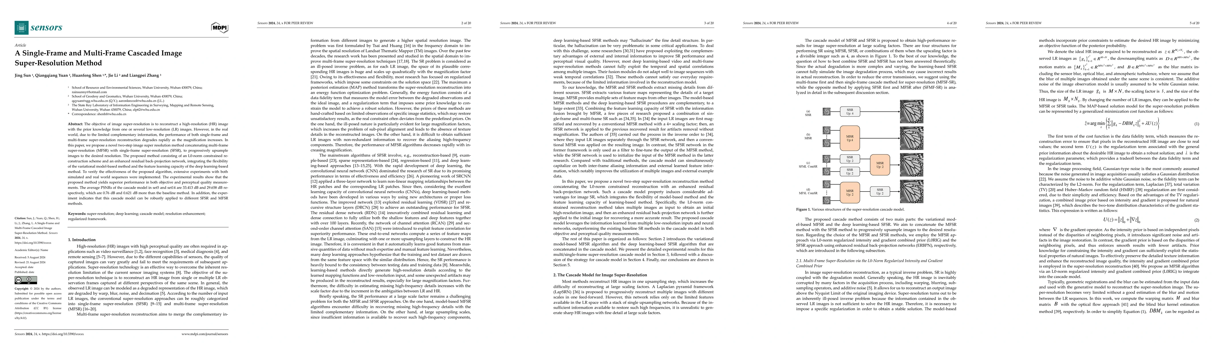
The objective of image super-resolution is to reconstruct a high-resolution (HR) image with the prior knowledge from one or several low-resolution (LR) images. However, in the real world, due to the l...
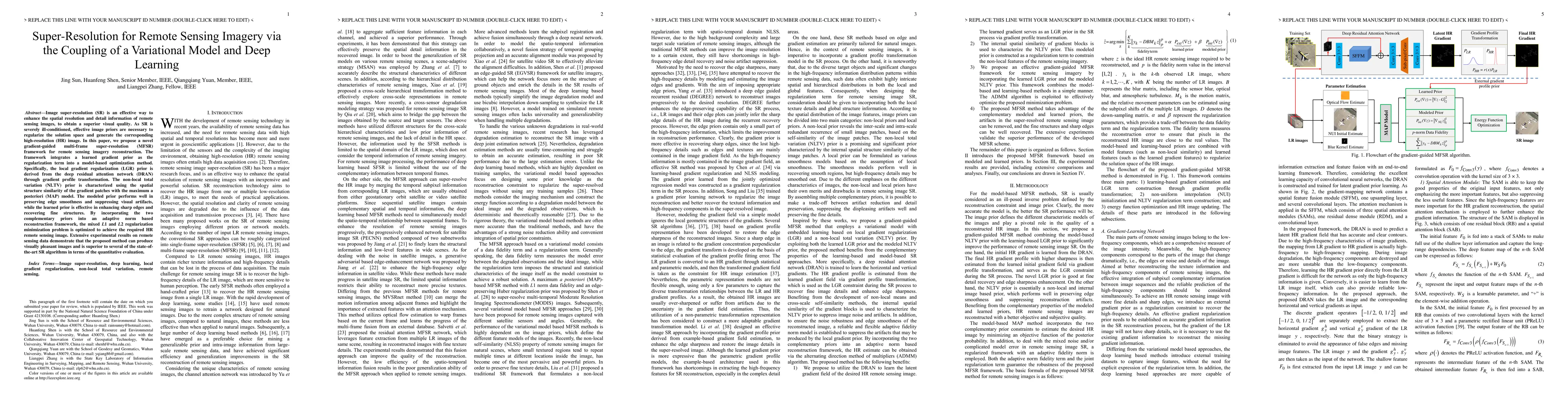
Image super-resolution (SR) is an effective way to enhance the spatial resolution and detail information of remote sensing images, to obtain a superior visual quality. As SR is severely ill-conditione...
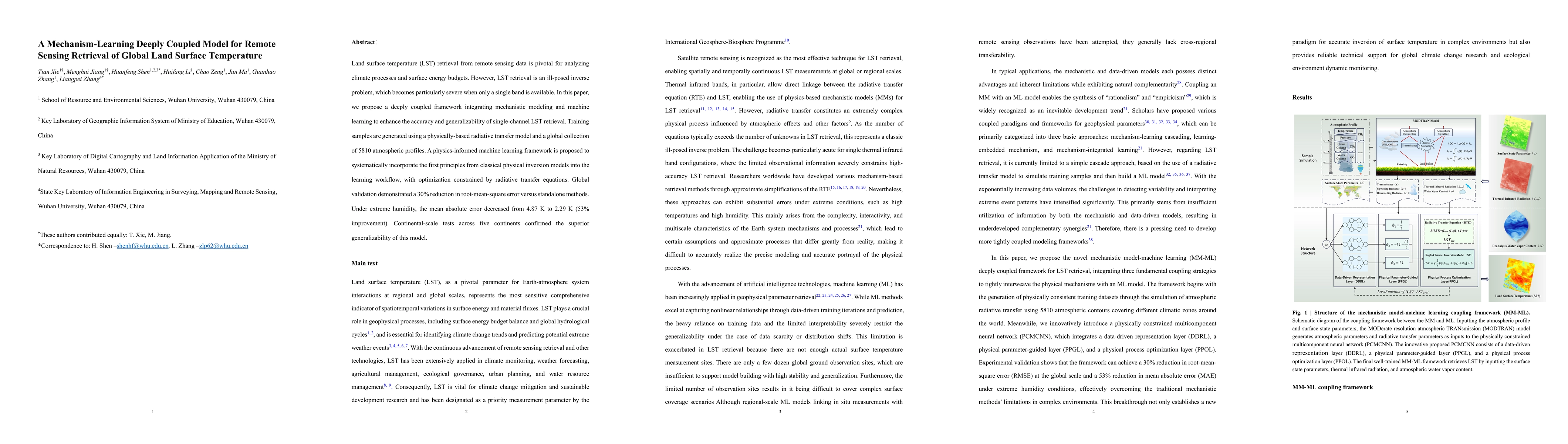
Land surface temperature (LST) retrieval from remote sensing data is pivotal for analyzing climate processes and surface energy budgets. However, LST retrieval is an ill-posed inverse problem, which b...
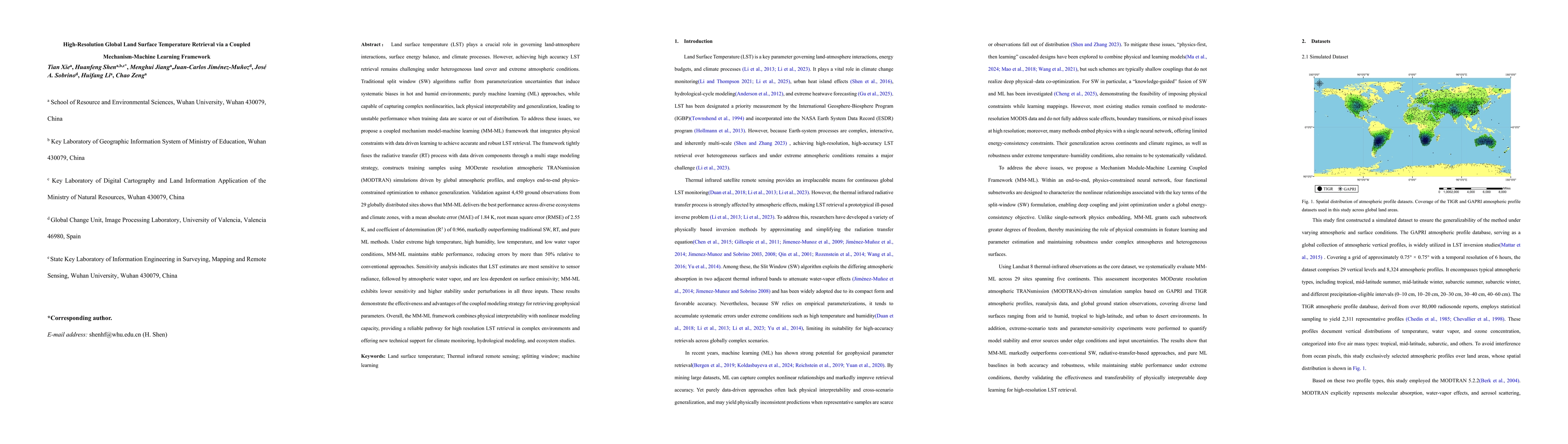
Land surface temperature (LST) is vital for land-atmosphere interactions and climate processes. Accurate LST retrieval remains challenging under heterogeneous land cover and extreme atmospheric condit...
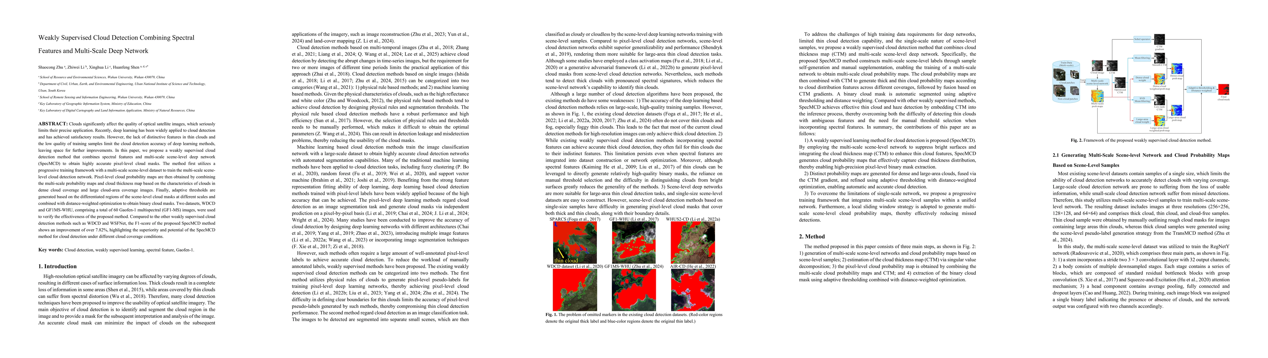
Clouds significantly affect the quality of optical satellite images, which seriously limits their precise application. Recently, deep learning has been widely applied to cloud detection and has achiev...
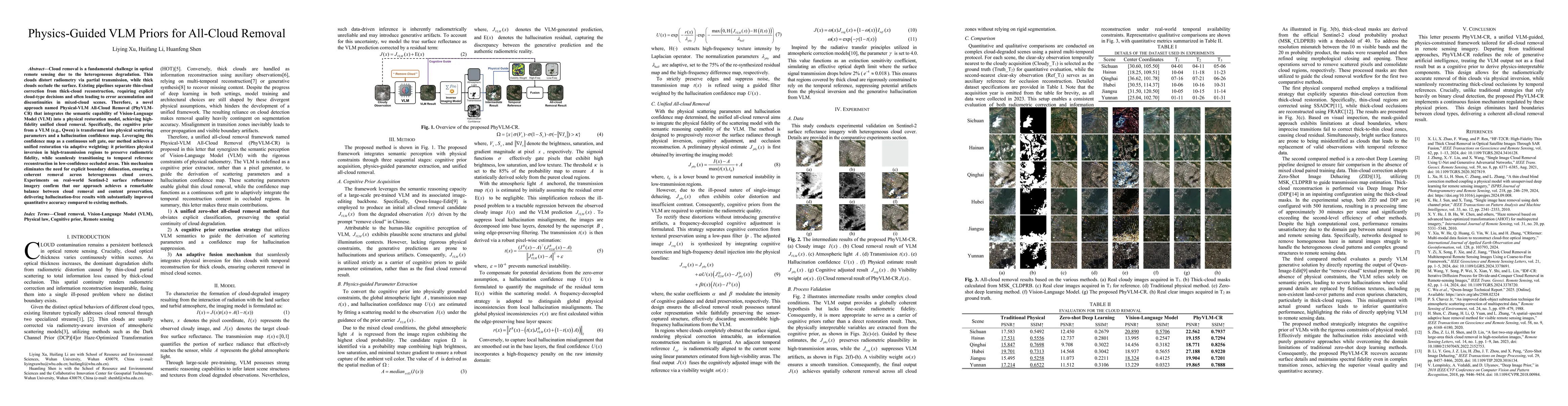
Cloud removal is a fundamental challenge in optical remote sensing due to the heterogeneous degradation. Thin clouds distort radiometry via partial transmission, while thick clouds occlude the surface...
Land surface temperature (LST) is a critical parameter for characterizing surface energy balance and hydrothermal processes. While Landsat provides invaluable LST observations at medium spatial resolu...