Academic Profile
Statistics
Similar Authors
Papers on arXiv
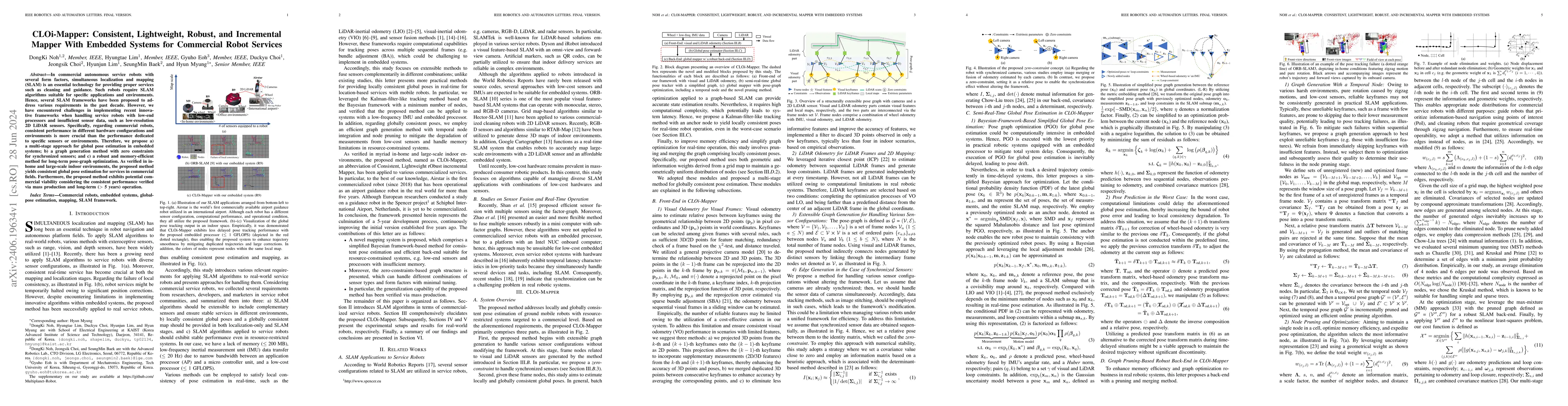
In commercial autonomous service robots with several form factors, simultaneous localization and mapping (SLAM) is an essential technology for providing proper services such as cleaning and guidance...
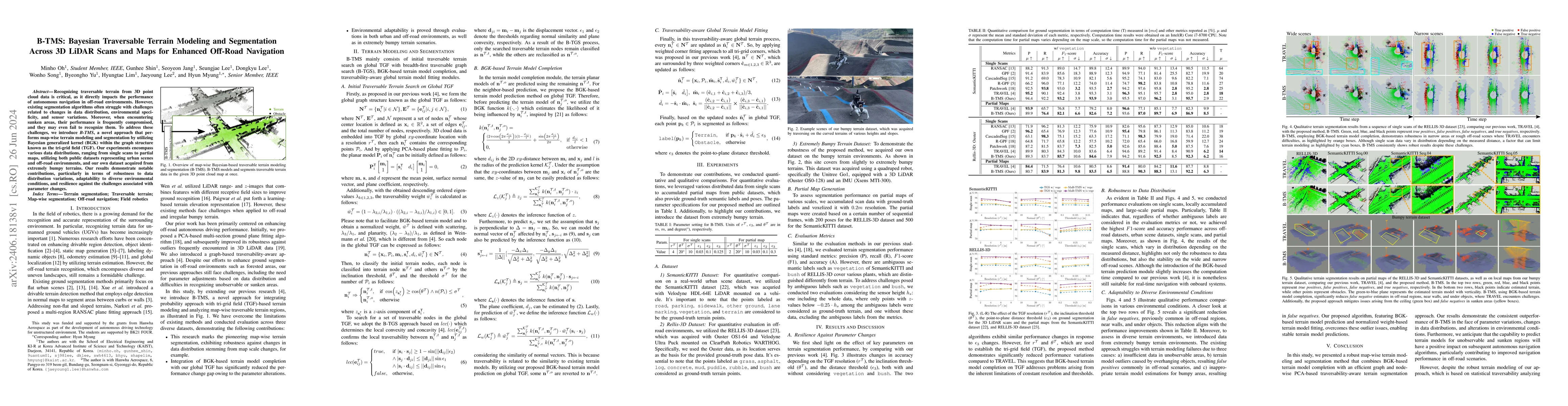
Recognizing traversable terrain from 3D point cloud data is critical, as it directly impacts the performance of autonomous navigation in off-road environments. However, existing segmentation algorit...
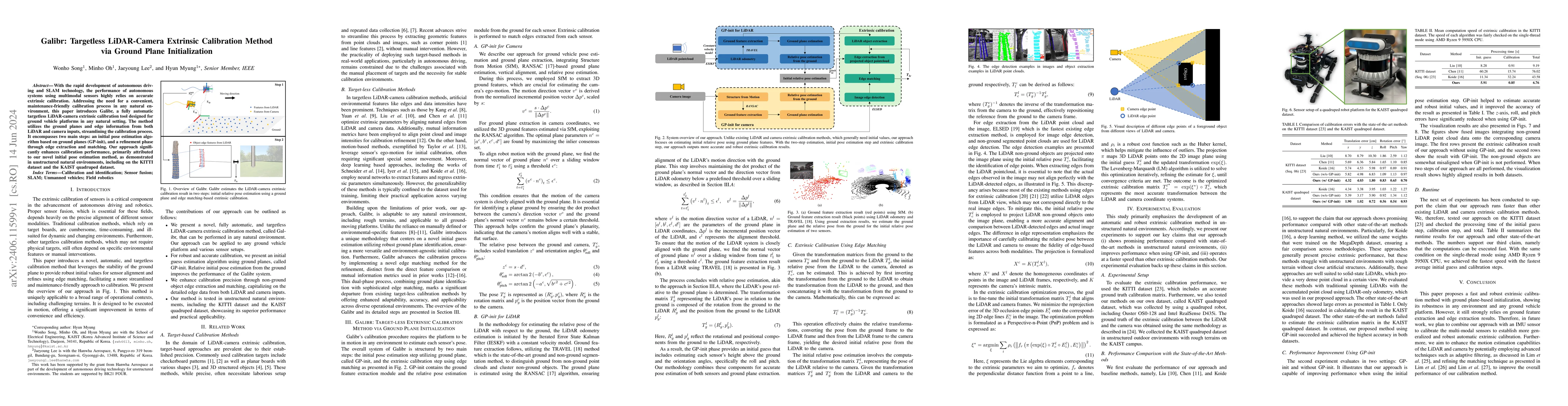
With the rapid development of autonomous driving and SLAM technology, the performance of autonomous systems using multimodal sensors highly relies on accurate extrinsic calibration. Addressing the n...
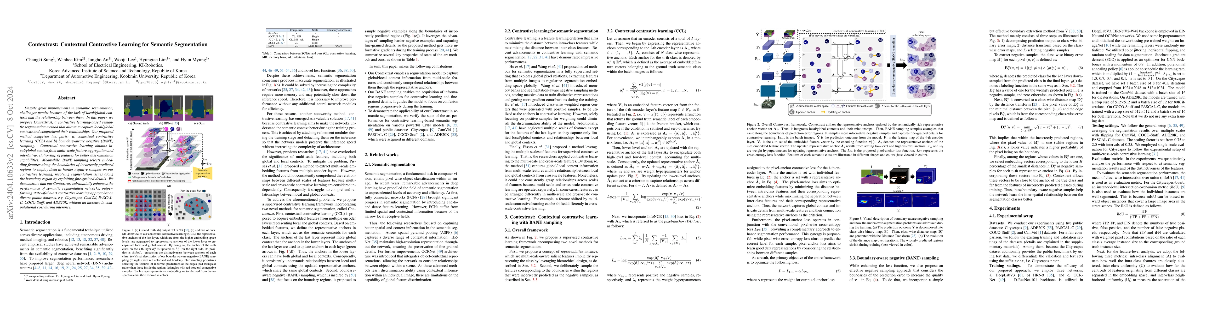
Despite great improvements in semantic segmentation, challenges persist because of the lack of local/global contexts and the relationship between them. In this paper, we propose Contextrast, a contr...
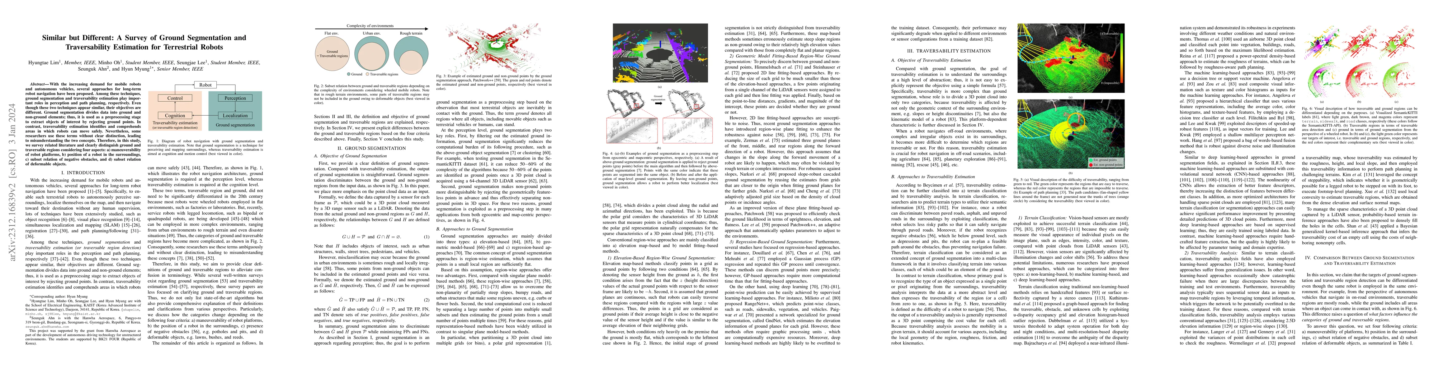
With the increasing demand for mobile robots and autonomous vehicles, several approaches for long-term robot navigation have been proposed. Among these techniques, ground segmentation and traversabi...
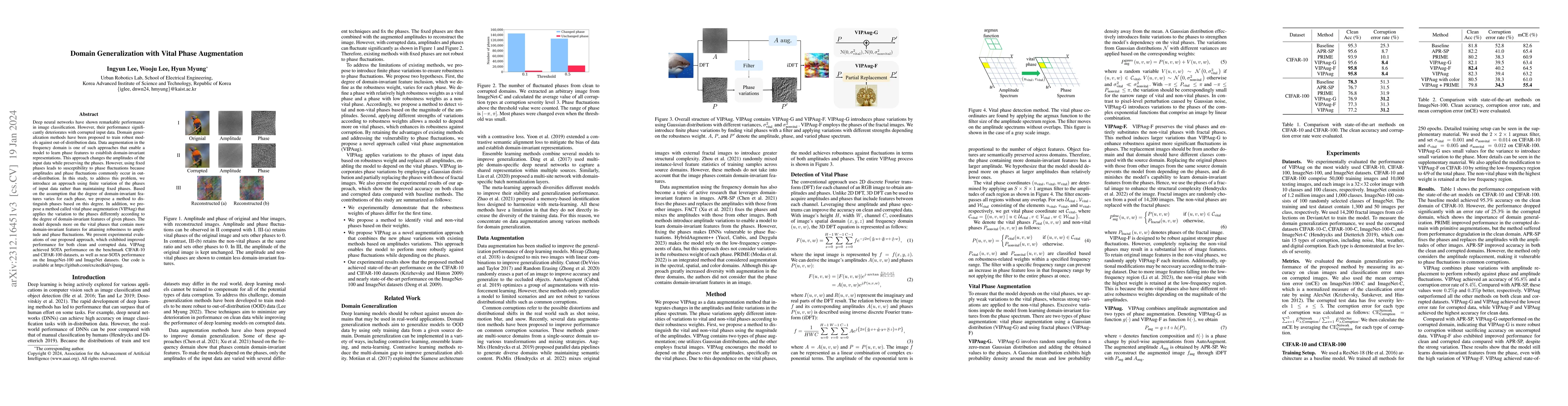
Deep neural networks have shown remarkable performance in image classification. However, their performance significantly deteriorates with corrupted input data. Domain generalization methods have be...

Single-domain generalization (S-DG) aims to generalize a model to unseen environments with a single-source domain. However, most S-DG approaches have been conducted in the field of classification. W...
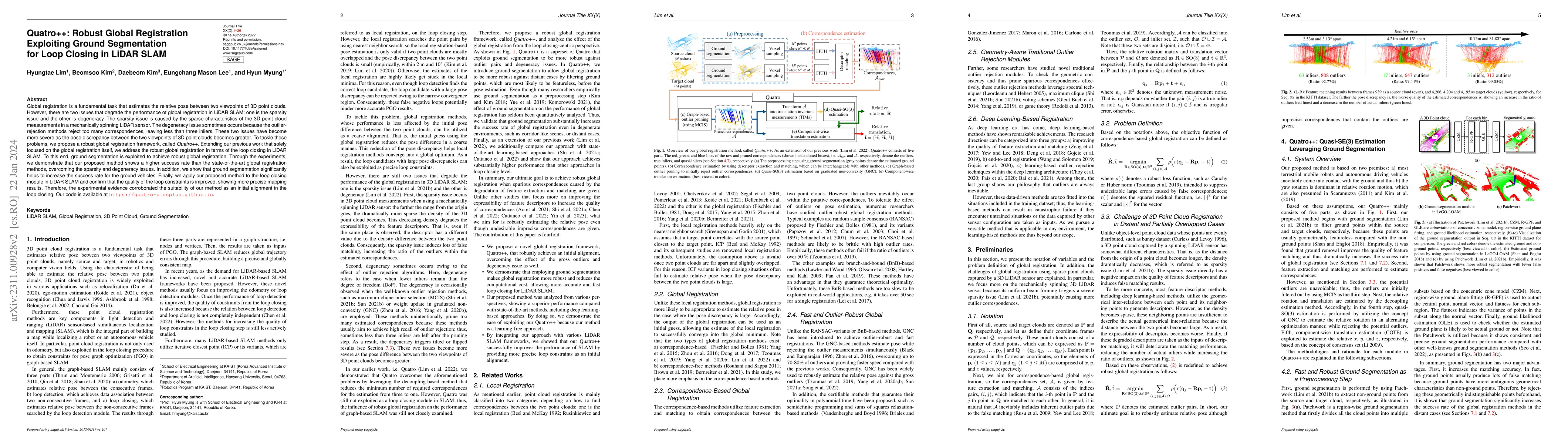
Global registration is a fundamental task that estimates the relative pose between two viewpoints of 3D point clouds. However, there are two issues that degrade the performance of global registratio...
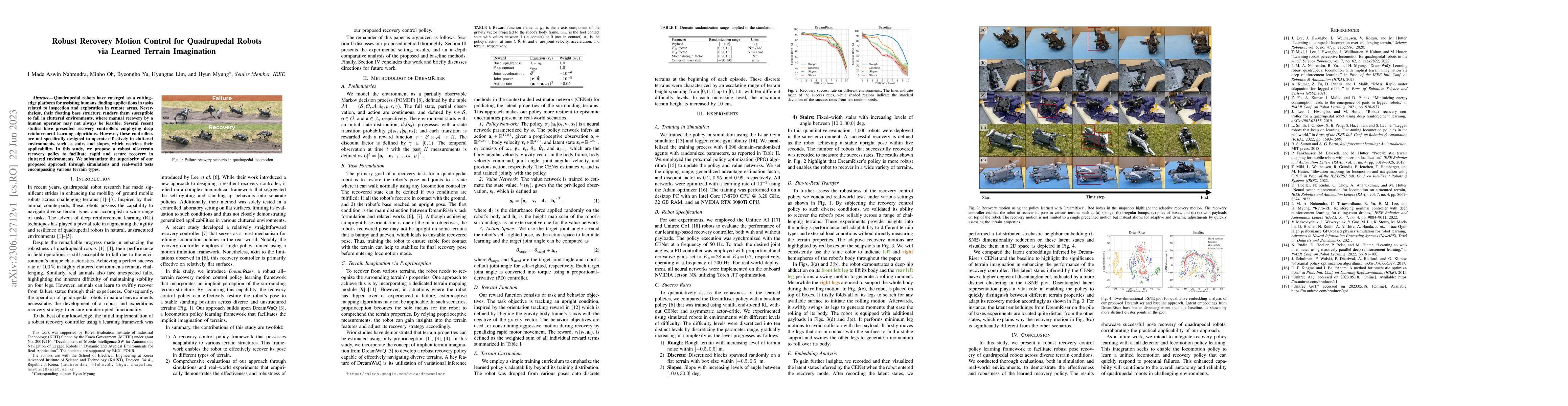
Quadrupedal robots have emerged as a cutting-edge platform for assisting humans, finding applications in tasks related to inspection and exploration in remote areas. Nevertheless, their floating bas...
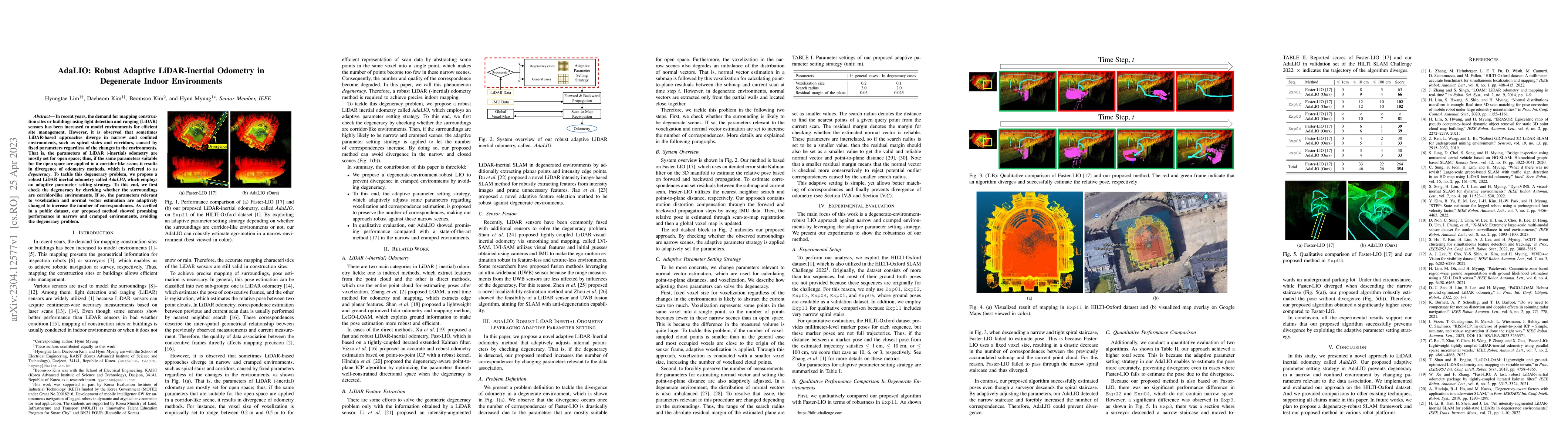
In recent years, the demand for mapping construction sites or buildings using light detection and ranging~(LiDAR) sensors has been increased to model environments for efficient site management. Howe...
Localization has been a challenging task for autonomous navigation. A loop detection algorithm must overcome environmental changes for the place recognition and re-localization of robots. Therefore,...
Radar sensors are emerging as solutions for perceiving surroundings and estimating ego-motion in extreme weather conditions. Unfortunately, radar measurements are noisy and suffer from mutual interf...
Quadrupedal robots resemble the physical ability of legged animals to walk through unstructured terrains. However, designing a controller for quadrupedal robots poses a significant challenge due to ...
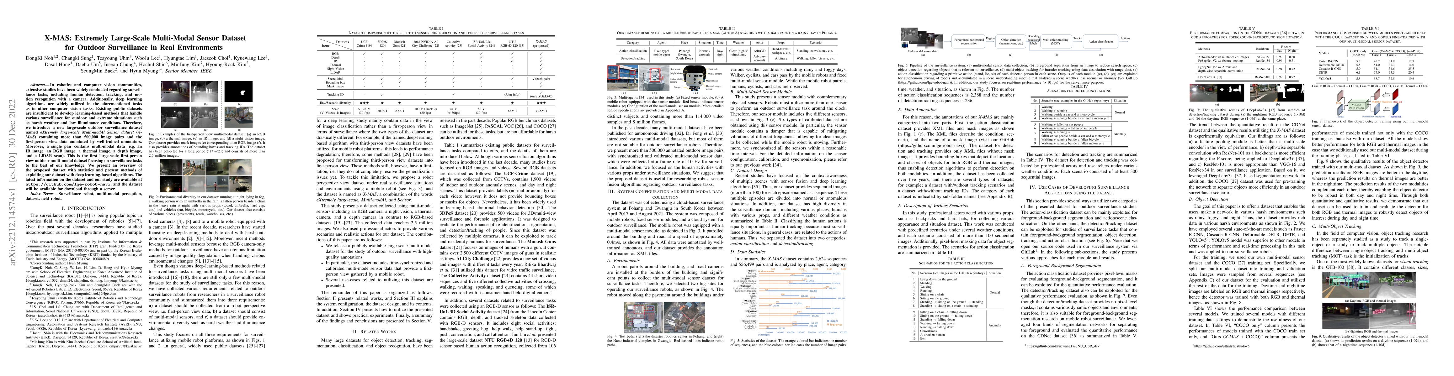
In robotics and computer vision communities, extensive studies have been widely conducted regarding surveillance tasks, including human detection, tracking, and motion recognition with a camera. Add...
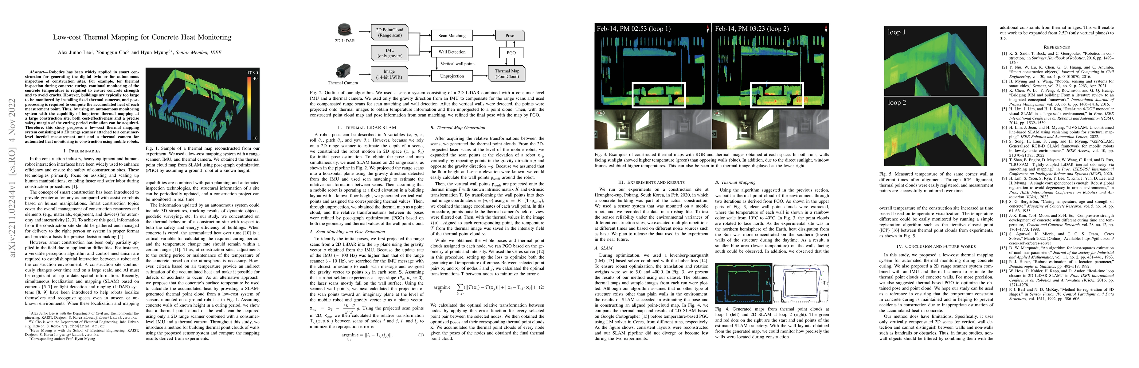
Robotics has been widely applied in smart construction for generating the digital twin or for autonomous inspection of construction sites. For example, for thermal inspection during concrete curing,...
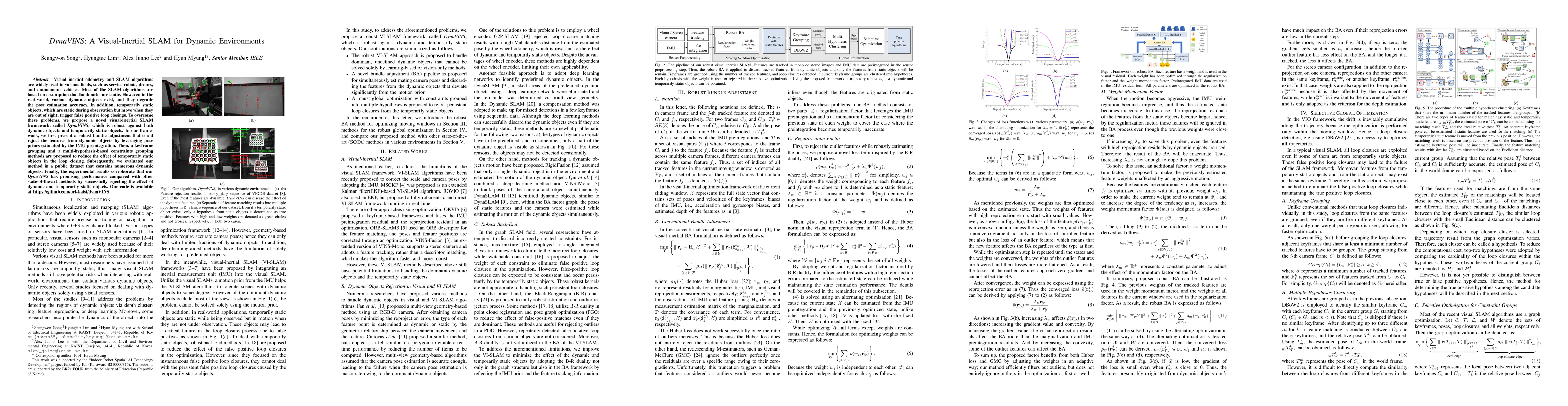
Visual inertial odometry and SLAM algorithms are widely used in various fields, such as service robots, drones, and autonomous vehicles. Most of the SLAM algorithms are based on assumption that land...
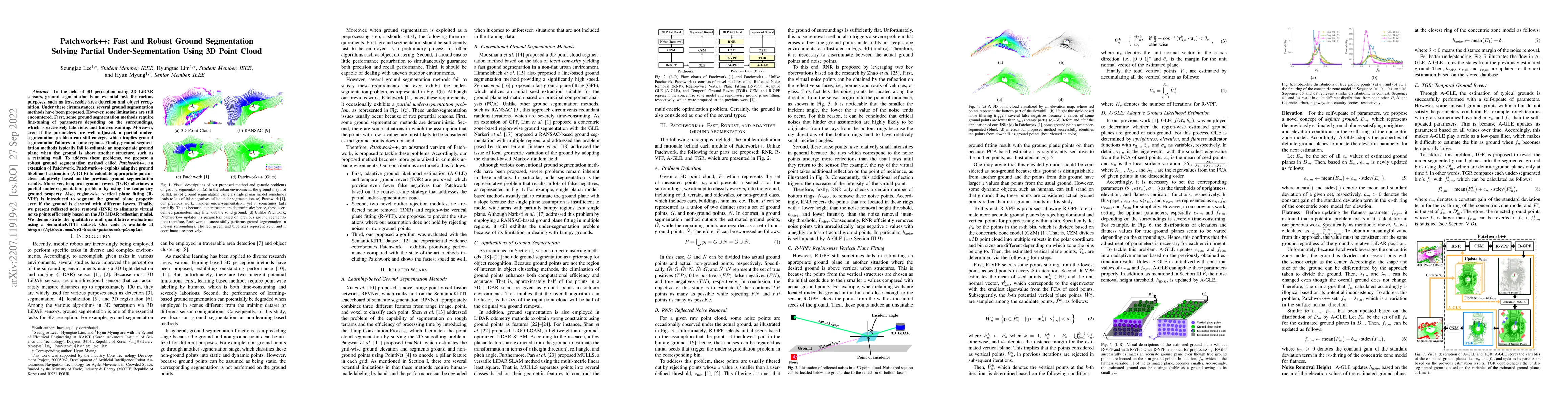
In the field of 3D perception using 3D LiDAR sensors, ground segmentation is an essential task for various purposes, such as traversable area detection and object recognition. Under these circumstan...
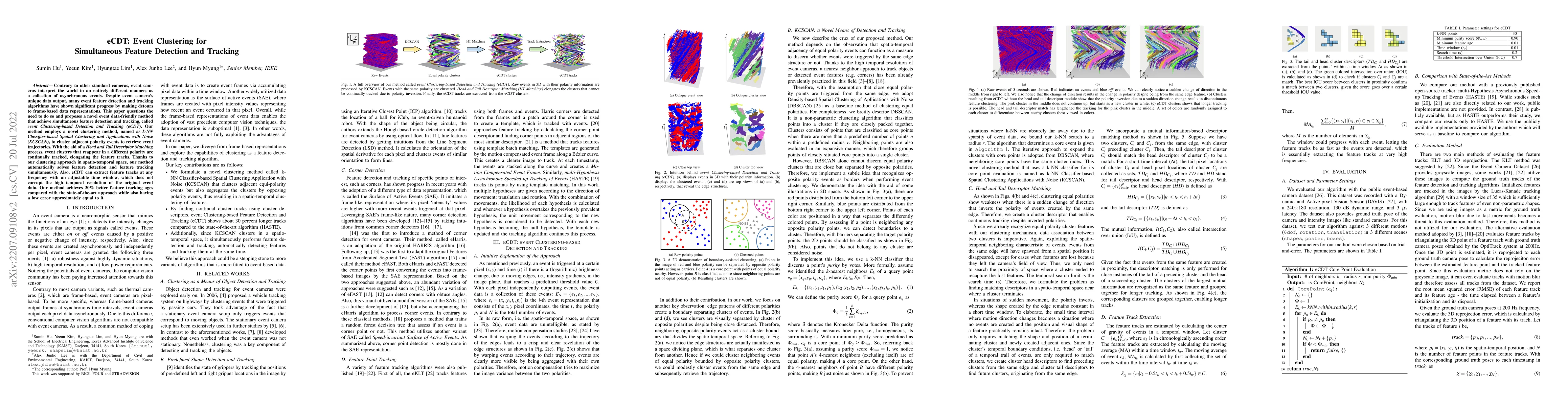
Contrary to other standard cameras, event cameras interpret the world in an entirely different manner; as a collection of asynchronous events. Despite event camera's unique data output, many event f...
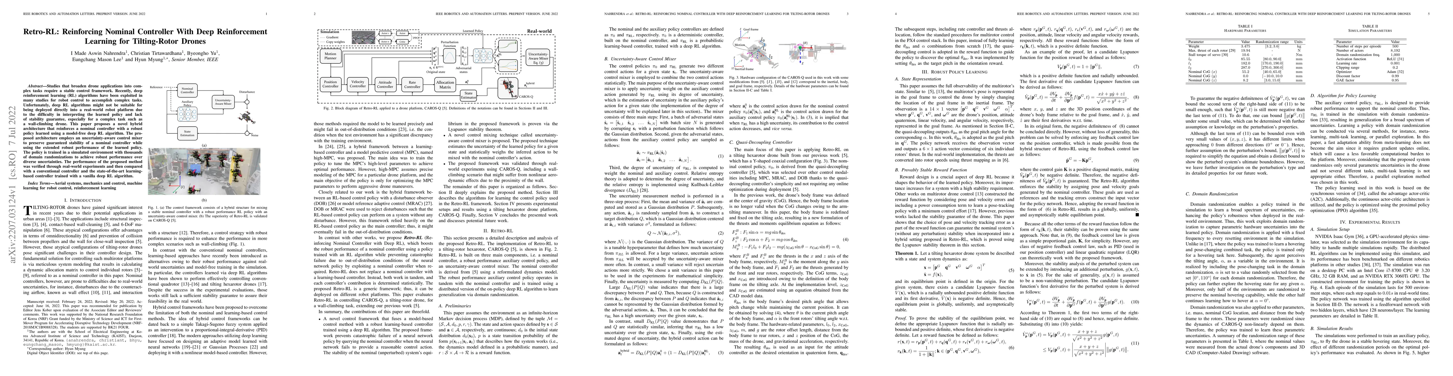
Studies that broaden drone applications into complex tasks require a stable control framework. Recently, deep reinforcement learning (RL) algorithms have been exploited in many studies for robot con...
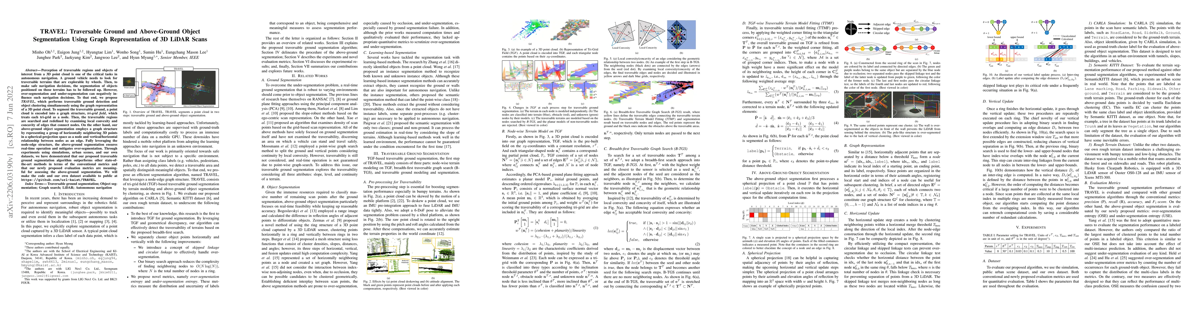
Perception of traversable regions and objects of interest from a 3D point cloud is one of the critical tasks in autonomous navigation. A ground vehicle needs to look for traversable terrains that ar...
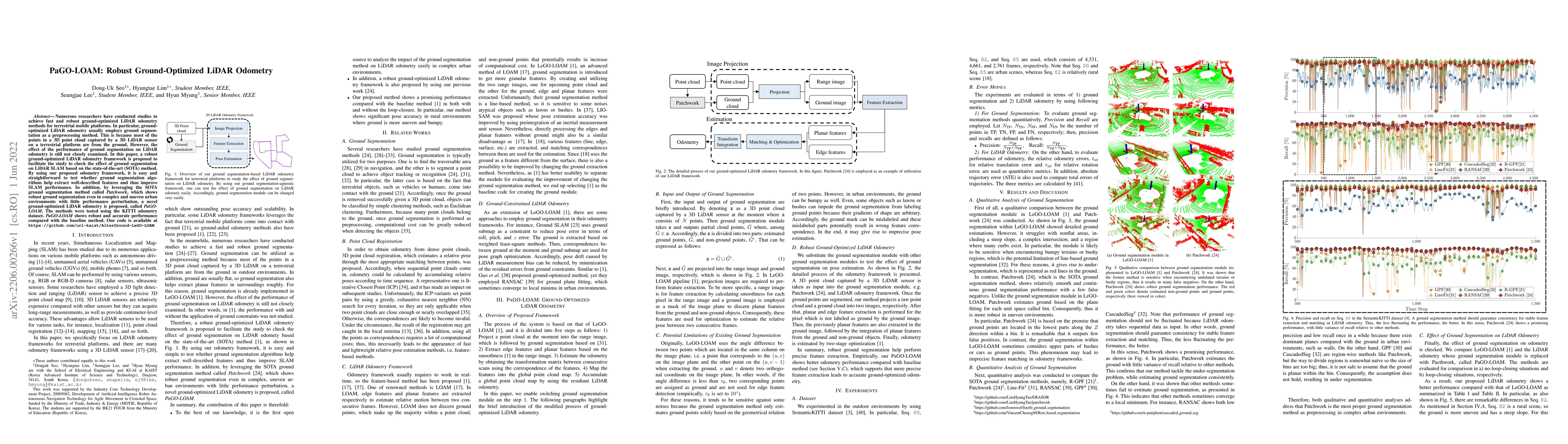
Numerous researchers have conducted studies to achieve fast and robust ground-optimized LiDAR odometry methods for terrestrial mobile platforms. In particular, ground-optimized LiDAR odometry usuall...
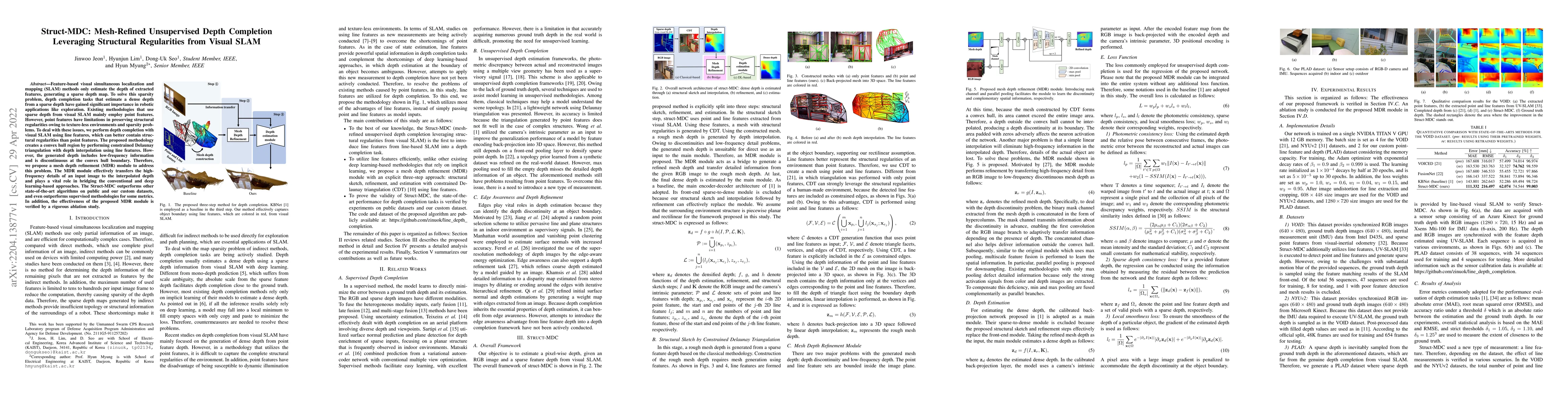
Feature-based visual simultaneous localization and mapping (SLAM) methods only estimate the depth of extracted features, generating a sparse depth map. To solve this sparsity problem, depth completi...
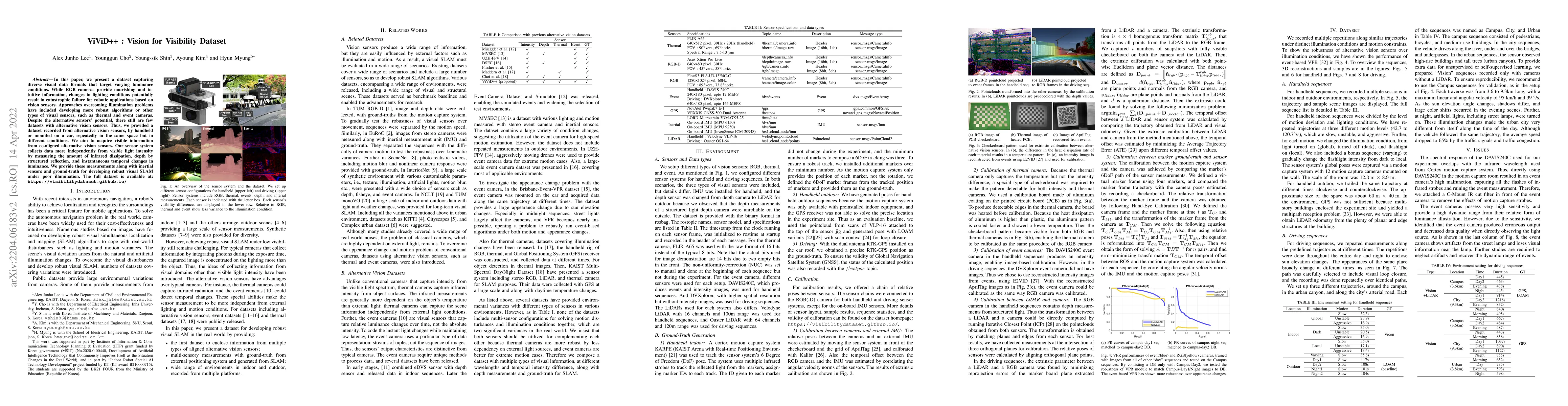
In this paper, we present a dataset capturing diverse visual data formats that target varying luminance conditions. While RGB cameras provide nourishing and intuitive information, changes in lightin...
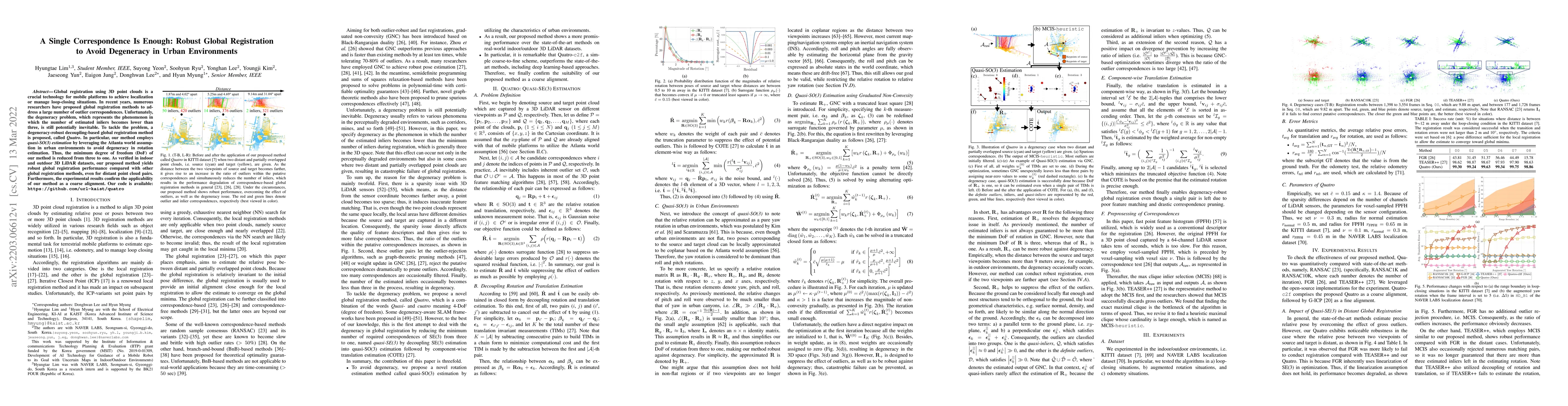
Global registration using 3D point clouds is a crucial technology for mobile platforms to achieve localization or manage loop-closing situations. In recent years, numerous researchers have proposed ...
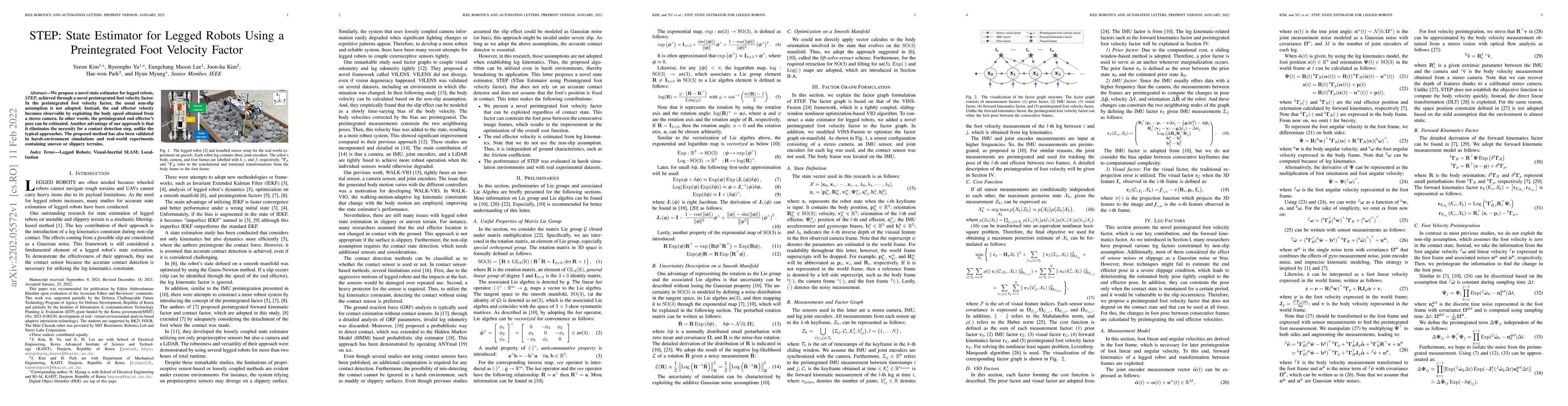
We propose a novel state estimator for legged robots, STEP, achieved through a novel preintegrated foot velocity factor. In the preintegrated foot velocity factor, the usual non-slip assumption is n...
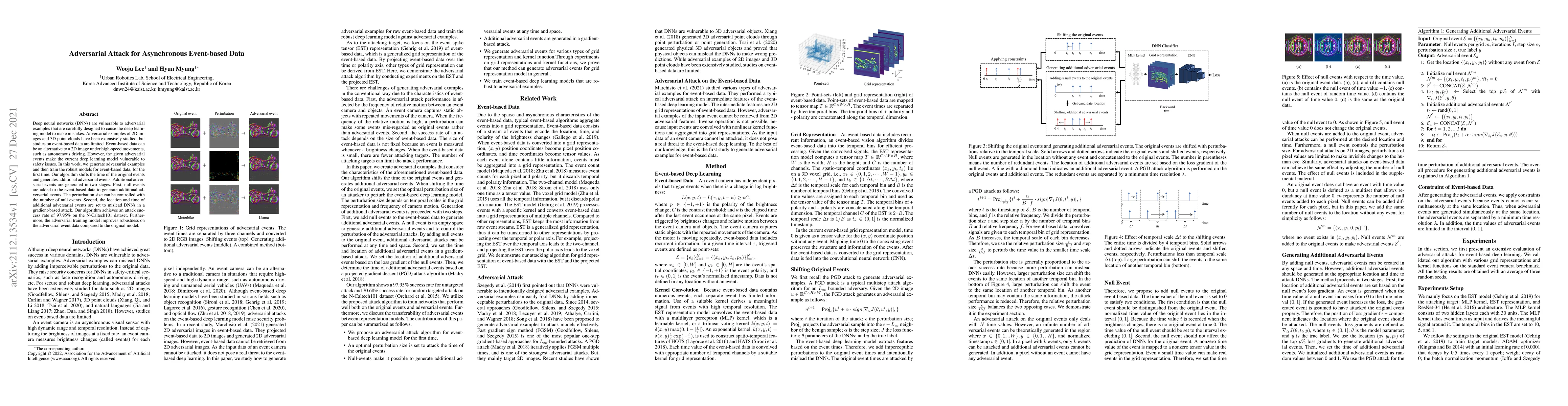
Deep neural networks (DNNs) are vulnerable to adversarial examples that are carefully designed to cause the deep learning model to make mistakes. Adversarial examples of 2D images and 3D point cloud...
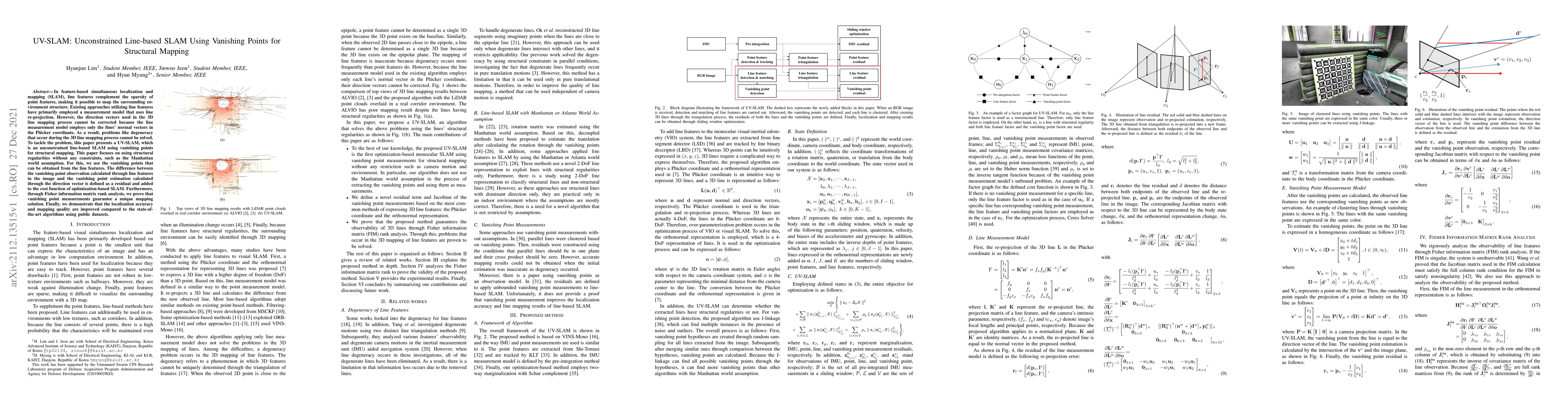
In feature-based simultaneous localization and mapping (SLAM), line features complement the sparsity of point features, making it possible to map the surrounding environment structure. Existing appr...
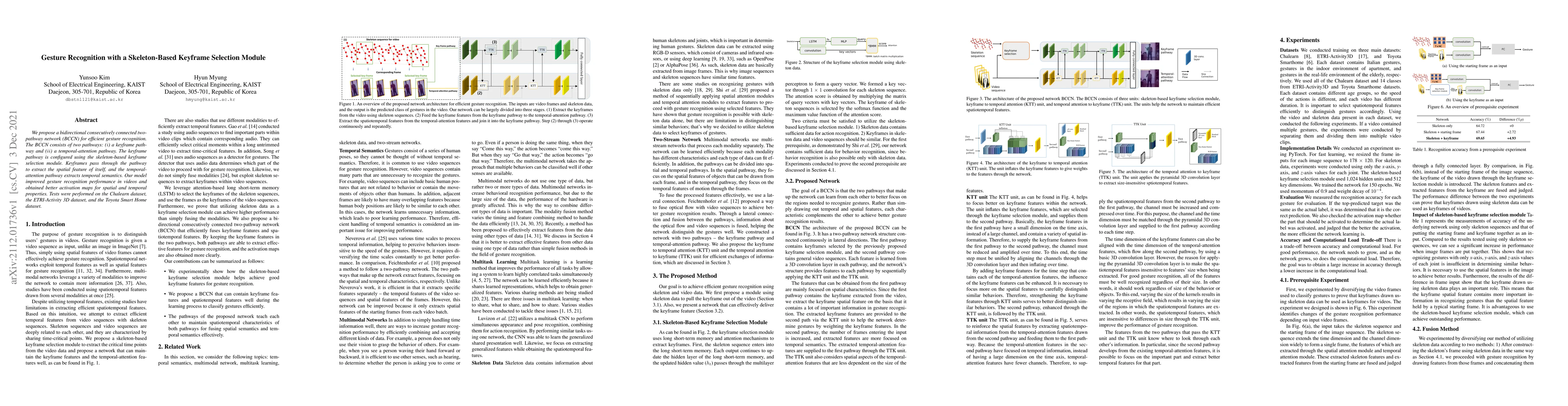
We propose a bidirectional consecutively connected two-pathway network (BCCN) for efficient gesture recognition. The BCCN consists of two pathways: (i) a keyframe pathway and (ii) a temporal-attenti...
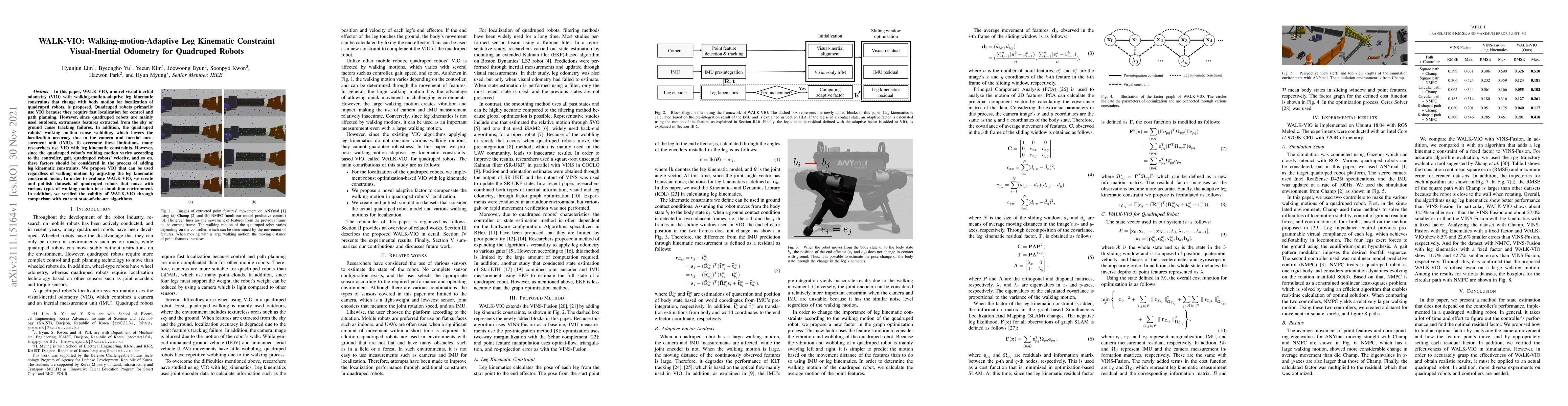
In this paper, WALK-VIO, a novel visual-inertial odometry (VIO) with walking-motion-adaptive leg kinematic constraints that change with body motion for localization of quadruped robots, is proposed....
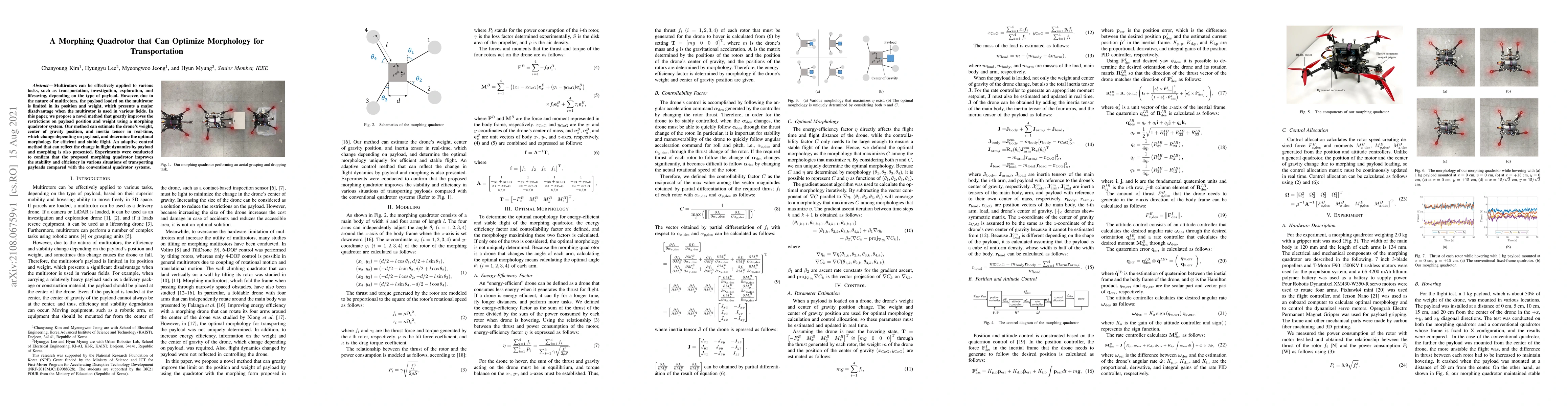
Multirotors can be effectively applied to various tasks, such as transportation, investigation, exploration, and lifesaving, depending on the type of payload. However, due to the nature of multiroto...
Ground segmentation is crucial for terrestrial mobile platforms to perform navigation or neighboring object recognition. Unfortunately, the ground is not flat, as it features steep slopes; bumpy roa...
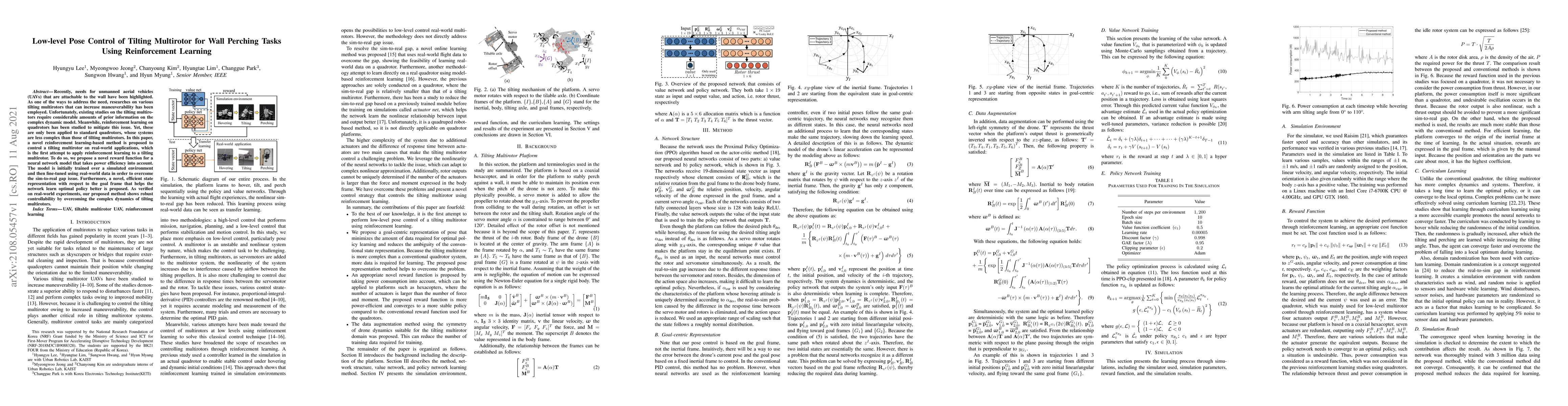
Recently, needs for unmanned aerial vehicles (UAVs) that are attachable to the wall have been highlighted. As one of the ways to address the need, researches on various tilting multirotors that can ...
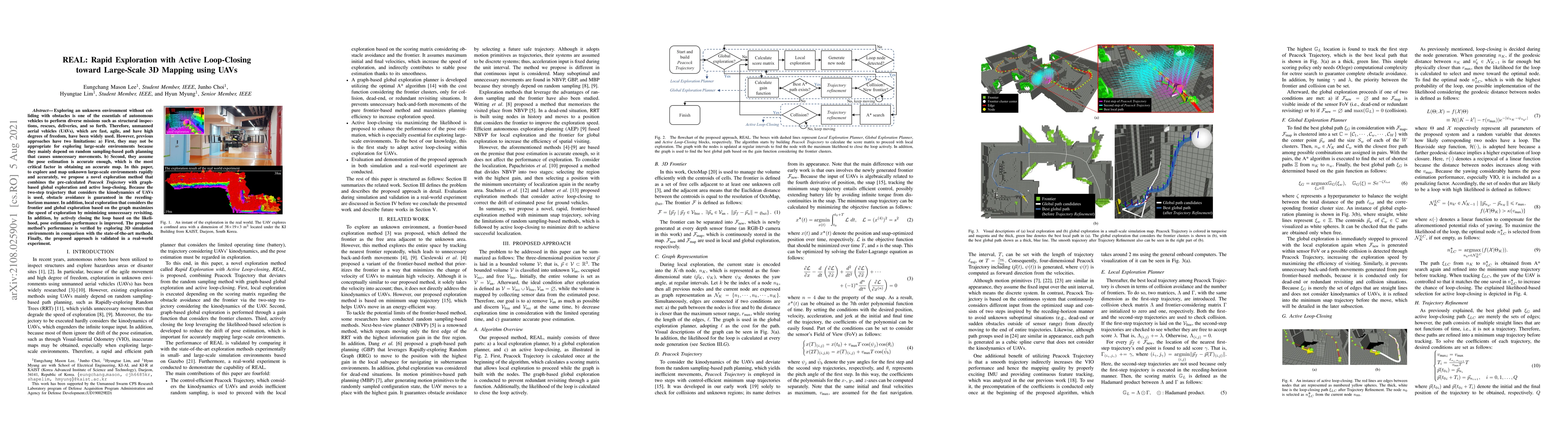
Exploring an unknown environment without colliding with obstacles is one of the essentials of autonomous vehicles to perform diverse missions such as structural inspections, rescues, deliveries, and...
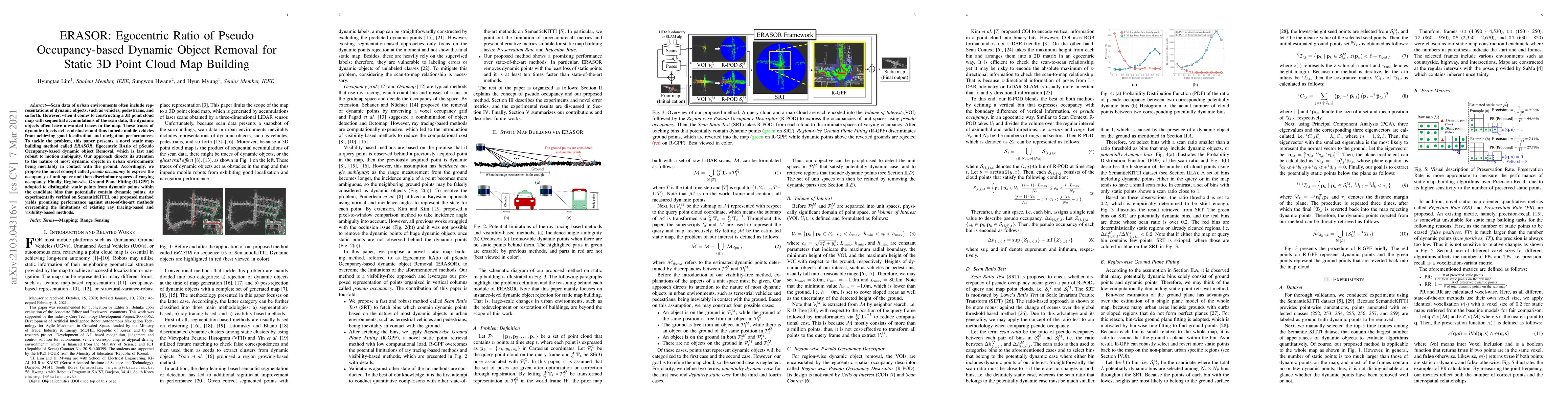
Scan data of urban environments often include representations of dynamic objects, such as vehicles, pedestrians, and so forth. However, when it comes to constructing a 3D point cloud map with sequen...
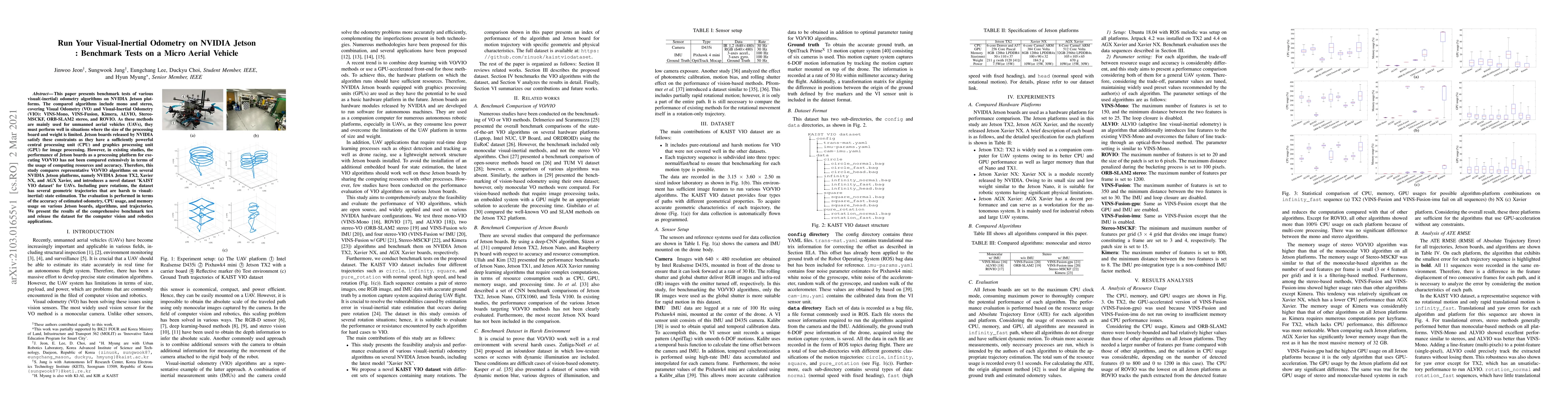
This paper presents benchmark tests of various visual(-inertial) odometry algorithms on NVIDIA Jetson platforms. The compared algorithms include mono and stereo, covering Visual Odometry (VO) and Vi...
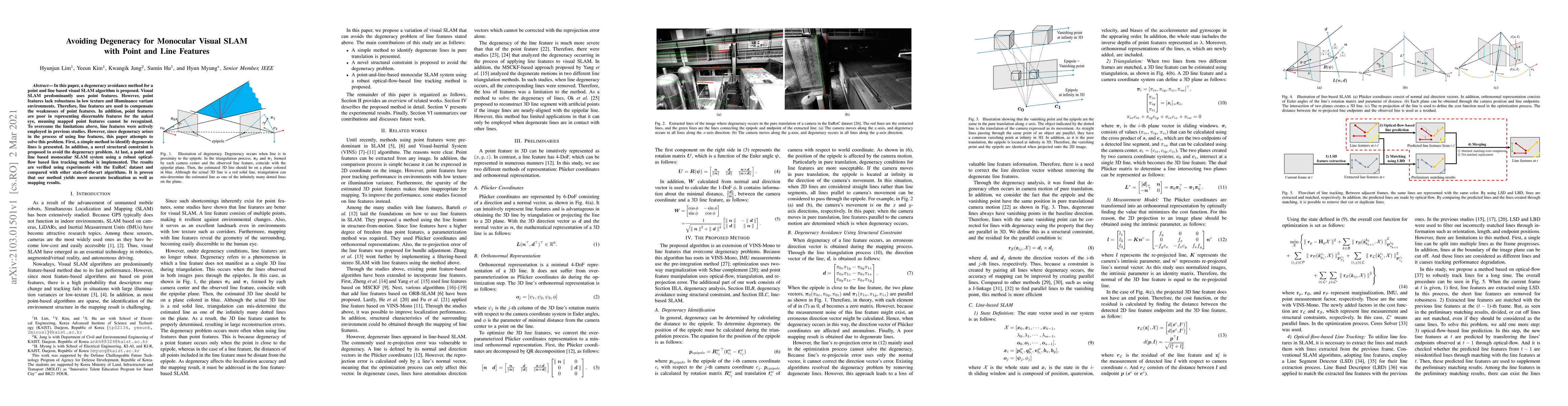
In this paper, a degeneracy avoidance method for a point and line based visual SLAM algorithm is proposed. Visual SLAM predominantly uses point features. However, point features lack robustness in l...
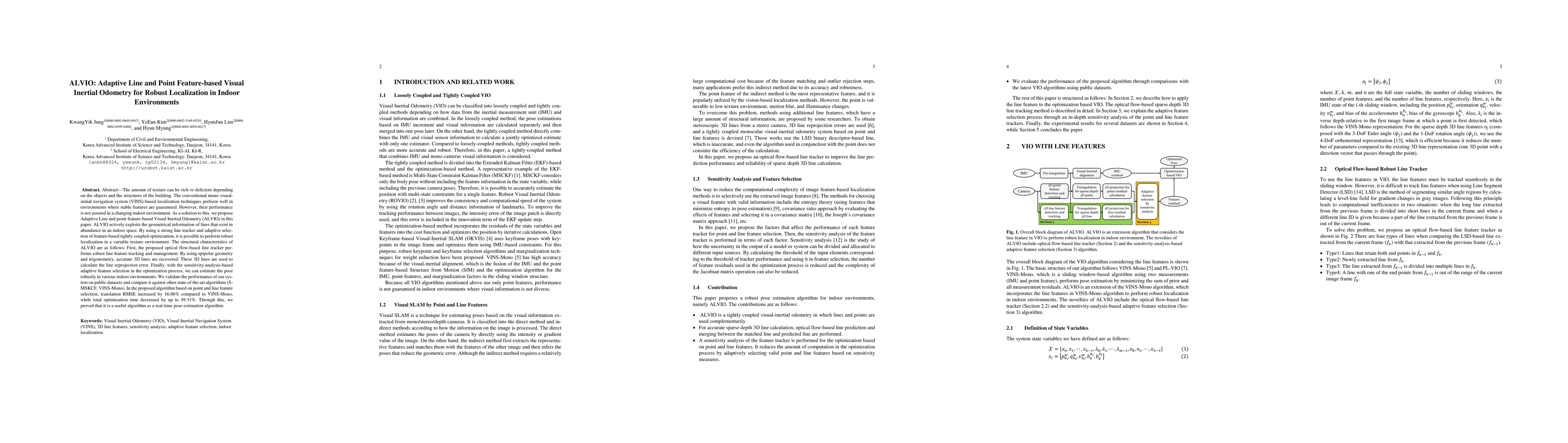
The amount of texture can be rich or deficient depending on the objects and the structures of the building. The conventional mono visual-initial navigation system (VINS)-based localization technique...
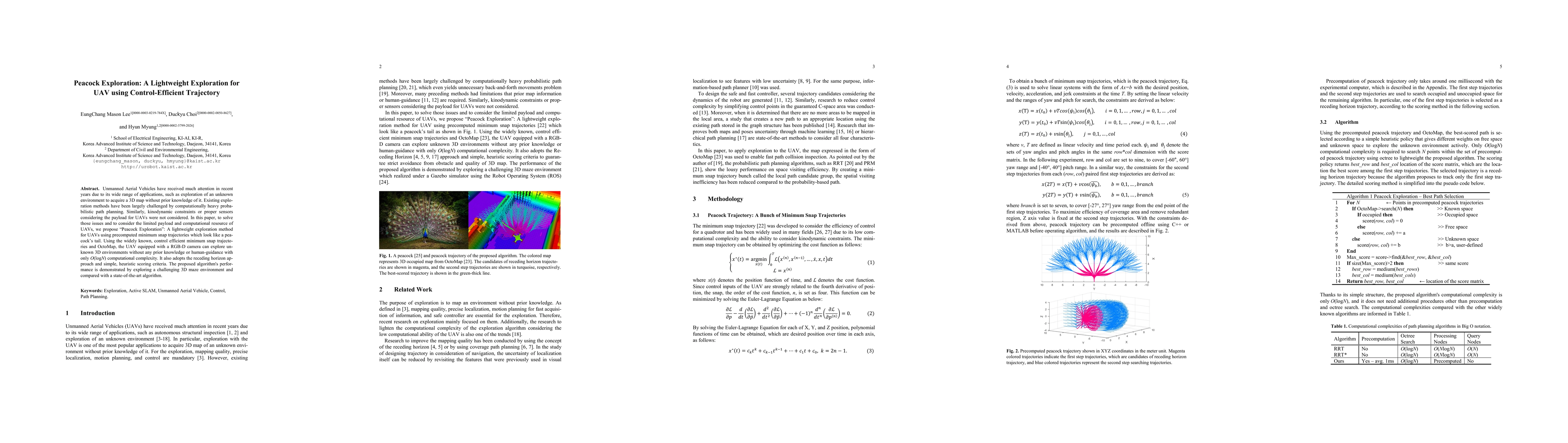
Unmanned Aerial Vehicles have received much attention in recent years due to its wide range of applications, such as exploration of an unknown environment to acquire a 3D map without prior knowledge...
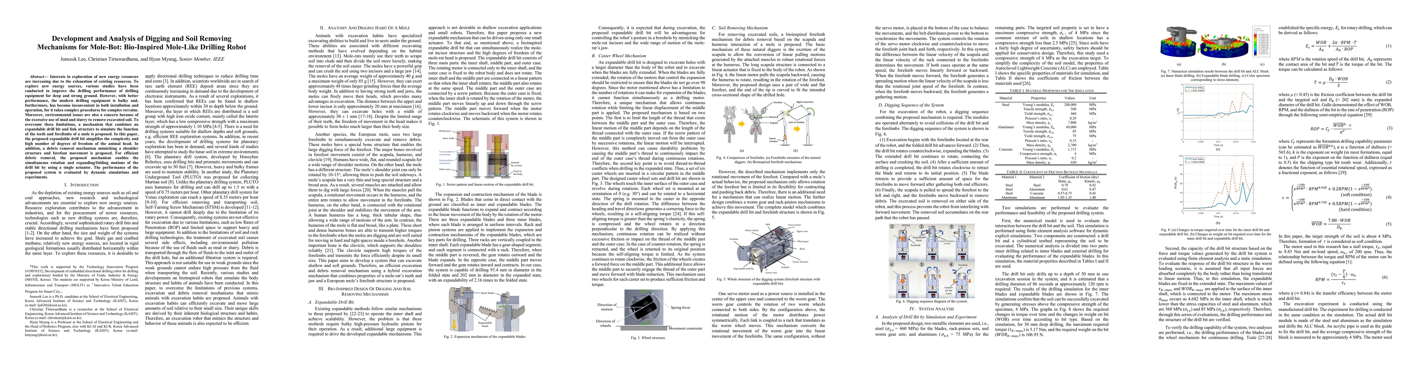
Interests in exploration of new energy resources are increasing due to the exhaustion of existing resources. To explore new energy sources, various studies have been conducted to improve the drillin...
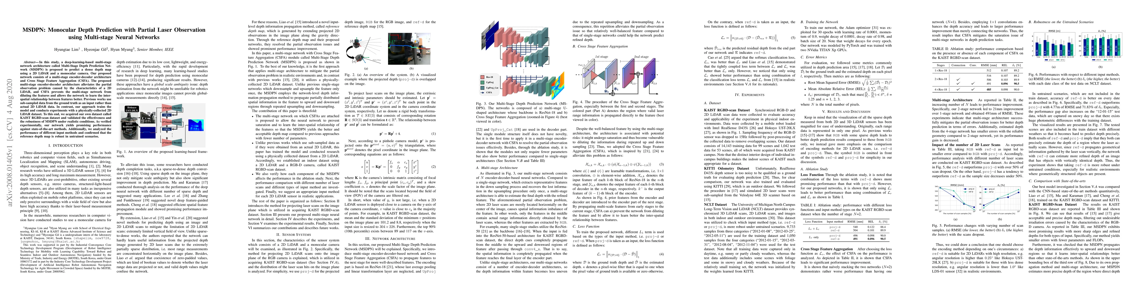
In this study, a deep-learning-based multi-stage network architecture called Multi-Stage Depth Prediction Network (MSDPN) is proposed to predict a dense depth map using a 2D LiDAR and a monocular ca...
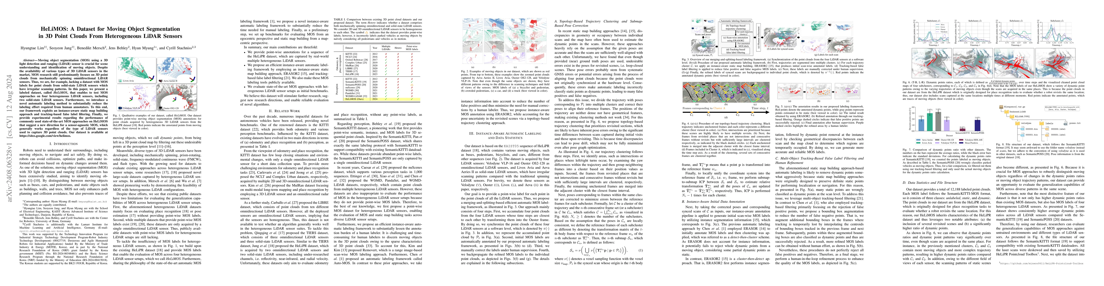
Moving object segmentation (MOS) using a 3D light detection and ranging (LiDAR) sensor is crucial for scene understanding and identification of moving objects. Despite the availability of various type...
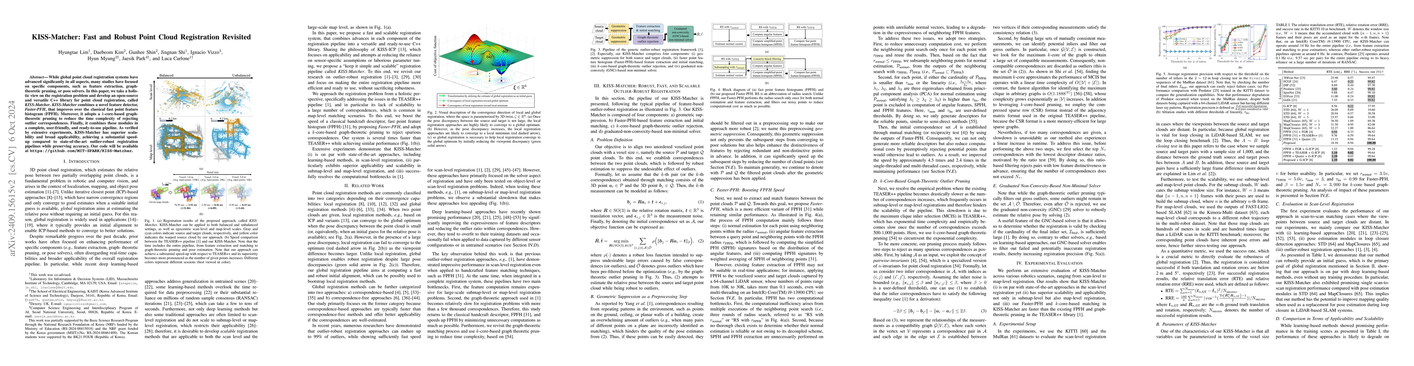
While global point cloud registration systems have advanced significantly in all aspects, many studies have focused on specific components, such as feature extraction, graph-theoretic pruning, or pose...
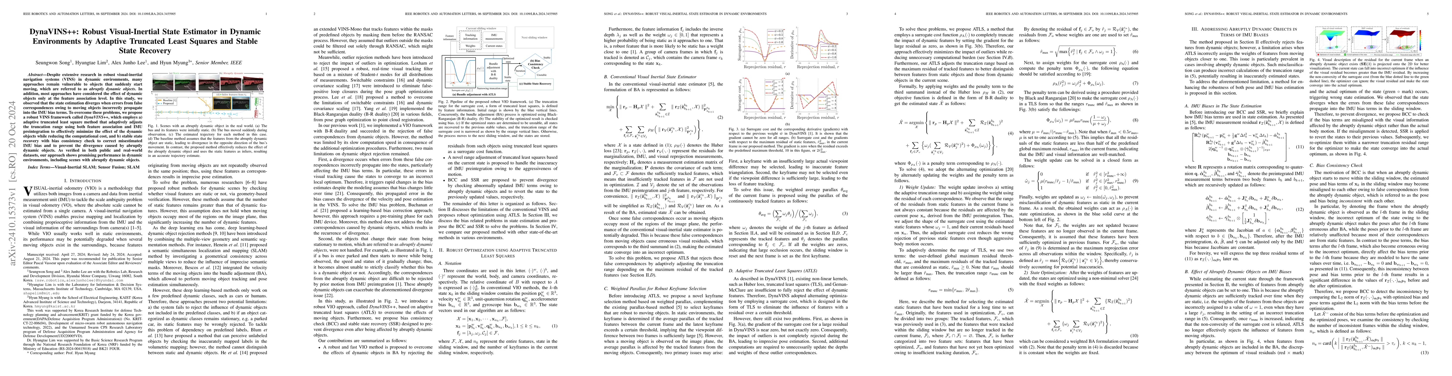
Despite extensive research in robust visual-inertial navigation systems~(VINS) in dynamic environments, many approaches remain vulnerable to objects that suddenly start moving, which are referred to a...
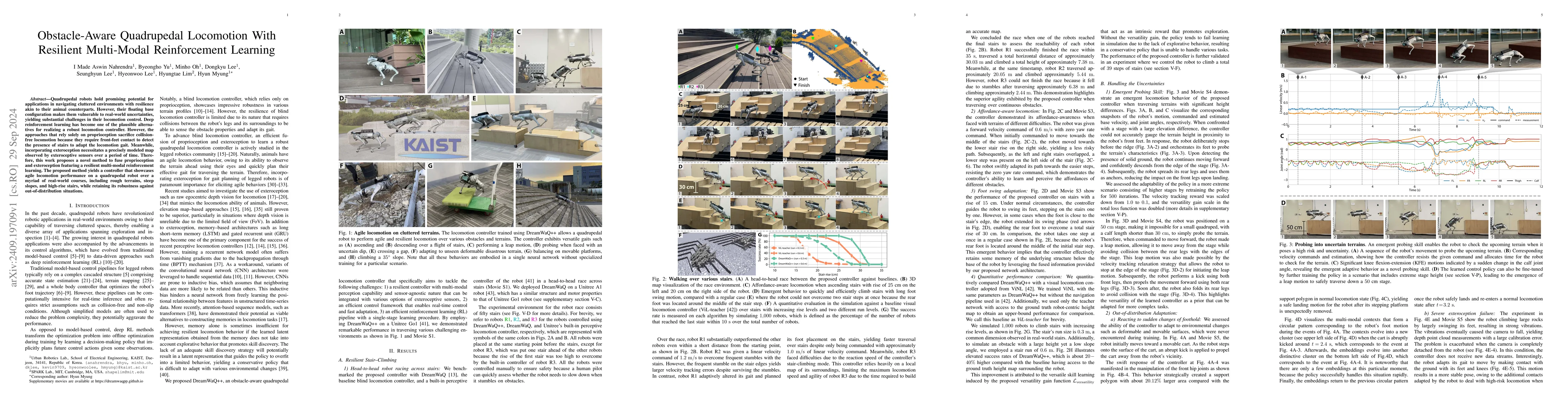
Quadrupedal robots hold promising potential for applications in navigating cluttered environments with resilience akin to their animal counterparts. However, their floating base configuration makes th...
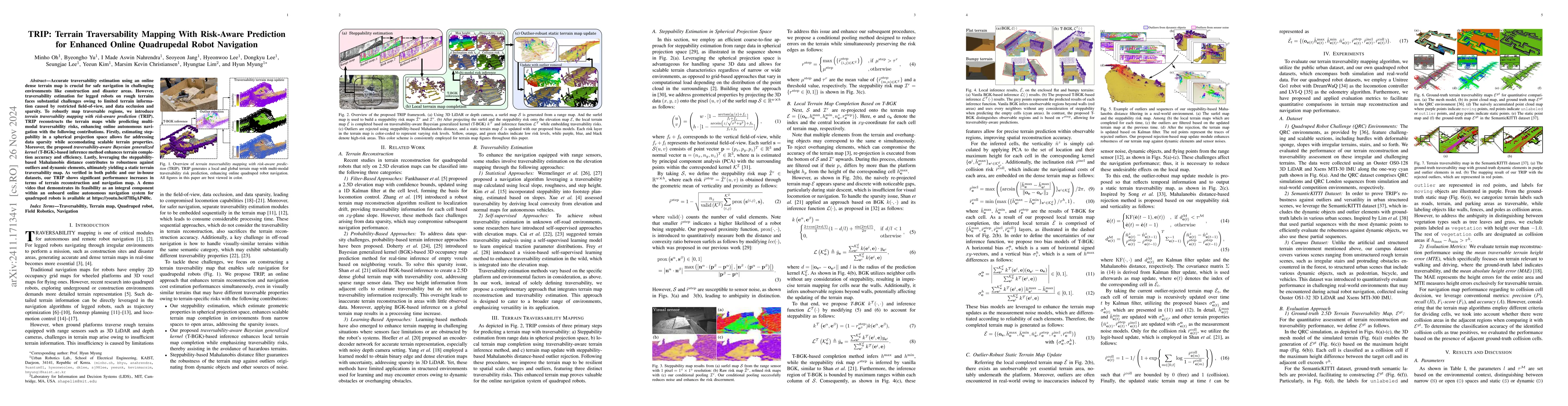
Accurate traversability estimation using an online dense terrain map is crucial for safe navigation in challenging environments like construction and disaster areas. However, traversability estimation...
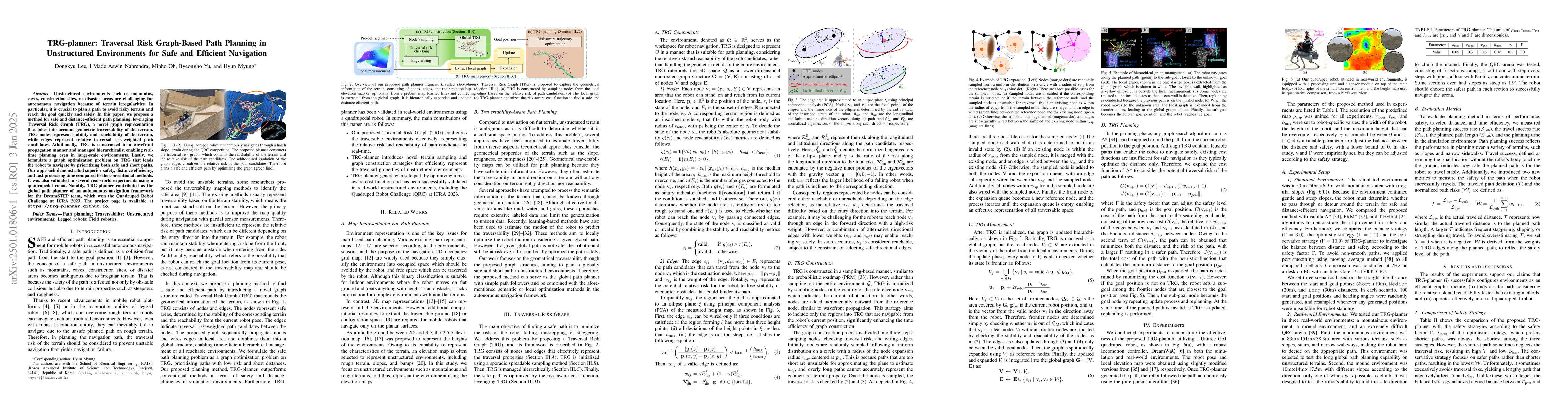
Unstructured environments such as mountains, caves, construction sites, or disaster areas are challenging for autonomous navigation because of terrain irregularities. In particular, it is crucial to p...
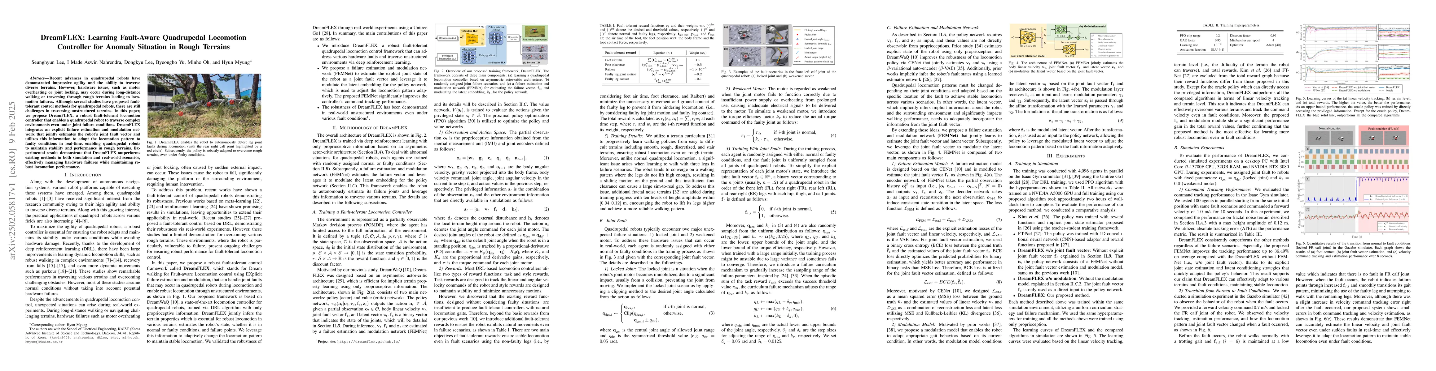
Recent advances in quadrupedal robots have demonstrated impressive agility and the ability to traverse diverse terrains. However, hardware issues, such as motor overheating or joint locking, may occur...
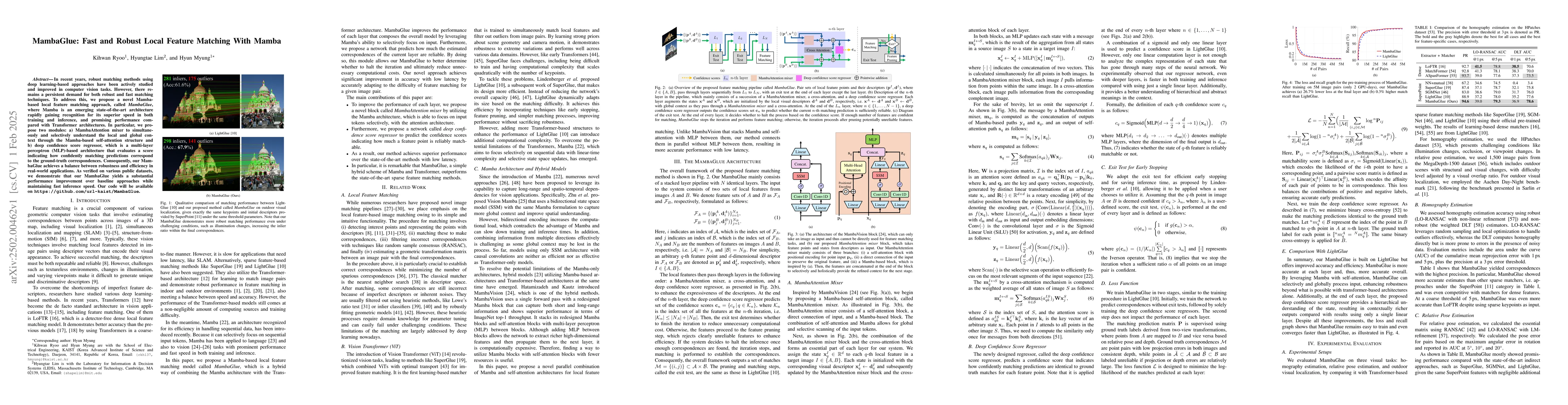
In recent years, robust matching methods using deep learning-based approaches have been actively studied and improved in computer vision tasks. However, there remains a persistent demand for both robu...
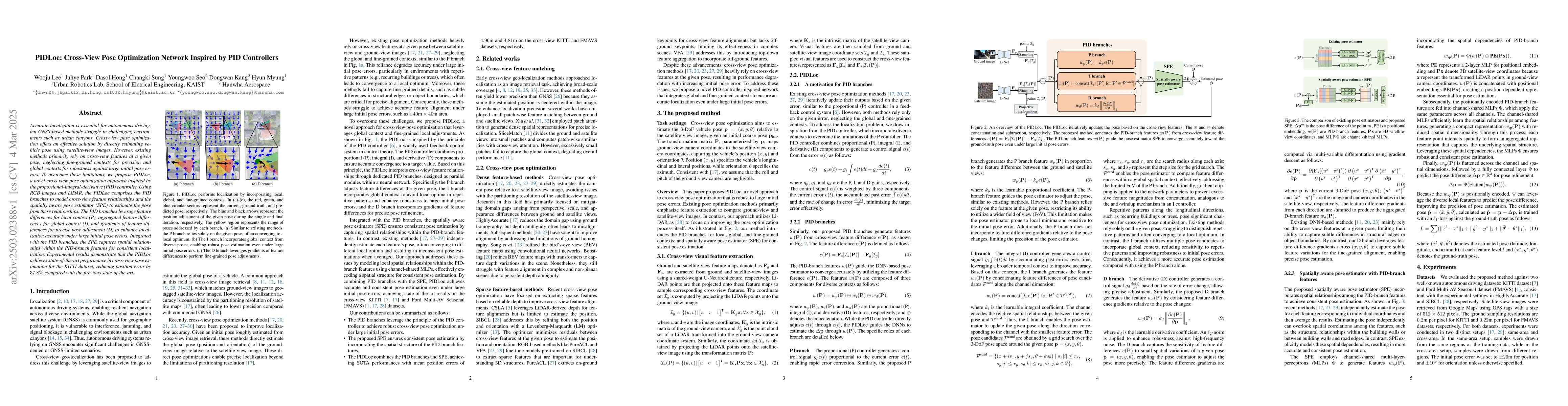
Accurate localization is essential for autonomous driving, but GNSS-based methods struggle in challenging environments such as urban canyons. Cross-view pose optimization offers an effective solution ...
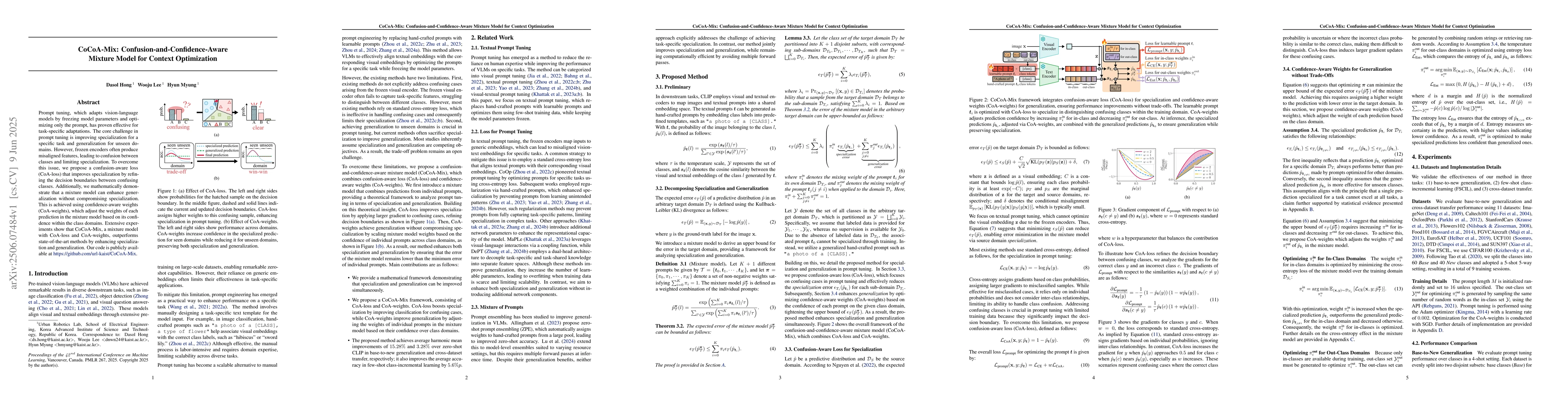
Prompt tuning, which adapts vision-language models by freezing model parameters and optimizing only the prompt, has proven effective for task-specific adaptations. The core challenge in prompt tuning ...
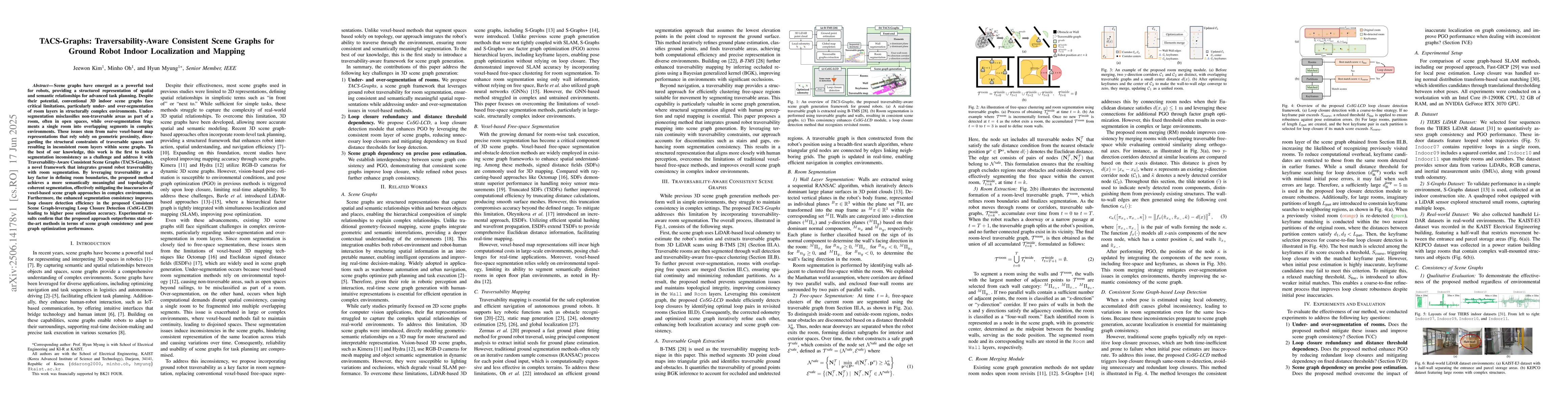
Scene graphs have emerged as a powerful tool for robots, providing a structured representation of spatial and semantic relationships for advanced task planning. Despite their potential, conventional 3...
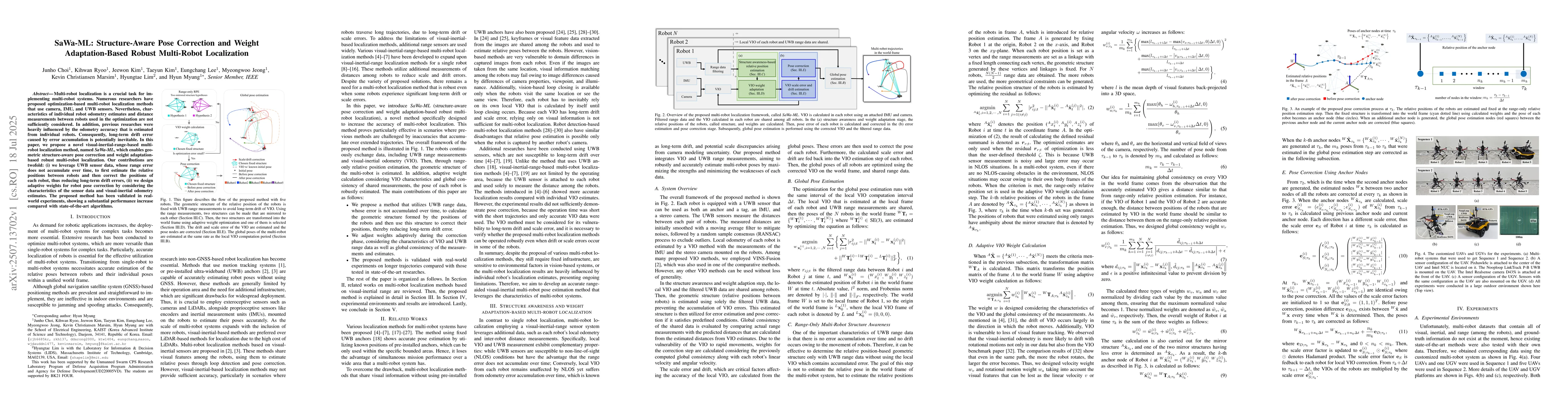
Multi-robot localization is a crucial task for implementing multi-robot systems. Numerous researchers have proposed optimization-based multi-robot localization methods that use camera, IMU, and UWB se...
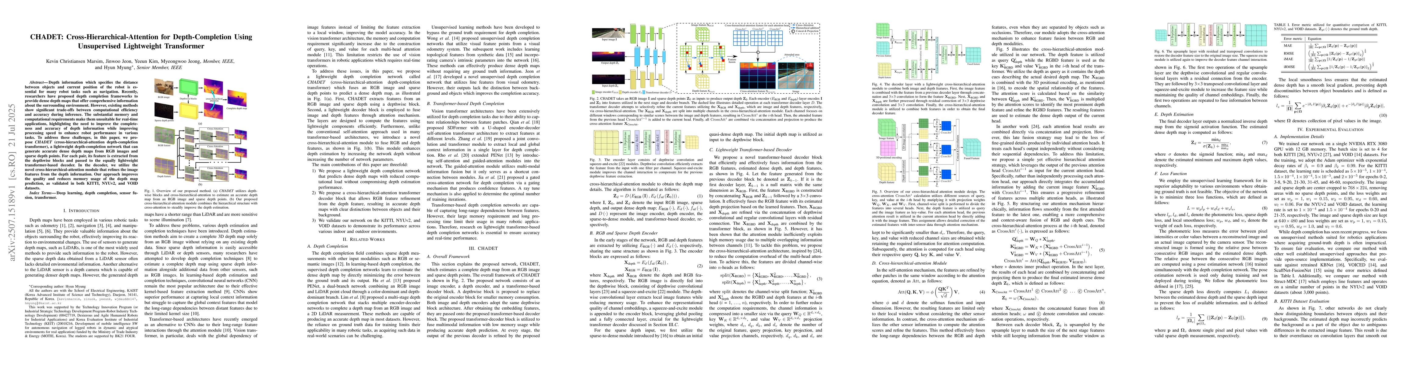
Depth information which specifies the distance between objects and current position of the robot is essential for many robot tasks such as navigation. Recently, researchers have proposed depth complet...
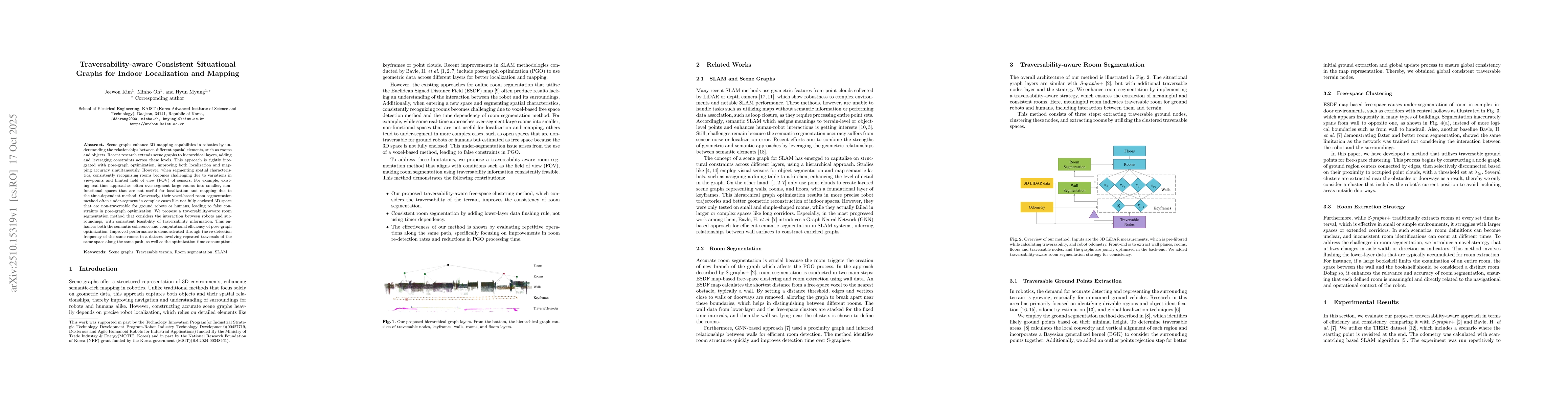
Scene graphs enhance 3D mapping capabilities in robotics by understanding the relationships between different spatial elements, such as rooms and objects. Recent research extends scene graphs to hiera...
Autonomous navigation for legged robots in complex and dynamic environments relies on robust simultaneous localization and mapping (SLAM) systems to accurately map surroundings and localize the robot,...
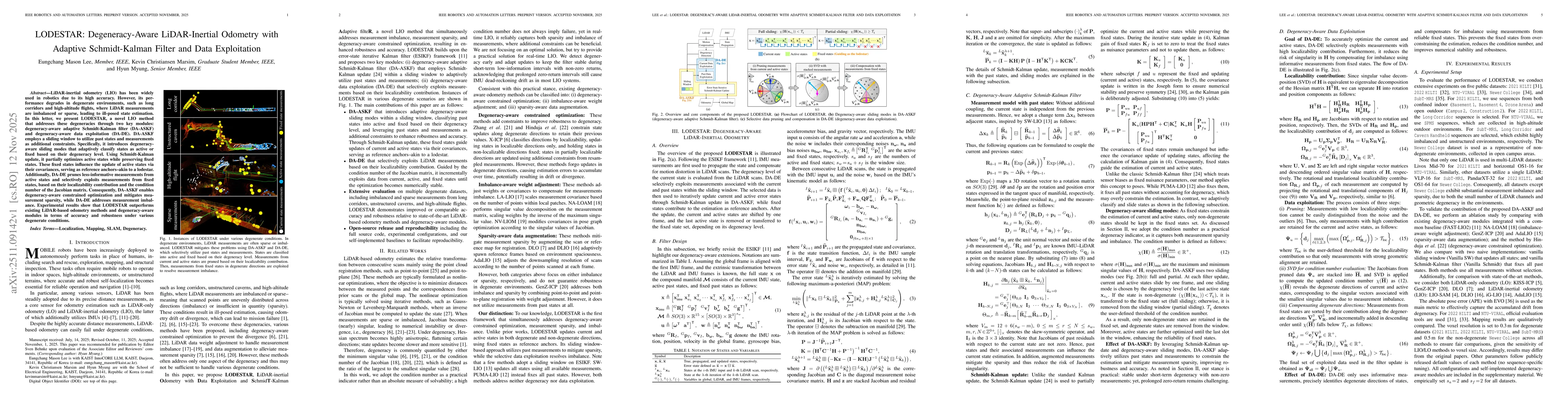
LiDAR-inertial odometry (LIO) has been widely used in robotics due to its high accuracy. However, its performance degrades in degenerate environments, such as long corridors and high-altitude flights,...
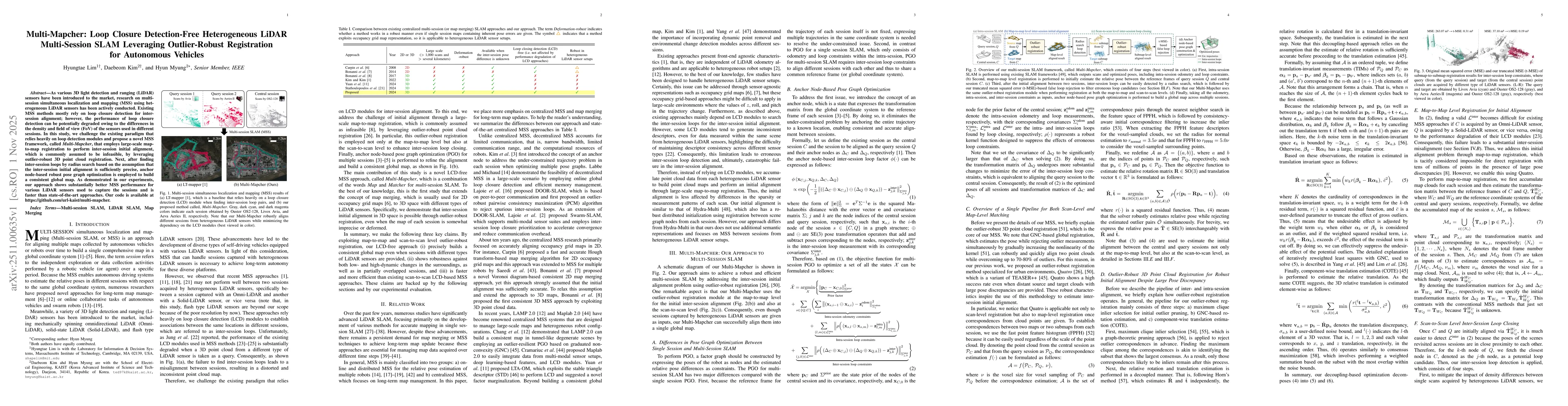
As various 3D light detection and ranging (LiDAR) sensors have been introduced to the market, research on multi-session simultaneous localization and mapping (MSS) using heterogeneous LiDAR sensors ha...

Online change detection is crucial for mobile robots to efficiently navigate through dynamic environments. Detecting changes in transient settings, such as active construction sites or frequently reco...
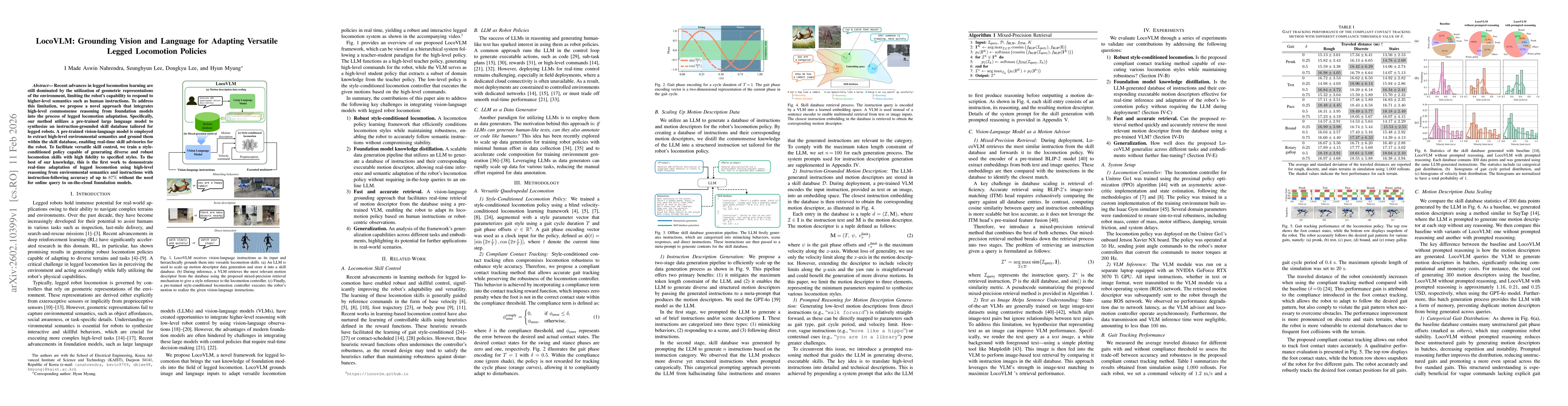
Recent advances in legged locomotion learning are still dominated by the utilization of geometric representations of the environment, limiting the robot's capability to respond to higher-level semanti...
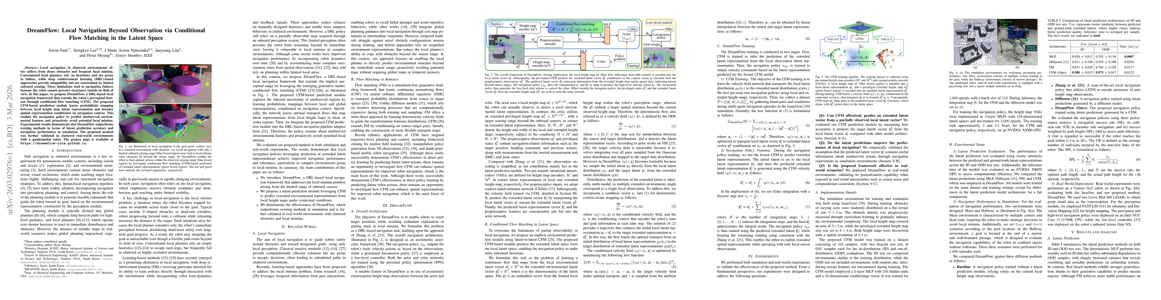
Local navigation in cluttered environments often suffers from dense obstacles and frequent local minima. Conventional local planners rely on heuristics and are prone to failure, while deep reinforceme...
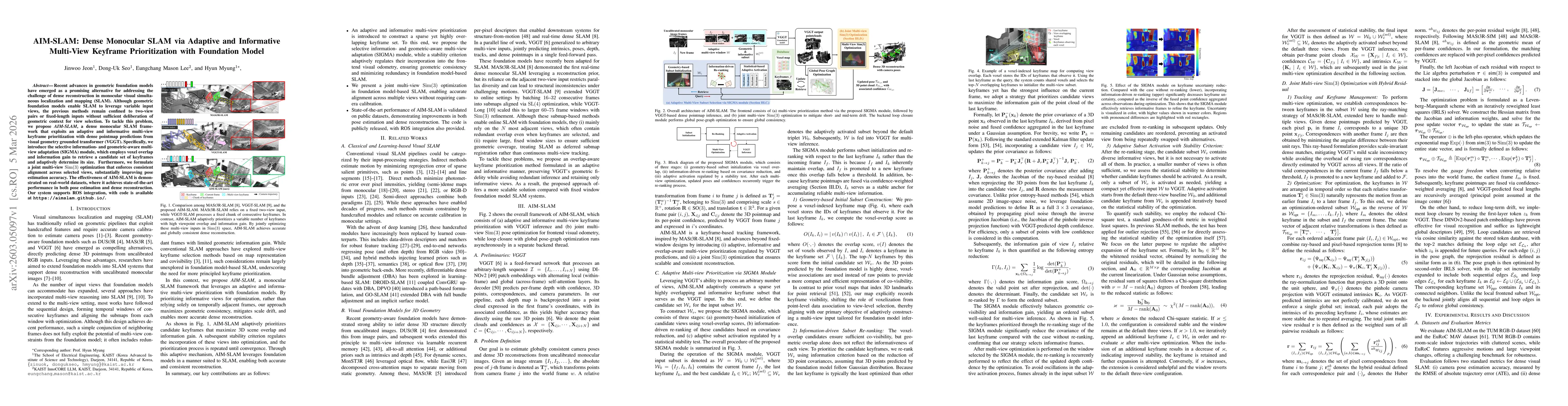
Recent advances in geometric foundation models have emerged as a promising alternative for addressing the challenge of dense reconstruction in monocular visual simultaneous localization and mapping (S...
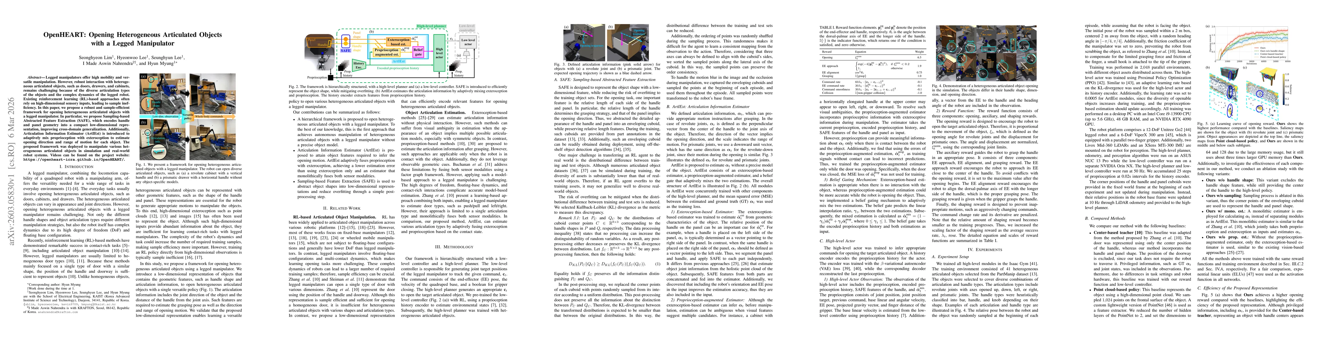
Legged manipulators offer high mobility and versatile manipulation. However, robust interaction with heterogeneous articulated objects, such as doors, drawers, and cabinets, remains challenging becaus...
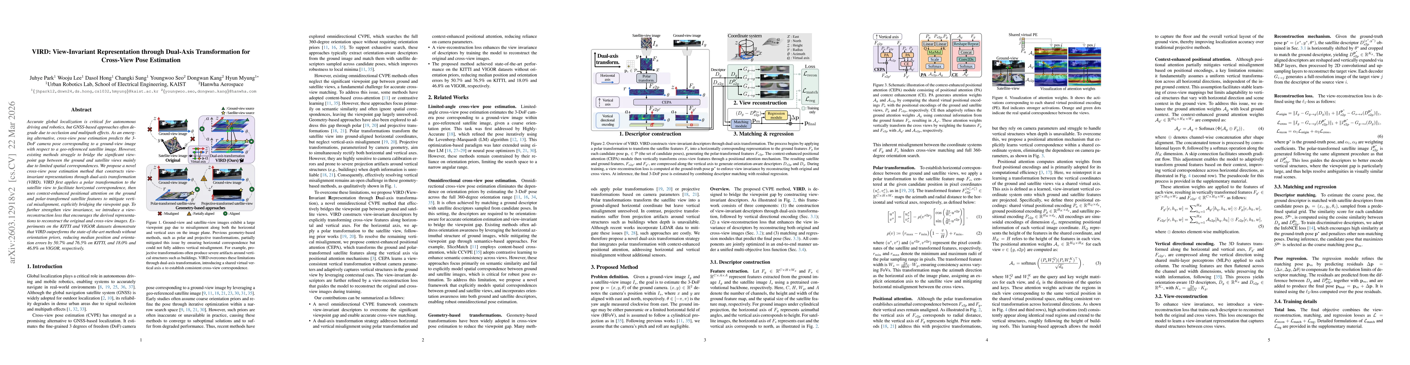
Accurate global localization is crucial for autonomous driving and robotics, but GNSS-based approaches often degrade due to occlusion and multipath effects. As an emerging alternative, cross-view pose...
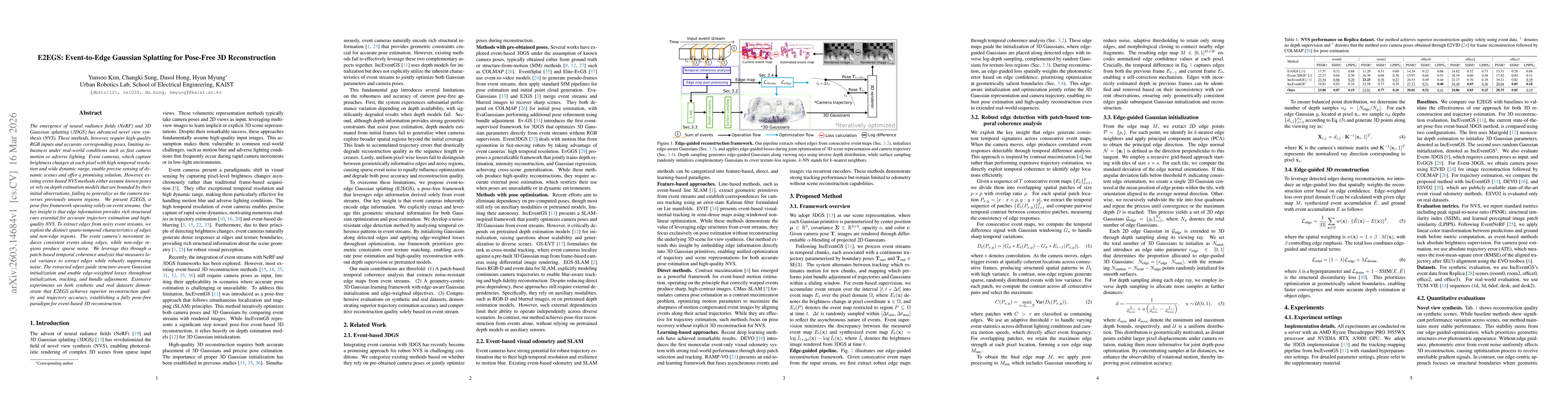
The emergence of neural radiance fields (NeRF) and 3D Gaussian splatting (3DGS) has advanced novel view synthesis (NVS). These methods, however, require high-quality RGB inputs and accurate correspond...
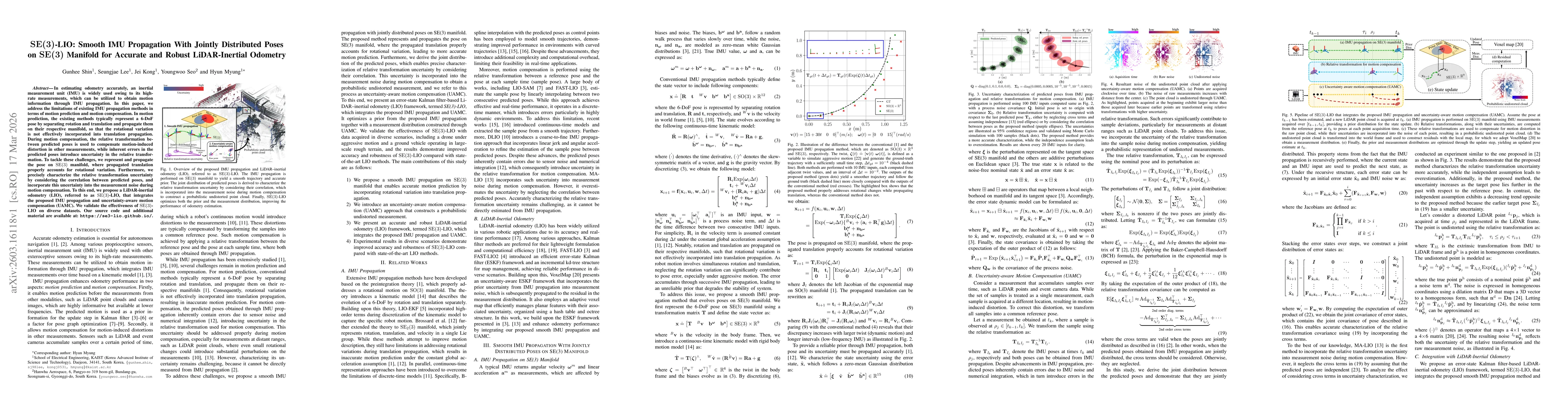
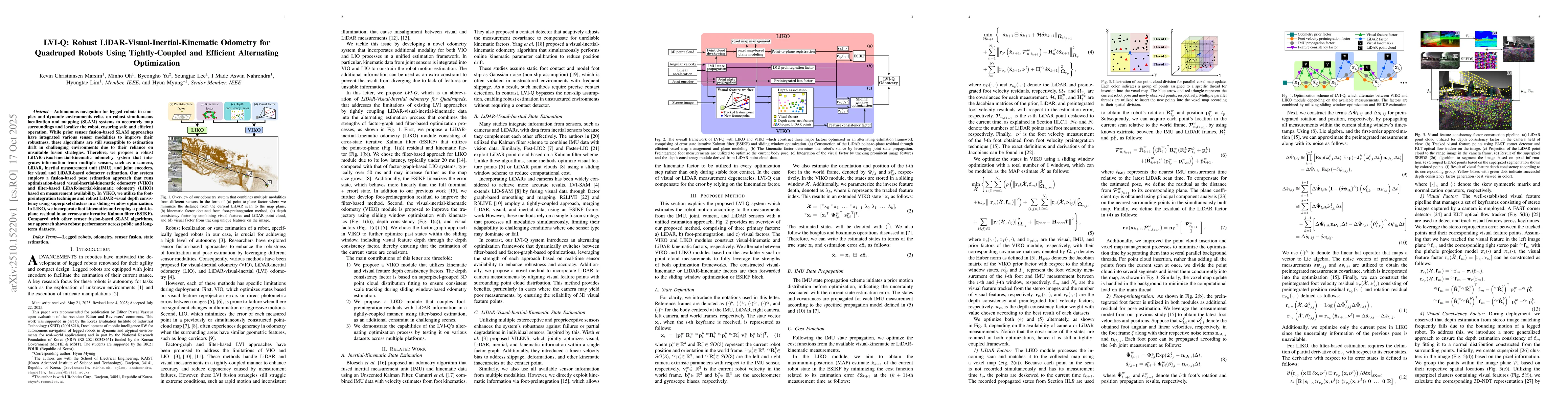
In estimating odometry accurately, an inertial measurement unit (IMU) is widely used owing to its high-rate measurements, which can be utilized to obtain motion information through IMU propagation. In...
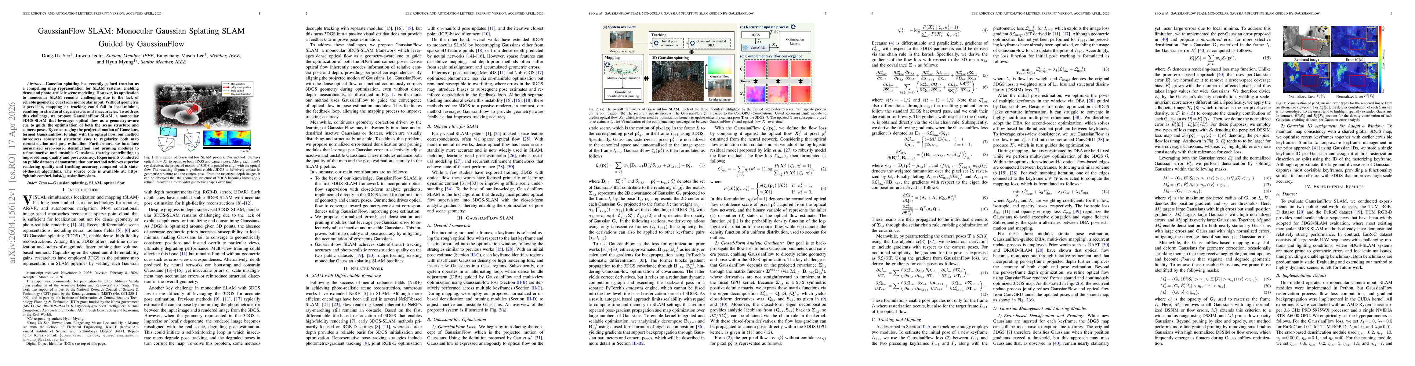
Gaussian splatting has recently gained traction as a compelling map representation for SLAM systems, enabling dense and photo-realistic scene modeling. However, its application to monocular SLAM remai...
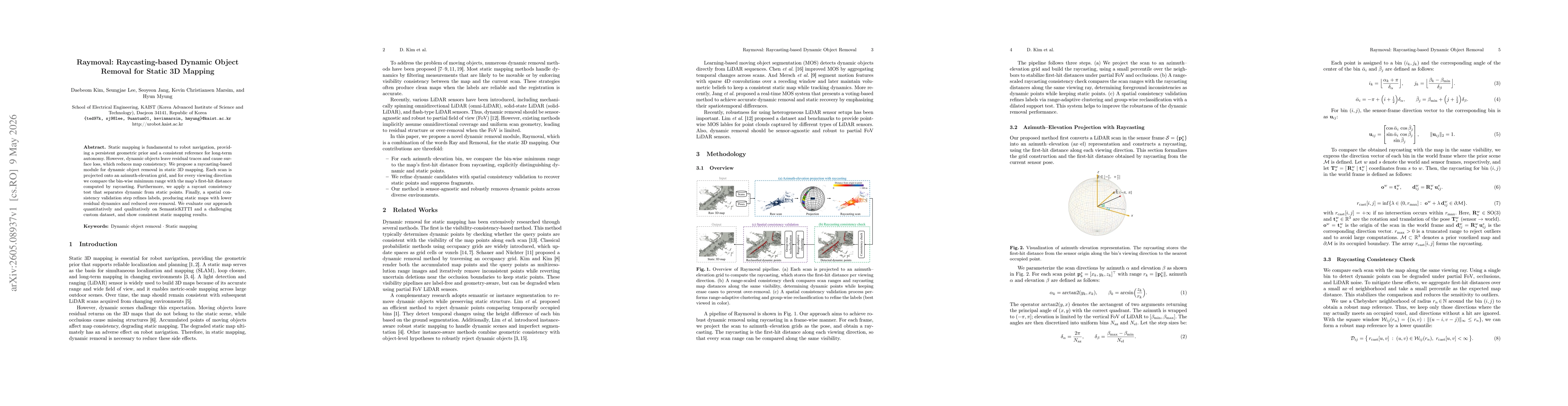
Static mapping is fundamental to robot navigation, providing a persistent geometric prior and a consistent reference for long-term autonomy. However, dynamic objects leave residual traces and cause su...
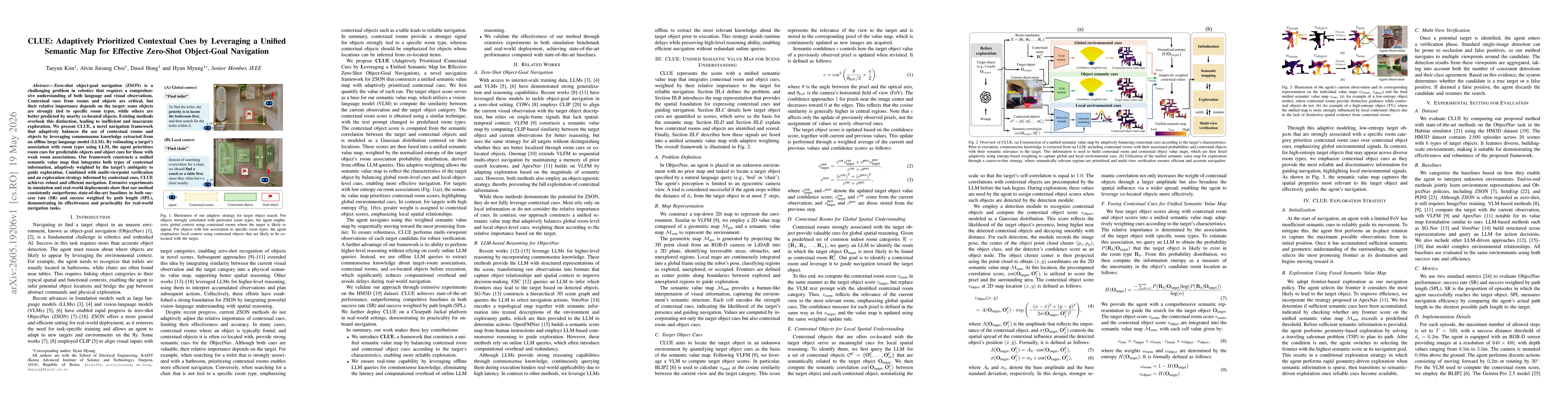
Zero-shot object-goal navigation (ZSON) is a challenging problem in robotics that requires a comprehensive understanding of both language and visual observations. Contextual cues from rooms and object...
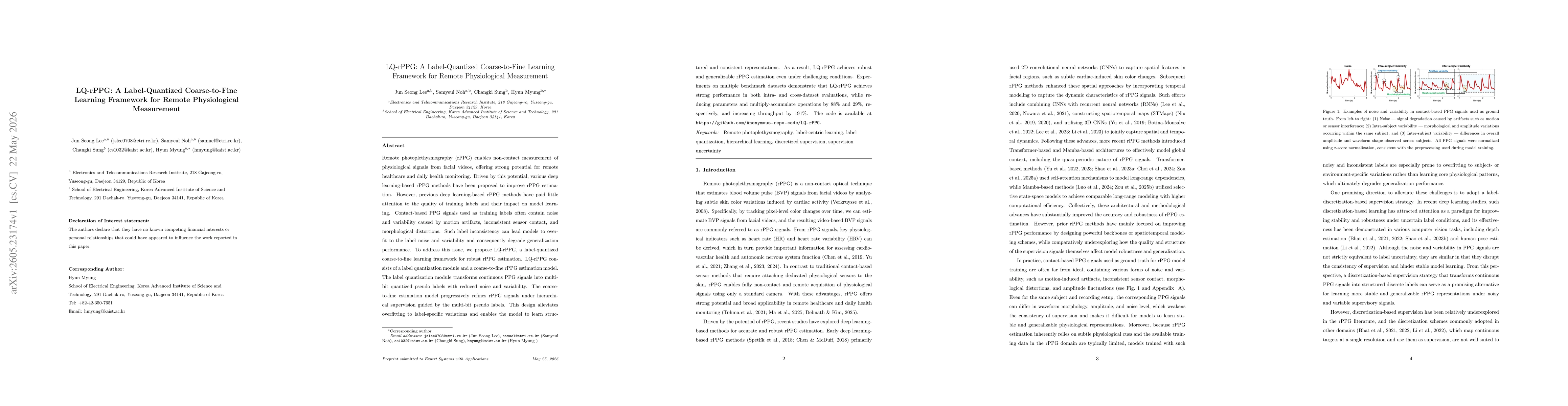
Remote photoplethysmography (rPPG) enables non-contact measurement of physiological signals from facial videos, offering strong potential for remote healthcare and daily health monitoring. Driven by t...
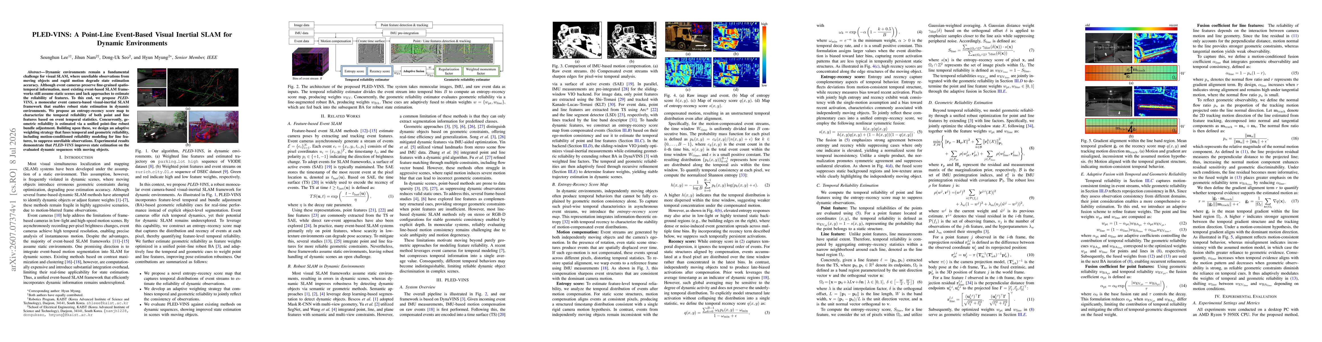
Dynamic environments remain a fundamental challenge for visual SLAM, where unreliable observations from moving objects and rapid motion degrade state estimation accuracy. Although event cameras preser...