Academic Profile
Statistics
Similar Authors
Papers on arXiv
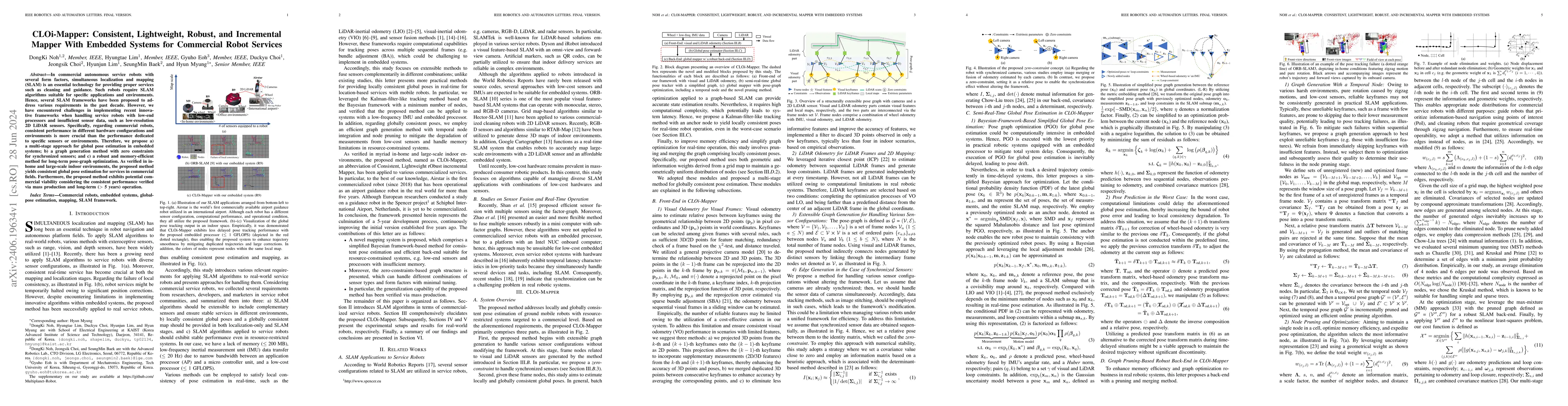
In commercial autonomous service robots with several form factors, simultaneous localization and mapping (SLAM) is an essential technology for providing proper services such as cleaning and guidance...
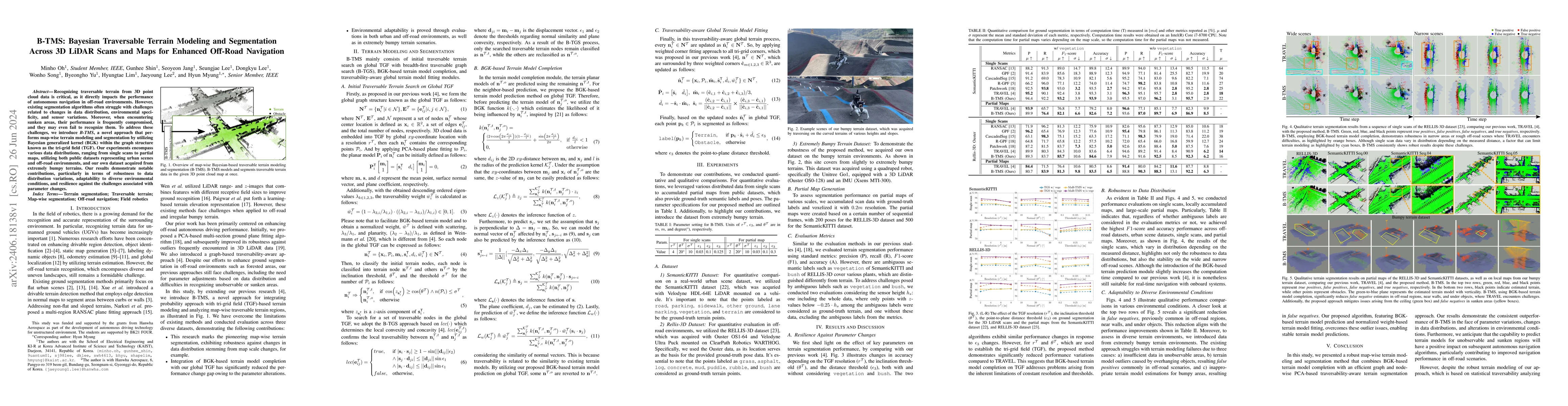
Recognizing traversable terrain from 3D point cloud data is critical, as it directly impacts the performance of autonomous navigation in off-road environments. However, existing segmentation algorit...
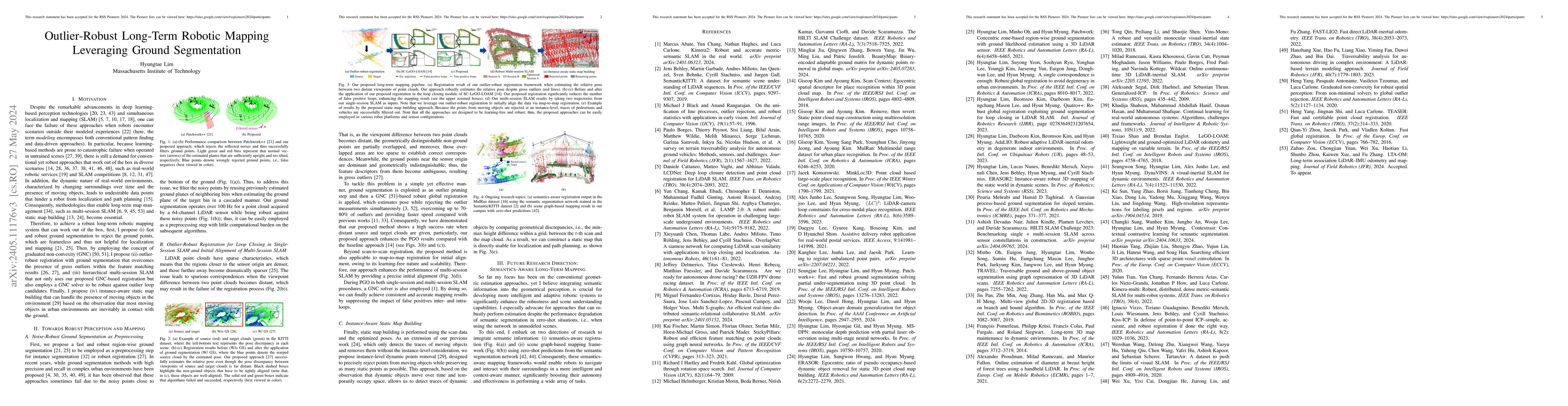
Despite the remarkable advancements in deep learning-based perception technologies and simultaneous localization and mapping (SLAM), one can face the failure of these approaches when robots encounte...
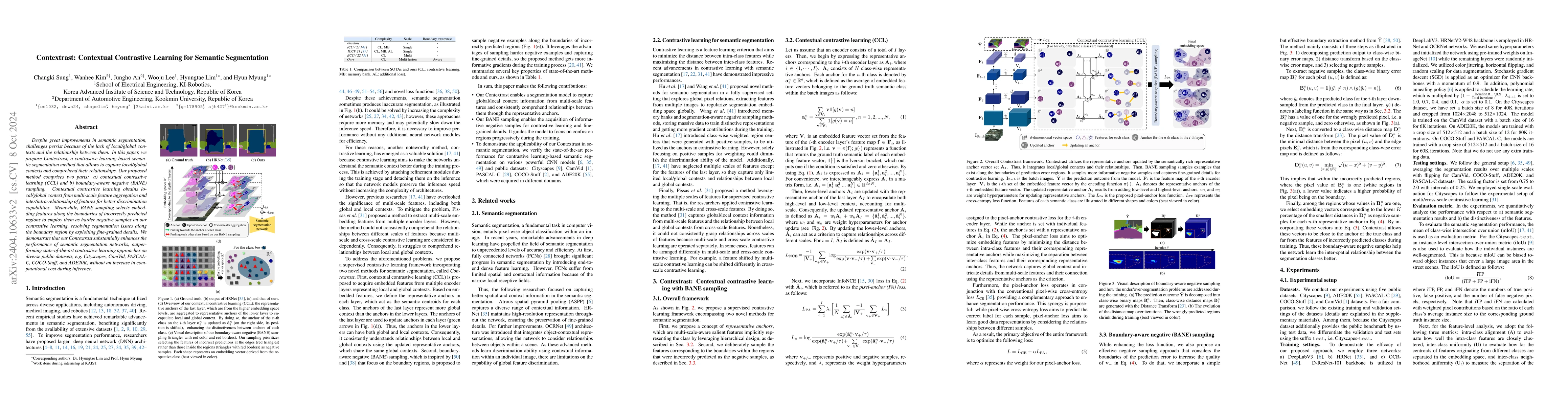
Despite great improvements in semantic segmentation, challenges persist because of the lack of local/global contexts and the relationship between them. In this paper, we propose Contextrast, a contr...
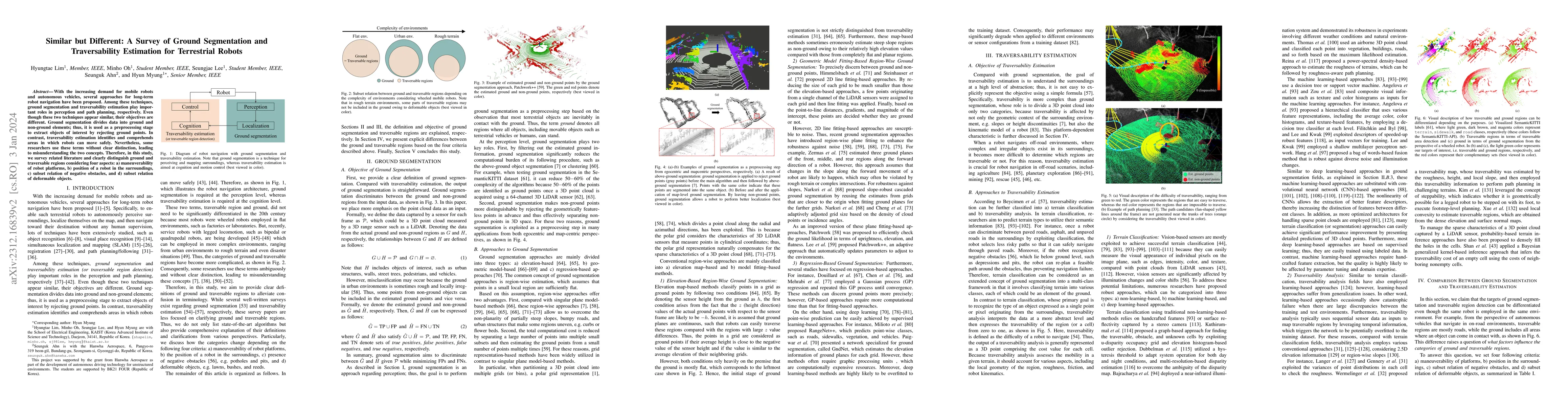
With the increasing demand for mobile robots and autonomous vehicles, several approaches for long-term robot navigation have been proposed. Among these techniques, ground segmentation and traversabi...

Single-domain generalization (S-DG) aims to generalize a model to unseen environments with a single-source domain. However, most S-DG approaches have been conducted in the field of classification. W...
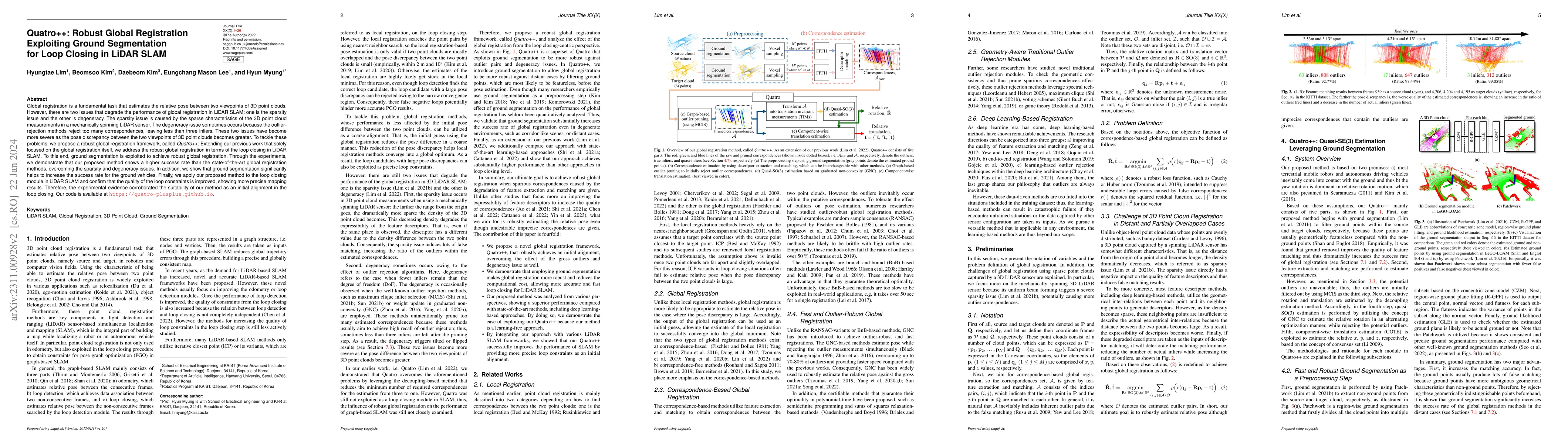
Global registration is a fundamental task that estimates the relative pose between two viewpoints of 3D point clouds. However, there are two issues that degrade the performance of global registratio...
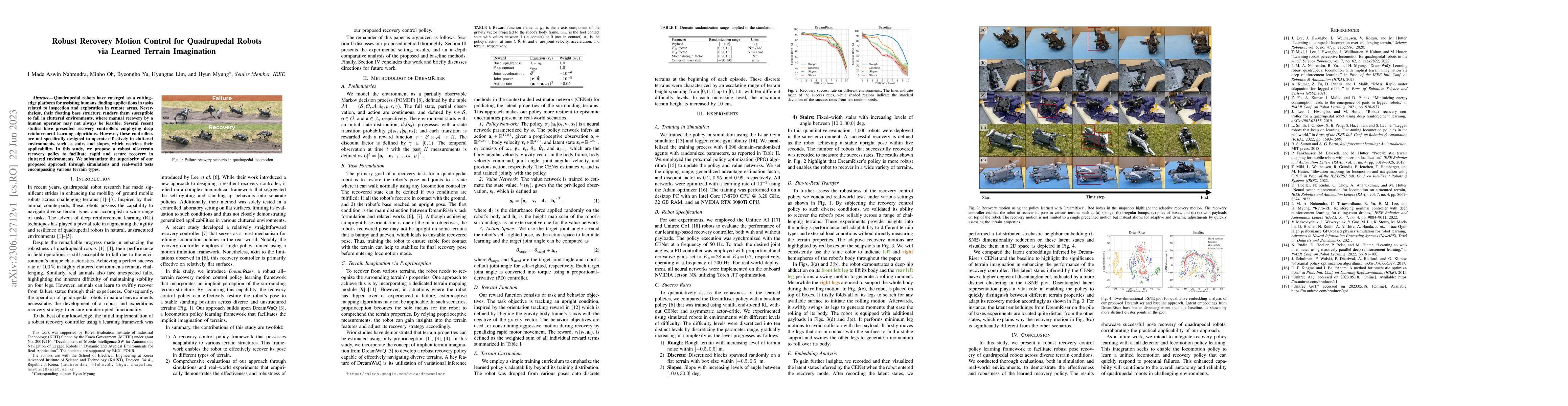
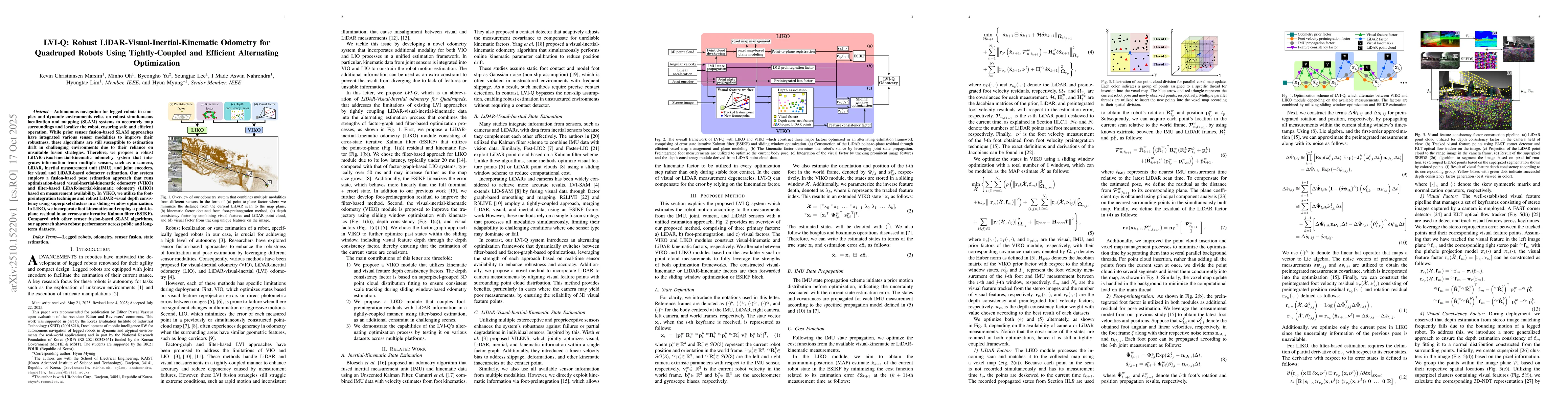
Quadrupedal robots have emerged as a cutting-edge platform for assisting humans, finding applications in tasks related to inspection and exploration in remote areas. Nevertheless, their floating bas...
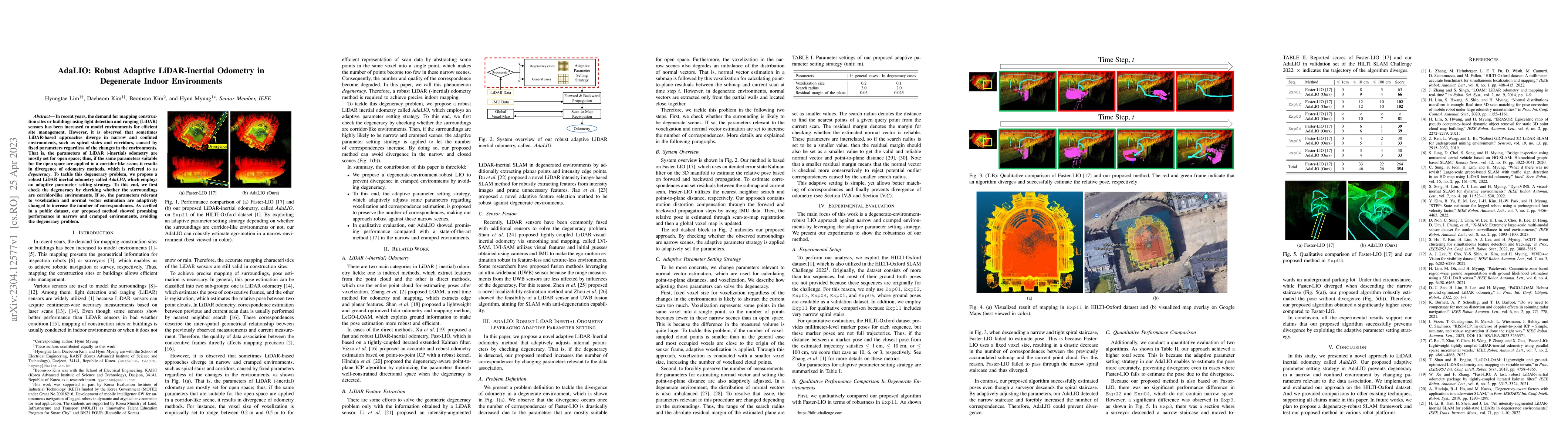
In recent years, the demand for mapping construction sites or buildings using light detection and ranging~(LiDAR) sensors has been increased to model environments for efficient site management. Howe...
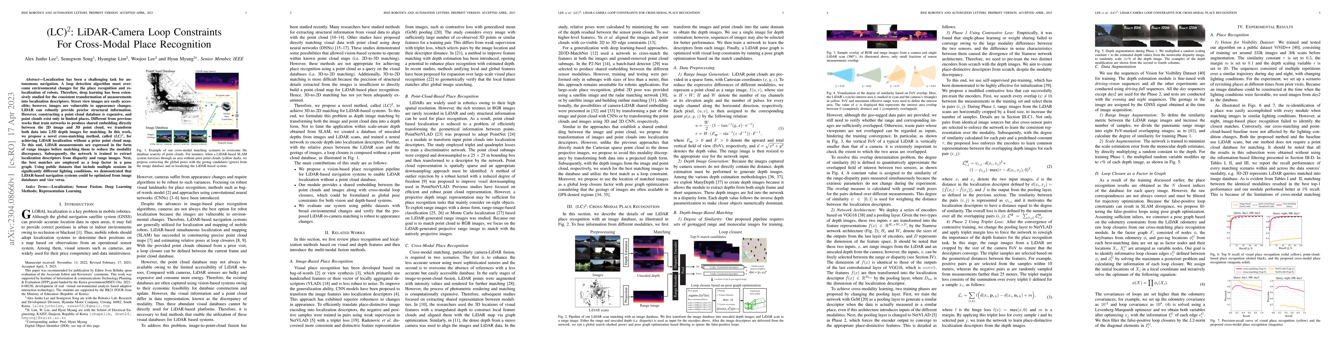
Localization has been a challenging task for autonomous navigation. A loop detection algorithm must overcome environmental changes for the place recognition and re-localization of robots. Therefore,...
Radar sensors are emerging as solutions for perceiving surroundings and estimating ego-motion in extreme weather conditions. Unfortunately, radar measurements are noisy and suffer from mutual interf...
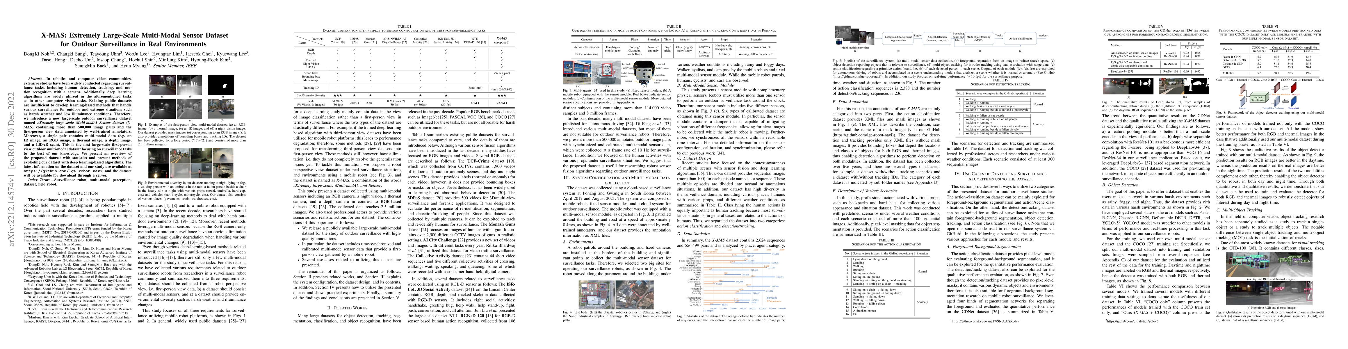
In robotics and computer vision communities, extensive studies have been widely conducted regarding surveillance tasks, including human detection, tracking, and motion recognition with a camera. Add...
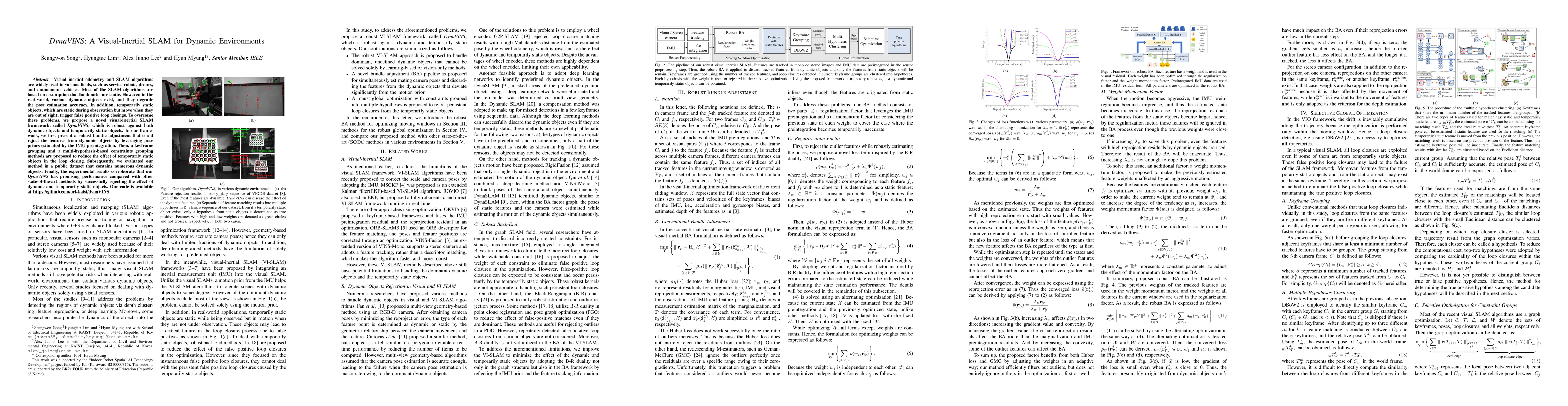
Visual inertial odometry and SLAM algorithms are widely used in various fields, such as service robots, drones, and autonomous vehicles. Most of the SLAM algorithms are based on assumption that land...
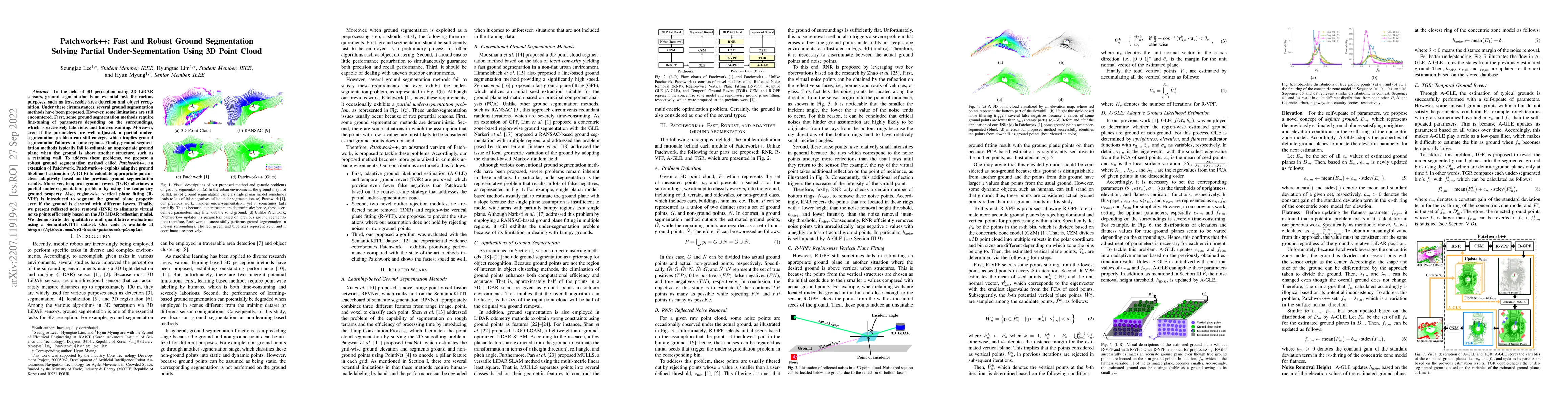
In the field of 3D perception using 3D LiDAR sensors, ground segmentation is an essential task for various purposes, such as traversable area detection and object recognition. Under these circumstan...
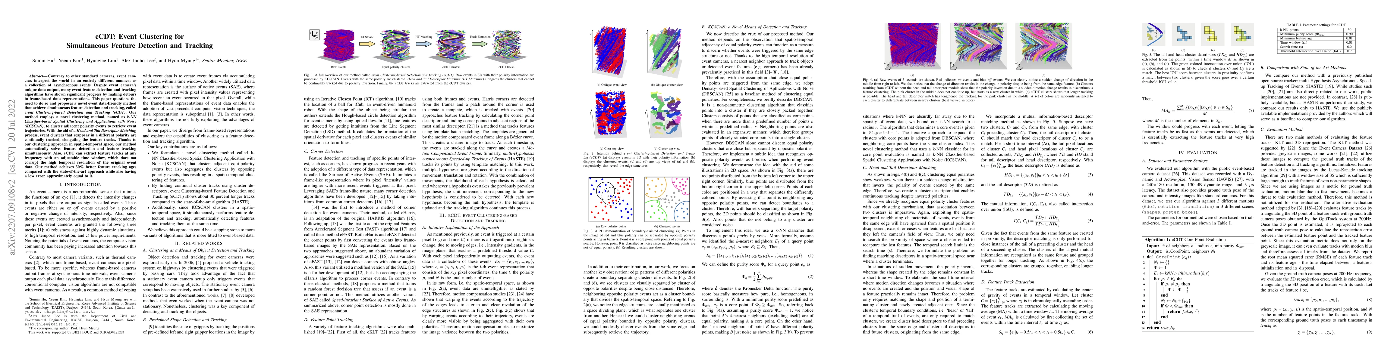
Contrary to other standard cameras, event cameras interpret the world in an entirely different manner; as a collection of asynchronous events. Despite event camera's unique data output, many event f...
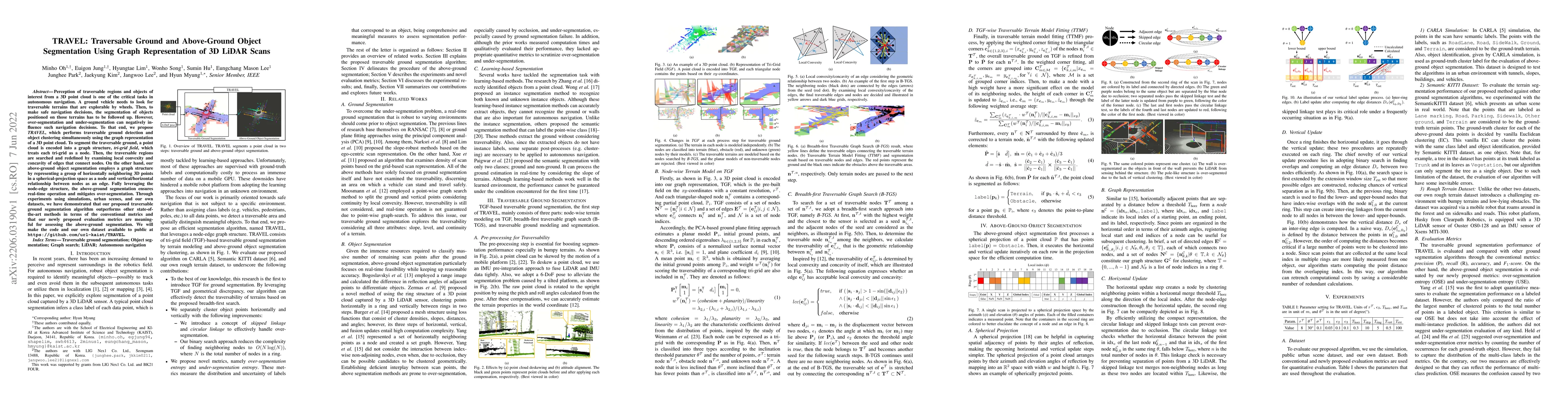
Perception of traversable regions and objects of interest from a 3D point cloud is one of the critical tasks in autonomous navigation. A ground vehicle needs to look for traversable terrains that ar...
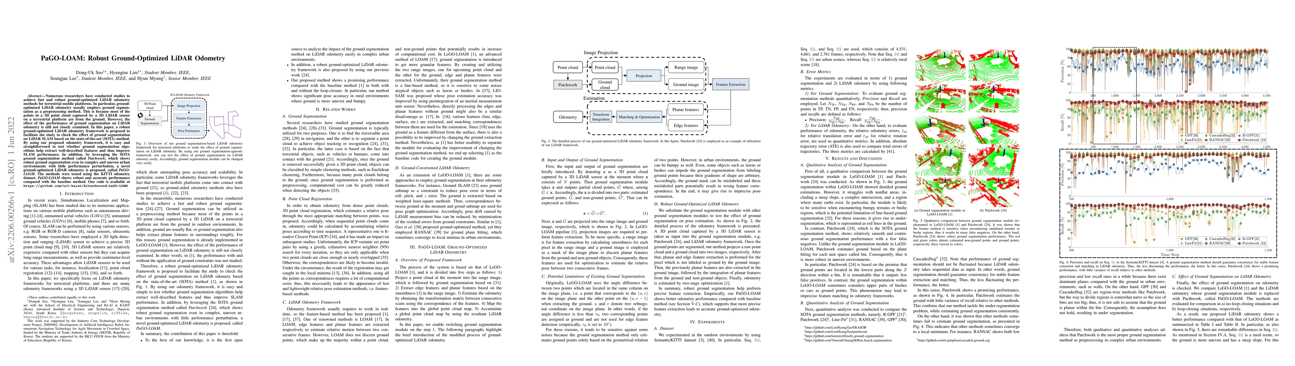
Numerous researchers have conducted studies to achieve fast and robust ground-optimized LiDAR odometry methods for terrestrial mobile platforms. In particular, ground-optimized LiDAR odometry usuall...
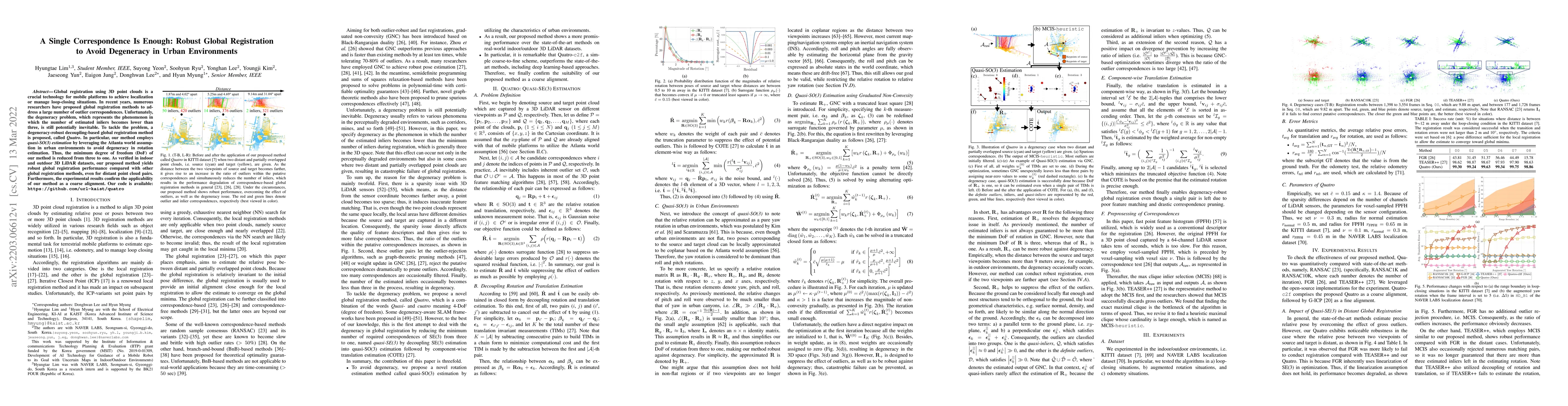
Global registration using 3D point clouds is a crucial technology for mobile platforms to achieve localization or manage loop-closing situations. In recent years, numerous researchers have proposed ...
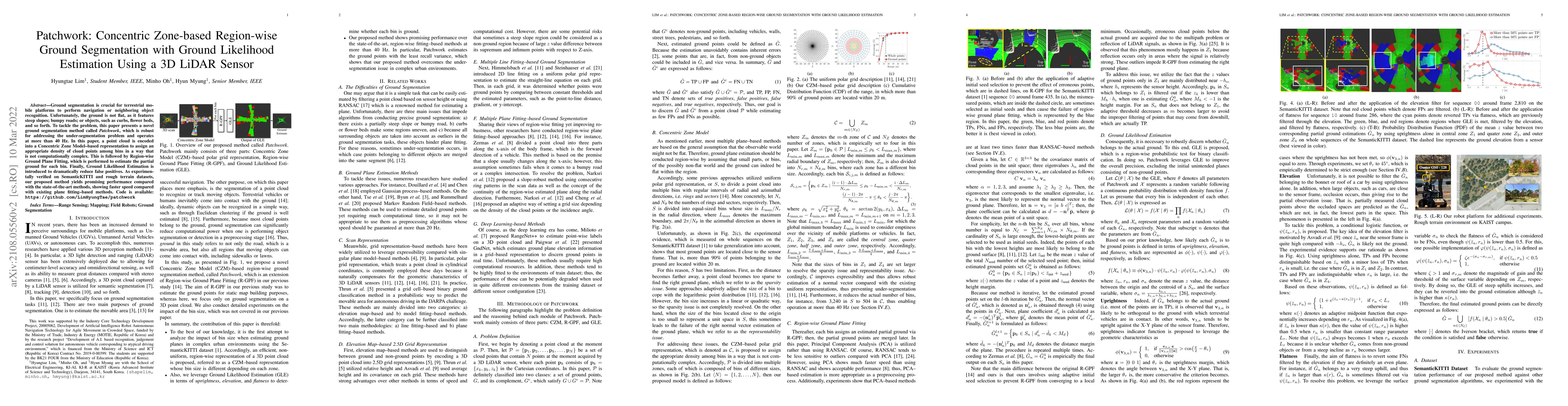
Ground segmentation is crucial for terrestrial mobile platforms to perform navigation or neighboring object recognition. Unfortunately, the ground is not flat, as it features steep slopes; bumpy roa...
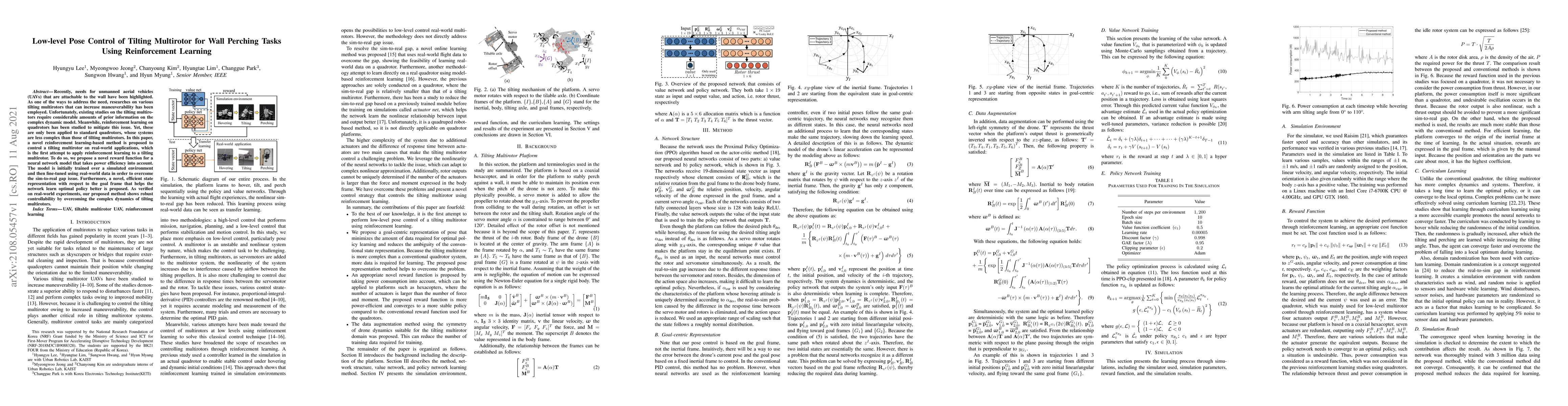
Recently, needs for unmanned aerial vehicles (UAVs) that are attachable to the wall have been highlighted. As one of the ways to address the need, researches on various tilting multirotors that can ...
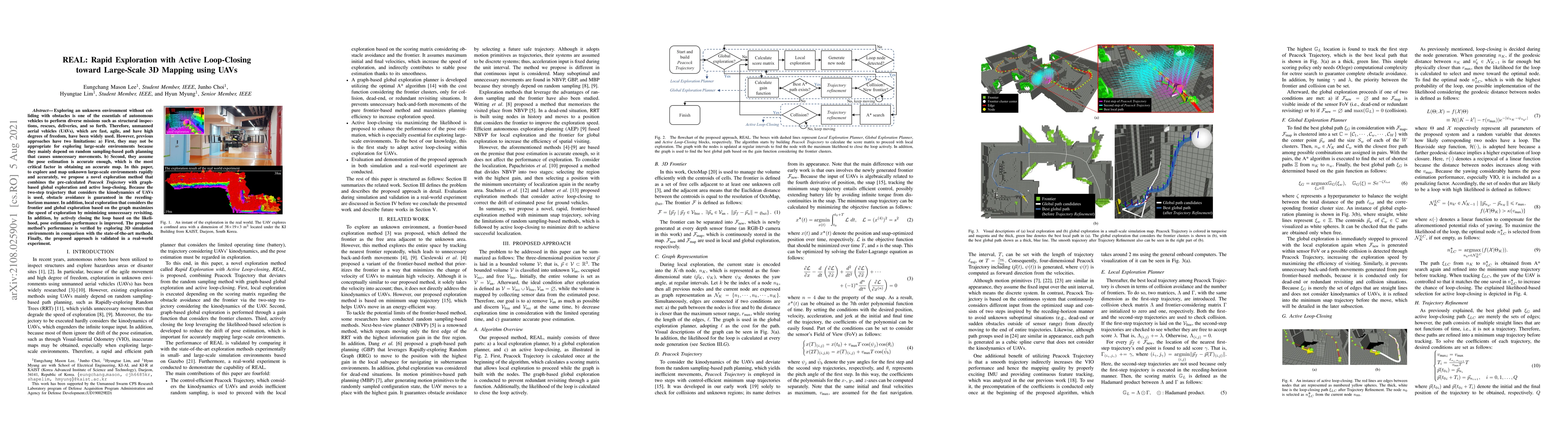
Exploring an unknown environment without colliding with obstacles is one of the essentials of autonomous vehicles to perform diverse missions such as structural inspections, rescues, deliveries, and...
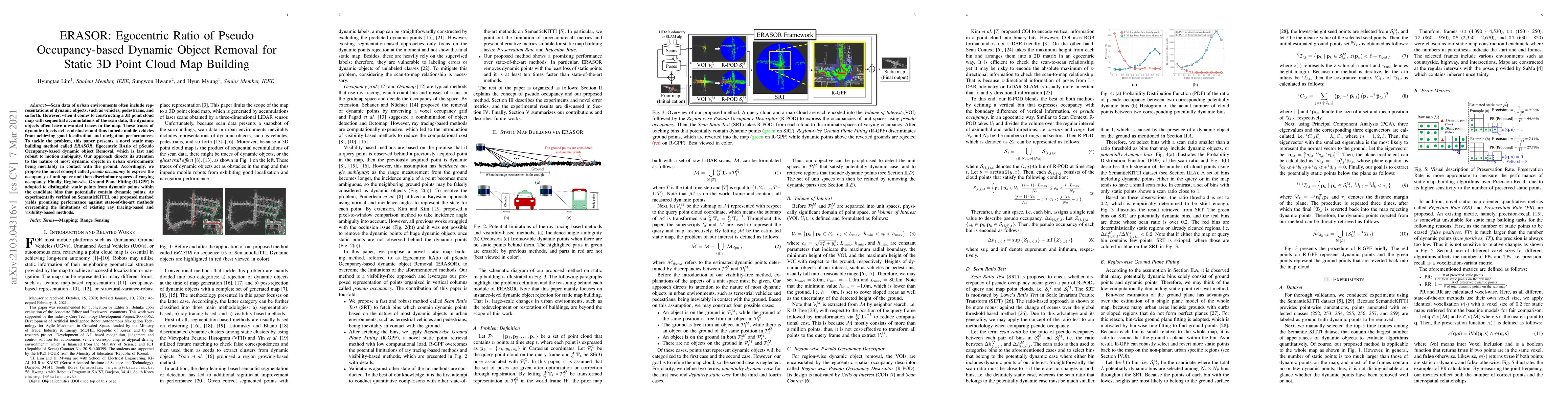
Scan data of urban environments often include representations of dynamic objects, such as vehicles, pedestrians, and so forth. However, when it comes to constructing a 3D point cloud map with sequen...
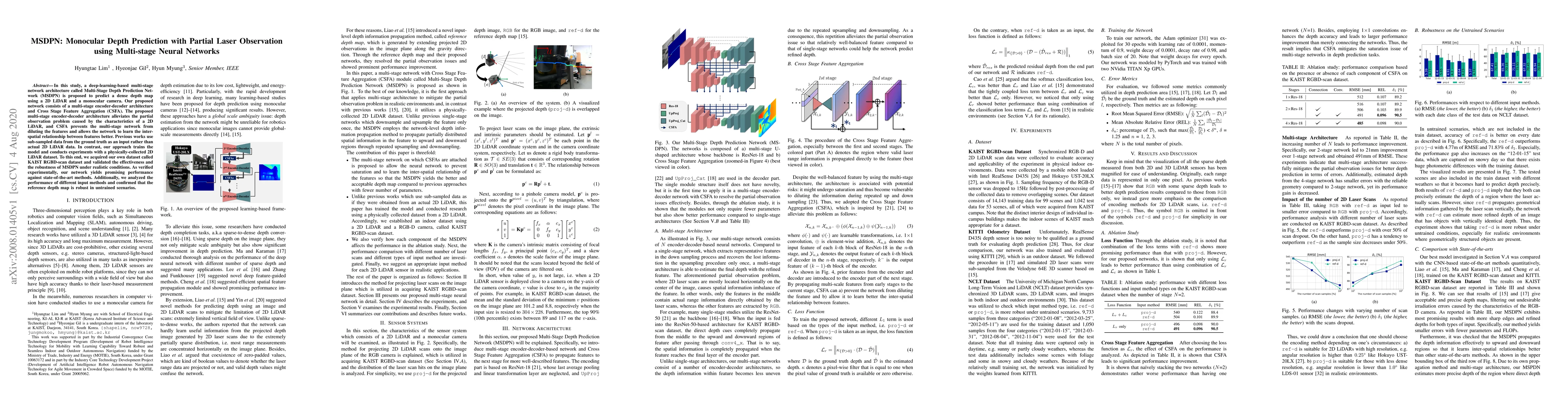
In this study, a deep-learning-based multi-stage network architecture called Multi-Stage Depth Prediction Network (MSDPN) is proposed to predict a dense depth map using a 2D LiDAR and a monocular ca...
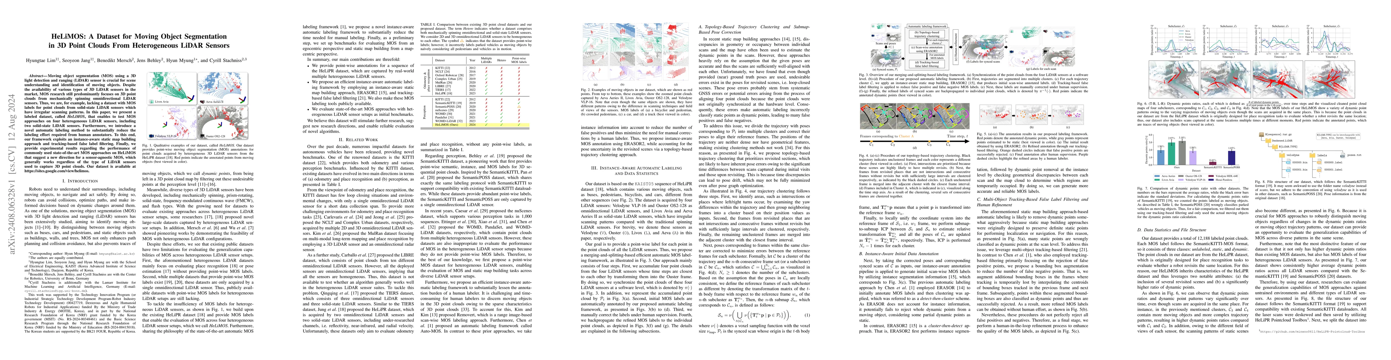
Moving object segmentation (MOS) using a 3D light detection and ranging (LiDAR) sensor is crucial for scene understanding and identification of moving objects. Despite the availability of various type...
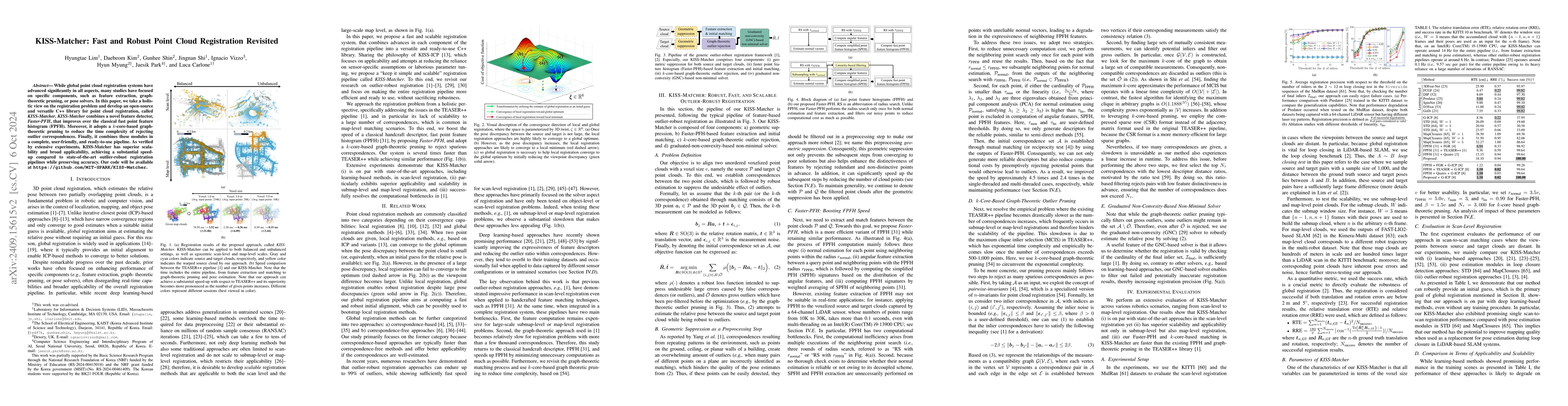
While global point cloud registration systems have advanced significantly in all aspects, many studies have focused on specific components, such as feature extraction, graph-theoretic pruning, or pose...
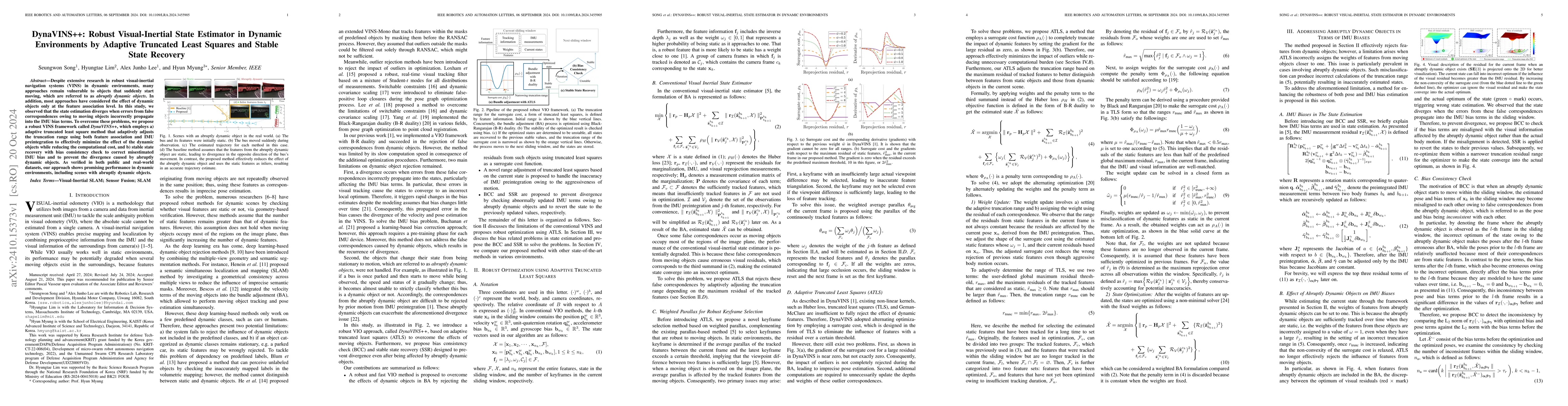
Despite extensive research in robust visual-inertial navigation systems~(VINS) in dynamic environments, many approaches remain vulnerable to objects that suddenly start moving, which are referred to a...
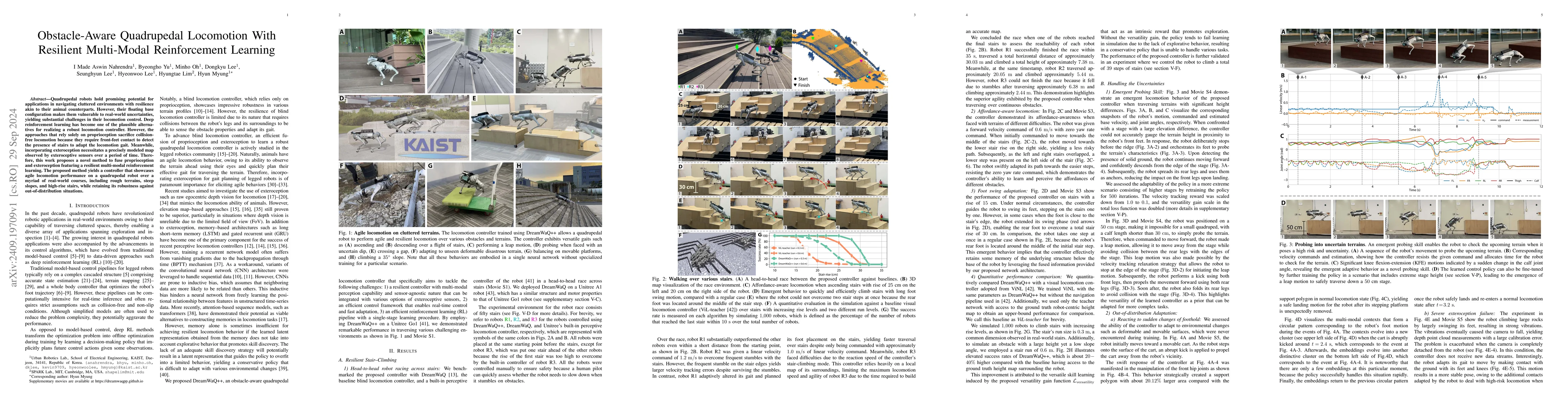
Quadrupedal robots hold promising potential for applications in navigating cluttered environments with resilience akin to their animal counterparts. However, their floating base configuration makes th...
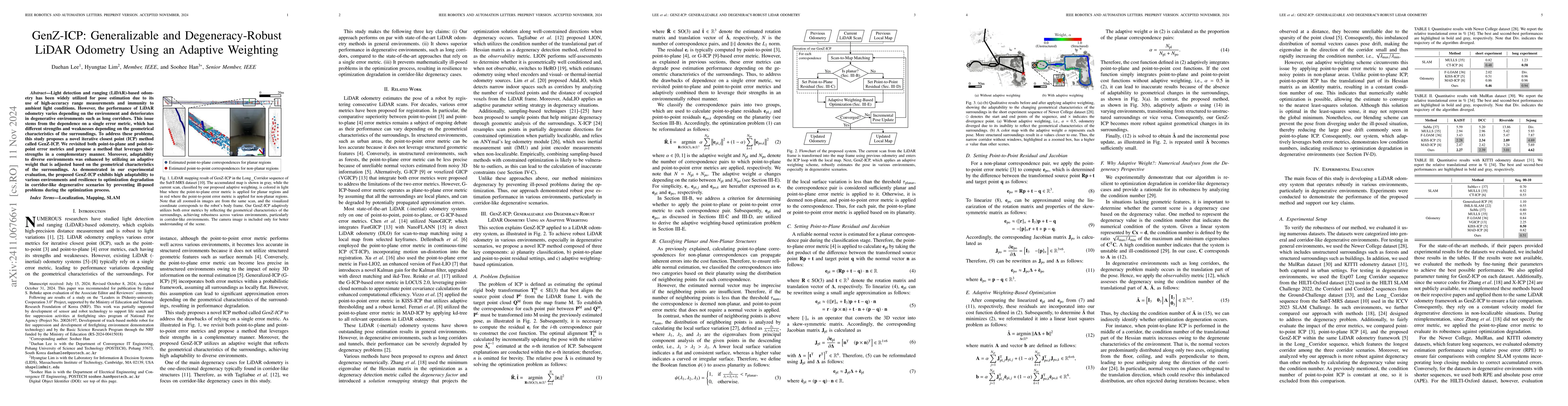
Light detection and ranging (LiDAR)-based odometry has been widely utilized for pose estimation due to its use of high-accuracy range measurements and immunity to ambient light conditions. However, th...
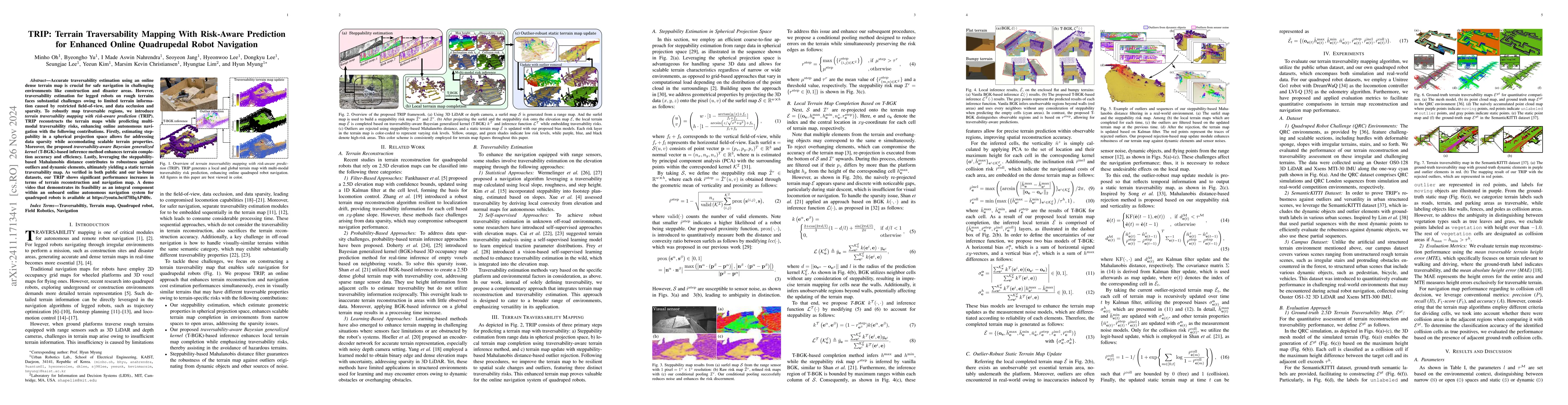
Accurate traversability estimation using an online dense terrain map is crucial for safe navigation in challenging environments like construction and disaster areas. However, traversability estimation...
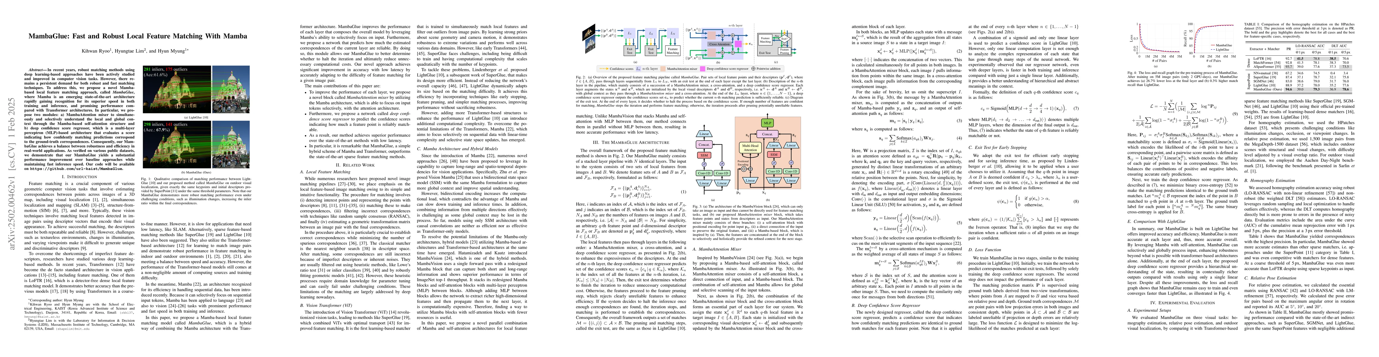
In recent years, robust matching methods using deep learning-based approaches have been actively studied and improved in computer vision tasks. However, there remains a persistent demand for both robu...
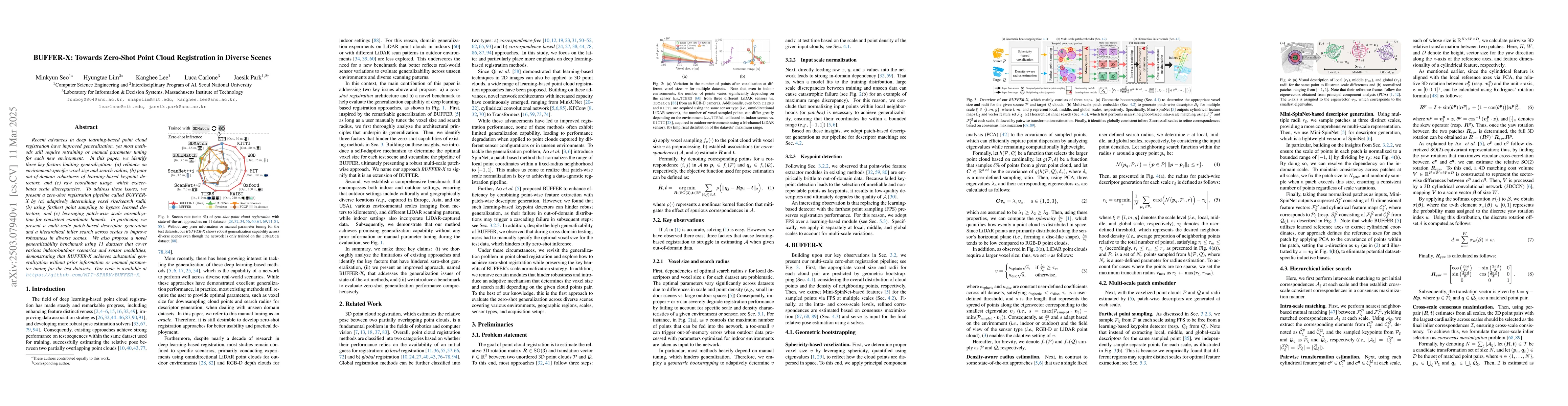
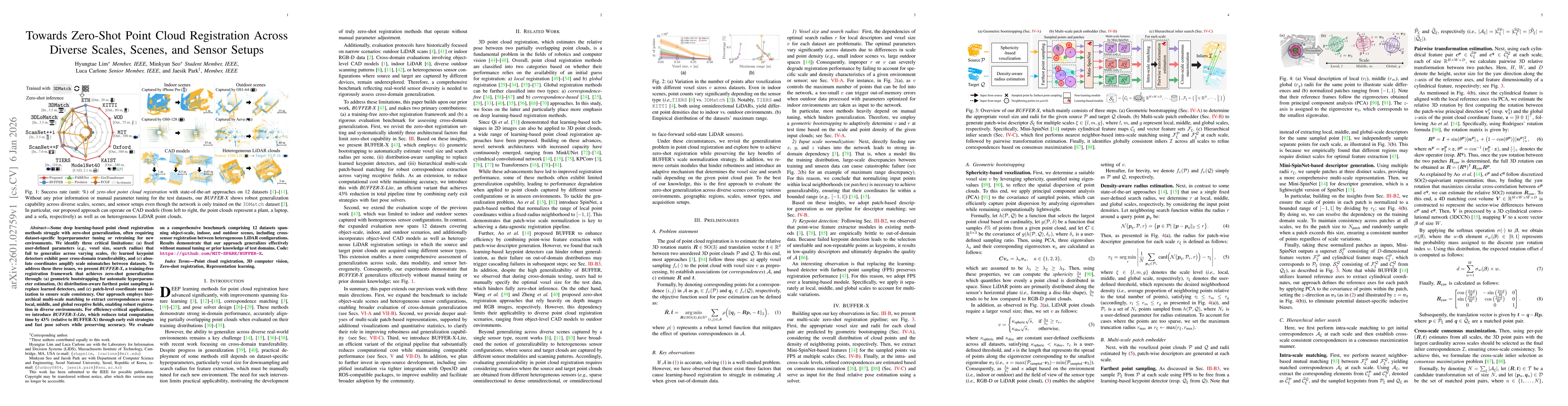
Recent advances in deep learning-based point cloud registration have improved generalization, yet most methods still require retraining or manual parameter tuning for each new environment. In this pap...
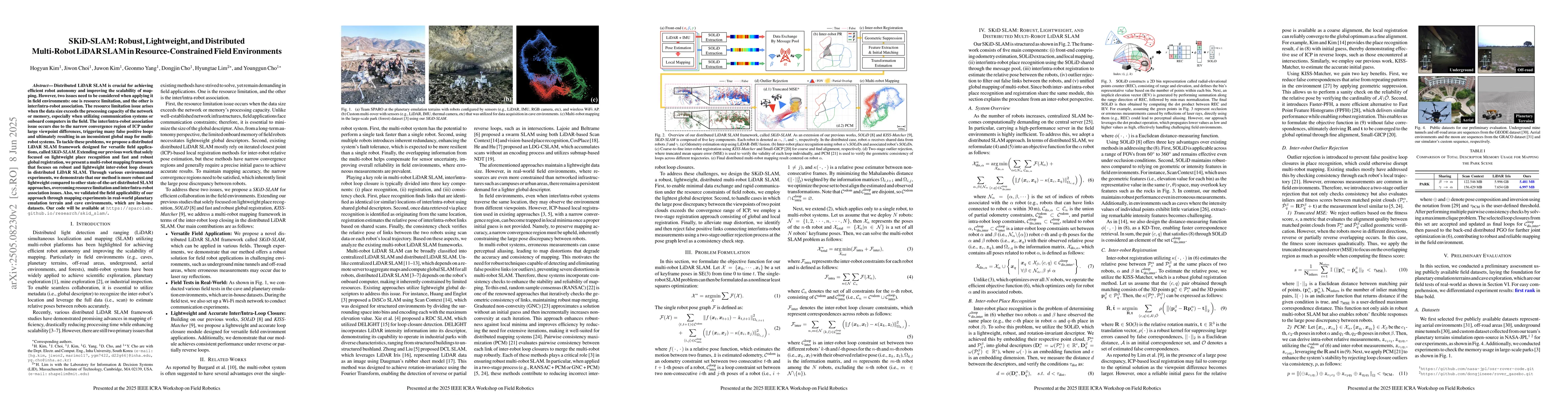
Distributed LiDAR SLAM is crucial for achieving efficient robot autonomy and improving the scalability of mapping. However, two issues need to be considered when applying it in field environments: one...
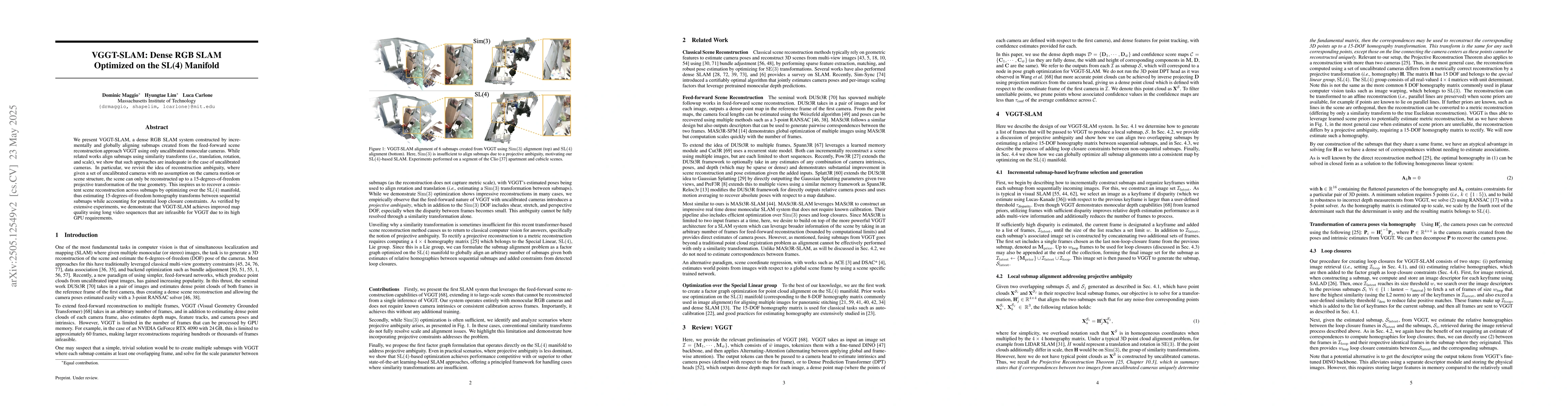
We present VGGT-SLAM, a dense RGB SLAM system constructed by incrementally and globally aligning submaps created from the feed-forward scene reconstruction approach VGGT using only uncalibrated monocu...
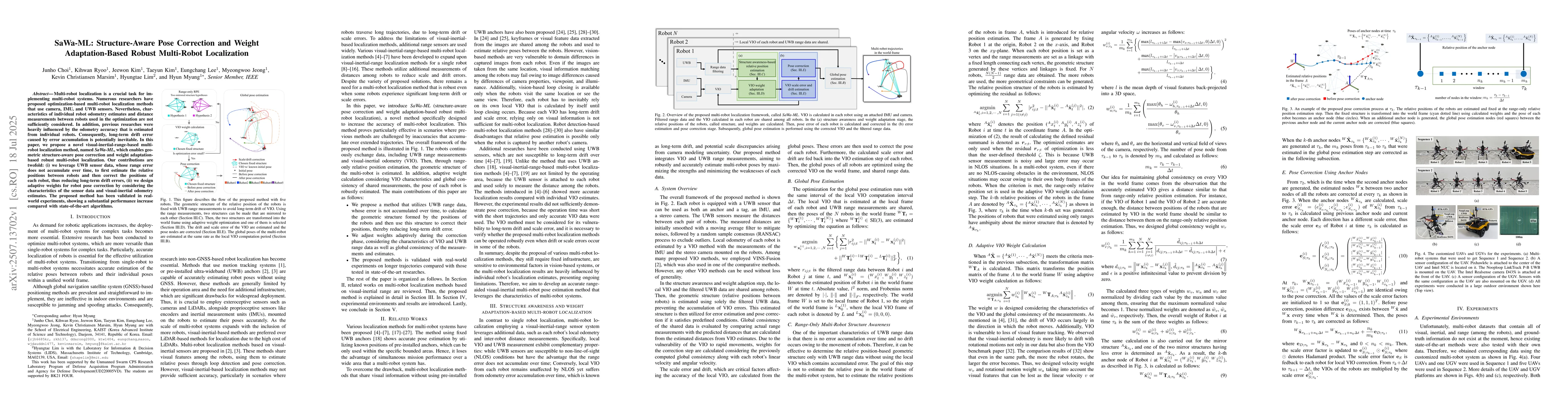
Multi-robot localization is a crucial task for implementing multi-robot systems. Numerous researchers have proposed optimization-based multi-robot localization methods that use camera, IMU, and UWB se...
Autonomous navigation for legged robots in complex and dynamic environments relies on robust simultaneous localization and mapping (SLAM) systems to accurately map surroundings and localize the robot,...
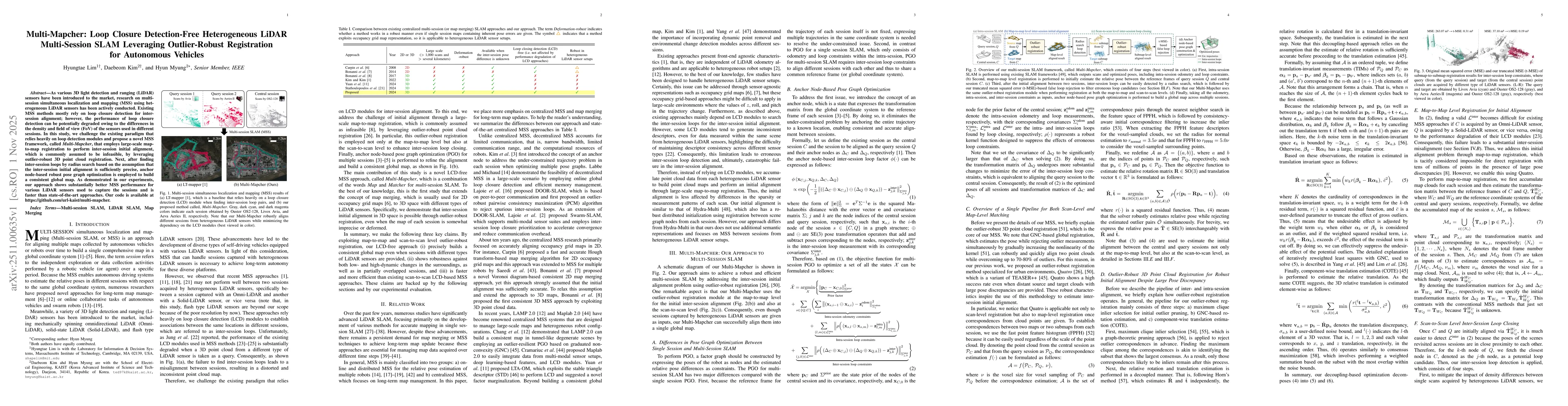
As various 3D light detection and ranging (LiDAR) sensors have been introduced to the market, research on multi-session simultaneous localization and mapping (MSS) using heterogeneous LiDAR sensors ha...
Some deep learning-based point cloud registration methods struggle with zero-shot generalization, often requiring dataset-specific hyperparameter tuning or retraining for new environments. We identify...
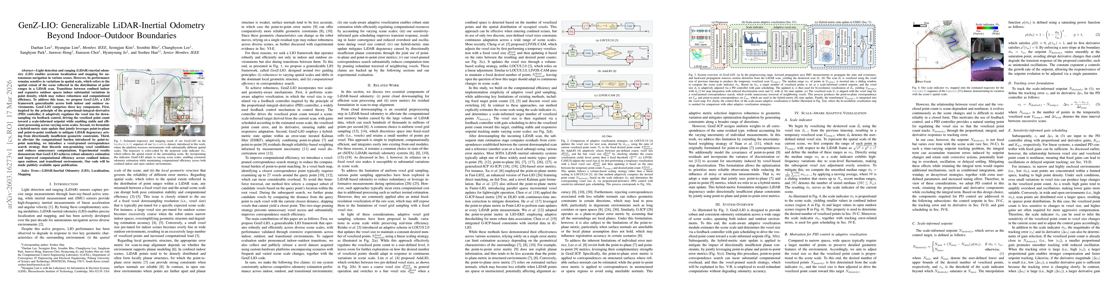
Light detection and ranging (LiDAR)-inertial odometry (LIO) enables accurate localization and mapping for autonomous navigation in various scenes. However, its performance remains sensitive to variati...
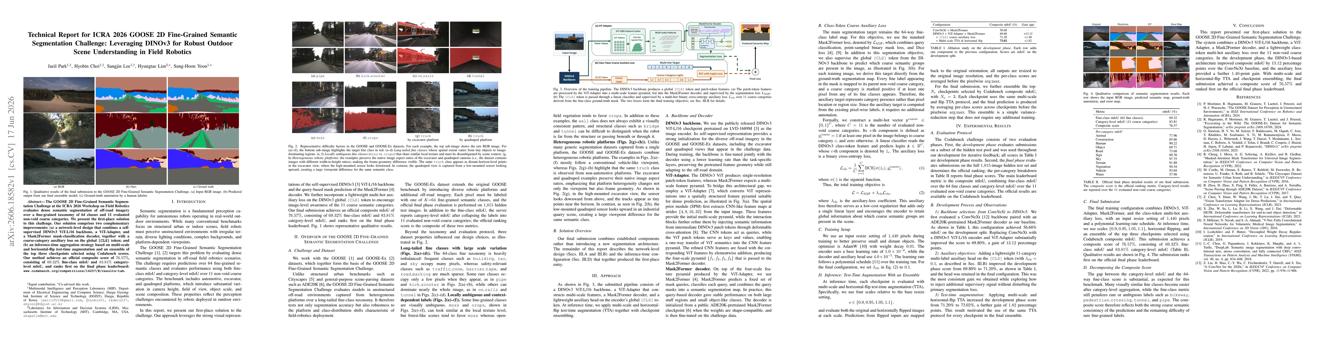
The GOOSE 2D Fine-Grained Semantic Segmentation Challenge at the ICRA 2026 Workshop on Field Robotics evaluates dense semantic segmentation of off-road imagery over a fine-grained taxonomy of 64 class...
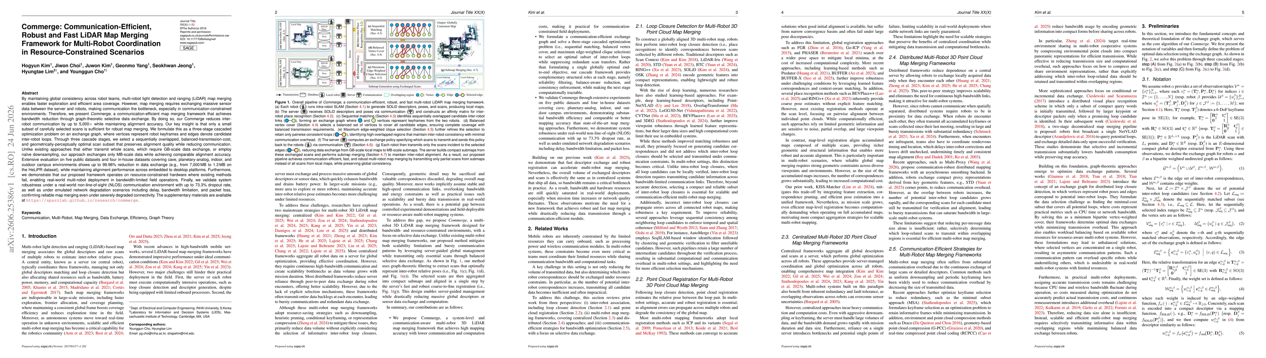
By maintaining global consistency across robot teams, multi-robot LiDAR map merging enables faster exploration and efficient area coverage. However, map merging requires exchanging massive sensor data...
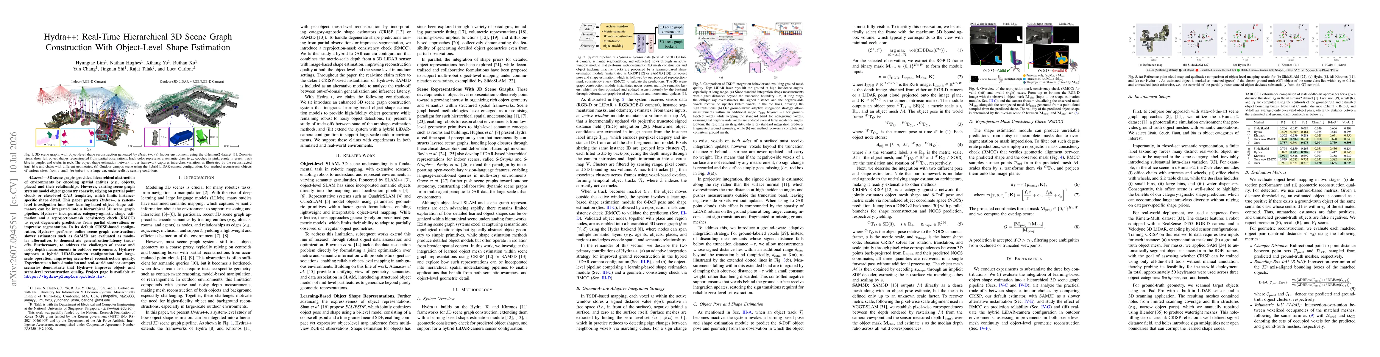
3D scene graphs provide a hierarchical abstraction of environments by encoding spatial entities, such as objects and places, and their relationships. However, existing scene graph systems model object...
Generating realistic 3D indoor scenes is an area of growing interest in computer vision and robotics. Existing methods, often motivated by applications such as interior design, generally focus on obje...