Imed Riadh Farah

5 papers on arXiv

Academic Profile

Name: I. Farah
Total Papers: 234

Statistics

arXiv Papers 5
Total Publications 234

Papers on arXiv

Thumbnail for Sustainable Palm Tree Farming: Leveraging IoT and Multi-Modal Data for
  Early Detection and Mapping of Red Palm Weevil

Sustainable Palm Tree Farming: Leveraging IoT and Multi-Modal Data for Early Detection and Mapping of Red Palm Weevil

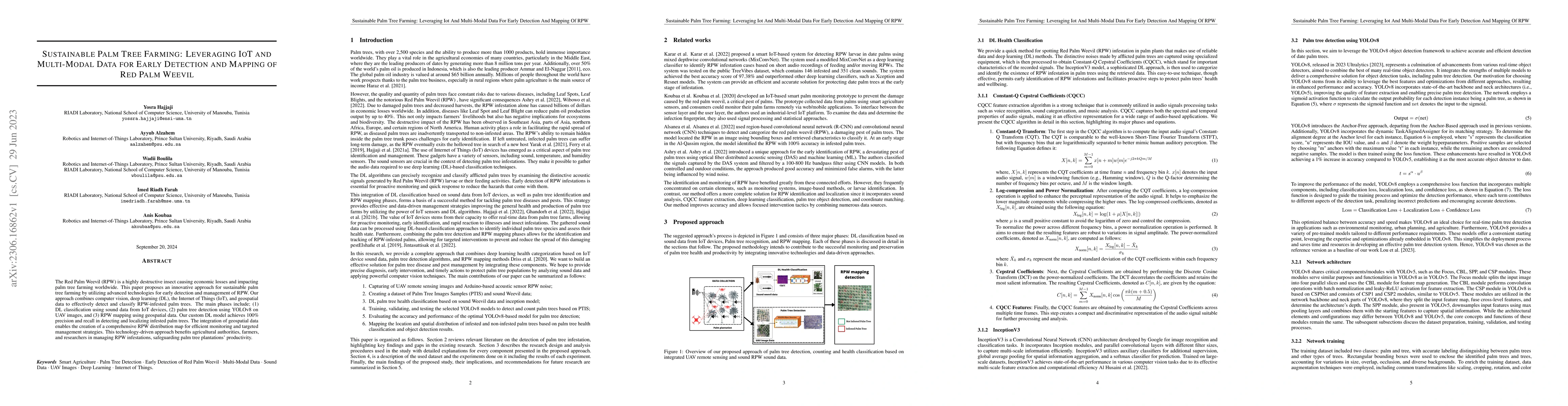
The Red Palm Weevil (RPW) is a highly destructive insect causing economic losses and impacting palm tree farming worldwide. This paper proposes an innovative approach for sustainable palm tree farmi...

Thumbnail for Modeling Complex Object Changes in Satellite Image Time-Series: Approach
  based on CSP and Spatiotemporal Graph

Modeling Complex Object Changes in Satellite Image Time-Series: Approach based on CSP and Spatiotemporal Graph

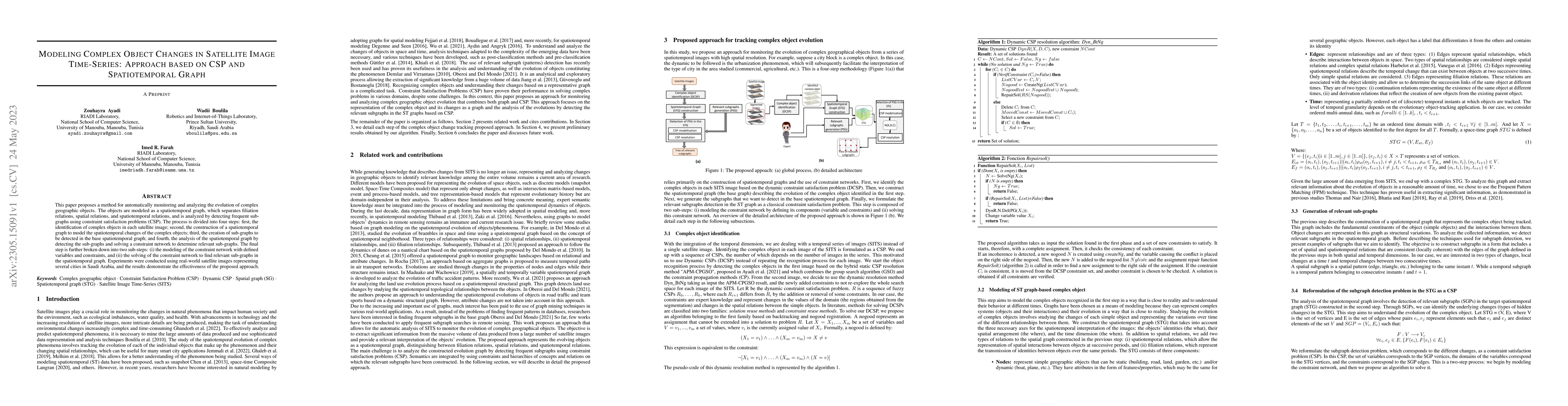
This paper proposes a method for automatically monitoring and analyzing the evolution of complex geographic objects. The objects are modeled as a spatiotemporal graph, which separates filiation rela...

Thumbnail for Leveraging Artificial Intelligence Techniques for Smart Palm Tree
  Detection: A Decade Systematic Review

Leveraging Artificial Intelligence Techniques for Smart Palm Tree Detection: A Decade Systematic Review

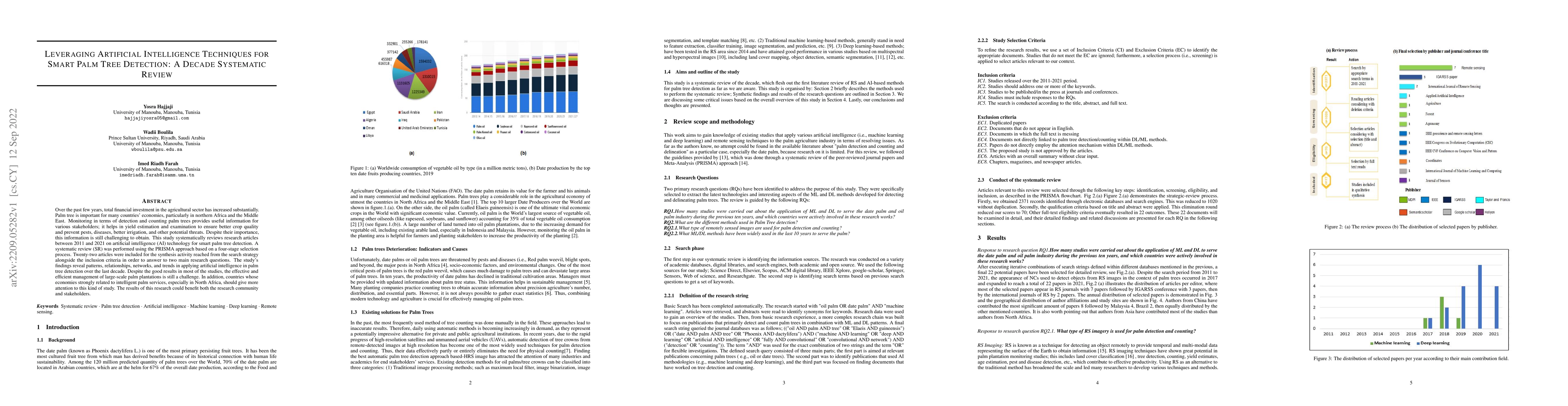
Over the past few years, total financial investment in the agricultural sector has increased substantially. Palm tree is important for many countries' economies, particularly in northern Africa and ...

Thumbnail for A Hybrid APM-CPGSO Approach for Constraint Satisfaction Problem Solving:
  Application to Remote Sensing

A Hybrid APM-CPGSO Approach for Constraint Satisfaction Problem Solving: Application to Remote Sensing

Constraint satisfaction problem (CSP) has been actively used for modeling and solving a wide range of complex real-world problems. However, it has been proven that developing efficient methods for s...

Thumbnail for An improved tile-based scalable distributed management model of massive
  high-resolution satellite images

An improved tile-based scalable distributed management model of massive high-resolution satellite images

The amount of remote sensing (RS) data has increased at an unexpected scale, due to the rapid progress of earth-observation and the growth of satellite RS and sensor technologies. Traditional relati...

This website uses cookies to ensure you get the best experience. Learn more