Modeling Complex Object Changes in Satellite Image Time-Series: Approach based on CSP and Spatiotemporal Graph
Publication
Metrics
AI Quick Summary
This paper introduces a method for monitoring and analyzing the evolution of complex geographic objects using a spatiotemporal graph and constraint satisfaction problems (CSP). The approach involves identifying objects, constructing spatiotemporal graphs, detecting frequent sub-graphs, and solving a constraint network to determine relevant sub-graphs, validated through experiments on satellite images from Saudi Arabia.
Paper Preview
Abstract
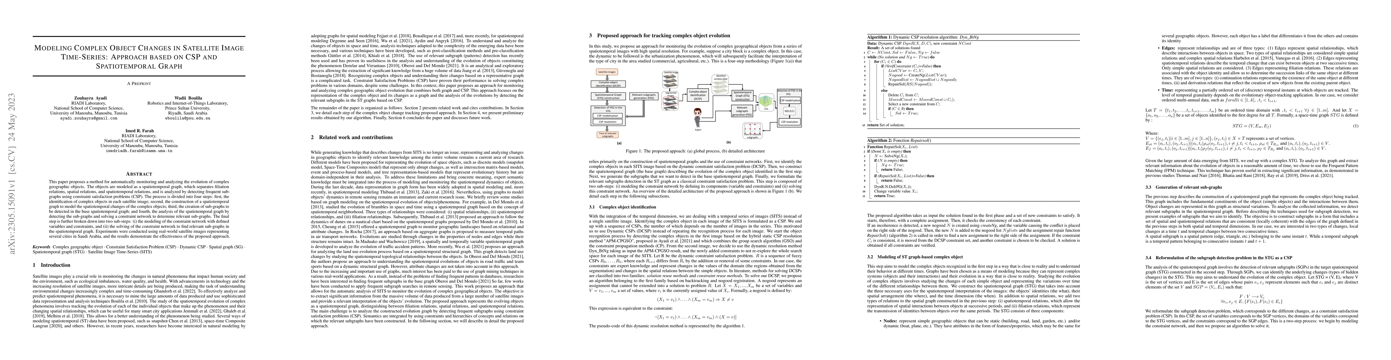
This paper proposes a method for automatically monitoring and analyzing the evolution of complex geographic objects. The objects are modeled as a spatiotemporal graph, which separates filiation relations, spatial relations, and spatiotemporal relations, and is analyzed by detecting frequent sub-graphs using constraint satisfaction problems (CSP). The process is divided into four steps: first, the identification of complex objects in each satellite image; second, the construction of a spatiotemporal graph to model the spatiotemporal changes of the complex objects; third, the creation of sub-graphs to be detected in the base spatiotemporal graph; and fourth, the analysis of the spatiotemporal graph by detecting the sub-graphs and solving a constraint network to determine relevant sub-graphs. The final step is further broken down into two sub-steps: (i) the modeling of the constraint network with defined variables and constraints, and (ii) the solving of the constraint network to find relevant sub-graphs in the spatiotemporal graph. Experiments were conducted using real-world satellite images representing several cities in Saudi Arabia, and the results demonstrate the effectiveness of the proposed approach.
AI Key Findings
Get AI-generated insights about this paper's methodology, results, significance, and more — seven facets brought into focus.
Impact
Paper Details
Authors
PDF Preview
Key Terms
Citation Network
Current paper (gray), citations (green), references (blue)
Display is limited for performance on very large graphs.
Discussion 0