Academic Profile
Statistics
Similar Authors
Papers on arXiv
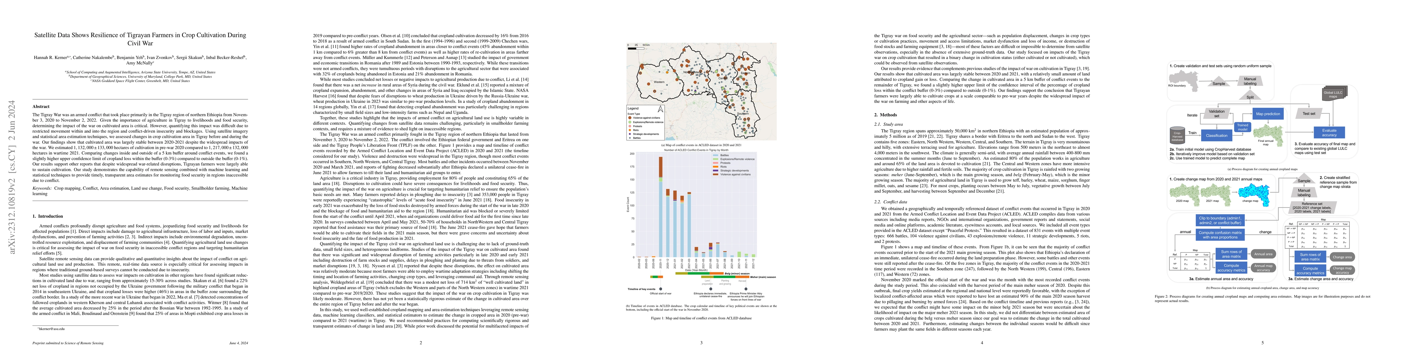
The Tigray War was an armed conflict that took place primarily in the Tigray region of northern Ethiopia from November 3, 2020 to November 2, 2022. Given the importance of agriculture in Tigray to l...
Satellite Earth observations (EO) can provide affordable and timely information for assessing crop conditions and food production. Such monitoring systems are essential in Africa, where there is hig...
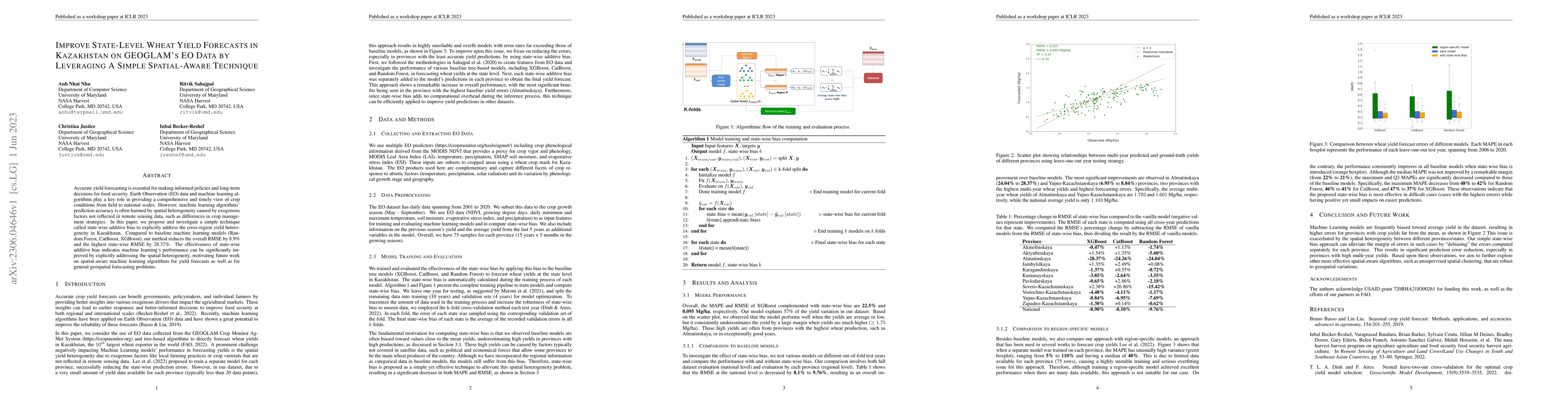
Accurate yield forecasting is essential for making informed policies and long-term decisions for food security. Earth Observation (EO) data and machine learning algorithms play a key role in providi...
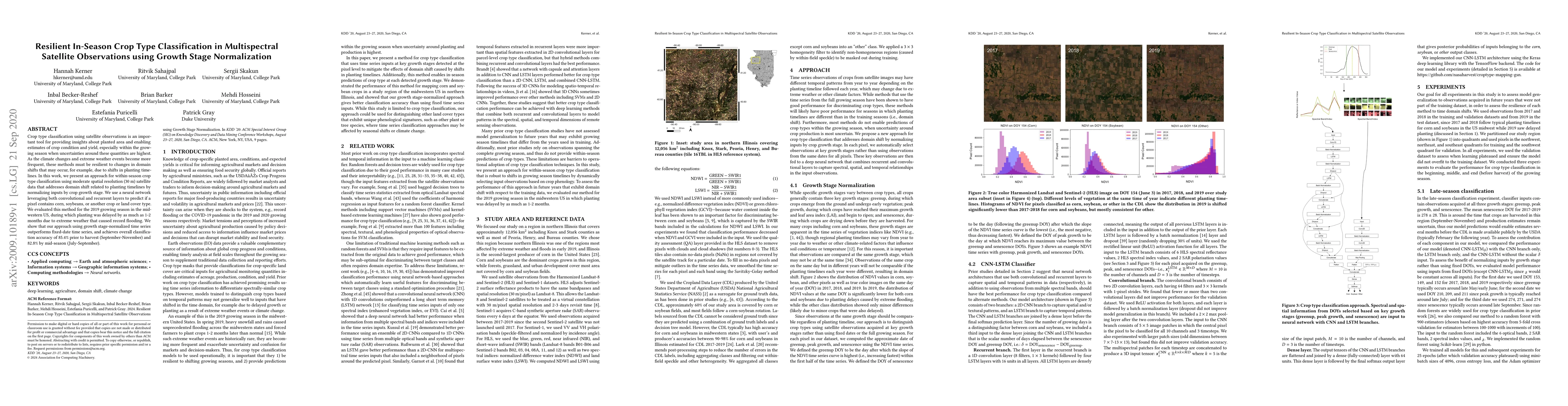
Crop type classification using satellite observations is an important tool for providing insights about planted area and enabling estimates of crop condition and yield, especially within the growing...
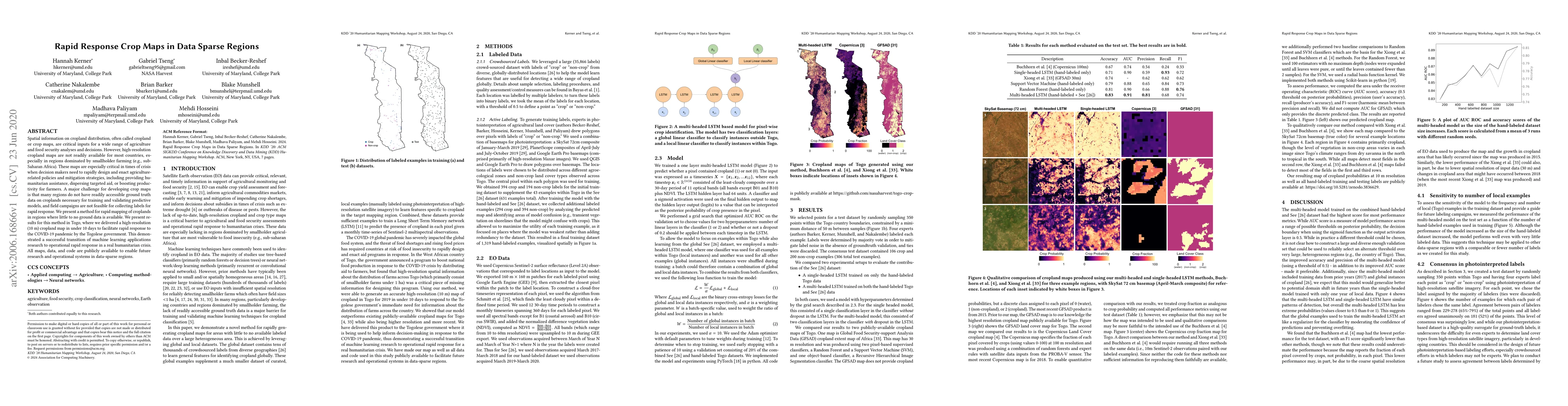
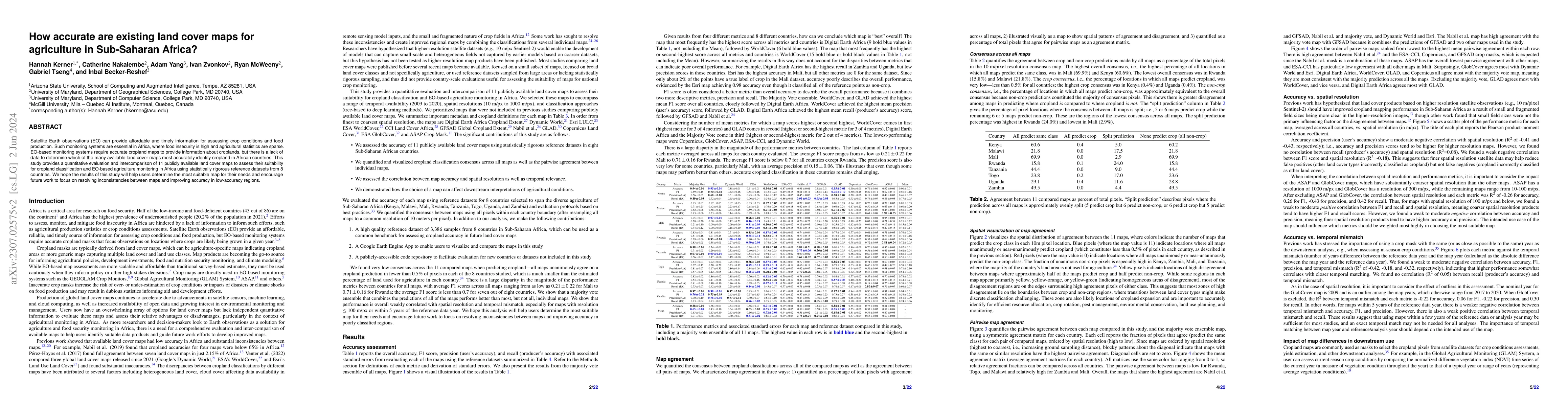
Spatial information on cropland distribution, often called cropland or crop maps, are critical inputs for a wide range of agriculture and food security analyses and decisions. However, high-resoluti...
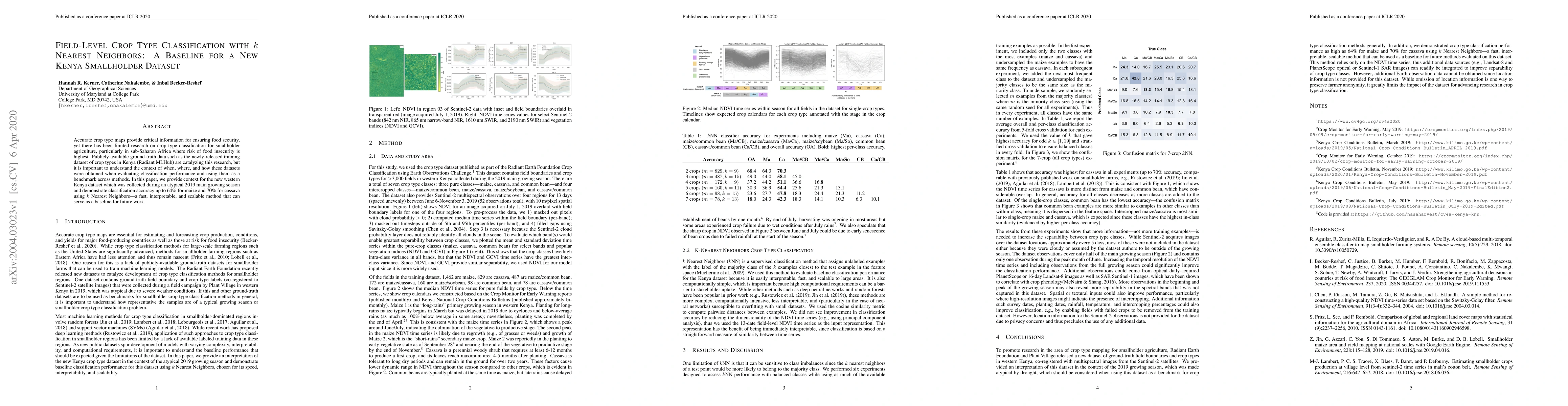
Accurate crop type maps provide critical information for ensuring food security, yet there has been limited research on crop type classification for smallholder agriculture, particularly in sub-Saha...
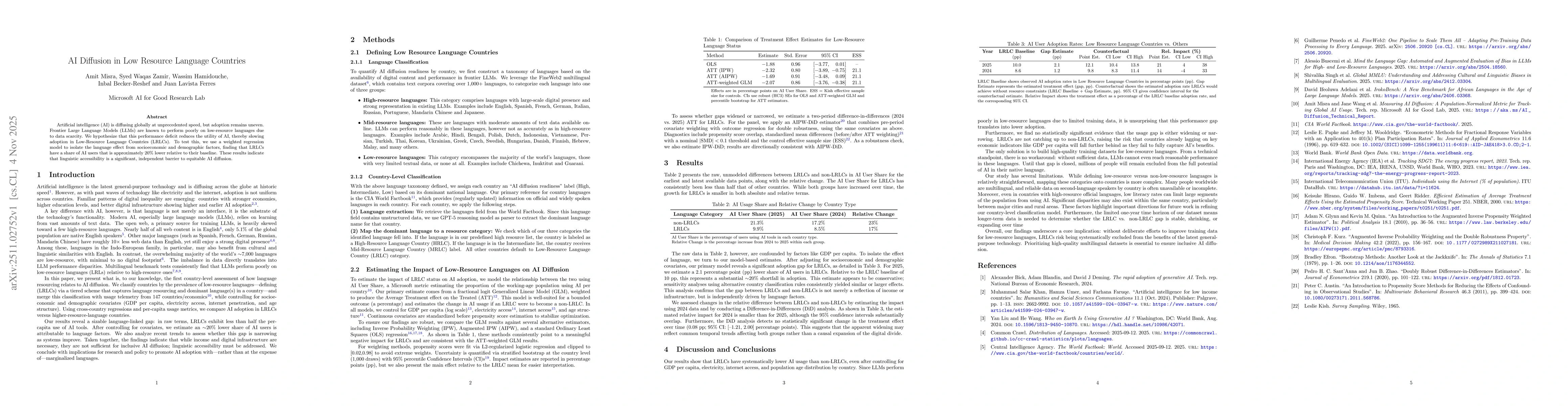
Artificial intelligence (AI) is diffusing globally at unprecedented speed, but adoption remains uneven. Frontier Large Language Models (LLMs) are known to perform poorly on low-resource languages due ...
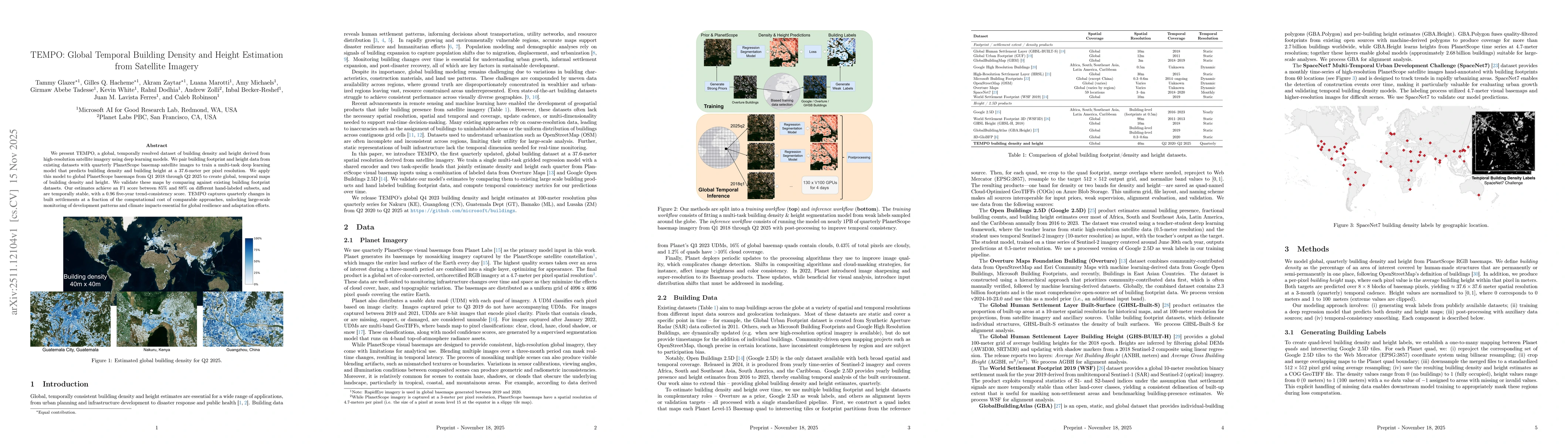
We present TEMPO, a global, temporally resolved dataset of building density and height derived from high-resolution satellite imagery using deep learning models. We pair building footprint and height ...
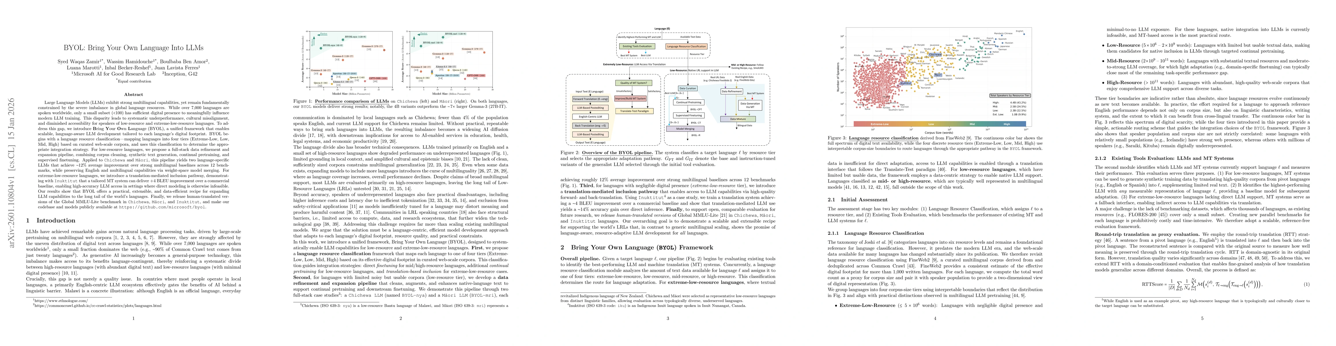
Large Language Models (LLMs) exhibit strong multilingual capabilities, yet remain fundamentally constrained by the severe imbalance in global language resources. While over 7,000 languages are spoken ...
Looting at archaeological sites poses a severe risk to cultural heritage, yet monitoring thousands of remote locations remains operationally difficult. We present a scalable and satellite-based pipeli...
As geospatial foundation models shift from patch-level to pixel-level embeddings, practitioners must aggregate thousands of pixel vectors into patch representations that preserve class-discriminative ...
We present ongoing research on agency primitives for GeoAI assistants -- core capabilities that connect Foundation models to the artifact-centric, human-in-the-loop workflows where GIS practitioners a...
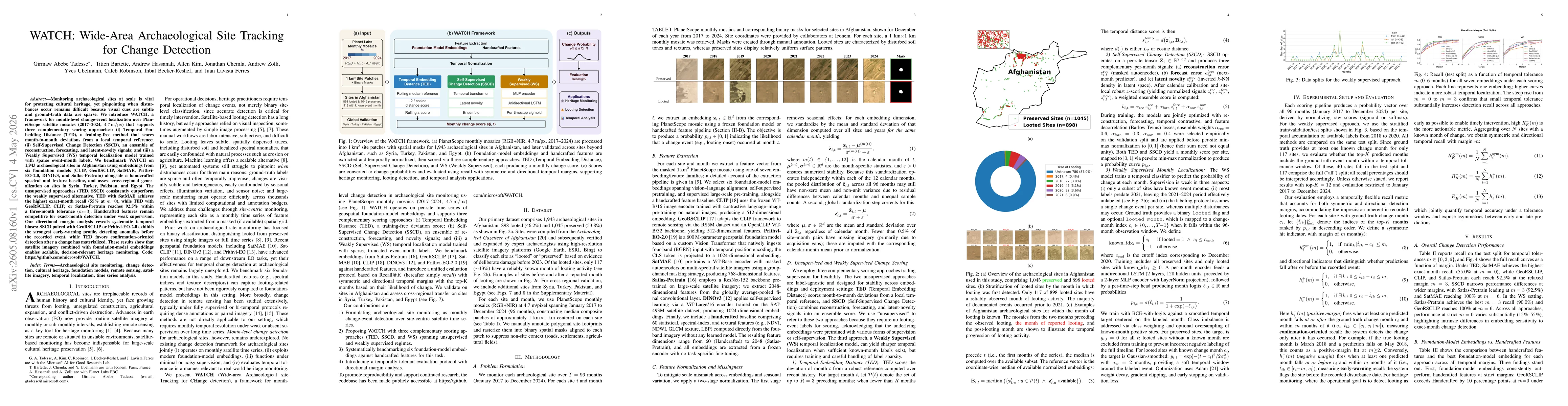
Monitoring archaeological sites at scale is vital for protecting cultural heritage, yet pinpointing when disturbances occur remains difficult because visual cues are subtle and ground-truth data are s...
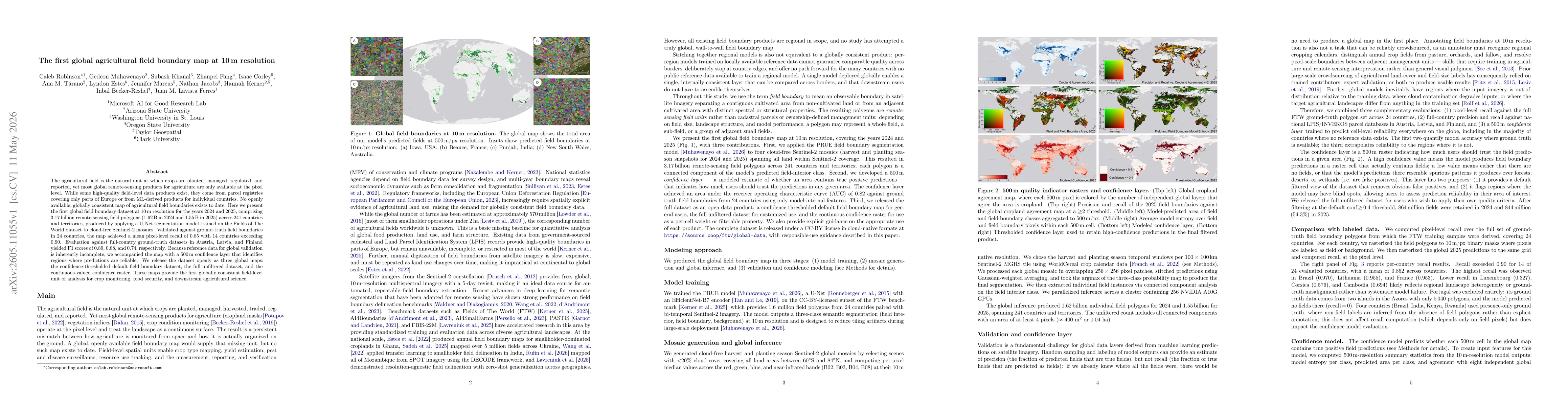
The agricultural field is the natural unit at which crops are planted, managed, regulated, and reported, yet most global remote-sensing products for agriculture are only available at the pixel level. ...
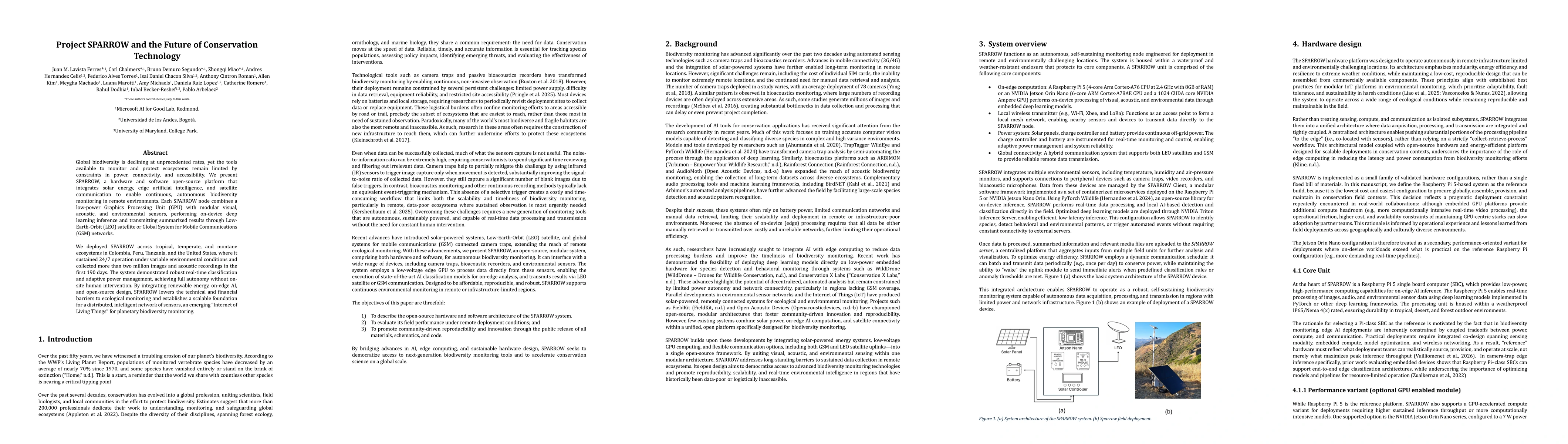
Global biodiversity is declining at unprecedented rates, yet the tools available to monitor and protect ecosystems remain limited by constraints in power, connectivity, and accessibility. We present S...
Safety evaluation of Large Language Models (LLMs) remains heavily English-centric, leaving Low-Resource Languages (LRLs), particularly African ones, critically underexplored. We introduce TUKABENCH, a...