Academic Profile
Statistics
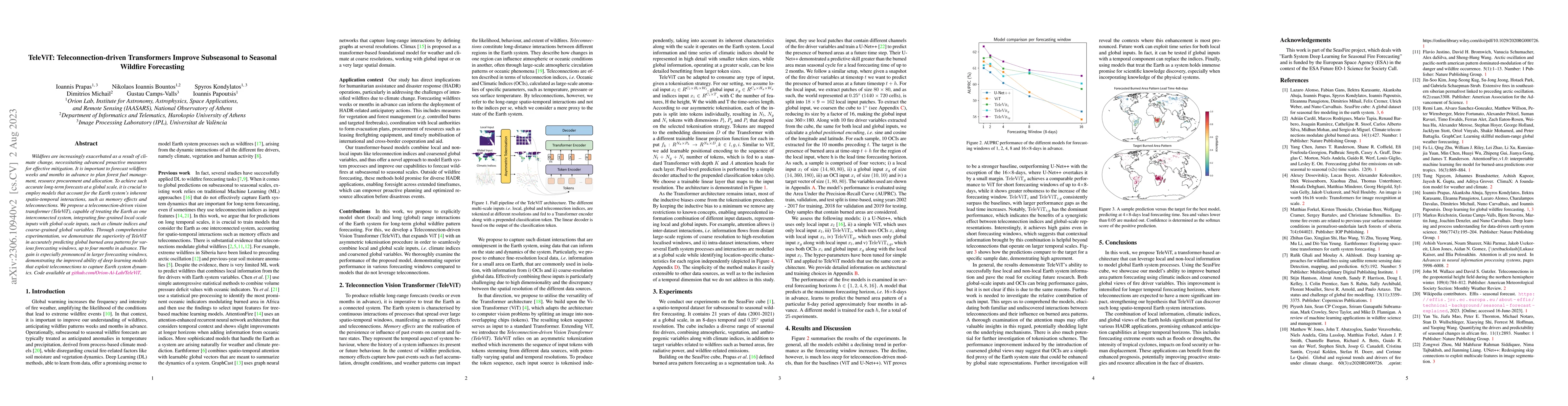
Similar Authors
Papers on arXiv
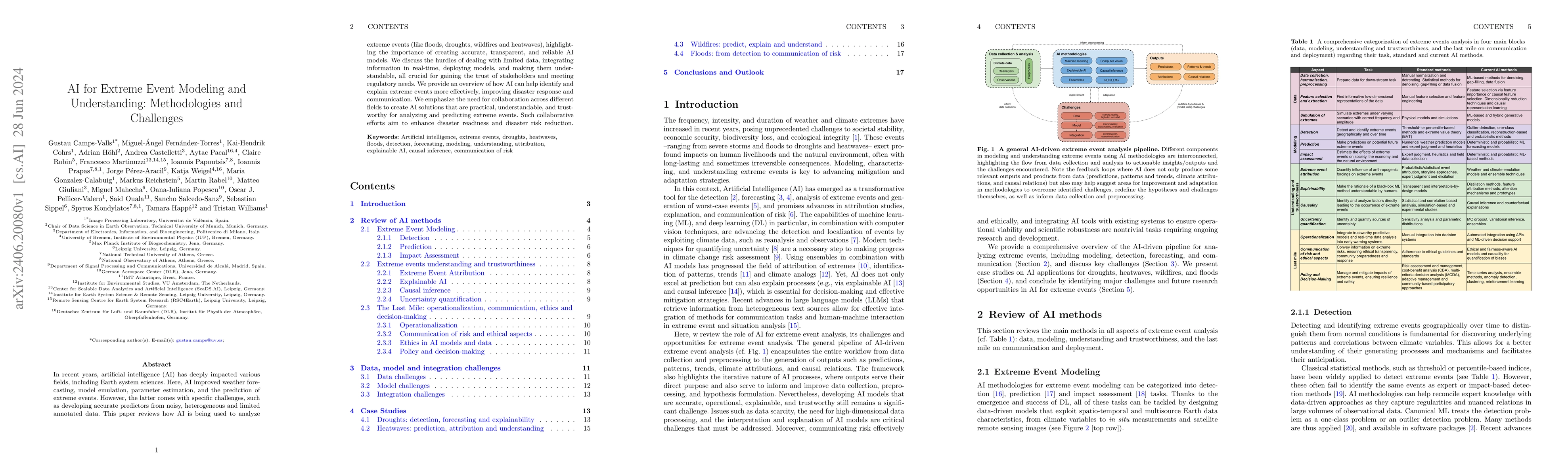
In recent years, artificial intelligence (AI) has deeply impacted various fields, including Earth system sciences. Here, AI improved weather forecasting, model emulation, parameter estimation, and the...
With climate change expected to exacerbate fire weather conditions, the accurate anticipation of wildfires on a global scale becomes increasingly crucial for disaster mitigation. In this study, we u...

Wildfire forecasting is notoriously hard due to the complex interplay of different factors such as weather conditions, vegetation types and human activities. Deep learning models show promise in dea...
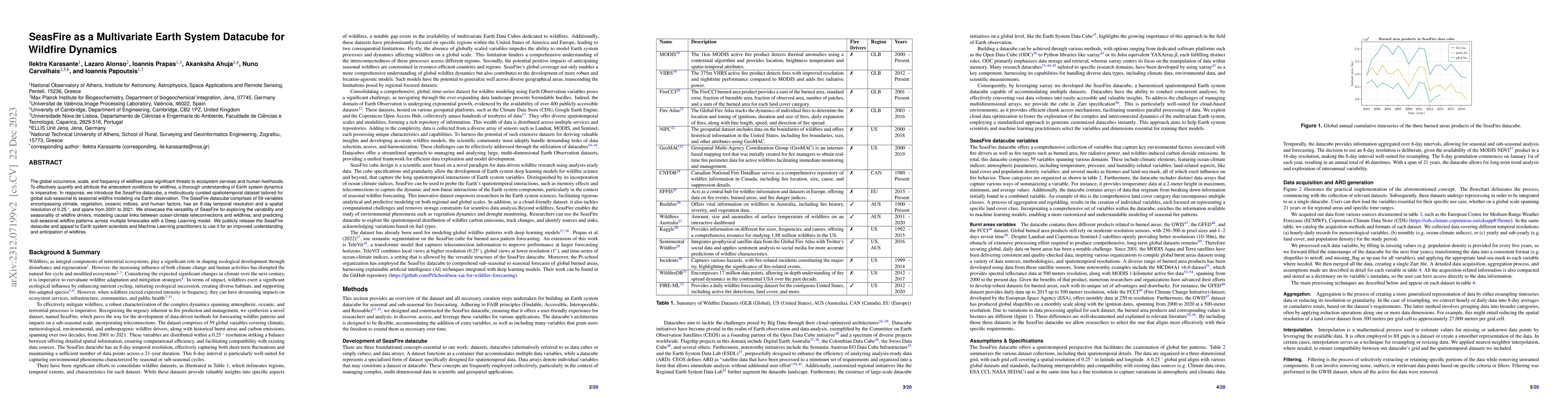
The global occurrence, scale, and frequency of wildfires pose significant threats to ecosystem services and human livelihoods. To effectively quantify and attribute the antecedent conditions for wil...
Wildfires are increasingly exacerbated as a result of climate change, necessitating advanced proactive measures for effective mitigation. It is important to forecast wildfires weeks and months in ad...
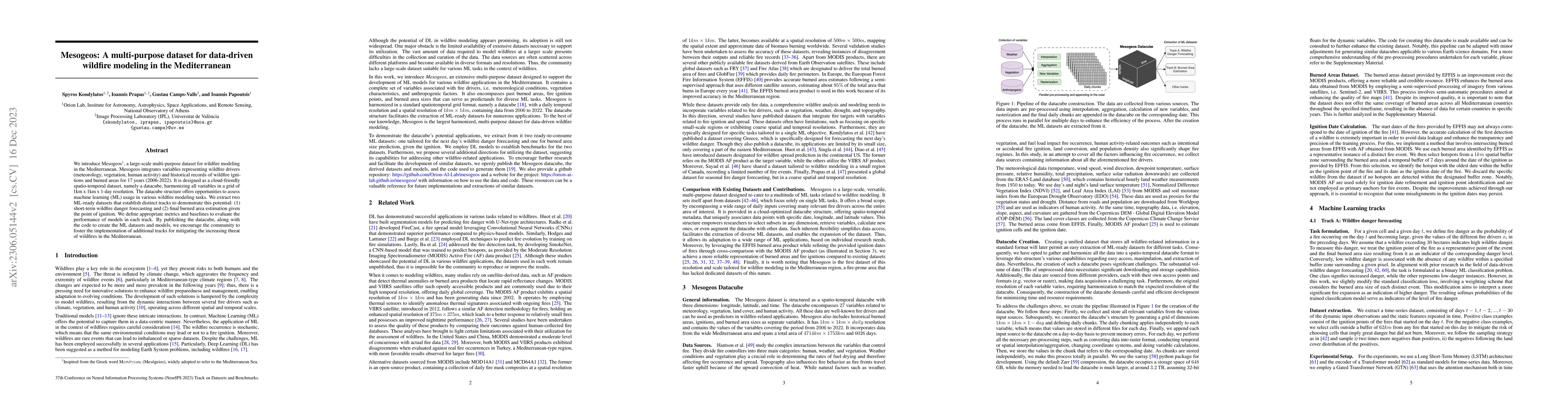
We introduce Mesogeos, a large-scale multi-purpose dataset for wildfire modeling in the Mediterranean. Mesogeos integrates variables representing wildfire drivers (meteorology, vegetation, human act...
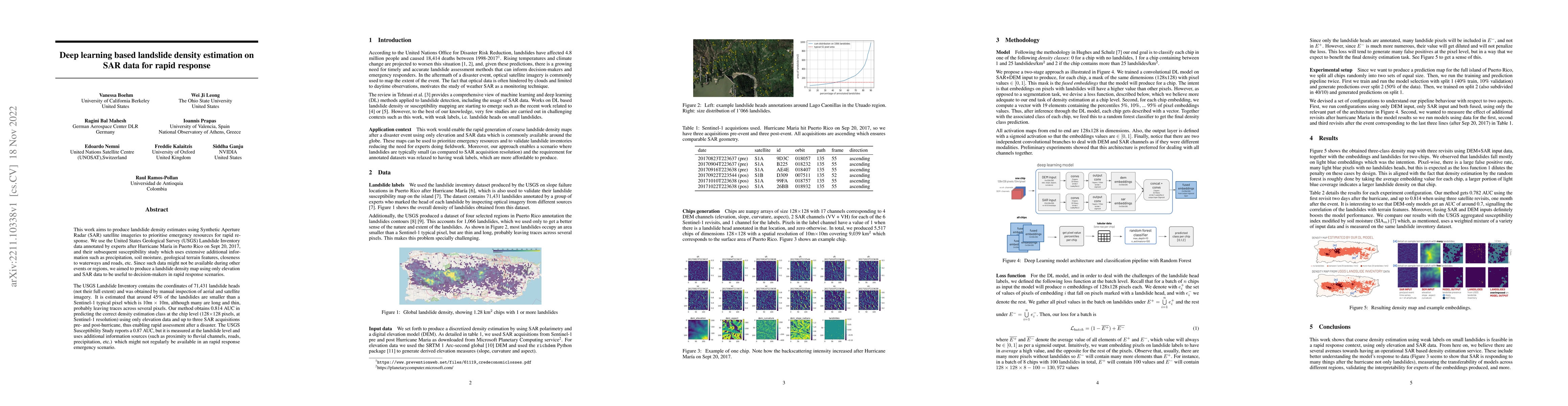
This work aims to produce landslide density estimates using Synthetic Aperture Radar (SAR) satellite imageries to prioritise emergency resources for rapid response. We use the United States Geologic...
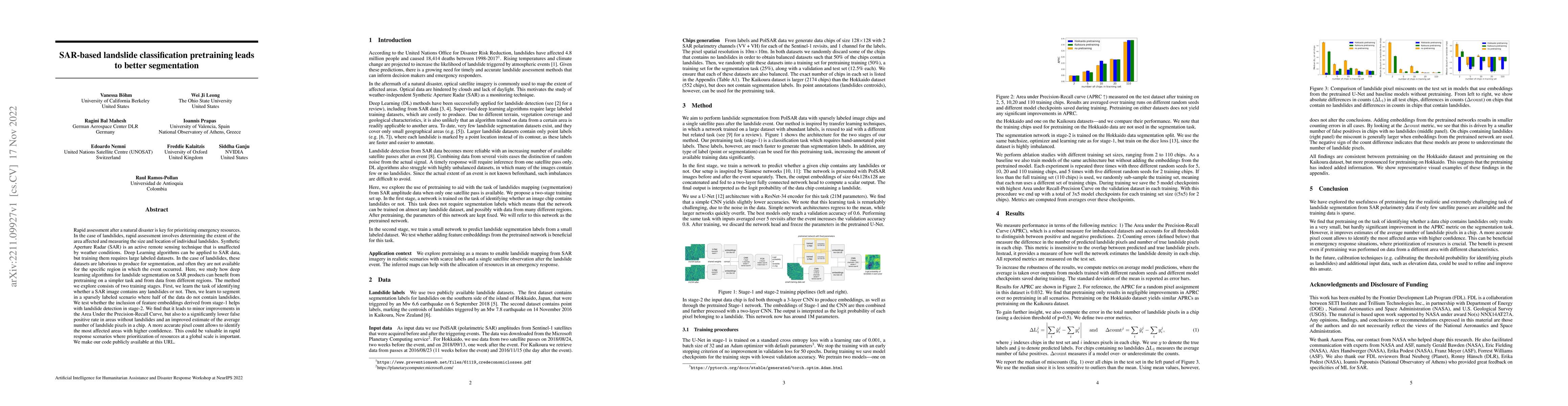
Rapid assessment after a natural disaster is key for prioritizing emergency resources. In the case of landslides, rapid assessment involves determining the extent of the area affected and measuring ...
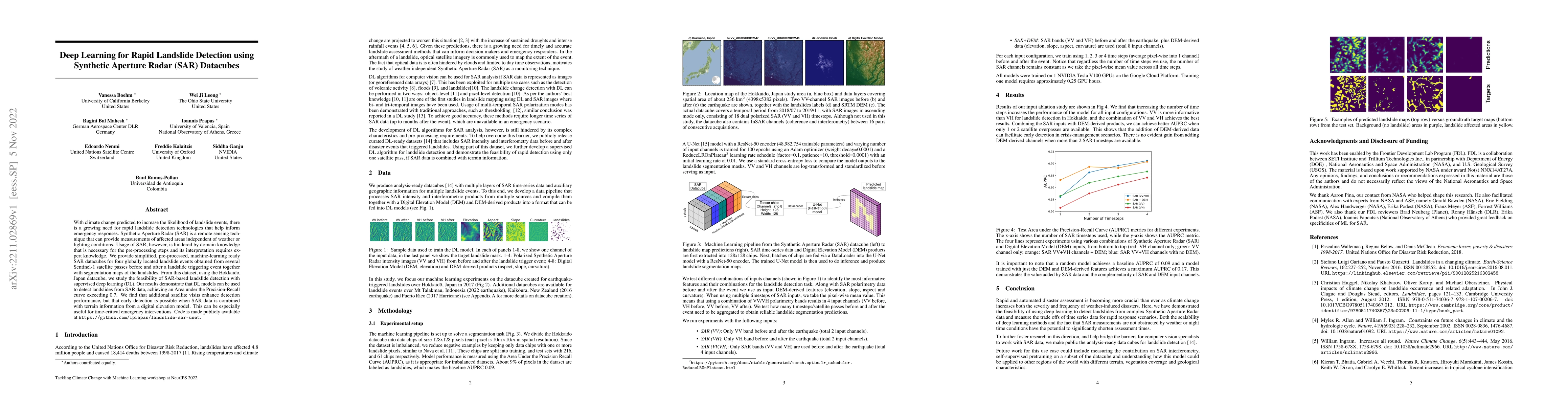
With climate change predicted to increase the likelihood of landslide events, there is a growing need for rapid landslide detection technologies that help inform emergency responses. Synthetic Apert...
Climate change is expected to aggravate wildfire activity through the exacerbation of fire weather. Improving our capabilities to anticipate wildfires on a global scale is of uttermost importance fo...
Wildfire forecasting is of paramount importance for disaster risk reduction and environmental sustainability. We approach daily fire danger prediction as a machine learning task, using historical Ea...
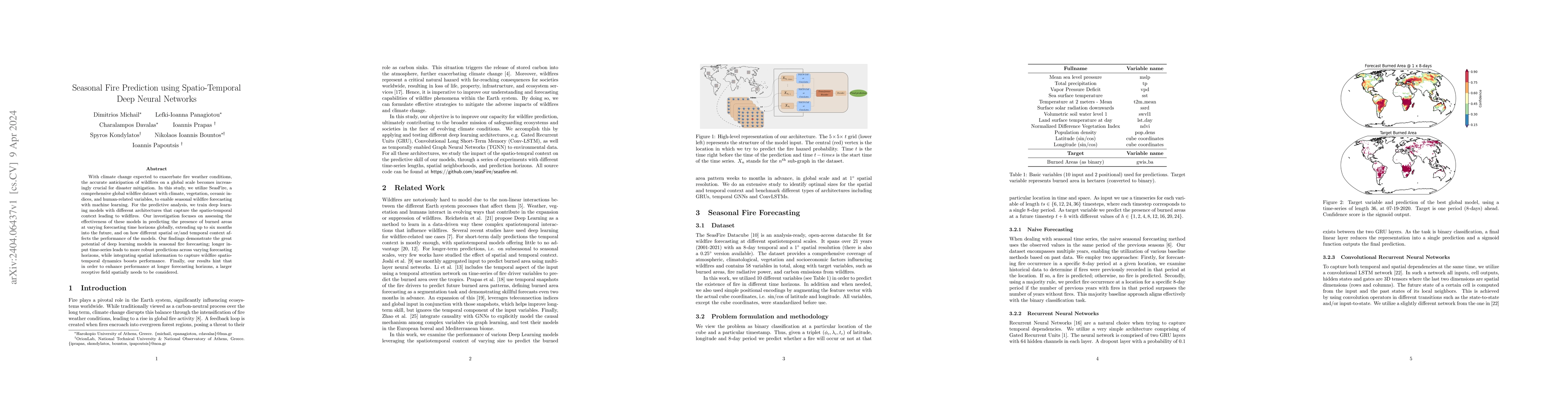
With climate change expected to exacerbate fire weather conditions, the accurate and timely anticipation of wildfires becomes increasingly crucial for disaster mitigation. In this study, we utilize Se...
Label noise poses a significant challenge in Earth Observation (EO), often degrading the performance and reliability of supervised Machine Learning (ML) models. Yet, given the critical nature of sever...
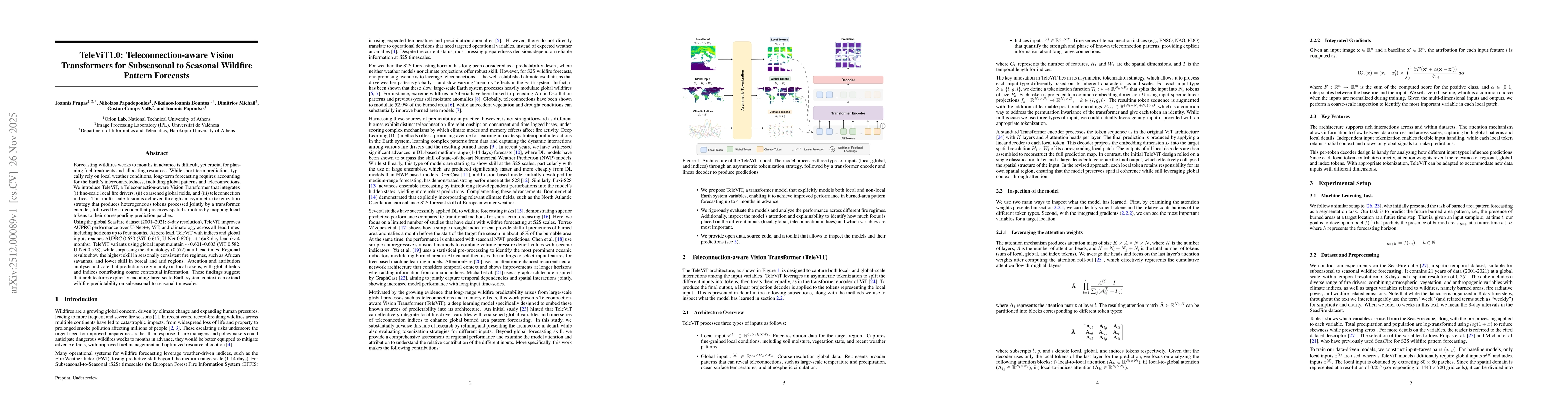
Forecasting wildfires weeks to months in advance is difficult, yet crucial for planning fuel treatments and allocating resources. While short-term predictions typically rely on local weather condition...