Academic Profile
Statistics
Similar Authors
Papers on arXiv
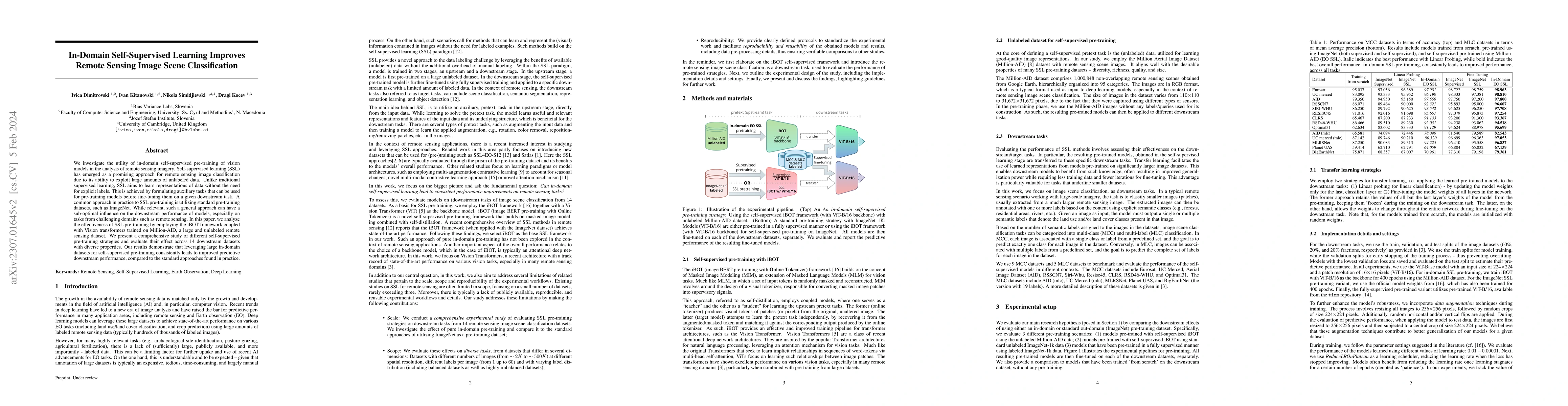
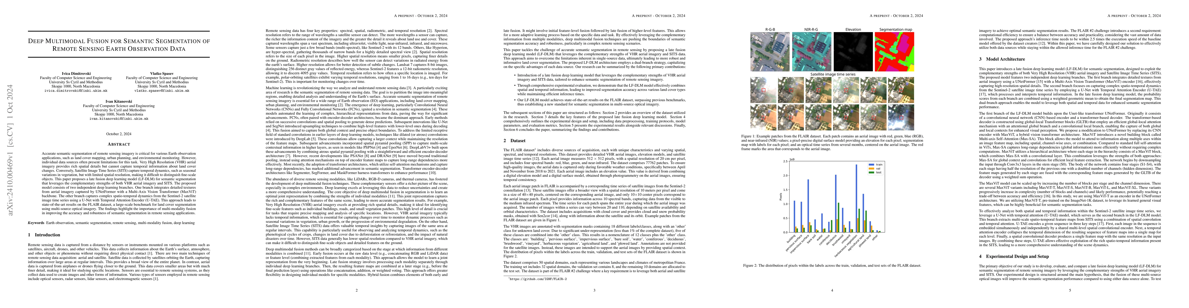
We investigate the utility of in-domain self-supervised pre-training of vision models in the analysis of remote sensing imagery. Self-supervised learning (SSL) has emerged as a promising approach fo...
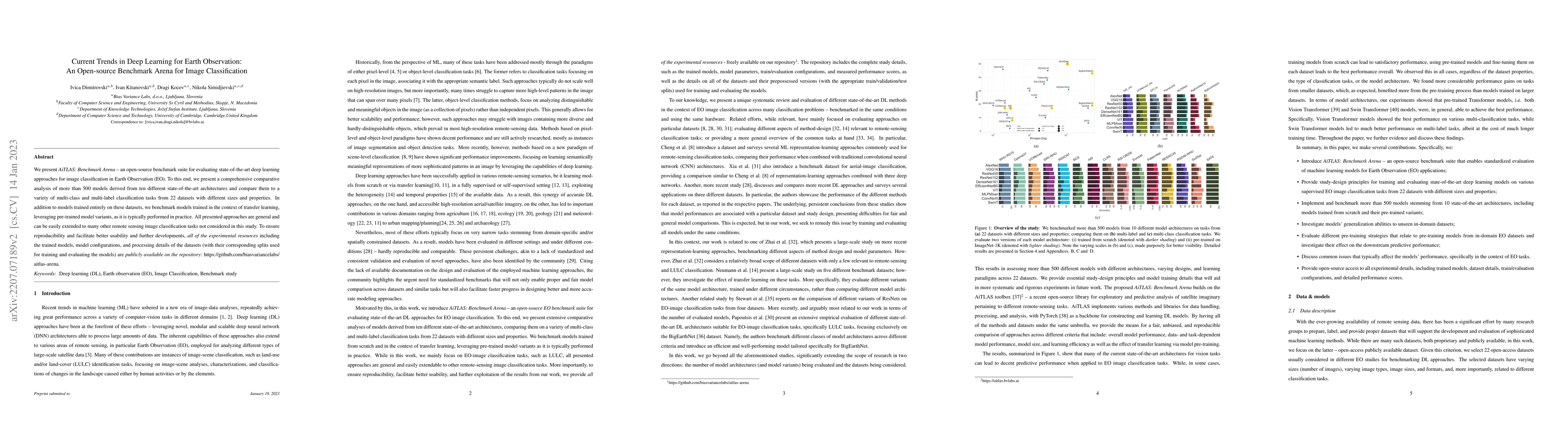
We present AiTLAS: Benchmark Arena -- an open-source benchmark suite for evaluating state-of-the-art deep learning approaches for image classification in Earth Observation (EO). To this end, we pres...
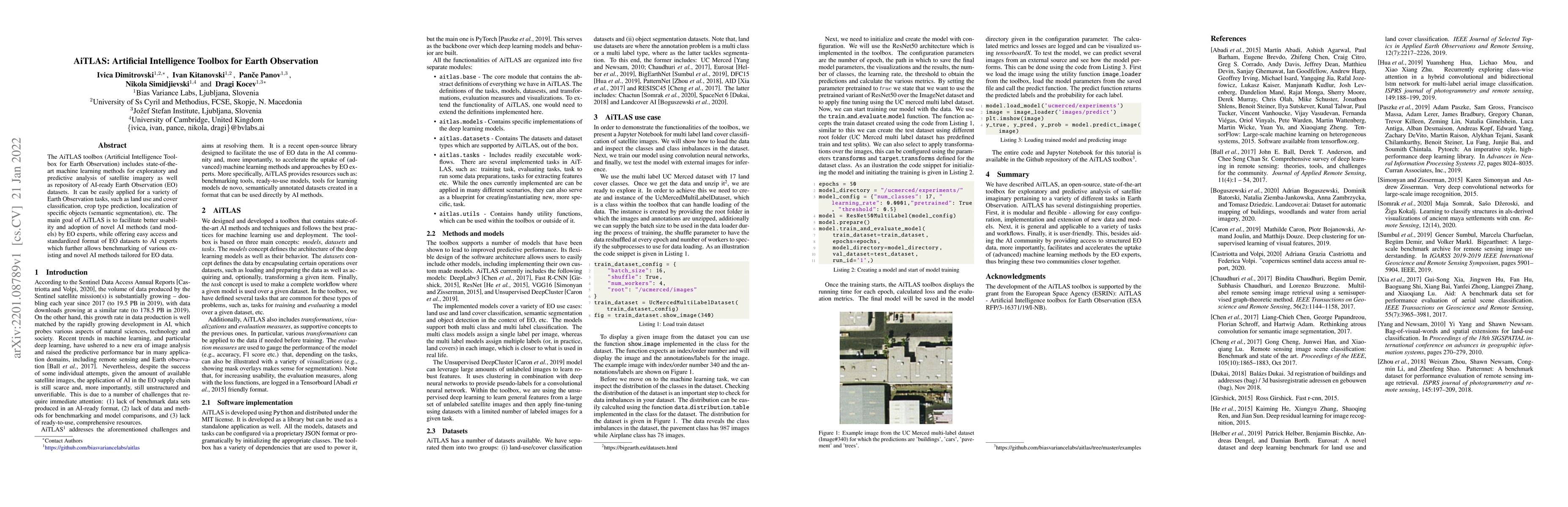
The AiTLAS toolbox (Artificial Intelligence Toolbox for Earth Observation) includes state-of-the-art machine learning methods for exploratory and predictive analysis of satellite imagery as well as ...
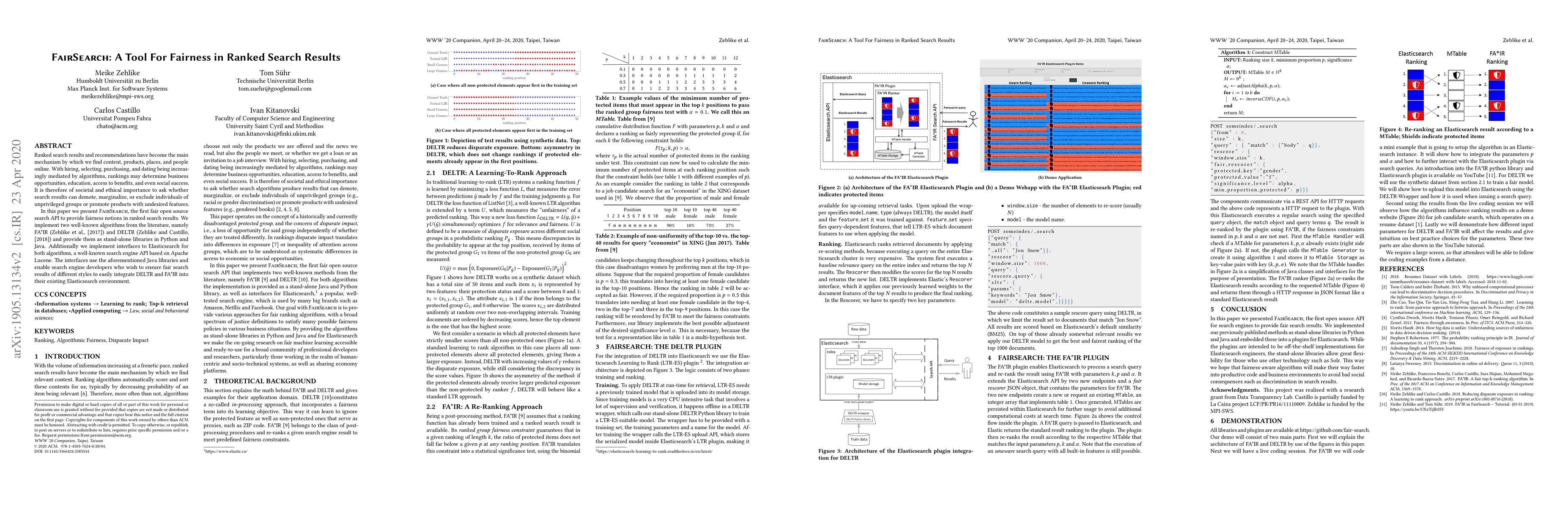
Ranked search results and recommendations have become the main mechanism by which we find content, products, places, and people online. With hiring, selecting, purchasing, and dating being increasin...
The escalating use of Unmanned Aerial Vehicles (UAVs) as remote sensing platforms has garnered considerable attention, proving invaluable for ground object recognition. While satellite remote sensing ...
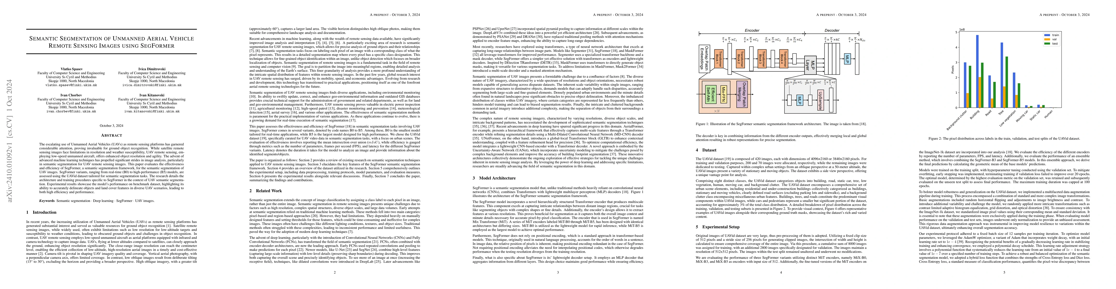
Accurate semantic segmentation of remote sensing imagery is critical for various Earth observation applications, such as land cover mapping, urban planning, and environmental monitoring. However, indi...
Remote sensing applications increasingly rely on deep learning for scene classification. However, their performance is often constrained by the scarcity of labeled data and the high cost of annotation...
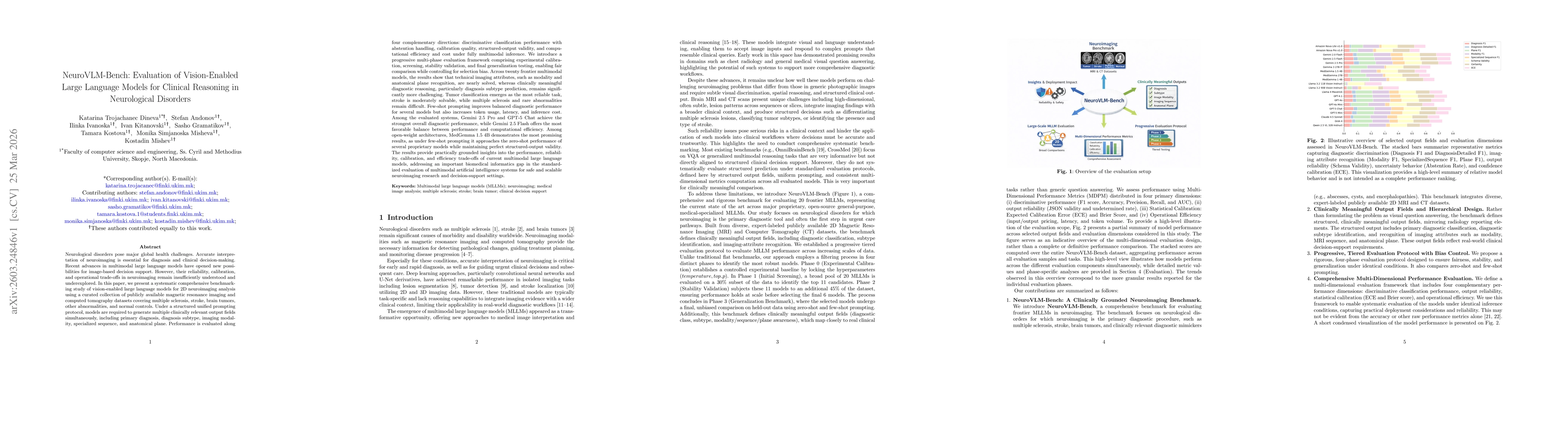
Recent advances in multimodal large language models enable new possibilities for image-based decision support. However, their reliability and operational trade-offs in neuroimaging remain insufficient...
Accurate early warning of vineyard disease risk from environmental observations is essential for timely intervention and more sustainable crop protection. However, many existing studies formulate dise...