AiTLAS: Artificial Intelligence Toolbox for Earth Observation
Publication
Metrics
AI Quick Summary
AiTLAS is an advanced AI toolbox for Earth Observation, providing state-of-the-art machine learning methods for satellite imagery analysis and a repository of AI-ready datasets. It aims to enhance usability and adoption of AI in Earth Observation tasks like land classification and crop prediction.
Paper Preview
Abstract
The AiTLAS toolbox (Artificial Intelligence Toolbox for Earth Observation) includes state-of-the-art machine learning methods for exploratory and predictive analysis of satellite imagery as well as repository of AI-ready Earth Observation (EO) datasets. It can be easily applied for a variety of Earth Observation tasks, such as land use and cover classification, crop type prediction, localization of specific objects (semantic segmentation), etc. The main goal of AiTLAS is to facilitate better usability and adoption of novel AI methods (and models) by EO experts, while offering easy access and standardized format of EO datasets to AI experts which further allows benchmarking of various existing and novel AI methods tailored for EO data.
AI Key Findings
Get AI-generated insights about this paper's methodology, results, significance, and more — seven facets brought into focus.
Impact
Paper Details
Authors
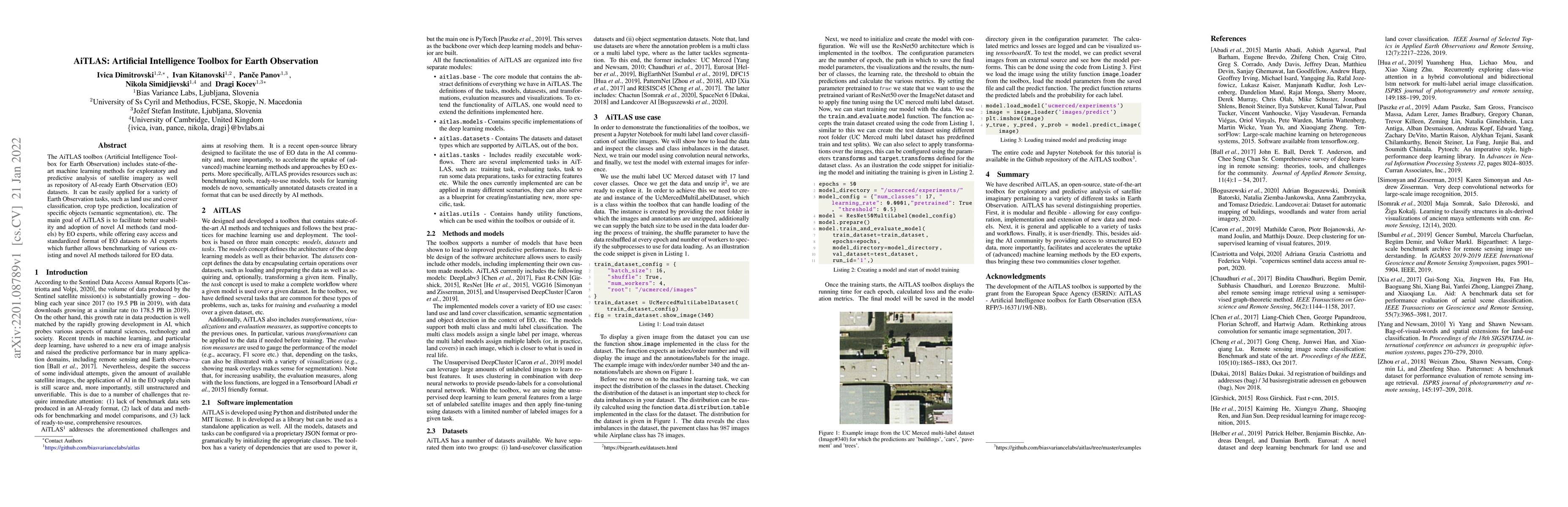
PDF Preview
Key Terms
Citation Network
Current paper (gray), citations (green), references (blue)
Display is limited for performance on very large graphs.
Discussion 0