Academic Profile
Statistics
Similar Authors
Papers on arXiv
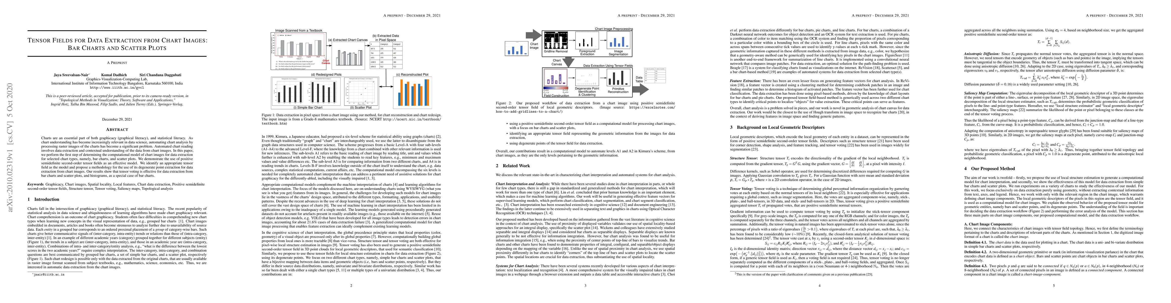
Charts are an essential part of both graphicacy (graphical literacy), and statistical literacy. As chart understanding has become increasingly relevant in data science, automating chart analysis by ...
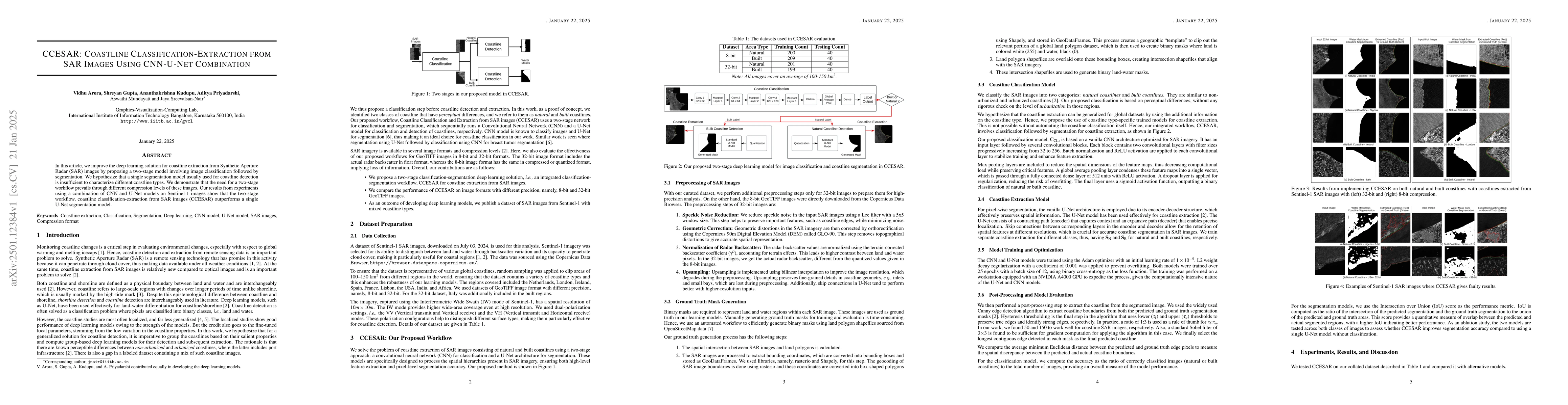
In this article, we improve the deep learning solution for coastline extraction from Synthetic Aperture Radar (SAR) images by proposing a two-stage model involving image classification followed by seg...
Data-driven susceptibility mapping of natural hazards has harnessed the advances in classification methods used on heterogeneous sources represented as raster images. Susceptibility mapping is an impo...
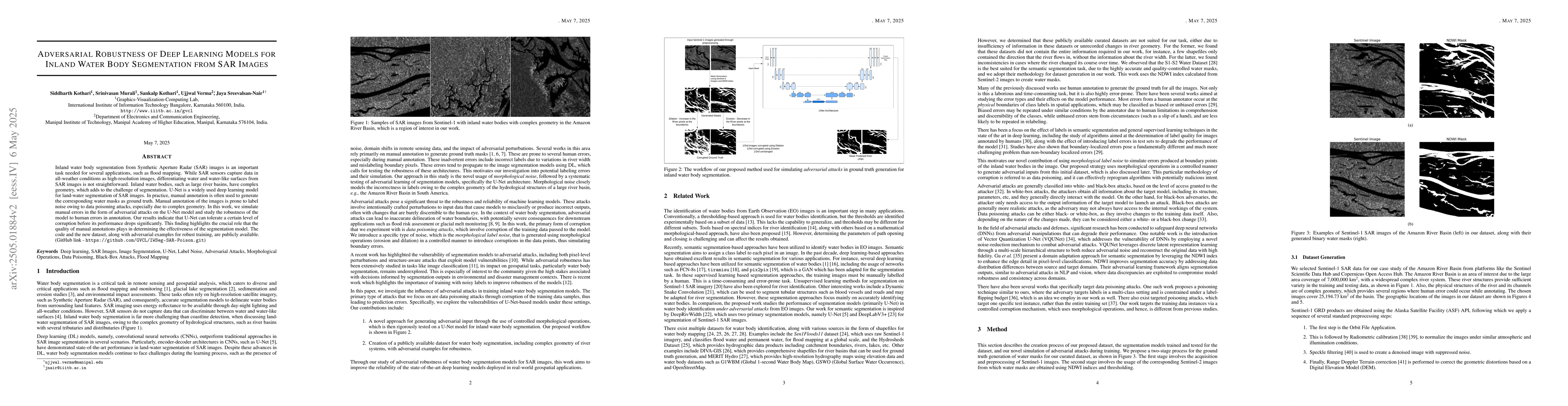
Inland water body segmentation from Synthetic Aperture Radar (SAR) images is an important task needed for several applications, such as flood mapping. While SAR sensors capture data in all-weather con...
Urban air pollution poses significant risks to public health, environmental sustainability, and policy planning. Effective air quality management requires predictive tools that can integrate diverse d...
Local Climate Zones (LCZs) give a zoning map to study urban structures and land use and analyze the impact of urbanization on local climate. Multimodal remote sensing enables LCZ classification, for w...
Existing multi-hazard susceptibility mapping (MHSM) studies often rely on spatially uniform models, treat hazards independently, and provide limited representation of cross-hazard dependence and uncer...
Free-viewing gaze data provides a rich, task-free window into human visual attention. Conventional exploratory data analysis of the data provides user attention patterns through fixations and areas of...