Academic Profile
Statistics
Similar Authors
Papers on arXiv
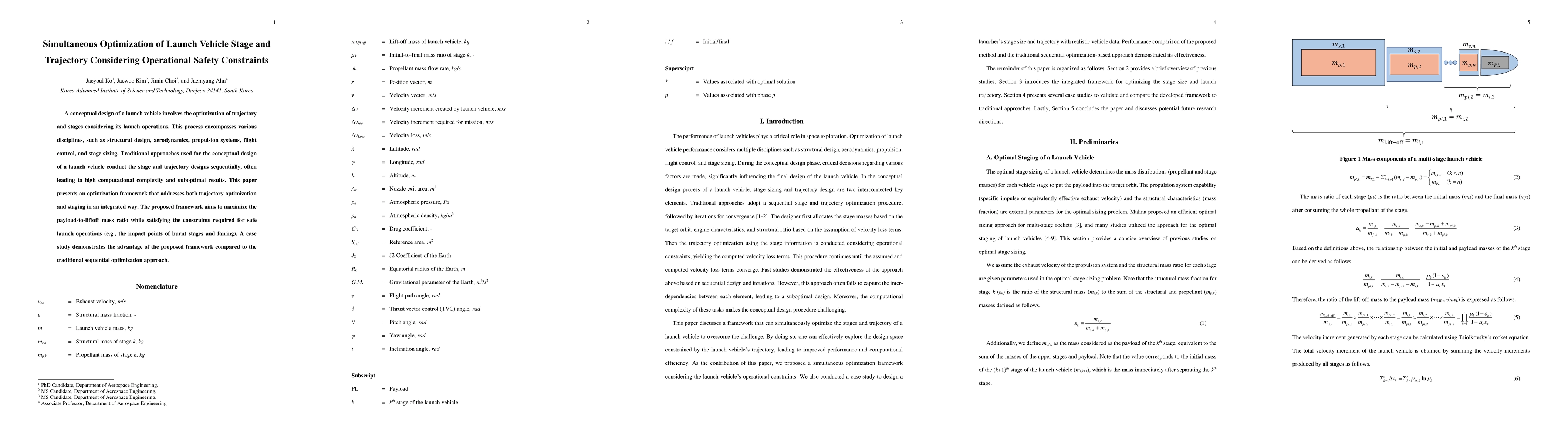
A conceptual design of a launch vehicle involves the optimization of trajectory and stages considering its launch operations. This process encompasses various disciplines, such as structural design,...
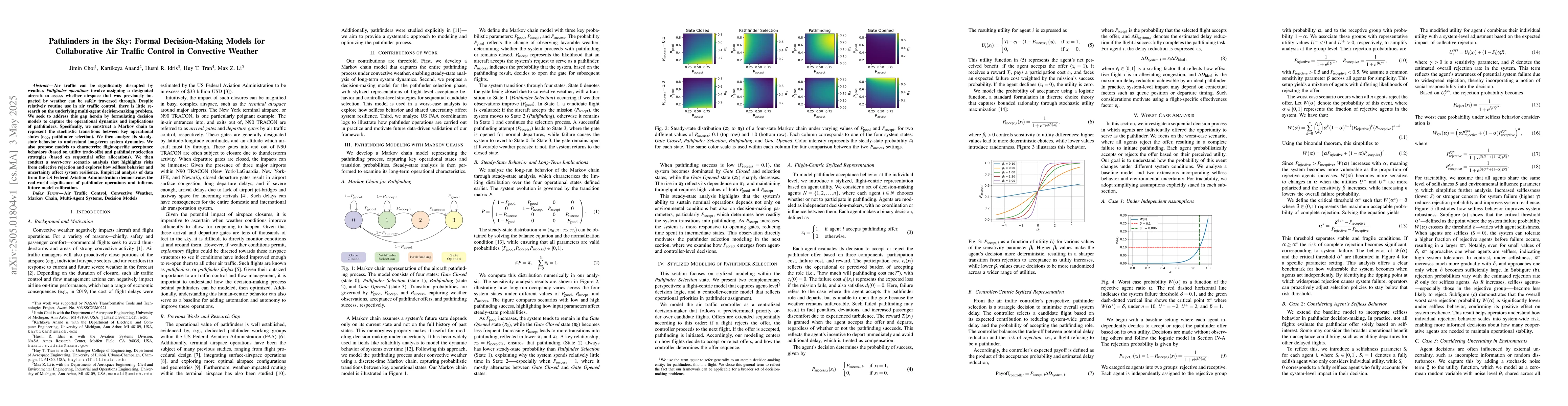
Air traffic can be significantly disrupted by weather. Pathfinder operations involve assigning a designated aircraft to assess whether airspace that was previously impacted by weather can be safely tr...
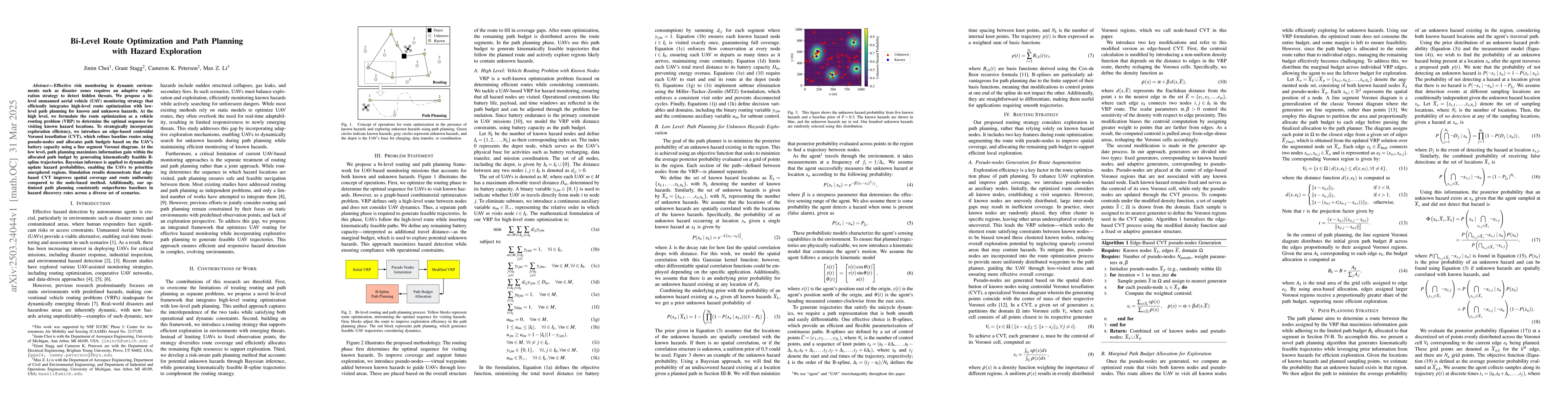
Effective risk monitoring in dynamic environments such as disaster zones requires an adaptive exploration strategy to detect hidden threats. We propose a bi-level unmanned aerial vehicle (UAV) monitor...
Hazardous environments such as chemical spills, radiological zones, and bio-contaminated sites pose significant threats to human safety and public infrastructure. Rapid and reliable hazard mitigation ...
Collaborative Combat Aircraft (CCAs) are envisioned to enable autonomous Intelligence, Surveillance, and Reconnaissance (ISR) missions in contested environments, where adversaries may act strategicall...
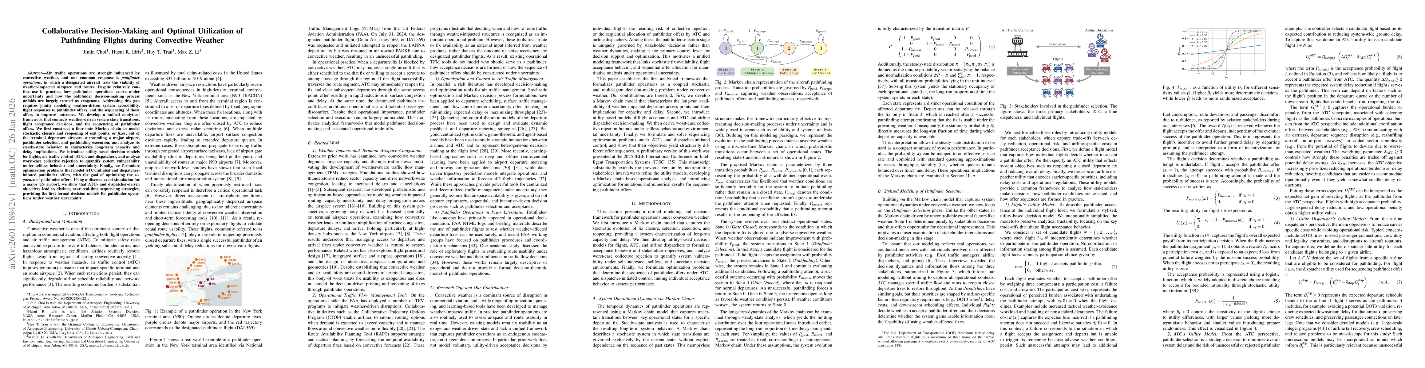
Air traffic operations are strongly influenced by convective weather, and one common response is pathfinder operations, in which a designated aircraft tests the viability of weather-impacted airspace ...
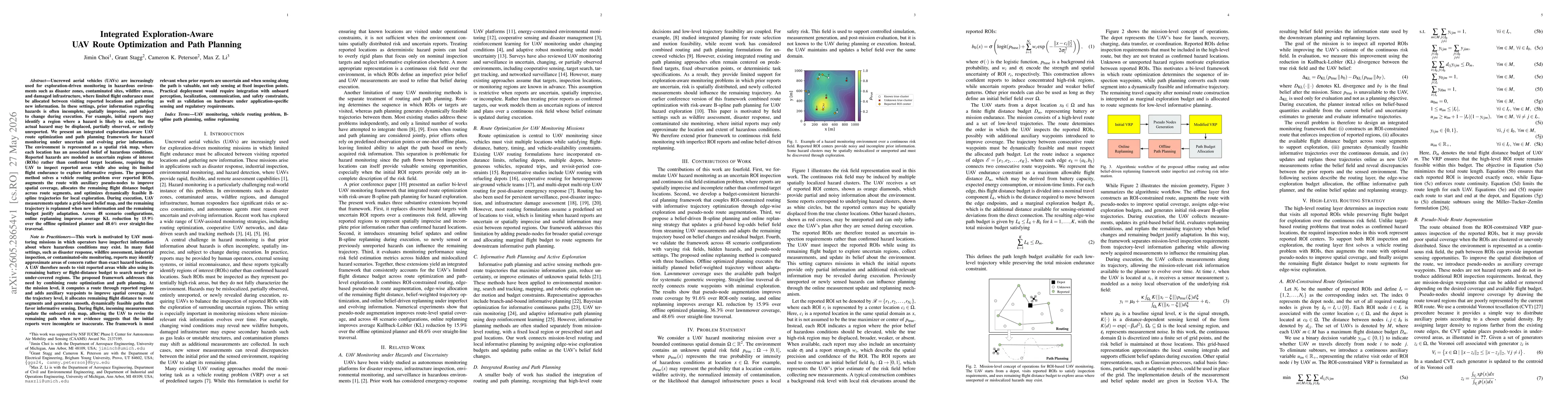
Uncrewed aerial vehicles (UAVs) are increasingly used for exploration-driven monitoring in hazardous environments such as disaster zones, contaminated sites, wildfire areas, and damaged infrastructure...