ArxivLens
J
Researcher

Johannes Breidenbach

7 papers on arXiv

7 arXiv Papers
93 Total Publications
Profile

Academic Profile

Name J. Breidenbach
Total Papers 93
Scholar Profile View on Semantic Scholar
Metrics

Statistics

7 arXiv Papers
93 Total Publications
Publications

Papers on arXiv

Thumbnail for Lidar-based Norwegian tree species detection using deep learning
arXiv
Lidar-based Norwegian tree species detection using deep learning

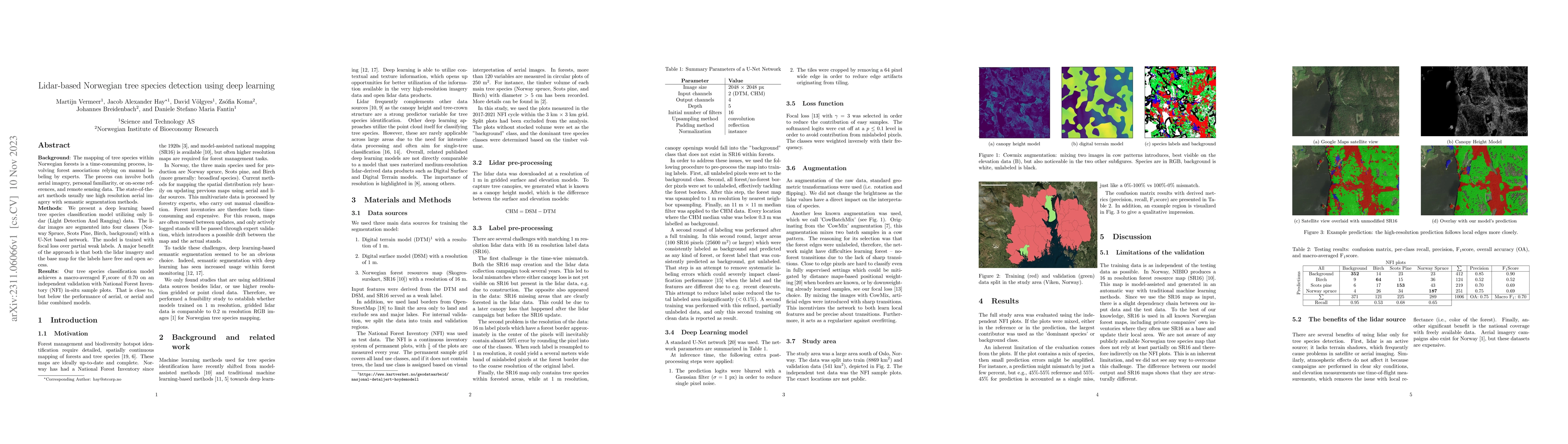
Background: The mapping of tree species within Norwegian forests is a time-consuming process, involving forest associations relying on manual labeling by experts. The process can involve both aerial...

Thumbnail for Assessing and mitigating systematic errors in forest attribute maps
  utilizing harvester and airborne laser scanning data
arXiv
Assessing and mitigating systematic errors in forest attribute maps utilizing harvester and airborne laser scanning data

Cut-to-length harvesters collect useful information for modeling relationships between forest attributes and airborne laser scanning (ALS) data. However, harvesters operate in mature forests, which ...

Thumbnail for Prediction of butt rot volume in Norway spruce forest stands using
  harvester, remotely sensed and environmental data
arXiv
Prediction of butt rot volume in Norway spruce forest stands using harvester, remotely sensed and environmental data

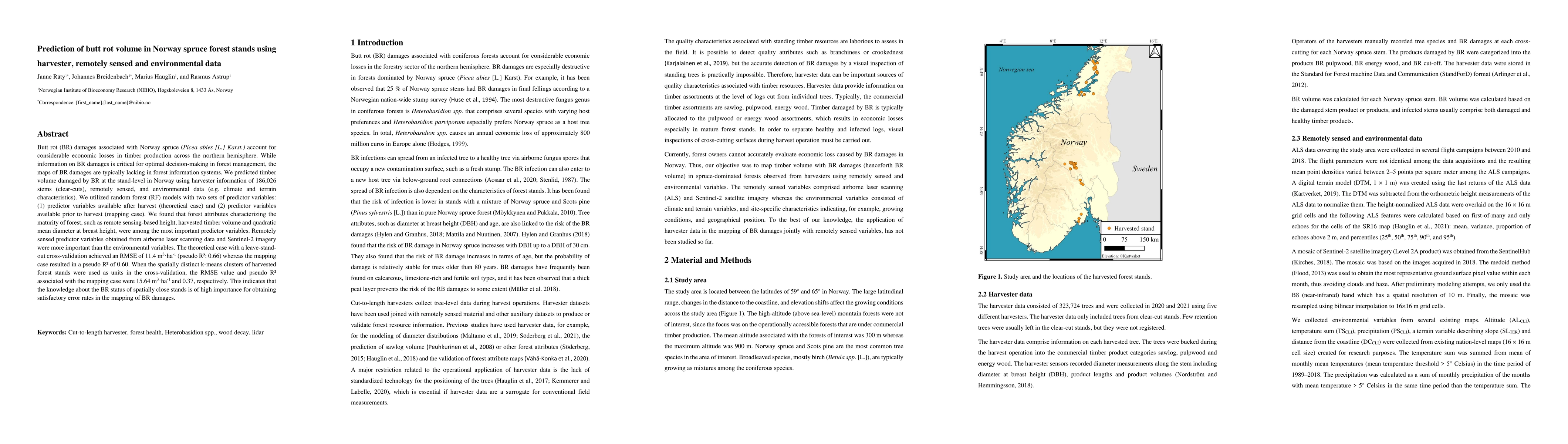
Butt rot (BR) damages associated with Norway spruce (Picea abies [L.] Karst.) account for considerable economic losses in timber production across the northern hemisphere. While information on BR da...

Thumbnail for Above-ground biomass change estimation using national forest inventory
  data with Sentinel-2 and Landsat 8
arXiv
Above-ground biomass change estimation using national forest inventory data with Sentinel-2 and Landsat 8

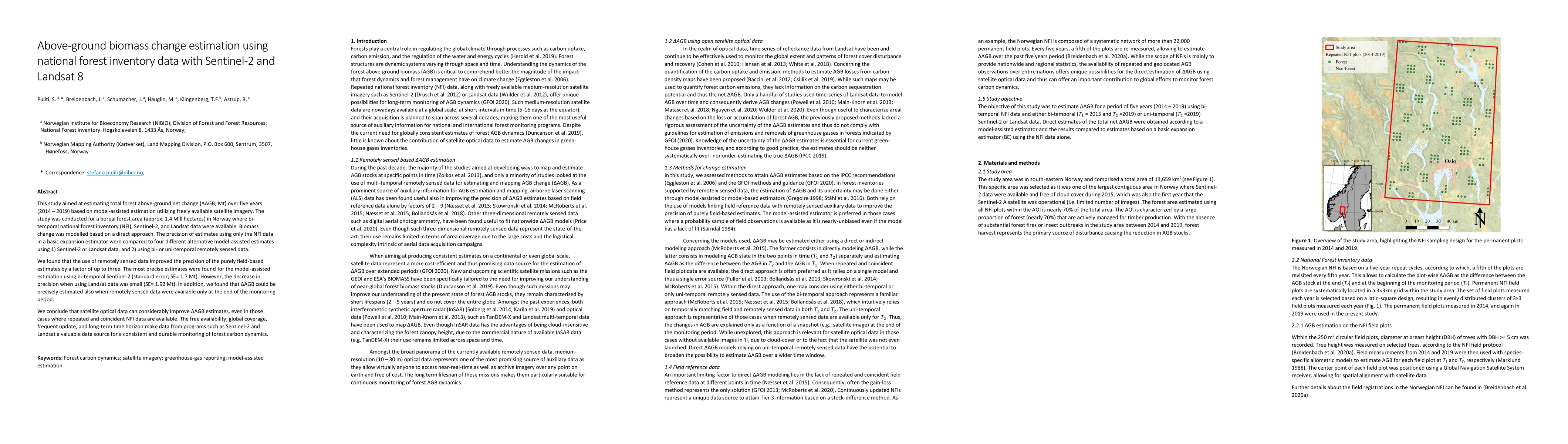
This study aimed at estimating total forest above-ground net change (Delta AGB, Mt) over five years (2014-2019) based on model-assisted estimation utilizing freely available satellite imagery. The s...

Thumbnail for Mapping forest age using National Forest Inventory, airborne laser
  scanning, and Sentinel-2 data
arXiv
Mapping forest age using National Forest Inventory, airborne laser scanning, and Sentinel-2 data

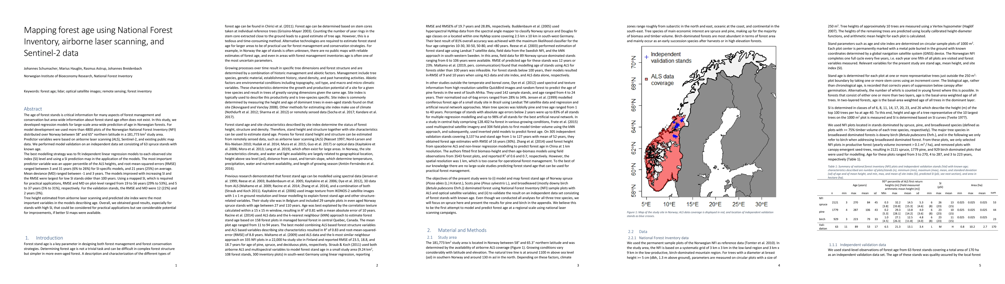
The age of forest stands is critical information for many aspects of forest management and conservation but area-wide information about forest stand age often does not exist. In this study, we devel...

Thumbnail for National mapping and estimation of forest area by dominant tree species
  using Sentinel-2 data
arXiv
National mapping and estimation of forest area by dominant tree species using Sentinel-2 data

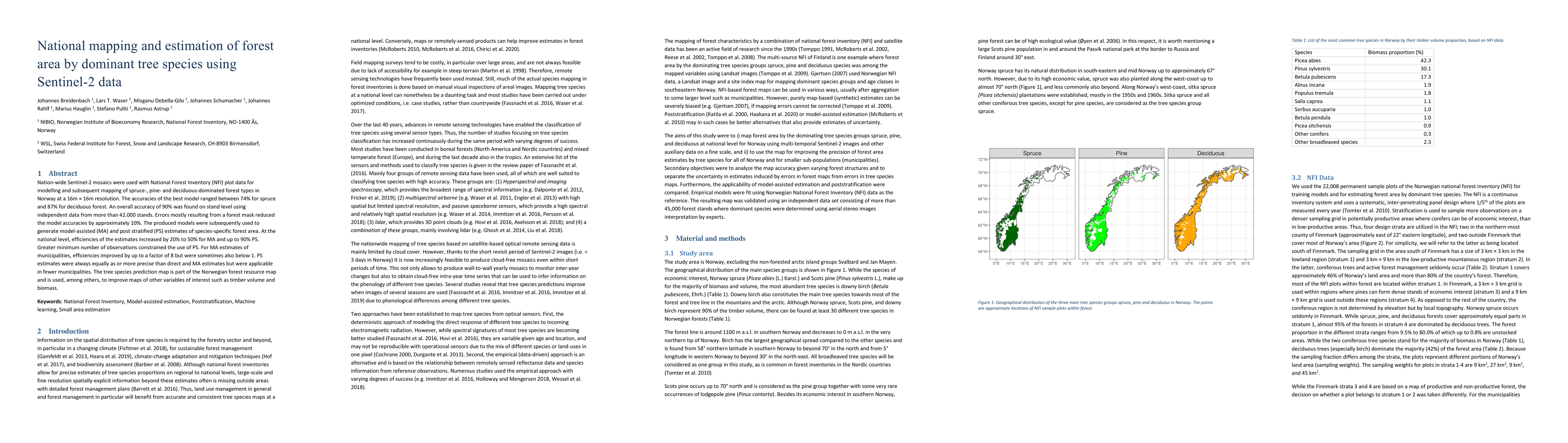
Nation-wide Sentinel-2 mosaics were used with National Forest Inventory (NFI) data for modelling and subsequent mapping of spruce, pine and deciduous forest in Norway in 16 m $\times$ 16 m resolutio...

Thumbnail for Enhancing Tree Species Classification: Insights from YOLOv8 and Explainable AI Applied to TLS Point Cloud Projections
arXiv
Enhancing Tree Species Classification: Insights from YOLOv8 and Explainable AI Applied to TLS Point Cloud Projections

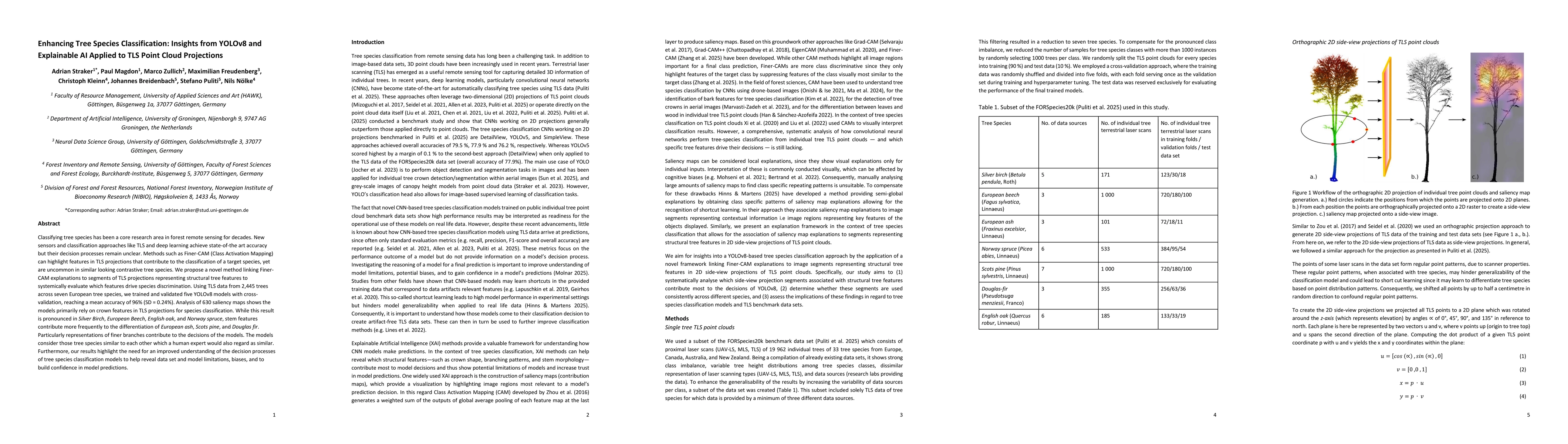
Classifying tree species has been a core research area in forest remote sensing for decades. New sensors and classification approaches like TLS and deep learning achieve state-of-the art accuracy but ...

This website uses cookies to ensure you get the best experience. Learn more