Academic Profile
Statistics
Similar Authors
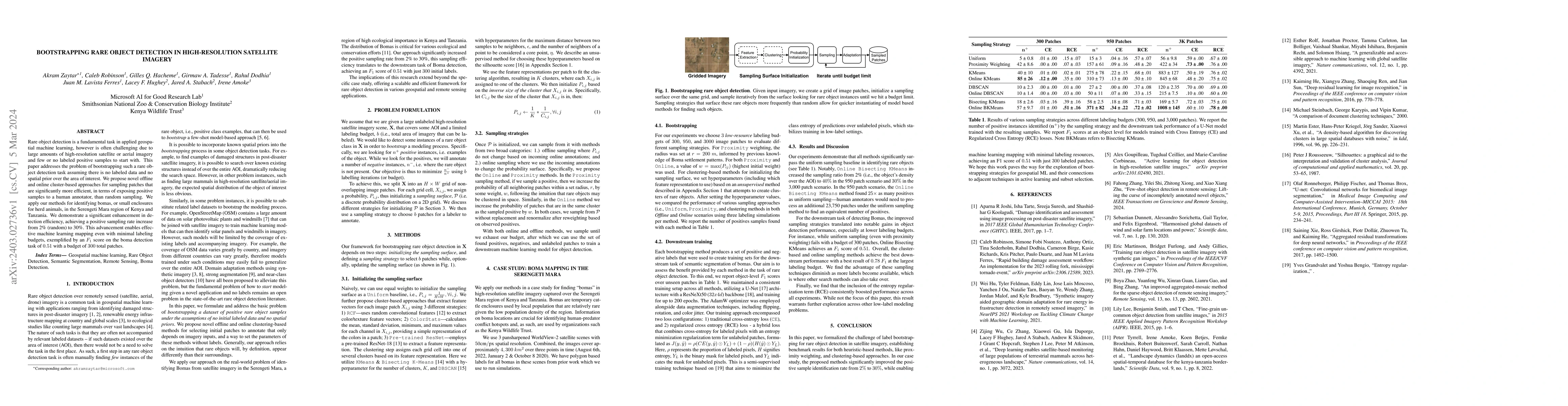
Papers on arXiv
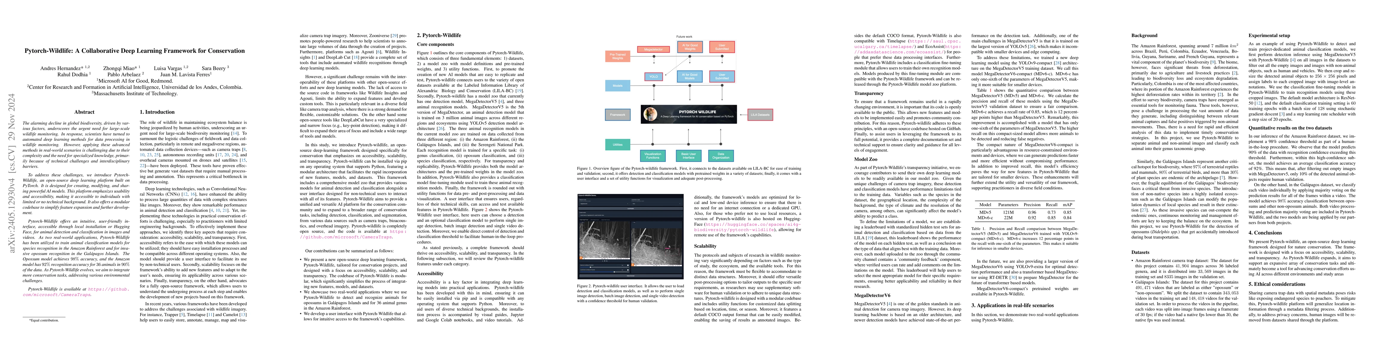
The alarming decline in global biodiversity, driven by various factors, underscores the urgent need for large-scale wildlife monitoring. In response, scientists have turned to automated deep learning ...
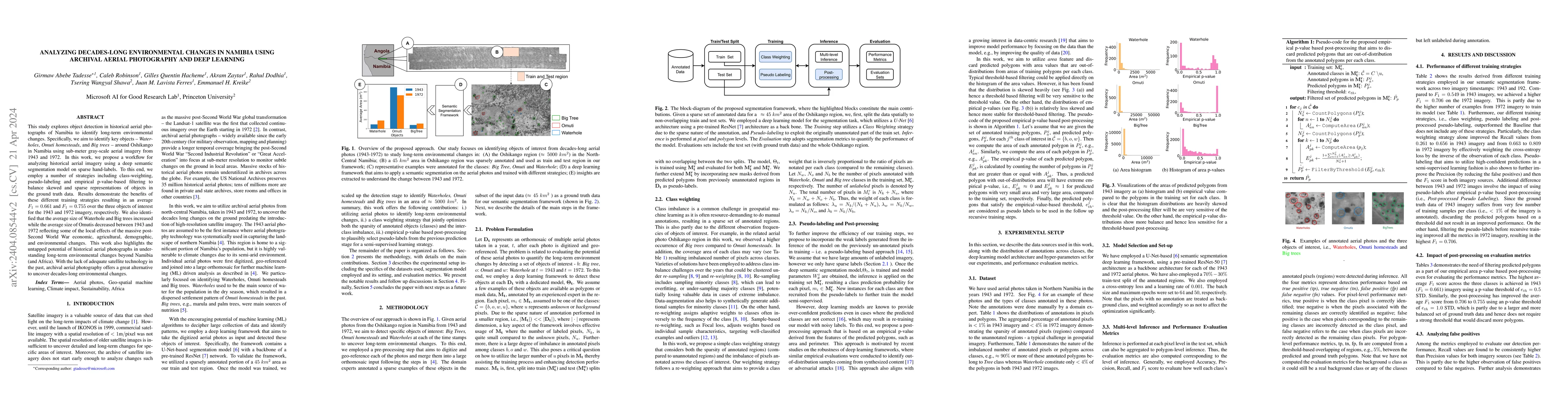
This study explores object detection in historical aerial photographs of Namibia to identify long-term environmental changes. Specifically, we aim to identify key objects -- Waterholes, Omuti homest...
Rare object detection is a fundamental task in applied geospatial machine learning, however is often challenging due to large amounts of high-resolution satellite or aerial imagery and few or no lab...
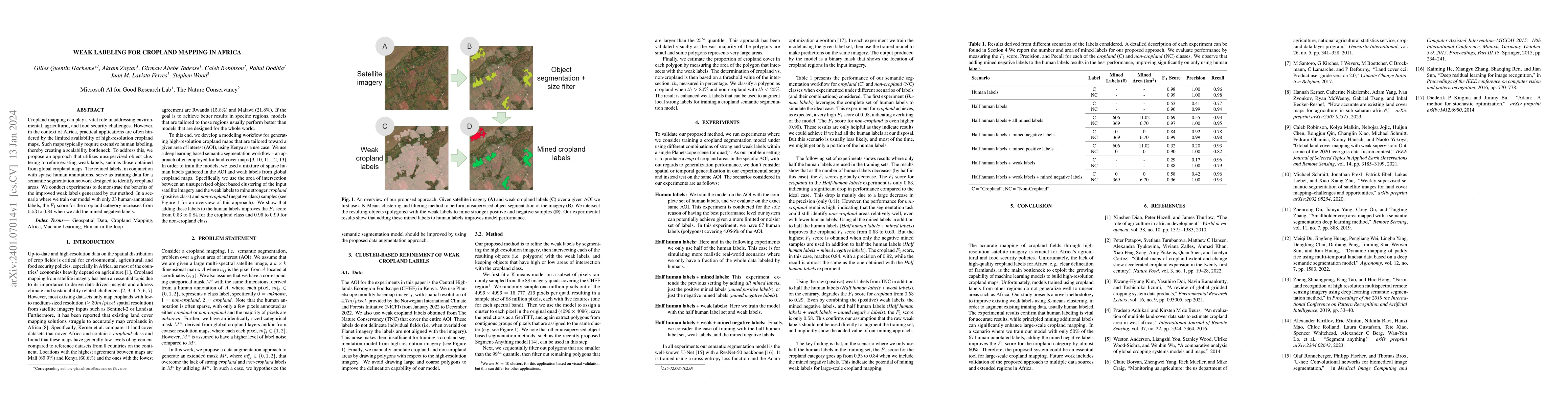
Cropland mapping can play a vital role in addressing environmental, agricultural, and food security challenges. However, in the context of Africa, practical applications are often hindered by the li...
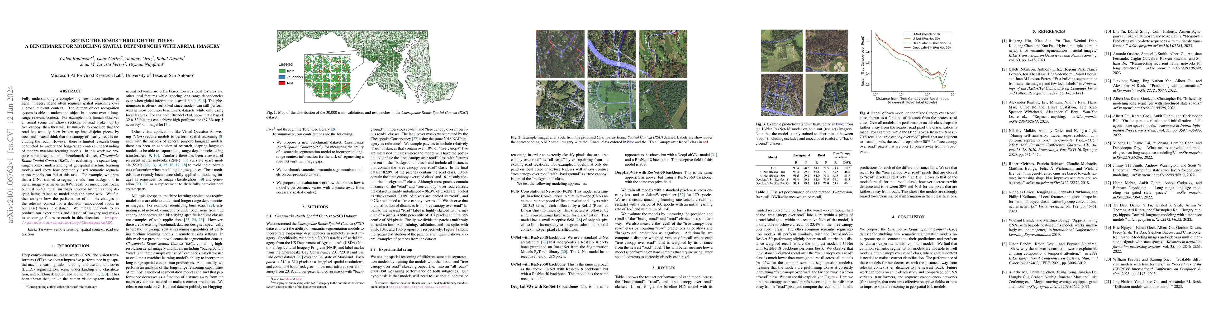
Fully understanding a complex high-resolution satellite or aerial imagery scene often requires spatial reasoning over a broad relevant context. The human object recognition system is able to underst...
This paper introduces a no-code, machine-readable documentation framework for open datasets, with a focus on responsible AI (RAI) considerations. The framework aims to improve comprehensibility, and...
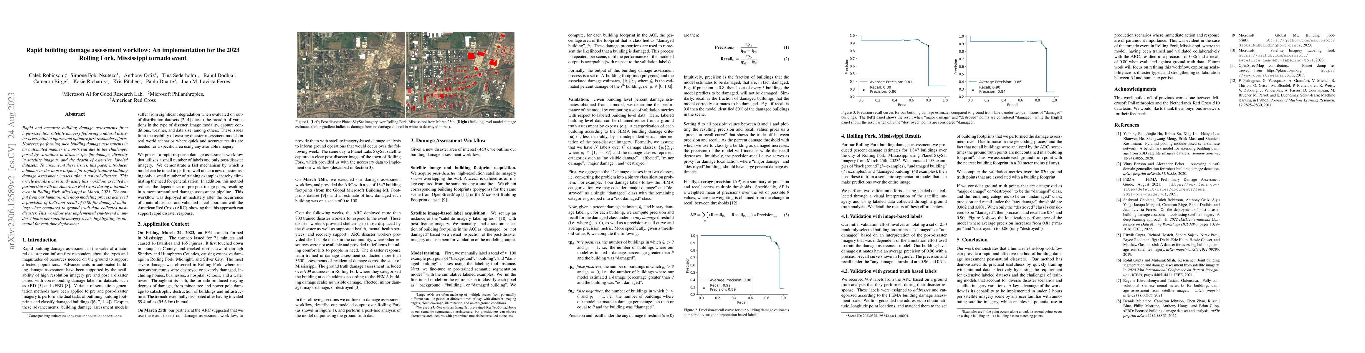
Rapid and accurate building damage assessments from high-resolution satellite imagery following a natural disaster is essential to inform and optimize first responder efforts. However, performing su...
Research in self-supervised learning (SSL) with natural images has progressed rapidly in recent years and is now increasingly being applied to and benchmarked with datasets containing remotely sense...
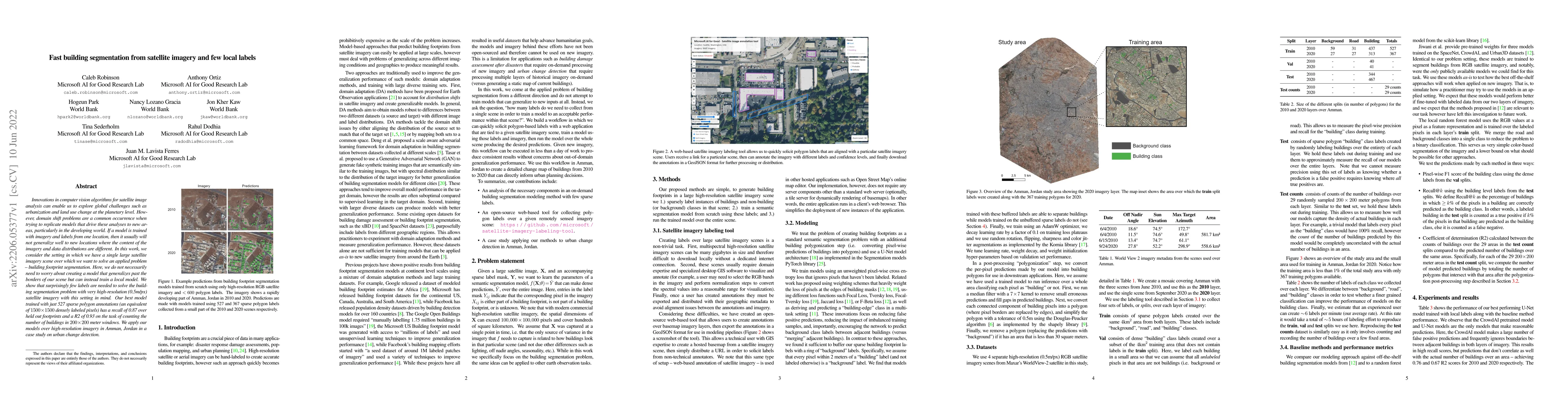
Innovations in computer vision algorithms for satellite image analysis can enable us to explore global challenges such as urbanization and land use change at the planetary level. However, domain shi...
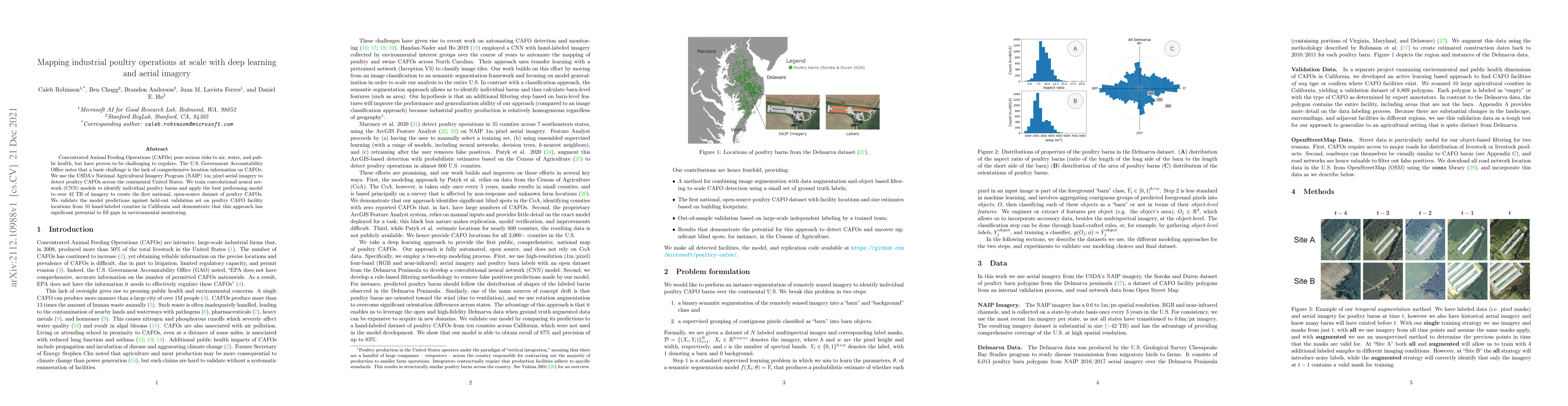
Concentrated Animal Feeding Operations (CAFOs) pose serious risks to air, water, and public health, but have proven to be challenging to regulate. The U.S. Government Accountability Office notes tha...
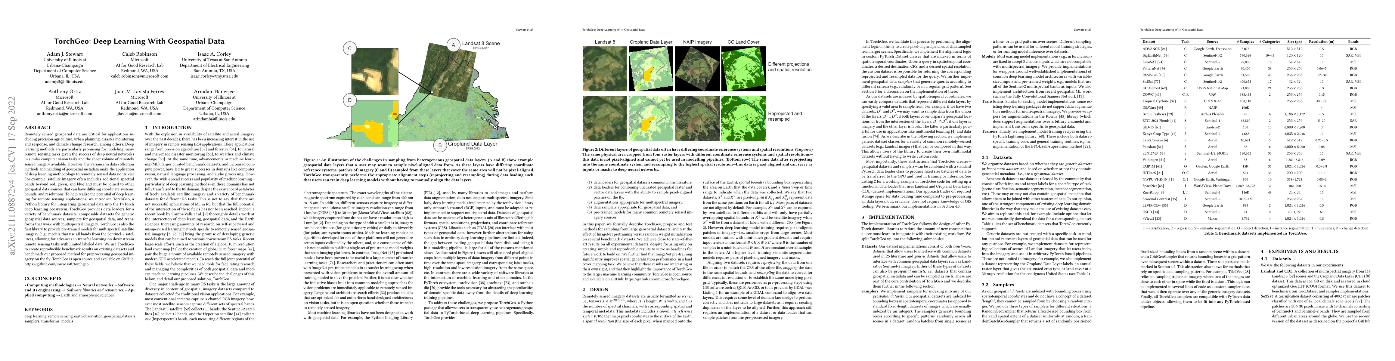
Remotely sensed geospatial data are critical for applications including precision agriculture, urban planning, disaster monitoring and response, and climate change research, among others. Deep learn...
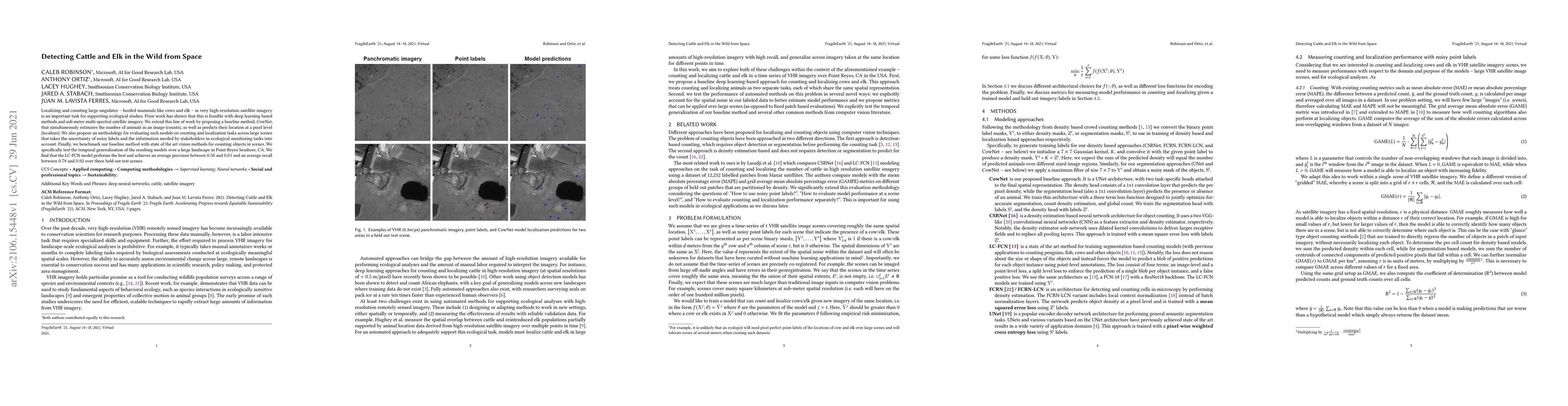
Localizing and counting large ungulates -- hoofed mammals like cows and elk -- in very high-resolution satellite imagery is an important task for supporting ecological studies. Prior work has shown ...
AI for good (AI4G) projects involve developing and applying artificial intelligence (AI) based solutions to further goals in areas such as sustainability, health, humanitarian aid, and social justic...
All datasets contain some biases, often unintentional, due to how they were acquired and annotated. These biases distort machine-learning models' performance, creating spurious correlations that the...
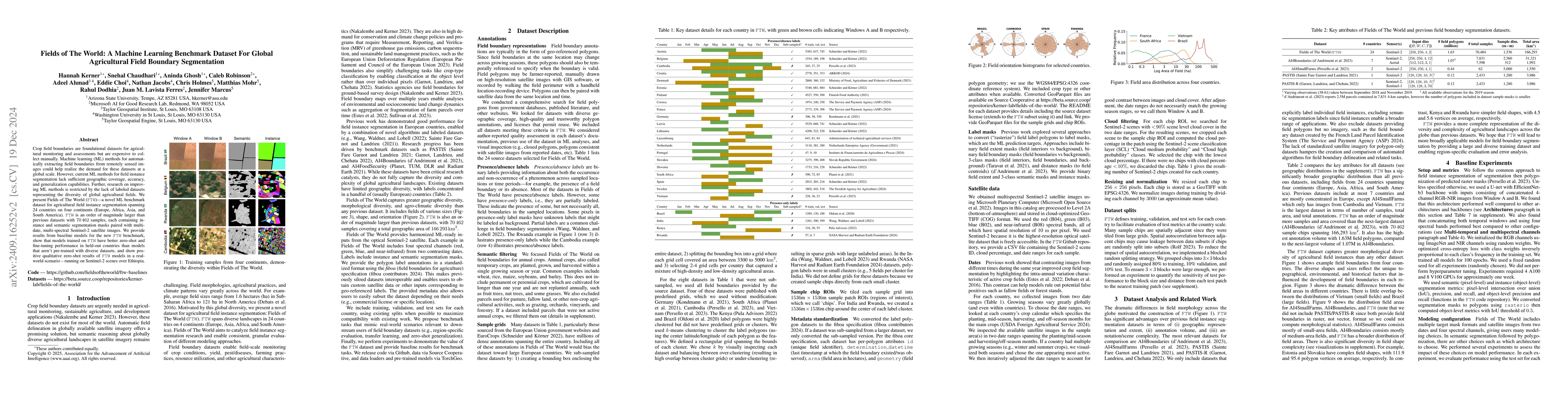
Crop field boundaries are foundational datasets for agricultural monitoring and assessments but are expensive to collect manually. Machine learning (ML) methods for automatically extracting field boun...
Approximately 20% of Africa's population suffered from undernourishment, and 868 million people experienced moderate to severe food insecurity in 2022. Land-use and land-cover maps provide crucial ins...
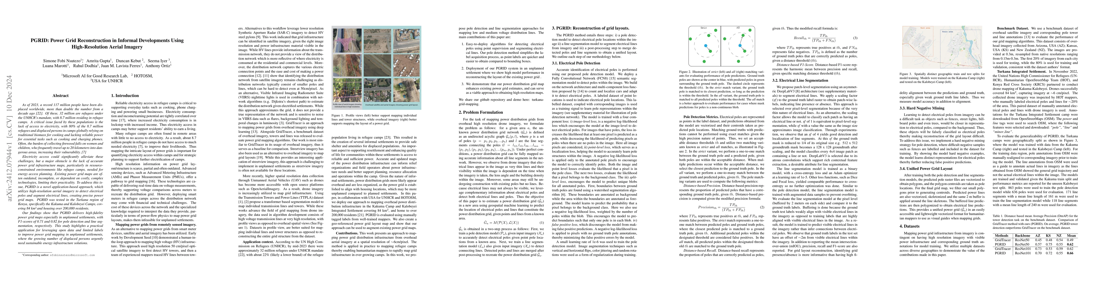
As of 2023, a record 117 million people have been displaced worldwide, more than double the number from a decade ago [22]. Of these, 32 million are refugees under the UNHCR mandate, with 8.7 million r...
Acquiring, processing, and visualizing geospatial data requires significant computing resources, especially for large spatio-temporal domains. This challenge hinders the rapid discovery of predictive ...
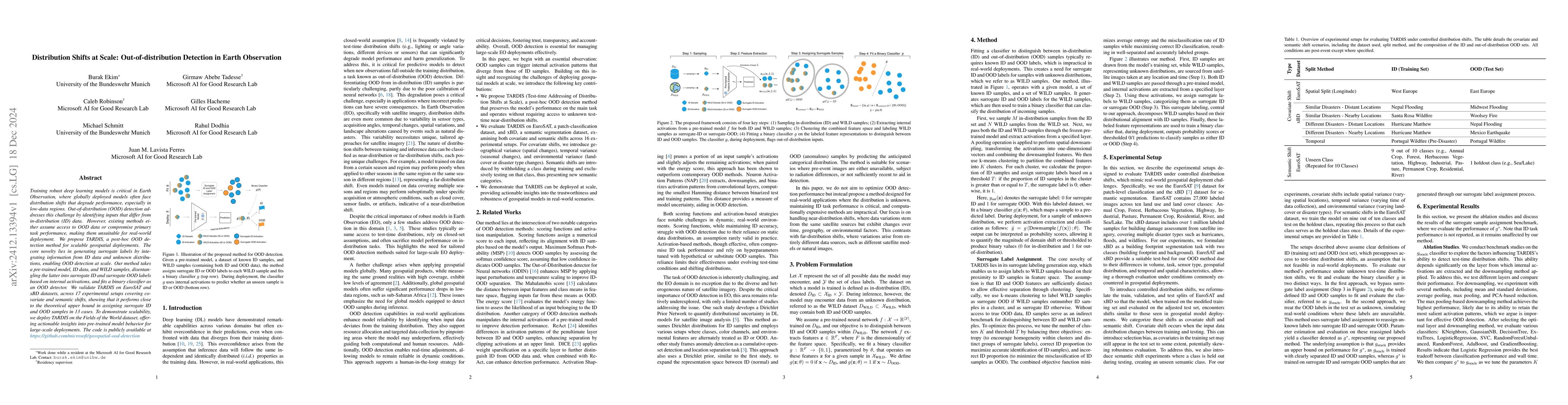
Training robust deep learning models is critical in Earth Observation, where globally deployed models often face distribution shifts that degrade performance, especially in low-data regions. Out-of-di...
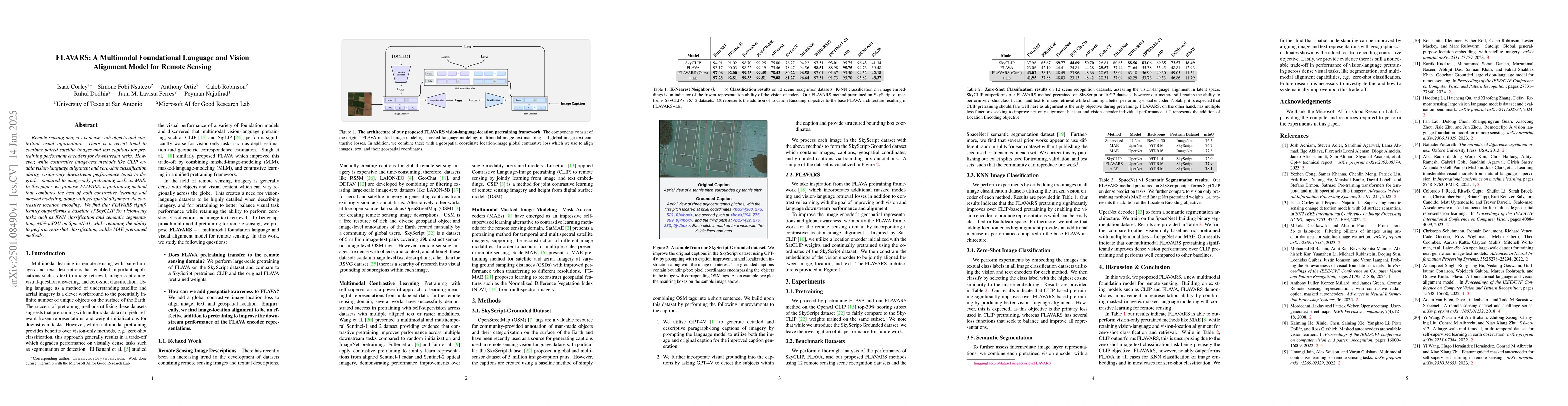
Remote sensing imagery is dense with objects and contextual visual information. There is a recent trend to combine paired satellite images and text captions for pretraining performant encoders for dow...
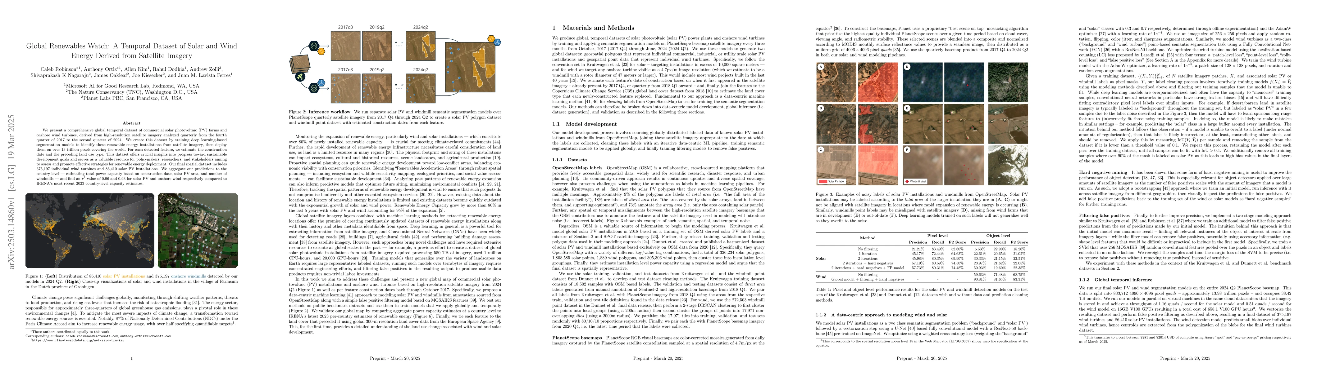
We present a comprehensive global temporal dataset of commercial solar photovoltaic (PV) farms and onshore wind turbines, derived from high-resolution satellite imagery analyzed quarterly from the fou...
The increasing accessibility of remotely sensed data and the potential of such data to inform large-scale decision-making has driven the development of deep learning models for many Earth Observation ...
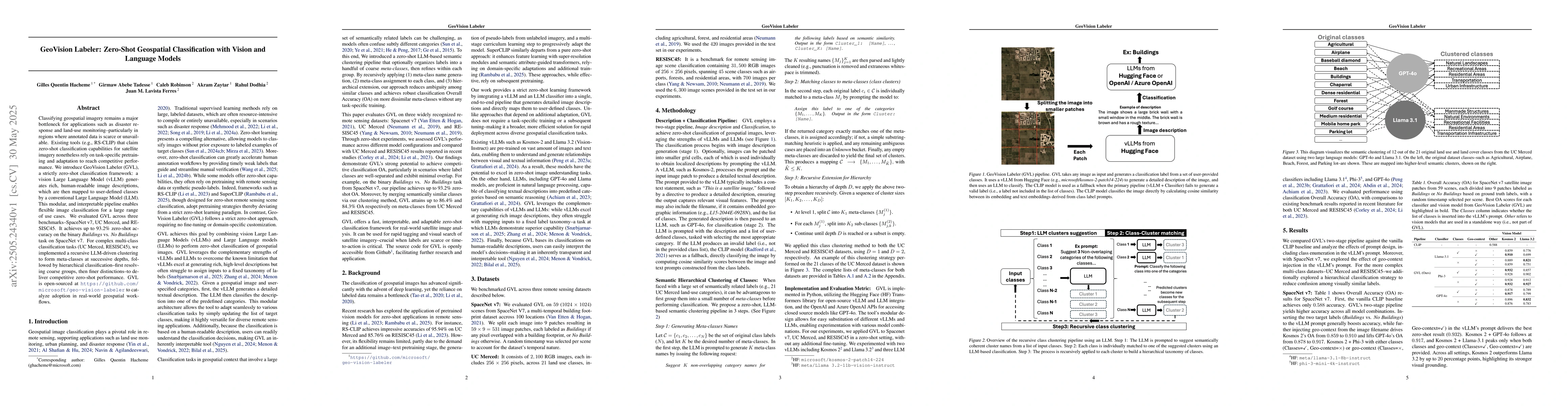
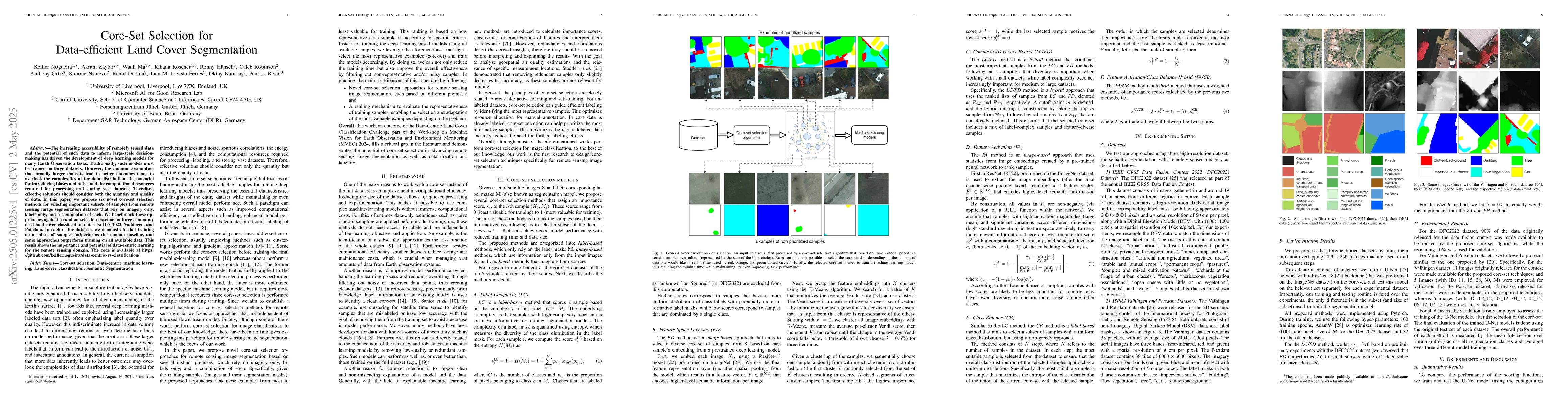
Classifying geospatial imagery remains a major bottleneck for applications such as disaster response and land-use monitoring-particularly in regions where annotated data is scarce or unavailable. Exis...
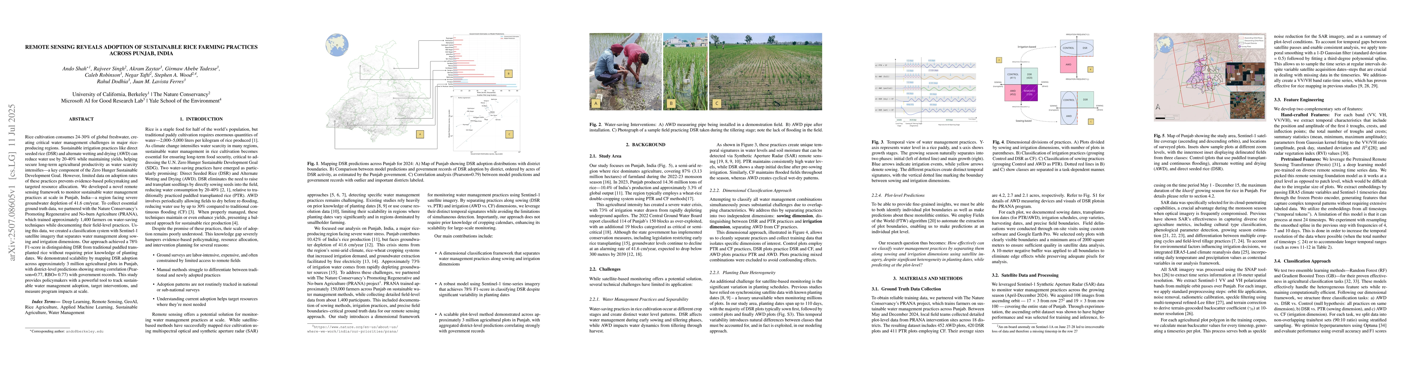
Rice cultivation consumes 24-30% of global freshwater, creating critical water management challenges in major rice-producing regions. Sustainable irrigation practices like direct seeded rice (DSR) and...
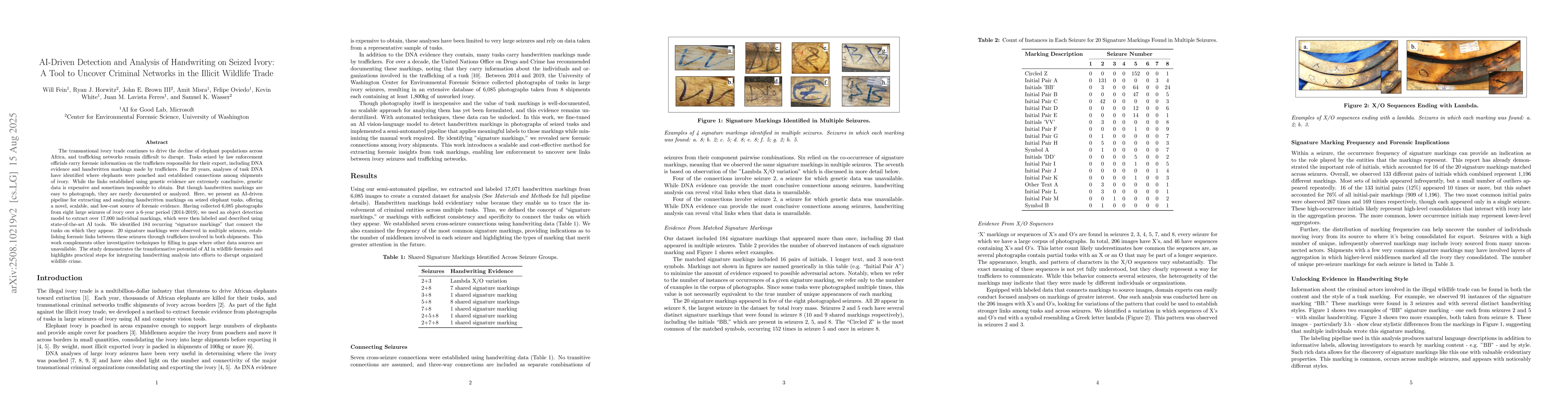
The transnational ivory trade continues to drive the decline of elephant populations across Africa, and trafficking networks remain difficult to disrupt. Tusks seized by law enforcement officials carr...
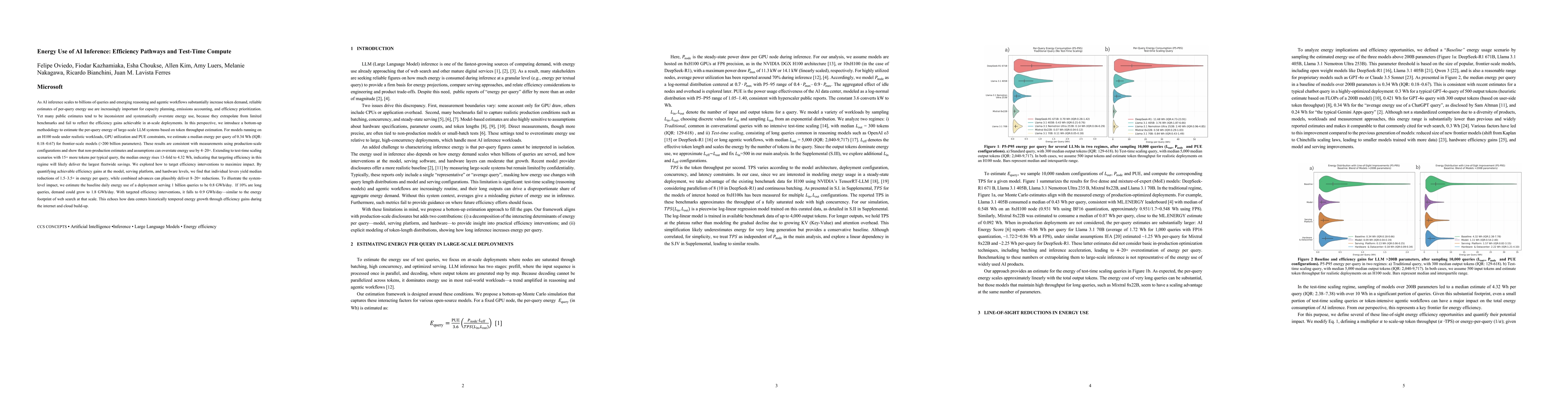
As AI inference scales to billions of queries and emerging reasoning and agentic workflows increase token demand, reliable estimates of per-query energy use are increasingly important for capacity pla...
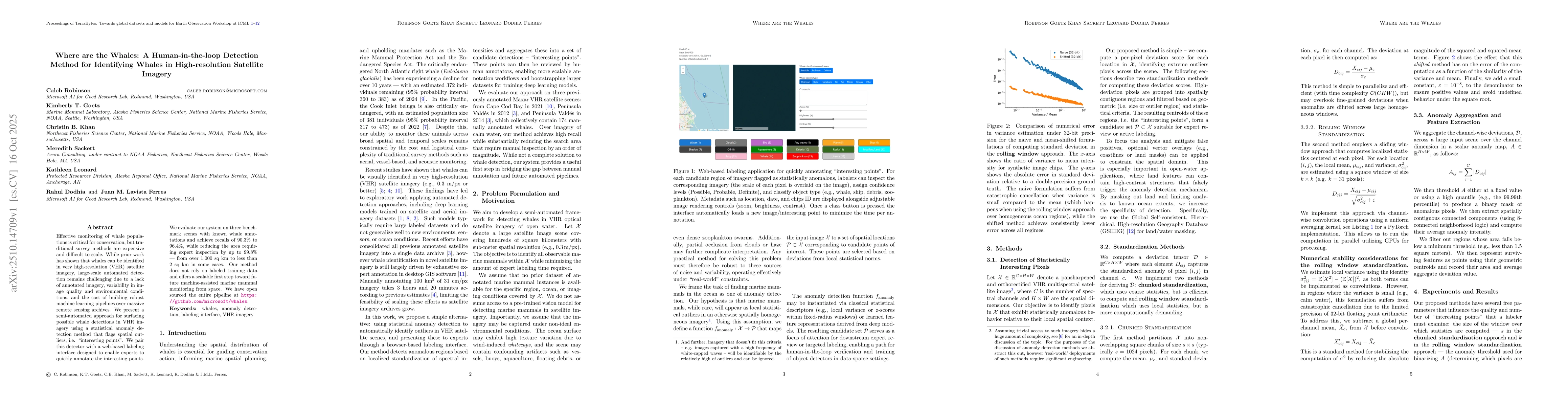
Effective monitoring of whale populations is critical for conservation, but traditional survey methods are expensive and difficult to scale. While prior work has shown that whales can be identified in...
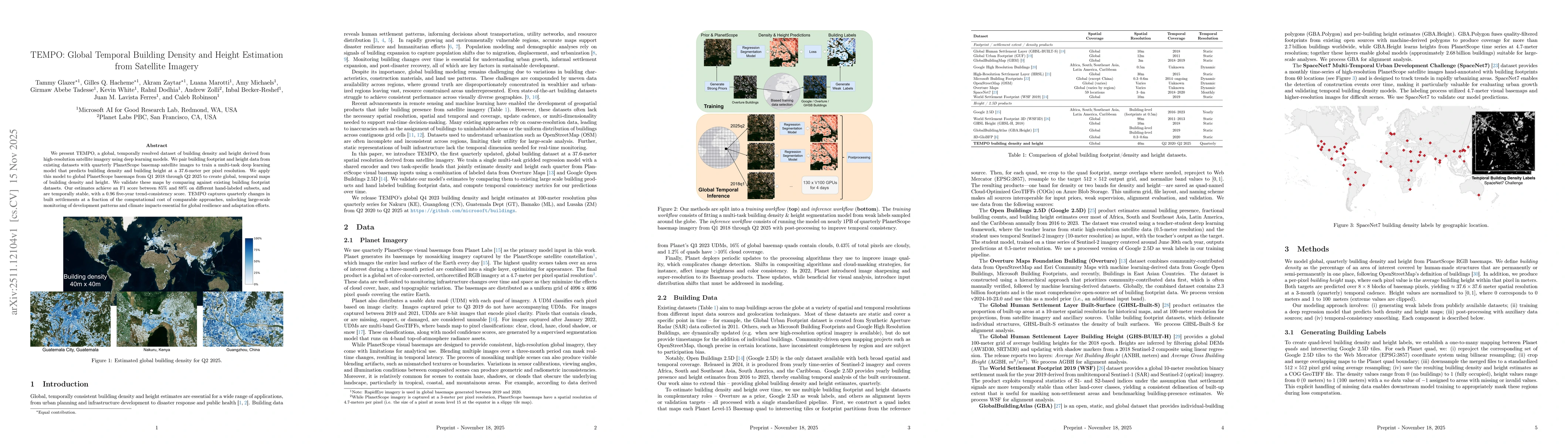
We present TEMPO, a global, temporally resolved dataset of building density and height derived from high-resolution satellite imagery using deep learning models. We pair building footprint and height ...
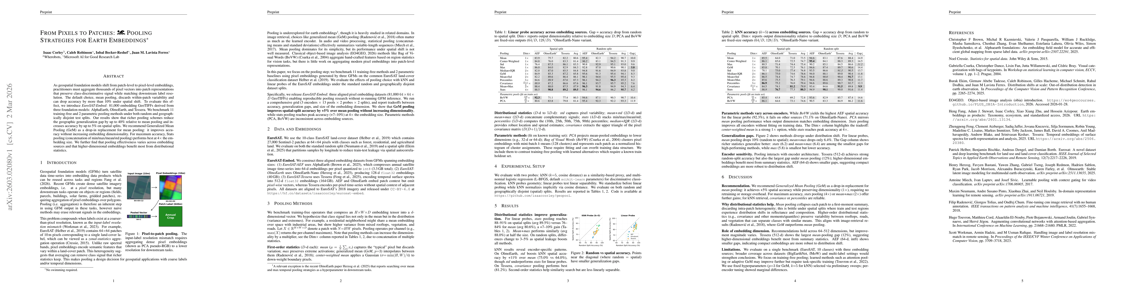
As geospatial foundation models shift from patch-level to pixel-level embeddings, practitioners must aggregate thousands of pixel vectors into patch representations that preserve class-discriminative ...
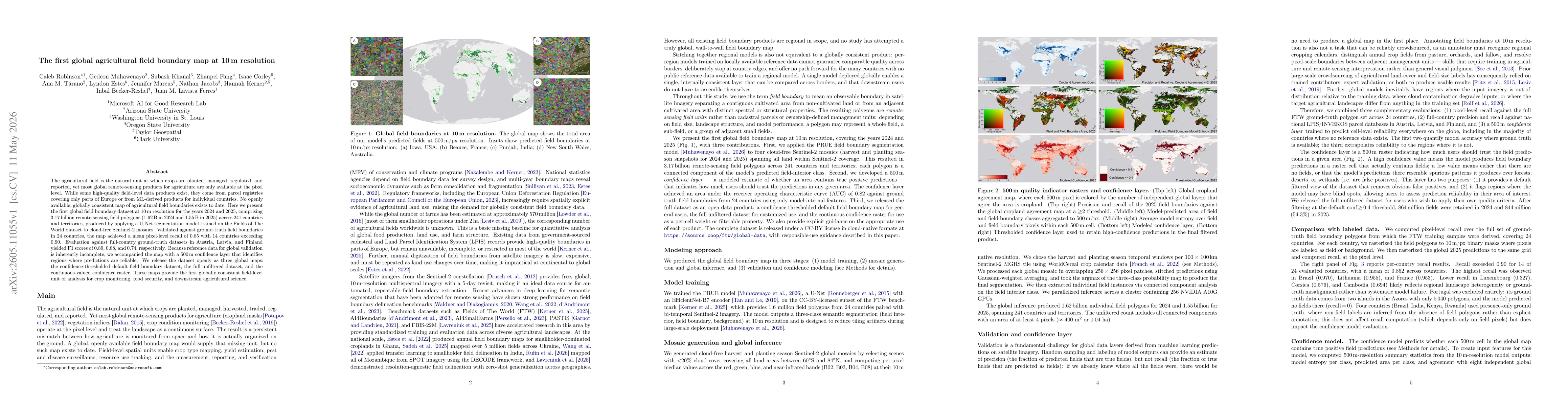
The agricultural field is the natural unit at which crops are planted, managed, regulated, and reported, yet most global remote-sensing products for agriculture are only available at the pixel level. ...
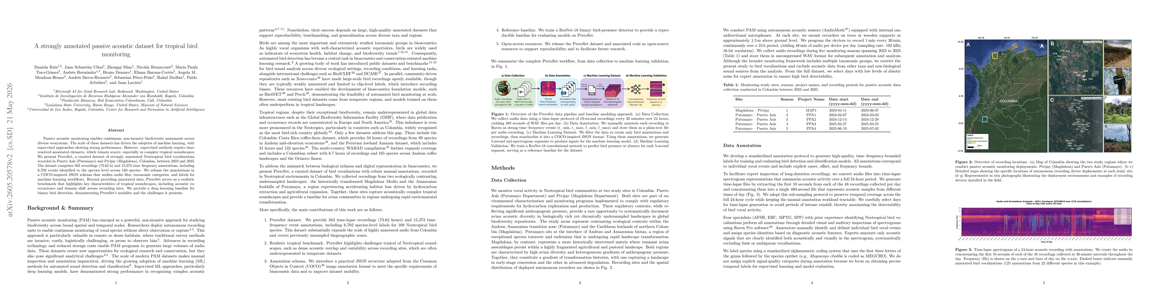
Passive acoustic monitoring enables continuous, non-invasive biodiversity assessment across diverse ecosystems. The scale of these datasets has driven the adoption of machine learning, with supervised...
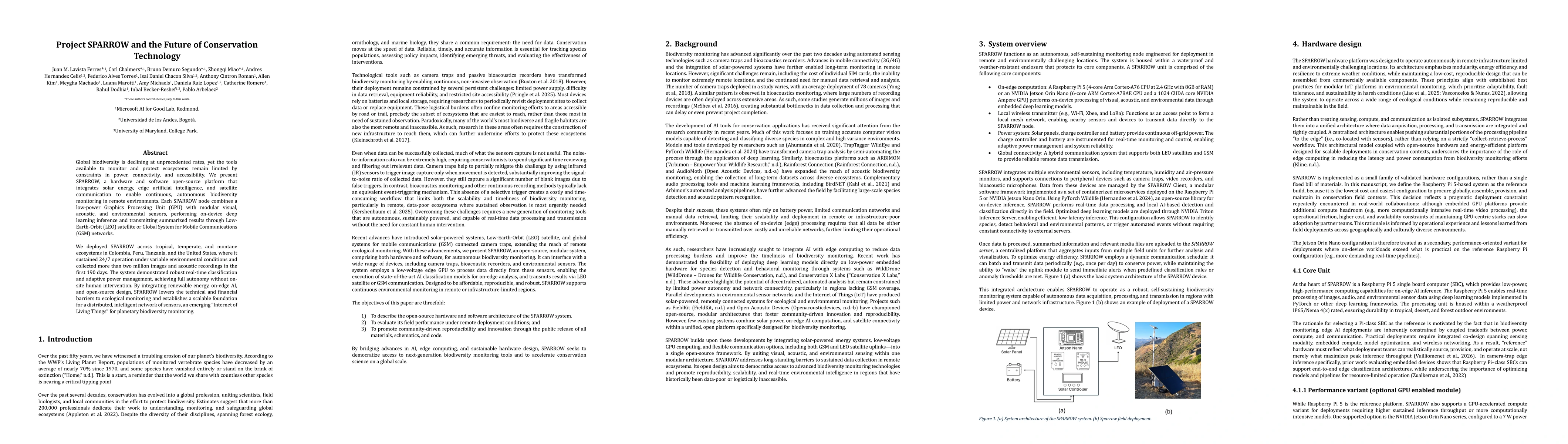
Global biodiversity is declining at unprecedented rates, yet the tools available to monitor and protect ecosystems remain limited by constraints in power, connectivity, and accessibility. We present S...
Automated aerial wildlife surveys increasingly rely on deep learning, yet standard object detectors require bounding-box annotations, reported to be up to seven times slower and three times more expen...
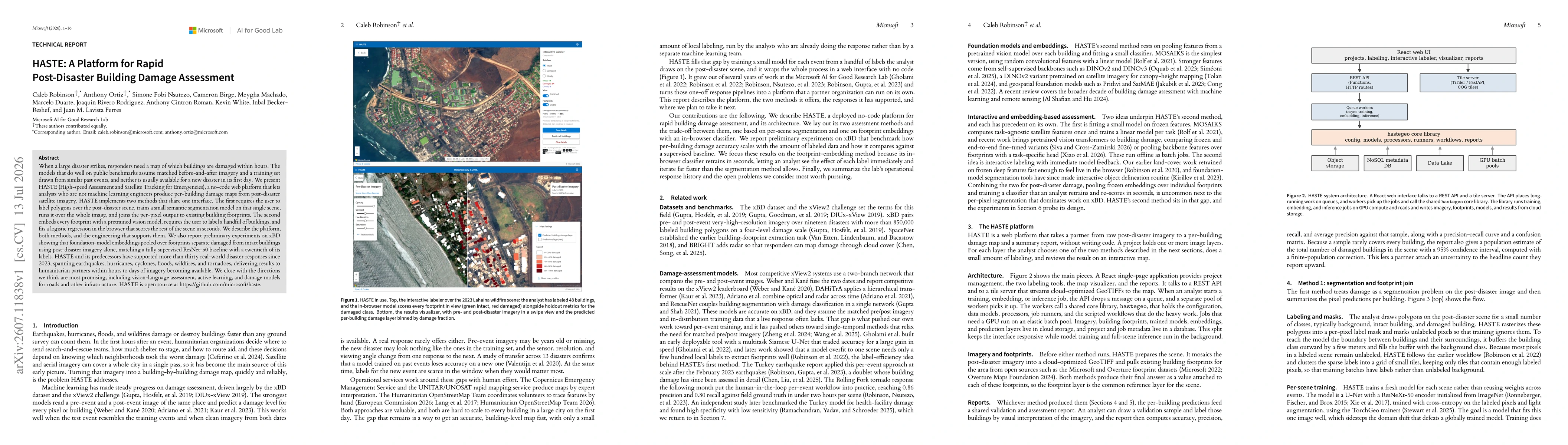
When a large disaster strikes, responders need a map of which buildings are damaged within hours. The models that do well on public benchmarks assume matched before-and-after imagery and a training se...