Academic Profile
Statistics
Similar Authors
Papers on arXiv
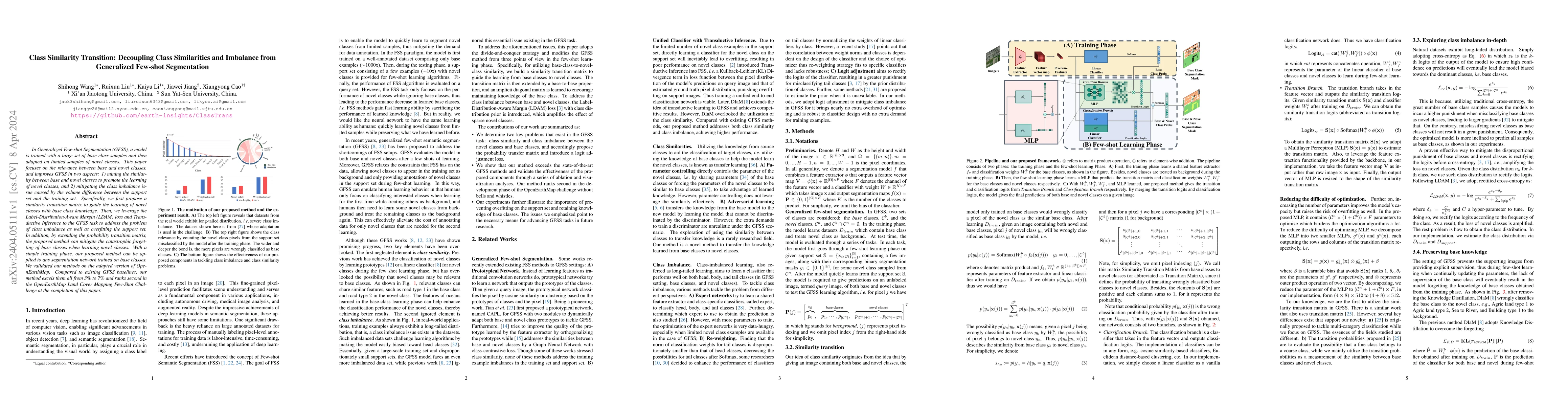
In Generalized Few-shot Segmentation (GFSS), a model is trained with a large corpus of base class samples and then adapted on limited samples of novel classes. This paper focuses on the relevance be...
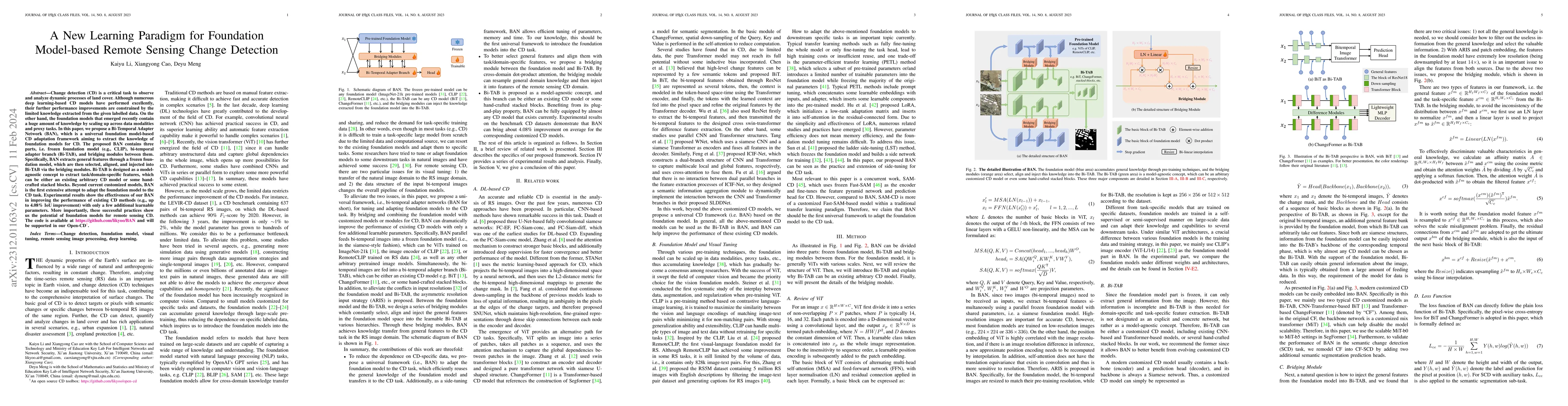
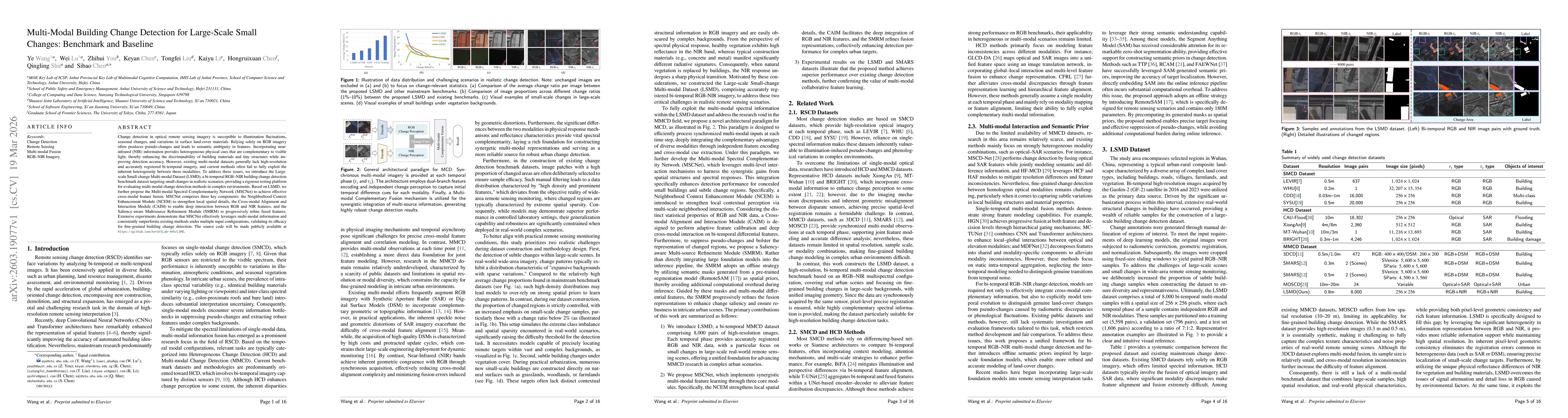
Change detection (CD) is a critical task to observe and analyze dynamic processes of land cover. Although numerous deep learning-based CD models have performed excellently, their further performance...
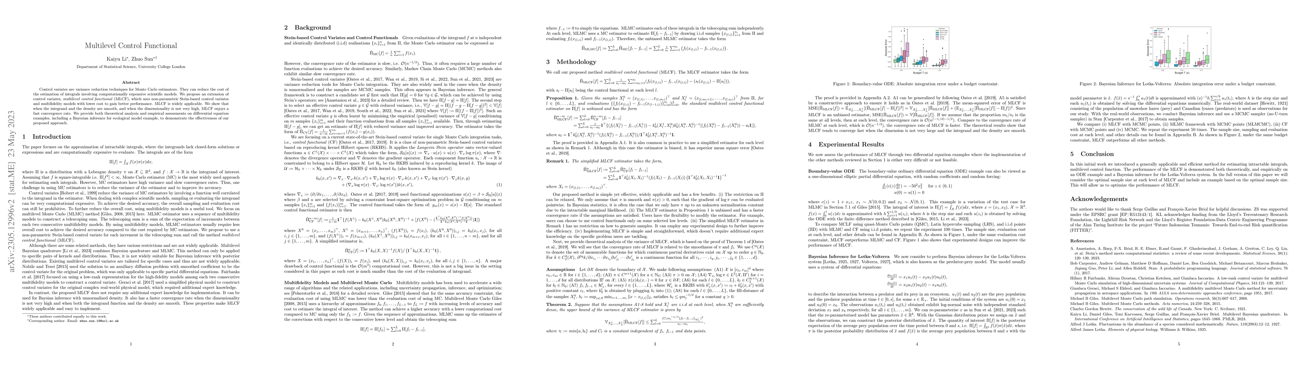
Control variates are variance reduction techniques for Monte Carlo estimators. They can reduce the cost of the estimation of integrals involving computationally expensive scientific models. We propo...
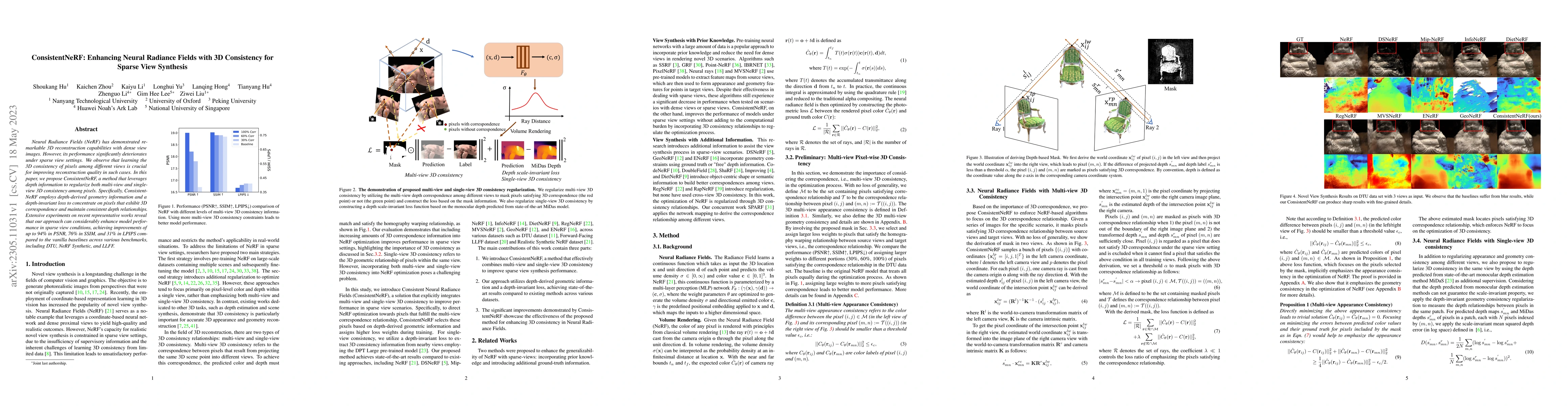
Neural Radiance Fields (NeRF) has demonstrated remarkable 3D reconstruction capabilities with dense view images. However, its performance significantly deteriorates under sparse view settings. We ob...
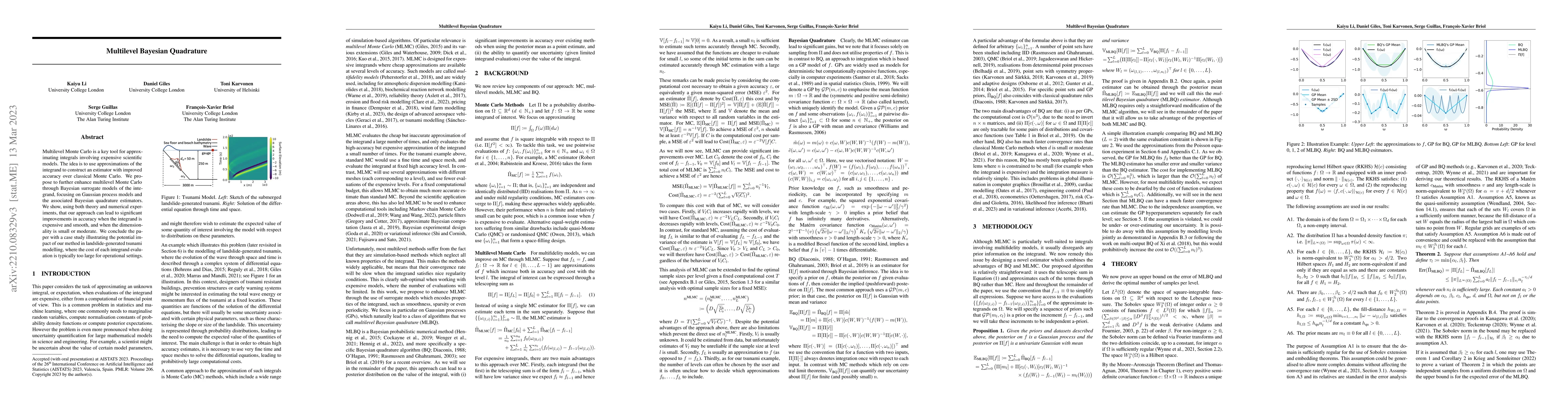
Multilevel Monte Carlo is a key tool for approximating integrals involving expensive scientific models. The idea is to use approximations of the integrand to construct an estimator with improved acc...
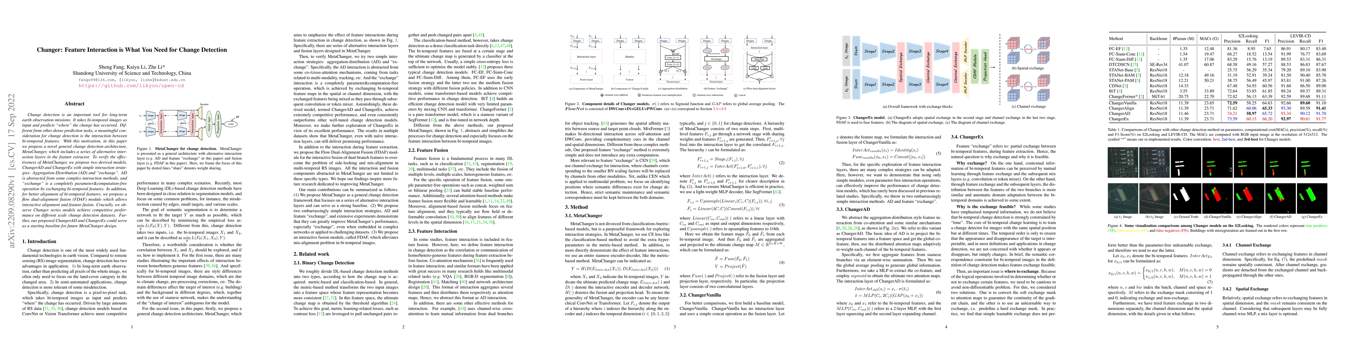
Change detection is an important tool for long-term earth observation missions. It takes bi-temporal images as input and predicts "where" the change has occurred. Different from other dense predicti...
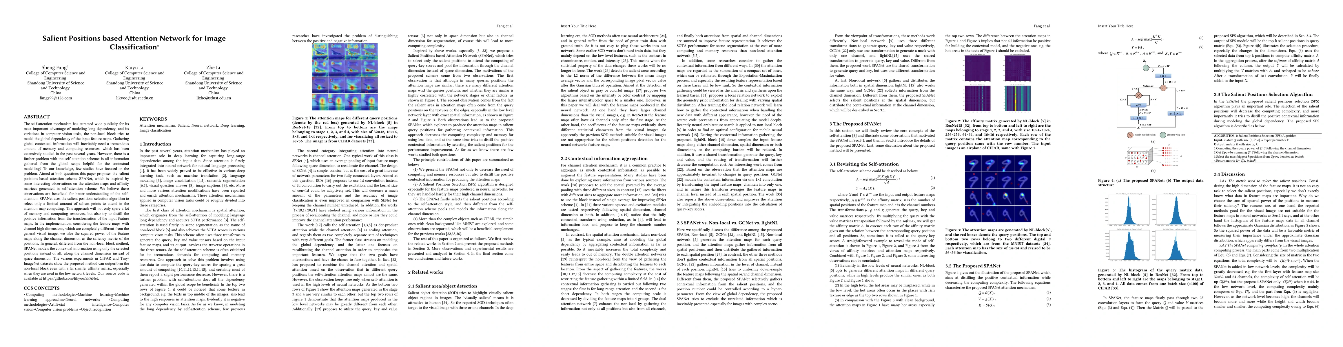
The self-attention mechanism has attracted wide publicity for its most important advantage of modeling long dependency, and its variations in computer vision tasks, the non-local block tries to mode...
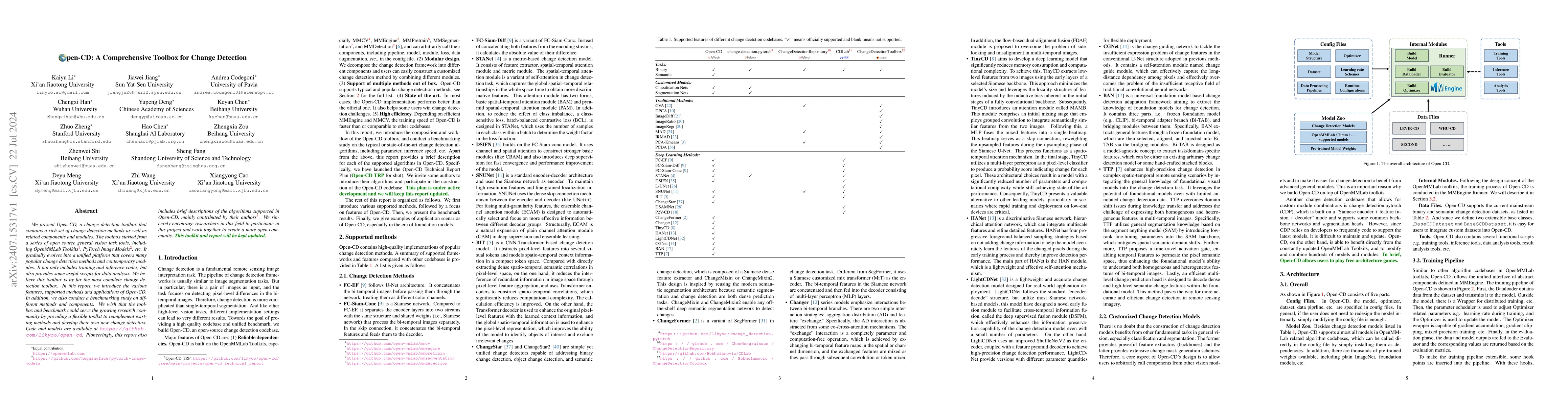
We present Open-CD, a change detection toolbox that contains a rich set of change detection methods as well as related components and modules. The toolbox started from a series of open source general ...
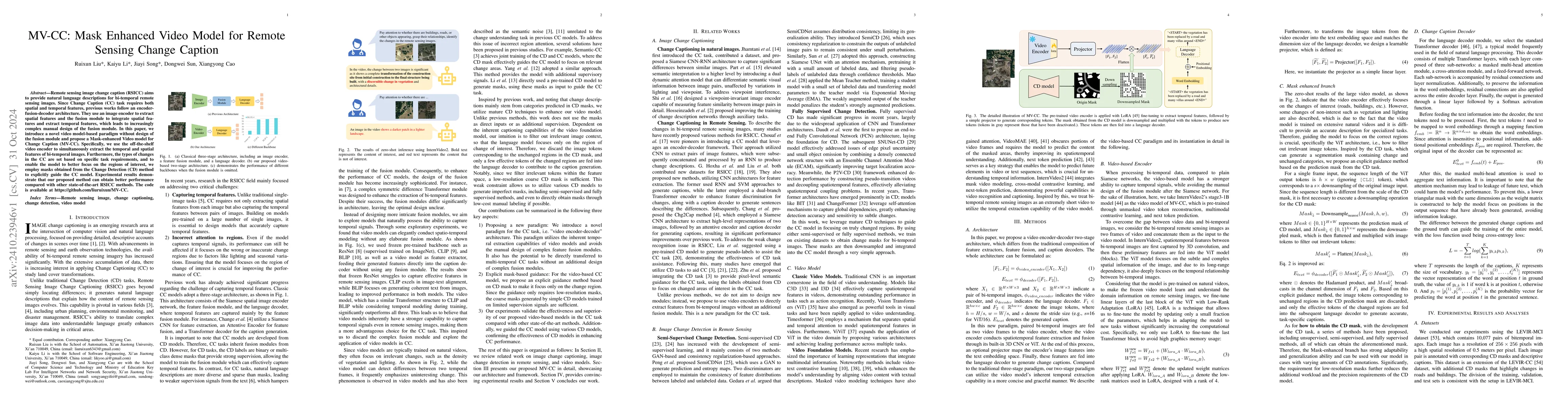
Remote sensing image change caption (RSICC) aims to provide natural language descriptions for bi-temporal remote sensing images. Since Change Caption (CC) task requires both spatial and temporal featu...
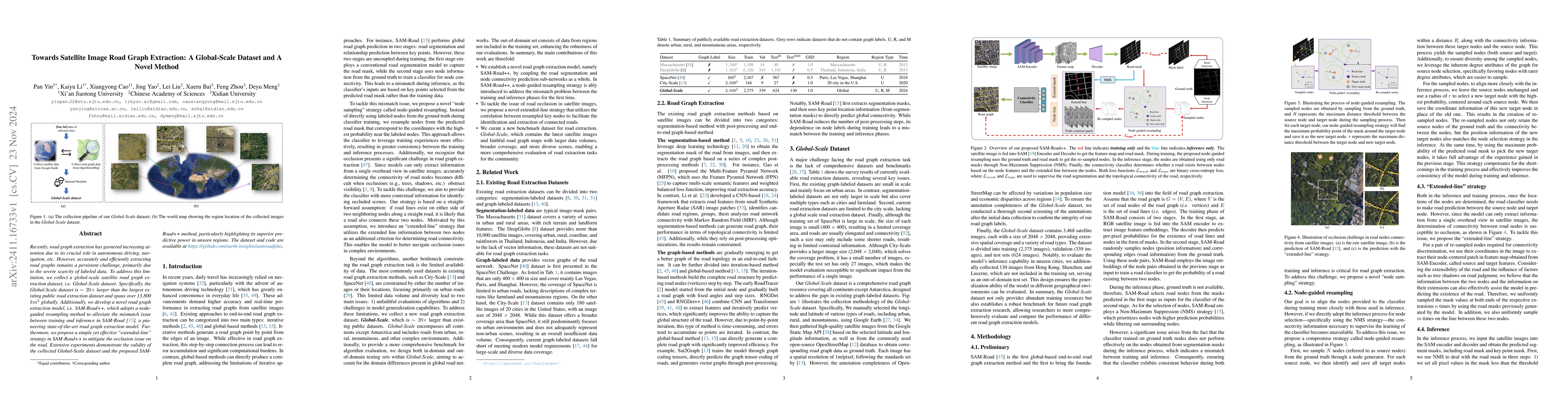
Recently, road graph extraction has garnered increasing attention due to its crucial role in autonomous driving, navigation, etc. However, accurately and efficiently extracting road graphs remains a p...
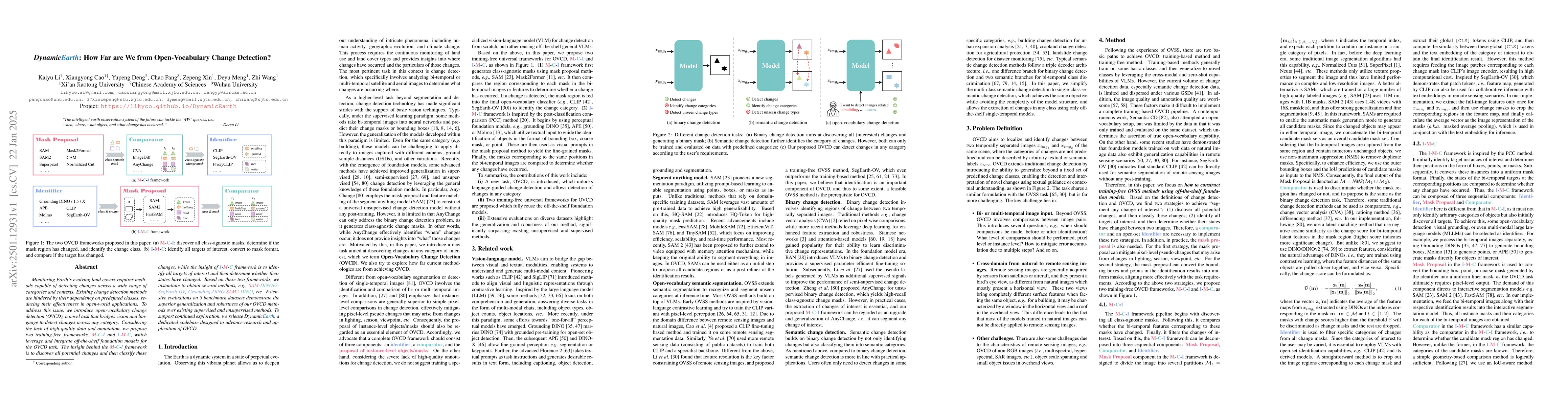
Monitoring Earth's evolving land covers requires methods capable of detecting changes across a wide range of categories and contexts. Existing change detection methods are hindered by their dependency...
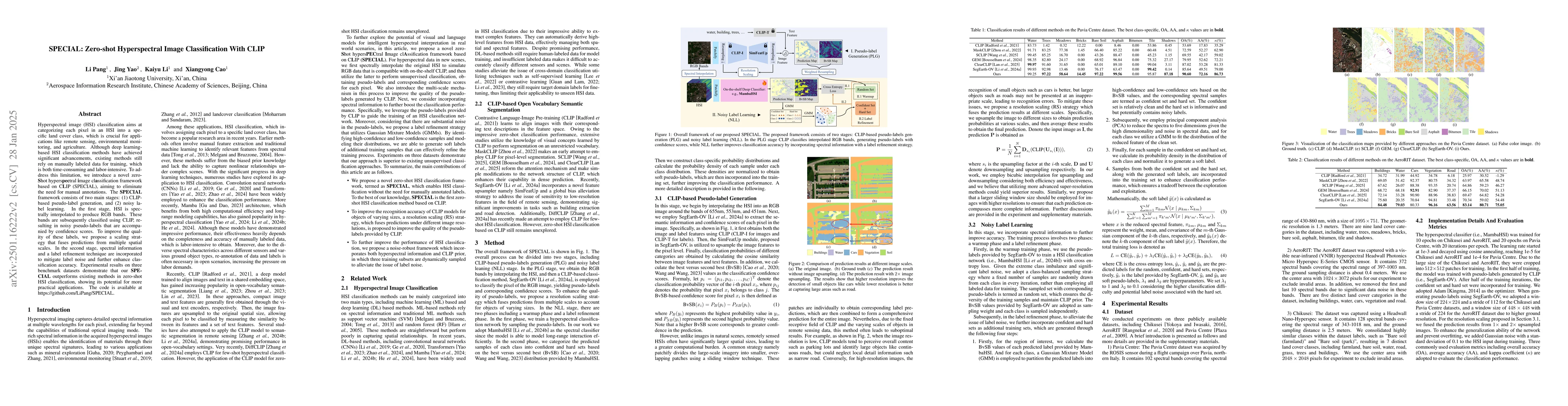
Hyperspectral image (HSI) classification aims at categorizing each pixel in an HSI into a specific land cover class, which is crucial for applications like remote sensing, environmental monitoring, an...
Image translation for change detection or classification in bi-temporal remote sensing images is unique. Although it can acquire paired images, it is still unsupervised. Moreover, strict semantic pres...
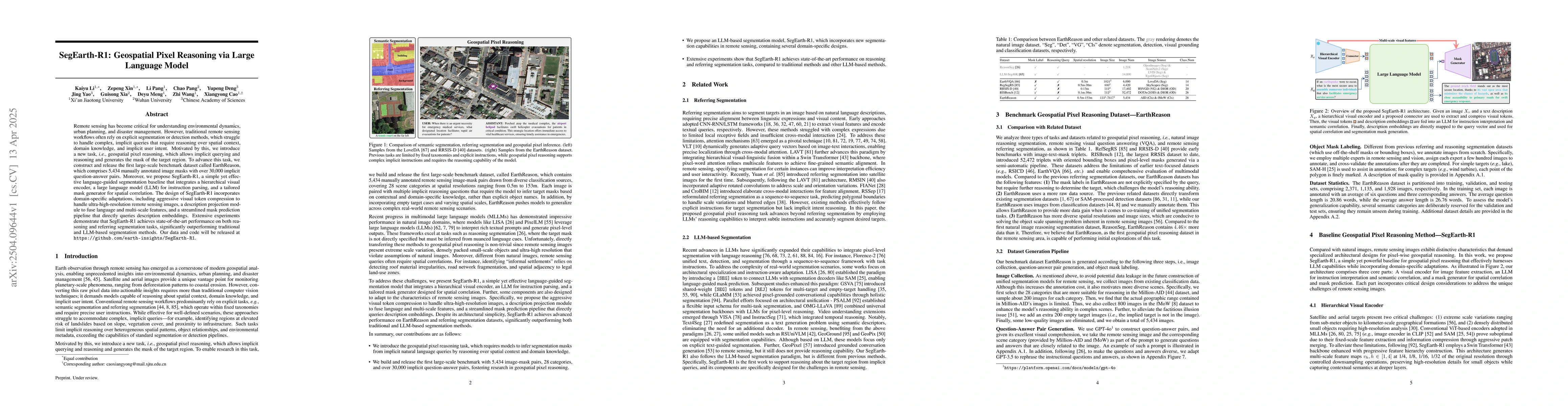
Remote sensing has become critical for understanding environmental dynamics, urban planning, and disaster management. However, traditional remote sensing workflows often rely on explicit segmentation ...
Semantic segmentation in remote sensing images is crucial for various applications, yet its performance is heavily reliant on large-scale, high-quality pixel-wise annotations, which are notoriously ex...
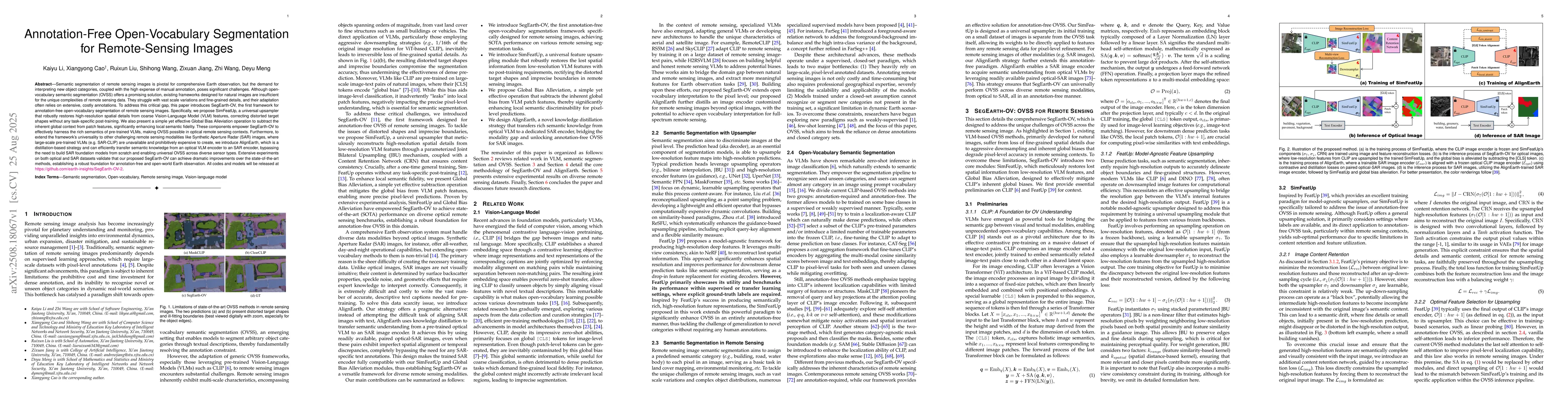
Semantic segmentation of remote sensing (RS) images is pivotal for comprehensive Earth observation, but the demand for interpreting new object categories, coupled with the high expense of manual annot...
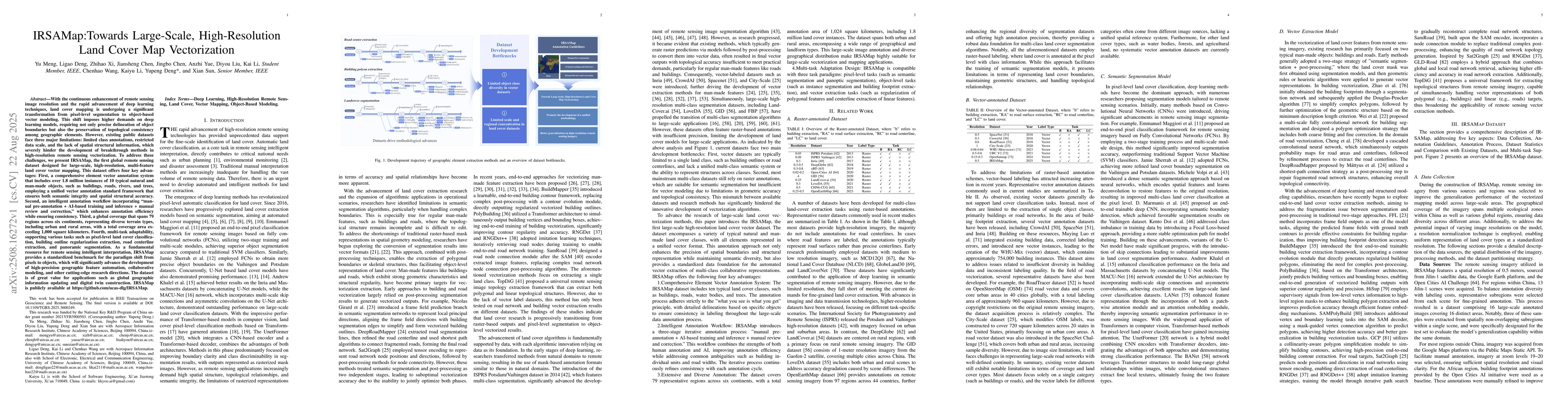
With the enhancement of remote sensing image resolution and the rapid advancement of deep learning, land cover mapping is transitioning from pixel-level segmentation to object-based vector modeling. T...
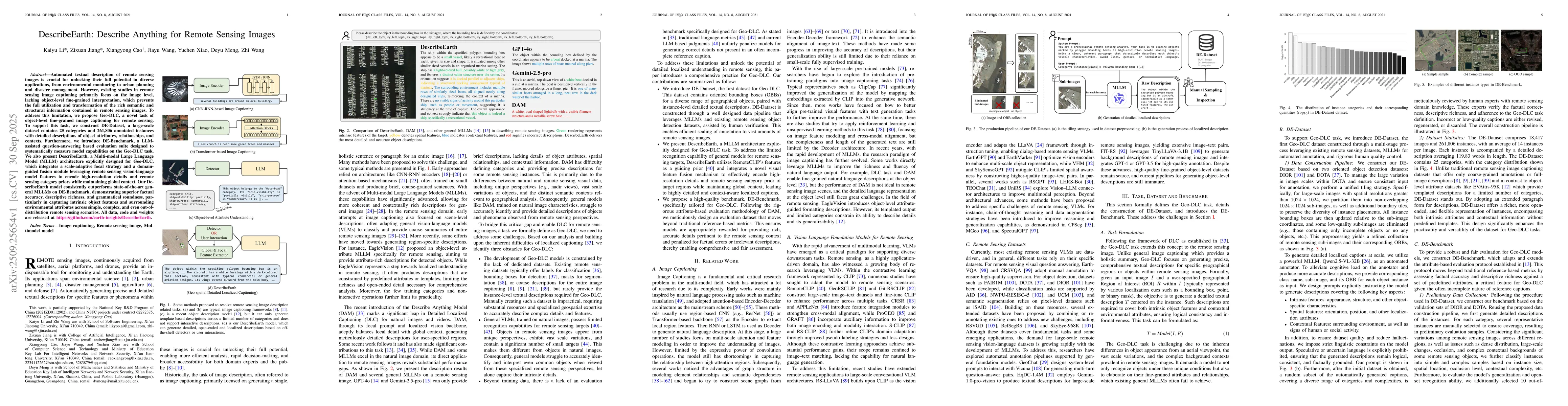
Automated textual description of remote sensing images is crucial for unlocking their full potential in diverse applications, from environmental monitoring to urban planning and disaster management. H...
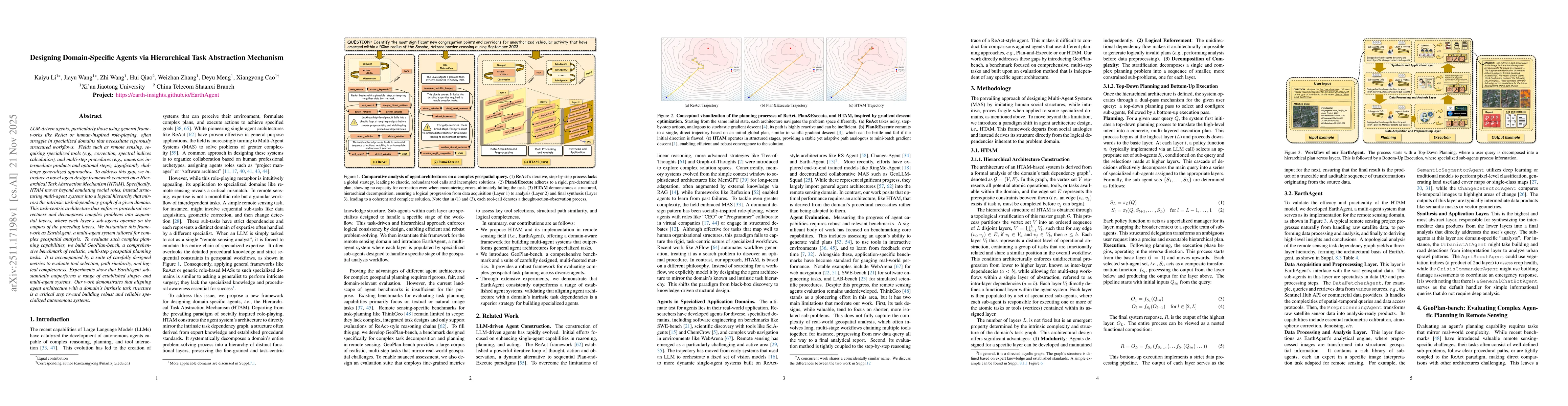
LLM-driven agents, particularly those using general frameworks like ReAct or human-inspired role-playing, often struggle in specialized domains that necessitate rigorously structured workflows. Fields...
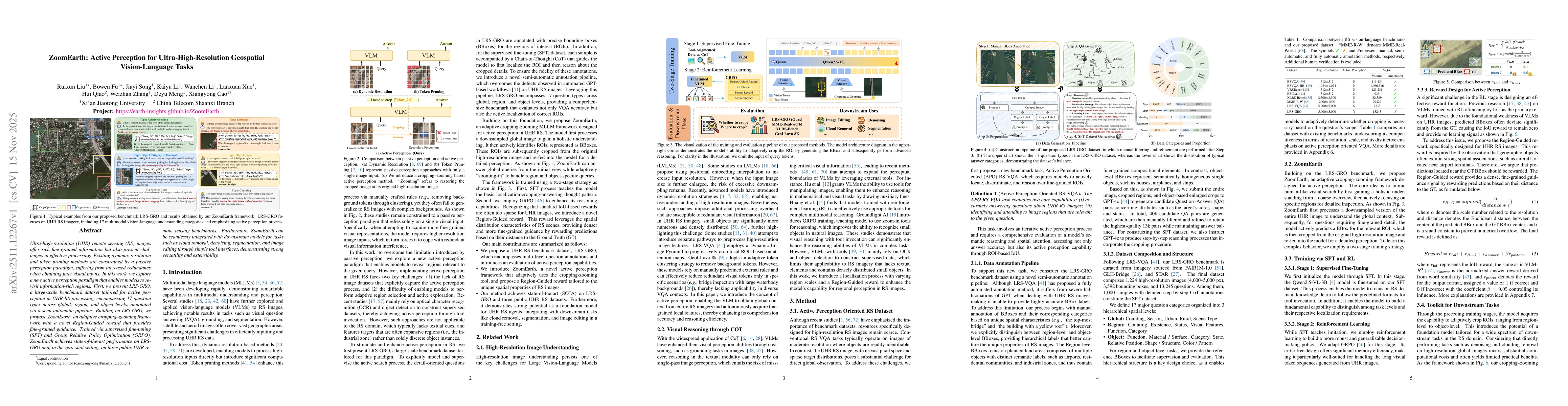
Ultra-high-resolution (UHR) remote sensing (RS) images offer rich fine-grained information but also present challenges in effective processing. Existing dynamic resolution and token pruning methods ar...
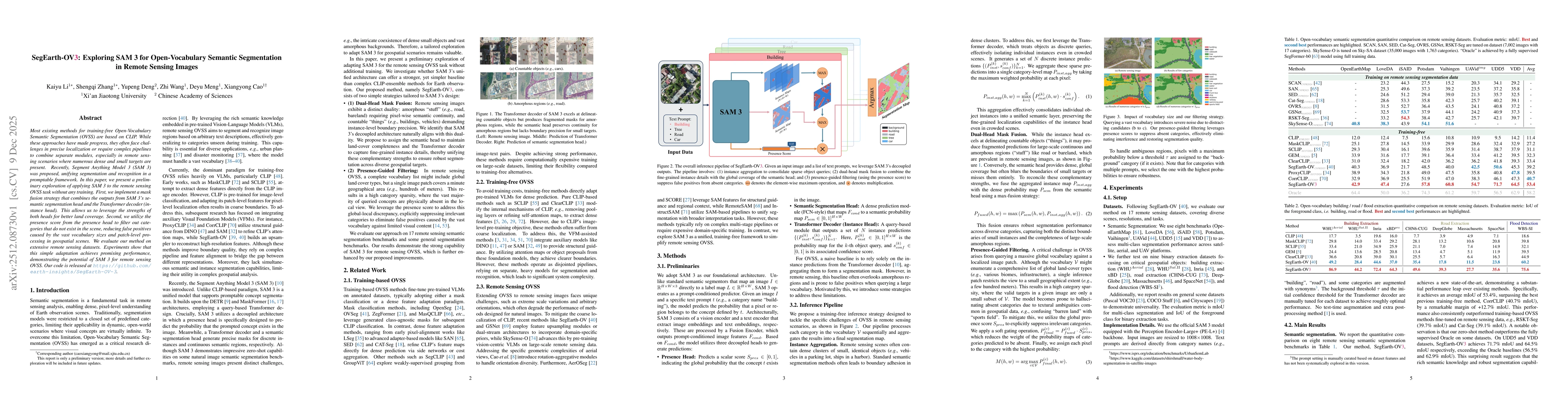
Most existing methods for training-free Open-Vocabulary Semantic Segmentation (OVSS) are based on CLIP. While these approaches have made progress, they often face challenges in precise localization or...
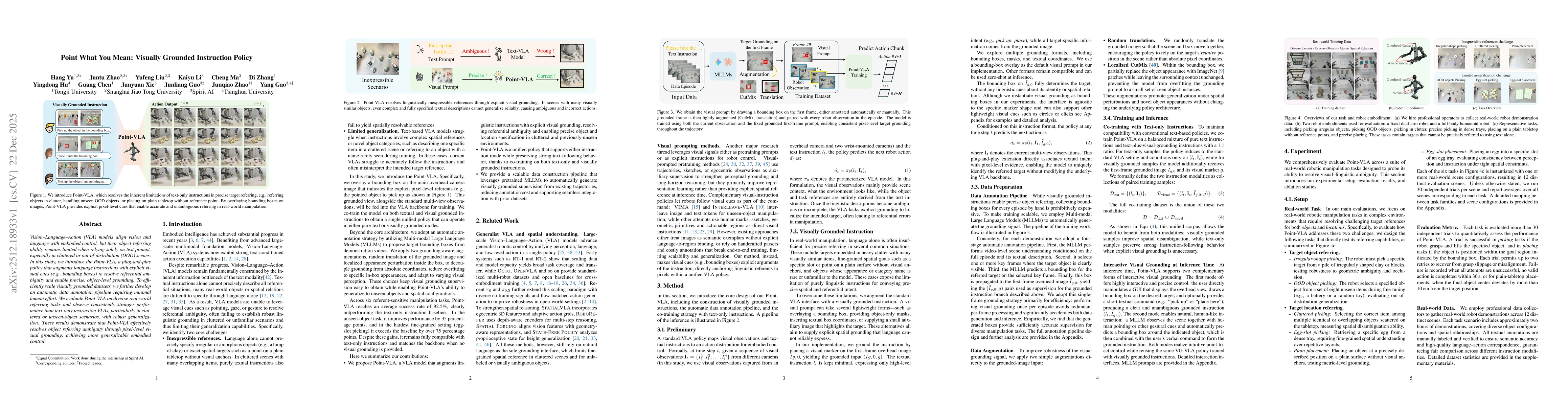
Vision-Language-Action (VLA) models align vision and language with embodied control, but their object referring ability remains limited when relying solely on text prompt, especially in cluttered or o...
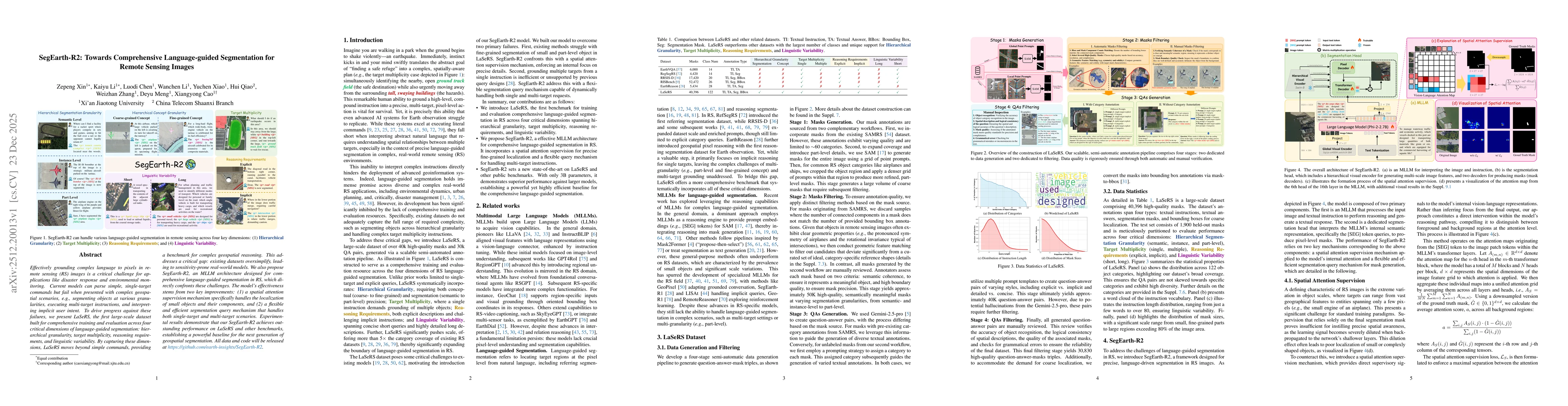
Effectively grounding complex language to pixels in remote sensing (RS) images is a critical challenge for applications like disaster response and environmental monitoring. Current models can parse si...
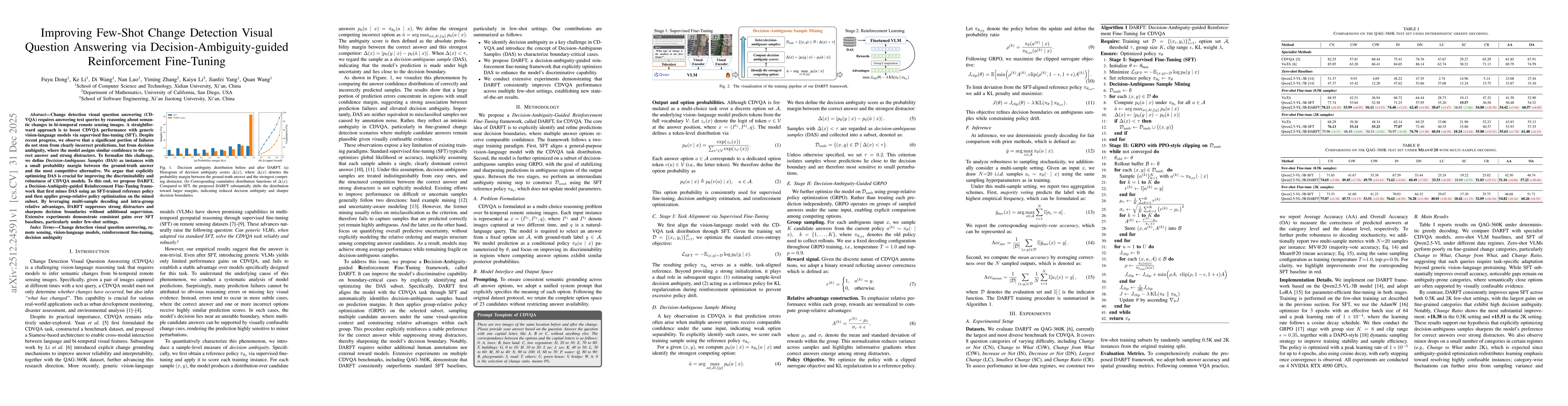
Change detection visual question answering (CDVQA) requires answering text queries by reasoning about semantic changes in bi-temporal remote sensing images. A straightforward approach is to boost CDVQ...
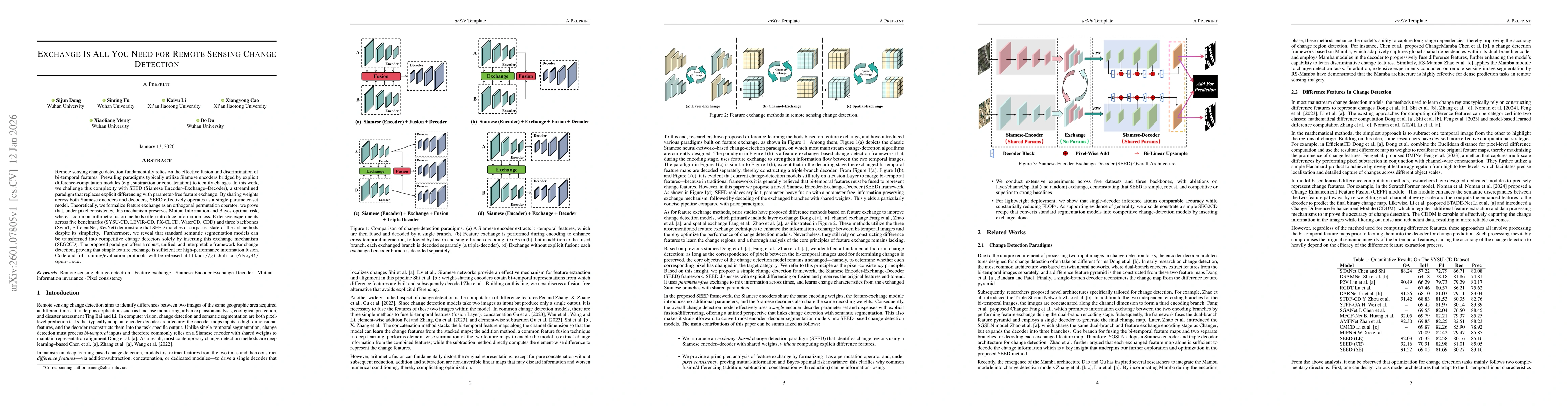
Remote sensing change detection fundamentally relies on the effective fusion and discrimination of bi-temporal features. Prevailing paradigms typically utilize Siamese encoders bridged by explicit dif...
Diffusion models have recently emerged as powerful learned priors for Bayesian inverse problems (BIPs). Diffusion-based solvers rely on a presumed likelihood for the observations in BIPs to guide the ...
Change detection in optical remote sensing imagery is susceptible to illumination fluctuations, seasonal changes, and variations in surface land-cover materials. Relying solely on RGB imagery often pr...
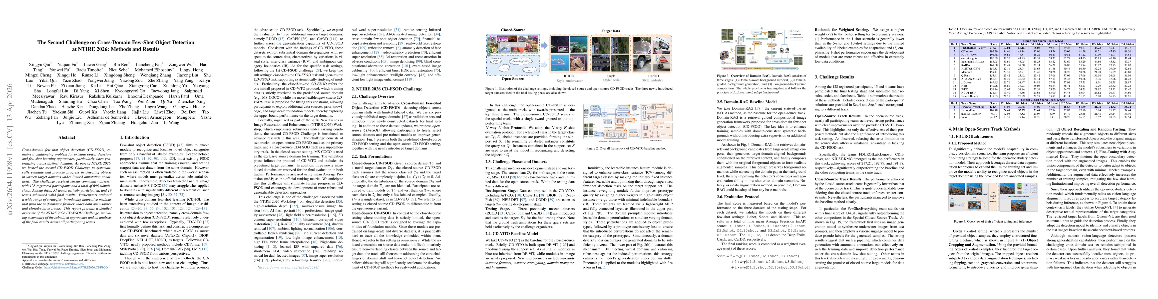
Cross-domain few-shot object detection (CD-FSOD) remains a challenging problem for existing object detectors and few-shot learning approaches, particularly when generalizing across distinct domains. A...
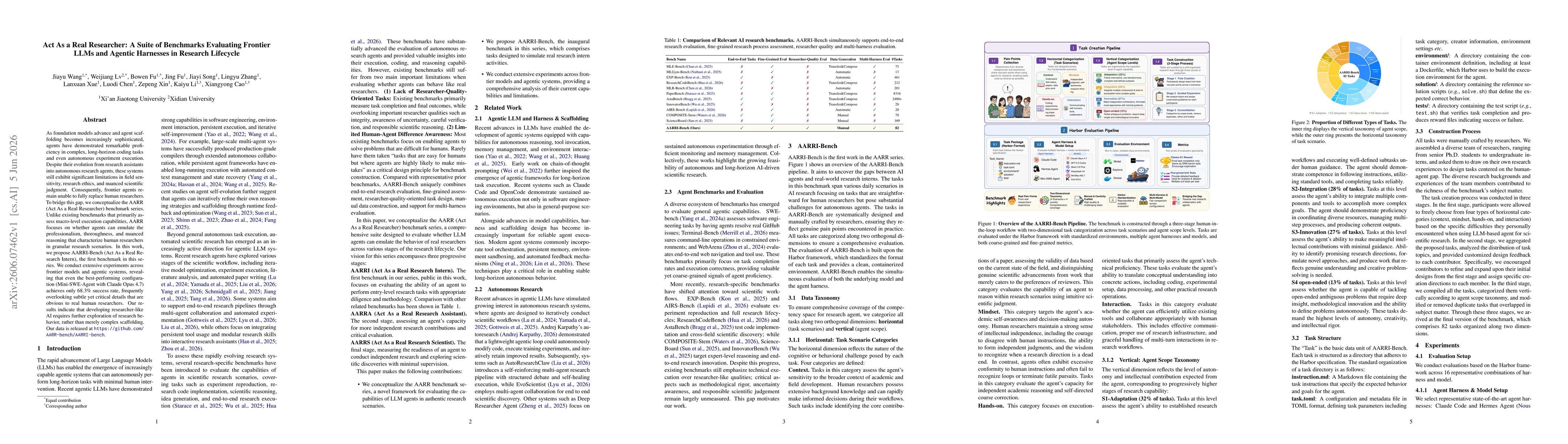
As foundation models advance and agent scaffolding becomes increasingly sophisticated, agents have demonstrated remarkable proficiency in complex, long-horizon coding tasks and even autonomous experim...
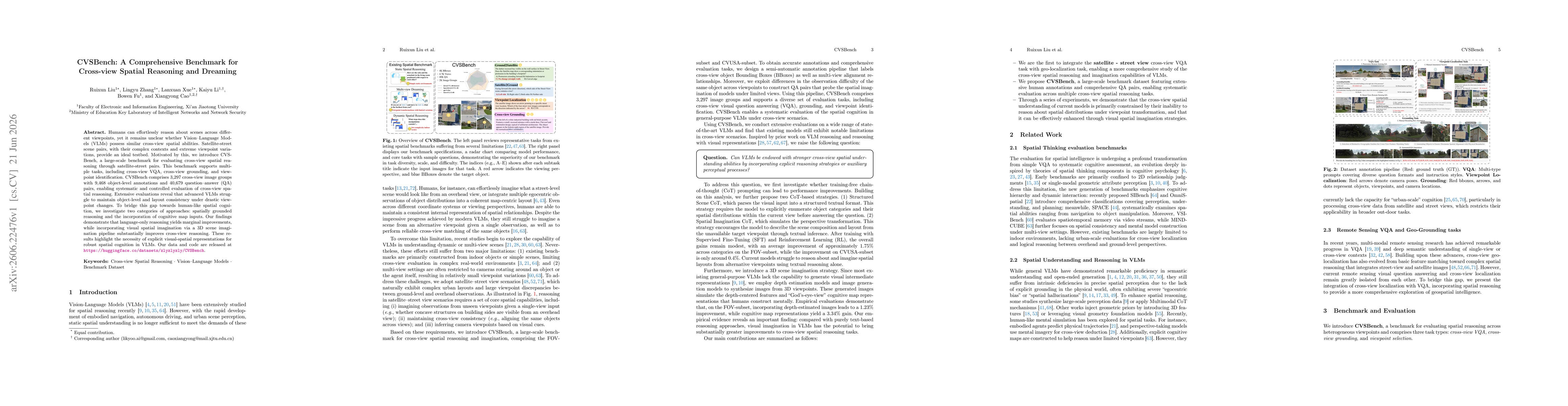
Humans can effortlessly reason about scenes across different viewpoints, yet it remains unclear whether Vision-Language Models (VLMs) possess similar cross-view spatial abilities. Satellite-street sce...