Academic Profile
Statistics
Similar Authors
Papers on arXiv
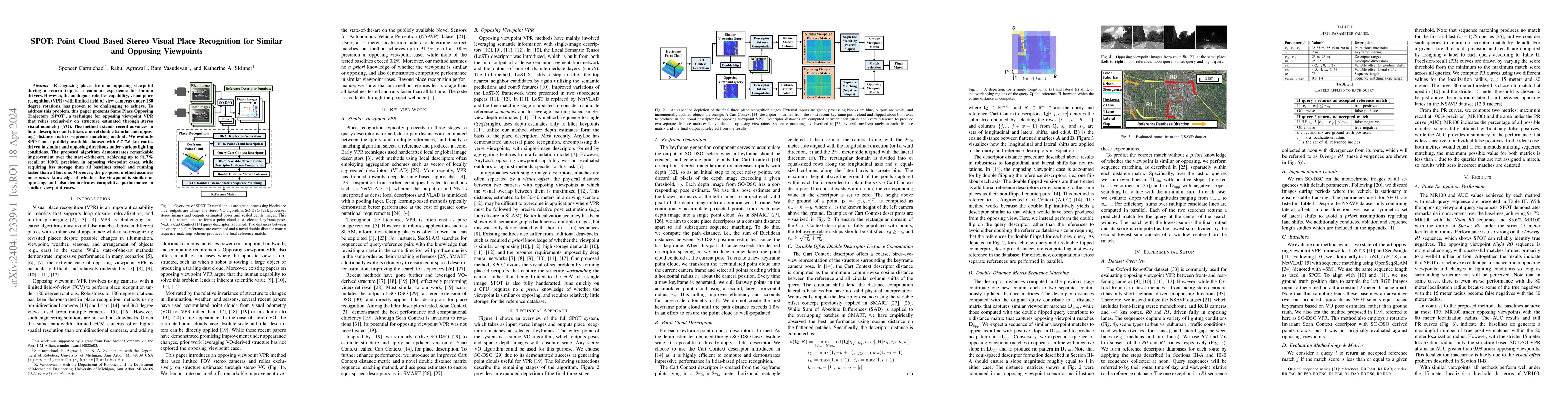
Recognizing places from an opposing viewpoint during a return trip is a common experience for human drivers. However, the analogous robotics capability, visual place recognition (VPR) with limited f...
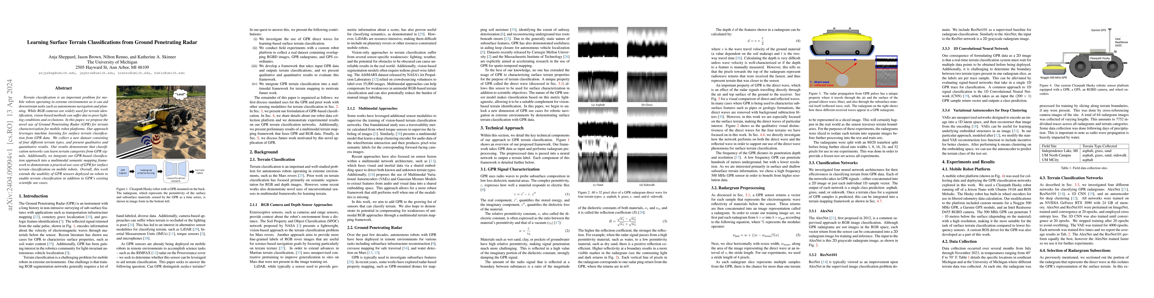
Terrain classification is an important problem for mobile robots operating in extreme environments as it can aid downstream tasks such as autonomous navigation and planning. While RGB cameras are wi...
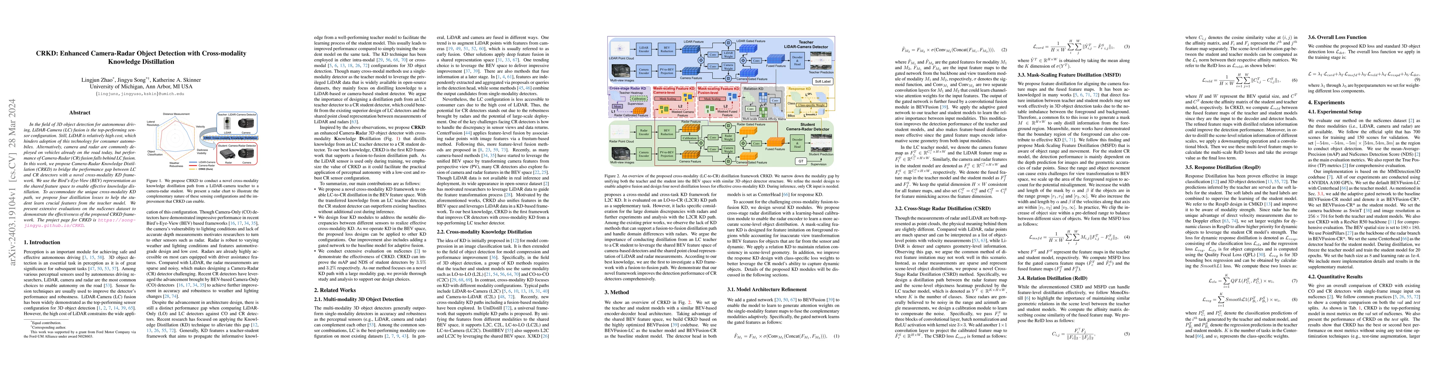
In the field of 3D object detection for autonomous driving, LiDAR-Camera (LC) fusion is the top-performing sensor configuration. Still, LiDAR is relatively high cost, which hinders adoption of this ...
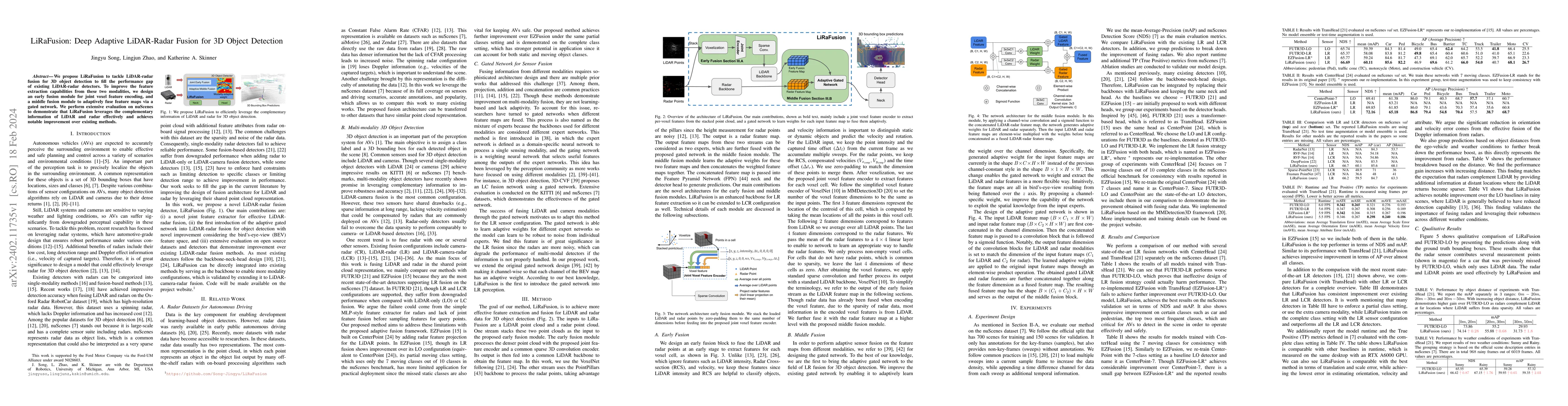
We propose LiRaFusion to tackle LiDAR-radar fusion for 3D object detection to fill the performance gap of existing LiDAR-radar detectors. To improve the feature extraction capabilities from these tw...
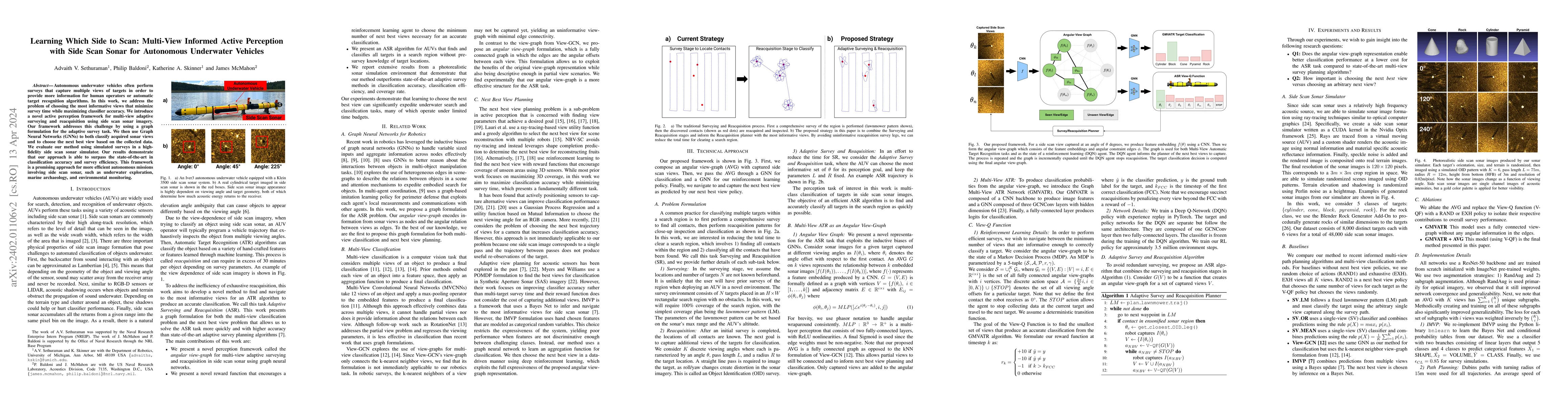
Autonomous underwater vehicles often perform surveys that capture multiple views of targets in order to provide more information for human operators or automatic target recognition algorithms. In th...
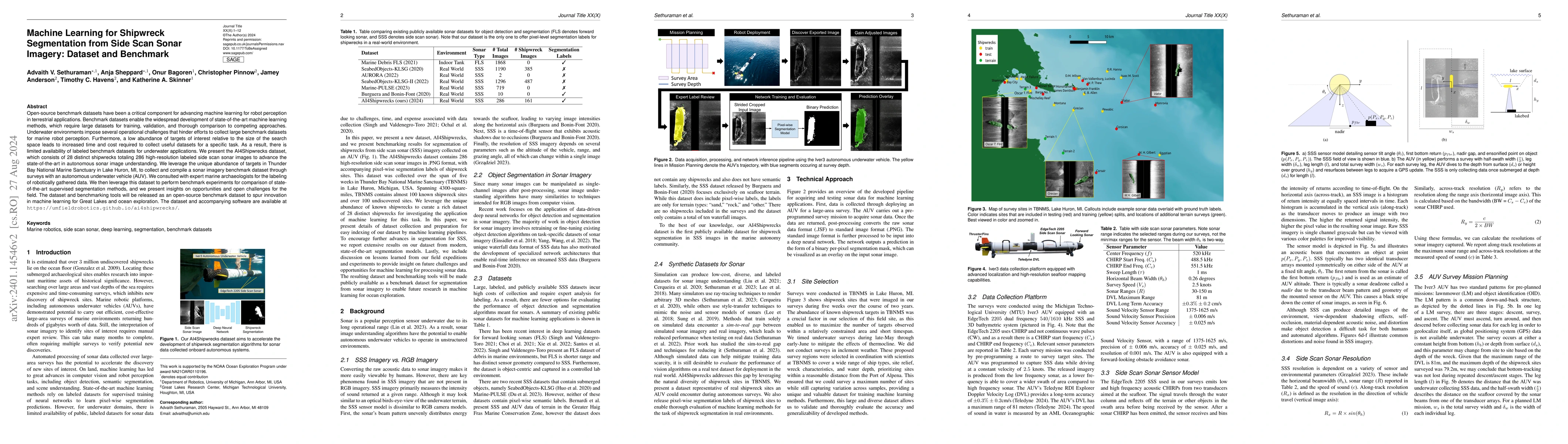
Open-source benchmark datasets have been a critical component for advancing machine learning for robot perception in terrestrial applications. Benchmark datasets enable the widespread development of...
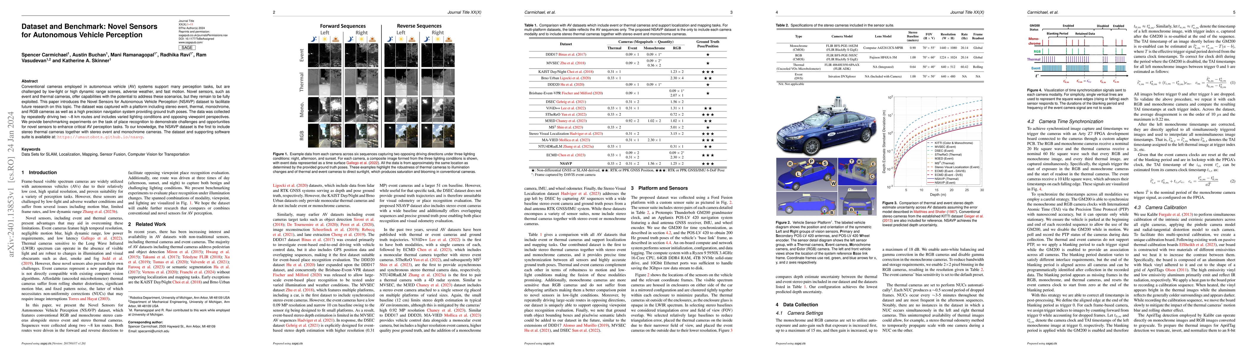
Conventional cameras employed in autonomous vehicle (AV) systems support many perception tasks, but are challenged by low-light or high dynamic range scenes, adverse weather, and fast motion. Novel ...
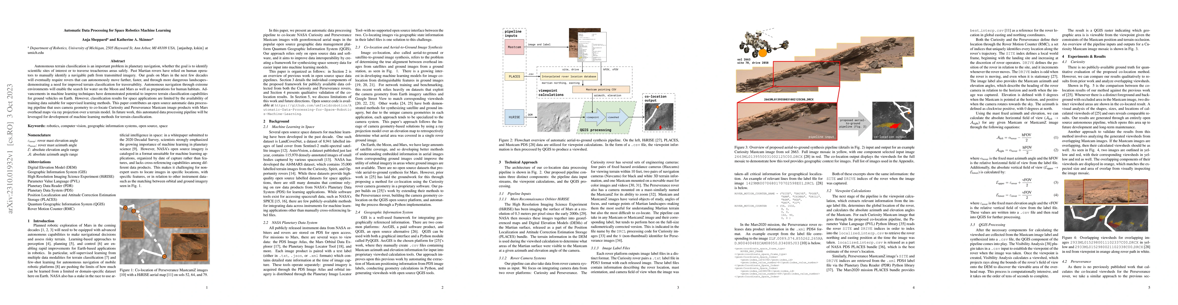
Autonomous terrain classification is an important problem in planetary navigation, whether the goal is to identify scientific sites of interest or to traverse treacherous areas safely. Past Martian ...
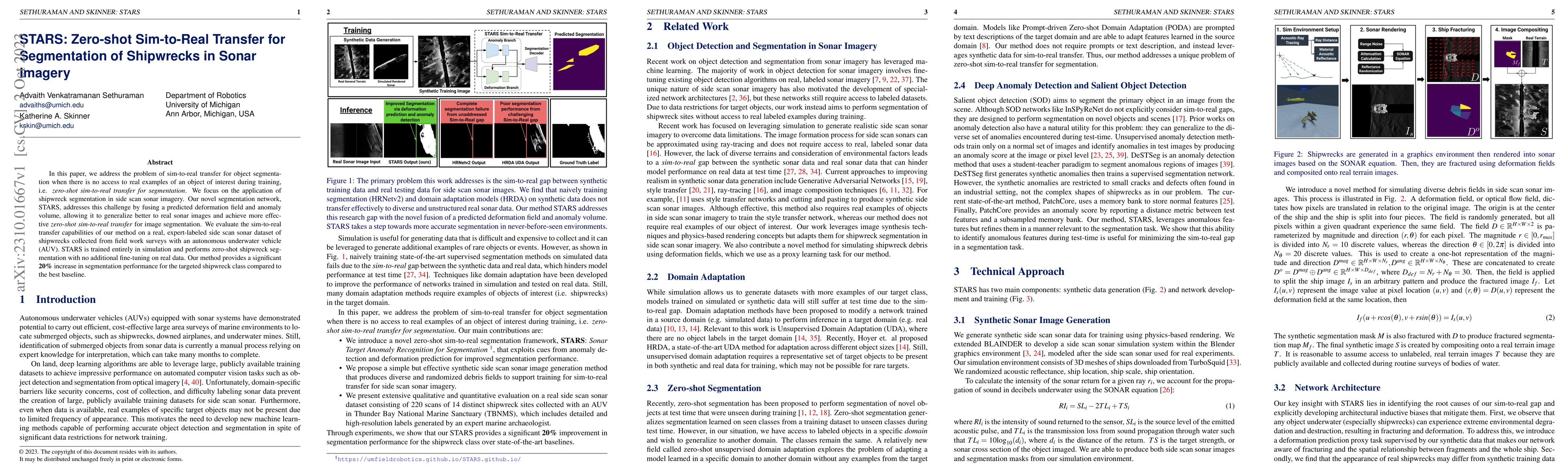
In this paper, we address the problem of sim-to-real transfer for object segmentation when there is no access to real examples of an object of interest during training, i.e. zero-shot sim-to-real tr...
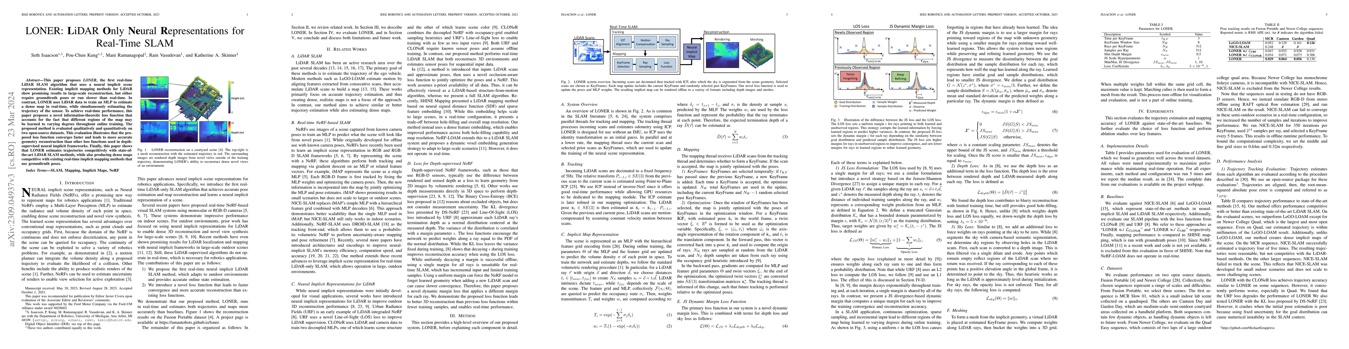
This paper proposes LONER, the first real-time LiDAR SLAM algorithm that uses a neural implicit scene representation. Existing implicit mapping methods for LiDAR show promising results in large-scal...
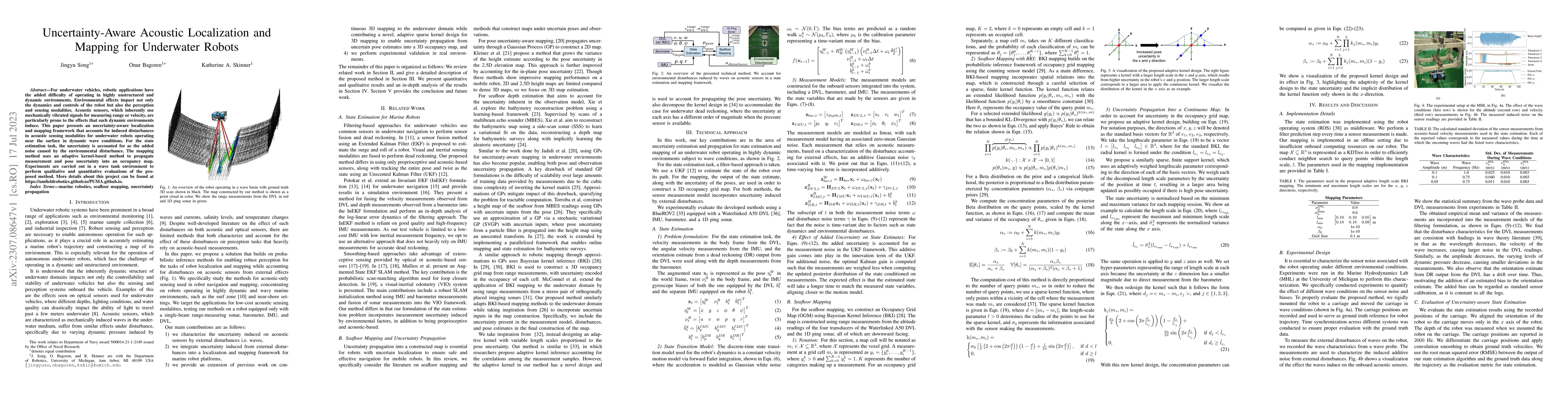
For underwater vehicles, robotic applications have the added difficulty of operating in highly unstructured and dynamic environments. Environmental effects impact not only the dynamics and controls ...
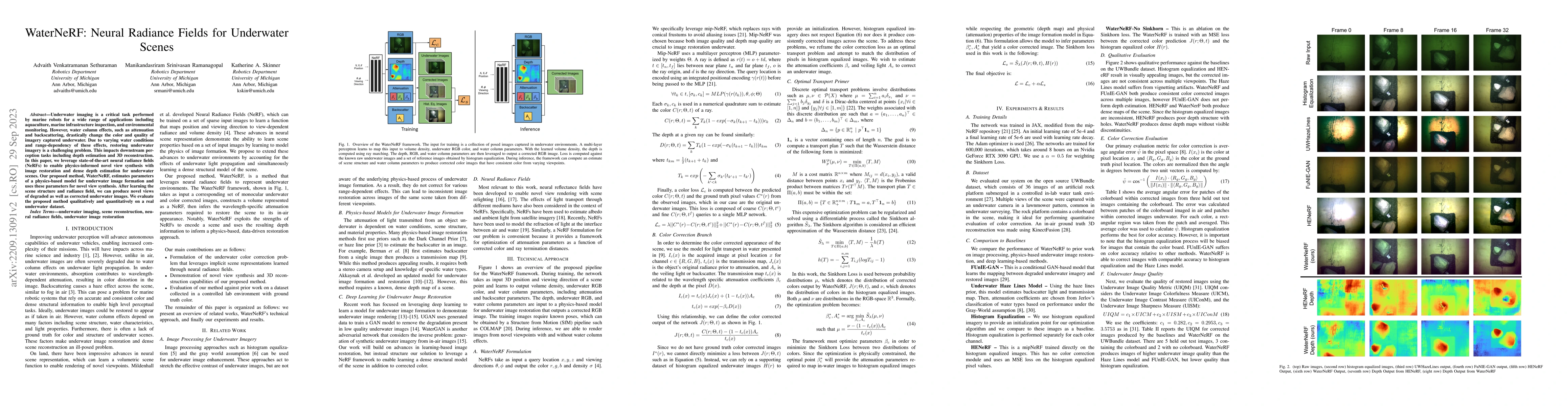
Underwater imaging is a critical task performed by marine robots for a wide range of applications including aquaculture, marine infrastructure inspection, and environmental monitoring. However, wate...
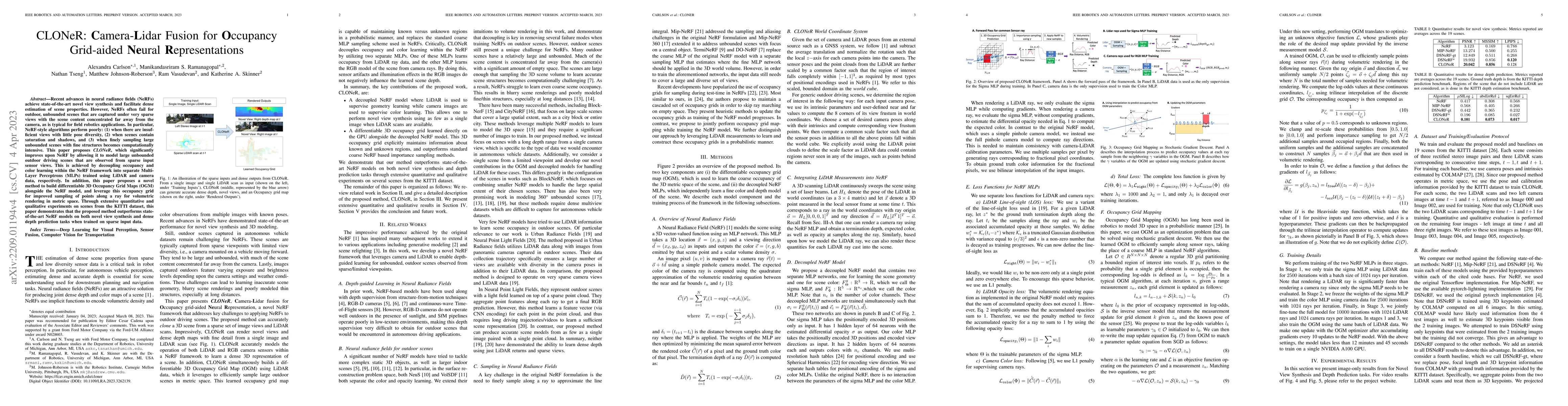
Recent advances in neural radiance fields (NeRFs) achieve state-of-the-art novel view synthesis and facilitate dense estimation of scene properties. However, NeRFs often fail for large, unbounded sc...
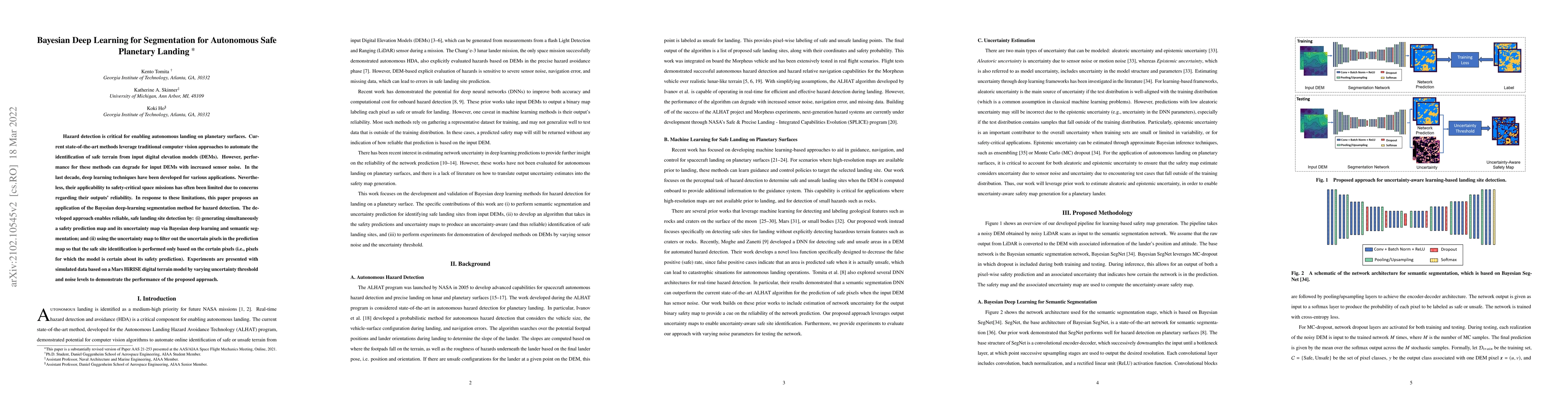
Hazard detection is critical for enabling autonomous landing on planetary surfaces. Current state-of-the-art methods leverage traditional computer vision approaches to automate the identification of...
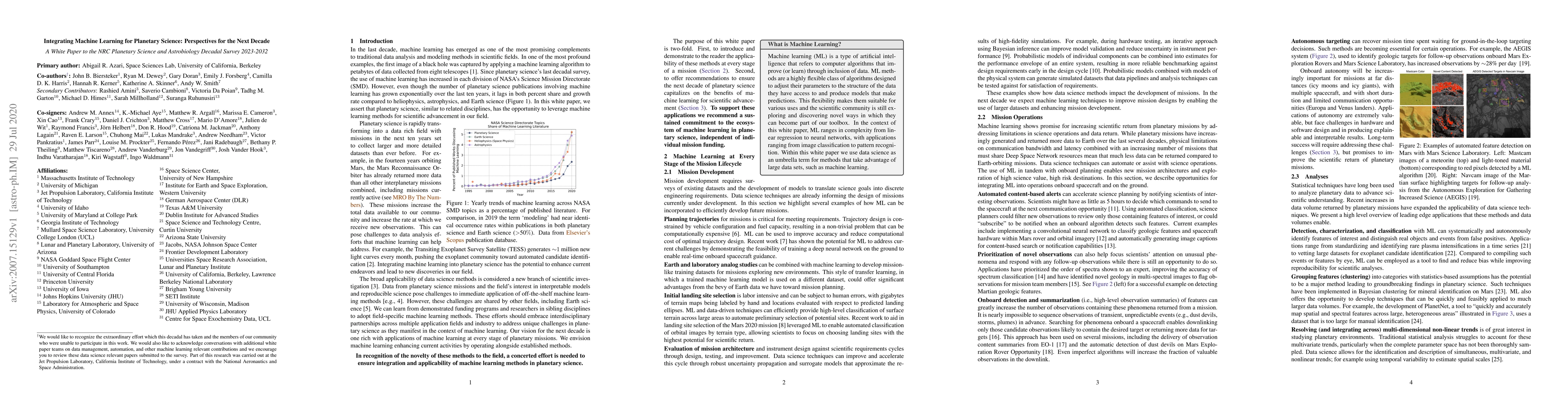
Machine learning (ML) methods can expand our ability to construct, and draw insight from large datasets. Despite the increasing volume of planetary observations, our field has seen few applications ...
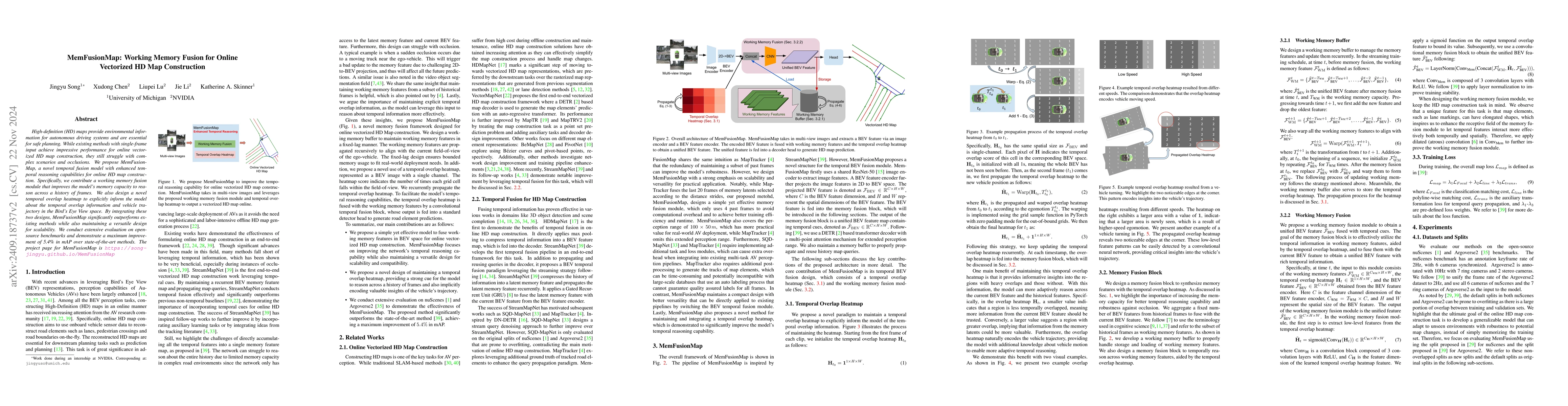
High-definition (HD) maps provide environmental information for autonomous driving systems and are essential for safe planning. While existing methods with single-frame input achieve impressive perfor...
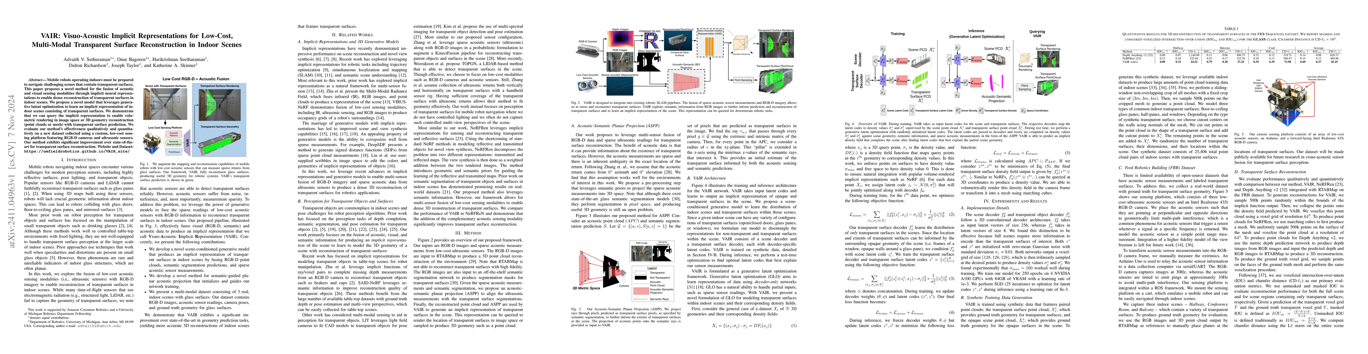
Mobile robots operating indoors must be prepared to navigate challenging scenes that contain transparent surfaces. This paper proposes a novel method for the fusion of acoustic and visual sensing moda...
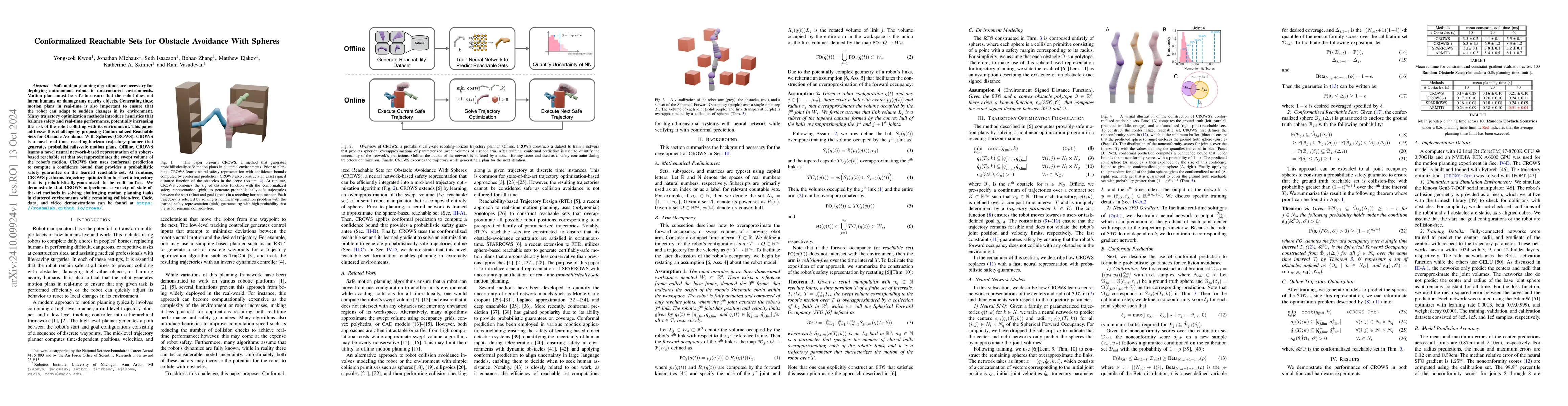
Safe motion planning algorithms are necessary for deploying autonomous robots in unstructured environments. Motion plans must be safe to ensure that the robot does not harm humans or damage any nearby...
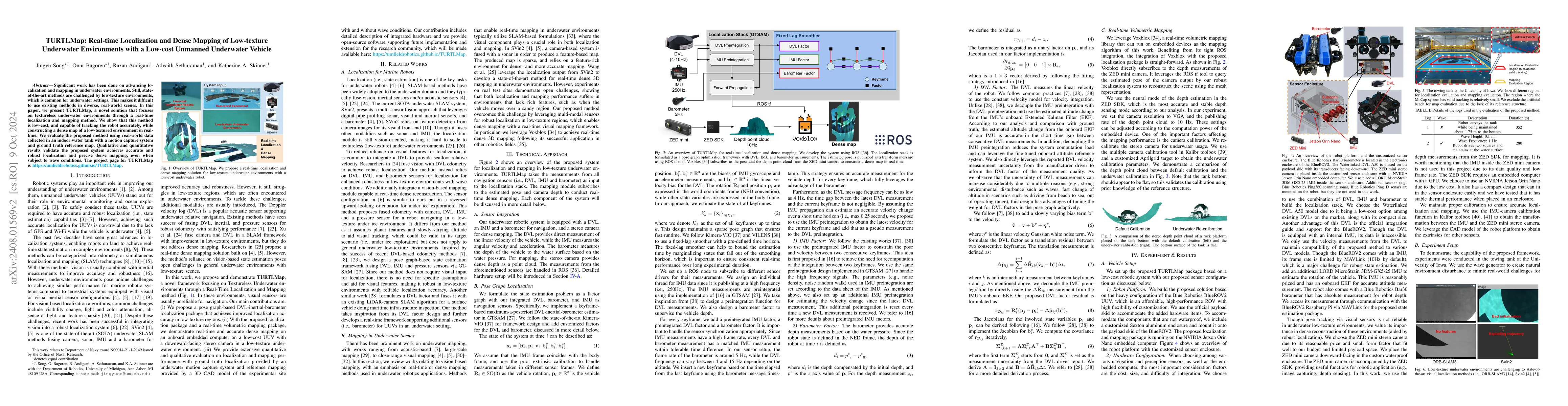
Significant work has been done on advancing localization and mapping in underwater environments. Still, state-of-the-art methods are challenged by low-texture environments, which is common for underwa...
Neural Radiance Fields and Gaussian Splatting have transformed the field of computer vision by enabling photo-realistic representation of complex scenes. Despite this success, they have seen only limi...
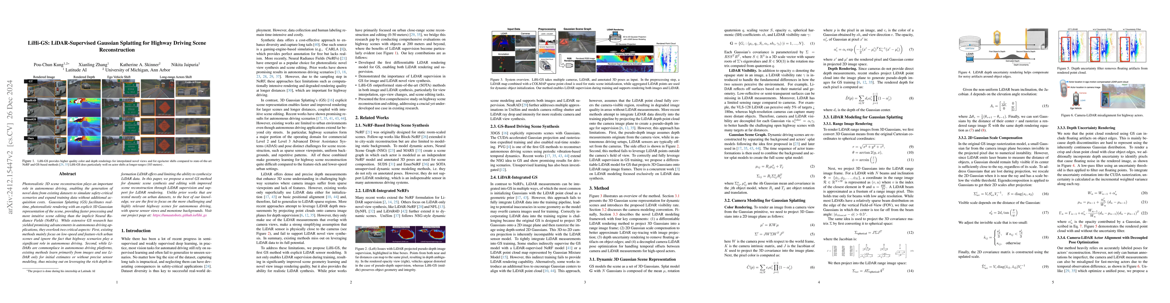
Photorealistic 3D scene reconstruction plays an important role in autonomous driving, enabling the generation of novel data from existing datasets to simulate safety-critical scenarios and expand trai...
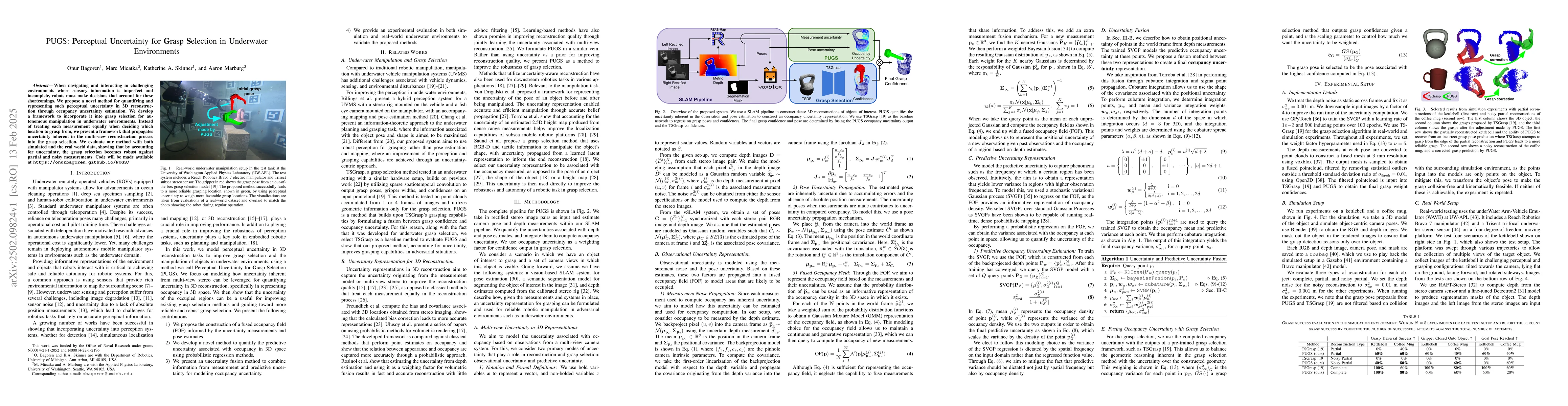
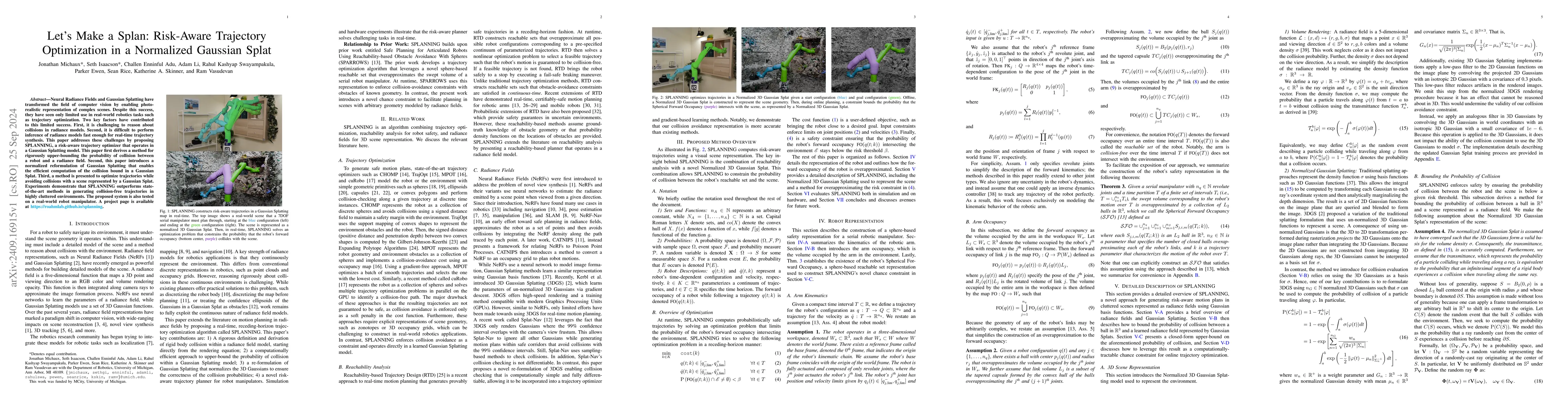
When navigating and interacting in challenging environments where sensory information is imperfect and incomplete, robots must make decisions that account for these shortcomings. We propose a novel me...
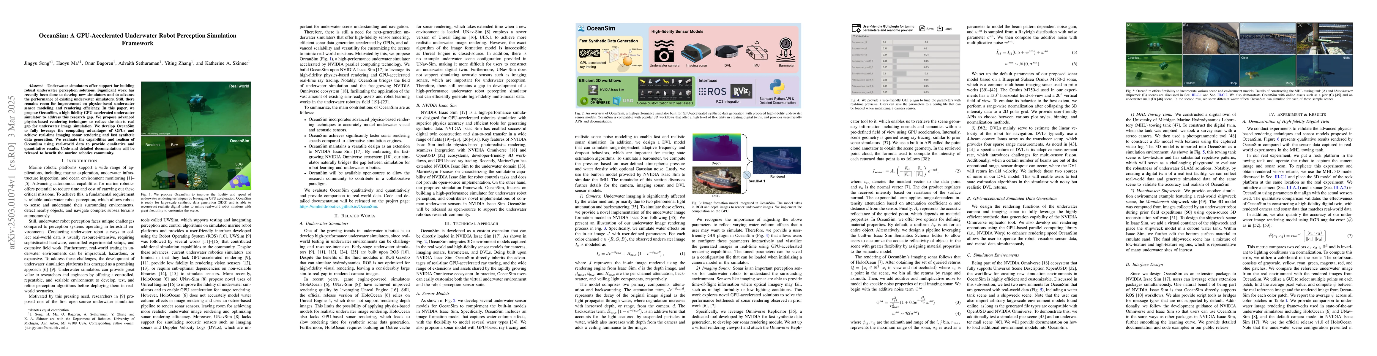
Underwater simulators offer support for building robust underwater perception solutions. Significant work has recently been done to develop new simulators and to advance the performance of existing un...
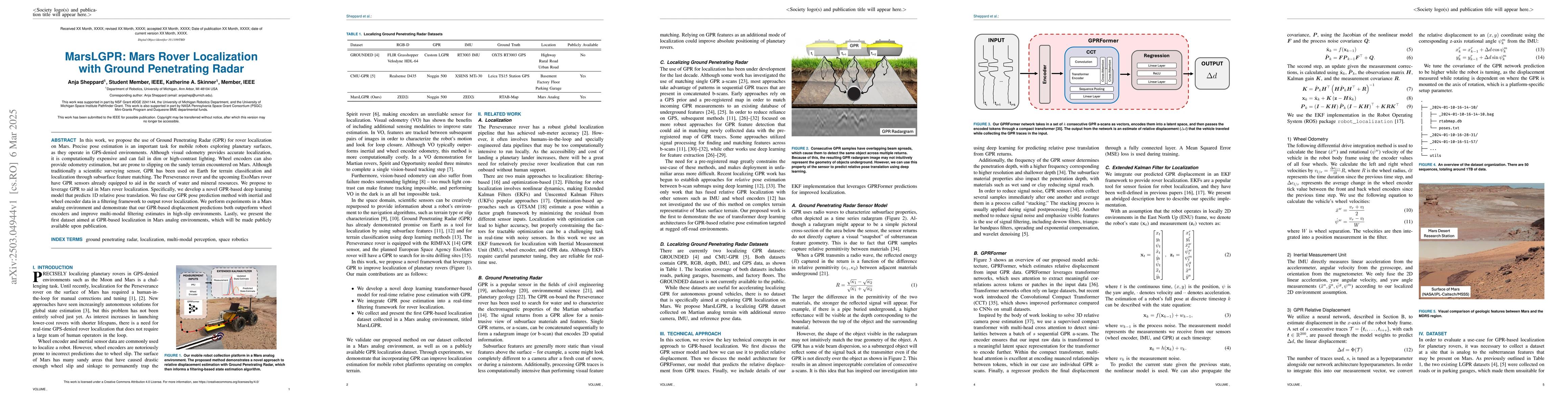
In this work, we propose the use of Ground Penetrating Radar (GPR) for rover localization on Mars. Precise pose estimation is an important task for mobile robots exploring planetary surfaces, as they ...
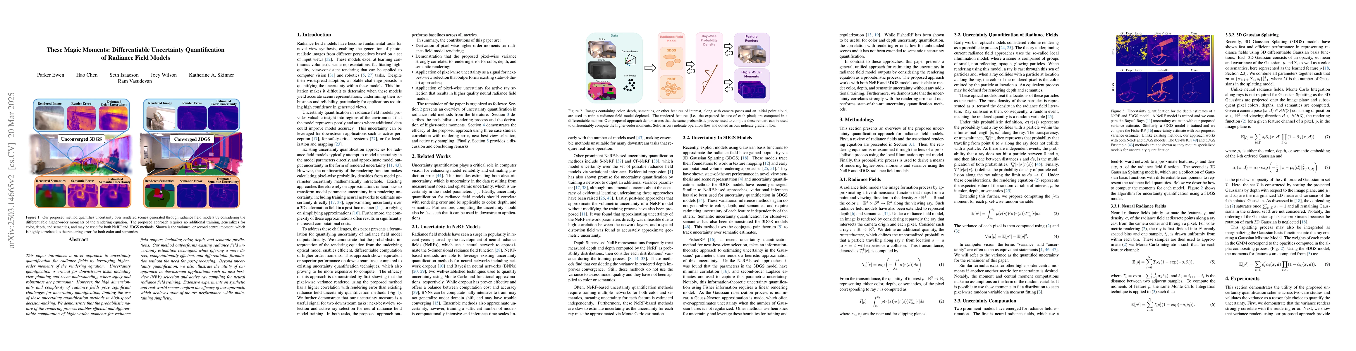
This paper introduces a novel approach to uncertainty quantification for radiance fields by leveraging higher-order moments of the rendering equation. Uncertainty quantification is crucial for downstr...
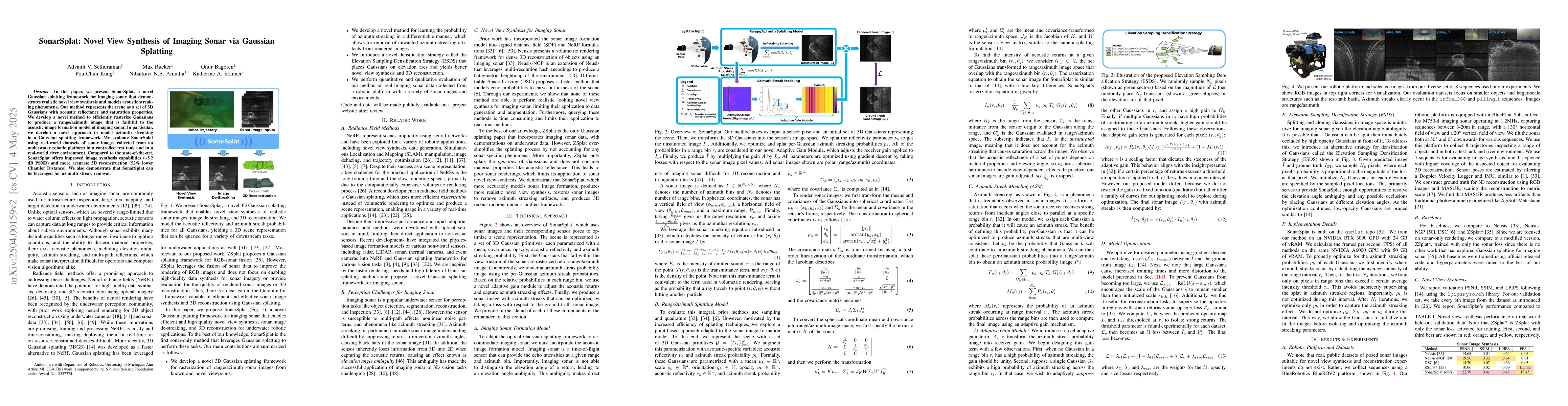
In this paper, we present SonarSplat, a novel Gaussian splatting framework for imaging sonar that demonstrates realistic novel view synthesis and models acoustic streaking phenomena. Our method repres...
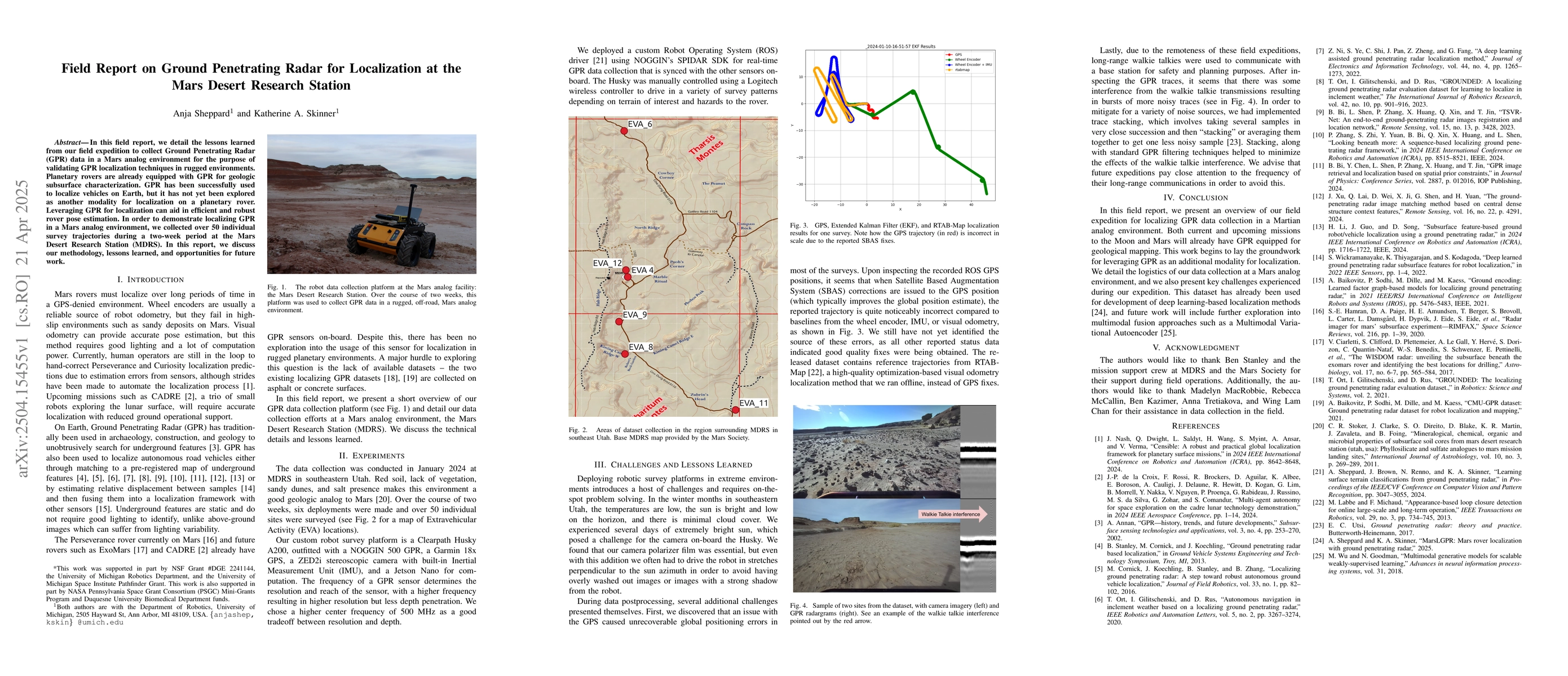
In this field report, we detail the lessons learned from our field expedition to collect Ground Penetrating Radar (GPR) data in a Mars analog environment for the purpose of validating GPR localization...
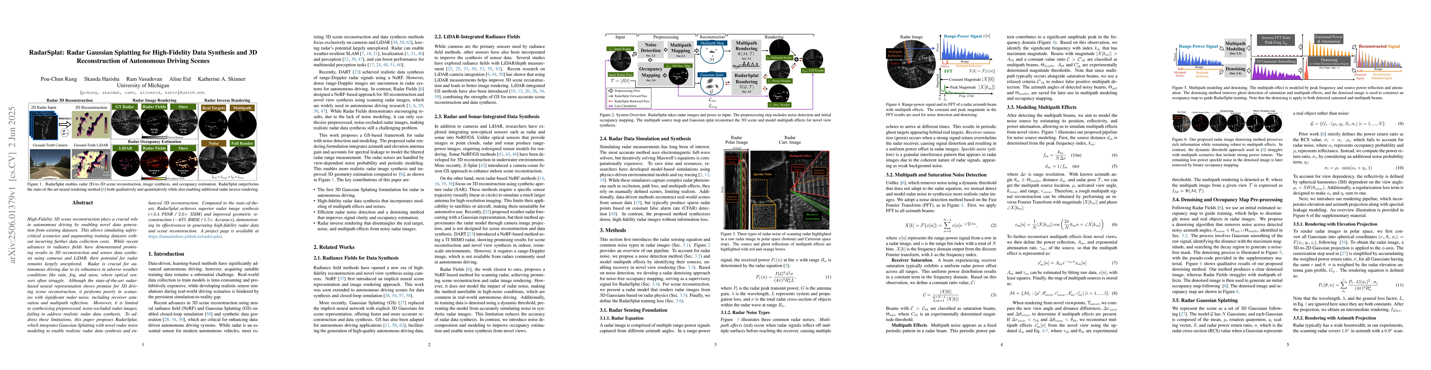
High-Fidelity 3D scene reconstruction plays a crucial role in autonomous driving by enabling novel data generation from existing datasets. This allows simulating safety-critical scenarios and augmenti...
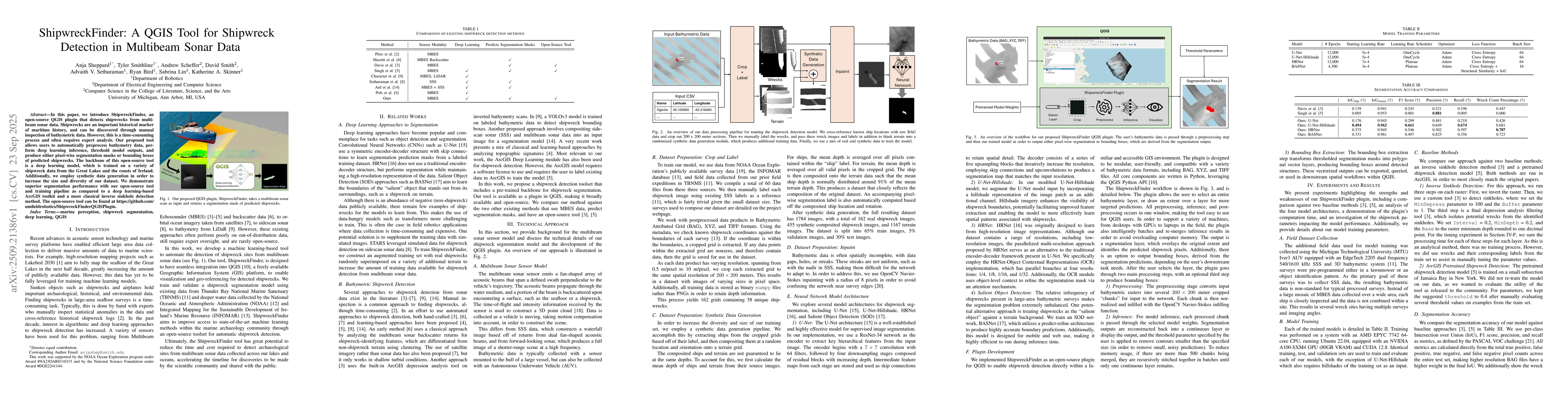
In this paper, we introduce ShipwreckFinder, an open-source QGIS plugin that detects shipwrecks from multibeam sonar data. Shipwrecks are an important historical marker of maritime history, and can be...
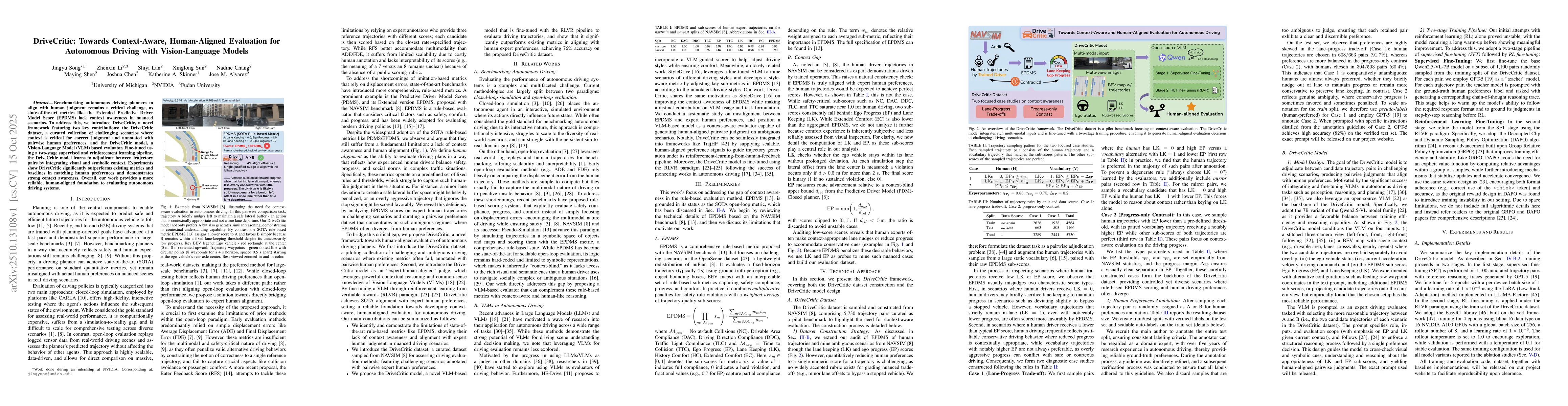
Benchmarking autonomous driving planners to align with human judgment remains a critical challenge, as state-of-the-art metrics like the Extended Predictive Driver Model Score (EPDMS) lack context awa...
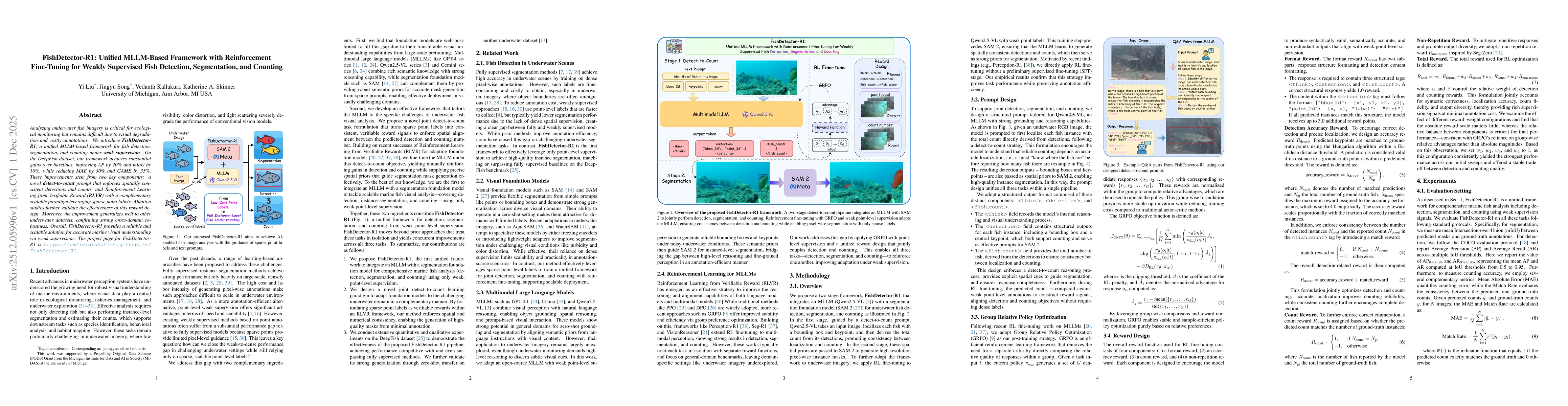
Analyzing underwater fish imagery is critical for ecological monitoring but remains difficult due to visual degradation and costly annotations. We introduce FishDetector-R1, a unified MLLM-based frame...
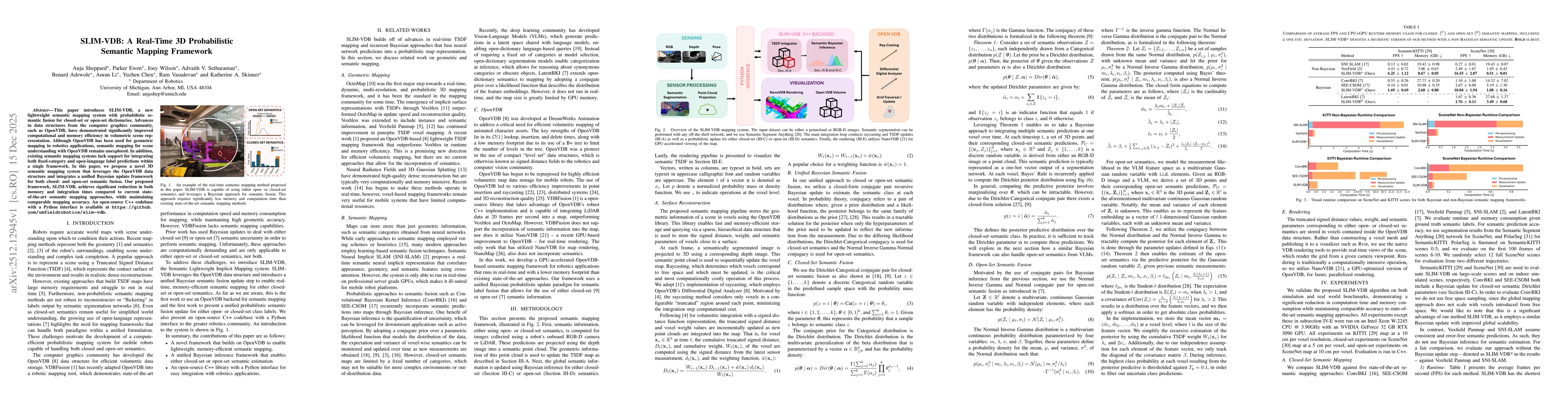
This paper introduces SLIM-VDB, a new lightweight semantic mapping system with probabilistic semantic fusion for closed-set or open-set dictionaries. Advances in data structures from the computer grap...
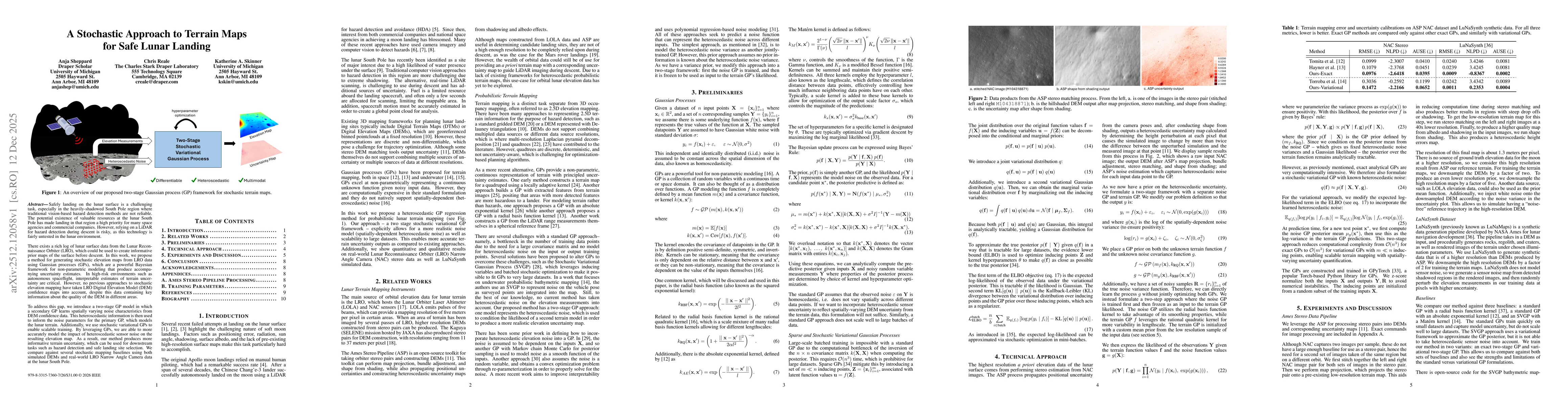
Safely landing on the lunar surface is a challenging task, especially in the heavily-shadowed South Pole region where traditional vision-based hazard detection methods are not reliable. The potential ...
Localization and mapping are core perceptual capabilities for underwater robots. Stereo cameras provide a low-cost means of directly estimating metric depth to support these tasks. However, despite re...
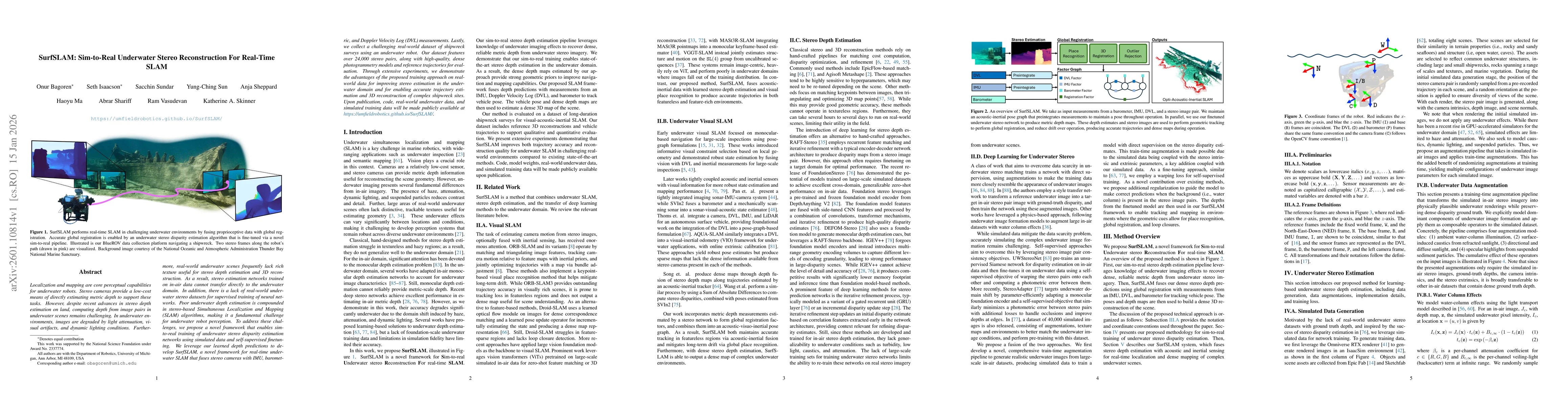
Thermal cameras offer several advantages for simultaneous localization and mapping (SLAM) with mobile robots: they provide a passive, low-power solution to operating in darkness, are invariant to rapi...
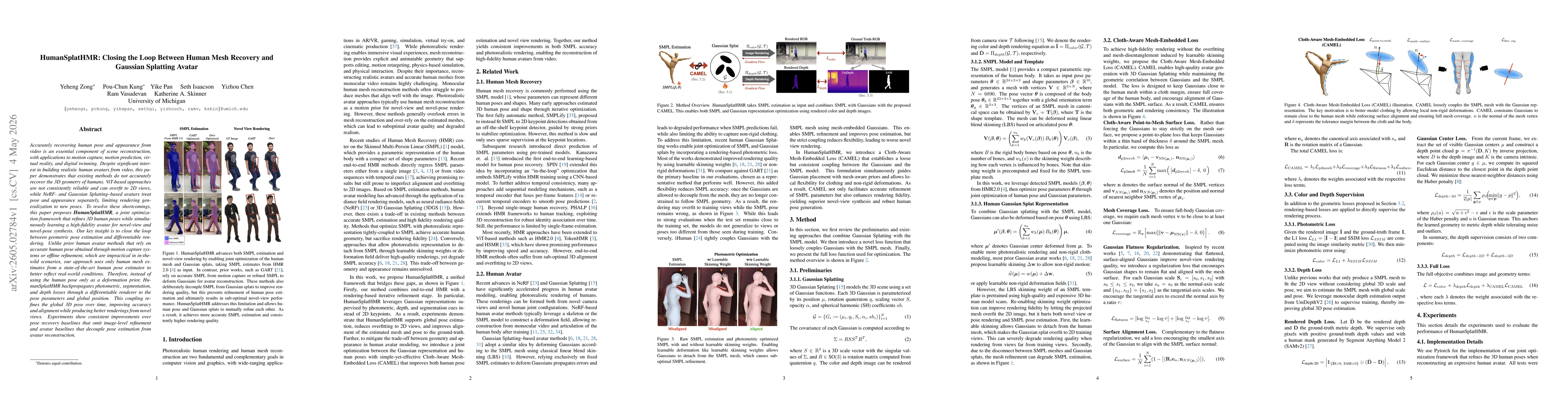
Accurately recovering human pose and appearance from video is an essential component of scene reconstruction, with applications to motion capture, motion prediction, virtual reality, and digital twinn...
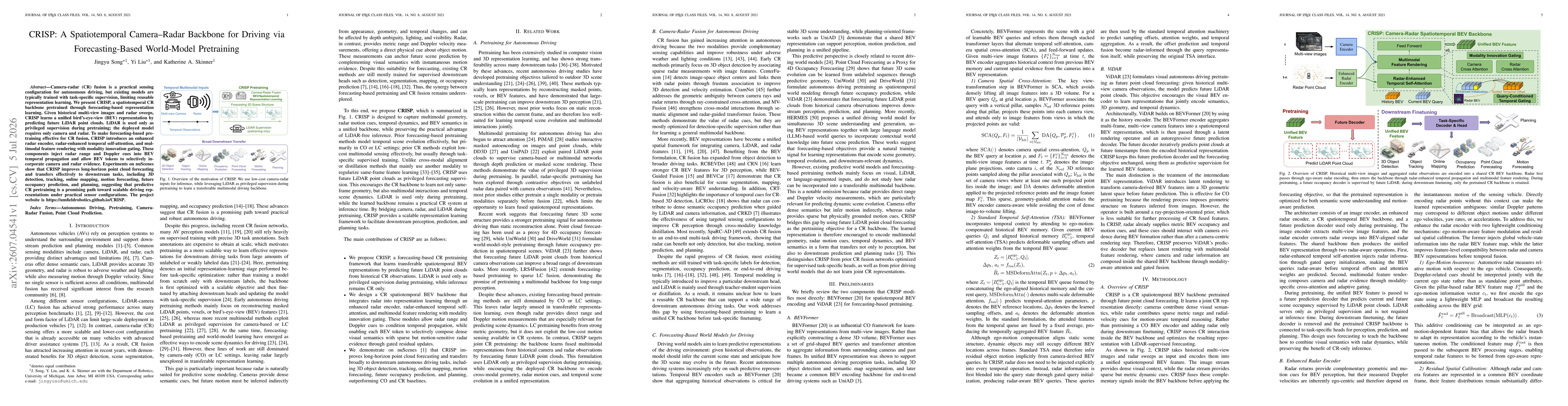
Camera-radar (CR) fusion is a practical sensing configuration for autonomous driving, but existing models are typically trained with task-specific supervision, limiting reusable representation learnin...