Academic Profile
Statistics
Similar Authors
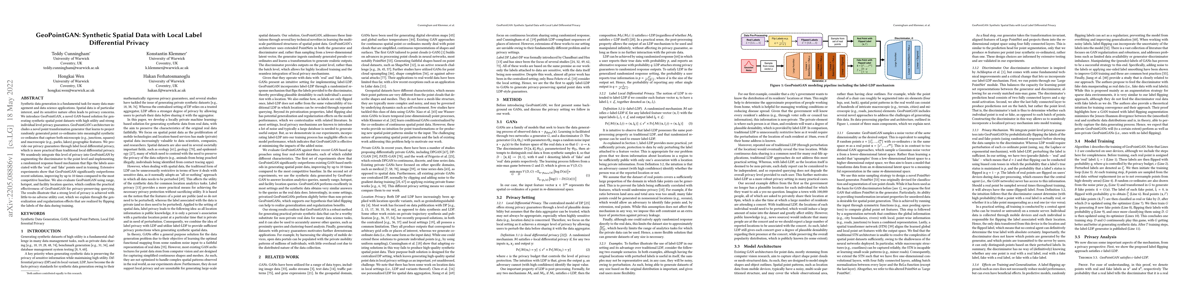
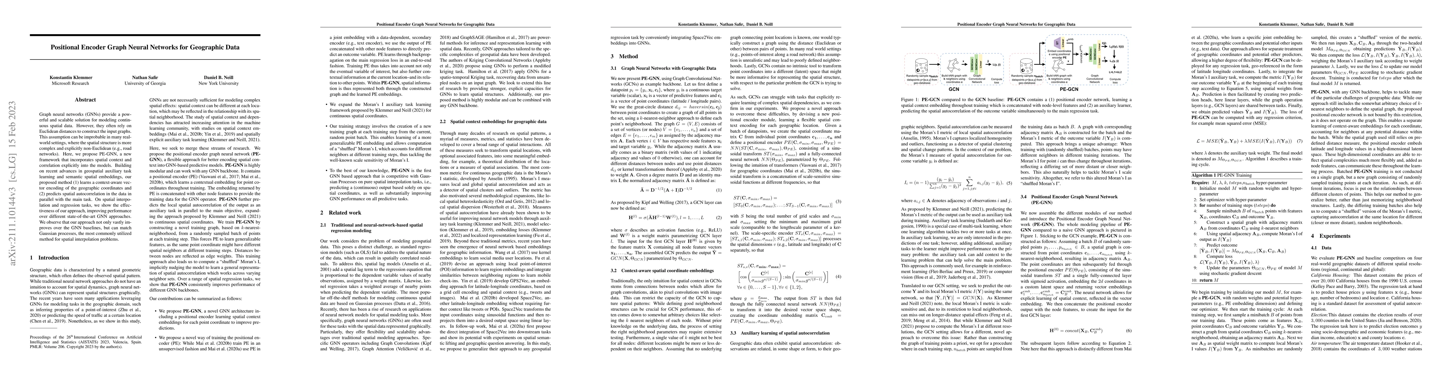
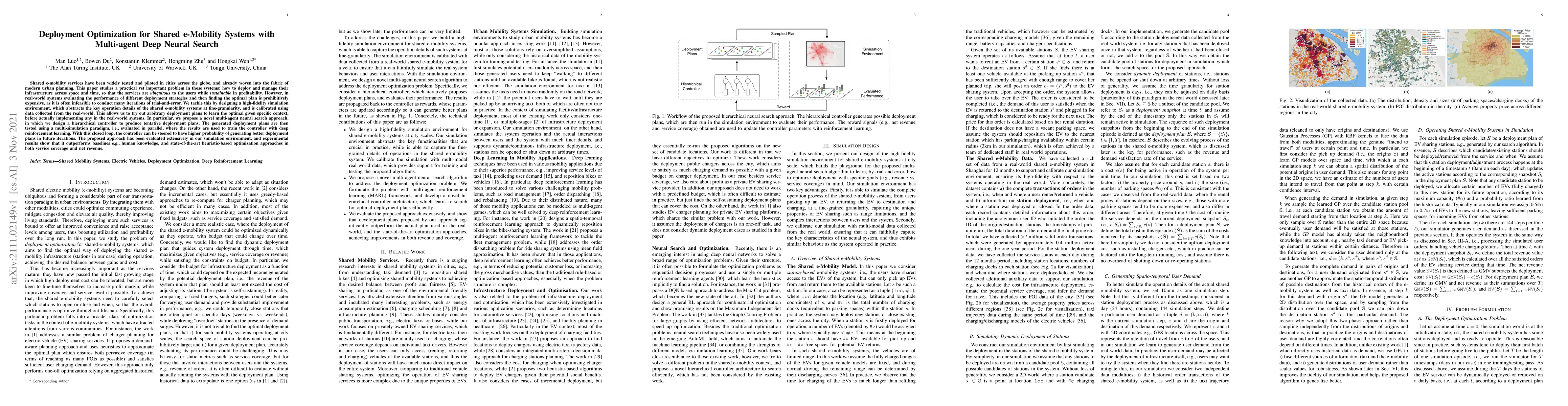
Papers on arXiv
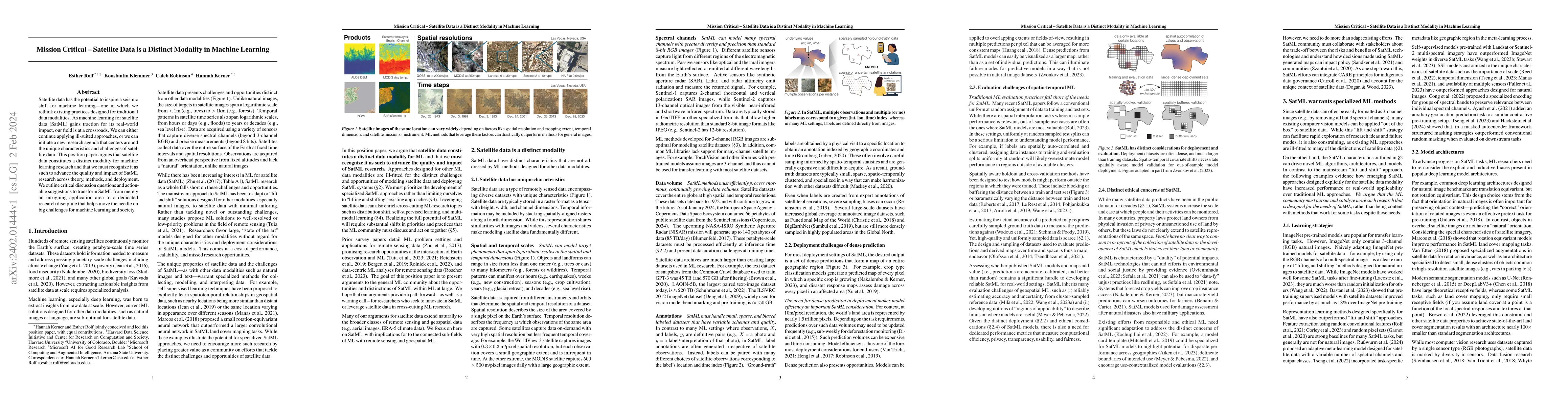
Satellite data has the potential to inspire a seismic shift for machine learning -- one in which we rethink existing practices designed for traditional data modalities. As machine learning for satel...
Geographic information is essential for modeling tasks in fields ranging from ecology to epidemiology. However, extracting relevant location characteristics for a given task can be challenging, ofte...
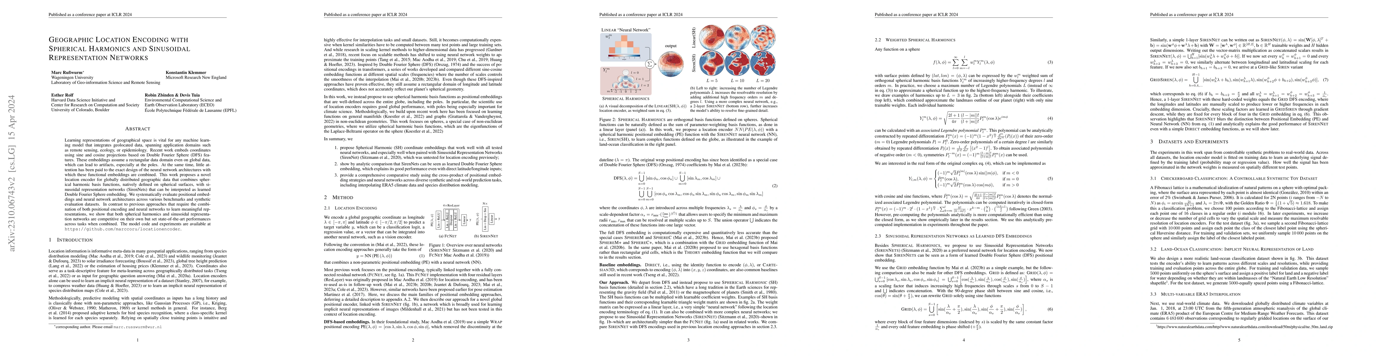
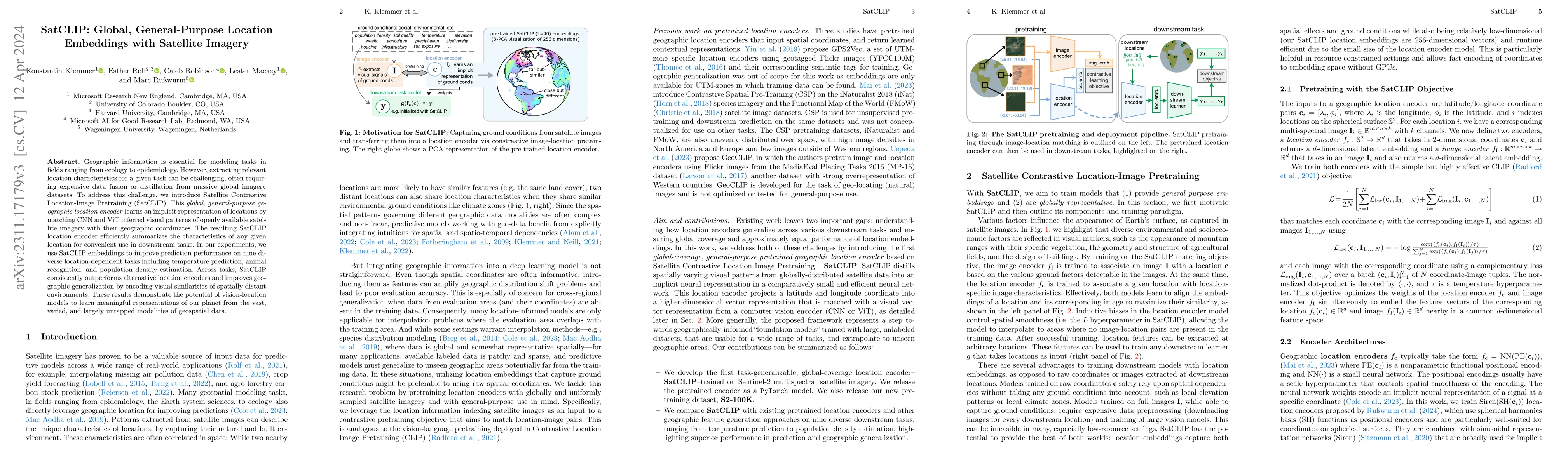
Learning representations of geographical space is vital for any machine learning model that integrates geolocated data, spanning application domains such as remote sensing, ecology, or epidemiology....
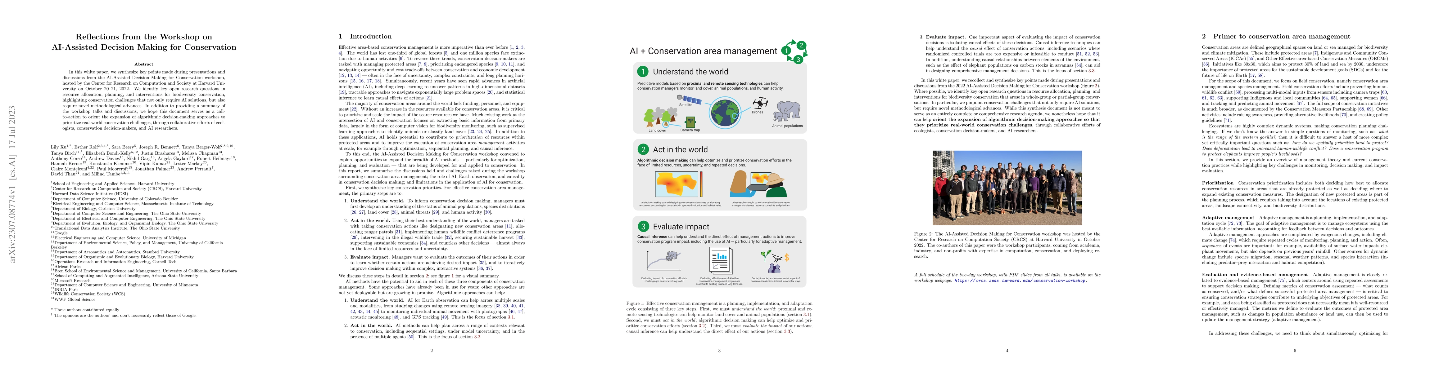
In this white paper, we synthesize key points made during presentations and discussions from the AI-Assisted Decision Making for Conservation workshop, hosted by the Center for Research on Computati...
These are the proceedings of the 5th workshop on Machine Learning for the Developing World (ML4D), held as part of the Thirty-fifth Conference on Neural Information Processing Systems (NeurIPS) on D...
Synthetic data generation is a fundamental task for many data management and data science applications. Spatial data is of particular interest, and its sensitive nature often leads to privacy concer...
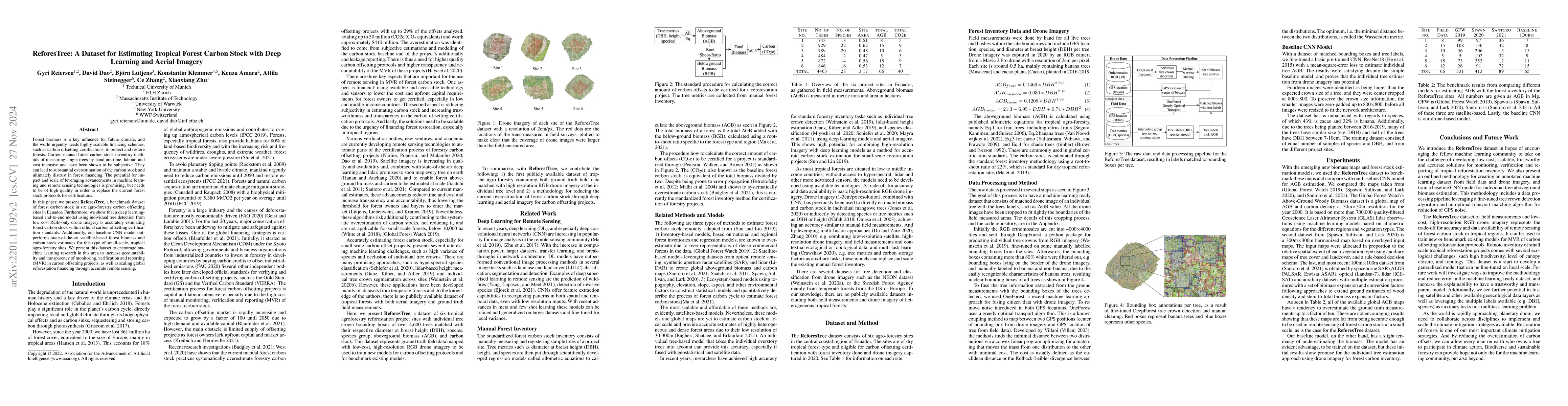
Forest biomass is a key influence for future climate, and the world urgently needs highly scalable financing schemes, such as carbon offsetting certifications, to protect and restore forests. Curren...
Graph neural networks (GNNs) provide a powerful and scalable solution for modeling continuous spatial data. However, they often rely on Euclidean distances to construct the input graphs. This assump...
Shared e-mobility services have been widely tested and piloted in cities across the globe, and already woven into the fabric of modern urban planning. This paper studies a practical yet important pr...
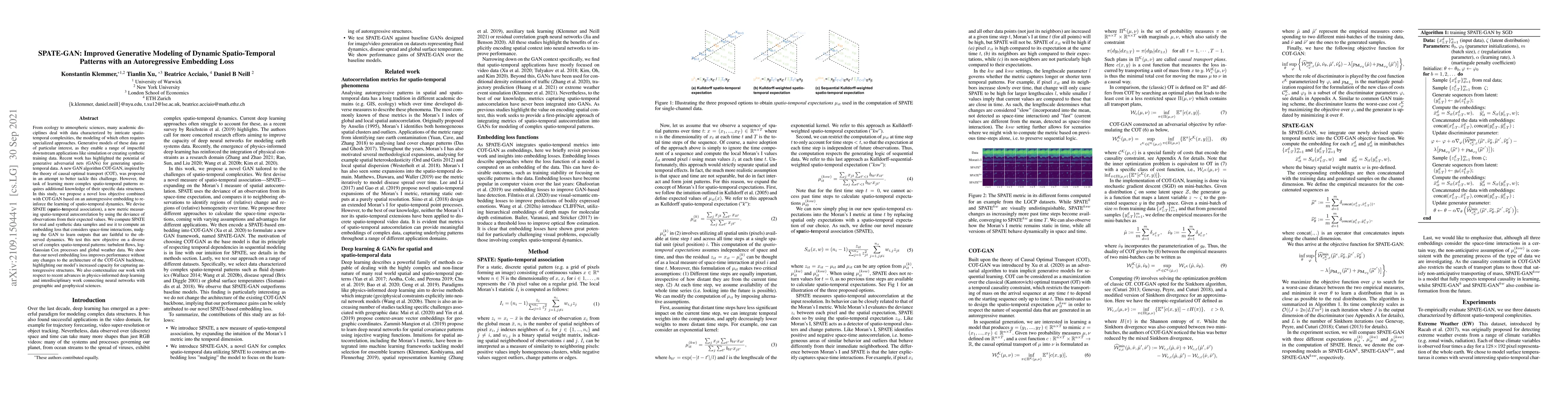
From ecology to atmospheric sciences, many academic disciplines deal with data characterized by intricate spatio-temporal complexities, the modeling of which often requires specialized approaches. G...
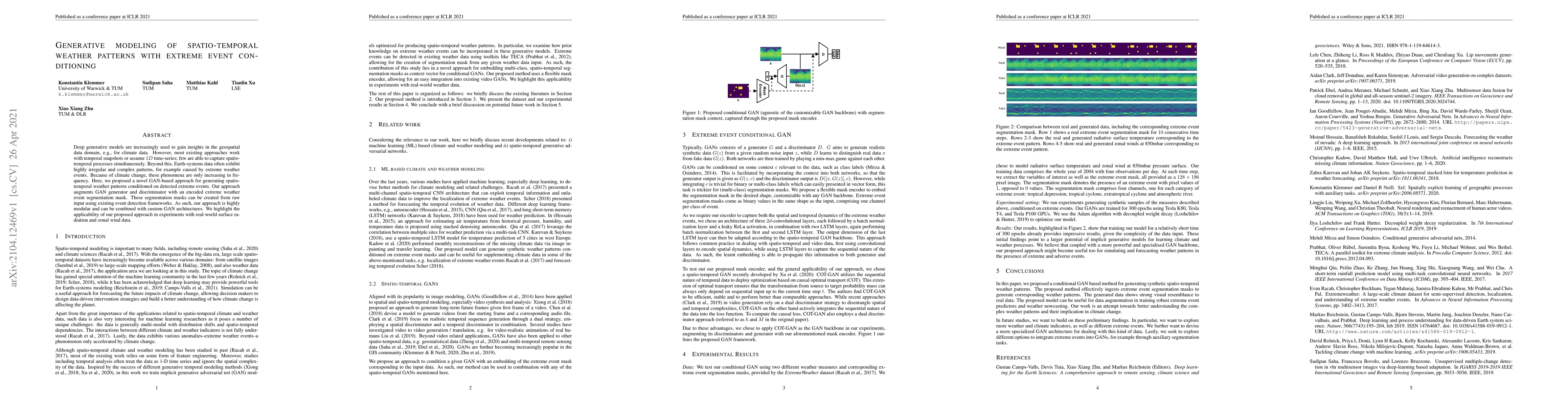
Deep generative models are increasingly used to gain insights in the geospatial data domain, e.g., for climate data. However, most existing approaches work with temporal snapshots or assume 1D time-...
These are the proceedings of the 4th workshop on Machine Learning for the Developing World (ML4D), held as part of the Thirty-fourth Conference on Neural Information Processing Systems (NeurIPS) on ...
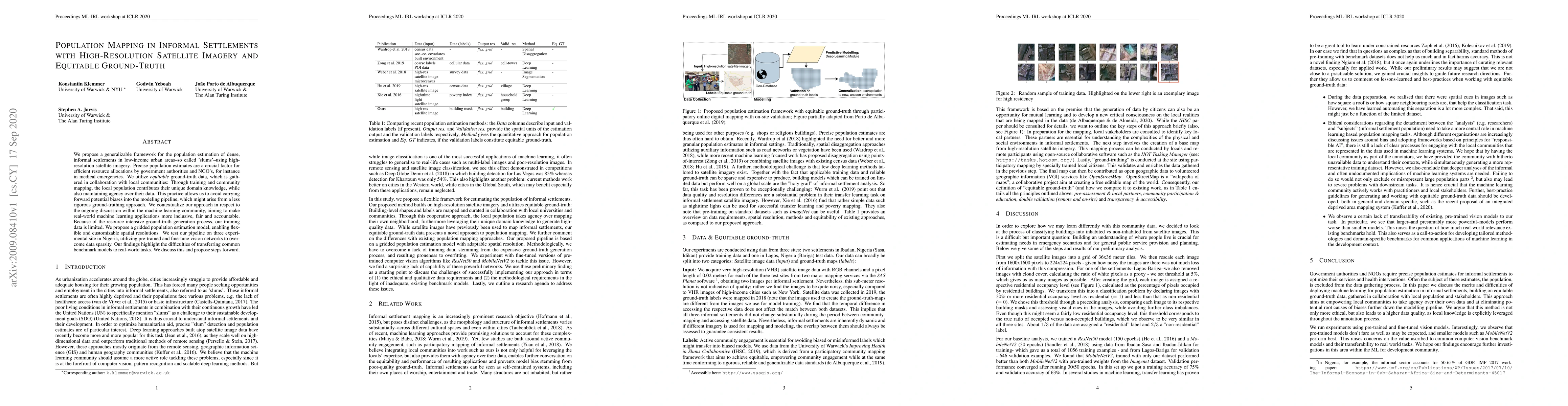
We propose a generalizable framework for the population estimation of dense, informal settlements in low-income urban areas--so called 'slums'--using high-resolution satellite imagery. Precise popul...
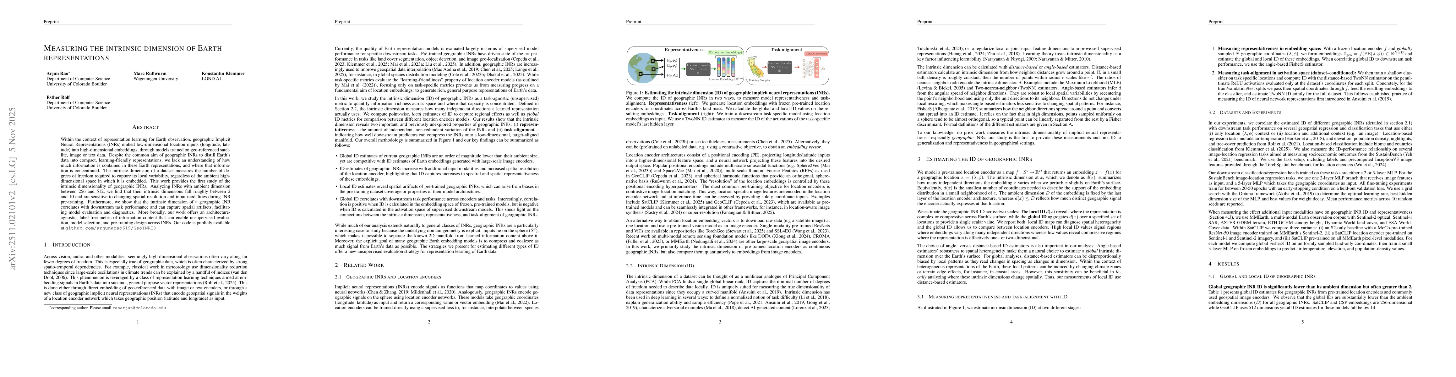
Within the context of representation learning for Earth observation, geographic Implicit Neural Representations (INRs) embed low-dimensional location inputs (longitude, latitude) into high-dimensional...
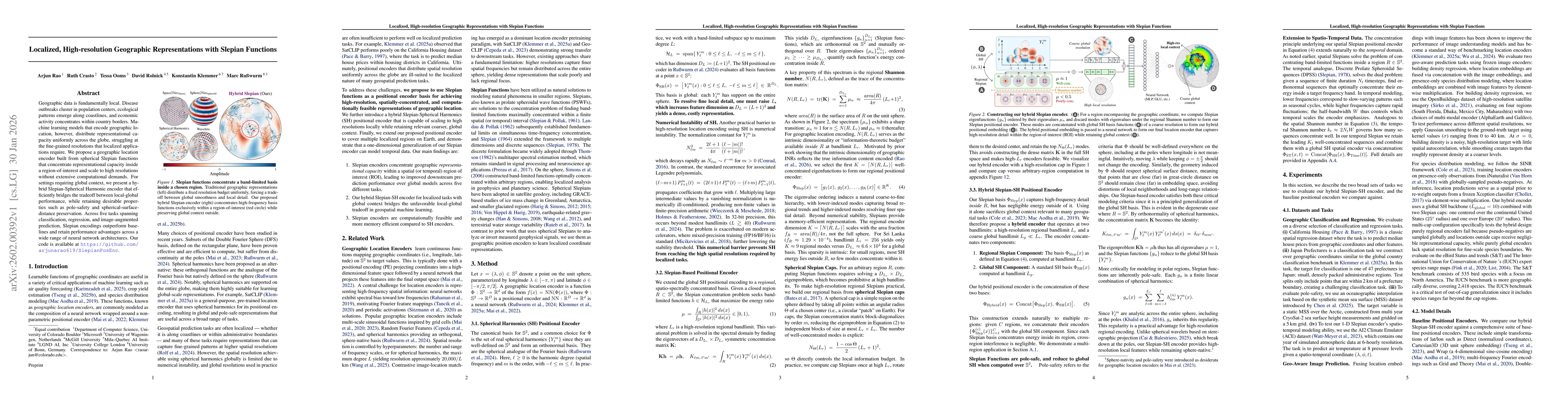
Geographic data is fundamentally local. Disease outbreaks cluster in population centers, ecological patterns emerge along coastlines, and economic activity concentrates within country borders. Machine...
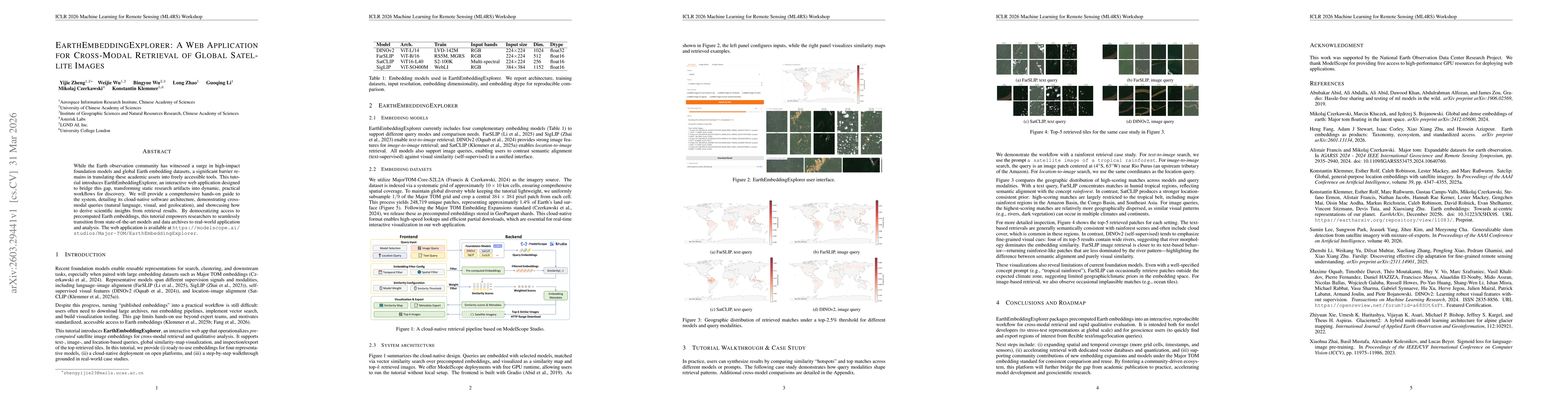
While the Earth observation community has witnessed a surge in high-impact foundation models and global Earth embedding datasets, a significant barrier remains in translating these academic assets int...
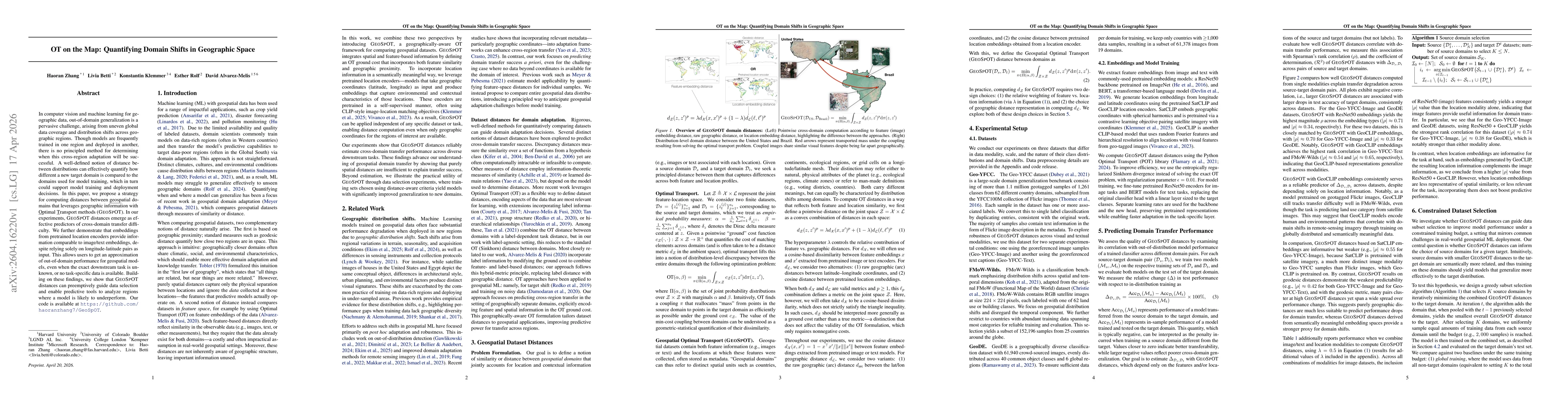
In computer vision and machine learning for geographic data, out-of-domain generalization is a pervasive challenge, arising from uneven global data coverage and distribution shifts across geographic r...
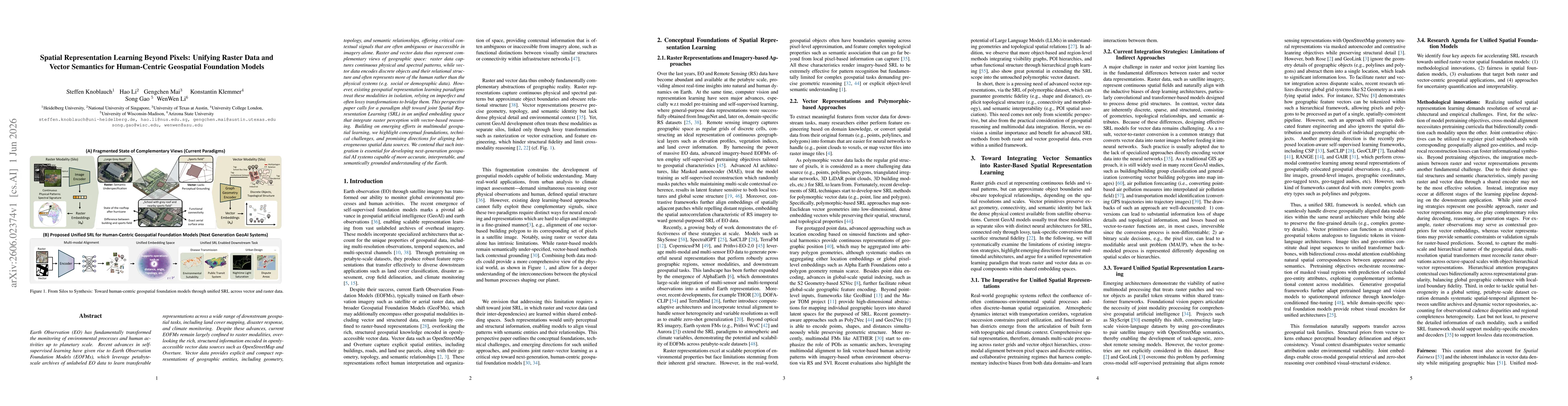
Earth Observation (EO) has fundamentally transformed the monitoring of environmental processes and human activities up to planetary scale. Recent advances in self-supervised learning have given rise t...